|
SHENANDOAH
Guidebook 1940 |

|
SHENANDOAH
THE Blue Ridge Mountains of Virginia are famed in song and tradition for their scenic loveliness, romantic setting, and historical association. In the heart of these mountains is the Shenandoah National Park, established in 1935, the first wilderness area east of the Mississippi to be created a national park.
Comprising 182,854 acres, the park extends for 75 miles in a narrow strip along the crest of the Blue Ridge from Front Royal on the northeast to the vicinity of Waynesboro on the southeast. The altitude varies from 600 feet above sea level at the north entrance to 4,049 feet at the summit of Hawksbill Mountain.
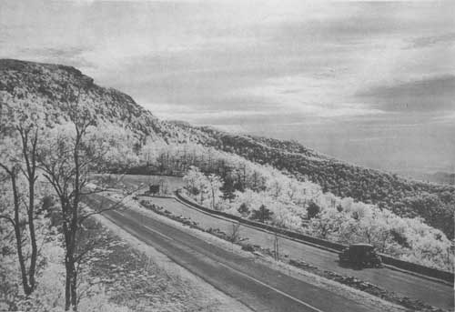
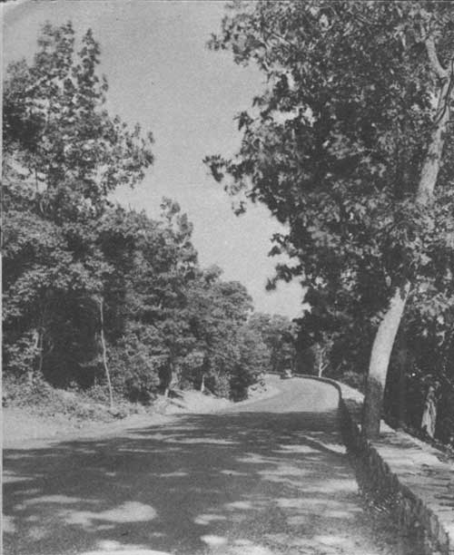 A TYPICAL SECTION OF THE FAMOUS SKYLINE DRIVE SHOWING THE EASY GRADIENT AND FLOWING CURVES. Virginia Conservation Commission Photo |
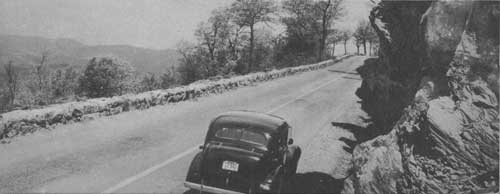
The Skyline Drive
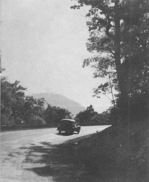
It is for the far-reaching views from the Skyline Drive that the park is most widely known. The drive, macadamized and smooth, with an easy gradient and wide, sweeping curves, unfolds to view innumerable sweeping panoramas of lofty peaks, forested ravines, meandering streams, and the green and brown patchwork fields of the valley farms below.
Built at a cost of more than $4,500,000, the famous 97-mile scenic highway traverses the entire length of the park along the backbone of the Blue Ridge from Front Royal to Jarman Gap, where it connects with the 485-mile Bloc Ridge Parkway, now under construction, that will link Shenandoah National Park with the Great Smoky Mountains National Park in Tennessee and North Carolina.
At intervals along the drive, parking overlooks have been constructed to afford the motorist an opportunity to pause and enjoy the breath-taking vistas.
 LATE AFTERNOON ON SKYLINE DRIVE. HAWKSBILL, HIGHEST POINT IN THE PARK, IS SILHOUETTED IN THE DISTANCE. Virginia State Chamber of Commerce Photo |
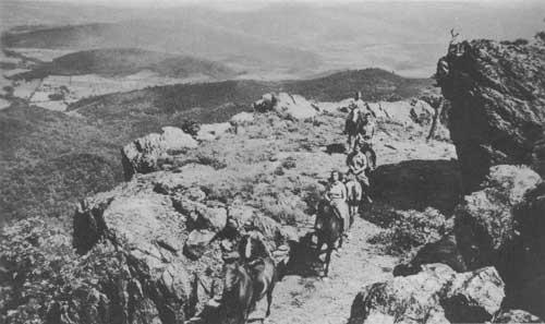
Trails and Bridle Paths
A system of bridle paths and foot trails invites horseman and hiker to exploration. Paralleling the Skyline Drive for its entire length is a section of the famous Appalachian Trail, which extends from Maine to Georgia. All of the trails are so planned as to enable amateur hikers to enjoy them without too great physical strain. Most of the trails may be reached easily from points along the Skyline Drive. The trail system is so extensive that the nature lover could spend every weekend for two years on walking trips in Shenandoah National Park, yet never go over the same ground twice.
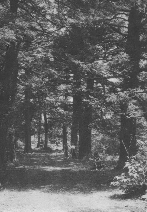
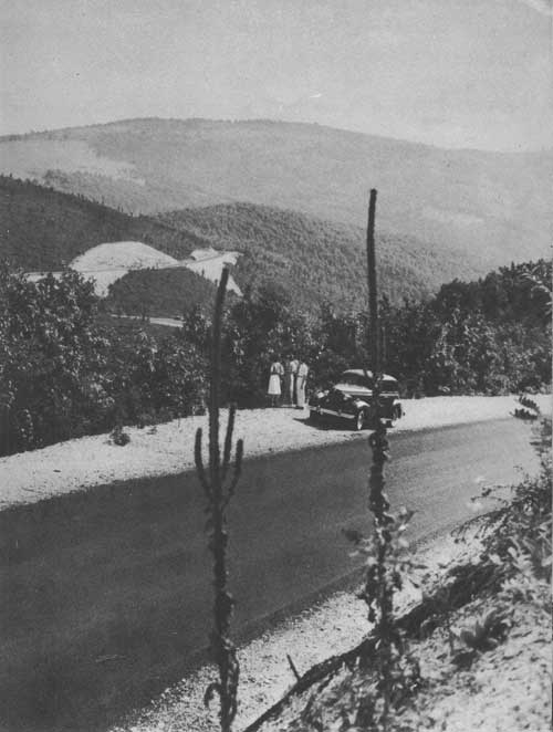 TYPICAL VIEW IN THE SOUTHERN SECTION OF THE PARK, FIRST OPENED TO AUTOMOBILE TRAFFIC IN 1939 |
GEOLOGY
THE rocks and mountains tell a story of an age-long conflict between the forces of nature. The tale begins at least a half billion years ago when the dense greenstone (Catoctin schist) which occurs frequently along Skyline Drive was poured out on a desolate rocky land as sheets of smoking lava. The scene which followed is obscure but the next clear record shows a great ocean in place of the fiery landscape. Into this inland sea which covered most of eastern North America was poured the debris of the land—sand, silt, mud, and minerals worn from the hills by the rain, wind, and other erosive agents and carried to the sea by streams. This debris accumulated to a thickness of thousands of feet and finally was changed to sandstone, shale and limestone. The latter now forms the floor of the Shenandoah Valley.
This era (Paleozoic) of accumulation of rock materials was ended by great mountain-making movements called by geologists the Appalachian revolution. Slowly but relentlessly the rocks were arched and folded. The pressure was so great that some of the folds were tightly compressed, others broke, forming faults which undoubtedly were accompanied by violent earthquakes. In places the sandstone was changed to glassy quartzites, the shales to slatey phillites. and the limestone to marble.
While these slow movements were in progress the forces of erosion were wearing away the rocks but before they were reduced to sea level a large part of the area was again submerged and the red shales and sandstones (Triassic) seen in the road cuts east of the park were deposited. A renewal of volcanic activity split the rocks and allowed sheets of molten material to force their way toward the surface. Thus were formed the bands of dense black rock (trap rock) which can be seen cutting these older rocks at the tunnel near Panorama and elsewhere.
The events of submergence, deposition, elevation, and erosion were repeated many times in the geologic history of the park to produce the present topography which now reveals the old, hard, folded, and faulted rocks as the backbone of the mountain.
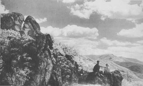
 OLD BAG MOUNTAIN, 3,291 FEET ABOVE SEA LEVEL, IS POPULAR WITH HIKERS |
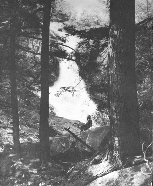
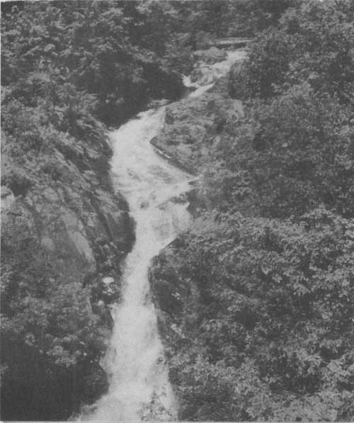 UPPER FALLS OF WHITE OAK RIVER IN WHITE OAK CANYON. HERE THE RIVER DROPS 1,500 FEET WITHIN TWO AND A HALF MILES. Virginia State Chamber of Commerce Photo |
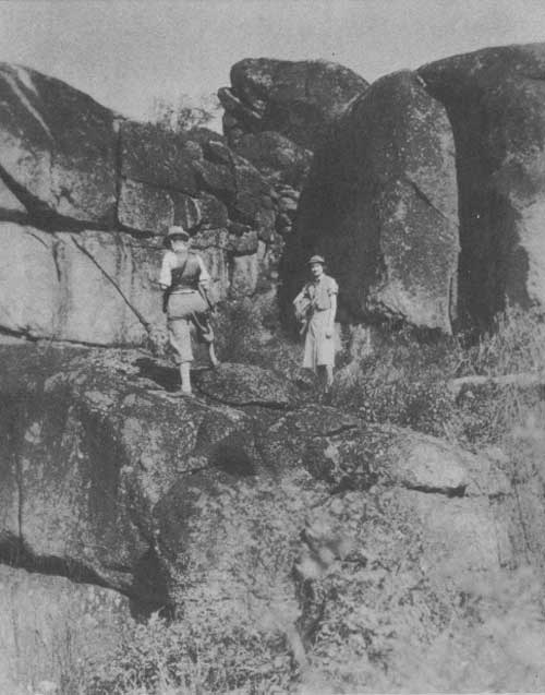
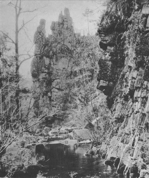 CASTELLATED CLIFFS IN THE BIG RUN AREA. SCORES OF INTERESTING GEOLOGICAL FORMATIONS ARE TO BE FOUND IN THE PARK. Norfolk and Western Railway Photo |
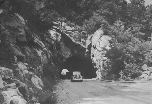 SOUTH PORTAL OF THE 700-FOOT TUNNEL THROUGH MARY'S ROCK, NEAR PANORAMA. BORED THROUGH SOLID GRANITE. IT IS ONE OF THE OUTSTANDING ENGINEERING ACCOMPLISHMENTS IN THE CONSTRUCTION OF THE DRIVE. H. Bagby (Richmond) Photo |
 HUGHES RIVER PARKING OVERLOOK, WITH STONY MAN MOUNTAIN, SECOND HIGHEST POINT IN THE PARK, TOP LEFT. H. Bagby (Richmond) Photo |
VACATION LAND
SHENANDOAH NATIONAL PARK offers to the visitor a combination of mountain and valley scenery of unsurpassed beauty. The mountains, with their rocky crags, rushing streams, haze-filled hollows, and verdant slopes, give to the visitor a sense of appreciation of scenic values derived from close association with nature. The scene is ever-changing, from day to day and season to season.
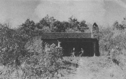 POCOSIN SHELTER IS ONE OF SEVERAL CABINS AND LEANTOS PROVIDED FOR HIKERS ALONG THE APPALACHIAN TRAIL |
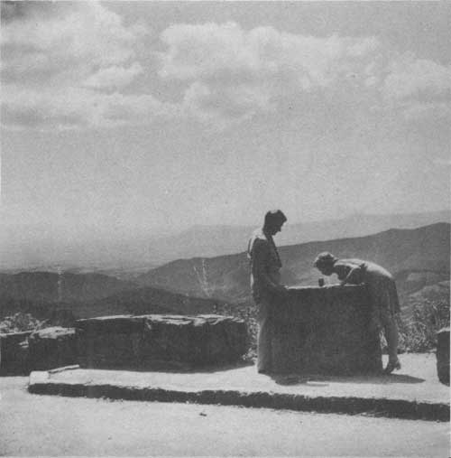
 STUDYING NATURE AT ITS BEST. Virginia Conservation Commission Photo |
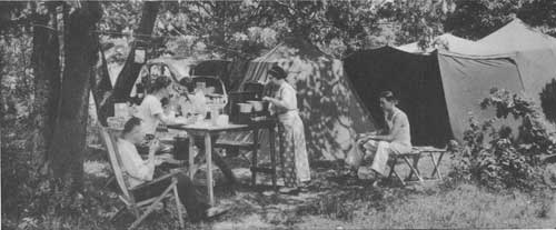 CAMPING AT THE BIG MEADOWS CAMPGROUND. Virginia Conservation Commission Photo |
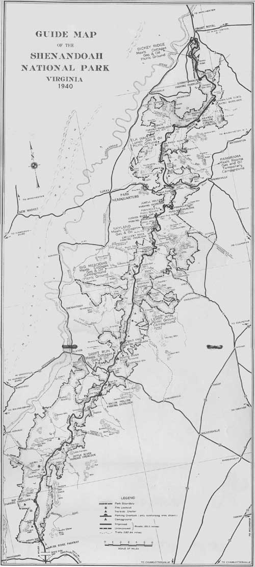 GUIDE MAP OF THE SHENANDOAH NATIONAL PARK, VIRGINIA (1940) (click on image for a PDF version) |
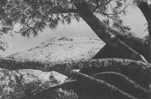 STONY MAN MOUNTAIN IN DISTANCE AFTER KING WINTER HAS BRUSHED ITS SLOPES WITH SNOW |
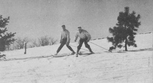 SKIING HAS BECOME A POPULAR SPORT AT PINNACLES, FORMERLY SEXTON KNOLL, JUST NORTH OF SKYLAND |
 ONE OF THE COMFORTABLE RUSTIC CABINS AT SKYLAND |
FLORA
ASIDE from the magnificent views, the profuse vegetation which smoothly cloaks the Blue Ridge never fails to charm the visitor to Shenandoah National Park.
There are fully 100 different kinds of trees in the area, 10 of which are evergreens; more than 50 shrubs, many with conspicuous flowers; hundreds of herbaceous wild flowers; and a wealth of ferns, mosses, lichens, and other plants which thrive in the moist woods.
Mountain laurel, blooming early in June, heads the list of flowering shrubs and is followed closely in profusion by azaleas, redbud, Jersey tea, nine-bark, sumac, purple-flowering raspberry, hydrangea, and witchhazel which blooms in late fall and early winter.
Any month from April through October finds an abundance of wild flowers in bloom. The large number of wild flowers to be seen by the motorist along the drive is simply a prelude to what awaits the hiker along the trails, who delights at every turn in the wondrous display of bloom.
One of the greatest displays of the spring is presented by the mountain laurel in early June over immense areas along the Skyline Drive and trails alike. The blooming of this shrub is a spectacle second only to the riotous colors of turning leaves in mid-October each year.
Because of the preponderance of hardwoods, the fall season in the park is a festival of color. Shenandoah's autumnal foliage display of all shades of crimson, gold, and russet, accentuated by the green of the conifers, bathed in the soft blue haze of Indian summer, annually attracts thousands of visitors from all over the United States. The color is usually at its height between October 10 and 20, but it is evident as early as the last week in September and remains until the end of October.
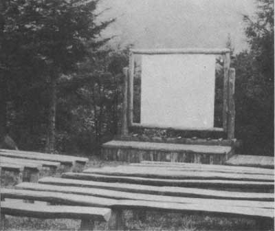 ILLUSTRATED LECTURES AND NATURALIST PROGRAMS ARE PRESENTED BY PARK RANGERS AT THE OUTDOOR THEATER AT SKYLAND |
 AMONG THE GIANT HEMLOCKS ON THE TRAIL THROUGH "LIMBERLOST SWAMP" Virginia State Chamber of Commerce Photo |
 PURE SPRING WATER IS PROVIDED AT NUMEROUS POINTS ALONG SKYLINE DRIVE Norfolk and Western Railway Photo |
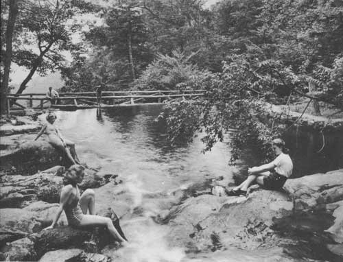 SWIMMING IN THE POOL AT WHITE OAK CANYON, APPROXIMATELY TWO MILES BY TRAIL FROM SKYLAND. Virginia Conservation Commission Photo |
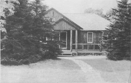
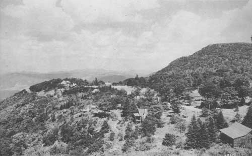 A VIEW OF SKYLAND FROM THE PORCH OF A CABIN. SKYLAND WAS A POPULAR MOUNTAIN RESORT 40 YEARS BEFORE THE ESTABLISHMENT OP SHENANDOAH NATIONAL PARK |
WILDLIFE
WHILE the population of wildlife in the region is not so great as it will be after a few years of protection, wild animals and birds are by no means absent. Bobcats and foxes move silently through the woods; white-tailed deer, raccoons, opossums, woodchucks, rabbits, and flying squirrels live in the area and are sometimes seen; gray squirrels and chipmunks are common. Hikers are often startled by the sudden booming flight of quail or ruffed grouse and are thrilled by the chattering, whistling, and warbling of numerous song birds.
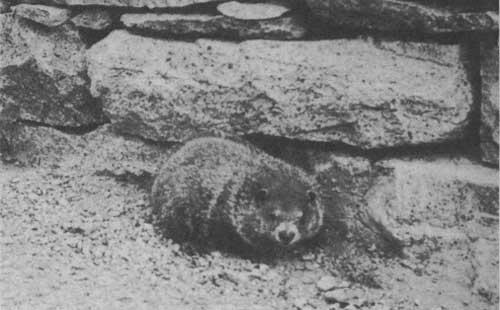 WOODCHUCK, ONE OF THE COMMON SMALL MAMMALS OF THE PARK |
 THE PASSAMAQUODDY TRAIL ON LITTLE STONY MAN MOUNTAIN IS POPULAR WITH HORSEMEN AND HIKERS. Virginia Conservation Commission Photo |
 A VIEW ALONG SKYLINE DRIVE. Virginia Conservation Commission Photo |
 LOWER FALLS IN BEAUTIFUL WHITE OAK CANYON. HERE THE HIKER MAY FOLLOW THE COURSE OF THE STREAM THROUGH UNSPOILED WILDERNESS THAT EXTENDS TO THE VALLEY FAR BELOW |
ACCOMMODATIONS
Open middle April through October, or later, depending upon weather conditions, are attractive cabins at, Dickey Ridge, Skyland, Big Meadows, and Swift Run Gap at prices ranging from approximately $1 to $4 per person. At Big Meadows is a spacious lodge situated on a cliff overlooking Page Valley. Here modern hotel accommodations may be secured at from $3 to $4 per person. There are ample restaurant facilities at Dickey Ridge, Elk Wallow, Panorama, Skyland, Big Meadows, and Swift Run Gap, where gas and oil stations are also located.
Requests for cabin or hotel reservations should be addressed to the Virginia Sky-Line Company, Inc., Skyland, Va
At Big Meadows is a public campground, where 50 trailer and 20 tent sires, tables, fireplaces, comfort stations, and a laundry and shower building are available free for periods up to thirty days.
A similar campground is planned at the Lewis Mountain area, where there are also cabins, a lunchroom, and a gas and oil station. At Big Meadows, Dickey Ridge, Elk Wallow, Lewis Mountain, Pinnacles (formerly Sexton Knoll), and South River are picnic grounds with water, fireplaces, free wood, tables and benches, comfort stations, and ample parking space. There is no charge for the use of these areas.
HOW TO REACH SHENANDOAH NATIONAL PARK
The Shenandoah National Park is accessible via main highways at four points—from State Highways 12 and 55 at Front Royal; from Lee Highway, U. S. 211, at Thornton Gap; from Spotswood Trail, U. S. 33, at Swift Run Gap, and from the Charlottesville-Waynesboro Highway, U. S. 250, 8 miles south of the park boundary.
RULES TO BE OBSERVED
It is unlawful to disturb flowers, shrubs, or trees, to mar or deface signs or buildings.
Do not park on roadway; use parking areas. Do not throw paper, lunch refuse, or other trash on road or elsewhere. Place in receptacles in all parking and picnic areas.
Fires should be built ONLY in designated picnic areas and campgrounds. Extinguish fires completely before leaving. Do not throw burning tobacco or matches on the ground.
State laws concerning fishing apply; State license required. Open season (except in closed waters), April 20 to July 5, sunrise to sunset. Only artificial bait permitted.
Hunting is prohibited.
SPEED LIMIT 35 MILES PER HOUR. Observe and obey traffic signs. Report all accidents and complaints to park rangers.
ENTRANCE FEES
Private vehicle, 25 cents per daily trip. Annual permits, $1 per private vehicle. Commercial busses, $5 per daily trip.
Any comments or suggestions for the betterment of service at Shenandoah National Park are welcomed. Address all communications to The Superintendent, Luray, Va.
| <<< Previous | <<< Contents>>> |
1940/shen/sec1.htm
Last Updated: 20-Jun-2010