|
YOSEMITE
Guidebook 1941 |

|
THE YOSEMITE VALLEY
YOSEMITE VALLEY was named for the Indians whose home it was when the first white men came in pursuit of the tribesmen in 1851. It was made a park 13 years later and administered by the State. In 1890 the high country around the Valley was made a national park and in 1906 the State receded Yosemite Valley to the Federal Government.
The Valley is surrounded by cliffs and pinnacles 3,000 to 5,000 feet high, with many spectacular waterfalls. There are green forests of pine and fir, wide expanses of meadow, and an abundant supply of clear, cold water. The climate is delightful the year 'round, and each season has its inviting charm. Here campers may pitch their tents where the song of the Merced River and the distant waterfalls bring peace and contentment, away from the confusion and noise of the city.
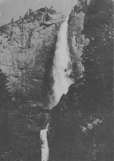
Waterfalls are an outstanding attraction. The thundering waters of Yosemite Falls plunge 2,425 feet from canyon brim to base of lower fall. The upper Yosemite Fall, highest free leaping waterfall in the world, drops 1,430 feet. Bridalveil, 620 feet, can be seen from all three of the scenic approach roads. The Ribbon Fall is 1,612 feet.
The falls are at their best in May and June when winter snows are melting; some are entirely dry by August 15 when there has been little rain or snow.
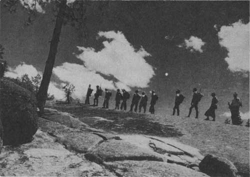
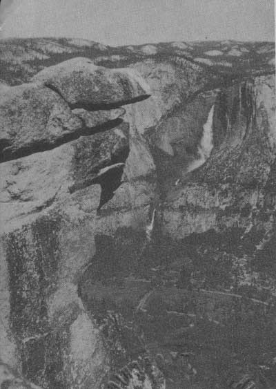 GLACIER POINT OVERLOOKS YOSEMITE VALLEY, 3,254 FEET BELOW. THE FIREFALL ORIGINATES HERE EVERY. EVENING DURING THE SUMMER. |
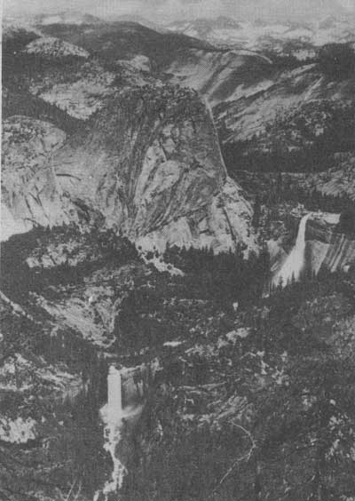
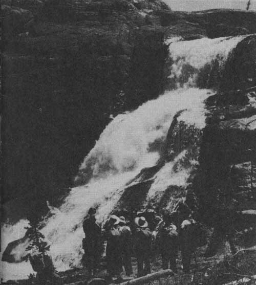
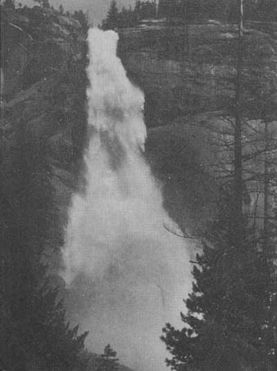 NEVADA FALL, 594 FEET HIGH, WHICH IS LOCATED IN THE MERCED GORGE ABOVE THE VALLEY, LEAPS AND ROARS IN THE WILDEST DISPLAY OF WATER ENERGY IN YOSEMITE. IT IS EASILY REACHED ON FOOT OR HORSEBACK BY A 3-1/2-MILE TRAIL FROM HAPPY ISLES. |
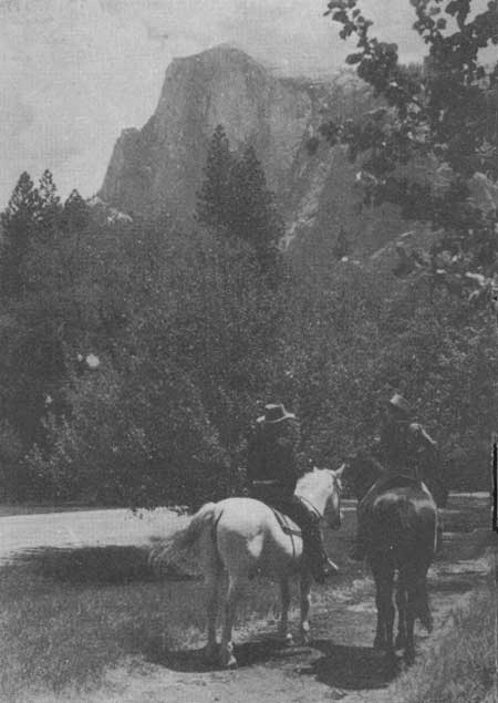 HORSEBACK RIDERS LOOK TOWARD HALF DOME, LIFTING ITS AGE-OLD HEAD ALMOST A MILE HIGH TO STAND GUARD OVER THE EAST PORTION OF THE VALLEY. |
 YOSEMITE FALLS ARE HEAVIEST IN MAY WHEN THE RUSH OF WATER BECOMES ALMOST APPALLING. |
 GLACIER POINT, THE VIEWS FROM GLACIER POINT ARE OUTSTANDING. HERE VERNAL AND NEVADA FALLS DOMINATE THE FOREGROUND, WITH SNOW-CLAD PEAKS IN THE DISTANCE. |
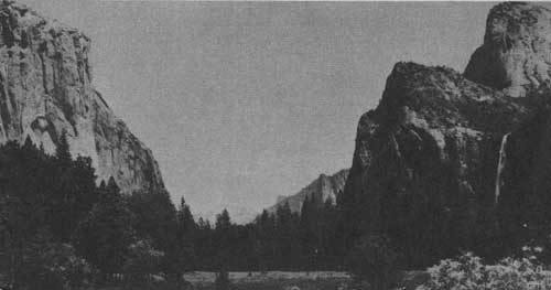
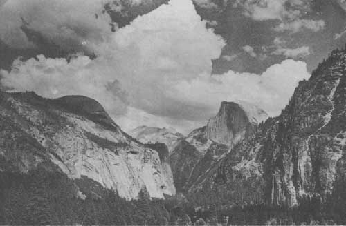
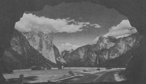 THE WHOLE GRAND SWEEP OF YOSEMITE VALLEY IS SEEN FROM THE WAWONA ROAD TUNNEL. BEYOND THE LARGE PARKING AREA EL CAPITAN RISES ON THE LEFT, WHILE SENTINEL ROCK, CATHEDRAL ROCKS, AND BRIDALVEIL FALL ARE VIEWED TO THE RIGHT. CLOUDS REST, LITERALLY LOST IN THE CLOUDS, RISES BEYOND HALF DOME IN THE DISTANCE TO COMPLETE AN ENCHANTING PICTURE. |
THE DOMES AND CLIFFS
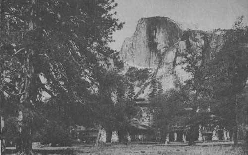
Among the most striking and widely known features of Yosemite National Park are the great domes and cliffs. El Capitan, one of the largest exposed monoliths in the world, rises 3,604 feet above the Valley floor, while Half Dome, most impressive of these massive features, is 8,852 feet above sea level and towers 4,892 feet above the Valley.
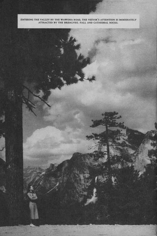 ENTERING THE VALLEY BY THE WAWONA ROAD, THE VISITOR'S ATTENTION IS IMMEDIATELY ATTRACTED BY THE BRIDALVEIL FALL AND CATHEDRAL ROCKS. |
HOW YOSEMITE VALLEY WAS FORMED
Yosemite Valley, 7 miles long, averaging 1 mile in width and 4,000 feet above sea level, was cut to its great depth by the Merced River which flows through it. The river was repeatedly accelerated to torrential speed by the uplifts which in the course of many million years have given the Sierra Nevada its great height. Each acceleration cut the channel deeper, until there was a V-shaped canyon over 2,000 feet deep. The lesser side streams, meanwhile, were unable to cut so fast, and their valleys were left hanging high above the bottom of the canyon. Thus the original canyon became adorned with many cascades of great height.
Then came the ice age, and mighty glaciers descended from the crest of the range, filling the canyon literally to its brinks and extending beyond the site of El Portal. Forcing its way with tremendous power, the moving glacier gradually widened the canyon to a broad U-shaped trough, cut back the sloping sides to sheer cliffs, and transformed the cascades into leaping waterfalls. It also added to the depth of the Valley, excavating a lake basin in its rock floor. Melting away, the glacier left a lake 5-1/2 miles long. But the lake did not endure, for the Merced River brought down vast quantities of sand and gravel which eventually filled the lake completely and made a level floor.
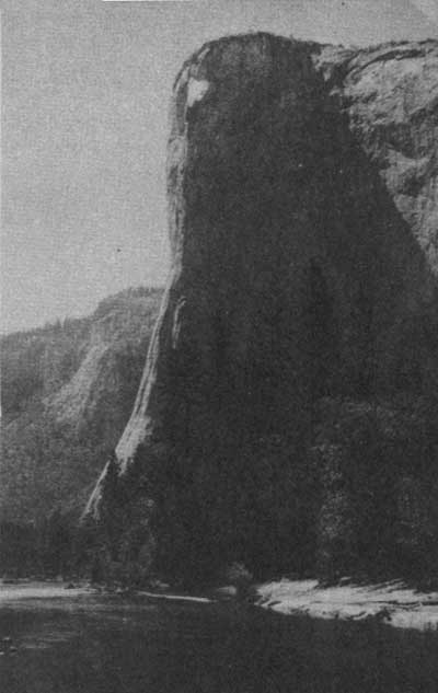 EL CAPITAN, RISING 3,604 FEET ABOVE THE VALLEY, IS A BREATH-TAKING SIGHT. THIS MAGNIFICENT MONOLITH IS ONE OF THE BEST KNOWN OF THE MANY GREAT CLIFFS TO BE FOUND IN YOSEMITE. |
 MAJESTIC PEAKS SURROUND YOSEMITE VALLEY |
GLACIER POINT ON THE RIM OF THE VALLEY
On the south rim of Yosemite Valley, overlooking a wide panorama of the High Sierra, is Glacier Point. Considered the finest observation point in the park, it offers a magnificent view of glacier-quarried canyons, granite domes, and waterfalls. Sunsets and sunrises are spectacular. A hotel, campground, and cafeteria are open in summer, and the historic old Mountain House offers meals and lodging all year, although the road is closed most of the winter.
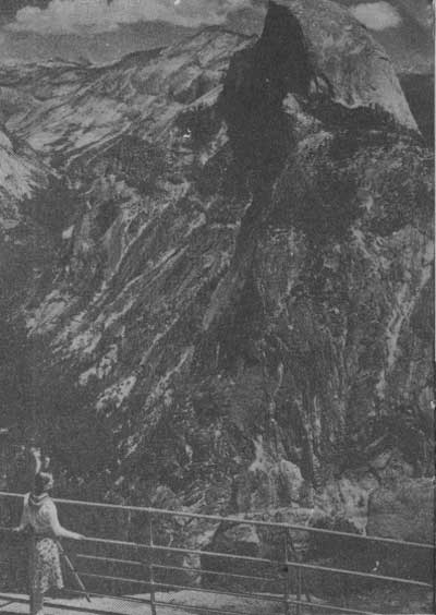 HALF DOME, WHOSE LEVEL GRANITE TOP IS REACHED BY MEANS OF 900 FEET OF STEEL CABLE, IS IMPRESSIVE FROM GLACIER POINT. |
ANIMALS AND PLANTS
Like other national parks, Yosemite is a wildlife sanctuary, and no hunting is permitted. Five life zones are represented, permitting a wide variety of animal and plant life. There are approximately 60 species of mammals in the park, more than 200 varieties of birds, about 25 kinds of reptiles, and 12 of amphibians. Bears are numerous, and while apparently tame, may be dangerous. Do not feed them. Deer may be seen throughout the park. Over 1,300 varieties of flowering plants have been recorded in the park.
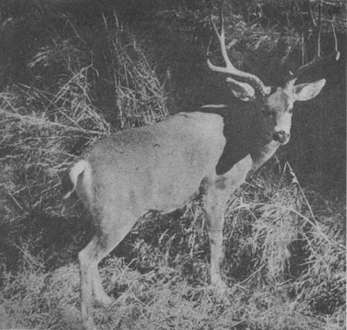 WILDLIFE IN YOSEMITE NATIONAL PARK IS PROTECTED AGAINST HUNTING. HERE DEER AND OTHER ANIMALS WHICH HAD BEEN DISAPPEARING RAPIDLY NOW THRIVE UNDER GOVERNMENT PROTECTION. THE ALERT CAMERA 'HUNTER' WILL BE REWARDED WITH EXCELLENT PICTURES. |
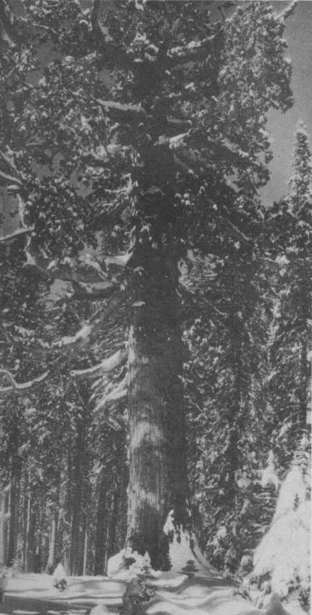
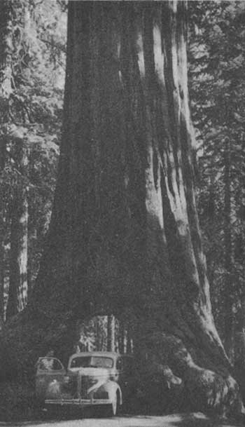 THE WAWONA TREE HAS BEEN FEATURED IN GEOGRAPHY BOOKS EVER SINCE THE TUNNEL WAS CUT IN 1881. IT IS 231 FEET HIGH AND 27.5 FEET IN DIAMETER AT THE BASE. THE TUNNEL IS 26 FEET LONG. |
MARIPOSA GROVE
An easy drive of 35 miles from the Valley on a paved highway takes the visitor to the Mariposa Grove of Big Trees. These sequoias, oldest of living things, once grew in many parts of the world, but now may be seen in their native habitat only in the isolated groves on the west slope of the Sierra Nevada. With diameters up to 30 feet at the base, and rising nearly 300 feet, they form a picture never to be forgotten.
There are two other groves of giant sequoias in the park. The Tuolumne Grove, 17 miles from the Valley, is on the Big Oak Flat Road, while the Merced Grove, 8 miles west of Crane Flat, is in a secluded corner of the park.
 THE GRIZZLY GIANT, 27.6 FEET IN DIAMETER, IS THE MOST GNARLED AND UNDOUBTEDLY THE OLDEST TREE IN THE MARIPOSA GROVE. ABOUT 3,800 YEARS OLD, IT WAS A SAPLING AT THE TIME OF THE BUILDING OF THE PYRAMIDS. |
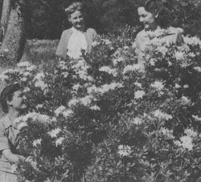 AZALEAS GROW ABUNDANTLY IN THE MEADOWS, ON THE BANKS OF THE MERCED RIVER, AND ALONG MANY OF THE ROADS IN THE PARK. THEY ARE USUALLY AT THEIR BEST IN EARLY JUNE. |
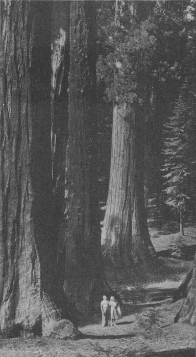 VISITORS STAND SILENTLY IMPRESSED BY THE IMMENSITY OF THE SEQUOIAS. SO GREAT IS THE RESISTANCE OF THESE TREES TO DISEASE, INSECT PESTS, AND FIRE THAT THEY APPEAR TO BE ALMOST IMMORTAL. |
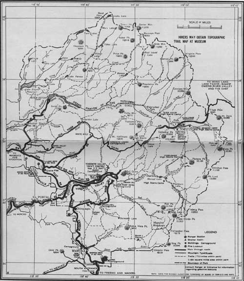 GUIDE MAP OF YOSEMITE NATIONAL PARK (click on image for a PDF version) |
 HALF DOME DOMINATES THIS SWEEPING PANORAMA OF THE YOSEMITE VALLEY |
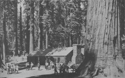 A LOG CABIN MUSEUM IN THE HEART OF THE MARIPOSA GROVE CONTAINS MANY EXHIBITS WHICH TELL THE STORY OF THE SEQUOIAS. |
 WISE VISITORS MAKE THE YOSEMITE MUSEUM THEIR HEADQUARTERS. HERE ARE INTERESTING EXHIBITS OF GEOLOGY, INDIANS, PLANTS, AND ANIMALS OF THE AREA. GIANT RELIEF MAPS FACILITATE THE PLANNING OF HIKES AND SADDLE TRIPS. A NATIVE WILDFLOWER GARDEN IS AN IMPORTANT FEATURE. MAPS AND BOOKLETS ABOUT YOSEMITE ARE AVAILABLE AT THE MUSEUM. |
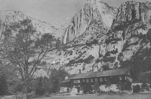
 THE AHWAHNEE HOTEL, CONSTRUCTED OF STONE AND REINFORCED CONCRETE, IS ATTRACTIVELY DESIGNED TO BLEND WITH ITS SURROUNDINGS. IT IS OPEN ALL YEAR. |
THE HIGH COUNTRY
To the north and east of Yosemite Valley extends a vast sea of granite peaks, dotted with innumerable lakes and high mountain meadows of vivid green studded with myriads of wildflowers during July and August. Here living glaciers nestle in the shadows of the highest peaks. This is truly a hiker's paradise, for rain seldom falls between June and September, except for occasional refreshing afternoon showers, and some 600 miles of fine trails invite one to enchantingly beautiful spots. Fishing may be enjoyed in all the larger streams and lakes.
Seven-day hikes, conducted without charge by ranger-naturalists of the National Park Service, start every Monday morning during July and August from Happy Isles. Averaging 10 miles a day, the hikers make a wide circuit of the High Sierra, sleeping each night at a comfortable camp.
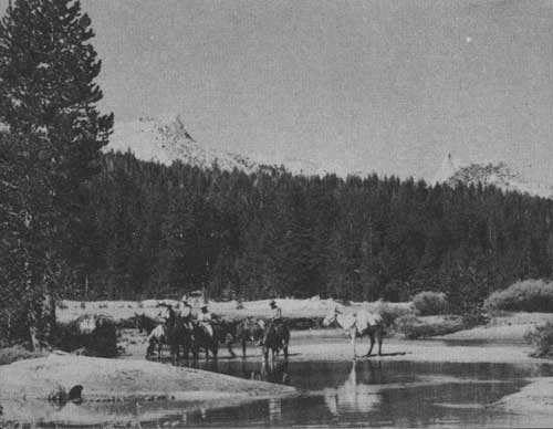
Horseback riding on the High Sierra trails is an experience enjoyed by ever increasing numbers of visitors. Saddle and pack stock and equipment may be rented at several points in the park.
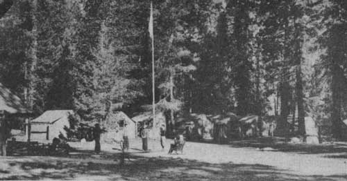
There are many campgrounds in the outlying areas of Yosemite, including those at Mariposa Grove and Wawona on the Wawona Road; Glacier Point and Bridalveil Meadows on the Glacier Point Road; and Porcupine Flat, Yosemite Creek, Tenaya Lake, and Tuolumne Meadows on the Tioga Road.
Tuolumne Meadows, over 8,600 feet above sea level, are the largest meadows in the High Sierra, and the starting point for many interesting trips on foot or horseback. A store, lodge, gas station, and free public campground are here.
 THOSE WHO TAKE THE 7-DAY HIKES CONDUCTED BY THE NATIONAL PARK SERVICE ARE ASSURED OF A PLEASANT OUTING. EACH GROUP IS LIMITED TO 15. |
 TUOLUMNE MEADOWS, WITH UNICORN AND CATHEDRAL PEAKS OUTLINED IN THE DISTANCE. |
 ONE OF THE LARGEST HIGH SIERRA CAMPS IS AT MERCED LAKE, 13 MILES FROM YOSEMITE VALLEY. FAR FROM THE NEAREST ROAD, HIKERS AND SADDLE PARTIES FIND THE UTMOST IN COMFORT AND QUIET HERE. |
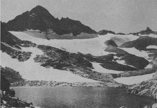 LIVING GLACIERS CLING TO THE NORTH SLOPES OF MANY HIGH SIERRA PEAKS, SUCH AS MT. MACLURE, 13,000 FEET. WHILE THERE ARE NO CONSTRUCTED TRAILS TO MANY OF THESE PEAKS, HIKING IS COMPARATIVELY EASY FOR EXPERIENCED MOUNTAINEERS. |
 HIKERS ALONG THE TUOLUMNE RIVER ARE IMPRESSED BY THE ROARING WATERFALLS AND CASCADES NEAR THE TRAIL. GREEN POOLS BELOW THESE FALLS TEMPT TROUT FISHERMEN. |
WINTER SPORTS
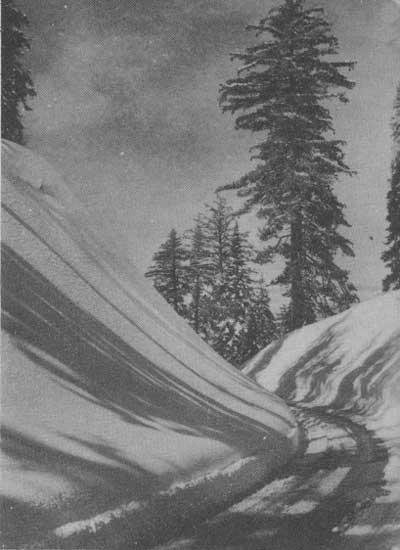
In winter, Yosemite is an ideal sports playground. Skiing, skating, tobogganing, and other forms of recreation add to the popularity of the park in this season. Badger Pass, elevation 7,300 feet, is the center of skiing activity. A ski house and ski lift facilities which transport skiers to the higher parts of the ski area are maintained by the Yosemite Park and Curry Co. Signed ski runs and trails of various lengths and other facilities are maintained by the National Park Service. A ranger is stationed at Badger Pass throughout the winter season.
 BORDERING THE GLACIER POINT ROAD, WHICH IS KEPT OPEN AS FAR AS BADGER PASS IN WINTER, ARE MANY MAGNIFICENT SUGAR PINES. |
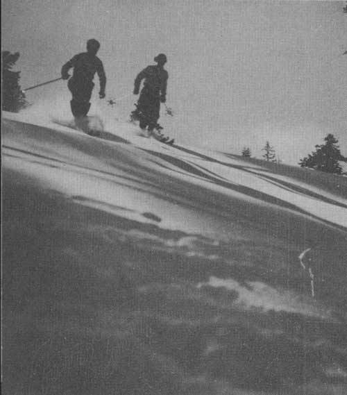 SKIERS ENJOYING THE SLOPES AT BADGER PASS. |
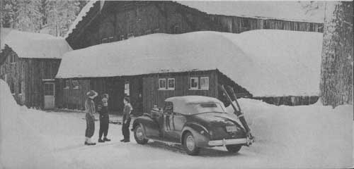 AT THE SKI LODGE AT BADGER PASS, EQUIPMENT IS RENTED AND HOT LUNCHES, SANDWICHES, AND REFRESHMENTS ARE SERVED. |
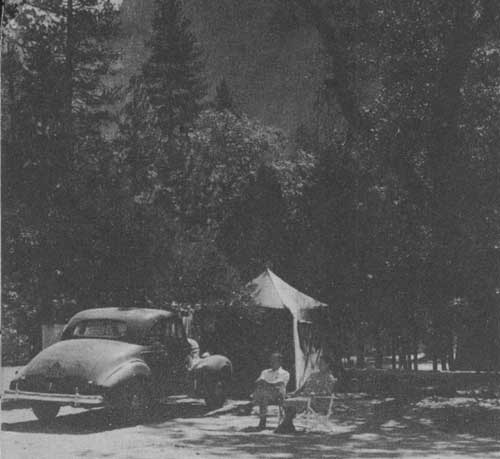 CAMPING IN YOSEMITE VALLEY. HERE THE NATIONAL PARK SERVICE MAINTAINS WATER HYDRANTS, HEAVY TABLES WITH BENCHES ATTACHED, AND MODERN REST ROOMS. A RANGER IS STATIONED AT THE ENTRANCE TO EACH CAMPGROUND TO HANDLE REGISTRATION, ASSIST VISITORS, AND ADMINISTER THE AREA. |
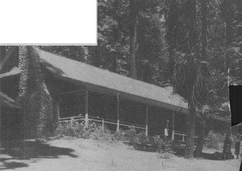 AN ATTRACTIVE LODGE OF ARCHITECTURE COMMON IN CALIFORNIA DURING THE "GOLD RUSH" DAYS OFFERS COMFORTABLE ACCOMMODATIONS FOR THOSE WHO WISH TO SLEEP IN THE MIDST OF THE MARIPOSA BIG TREES IN SUMMER. |
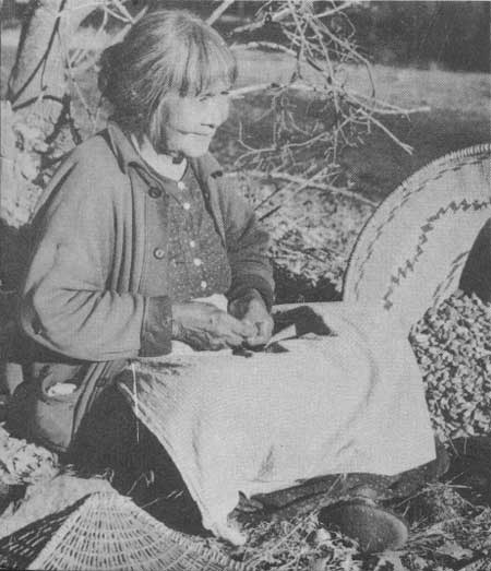 TA-BU-CE, ELDERLY INDIAN WOMAN, POUNDS ACORNS BACK OF THE YOSEMITE MUSEUM IN A MODEL INDIAN VILLAGE. SHE DOES NATIVE COOKING, BEAD WORK AND BASKET WEAVING, AND RELATES STORIES OF OLD TIMES TO HER MANY WHITE FRIENDS. THIS IS ONE OF THE FEW PLACES WHERE CALIFORNIA INDIANS MAY BE SEEN AT WORK ON THEIR NATIVE ARTS AND CRAFTS. |
HOW TO REACH YOSEMITE NATIONAL PARK
There are four principal entrance roads to Yosemite:
By Automobile.—The All-Year Highway from Merced is a modern highway, hard-surfaced throughout. Distance from Merced to Yosemite Valley is 81 miles. Arch Rock Entrance Station is open from 5 a. m. to midnight throughout the year.
Automobile permit fee $2; house trailers $1; motorcycles $1. Good for same vehicle the entire calendar year.
The Wawona Road, connecting with State Highway No. 41 from Fresno and Madera, is a modern road, surfaced throughout. Distance from Fresno to Yosemite Valley is 94 miles from Madera to Yosemite Valley, 88 miles. South entrance is open daily from 6 a. m. to midnight, May 29 to September 15, inclusive, and to 10 p. m. during the rest of the year, except Friday and Saturday nights, when it closes at 11 p. m.
The Big Oak Flat Road, from U. S. Highway No. 99 at Manteca, via Oakdale and Groveland, is paved or oil-surfaced throughout. It is a winding mountain road which traverses the foothills and mountains from Yosemite Junction to Crane Flat, whence a modern high-gear road leads to Yosemite Valley. Distance from Manteca to Yosemite Valley is 118 miles. The entrance station is open from 6 a. m. to midnight, May 29 through Sept. 1; 6 a. m. to 10 p. m. remainder of year when open. This road is closed by snow during winter.
The Tioga Road, entering the park from the east through Leevining on U. S. Highway No. 395, via Tioga Pass and Tuolumne Meadows, and connecting with the Big Oak Flat Road at Crane Flat, is paved or oil-surfaced throughout. There are 20 miles of narrow oil-surfaced road inside the park. Leevining to Yosemite Valley is 76 miles. Tioga Pass Entrance Station is open from 6 a. m. to midnight during summer, through September 15; during remainder of year, when road is open, to 10 p. m. This road is closed by snow during winter.
By Railroad and Bus.—Yosemite National Park is served by the Yosemite Valley Railway, from Merced to El Portal near the western park boundary, and by buses of the Yosemite Transportation stem from Merced and Fresno to Yosemite Valley. Connections are made at Merced and Fresno with the Southern Pacific and Santa Fe Railroads and the Pacific Greyhound and Santa Fe Trailways buses. Rail and bus service from Merced is on an all-year basis; however, bus service from Fresno is available during summer season only. Yosemite Transportation System buses connect with Yosemite Valley Railway trains at El Portal.
From about July 4 to September 3 cars of the Yosemite Transportation System operate daily between Yosemite Valley and Lake Tahoe, via the Tioga Road.
By Airplane.—Airline service is furnished to Fresno by United Airlines Transport Corp. and TWA. Connections with transcontinental planes are made at San Francisco and Los Angeles. In addition, a daily Service between Fresno, Boulder City, and eastern points is furnished by TWA.
ACCOMMODATIONS
Tent, cabin, and hotel accommodations, meal service, stores, and photographic studios are operated under contracts with the Government. Free public campgrounds are maintained by the National Park Service.
For further information regarding park regulations or other matters write to the Superintendent, Yosemite National Park, Calif., or to the Director, National Park Service, Washington, D. C.
| <<< Previous | <<< Contents>>> |
19401/yose/sec1.htm
Last Updated: 20-Jun-2010