|
This month as we explore the evolution of the National Park System, it is fitting to look back
at park units which were created but due to various reasons delisted and removed from the National
Park System. Barry Mackintosh explores 23 such units. Alan Hogenauer explores this subject in
greater depth with two excellent articles: Gone,
But Not Forgotten: The Delisted Units of the U.S. National Park System George Wright Forum, Vol. 7 No. 4, 1991
and An
Update to Gone, But Not Forgotten: The Delisted Units of the U.S. National Park System George Wright Forum, Vol. 8 No. 3, 1992,
and more recently Joe Weber revisits this subject in America's
Lost National Park Units: A Closer Look George Wright Forum, Vol. 33 No. 1, 2016.
In a second article we'll take a quick look at some of the park proposals which
never resulted in declaration as national park units.
Former National Park System Units: An Analysis
Barry Mackintosh
1995
Between 1930 and 1994, 23 units of the National
Park System were transferred from National Park Service
administration to other custody. (Not included in this number are
areas authorized but never established as park system units, such
as Georgia O'Keeffe National Historic Site and Zuni-Cibola
National Historical Park.) These former units, in order of their
divestiture from the system, are as follows:
Papago Saguaro National Monument,
Arizona: Established by presidential proclamation Jan. 31, 1914;
transferred to state of Arizona by act of Congress Apr. 7,
1930.
Sullys Hill National Park, North Dakota:
Established by act of Congress Apr. 27, 1904; transferred to U.S.
Dept. of Agriculture by act of Congress Mar. 3, 1931.
Lewis and Clark Cavern National
Monument, Montana: Established by presidential proclamation
May 11, 1908; transferred to state of Montana by act of Congress
Aug. 24, 1937.
Chattanooga National Cemetery
(U.S. Department of Veterans Affairs) |
Chattanooga National Cemetery,
Tennessee: Established under War Department by Army general order
Dec. 25, 1863; transferred to NPS by presidential executive order
effective Aug. 10, 1933; returned to War Department by act of
Congress Dec. 7, 1944.
Shasta Lake Recreation Area, California:
NPS administration arranged by agreement with Bureau of
Reclamation May 22, 1945; transferred to Forest Service by act of
Congress effective July 1, 1948.
Lake Texoma Recreation Area,
Texas-Oklahoma: NPS administration arranged by agreement with
Corps of Engineers Apr. 18, 1946; returned to Corps of Engineers
by termination of agreement June 30, 1949.
Father Millet Cross National Monument,
New York: Established under War Department by presidential
proclamation Sept. 5, 1925; transferred to NPS by presidential
executive order effective Aug. 10, 1933; transferred to state of
New York by act of Congress Sept.7, 1949.
Wheeler National Monument, Colorado:
Established under Forest Service by presidential proclamation Dec.
7, 1908; transferred to NPS by presidential executive order
effective Aug. 10, 1933; returned to Forest Service by act of
Congress Aug.3, 1950.
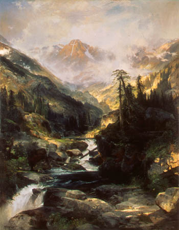
Mountain of the Holy Cross
Thomas Moran 1875
(Autry Museum of Western Heritage) |
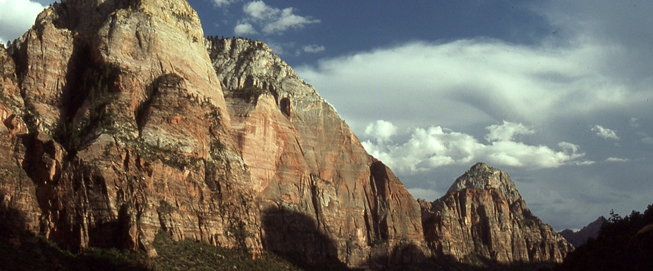
Holy Cross National Monument, Colorado:
Established under Forest Service by presidential proclamation May
11, 1929; transferred to NPS by presidential executive order
effective Aug. 10, 1933; returned to Forest Service by act of
Congress Aug.3, 1950.
New Echota Marker, Georgia: Authorized
under War Department by act of Congress May 28, 1930; transferred
to NPS by presidential executive order effective Aug. 10, 1933;
transferred to state of Georgia by act of Congress Sept.21,
1950.
Atlanta Campaign National Historic Site,
Georgia: Established by Secretary of the Interior's order Oct. 13,
1944; transferred to state of Georgia by act of Congress Sept.21,
1950.
Shoshone Cavern National Monument,
Wyoming: Established by presidential proclamation Sept. 21, 1909;
transferred to Cody, Wyoming, by act of Congress May 17,
1954.
Old Kasaan National Monument, Alaska:
Established by presidential proclamation Oct. 25, 1916;
transferred to Forest Service by act of Congress July 26,
1955.
Castle Pinckney National Monument, South
Carolina: Established under War Department by presidential
proclamation Oct. 15, 1924; transferred to NPS by presidential
executive order effective Aug.10, 1933; transferred to state of
South Carolina following act of Congress declaring property
surplus Mar. 29, 1956.
Verendrye National Monument, North
Dakota: Established by presidential proclamation June 29, 1917;
transferred to state of North Dakota by act of Congress July 30,
1956.
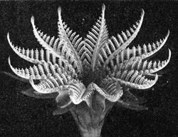
Fossil Cyad |
Fossil Cycad National Monument, South
Dakota: Established by presidential proclamation Oct. 21, 1922;
transferred to Bureau of Land Management by act of Congress Aug.
1, 1956.
Millerton Lake Recreation Area,
California: NPS administration arranged by agreement with Bureau
of Reclamation May 22, 1945; transferred to state of California by
lease agreement Nov. 1, 1957.
Flaming Gorge Recreation Area,
Utah-Wyoming: NPS administration arranged by agreement with Bureau
of Reclamation July 22, 1963; transferred to Forest Service by act
of Congress Oct. 1, 1968.
St. Thomas National Historic Site,
Virgin Islands: Established by Secretary of the Interior's order
Dec. 24, 1960; transferred to Virgin Islands government by act of
Congress Feb. 5, 1975.
Shadow Mountain
(from 1957 park brochure) |
Shadow Mountain Recreation Area,
Colorado: NPS administration arranged by agreement with Bureau of
Reclamation June 27, 1952; transferred to Forest Service by act of
Congress effective Mar.1, 1979.
Mar-A-Lago National Historic Site,
Florida: Designated by Secretary of the Interior's order Jan. 16,
1969; NPS administration authorized by act of Congress Oct.21,
1972; returned to Post Foundation by act of Congress Dec.23,
1980.
National Visitor Center, Washington, DC:
Authorized by act of Congress Mar. 12, 1968; transferred to
Department of Transportation by act of Congress Dec. 29,
1981.
John F. Kennedy Center for the Performing
Arts, Washington, DC: NPS administration authorized by act of
Congress June 16, 1972; transferred to Kennedy Center Trustees by
act of Congress July 21, 1994.
The NPS had a visible staff presence at only
eight of the 23 areas. Five of these were reservoir recreation
areas--Flaming Gorge, Shasta Lake, Lake Texoma, Millerton Lake,
and Shadow Mountain--where NPS involvement resulted from
agreements with the Bureau of Reclamation or the Corps of
Engineers rather than specific acts of Congress. Because Congress
had not mandated NPS involvement and because the NPS was not
deeply committed to reservoir recreation management, the bureau
willingly relinquished these areas to other agencies willing to
accept them. Three of them went to the Forest Service because it
already administered the surrounding lands and could more
efficiently manage the reservoir recreation facilities.
The sixth area that the NPS actively managed
was Chattanooga National Cemetery. Inherited from the War
Department in 1933 together with Chickamauga and Chattanooga
National Military Park, the cemetery was returned to that
department in 1944 because it was physically removed from the park
and was still used for burials.
The two other areas with a visible NPS presence
were the National Visitor Center and the John F. Kennedy Center
for the Performing Arts in Washington, DC--both atypical park
units. In the first case, Congress determined that the visitor
center concept had failed and that Washington's Union Station
could better be redeveloped privately under Department of
Transportation auspices. In the second case, Congress decided that
the organization responsible for the center's performing arts
functions could also assume the Service's responsibility for
managing the building.
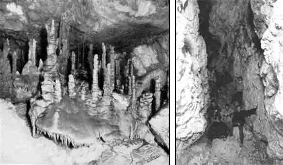
Left: Lewis and Clark Caverns
(Photo by D. B. Church. Courtesy National Geographic Society)
Right: Shoshone caverns Photo by F. J. Hiscock |
Most of the other 15 areas were transferred
because their significance was marginal and/or they did not lend
themselves well to park development and use. Two national
monuments inherited from the War Department in 1933 exemplified
both shortcomings: Castle Pinckney paled in comparison with
another island fortification in Charleston Harbor, Fort Sumter;
and Father Millet Cross featured only a stone cross erected by the
Knights of Columbus in 1926. Verendrye National Monument was found
to have no historical connection with the French explorer for whom
it was named. Fossil Cycad National Monument later disclosed few
of the fossils for which it had been proclaimed. Old Kasaan
National Monument was inaccessible to the public, and the totem
poles that were its primary feature were ultimately removed to a
museum. Sullys Hill National Park lacked notable natural qualities
worthy of its designation and became a game preserve under the
Agriculture Department. The most recent divestiture before the
Kennedy Center and National Visitor Center, Mar-A-Lago National
Historic Site, was never opened to the public and could not be
maintained with the endowment left by Marjorie Merriweather Post
for that purpose.
It is noteworthy that six of the 23 areas--more
than a quarter--had been established under Agriculture or War
department auspices before being transferred to the NPS by
executive order in 1933 and thus had not been subject to prior NPS
evaluation.
Except for two of the reservoir areas, all of
the areas were divested from the National Park System by acts of
Congress. The NPS normally took the initiative in recommending the
transfers and drafted the legislation.
The following generalizations may be made about
the 23 areas divested from the National Park System:
Areas in public use under NPS custody
remained in public use with no significant reductions in services
under their new custodians. Both the NPS and the receiving parties
supported the transfers. There was no significant public or
political opposition to the transfers. None of the divested areas would meet
current NPS standards for inclusion in the National Park
System.
 Information regarding Fossil Cycad,
Lewis and Clark Cavern, Shoshone Cavern, and Verendrye can be obtained
by reading the 1930 issue of
Glimpses of National Monuments,
as well as additional information on these and other National Monuments
by reading the 1913,
1914,
1915
Report on Sullys Hill Park, Casa Grande Ruin; The Muir Woods, Petrified
Forest, and Other National Monuments, Including List of Bird Reserves.
Information regarding Fossil Cycad,
Lewis and Clark Cavern, Shoshone Cavern, and Verendrye can be obtained
by reading the 1930 issue of
Glimpses of National Monuments,
as well as additional information on these and other National Monuments
by reading the 1913,
1914,
1915
Report on Sullys Hill Park, Casa Grande Ruin; The Muir Woods, Petrified
Forest, and Other National Monuments, Including List of Bird Reserves. |
Addendum
The following is a list of additional delisted units excerpted
from Alan Hogenauer's articles listed above.
Camp Blounts Tables National Memorial,
Tennessee: All that remains of this site is a stone marker along U.S.
Highway 231 near Fayetteville, Tennessee. The site was authorized to
commemorate the rendezvous of Andrew Jackson's troops in 1813, en route to
Horseshoe Bend. Another rendezvous occurred at Camp Blount of troops en
route to the Second Seminole War in 1836.
In 1861, an arched stone bridge was completed across
the Elk River, not far from the site. Both the camp and the bridge played
minor roles in the Civil War: Union troops of the Army of the Cumberland
occupied the camp in 1863 and spared the bridge from
destruction.
A 1927 proposal to make the area a National Military
Park was unsuccessful, but in 1930 the Secretary of War was authorized to
accept, by donation and gift, lands sufficient to commemorate both the
camp and bridge. In 1933, the site was transferred from the War
Department to the National Park Service, but nothing further was done to
develop the park, and in 1944 it was abolished. In 1969, the old stone
bridge collapsed. With a shopping center now covering the bivouac site,
only the forgotten marker is left.
Mackinac Island National Park, Michigan: There
are bound to be exceptions to any classification scheme, and this is one
of them. This unique delisted National Park, lying in the Straits of
Mackinac between Michigan's two peninsulas, was both established and
removed before creation of the National Park Service in 1916.
Initially designated in 1875, Mackinac Island National
Park was never operated in the sense that the term implies today. Under
War Department oversight, lots along the bluffs overlooking Lake Huron
were leased to wealthy individuals for home sites, and the Army was the
principal administrative force during the twenty-year life of the
Park.
The focus of historical interest on the island, Fort
Mackinac, was begun by the British in 1780, surrendered unfinished to the
United States in 1796 under the terms of Jay's treaty of 1794, and
recaptured by the British during the War of 1812. John Jacob Astor made
the island the northern headquarters of his American Fur Company in 1815.
Although the furt trade declined steadily after 1840, the fort itself
remained active throughout most of the period that the National Park
existed.
During this time, thousands of visitors flocked to the
island in season. The destination was widely featured in steamboat and
railroad excursion leaflets and advertisements, and numerous resort hotels
were developed, including the massive Grand Hotel, built in 1887 and still
open for guests.
In 1894 the Army finally abandoned the fort and the
island; the next year, the island was transferred to the state of Michigan
for use as a state park. Today Mackinac Island remains a principal
tourist destination, and is served by seasonal ferry connections from St.
Ignace and Mackinaw City at either end of the Mackinac Bridge. On the
island itself, the historic fort is well-preserved under the
administration of the Mackinac Island State Park Commission.
Fort Benton, Montana: On 1976, legislation
authorized the National Park Service to build and maintain a visitor
center at Fort Benton, forty miles northeast of Great Falls, Montana, to
commerate the historic fur trading post on the Missouri River. The
authorization was never acted upon, however, and the park-elect was
delisted by 1985. There is still a small, but active, community at Fort
Benton; the superb Grand Union Hotel and the ruins of the orginal fort can
still be visited.
White Plans National Battlefield Site, New York:
The battle of White Plains, New York, was fought from October 28 to
November 1, 1776, as General George Washington's patriot army, moving
northward in retreat from Long Island and Manhattan, successfully delayed
further advances by Sir William Howe's pursuing British forces.
To commemorate various locations pertinent to this
fighting, White Plains National Battlefield Site was proclaimed under War
Department administration in 1926, and transferred to the National Park
Service in 1933. No federal lands were ever involved, and what little
development there was, was limited to three descriptive markers. The
Battlefield Site, such as it was, was dropped from the National Park
Service in 1956.
Two years later a group of local citizens organized the
Battle of White Plains Monument Committee to identify, preserve, and
protect as many relevant sites as possible. For a number of years, the
Committee sponsored an annual re-enactment of the battle, and they laid
out a nine-mile Heritage Trail connecting all the principal points of
interest.
Angel Island, California: Under a memorandum of
understanding with the Bureau of Land Management, to which Angel Island,
in San Francisco Bay, had been transferred for disposal, the National Park
Service has undertaken temporary responsibility for its administration and
protection (from 1950-1954). Funds to meet the costs of administration
and protection have been furnished by the Angel Island Foundation, a
non-profit corporation of San Francisco. (Source: Annual Report of the
Director of the National Park Service, Fiscal Year 1951).
Proposed National Park System Units: But Were Never Established
The following is far from an exhaustive list of National Parks which have
been proposed over the years, but were never established. These proposals,
however, were brought forward by the National Park Service/Department of the
Interior as outlined in various Director's Annual Reports; these proposals included both the
creation of new parks and expansion of existing parks.
As stated in the 1916
Director's Annual Report, 16 new national parks were proposed, only four
of which have since been established:
The general public interest in national playgrounds may be evidenced
by the number of bills now pending in Congress calling for
the creation of 16 new national parks, as follows:
Cabinet National Park, in the extreme northwest corner of Montana.
Cliff Cities National Park, in the northern part of New Mexico.
Denver National Park, in the north-central part of Colorado, near Denver.
Mammoth Cave National Park, in the west-central part of Kentucky.
Mescalero National Park, in the southern part of New Mexico.
Mount Hood National Park, in the northern part of Oregon.
Mississippi Valley National Park, in the southwestern part of Wisconsin and northeastern part of Iowa, near McGregor, Iowa.
Mount McKinley National Park, in the southern part of Alaska.
Mount Baker National Park, in the extreme northwestern part of Washington.
Mount Katahdin National Park, in the central part of Maine.
Olympic National Park, in the northwestern part of Washington.
Palo Duro National Park, in the northwestern part of Texas.
Rio Grande National Park, in the southwestern part of New Mexico.
Sand Dunes National Park, in the extreme northwestern part of Indiana.
Sawtooth National Park, in the south-central part of Idaho.
Expansion of several existing national parks was proposed in the
1919 Director's Annual Report:
There are several important steps yet to be taken by Congress before the
national-park system is complete. Several new national parks should be added to
the group already created, and there should be some important extensions of a
number of the existing parks.... They include the enlargement of Sequoia
National Park and the changing of its name to Roosevelt National Park, the
inclusion of the Teton Mountains and other scenic territory in Yellowstone
National Park, the addition of the Diamond Lake region to Crater Lake National
Park, and the extension of Mount Rainier Park to take in Ohanapecosh Hot
Springs. Likewise there is a pressing necessity for adding the Mount Evans
region to Rocky Mountain National Park. It is not unlikely that certain changes
should be made in Yosemite National Park, some lands being excluded and other
lands in the High Sierra being included. Also, it seems essential that the east
boundary line of Glacier National Park be extended to the section of the park
highway that traverses the Blackfeet Indian Reservation.
Several new parks were proposed in the
1916 Director's Annual Report:
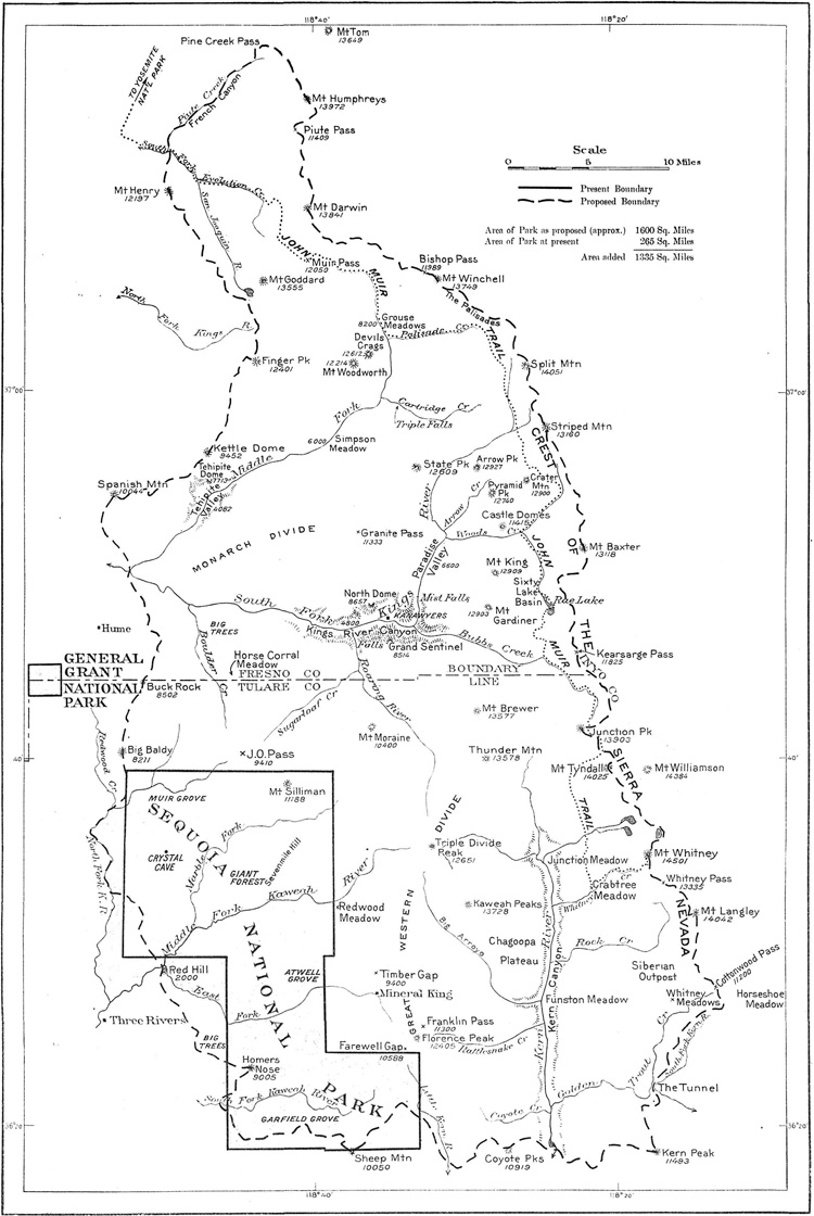
Greater Sequoia (Roosevelt) National Park
A bill was introduced in Congress to enlarge the boundaries of the present
Sequoia National Park, in California, to include the Kings and Kern River
Canyons, and it is hoped this bill will be enacted at the next session of
Congress. This would make the area approximately 1,600 square miles, an increase
of 1,335 square miles over its present area. The park at present has no
exceptional scenery except the three groves of Sequoia washingtoniana, which it
was originally created to preserve, while just to the east of it lies some of
the most magnificent scenery to be found anywhere in the world. I earnestly
recommend the proposed extension which includes a portion of the great Western
Divide and the crest of the Sierra topped by Mount Whitney, the highest point in
continental United States.
The summit of Mount Whitney, nearly 3 miles high, in the proposed
Greater Sequoia National Park.
|
Map showing proposed enlargement of the Sequoia National Park to be
known as the Roosevelt National Park.
(click on map for a PDF enlargement, from 1919 Director's Annual Report)
|
Much of the land in the proposed boundaries was eventually included in Kings Canyon
National Park (which was designated in 1940) and in an enlarged Sequoia National Park.
Mount Hood National Park
A bill was introduced in Congress for the creation of the Mount Hood National
Parks, in the State of Oregon. This bill proposed to embody in the parks eight
noncontiguous tracts of land. A national park should be made of Mount Hood, but
it is not considered advisable that it consist of these separated tracts of
land. You recommended in your annual report to the President in 1915 that this
national park be established, and this year you submitted to Congress a draft
of proposed legislation creating a park comprising one undivided tract of
land.
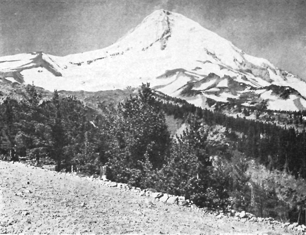
Mount Hood, in the proposed Mount Hood National Park.
|
Designated a National Recreation Area in 2009 and managed by the U.S. Forest
Service.
Idaho (Sawtooth) National Park
A bill was introduced in Congress to establish the Sawtooth National Park, in
the State of Idaho. The land proposed to he included in this park is practically
in the center of the State of Idaho, and has an area of about 329,910 acres,
less than 4,000 acres of which is affected by any sort of private claim. This
State has no national park, and the proposed new park would be readily
accessible from various branches of the Oregon Short Line. It is not far distant
from the regularly traveled automobile highway through Twin Falls and Shoshone,
and could be readily visited, and no doubt would be, by visitors from the
Yellowstone National Park. It would constitute a most important link in the
chain of national parks, located as it is between the Yellowstone and the Mount
Rainier Parks. The proposed park contains an unusually interesting portion of
the Sawtooth Range, which shows the characteristics of the three main mountain
ranges in the United States. The southern portion reminds one of the Rocky
Mountains in Colorado, the middle resembles the Sierra in California, and the
northern end exhibits the characteristics of the Cascade Range in Washington. It
should be known as the Idaho National Park rather than the Sawtooth.
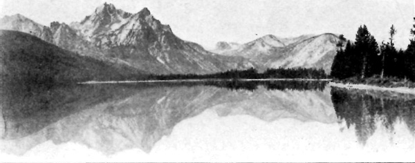
Stanley Lake, in proposed Idaho (Sawtooth) National Park.
|
Designated a National Recreation Area in 1972 and managed by the U.S. Forest
Service. More information about the history of the effort to designate this area
can be found in Douglas W. Dodd's article from Idaho Yesterdays (Vol. 50, No.1,
Spring 2009) "A National Park for the Gem State? The
Forest Service, the National Park Service, and the Sawtooth National Park Campaign,
1911-1926". As recently as 2010 there was a renewed effort to declare portions
of this area as Boulder-White Clouds National Monument (in 2015, portions of this
area was added to Sawtooth National Recreation Area as well as establishment of
designated wilderness areas).
Mount Baker National Park
A bill was introduced in Congress for the creation of the Mount
Baker National Park in the State of Washington. Mount Baker
is the farthest north of America's high mountains, outside of Alaska,
and overlooks a scene of wildest grandeur. It is a dome-crowned
bulk of vast extent, nearly 11,000 feet high, and is deeply grooved
by 12 glaciers. From the mountain itself stretches a bewildering
panorama of mountain and valley, forest and field, threaded by
numerous clear streams, and on clear days the sea can be seen in
the distance.
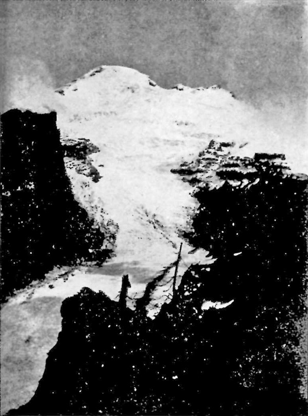
Mount Baker, in proposed Mount Baker National Park.
|
Designated a National Recreation Area in 1984 and managed by the U.S. Forest
Service.
Additional proposals appeared in the 1917
Director's Annual Report:
Grandfather Mountain National Park
Within a short time there will be a national park established in the southern
Appalachian Mountains under the authority contained in the sundry civil act
approved June 12, 1917. Doubtless the new park will be called Grandfather
Mountain National Park, because the famous peak that will form its center has
long been known as the "Grandfather." The tract will be donated to the Federal
Government by public-spirited citizens of North Carolina and will be a very
valuable addition to our national playground system....
Grandfather Mountain was said by the early settlers to have received its name
because it was supposed to be the highest mountain in the East when measured
from its base in the Johns River Valley to the" peak. While it does not rise to
as great a height as Mount Mitchell, the base of its eastern slope is probably a
thousand feet lower than the base of Mount Mitchell. Taking in consideration its
height, ruggedness, beauty of scenery, and the forests which surround it, the
mountain is most striking and impressive. The Grandfather is the highest
mountain in the Blue Ridge Range. It appears that all higher peaks are in spurs
of the Blue Ridge. The ridge approaches one side of Grandfather Mountain from
the southwest at an elevation of about 4,500 feet, and seems to run under the
mountain and leave the other side, going northwest at about the same elevation.
The mountain is said to be the center of more river systems than any other peak.
The East and West Forks of the Linville River, the North Toe River, the South
and East Forks of the Watauga River, and Wilson Creek, which runs into the
Catawba, all have headwaters on the slopes of Grandfather Mountain; and the
headwaters of the Yadkin River are not far distant. The mountain is covered with
a growth of hardwood and in the park area of 1,400 acres the growth is largely
spruce, fir, and balsam. There has been considerable road and trail improvement
accomplished already and the area will be accessible to visitors as soon as it
is dedicated for park purposes.
Proposed Grandfather Mountain National Park, North Carolina.
Yonahlossee Road long the side of Grandfather Mountain.
|
Grandfather Mountain lies within Grandfather Mountain State Park (established
in 2009), which lies along the Blue Ridge Parkway.
Mississippi Valley National Park
Investigation was also made last winter of the proposed Mississippi Valley
National Park. This park project contemplates the purchase of lands near
McGregor, Iowa, on the shore of the Mississippi River, and certain islands in
the river. The investigation disclosed the fact that a national park of
dignified proportions in this region should include land on both sides of the
Mississippi River and the islands therein, between McGregor and Prairie du
Chien, Wis. Part of the lands that might be included in a national park are now
part of a Wisconsin State park. No estimate has been made of the cost of
obtaining these lands. It is understood that areas of considerable size in the
proposed park would be donated in the event that Congress should favorably
consider the establishment of a national park.
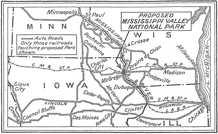
Map showing position of proposed Mississippi Valley National Park, Iowa-Wisconsin.
(click on map for a PDF enlargement, from 1917 Director's Annual Report)
|
Sand Dunes National Park
Since the close of the war renewed interest has been taken in the
idea of establishing a national park in the sand-dune area of northern
Indiana. Individuals who know the dunes intimately and who
have a true appreciation of their beauties, and societies of which
these lovers and users of the dunes are members, are preparing to
arouse wide consideration of this park project. They realize that
if steps are not taken soon to set apart a section of the dunes area
as a national playground, it will be cut up and sold for commercial
uses of one kind or another.
It will be recalled that in the autumn of 1916, pursuant to the request
contained in a Senate resolution, we conducted a careful investigation
of this sand-dune park proposal, holding hearings on the
plan in Chicago and later publishing a comprehensive report on the
findings. This report has been in constant demand, and the first
edition has become exhausted. A new edition will soon be published
for use in the forthcoming campaign to safeguard a portion
of the dune area.
The people who are interested in this project understand clearly
the policy of Congress relating to the purchase of land for national
parks, and are not preparing to call upon the Government for funds
to aid their enterprise. On the contrary, they expect to enlist the
financial aid of unofficial bodies and of individuals in the purchase
of as much of the dune region as possible.
I will be much interested in the progress of the movement to save
a bit of the typical sand-dune landscape. It is entirely unique, and
the region possesses, in addition to this, recreative advantages of
national importance. The Lake Michigan beach, a part of the sand
dune area, would alone furnish pleasure to hundreds of thousands
in the summer season, while a tract of from 8,000 to 12,000 acres,
including some of the woodlands, would offer opportunities for camping
that could hardly be excelled in most of the big parks of the
West.
I hope the movement may splendidly succeed.
Complying with the resolution of the United States Senate, dated September 7,
1916, Director Mather made a study of the proposed Sand Dunes National Park in
Lake, Porter, and Laporte Counties, Ind. A hearing on the project was held in
Chicago on October 30, 1916, and the dunes areas themselves were inspected early
in November. Mr. Mather's complete report on the project was recently published.
The Senate resolution required a report as to "the advisability of securing, by
purchase or otherwise, all that portion of the counties of Lake, Laporte, and
Porter, in the State of Indiana, bordering upon Lake Michigan and commonly known
as the 'sand dunes,' with a view that such lands be created a national park."
The department was also requested to furnish information as to the cost of
acquiring the dunes and the probable cost of maintaining the area as a national
park. Director Mather in his report states that the sand dunes of Lake and
Laporte Counties are unimportant and not valuable for park purposes, but he
states that the Porter County dunes possess national-park quality. A park in
this county should include from 15 to 20 miles of the Lake Michigan beach. In
order to include all of the scenic sand dunes in this vicinity the park should
be approximately a mile wide. It is estimated that it would cost between
$1,800,000 and $2,600,000 to purchase the sand-dunes land. As Congress has never
purchased lands for the purpose of establishing national parks, no
recommendation was made as to the advisability of establishing the Sand Dunes
Park. Full data regarding the physical characteristics of the sand dunes have
been submitted to Congress in compliance with the Senate resolution.
More specifics of this proposal can be found in Stephen T. Mather's
Report on
the Proposed Sand Dunes National Park Indiana published in 1917.
Portions of this proposed national park were incorporated in Indiana
Dunes National Lakeshore (established in 1966).
An expansion of Rocky Mountain National Park was proposed in the 1919
Director's Annual Report:.
Mount Evans (Denver) National Park
ADD MOUNT EVANS TO ROCKY MOUNTAIN PARK.
The next legislation that should be enacted with reference to the park, aside
from appropriation measures, should provide for the addition of the Mount Evans
region to the park area. A bill providing for this extension was introduced in
the last session of Congress but was not brought up by its proponents. It is
expected that other legislation to accomplish this purpose will be introduced
again in the early future.
Briefly, this project contemplates giving a park status to the remarkable
section of the Front Range almost directly west of Denver, which in reality is
simply Mount Evans, highest peak in the Front Range, and its great buttresses.
Mount Evans rises 14,260 feet above the sea. To describe it adequately would
require more space than this limited report will allow, but it is sufficient to
say that, with the exception of Mount Rainier, the national park system does not
include a mountain that is so well proportioned and so distinctive in all of its
features as Mount Evans.
Former Assistant Director Albright made a thorough examination of this proposed
park area last October, when he climbed to the summit of Mount Evans and covered
most of its valleys. In his comprehensive report he describes Mount Evans as
follows:
"Mount Evans is the central pile of a vast cathedral-like structure. From the
northeast it is supported by a splendid buttress of peaks whose connecting
slopes an automobile highway will ultimately skirt. Squaw Mountain, 11,470 feet;
Chief Mountain, 11,710 feet:; Warrior Mountain, 11,270 feet; Devil's Nose,
11,100 feet; Goliath Peak, 12,200 feet; Mount Rogers, 13,330 feet; and Mount
Warren, 13,300 feet, lead progressively to Mount Evans's supreme summit, whose
altitude is 14,260 feet. The northwestern buttress is shorter but nobler in its
elevation—Sugar Loaf Peak, 12,513 feet; Mount Gray Wolf, 13,610 feet; and
Mount Spalding, 13,800 feet. Up from the southeast another noble buttress has
for its high points Meridian Hill, 11,000 feet; Rosedale Peak, 12,200 feet;
Rosalie Peak, 13,575 feet; and Epaulet Mountain, 13,500 feet. Another buttress
joins Mount Evans from the south and contains Mount Logan, 12,730 feet, and
several other unnamed eminences over 12,000 feet in altitude. Upon the west
Evans is supported by Mount Bierstadt, a monster of 14,016 feet.
"It requires no imagination to picture this system in its architectural
proportions. And all within a compact area of 160 square miles."
The Mount Evans region abounds in animal life, and its trees, wild flowers, and
shrubs represent a wide range of Rocky Mountain plant life. The lakes of its
glacial valleys are very beautiful. Commercially the region is worthless, aside
from certain grazing lands that are now and always should be preserved as range
for game.
EXTENT OF MOUNT EVANS REGION.
The total area of the proposed extension is 159.34 square miles, or 101,981.83
acres. The area of the present park is 397.5 square miles, or 254,327 acres.
Mount Evans lies within the Pike National Forest, which has an area of 1,256,112
acres; hence only about 8 per cent of this reserve is involved in the extension
plan.
DENVER PLEDGES AID.
The city of Denver is extending its Mountain Park road system toward Mount
Evans, and already a remarkably scenic approach road is built practically to the
northeastern corner of the national park area. It should be continued to the top
of Mount Evans, which offers a feasible route along its northeastern buttress,
an array of peaks with exquisite lakes in their ice-eaten cirques that will make
the suggested road unique among the highways of the world.
Denver has also agreed to acquire all of the private holdings in the park area
that are needed, for administration or improvement purposes.
There is a great opportunity here to expand Rocky Mountain National Park and its
usefulness to the Nation with the cooperation of a city which has already taken
a surpassing interest in national-park development.

Map showing proposed Mount Evans Region Added to the Rocky Mountain National Park.
(click on map for a PDF enlargement, from 1919 Director's Annual Report)
|
Portions of which were subsequently declared Mount Evans National
Recreation Area, managed by the U.S. Forest Service and the City of
Denver (Summit Lake area).
A quick Internet search (conducted in 2016) shows the following proposed
additions to the National Park System. These are not proposals by the National
Park Service/Department of the Interior and by no means is this a complete list
(plus some of the proposals overlap boundaries of earlier proposals):
Ancient Forest, California-Oregon
Atchafalaya, Louisana
Bears Ears, Utah
Birthplace of Rivers, West Virginia
Bodie Hills, California
Csstner Ranger, New Mexico
Cotoni-Coast Dairies
Driftless Rivers, Minnesota-Wisconsin-Illinois-Iowa
Florida Big Bend, Florida
Gold Butte, Nevada
Grand Canyon Watershed, Arizona
Great Bend of the Gila River, Arizona
Greater Canyonlands, Utah
Greater Grand Canyon Heritage, Arizona
Greater Hart-Sheldon, Oregon-Nevada
Grizzly Bear/Santa Ana, California
Hells Canyon/Chief Joseph, Idaho-Oregon
Hidden Gems, Colorado
High Allegheny, West Virginia
Kissimmee Prairie Grasslands, Florida
Lesser Prairie Chicken, New Mexico
Lighthouse Ranch, California
Maine Woods, Maine
Mobile-Tensaw Delta, Alabama
Modoc Plateau, California
Mount St. Helens, Washington
Northwest Sonoran Desert, Arizona
Orange County Offshore, California
Otero Mesa, New Mexico
Owyhee Canyonlands, Idaho-Oregon
Piedras Blancas, California
Red Desert, Wyoming
Rocky Mountain Front, Montana
Sagebrush Steppe, Nevada-Oregon
San Rafael Swell, Utah
Sedona Verde Valley Red Rock, Arizona
Siskiyou Wild Rivers, Oregon
Steens Mountain, Oregon
The Lost Coast Headlands, California
Trinidad Head, California
Upper Bald River, Tennessee
Vermillion Basin, Colorado
Wind River Range, Wyoming
The following list contains sites which the National Park Service has
conducted Special Resource Studies (since 2001) to evaluate their potential for
being added to the National Park System (or as National Heritage Areas/National
Historic Trails/Wild and Scenic Rivers). This list excludes sites which have
since been added to the System.
A.G. Gaston Motel, Alabama
Alexander Hamilton Estate, Virgin Islands
Anderson Cottage, District of Columbia
Androscoggin Valley, New Hampshire
Angel Island Immigration Station, California
Battle of Franklin, Tennessee
Battle of Homestead & Carrie Furnance, Pennsylvania
Battle of Matewan, West Virginia
Bioluminescent Bay, Puerto Rico
Boggsville Historic Site, Colorado
Butterfield Overland Trail
Cahokia Mounds, Illinois
Catle Nugeent Farms, Virgin Islands
Chevy in the Hole, Michigan
Chisolm Trail
D-Day National Memorial, Viriginia
Eaker Air Force Base, Arkansas
Eightmile River, Connecticut
Farmington Quaker Meeting House, New York
Flushing Remonstrance, New York
Fort Hunter Liggett, California
Fort King, Florida
Fort Ontario and the Safe Haven Holocaust Refugee Shelter Museum, New York
Fort San Geronimo, Puerto Rico
Freedom Riders Park, Alabama
Gaviota Coast Seashore, California
George W. Bush Childhood Home, Texas
George Washington Boyhood Home (Ferry Farm), Virginia
Grant's Farm, Missouri
Greast Western Trail
Green McAdoo School, Tennessee
Harriet Beecher Stowe House, Maine
Harry S Truman Birthplace, Missouri
Hero Street, Illinois
Hot Springs High School, Arkansas
James K. Polk Home, Tennessee
John P. Parker House, Ohio
|
|
Kate Mullaney House, New York
Lewis and Clark NHT — Eastern Legacy Route
Loess Hills, Iowa
Mare Island, California
Miami Circle, Florida
Michigan Maritime Sites, Michigan
Mill Springs Battlefield, Kentucky
Musconetcong River, New Jersey
Nashua River, Massachusetts
Natural Bridge, Virgini
New Jersey Shore of Delaware Bay, New Jersey
New Philadelphia, Illinois
Newtonia Civil War Battlefields, Missouri
Norman Studios, Florida
President James A. Garfield Memorial, Ohio
Prison Ship Martyr's Monument, New York
Robert Moton High School, Virginia
Rock Springs Ranch, California
San Luis Valley/Sangre de Cristo Mountains, Colorado-New Mexico
Shepherdstown Battlefield, New York
Space Shuttle Columbia Memorial, Texas
Ste. Genevieve County, Missouri
Susan B. Anthony Home, New York
Taunton, Massachusetts
Tunica River Park, Mississippi
Virginia Key Beach Park, Florida
Walden Pond and Woods, Massachusetts
Washiington Crossing Historic Park, Delaware-Pennsylvania
Washington Trail — 1753, Pennsylvania
West Hunter Street Baptist Church, Georgia
William Lloyd Garrison Birthplace, Massachusetts
Wolf House, Arkansas
Wood-Pawcatuck Watershed, Connecticut-Rhode Island
York River, Maine
Yuma Quartermaster Depot, Arizona
|
|