|
MANASSAS National Battlefield Park |
 |
Guide to the Area

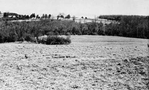
Looking east from Chinn Ridge to Henry Hill,
showing the nature of the terrain that saw heavy fighting in both
battles. The Henry House is shown on the left, the Visitor Center in
center of photograph.
5. CHINN RIDGE. This commanding ridge was twice utilized by the Confederates in turning movements that brought defeat to Federal arms. In the first battle, the brigades of Early and Elzey, supported by Beckham's artillery, hurled back the Federal right under Howard to precipitate a general rout of the Federal army. In the second, Longstreet's troops swept forward to seize the ridge in an attack that, but for the successful defense of Henry Hill, would have turned the Federal left. The ridge is served by a park road which terminates at a commanding overlook at its northern end.
Site of the Chinn House. Only the foundation walls and the bases of two massive chimneys remain to attest what was once one of the most spacious residences on the Manassas battlefields. Built reputedly in the late eighteenth century, the house derived its name from Benjamin T. Chinn, who purchased the property in 1853. Twice used as a field hospital, it stood until 1950 when, in ruinous condition, it was dismantled.
Webster Monument. About 600 yards north of the Chinn House stands a granite boulder with bronze plaque marking the spot where Col. Fletcher Webster, son of the statesman, Daniel Webster, fell mortally wounded in the second battle, August 30, 1862. The boulder was brought from "Marshfield," Mass., the estate of the elder Webster.
Chinn Spring. Located on the north side of the Chinn House Road, a few yards from the little stream known as Chinn Branch, is Chinn Spring. Following the heat of battle, many of the exhausted and wounded soldiers of both armies came here to drink gratefully from its cool, bubbling waters. It is an attractive spot, shaded by tall oaks and marked by grass that is always green.
6. UNFINISHED RAILROAD. About 300 yards south of the present Sudley Church, the old grade of an independent line of the Manassas Gap Railroad crosses the Manassas-Sudley Road (State Route 234). Stretching southwestward from this point for a distance of nearly 2 miles is the section of the grade occupied by Jackson's troops during the second battle. From this protecting screen he first revealed his position in the attack on King's column on August 28. Here, in the next 2 days, he successfully repelled repeated Federal assaults. Though brush and trees have grown up along much of it, the grade is still clearly defined.

|

|
|
Last Modified: Sat, Apr 7 2001 10:00:00 am PDT |


