|
FORT NECESSITY National Battlefield |
 |

(click on image for an enlargement in a new window)
The Fort Necessity Campaign
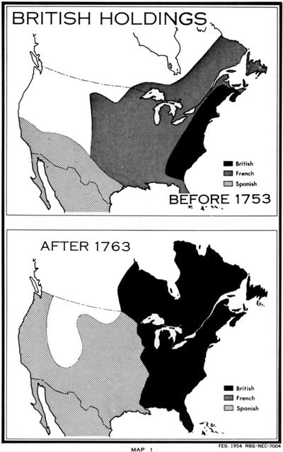
RIVALRY OF FRANCE AND ENGLAND. In 1749, the Marquis de la Galissonière, Governor General of Canada, sent Pierre-Joseph Celoron de Blainville with about 215 Frenchmen and a force of Indians to take possession of the Ohio Valley for France. The expedition set out from La Chine, Canada, in birchbark canoes and eventually reached the headwaters of the Allegheny River. At Lake Chautauqua, and along the Allegheny, Ohio, and Great Miami Rivers, Blainville posted notices on trees and buried lead plates graven with an inscription asserting that the adjacent lands belonged to the French Crown.
The British likewise had become interested in the fertile lands of the Ohio Valley. Several prominent Englishmen and Virginians, among them Lawrence and Augustine Washington, elder brothers of George, appreciating the potential value of the area and the possibilities for trading posts and settlements, organized the Ohio Company in 1748. The following year, the company obtained from the British Crown a grant of 200,000 acres on both sides of the Ohio between the Monongahela and Great Kanawha Rivers. An additional 300,000 acres was promised if 100 families were settled on the first tract within 7 years. Fearing the encroachment of Pennsylvania settlers, as well as the French, the Ohio Company established a base of operations at Wills Creek, now Cumberland, Md. The company directed the opening of a wagon road to the Monongahela River over a path blazed by Nemacolin, a friendly Delaware Indian. Christopher Gist, explorer and guide, was engaged to locate lands and to determine whether conditions on the extreme frontier were suitable for settlements.

|
|
Last Modified: Mon, Dec 2 2002 10:00:00 am PDT |


