|
FORT NECESSITY National Battlefield |
 |

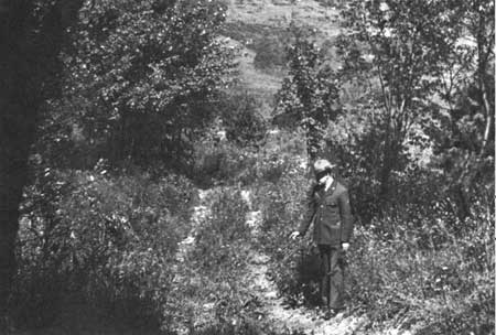
Trace of the Braddock Road.
Surveys and Excavations of Fort Necessity
In the two centuries that have elapsed since Washington's capitulation and the subsequent destruction of Fort Necessity by Villiers, several attempts have been made to fix the exact location of the fort and to define its construction in detail. Destruction of the stockade by the French, erosion of the surface, and other disturbances of the soil made this a difficult task, and led to varying ideas concerning the original structure. Much of the source material relating to the fort was not available to those who undertook early surveys and excavations. Only in recent years have research studies produced documentary evidence bearing on the shape and size of the stockade and defenses. This evidence, forming the basis of archeological investigation early in 1953, led to the definite establishment of the stockade location and the outlines of the entrenchments built by Washington's men.
Maps of the period were generally diagrammatic and contained only fragmentary evidence. Although certain charts indicated the fort as a small square, the repetition of the same, or similar, symbols for many fort locations implies that this was a conventional sign for a fortification and was not intended to indicate actual fort lines. Therefore, investigators turned early to ground evidence in an effort to establish the fort entrenchments and the stockade.
Contemporary methods of stockade construction, particularly those at Fort Le Boeuf and at Wills Creek, were well known to Washington. In the earlier attempts to locate the outlines of the fort, it was apparently assumed that the structure at Fort Necessity followed the general lines of contemporary forts with which Washington was acquainted.

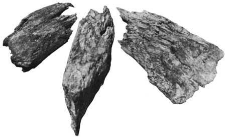
Post ends of the original stockade of Fort Necessity.
The first known study of the ground surface was made by Freeman Lewis, a local surveyor, in 1816. In his attempt to locate the fort, he found clearly defined mounds, but the outlines were not sufficiently distinct to establish the original works. He concluded, on the basis of an examination of the 3-foot-high embankments on the southwest and southeast of Great Meadows Run, that the fort was triangular in shape. The existing mound led him to believe that the long side of the triangular fort was parallel to the stream bed and that a sector was projected to the creek to include a water supply within the fort bounds.
Jared Sparks, historian and traveler, visited the site in 1830. Observing closely the remnants of the embankments, Sparks concluded that the fort had four sides of nearly equal length, each approximately 35 yards long. For the clarification of his findings, Sparks prepared a sketch embodying his conclusions. Entrances were indicated on the southwest side, the direction from which the initial French attack developed. A supply of water being vital to occupants of the fort, Sparks indicated a bulge of the northeast corner to include the stream bed.
Seventy years passed before another effort was made to determine the appearance of the fort. In 1901, Robert McCracken, a civil engineer, made the first archeological approach to the problem. Aided by the findings of the Lewis survey and supplemented by his own study and excavations, McCracken believed the fort had four nearly equal sides and a projection to include the stream bed. Excavations undertaken near the creek unearthed a quantity of oak bark, believed to be remnants of the logs used in the original fort destroyed by the French. It was believed that the stockade had been implanted on the line of the entrenchments.

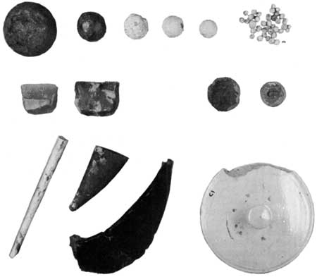
Relics of the Fort Necessity Battle.
Additional excavation work was undertaken in 1931 by Harry R. Blackford, also a civil engineer. Conducting further digging in the mounds near the stream bed, Blackford located remnants of the original palisade 3 feet below the surface near the northern and northeastern embankments and adjacent to the stream. The post ends varied con siderably in thickness and the tops showed signs of having been exposed to the action of time and water. At various points in this area, according to Blackford, "pieces of charred wood and lumps of charcoal were excavated from a depth of about three feet, this giving evidence to support the statement that the stockade was burned." He concluded that the original stockade had been built on the entrenchments, the outlines of which could readily be followed. Therefore, the recon structed stockade built in 1932 was placed upon the line of the restored entrenchments.

|
|
Last Modified: Mon, Dec 2 2002 10:00:00 am PDT |


