|
FORT NECESSITY National Battlefield |
 |
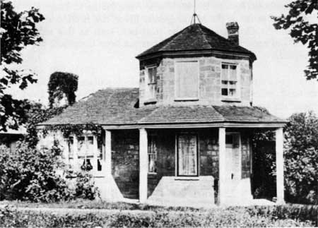
Toll House at Addison, Pa., on the Old National Pike.
Guide to the Area
This guide is planned to help you reach points of historical interest at Fort Necessity and immediate vicinity and learn of the principal events which took place at each point.
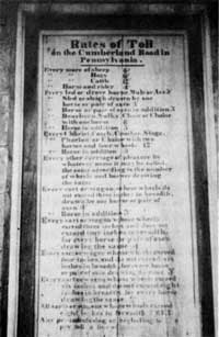 Schedule of rates on the Addison Toll House. |
1. FORT NECESSITY NATIONAL BATTLEFIELD SITE. Fort Necessity National Battlefield Site is administered by the National Park Service, United States Department of the Interior. Two acres in extent, it is entirely surrounded by Fort Necessity State Park, a 311-acre recreational area including the 234-1/2-acre tract purchased by George Washington in 1769 and owned by him until the time of his death.
As you approach the fort by the footpath you will cross a small stream known as Indian Run. The junction of this stream and Great Meadows Run, to your right, was the location of the natural entrenchments to which Washington refers in one of his communications. Soon after the initial fortifications were completed, the circular stockade and small house on the interior were built for the safekeeping of supplies and ammunition. The present stockade was constructed in the spring of 1954 of split logs of irregular length and shape. The palisades are in the exact location of the original stockade posts which formed a circle 53 feet in diameter. The gate to the stockade is in the southwest sector of the circle.
The embankments in the foreground are authentic restorations of those built by Washington's men as defense positions during the brief time between the return of the men to the fort on July 1 and the beginning of the French attack on the morning of July 3. The French approached from the hillside on your left (then a wooded area), then shifted eastward to the fringe of trees on the southeast (back of you), from the cover of which the French and Indians directed much of their fire at the English force in the fort.
2. BRADDOCK ROAD. First blazed for the Ohio Company about 1750 by Nemacolin, a Delaware Indian, working with Thomas Cresap, a noted frontiersman, this road was improved and used by Washington in the Fort Necessity campaign in 1754 and by Braddock the following year. Extending from Wills Creek (Cumberland, Md.) to the Monongahela River, the road subsequently became a highway of westward expansion. At various times in its history this avenue of travel was known as Nemacolin's Path, Gist's Trail, Washington's Road, and Braddock Road. By 1817, when the National Road had been completed as far as the Monongahela River, the Braddock Road was abandoned. Only traces of the road bed, such as this section in a woodland area where the ground has not been disturbed, are still in evidence.
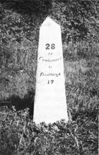 Marker on the Old National Pike. |
3. THE OLD NATIONAL PIKE. The road which replaced Braddock Road, variously known as the Old National Pike, the National Road, and the Cumberland Road, was the first step in the development of a national highway system. Conceived first in the mind of Washington, and later heartily advanced by Albert Gallatin and Henry Clay, the undertaking was given further impetus by the admission of Ohio into the Union in 1803. Three years later, Congress authorized the con struction of a road from Cumberland, Md., to the State of Ohio, although actual construction did not begin until 1811.
The road commissioners pointed out in their report of 1808 that because of the "crooked and hilly course of the road [Braddock's] now traveled, the new route could not be made to occupy any part of it except an intersection on Wills Mountain, another at Jess Tomlinson's [Little Meadows], and a third near Big Youghioghana [Great Crossings], embracing not a mile of distance in the whole without unnecessary sacrifices of distance and expense." The National Road followed generally the line of Braddock Road westward as far as Braddock Park, where Braddock Road veered northwestwardly to Fort Pitt (formerly Fort Duquesne). The National Road was extended westward and by 1819 had reached Wheeling, W. Va., where, due to prevailing economic conditions, work was suspended. In later years, construction of the road continued through Ohio and Indiana to central Illinois.
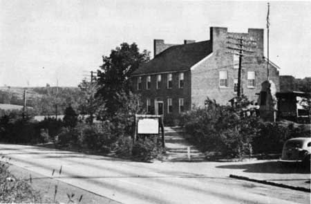
Mount Washington Tavern
4. MOUNT WASHINGTON TAVERN. As the National Road was developed, many taverns were built along the route to serve as stopping places for stage coaches. In 1818, about the time that the National Road was opened to traffic through the Fort Necessity area, Judge Nathaniel Ewing of Fayette County, then owner of the Great Meadows tract, erected a large house beside the new road and named it Mount Washington. One of the first substantial buildings on the road between Little Meadows and Uniontown, it was operated by successive owners as a tavern, and because of its size and comfortable accommodations it was designated a stage house.
The Tavern, now used as a museum, is owned by the Commonwealth of Pennsylvania. Relics of the Fort Necessity and Braddock expeditions, many of which were found on the site of Fort Necessity and other historic areas in the vicinity, are on exhibit in the museum.
5. BRADDOCK'S GRAVE AND OLD ORCHARD CAMP. Old Orchard Camp, scene of Braddock's ninth encampment on June 25, 1755, during the expedition against Fort Duquesne, is located near the National Road, 1 mile west of Fort Necessity. On July 13, less than 3 weeks later, Braddock died and was buried here, at the first bivouac of the British troops in their panic-stricken retreat from the battlefield at Turtle Creek.
When Braddock Road was being repaired in 1804, workmen came upon a human skeleton in the middle of the road near the east bank of Braddock Run. With the bones were found buttons and buckles which indicated that the body had probably been clothed in a uniform of a British officer of rank. Believing that the remains were those of General Braddock, they were moved 100 yards southeast of the first grave and reinterred on a knoll which now overlooks the National Road.
In 1909, the citizens of Fayette County, Pa., organized the Braddock Park Association and acquired 23 acres of land, including a portion of the Old Orchard Camp site. Funds were raised for the erection of a monument, which was dedicated October 15, 1913. Held since 1931 by the Fort Necessity Chapter, Sons of the American Revolution, the area was transferred in 1952 to the Pennsylvania Department of Forests and Waters. The Braddock Road marker is located on the section of the road extending through Braddock Park.
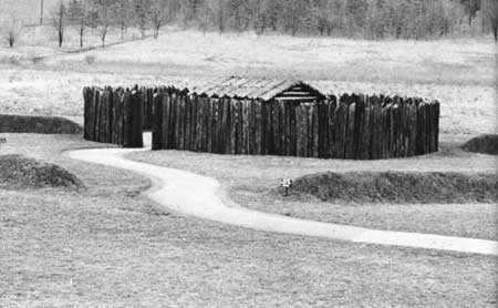
Reconstructed Fort Necessity.
6. HALF KING'S ROCKS. This massive rock formation, located on the crest of Chestnut Ridge, was the place where the Mingo Chief, the Half King, and Washington joined forces on the night of May 27, 1754, just before attacking the French force in a deep ravine 2 miles northward, since known as Jumonville Glen. Half King's Rocks, 1 mile north of U. S. 40, is located at a point where old Braddock Road joins the modern road.
7. JUMONVILLE GLEN. This secluded ravine, fringed on its western bank by a massive rock formation, was the scene of Washington's attack on Jumonville's small party of Frenchmen early on the morning of May 28, 1754. The reaction of the French at Fort Duquesne to this engagement brought about the Coulon de Villiers expedition of revenge against Washington which culminated in the action at Fort Necessity.
Located 3 miles north of U. S. 40, on the crest of Chestnut Ridge, the site was acquired and held for many years by the Fort Necessity Chapter, Sons of the American Revolution. In recent years, the site and adjacent land have been owned by the Methodist Center of Pittsburgh and used as a Youth Recreational Camp.
8. DUNBAR'S CAMP. This site, situated a few hundred yards north of Jumonville Glen, was the encampment of Dunbar's regiment. This unit of Braddock's expedition, bearing the heavy arms and supplies, had reached this point when the ill-fated advance regiment led by Braddock was struck by the French and Indians at Turtle Creek on July 9, 1755. As the remnants from that field reached this camp, immense quantities of ammunition and supplies, as well as cannon and wagons, were destroyed, and Dunbar began a hurried retreat toward Fort Cumberland.
Dunbar's Camp lies at the southern base of Dunbar's Knob, a lofty, treeless eminence which offers, on a clear day, a magnificent view of the rolling country westward.

|
|
Last Modified: Mon, Dec 2 2002 10:00:00 am PDT |


