|
LITTLE BIGHORN BATTLEFIELD National Monument |
 |
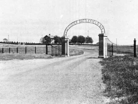
Main entrance to Custer Battlefield National Monument.
(Courtesy K. F. Roahen, Billings, Mont.)
Guide to the Area
The principal feature of Custer Battlefield National Monument is the battlefield, marked by the memorial which stands over the grave of most of the slain victims of this battle. This memorial is about one-half mile beyond the main entrance to the area. From near this fenced, granite shaft is obtained an excellent view of the field over which occurred the final stages of Custer's last battle. White markers, scattered over the hillsides, show as nearly as possible where the dead were found after their struggle was over.
Just below the memorial is a small group of markers indicating the sites where General Custer and those nearest him in battle were found. Two brothers of the general, Capt. Thomas Ward Custer and Boston Custer, with their nephew "Autie" Reed, were also found in this group.
A road from the memorial leads along the ridge from which can be seen the rough terrain over which the men fought. Groups of markers to the right on the slope toward the river tell the story of how Companies C and E fought to their death. A number of bodies were found in deep ravines near the river. Some markers cannot be seen, for they are concealed by the rolling contour of the slope. Beyond these markers and across the river is the location of the Indian encampment at the time of the battle.
On the left side of the ridge are the markers for Companies F and I. Each of these markers designates a site where a man was found and where he was first buried. All the bodies have been removed from the field to the single grave beneath the memorial.
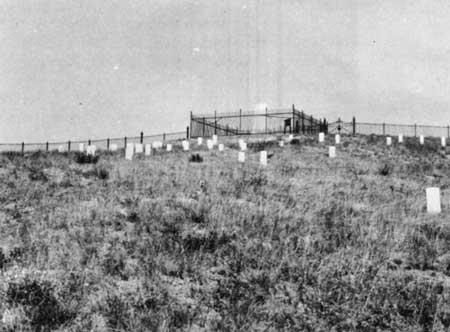
Custer Hill, showing the memorial and the site
where General Custer and 51 of his gallant troopers were found by
General Terry's troops on June 27, 1876.
(Courtesy K. F. Roahen, Billings, Mont.)
About one-half mile from the memorial, on a loop road to the left, is an interpretive sign at the position where Company L made its last stand. Lieutenant Calhoun, a brother-in-law of General Custer was in command of this company. According to those who buried the soldiers on June 28, 1876, the bodies of these men showed the most clearly drawn skirmish line on the battlefield.
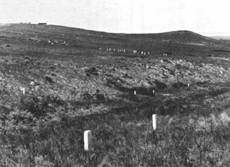
Looking west from Calhoun Hill toward Custer
Hill. The white markers show where the men of Companies I and L were
annihilated and the approximate location where the horse Comanche,
was found.
(Courtesy K. F. Roahen, Billings, Mont.)
Just beyond the loop road at Calhoun Hill, the road turning to the right leads to the Reno-Benteen Battlefield entrenchments, 4 miles to the southeast. In a short distance, this road leaves Custer's Battlefield and passes over Indian reservation range land. This is a graded road which is good in dry weather. However, not being surfaced, it must be closed during inclement weather. Those driving to the Reno-Benteen Battle field must return by the same route. The round-trip is approximately 10 miles.
After leaving Custer's Battlefield,, this road drops down very near to the Little Bighorn River. It was at this point, which was about the center of the Indian encampment, that the Sioux Chief Gall crossed to make his first attack on Custer's battalion. They met Custer about three-fourths of a mile northeast of this ford.
In about 2 miles, the road is cut through the high point from which Captain Weir and his company viewed Custer's Battlefield on the after noon of June 25. It is the farthest point any of Reno's or Benteen's men reached before being forced back. A descriptive sign marks this position.
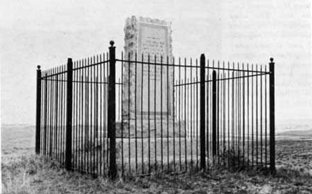
Seventh Cavalry Memorial on the Reno-Benteen
entrenchment position.
(Courtesy K. F. Roahen, Billings, Mont.)
A mile and a half farther is the Seventh Cavalry Memorial on the Reno-Benteen Battlefield. An interpretive sign describes the action in this vicinity. This location affords a very fine view of the valley where Major Reno's battalion fought and of their retreat route up the bluffs. For those who plan to see both battlefields, it would be well to make the trip to the Reno-Benteen Battlefield and reconstruct the battalion movements on the return trip so that the story may be studied in the correct order of events.
The museum is located just below the memorial and may be visited before or after viewing the battlefields. Here a graphic story of the battle is told by the use of maps, photographs, dioramas, and artifacts.
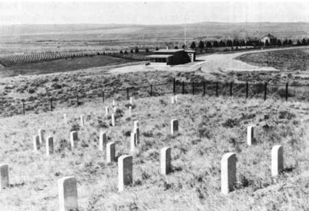
View of the museum and national cemetery as seen from Custer Hill.
The stone at the far right stands where Custer's body was found.
The national cemetery, located to the rear of the administration building, is of interest to many visitors. Within the national cemetery are buried many who died in other Indian battles. Among those of historical interest are Capt. (Bvt. Lt. Col.) William Judd Fetterman and his command of 3 officers, 76 enlisted men, and 4 civilians who were slain in the Old Fort Phil Kearny Fight, commonly known as the "Fetterman Massacre," December 21, 1866. The Fetterman Fight of 1866 and the Custer Fight of 1876 are analogous, in that both commands were killed with no survivors to tell the story. Others buried here are those slain at the Wagon Box Fight, August 2, 1867; the Hayfield Fight near Fort C. F. Smith, Mont., August 1, 1867; Battle of the Big Hole, Mont., August 9, 1877; the Battle of Bear Paw Mountain, Mont., September 30, 1877; and other battles and skirmishes of lesser importance.
In addition to those who died in Indian battles, burials of later wars are currently being made in the national cemetery. Those who have served honorably in any branch of the armed services of the United States hold burial privileges.

|
|
Last Modified: Sat, Sep 28 2002 10:00:00 pm PDT |


