

|
MORRISTOWN National Historic Park |
 |
Morristown National Historical Park.
(click on image for an enlargement in a new window)
Guide to the Area
The following information, supplementing that contained in the narrative section of this handbook, is furnished as a convenient guide to points of special interest in and around Morristown National Historical Park. Numbers and titles in the text correspond to those shown on the Guide Map (pp. 20—21). Another map (p. 35) shows the bridle paths and foot trails in the Jockey Hollow Area.
The historical museum, focal point in telling the Morristown
story.
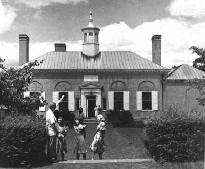
NO. 1. HISTORICAL MUSEUM. Located in the rear of the Ford Mansion (No. 2), at 230 Morris Street, Morristown, is the historical museum, a fireproof structure erected by the National Park Service in 1935. In the attractive entrance hall and four exhibition rooms of this building may be seen military arms and equipment, important relics of George and Martha Washington, and a large collection of other objects associated with the story of Morristown in Revolutionary War times. Here also are located the park administrative offices, including those of the superintendent, chief clerk, historian, and museum staff.
The Revolution Room in the historical museum, where weapons and military
equipment of the Revolutionary War period are displayed.
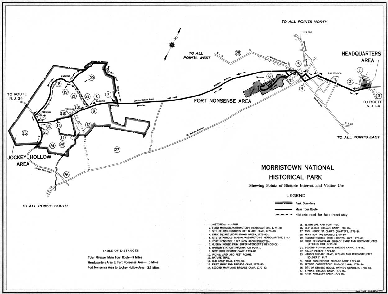
NO. 2. FORD MANSION, WASHINGTON'S HEADQUARTERS, 1779—80. Facing Morris Street where it joins Washington Avenue, is the Ford Mansion. This structure, a splendid example of late American colonial architecture, was built about 1772—74 by Col. Jacob Ford, Jr., an influential citizen, iron manufacturer, powder mill owner, and patriot soldier of Morristown. Colonel Ford died on January 10, 1777, from illness contracted during the "Mud Rounds" campaign of late 1776, in which he rendered valuable service to the American cause as commander of the Eastern Battalion, Morris County Militia. He was buried with military honors in the graveyard of the Presbyterian Church at Morristown.
The mansion itself served for a brief period in 1777 as quarters for the Delaware Light Infantry Regiment commanded by Capt. Thomas Rodney. During the Continental Army encampment of 1779—80, all but two rooms in the house were occupied by Washington's official family, which, besides the Commander in Chief, included his devoted wife, Martha, his aides-de-camp, and some servants (p. 23). Mrs. Ford's family consisted of herself and her four children: Timothy (aged 17), Gabriel (aged 15), Elizabeth (aged 13), and Jacob, III (aged 8).
Restoration of the Ford Mansion was begun by the National Park Service in 1939. Much of the beautiful old furniture now displayed in the building was there when Washington occupied it. The remaining furnishings are mostly pieces dating from the Revolutionary War period or earlier, such as Mrs. Ford and her distinguished guests might have used.
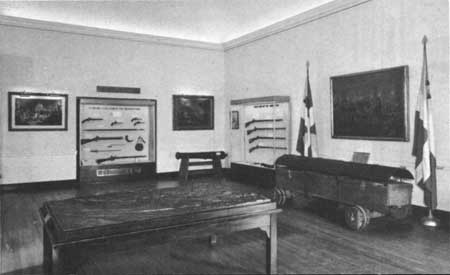
"Washington's Inaugural Costume," a typical exhibit in the
historical museum.
NO. 3. SITE OF WASHINGTON'S LIFE GUARD CAMP, 1779—80. Across Morris Street, slightly northeast of the Ford Mansion (No. 2), is the site occupied in 1779—80 by Washington's Life Guard (officially, the Commander in Chief's Guard). Erskine's map of Morristown (p. 13) shows the exact position of some 13 or 14 log huts built by this unit for its winter quarters. Except for minor changes introduced at some uncertain date after March 1779, the Guard uniform consisted of a dark blue coat with buff collar and facings, red vest, fitted buckskin breeches, black shoes, white bayonet and body belts, black stock and tie for the hair, and a black cocked hat bound with white tape. The buttons were gilt.
NO. 4. PARK SQUARE (MORRISTOWN GREEN). Surrounded by the main business district of Morristown is a parklike area about 2-1/2 acres in size. Here was the old Morristown Green of eighteenth century times. On the green itself, then crossed by roadways, stood the Morris County Courthouse and Jail, where both civil and military prisoners were confined during the Revolutionary War. About a dozen other buildings faced toward the green, among them the Arnold Tavern (No. 5), the Presbyterian and Baptist Churches (p. 9), and, in the winter of 1779-80, a large structure where Continental Army supplies were stored. Extending from the southwest side of the green was a broad, open space about 150 feet in depth and 250 feet long. This was often used for drill and parade purposes by both Continental troops and militia.
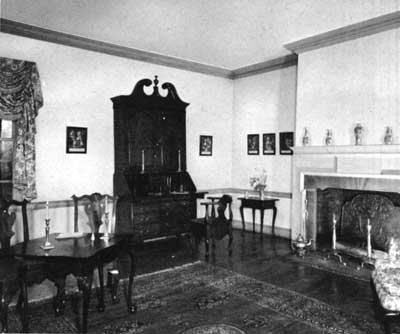
Washington's living and dining room in the Ford Mansion, showing the
"secretary" desk once used by him as the American Commander in Chief.
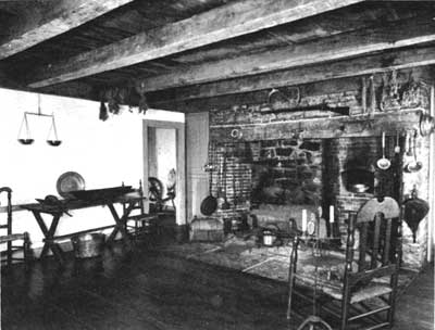
The kitchen in the Ford Mansion, where
Washington's official "family" and "all Mrs. Fords" tried to keep warm
in January 1780.
NO. 5. SITE OF ARNOLD TAVERN WASHINGTON'S HEADQUARTERS, 1777. Facing the northwest side of Morristown Green, about 100 to 150 feet from the present Washington Street corner, is the site of the Arnold Tavern, which, according to local tradition, served as Washington's headquarters in the winter of 1777 (p. 5). Built some years before the Revolutionary War, this structure was originally quite pretentious and handsomely furnished. During the nineteenth century it was converted into stores, and, in 1886, removed to another part of Morristown. Fire completed destruction of the building some 25 years later.
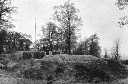
"Fort Nonsense," built in 1777 as a "retreat in
case of Necessity" for troops assigned to guard American military stores
at Morristown.
NO. 6. FORT NONSENSE, 1777 (NOW RECONSTRUCTED). Continuing from the south end of Court Street is a road leading upward into the Fort Nonsense Area of the park. There, at the top of a steep hill (the northern terminus of Mount Kemble), visitors may see a restored earthwork originally built at Washington's order in 1777.
How the name "Fort Nonsense" came into being is unknown. It does not appear in any available written record before 1833, nor has anyone yet authenticated the oft-repeated story that the Commander in Chief's reason for constructing this work was merely to keep the American troops occupied and out of mischief. Washington's real intention is disclosed by an order of May 28, 1777, issued as the Continental Army moved to Middlebrook (p. 11). In this he directed Lt. Col. Jeremiah Olney to remain behind at Morristown, and with his detachment "and the Militia now here . . . Guard the Stores of different kinds . . . Strengthen the Works already begun upon the Hill near this place, and erect such others as are necessary for the better defending of it, that it may become a safe retreat in case of Necessity." Other orders confirm the conclusion that Fort Nonsense was actually built to serve a very practical purpose.
As years passed, the original lines of this earthwork gradually crumbled away. Their present appearance is the result of research and physical restoration work completed by the National Park Service in 1937.
NO. 7. GUERIN HOUSE (PARK SUPERINTENDENT'S RESIDENCE). At the southwest corner of the Jockey Hollow and Sugar Loaf Roads stands the Guerin House, in which is incorporated some of the original dwelling owned and occupied in Revolutionary War days by Joshua Guerin, a farmer and blacksmith of French Huguenor descent. Largely remodeled, the building now serves as a residence for the park superintendent. It is not open to visitors.
NO. 8. RANGER STATION (INFORMATION POINT). About one-quarter of a mile southwest of the Guerin House (No. 7), on the same side of the Jockey Hollow Road, is the ranger station. Here are located the office and quarters of the park ranger. Visitors may obtain free literature and other park information at this point.
NO. 9. NEW YORK BRIGADE CAMP, 1779—80. About opposite the ranger station (No. 8), parallel to the east side of the Jockey Hollow Road, is the campsite occupied in 1779—80 by the New York Brigade under Brig. Gen. James Clinton. In this brigade were the 2d, 3d, 4th, and 5th New York Regiments, with a combined total enlistment, in December 1779, of 1,267 men. The official uniform of these troops was blue, faced with buff; the buttons and linings, white.
NO. 10. PICNIC AREA AND REST ROOMS. Three-eighths of a mile south west of the New York Brigade campsite (No. 9), on the west side of the Jockey Hollow Road, are a picnic area and rest rooms. Parking facilities are provided close to the road. From that point a winding foot trail (pp. 20, 35) leads to open places among the trees where tables and benches are placed for the convenience of visitors who wish to bring basket lunches. No fires are permitted, either here or elsewhere in the park.
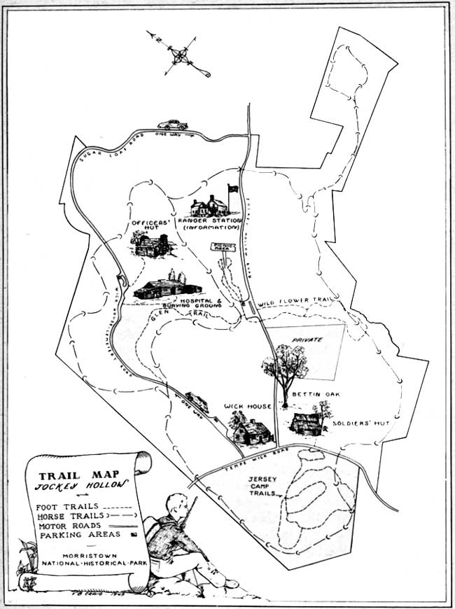
Jockey Hollow Trail Map
(click on image for an enlargement in a new window)
NO. 11. NATURE TRAIL. More than 100 species of birds, some 20 species of mammals, and over 300 species of trees, shrubs, and wildflowers have been observed in Jockey Hollow at various times of the year. A walk over the Nature Trail (pp. 20, 35), which begins and ends at the Picnic Area (No. 10), affords opportunity to enjoy seeing many such elements of the park landscape. The area is a wildlife sanctuary, however, and visitors are reminded that disturbance of its natural features is prohibited by law (pp. 43—44).
NO. 12. OLD CAMP ROAD, 1779—80. Almost opposite the Picnic Area (No. 10), intersecting with the east side of the Jockey Hollow Road, is what has long been known as the Old Camp Road (p. 20). This leads across Mount Kemble to the old Basking Ridge Road, now Mount Kemble Avenue (U. S. Route 202), and to the site of Jacob Larzeleer's Tavern, where Brig. Gen. John Stark made his quarters in 1779—80. Part of the road may have been built as the result of orders issued to Stark's and the New York Brigades, on April 25, 1780, to "open a Road between the two encampments."
NO. 13. FIRST MARYLAND BRIGADE CAMP, 1779—80. About one-sixth of a mile southwest of the Picnic Area (No. 10), on the same side of the Jockey Hollow Road and parallel to it, is the campsite occupied in 1779—80 by the 1st Maryland Brigade under Brig. Gen. William Smallwood. In this brigade were the 1st, 3d, 5th, and 7th Maryland Regiments, with a combined total enlistment, in December 1779, of 1,416 men. The official uniform of these troops was blue, faced with red; the buttons and linings, white. About the middle of May 1780, following the departure of the 1st Maryland Brigade on April 17 preceding, soldiers of the Connecticut Line moved into the log huts erected on this site (p. 41).
NO. 14. SECOND MARYLAND BRIGADE CAMP, 1779—80. About three tenths of a mile southwest of the Picnic Area (No. 10), paralleling the opposite side of the Jockey Hollow Road, is the campsite occupied in 1779—80 by the 2d Maryland Brigade under Brig. Gen. Mordecai Gist. In this brigade were the 2d, 4th, and 6th Maryland Regiments, and Hall's Delaware Regiment, with a combined total enlistment, in December 1779, of 1,497 men. The official uniform of these troops was the same as that of the 1st Maryland Brigade. About the middle of May 1780, following the departure of the 2d Maryland Brigade on April 17 preceding, soldiers of the Connecticut Line moved into the log huts erected on this sire (p. 41).

|

|
Last Modified: Mon, Dec 2 2002 10:00:00 am PDT |