The Mountains of Glacier
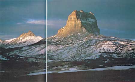
Lying astride the Continental Divide in the Northern Rockies, Glacier is
above all else a mountain park. The special beauty of its lakes,
streams, and forests derives from the microclimates and varied
topography and soil produced by mountain-building and mountain-eroding
forces.
|
Overthrust Mountains
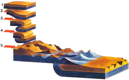
1 A hypothetical block of the Earth's crust in the region of
Glacier National Park as it existed more than 60 million years ago. The
two layers shown actually represent many strata of sedimentary
rocks.
2 Lateral pressure begins to force the rock layers to
buckle.
3 A large fold has been created, forcing the rock strata to
double over and overturning some layers. A break, or fault, is
forming at the plane of greatest stress.
4 The break has been completed and the strata west of the fault
have slid eastward, up and over the rocks east of the fault.
5 The Glacier landscape today. Throughout the millions of years
during which the folding, faulting, and overthrusting have been taking
place, the process of erosion has continued; a thousand meters of
stratified rocks have been worn away, so that only a remnant of the
overthrust layers can be seen today. Because Glacier's eastern slope
represents the eroded face of the overthrust block, the mountain range
rises precipitously from the prairie, with no foothills breaking the
abrupt transition from open prairie to mountain valley.
(click on above image for an enlargement in a new window)
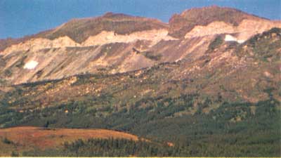
The peaks in this photograph (a view to the northwest from Marias Pass)
are remnants of the overthrust block, which moved eastward. The dividing
line between the light-colored rocks and the gray talus slopes beneath
them is the Lewis Overthrust Fault.
|
Glaciation
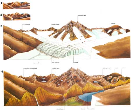
1 This is how the landscape in this region might have appeared
before the onset of the Pleistocene, millions of years ago. Note the
stream-eroded, V-shaped valleys. The climate at that time was
dry.
2 Glaciers began to form high on the peaks, crept downward, and
joined to form larger glaciers.
3 After many centuries of glaciation, tributary glaciers have cut
back into the peaks, forming basins called cirques. Thick
glaciers, moving rapidly and carrying rock fragments, have abraded the
main valleys' floors and sides, widening and deepening the valleys into
characteristic U-shapes.
4 In the present landscape, free of all but remnant glaciers,
small lakes called tarns occupy many of the cirque basins; and
waterfalls plunge into the main valleys from higher, shallower,
tributary valleys, called hanging valleys. Alluvial
cones—recent accumulations of rock debris—have begun to
build along the valley walls. In the main valley, a moraine (a
deposit of rock materials left by the retreating glacier) has formed a
dam that holds back a large lake.
During all this time, all parts of the terrain not buried under ice and
snow have been weathered and eroded by nonglacial forces. Thus the
contours of the jagged peaks and sheer cliffs have been
softened.
(click on above image for an enlargement in a new window)
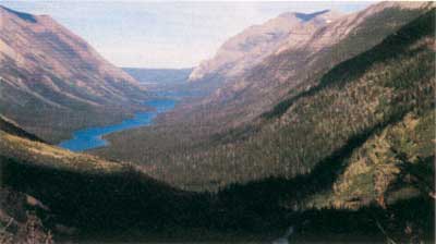
Glacial landforms can be identified in this view of the Mokowanis Valley.
|

|

|
|


