|
Volume XIX - 1953
Crater Lake Discovery Centennial
Nesting Birds
By Robert C. Wood, Ranger Naturalist
During the summer, at least several visitors came into the
Information Building to inquire about the two blue birds seen near the
back of the building. Of those who saw the pair of mountain bluebirds,
Sialia currucoides (Bechstein), only a few realized that the
birds were nesting behind a half-closed window shutter on the second
floor. When the nest, made up of grass, dead staghorn lichen and one
piece of twine, was first discovered on July 11, it contained two
eggs.
On subsequent visits the female was nearly always seen on the nest,
incubating her undersized clutch of eggs. On July 21, two helpless, pink
mites were seen for the first time. The babies grew rapidly; 20 days
later one was still in the nest but the other had ventured as far as the
ledge a foot away. When the nest was visited the following day, both
young bluebirds had departed.
Other nests were found during the summer, most of them being located
by observing the adults carrying food. In this way, a second mountain
bluebird's nest was discovered in a hole 20 feet up in a mountain
hemlock, several hundred feet east of the Lodge.
The nesting hole of a red-breasted nuthatch, Sitta canadensis
Linnaeus, also in mountain hemlock, was watched by numerous members of
the morning Garfield Peak field trips. The dead stub, to which the
nuthatches came regularly with food, was conveniently located near the
first lookout along the Garfield Trail.
Mountain chickadees, Parus gambeli Ridgway, were found in a
snag at Cold Spring Campground, and a pair of violet-green swallows,
Tachycineta thalassina (Swainson), evidently reared a family in a
cavity in one of the Wheeler Creek pinnacles. The swallows were observed
making frequent trips to a small hole in one of the tall, spire-shaped
formations, presumably feeding their young.
The nests of two Oregon juncos, Junco oreganus (Townsend),
were discovered quite by accident when, in each case, the incubating
female was flushed from her nest, well-hidden in a depression in the
ground. One nest contained three eggs, the other held four; both were
located between the highway and lower Munson Meadow. Unfortunately,
there was not an opportunity to observe the hatching and growth of the
young. Perhaps our visits were too frequent, perhaps some catastrophe
overtook the females. At any rate, the nests were abandoned and neither
adult was seen again in the immediate vicinity.
References
Farner, Donald S. 1952. The Birds of Crater Lake National
Park. University of Kansas Press. ix, 190 pp.
Farner, Donald S. 1952. The use of the Wheeler Creek Pinnacles by
nesting birds. Crater Lake Nature Notes 18:9-10.
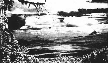
Mt. Thielsen is on the right. Photo by James Richards,
Seasonal Ranger, 1952.
Climb Mount Thielsen!
By Clifton E. Peterson, Ranger Naturalist, 1952
Mount Thielsen, the magnificent pinnacle seventeen miles NNE of Rim
Village, always excites the interest of the visitor to Crater Lake
National Park. This pointed spire, commonly compared to the Matterhorn
in Switzerland by the European visitor, even though only 9,173 feet in
elevation, beckons the adventurous.
Mount Thielsen rests on a base of rocks uplifted from the ocean
about 60 million years ago. Covering this, and rising to an elevation of
3-4 thousand feet, is the same kind of basalt that makes up the Columbia
River plateau. The next several thousand feet are composed partially of
lavas which may be referred to as either basalts or andesites, the
remainder being pumice and scoria. Forming the mass of the barren
pyramidal summit is a compact cinder-like material which has been
invaded by many basalt dikes. Through this tuff cone projects the dark
lava plug which forms the sharp projecting peak of the mountain.
Mount Thielsen, like all volcanoes, is thus composed of materials
thrown up by its own eruptions. Intermittent eruptions began some 25
million years ago and ceased sometime during the last of the Great Ice
Ages, probably about one million years ago. At that time the elevation
of the summit was in excess of 10,000 feet. The ponderous, moving sheets
of ice upon Mount Thielsen's slopes ground away the top until, with the
gradual warming of this continent, the glaciers passed away.
The Skyline Trail to the summit of Mount Thielsen begins near the
trailer camp just off Hwy. 209, at the SE corner of Diamond Lake. The
five mile trail to the summit of Mount Thielsen fades as the solid rock
near the top is reached, but beyond this point the best route
approaching the spire from the south should be apparent. Except for the
last 100 feet, which necessitates climbing upward at an eighty degree
angle utilizing crevices in the rocks as support, this trip should
present no problems to the average hiker using common sense. No ropes
are needed. The hike to the top will take 2-5 hours.
For the safety of hikers, it is desirable for them to state, on
forms available at the Forest Ranger Station 1.4 miles north from the
trail entrance along the Diamond Lake road, their intention to climb
Mount Thielsen. At the end of the hike they should return to the Ranger
Station and note the successful completion of the climb on the same
form.
On the morning of August 8, 1952, our party of six started from the
foot of the Skyline Trail, packing canteens and lunches. The meadow at
the start of the trail changed rapidly to the dense forest of lodgepole
pine which covers all the lower slopes of the mountain. The few small
open areas beside the trail were filled with flowers. After a slight
downward slope across the now dry Camp Creek, the trail became steeper.
From the deadened tramping of feet on the dry pumice slopes little
clouds of dust arose. We stopped to rest, discussing the natural history
unfolding before us. Juncos and western tanagers perched above us.
We started upward again. Intermixed with the lodgepoles were a few
ponderosa pines, western white pines and firs. More and more mountain
hemlocks were noted; the elevation was becoming too high for the
lodgepoles. Small pieces of pumice covered the ground, replacing the
pumice dust. More basalt was seen.
We passed across relatively open pumice slopes. Trees were fewer,
and most of these were white-bark pines. Then the pumice slope became
barren of trees, except for a few small scraggly white-bark pines
struggling in a sterile and as yet undeveloped soil. But sulphur flower,
Newberry's knotweed, lovage, alpine false dandelion, varied-leaved
phacelis and other flowers brightened the area. Each step forward was
partly lost by sliding backwards, due to the softness and slope of the
trail.
Light colored, fragmented lava gradually replaced the pumice and the
slope increased. Here visible plant life was at a minimum. We passed by
dark, horizontally-layered remnants of the old tuff cone projecting high
into the air. To the south and southeast the tuffs dip steeply for the
most part. This material gave a better foothold for climbing than was
available upon the fragmented lava.
A depressed area in the sloping tuff to the west of the spire, cut
by water from melting snows, was heavily populated by the golden
long-leaved arnica, bleeding heart, Davidson's penstemon, long-stemmed
penstemon, lovage, and, more rarely, Lewis' monkey flower, Jacob's
ladder and five-finger.
As we neared the top, rests were more frequent. We approached the
base of the summit pinnacle from the south--the only readily accessible
route to the top. A few dwarfed white-bark pines grow near the base of
this last obstacle to a successful climb.
The last 100 feet was almost straight up, and it was necessary to
pull oneself up by handholds in the rock. I was carrying the pack
containing the lunches. Trying to hug the bare rock for that last
hundred feet, the feeling of being pulled off-balance and away from the
rock by the pack, the strange feeling at looking off into a void from
this precarious position -- well, nothing can quite compare to it.
The view from the top was spectacular! To the north we saw a
storm-lightning and thunder and drenching rainfall. Westward, the slopes
of Mount Thielsen fall off toward shallow Diamond Lake, lying 4,000 feet
below. Beyond the lake is the broad-shouldered volcano, Mount Bailey.
Eastward, the slopes of Mount Thielsen lead gradually down to the broad
basaltic plateau of central Oregon and across the marshlands where graze
150,000 cattle. To the north, the Three Sisters are easily visible, and
to the south, across Pumice Desert, is the grandeur of the rising slopes
in which nestles Crater Lake. Fully one-third of Crater Lake is visible
beyond its precipitous rim. Far, far to the south, the snow-capped peak
of Mount Shasta is dimly seen through the slight haze, 140 miles away in
California.
The top of Mount Thielsen is a small area about 9x14 feet. This is
where we ate our lunch. The wind was blowing with that eerie sound to be
heard around barren rocks in high places. To the NE and ESE of this
platform are sheer drops of 1,600 feet into barren valleys containing
masses of glacial debris. These valleys were formed as glacial cirques
ages ago. Far down, 1,900 feet below, mighty springs can be seen gushing
from the side of the valleys, the waters of which wend their way across
forested valleys, eventually to reach the Pacific.
We prepared to leave. All around as far as the eye could see were
foresee and lakes and mountains, certainly defying description, almost
defying belief. Except for the very intriguing first portion of the
descent, the trip down was uneventful.
For the visitor to Oregon, the climb up Mount Thielsen will provide
a memorable experience.
Reference
Williams, Howell 1933. Mount Thielsen: A dissected Cascade volcano.
University of California, Berkeley. Bulletin of the Department of
Geological Sciences 23: 195-214.
|