|
|
|
GRAND TETON NATURE NOTES
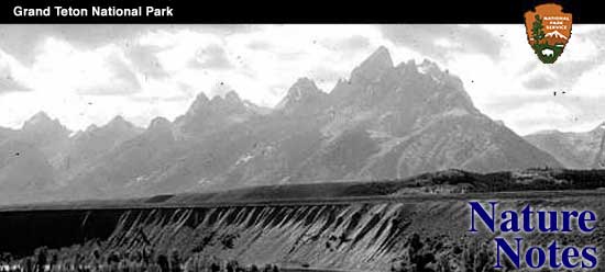
JACKSON LAKE SHORELINE by Howard R. Stagner Jackson Lake, the largest of the several piedmont lakes of Jackson Hole, lies in the northern end of this mountain-girt valley just east of the boundary of Grand Teton National Park. Bordered with dense forests of pine, spruce and fir with Mount Moran, Bivouac, Eagle's Rest and other mountains of the north end of the Teton Range rising abruptly from its western shore, and the Grand Teton and other sharp peaks of the range clearly visible across the waters to the south, it presents a view, which for its quiet beauty and spectacular character is not excelled. From such a vantage point as Signal Mountain, where the Forest Service maintains a lookout a thousand feet above the water level, nearly the entire irregular shoreline can be followed with the eye, the several islands distinguished, and the majestic peaks of the entire length of the Teton Range identified. In the bordering forests elk, deer, bear and smaller animals abound, and many moose find the wide-spread willow thickets of the north and northeast sides of the lake to their desire. Especially attractive is this lake in the spring when the water is at its highest level. As summer advances, however, the water rapidly recedes as much as 39 feet leaving a conspicuous white beach, and on the north, great expanses of mud flats to mark the shoreline. So great a change in water level does not characterize other similarly situated lakes of the area, nor is this fluctuation a natural one for it is controlled by a dam across the lake's outlet. Completed in 1916, this dam makes possible the storage of water to be released into the Snake River during the summer for irrigation in south-central Idaho. Two very obvious results followed the erection of the dam and the resulting artificial control of the water level. First, the lake area has been greatly increased. The original area of the lake was some 25,650 acres, and now, at high water level an additional 8,000 acres of low-lying, flat lands to the north and northeast sides of the lake are flooded. Then, by fall, when the impounded waters have been released, these flats are exposed as mud flats, and along the steeper banks a gravel and boulder-littered beach develops. A third quite undesirable effect has been largely rectified within recent years. When this lake was artifically enlarged, it was not the policy, as it now is to clear the trees from the area to be flooded. As a result, some 7,500 acres of forest were flooded by the rising waters, and the trees drowned. Consequently, for many years the entire lake was fringed with a forest of stark, naked, dead trees. Not only did this detract from the mountain and lake view and in places actually create a picture of dismal, depressing desolation, but from a practical viewpoint was becoming a factor of great danger. As dead trees became loosened, they floated into the open lake, frequently nearly or completely submerged, and constituted a real menace to boating. Finally the tremendous task of removing the dead trees was undertaken. The first work was done under the direction of the Bureau of Reclamation, but in 1933 the task was assumed by the National Park Service and the actual work done by boys of the Civilian Conservation Corps. By this time many of the trees had fallen, and in some places the beach was covered six to ten feet deep in a thick, tangled mass of dead trees. The last of the shore was cleaned up and the last piles of brush and dead, half-rotted trees burned in the fall of 1936. The shoreline now presents, as nearly as possible, the appearance of any normal mountain lake. Only the dam itself, the mud flats and high white beaches exposed in the fall belie this natural appearance. Not all of the trees were removed, however. In several hidden bays the dead forest was left undisturbed for the advantage of any wildlife that may have been attracted by the original creation of an abnormal abundance of dead trees. The sketch on the cover of this issue of Nature Notes attempts to picture the forest of dead trees along the shoreline before the clean-up. The lake in this view is considerable below high water mark, the level of which is indicated by the height of the bleached portion of the tree trunks. Mount Moran and Skillet Glacier are seen in the background. | |||||||||
| <<< Previous | > Cover < | Next >>> |
vol3-3c.htm
24-Mar-2016