|
Assateague Island
Administrative History |

|
Chapter I:
THE BECOMING OF THE SEASHORE
The Island Becomes
Assateague Island in approximately its present configuration dates from 1933. Approximately, because the island has ever been characterized by change: most dramatically the apparent erosion of the north end during the past 50 years and the extensive accretion at its southern extremity for more than a century. Nineteen thirty—three, because a storm in that year defined the present (more or less) island via the cutting of Ocean City Inlet, which severed its contact with the mainland to the north. The resulting landform, comparable to those lining much of the nation's Atlantic coast, is a low strip of variously vegetated sand, now some 37 miles long and from one—quarter to 2—1/2 miles across, comprising about 19,000 acres. The northern 22 miles are in Maryland, the southern 15 lie in Virginia.
In the natural course of events the 1933 inlet, like others preceding it up and down the barrier formation, would have silted in from sand borne by the prevailing littoral drift southward along the coast. To keep it open for navigation between the Atlantic and the bays separating Ocean City and Assateague from the mainland, jetties were soon constructed into the ocean from the south tip of Ocean City and the north tip of Assateague. The jetties, in addition to keeping the drifting sand from clogging the inlet, impeded its natural progress onto the north coast of Assateague. This "starvation" of the littoral drift has resulted in a pronounced westward recession of the northern six miles of the island toward the mainland. To the south the unimpeded littoral drift has extended Assateague some six miles since the mid—19th century, forming Toms Cove Hook. With and without human intervention, Assateague has been and will continue to be a dynamic piece of real estate.
Despite their location adjacent to the megalopolis of the northeastern United States, Assateague and most of the Delmarva Peninsula to which it belongs long escaped the burgeoning urbanization of the region. The north portion of the future island was subdivided in 1890 by the Synepuxent Beach Company, and a second subdivision under the name South Ocean City occurred about 1920. [1] Existing only on paper, these prospective developments came to naught. The southward expansion of the incipient resort of Ocean City was effectively halted by the cutting of the inlet in 1933, which left Assateague accessible only by boat. Several small settlements farther south had declined to the point of disappearance by that time, leaving the island occupied primarily by personnel of four small Coast Guard stations and seasonal users of several hunting lodges.
Early Federal Interest, 1934—1949
Long a favorite locale for fishing, hunting, and bathing among regional residents, Assateague first came to national attention for such recreational pursuits in 1934. In that year the National Park Service of the Department of the Interior undertook a survey of lands along the Atlantic and Gulf coasts to identify those with potential to be acquired by the Federal Government and administered by the Service as national seashore recreational areas. Assateague Island and the adjacent mainland comprised one of 12 areas found to qualify for such status by virtue of their natural qualities, recreational values, and propinquity to major populations. (Cape Hatteras, the first area subsequently established as a national seashore, was another.) In September 1938 Service representatives Victor H. Cahalane, Harry T. Thompson, Merel Sager, and Wendell Little prepared a specific report to NPS Director Arno B. Cammerer on the seacoast between Rehoboth, Delaware, and Chincoteague Island, Virginia. A year later Park and Recreation Planning Consultant T. H. Desmond flew over the area and relayed his favorable findings to Conrad L. Wirth, then Supervisor of Recreation and Land Planning for the Service. "One excellent feature of the area," Wirth stated on the basis of these reports, "is that all human use may be concentrated in the northern section between Ocean City, Maryland, and Rehoboth Beach, Delaware.... The 34—mile strip between Ocean City and Fishing Point [the south end of Assateague ] could be preserved without any roads whatsoever." [2]
These explorations led Director Cammerer in April 1940 to recommend to Secretary of the Interior Harold L. Ickes the "particular suitability of the Rehoboth—Assateague area for establishment as a national seashore." Ickes approved further investigation of the proposal. [3] On the legislative front, Representative Schuyler Otis Bland of Virginia cooperated by introducing H.R. 9718 in the 76th Congress on May 9, 1940, to provide for the establishment of a Rehoboth—Assateague National Seashore in Delaware, Maryland, and Virginia. The bill called for Federal acquisition of up to 75,000 acres between Cape Henlopen, Delaware, and the south end of Assateague Island, one quarter of which could be on the mainland side of the bays and inlets west of the barrier islands. At least half the lands or funds for acquisition were to be donated from other than Federal sources. The towns of Rehoboth, Bethany Beach, Ocean City, and Chincoteague would be excluded from the national seashore.
Representative Bland introduced similar bills in the 77th, 78th, [4] 79th, and 80th Congresses, but the House took no action and no companion bills were introduced in the Senate. The Park Service continued to monitor the area. In July 1941 the prominent landscape architect Frederick Law Olmsted, Jr., accompanied by Ben H. Thompson, Chief, Land Planning Division, made a land and aerial survey of the proposed seashore. Olmsted's report selected stretches north of Ocean City as advantageous for seashore recreation and recommended a stabilization study for building up Assateague, which was low and subject to overwash in several places. Pursuing this recommendation, Field Supervisor A. Clark Stratton of the Region One Office and Senior Engineer E.F. Preece of the Washington Office studied the problem in the spring of 1942 and recommended beach protection measures similar to those undertaken by the Service at Cape Hatteras. [5]
The National Park Service was not the only Federal bureau interested in Assateague. On May 13, 1943, the Fish and Wildlife Service of the Department of the Interior established Chincoteague National Wildlife Refuge on the south end of the island. The refuge lands, acquired with funds from the sale of Migratory Bird Hunting and Conservation Stamps ("duck stamps") under the Migratory Bird Conservation Act of 1929, came to include virtually all of the Virginia portion of Assateague (more than 9,000 acres) and just over 400 acres near the state line in Maryland. During the next decade sand flats were diked and water control structures installed to create 11 freshwater impoundments covering more than 2,800 acres. Established primarily to support the migration of the greater snow goose, the refuge has come to be occupied or visited by over 275 species of birds and is one of the showplaces of the National Wildlife Refuge System.
Outflanked on the south and cognizant of insufficient political support for the 75,000—acre Rehoboth—Assateague proposal, the Park Service lowered its sights in 1947. Its "Supplemental Report on the Proposed Rehoboth—Assateague National Seashore" that July recommended acquisition of only 12,700 acres in Delaware and 7,300 in Maryland, the latter to include Maryland's portion of Assateague Island and land north of Ocean City. The fact that the state of Delaware owned much of the ocean frontage there and would presumably donate its holdings to the Federal Government was cited to justify the feasibility of the project. The report noted, however, that "the feeling of members of the Delaware State Park Commission toward this procedure was definitely not enthusiastic in August, 1940"—a situation that apparently held. [6] Representative Bland introduced a scaled—down Rehoboth—Assateague bill at the beginning of the 81st Congress in 1949, but it got no further than its predecessors. [7] Bland's death in office the following year ended legislative activity on the subject for more than a decade.
Private Subdivision and Development, 1950—1962
The passing of Assateague's congressional champion coincided with a major new push for private development of the island. A group of Baltimore and Washington investors headed by Leon Ackerman acquired 15 miles of the ocean side of Assateague north of the Virginia line. In February 1950 they commissioned Robert C. Walker, an engineering consultant, to survey, subdivide, and plat the area for recordation. [8] Ackerman paved a road—"Baltimore Boulevard"—down the island, erected numbered street signs for the unbuilt lateral streets, and inaugurated a major sales campaign with full—page advertisements in the metropolitan papers for his development, named Ocean Beach. The promoters ferried prospective buyers from South Point at the tip of Sinepuxent Neck on the mainland to Assateague, where they were enticed to purchase residential and commercial lots at prices from $1,250 to $8,500 (as of September 1954). The opening of the Chesapeake Bay Bridge in 1955, easing access to the Eastern Shore from the Baltimore and Washington metropolitan areas, proved a boon to the venture. Visions of seaside vacation retreats and expectations of speculative profits from resale led some 3,200 parties to acquire 5,850 lots at Ocean Beach by the early 1960s, although fewer than 30 dwellings were constructed. [9]
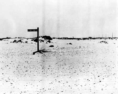
|
| Remnants of Leon Ackerman's Ocean Beach subdivision on Assateague, c. 1965. |
As it had done 20 years earlier, the National Park Service undertook another survey of potential national seashores along the Atlantic and Gulf coasts. Among the 126 areas considered was Assateague. The survey report, issued in 1955 after an 18—month study funded by the Mellon Foundation, described the Maryland portion of the island as "the site of one of the largest seashore developments along the Atlantic coast." It concluded that "the advanced stages of real estate development appear to preclude the possibility of this area being set aside for public recreational use," while suggesting that the Virginia portion had potential for recreation compatible with its status as a wildlife refuge. [10]
In 1957 Atlantic Ocean Estates, Inc., acquired much of the northern end of Assateague from the Delaware Mortgage Company and subdivided it into 1,740 lots. An intensive sales promotion featured radio broadcasts in which listeners were offered "down payments" of up to $1,000 if they could identify familiar "mystery tunes" like "You Are My Sunshine" and "The Missouri Waltz." Many sales followed, although there was no legal access to the subdivision across the private 671—acre McCabe tract to the south, no streets or utilities were ever installed, no lot was ever improved, and the rapid westward migration of that end of the island—frequently overwashed by the ocean—resulted in the permanent inundation of many tracts, which quite literally became "Atlantic Ocean Estates." (John T. Moton, the principal of this operation, was jailed in the unrelated Maryland savings land loan scandal of 1962.) [11]
During and after the early Federal interest in a national seashore encompassing Assateague, the state of Maryland found the island worthy of consideration for a state park. State planners proposed such a park on Assateague in 1940 and again in 1952, each time without result. Then in 1956 Leon Ackerman's North Ocean Beach, Inc., donated its interest in 540 Assateague acres to the state. [12] The donation was not entirely altruistic. Those with a financial stake in the island wanted nothing more than a bridge link to the mainland, for ease of access and for the increase in property values that would surely follow. The landowners and other interested private investors attempted to finance and build their own bridge, but this venture got no further than the construction of a causeway stub out from the bay side of the island. A bridge built by the state would solve the problem. To justify such a public expenditure, there had to be a comparable public interest on Assateague—ergo, the contribution of land for the state park.
The Maryland Board of Public Works accepted the donation, following which the Maryland General Assembly authorized establishment of the Assateague State Park and appropriated $750,000 for additional land. The private Assateague interests were repaid when the General Assembly authorized construction of a bridge to the island park in 1961 and appropriated 1,500,000 for the purpose the following year. (The bridge and its approaches ultimately cost the state $1,709,026.) [13]
Just as prospects looked brightest for the island's landowners, a storm on March 6, 1962, devastated Assateague. The protective dunes were severed in many places, and high winds and water destroyed all but the sturdiest structures. Only about 16 cottages, 17 gun clubs, and a few other buildings remained in the Maryland portion, many of them older structures on the relatively sheltered bay side outside the Ocean Beach subdivision. [14] The road down the island was variously washed out and buried. The suitability of the shifting barrier reef for private development, always a matter of doubt, was called much more widely into question.
Renewed Federal Interest, 1962—1963
Just two months before the great March 1962 storm, the federally sponsored Outdoor Recreation Resources Review Commission had issued yet another report on the need for additional shoreline recreation areas to serve America's growing, mobile, urban population. The storm, which had undone much of the development for which Assateague had been discounted in the 1955 National Park Service survey report and which augured ill for future private investment, galvanized Secretary of the Interior Stewart L. Udall to revive the prospect of Federal acquisition. Udall enlisted the support of Maryland Governor J. Millard Tawes for "a joint study to determine the best use of Assateague (as if the Federal position were not predetermined). [15]
The "joint study" was in fact an Interior Department product, with its new Bureau of Outdoor Recreation (BOR) receiving top billing in the resulting report and its National Park Service and Bureau of Sport Fisheries and Wildlife (Fish and Wildlife Service) playing supporting roles. Issued in April 1963, the report recommended establishment of an Assateague Island National Seashore under the Park Service, encompassing the entire island. To avert opposition from the Maryland Department of Forests and Parks and the Bureau of Sport Fisheries and Wildlife, Assateague State Park and Chincoteague National Wildlife Refuge would retain their individual identities under their separate administrations. The island would be developed for both intensive (concentrated) and extensive (dispersed) day use; off-island private enterprise would be depended on for food, lodging, and other such facilities. All private holdings would be acquired with limited tenure for owners of improved properties. The state park could expand to cover the northern nine miles of Assateague unless the state were willing to relinquish this area to the Federal Government.
In accordance with recent legislation authorizing compatible recreational use of national wildlife refuges, Chincoteague National Wildlife Refuge would be managed for appropriate general recreation as an integral part of the national seashore. The Federal Government would acquire the interests of the existing Chincoteague—Assateague Bridge and Beach Authority, which had built a bridge to the south end of Assateague and a road thence to the beach at Toms Cove Hook under Federal lease in 1962. This bridge and the Sandy Point (Sinepuxent Neck) bridge under construction in Maryland would serve for public access to the seashore. The original edition of the report called for a limited—capacity road down the island linking the bridges; reference to this road was deleted in a subsequent printing. [16]
Appended to the BOR report was a contract study by Robert R. Nathan Associates, "Impact of Development of Assateague Island." The Nathan report argued against the feasibility of private development. It noted that the construction of sufficient protective dunes would obliterate most oceanfront lots where private equity was greatest and would be unaffordable by the landowners. (With private ownership, the Army Corps of Engineers would pay no more that half the cost of such protection.) It pointed up the need for an expensive sewer system, as septic tanks would be unacceptable. Anticipating a major concern of local government, it forecast little if any loss of net revenue to Worcester County, Maryland, in the expectation that increased development on the mainland would offset foregone property taxes on the island.
Most Worcester County officials and Assateague property owners were averse to the proposed Federal takeover. The county, envisioning a more residential but comparably lucrative version of Ocean City on Assateague, was unconvinced by the federally commissioned Nathan report and vigorously opposed the perceived threat to its tax base. Its planning commission, aided by the Maryland State Planning Department, commissioned a counter report by Julian Tarrant, a Richmond consultant, titled "A Plan for Private Development on Assateague Island, Maryland." In fact, the Tarrant report was less than encouraging. It found that 84 percent of the subdivided lands would require from one to seven or more feet of fill, totaling some 17 million cubic yards, to bring them up to the minimum level recommended for permanent construction. Hydraulic filling from the floor of the bay, the most economical method, would deepen the shallows there with a probable adverse effect on water life. The estimated cost of filling alone was from $6.8 to $8.5 million; utilities, dune construction, and other expenses to bring the subdivided lands to a buildable state would boost the total to between $10.5 and $19 million. As the Nathan report had observed, necessary dune construction would eliminate the platted oceanfront lots. "Private development on at least a good part of Assateague Island is altogether possible," the Tarrant plan concluded, "but it will be expensive." [17]
Assateague property owners, who might have been expected to welcome Government purchase of their lots after the daunting 1962 storm and the evident difficulties of development on the island, for the most part did not. Construction of the Sandy Point bridge, finally proceeding in 1963, rekindled the owners' dreams of island pleasures and profits. The preceding June, Interior Secretary Udall had told Maryland officials that he had no objection to their schedule for the bridge; in May 1963, however, he urged Governor Tawes to defer its construction for a year until Congress had considered the national seashore proposal. His principal concern was the certain inflation in island property values that would result. A "Governor's Committee on Assateague Island" appointed to review the matter rejected Udall's plea (construction bids had already been received), and the bridge went forward. This Federal intervention did nothing to lessen private hostility to the seashore plan, which Udall, other Federal and state officials, and congressional representatives witnessed firsthand on a June 24 trip to Assateague. There lot owners led by Philip King, president of their Ocean Beach Club association (and a retired assistant to the director of the National Park Service), verbally assaulted the delegation for threatening their property rights. "If your attitude had prevailed there would be no National Park System," the Washington Post reported Udall as shouting in response. [18]
The national seashore proponents gained an unlikely ally in Leon Ackerman. Having grossed some $4.5 million from lot sales there, he now declared Assateague unsuited for private development. (Ackerman had moved on to other real estate venture in Florida, Indian Lake Estates, which collapsed. Despondent over financial and legal difficulties, he committed suicide in April 1964.) [19]
The state of Maryland was also more inclined to favor the Federal plan for Assateague. The Maryland Board of Public Works held a public hearing at the Baltimore Civic Center in August 1963 at which a majority of those testifying supported the national seashore. The Maryland Department of Economic Development concluded that Federal recreational development of Assateague would be preferable to private development. By early September the Board of Public Works and other state officials had received 936 letters and telegrams on the issue; most were from island lot owners opposing the Federal plan, but a majority of non—owners favored it. After reviewing the Nathan and Tarrant reports and considering all views, the Board in September came out in support of joint Federal—state development, with appropriate compensation to Worcester County for its contribution to the Sandy Point bridge and its loss of island tax revenues. Economic considerations played no small role in the state's position: responsible officials contrasted the tourism income from a national seashore with the specter of major state investment to protect private property on Assateague. [20]
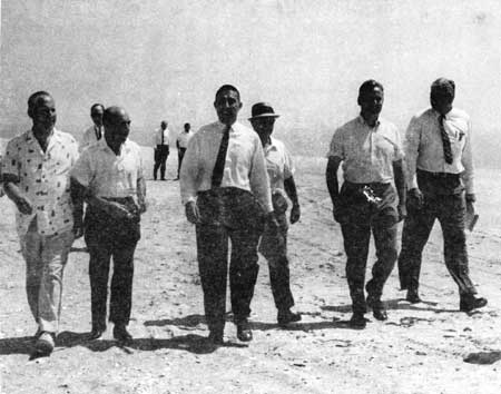
|
| Some principal promoters of the national seashore visit Assateague, 1965: Interior Secretary Stewart L. Udall (center), Sen. Daniel B. Brewster (second from right), Rep. Rogers C B. Morton (right). |
Senator Daniel B. Brewster of Maryland relayed to the Interior Department several questions raised at the state hearing. Would Interior consider taking the beach front only, leaving the remainder of Assateague to private development? Noting that the cost of dune stabilization would soar if it were necessary to protect landward private development, Assistant Secretary John Carver squelched this idea: "We believe that all of the stable land is required to develop the full potential as a Federal seashore." Would the Government ever want mainland property across the bay for park purposes? No, Carver replied, just a small headquarters and service area by the bridge approach. Would Interior furnish Maryland with a plan and timetable for its proposed development? Yes, a plan and tentative timetable were in progress, but development would necessarily be contingent on appropriations. Would the Federal Government compensate Maryland for a portion of the Sandy Point bridge costs? Again necessarily avoiding commitment, Carver found the proposal proper: "The fact that, except for the State park, the entire island would be in Federal ownership under the proposal, would justify a substantial Federal contribution to the cost of the bridge, in our opinion." [21]
Congressional Deliberations and Local Developments, 1963—1964
With most of Maryland—outside Worcester County—behind the national seashore, cooperation was readily forthcoming from the state's congressional delegation in the matter of authorizing legislation that September and October in the 88th Congress. Representatives Clarence D. Long, Carleton R. Sickles, and Rogers C. B. Morton introduced H.R. 8371, H.R. 8385, and H.R. 8755 respectively in the House; Senators Brewster and J. Glenn Beall cosponsored S. 2128. Introduced pursuant to executive communication, the Long and Beall—Brewster bills closely reflected Interior's position. Representative Morton, in whose district Worcester County lay, was most directly affected by the local opponents of Federal acquisition. Submitted a month after the others, his bill incorporated "The Morton Plan—Assateague's Reach for Greatness," as heralded by a press release from his office. The "Morton Plan" featured three "stylized communities" of private residential and commercial development approximately 10 miles apart: the northern one, at the Sandy Point bridge, containing a cultural center for the fine and performing arts; the middle one, at Green Run, centering on an "Olympic Village" with sports facilities; the southern one, at Toms Cove Hook, Virginia, including a wildlife center with a museum and auditorium. Owners of existing properties would trade their holdings for lands in the new communities. [22]
The complexity of Morton's scheme drew fire from landowners and conservationists alike. The Interior Department was equally unenthusiastic. Retreating from the multiple village concept but not from the need to placate Worcester County by retaining some taxable development on Assateague, Morton introduced a new bill, H.R. 11117, on May 4, 1964. This provided that an area of up to 600 acres south of the Sandy Point bridge would be set aside for commercial concessions for overnight and other public accommodations. The 600—acre concession area was accepted by Interior as an unpalatable but necessary compromise with local interests. [23]
The Subcommittee on Public Lands of the Senate Committee on Interior and Insular Affairs held a hearing on the Beall—Brewster bill August 11, 1964. As the 88th Congress would shortly adjourn, it was understood that new legislation would have to be introduced the following year, at which time public testimony would be heard. The 1964 hearing was thus reserved for members of Congress and Interior witnesses to present their advocacy of the national seashore.
"The drawing power of a national seashore at Assateague, promoted with all of the skill and good taste that is typical of all of our national parks, will attract visitors to Maryland from every State in the Union," Senator Brewster glowingly forecast in his testimony. "As the Nation goes to the Grand Canyon, so the Nation will come to Assateague." Brewster recognized the public support represented by the Citizens Committee to Preserve Assateague Island, organized early that ear under the chairmanship of C. A. Porter Hopkins, and favorable editorials in the Baltimore Sun, Washington Post, and Washington Evening Star. To justify the proposed Federal payment to Maryland for the Sandy Point bridge of up to $1 million, from which the state would reimburse Worcester County for its contribution, Brewster declared that "the great majority of the traffic using the bridge will be going to the Federal park. [24]
Representative Morton appeared in support of the national seashore with the 600—acre concession development area in his House bill. Reviewing his original "Morton Plan" and its demise, he described the concession area as practical means of achieving maximum public utilization of Assateague and tax revenue for Worcester County. "The Department of the Interior assured me that this was a suitable arrangement for which there was precedent in other national parks," he announced. [25]
By letter, Secretary Udall had already recommended that the Senate committee amend the Beall—Brewster bill to incorporate the concession area. The sponsoring senators accepted the amendment at the hearing, and Udall testified to the local benefits expected therefrom: "The property that would be constructed, the buildings and everything, would, as is explicitly provided in the language, be taxable...by the State and local governments." He estimated that tax revenues of $30—35,000 after full development of the 600 acres would provide "a substantial replacement of the real property taxes that would be lost as a result of the acquisition." The only dissenting note was sounded by Representative Thomas N. Downing of Virginia, in whose district Accomack County, the town of Chincoteague, and the southern end of Assateague lay. Although Virginia had supported the original Interior plan for the island, there was concern that the proposed concession development in Maryland would promote tourism there at Virginia's expense. If Maryland were to have such a development, Downing thought, so should Virginia. [26]
A statement presented by National Park Service Director George B. Hartzog, Jr., outlined the Service's "preliminary development plans for Assateague, from north to south:
—The Inlet Jetty Area, adjacent to the Ocean City Inlet, would offer fishing and picnicking facilities with access by foot trails and boat.
—The Assateague State Park would provide for intensive use, with a restaurant, marina, riding stables, and other facilities in addition to the existing camping and bathing.
—The Concession Area, occupying 1—1/2 mile of beach frontage below the state park, would include overnight accommodations, a marina, outdoor game courts, and a recreation building constructed and operated by private capital under concession contract.
—The Lumber Marsh Area, with bathing and picnicking facilities, would be the first of three major NPS—operated recreational areas.
—The Sugar Point Area would be similar to Lumber Marsh.
—The Green Run Bay Area, at the end of the road down the island from the Sandy Point bridge, would resemble the two preceding but with the addition of a visitor contact station, marina, camping, and interpretive trails.
—At Chincoteague National Wildlife Refuge, the Bureau of Sport Fisheries and Wildlife would provide a "major development" near the existing restaurant concession at the head of Toms Cove Hook and beach shelters along the hook. A visitor center and interpretive services would be provided at the refuge headquarters near the Chincoteague—Assateague bridge.
On the mainland by the Sandy Point bridge, the seashore administrative headquarters and a visitor center would occupy a 10—acre tract. [27]
A month after the Senate hearing, in September 1964, the Sandy Point bridge was opened to traffic. Completion of the bridge sharpened the issue of public versus private development of Assateague. The state, having come down on the side of the former, refused to let Worcester County build a road from the bridge through the state park land to the Ocean Beach subdivision. Previously, Maryland health authorities had denied clearance for septic tanks on the island. Robert C. Walker, Leon Ackerman's former associate, appealed the state's refusal to allow water and septic tank permits for his planned construction. A court decision ordering the permits was appealed by the state but the Maryland Court of Appeals sustained the decision on May 4, 1965. [28]
The Seashore Succeeds, 1965
With this renewal of private development pressure, there was no time to lose if Assateague were to be acquired for public use. Early in 1965 the National Park Service published an attractive 24—page promotional brochure, Assateague Island National Seashore: A Proposal. The brochure described Assateague as the largest undeveloped seashore between Cape Cod and Cape Hatteras. It publicized the endorsement of national seashore status by the Secretary of the Interior's Advisory Board on National Parks, Historic Sites, Buildings, and Monuments in September 1963 and Assateague's compliance with the criteria for national recreation areas established by the President's Recreation Advisory Council. [29] Three million visitors were predicted annually by 1975.
The proposal called for the national seashore to encompass 39,630 acres, including all of Assateague Island, the small adjoining bayside islands, marshes, and submerged lands, a 1000—foot strip of the Atlantic, and the 10—acre headquarters tract on the mainland. The Government would acquire the Chincoteague—Assateague bridge and compensate Maryland for construction of the Sandy Point bridge if the state operated it free of tolls. Maryland would be assured the right of acquiring additional land for its state park from the Federal Government at the north end of the island.
Assateague would be developed for "maximum public recreation use," with the Federal portion generally augmenting the high—density use facilities planned for the state park. In addition to the facilities suggested earlier, the 600—acre concession area was now envisioned to include a pavilion with a large restaurant and snack bar, a gift shop, a saltwater pool and bathhouse, and a 500—unit motel in 20 buildings. The road down the island would extend to "within a few miles" of the wildlife refuge; it was stressed that it would not connect with the Virginia bridge. Recreational activities would include swimming, surfing, sunbathing, skin diving, water skiing, boating, clamming, crabbing, fishing, and hunting, the last to be permitted under applicable Federal and state laws in the Maryland portion of the seashore. [30]
The Park Service promotional brochure was preceded by the reintroduction of national seashore legislation in the new 89th Congress. Interior's proposal was consistent with S. 20, introduced January 6, 1965, by Senator Brewster with the cosponsorship of Joseph D. Tydings, Maryland's new junior senator, and 14 others. On February 11 Senator A. Willis Robertson of Virginia introduced a different version, S. 1121, which matched Representative Downing's H.R.4426 in the House. Other House bills with other differences were submitted by Representatives Morton (H.R. 2071), Long (H.R. 2101), Sickles (H.R. 1730), and Samuel N. Friedel (H.R. 2607) of Maryland, and John P. Saylor of Pennsylvania (H.R. 6986).
The Interior Department was asked for its position on the Senate bills before resumption of the Interior and Insular Affairs subcommittee hearings in March. Secretary Udall's report to Chairman Henry M. Jackson, advocating passage of S. 20 and opposing S 1121, pointed up the key differences in the bills. Senator Robertson (and Representative Downing), reflecting Virginia interests, would require the national seashore to be kept open at all times (a reaction to local complaints that Chincoteague National Wildlife Refuge was often closed), designation of sufficient grazing areas for the wild ponies on Assateague, establishment of a concession accommodations area comparable to that proposed in Maryland, and a road down the island linking the Maryland and Virginia bridges. The Interior response argued that the seashore, for reasons of public safety, should not be precluded from closure (as during storms); that a specific requirement for grazing areas could conflict with wildlife habitat protection and was unnecessary; that overnight public accommodations in the refuge would be incompatible; and that a connecting road through the refuge "would all but eliminate the fine waterfowl habitat which the Department has developed through the years at considerable expense." [31]
The Senate hearings ran for four days, indicative of the widespread and intense interest in the Assateague legislation. Among the first day's witnesses was Governor Tawes, who stressed the urgency of congressional action in the face of the pending court suits to force private building permits. "We in Maryland are doing everything legally possible to prevent residential and commercial development on the island..," he stated. "We are doing our very best to hold the line but I don't know how long we can prevail." Subcommittee Chairman Alan Bible pressed Tawes and other Maryland officials to justify the unusual retention of a state park within a unit of the National Park System, which Interior had been forced to support as a price for Maryland's advocacy of the national seashore. The state witnesses remained firm on the issue, contending that Assateague State Park's intensive use facilities would complement the lower—profile development elsewhere. [32]
Following the testimony of the congressional sponsors and Federal and state government officials, all of whom advocated one or more of the bills, a great array of local officials, interest group representatives, Assateague property owners, and others came forth to speak or inserted statements in the record. Favorable to the national seashore (although in some cases opposed to particular development proposals) were such organizations as the Pocomoke City Chamber of Commerce, the Izaak Walton League, the American Automobile Association, the Wilderness Society, the Sport Fishing Institute, the National Parks Association, the Travel Trailer Clubs of America, the Canoe Cruisers Association of Greater Washington, and the Audubon Naturalist Society of the Central Atlantic States. Although some lot owners submitted supporting letters, a majority of those voicing their views were displeased. Worcester County officials were uniformly unhappy.
Philip King, the property owners' association leader who had accosted Secretary Udall on Assateague, claimed the backing of more than 80 per cent of Ocean Beach owners. He urged the establishment of a national seashore elsewhere on Assateague and on Parramore and Hog islands to the south in Virginia. (Parramore, still undivided and unimproved, had been favorably mentioned in the 1955 Park Service seashore survey.) Several owners, identifying themselves as military veterans, characterized the confiscation of their property as un—American. Others decried the unfairness of taking lands from those who had purchased after the 1955 NPS study had ruled out the prospect of a national seashore on Assateague. The concession area, devised to placate Worcester County, was no comfort to those who viewed it as a means for other private interests to profit from their loss. "Why should Mr. Udall want to spend millions of dollars of tax money on Assateague Island and remove this land from the tax rolls when private citizens are willing to spend millions of dollars of private funds in developing the island and then pay additional millions in taxes as the years go by?" asked J. Thomas Stanley, owner of seven lots. "We think that it is completely unfair for the Government to take our land and then lease any part of it to private developers as has been proposed." [33]
State Senator John L. Sanford, Jr., Delegates Russell O. Hickman and Mark O. Pilchard, and L. Hollingsworth Pittman, attorney for the Worcester County Commissioners, appeared to present the county's position. Refusing to accept that revenues from the concession area and increased private development on the mainland would offset the loss of property tax revenues from Assateague, they portrayed the national seashore as strangling local growth. They would agree to having the north eight miles of the island acquired by either the Federal or state government for a day—use park, with the island's entire beach open for public use. If the proposed legislation were to go forward, they wanted it amended to grant the county a payment in lieu of taxes on Assateague's projected development to a level of parity with Ocean City. "We beseech you, if necessary we will get on our knees and beg you, to leave us alone, to not take Assateague Island, to not impair our credit standing or our future," Pittman implored the committee. "Please do not bury us in the golden sands of Assateague." [34]
A document prepared by the county, "Assateague—Worcester's Answer," summarized the local viewpoint for the record. Describing the great mass of the public as favoring commercially developed seaside resorts of the Atlantic City—Ocean City variety with hotels, shopping, and nightclubs, it saw only a tiny minority—"the magnifying—glass nature lover and the bird watcher"—being drawn to the proposed national seashore, which would but duplicate facilities already provided at Cape Cod, Chincoteague National Wildlife Refuge, and Cape Hatteras.
Worcester County does not believe that it is necessary or that it is warranted that the Federal Government condemn Assateague Island for a Federal recreation project, and does not believe that it would become anything but a barren wilderness useful only to bird watchers. It feels that if the public needs the services proposed, they can be acquired nearby in the State park to the north or in the wildlife refuge to the south. Worcester County believes that the Federal condemnation of Assateague Island will detrimentally affect its local economy with no ensuing benefits. Worcester County believes that the 3,200 lot owners who have waited 10 years or more to see their dreams of a seaside home come true should be protected in their private holdings. And Worcester County believes that Assateague Island should be privately developed with private capital, initiative, and energy in the American way, and not by socialistic bureaucrats desiring public ownership for the satisfaction of those few who do not have the industry and energy to provide for themselves. [35]
Aside from the basic issue of whether or not there should be an Assateague Island National Seashore, the biggest controversy revolved around the extent of development to be allowed or required. The proposed road connecting the Maryland and Virginia bridges was most controversial of all. First officially mentioned in the original April 1963 report by the Bureau of Outdoor Recreation, it was deleted following strong objection from the Bureau of Sport Fisheries and Wildlife (which claimed it had not been consulted), but copies of the report containing the road proposal were released. [36] With Senator Robertson as their most influential and insistent spokesman, Virginia interests embraced the road as a means of drawing tourism to their end of the island and the adjacent town of Chincoteague. Robertson and Representative Downing pushed strongly for the road, prescribed in their bills, at the Senate hearings and submitted for the record resolutions of endorsement by the town of Chincoteague, the Accomack County Board of Supervisors, the Eastern Shore of Virginia Chamber of Commerce, the Chincoteague Volunteer Fire Company, and other local groups. They acquired an important ally in Representative Morton, who had included the road in his bill as well. (A road had been implicit in the original "Morton Plan" but was not part of his revised legislation in the preceding Congress.) Undoubtedly motivated primarily by the need to cultivate Virginia support, Morton publicly justified the road as a means of dispersing Assateague visitors along the island rather than leaving them concentrated at the bridgeheads. [37]
Secretary Udall remained opposed to the road requirement. "It may very well prove in the long run, after we get established, that we can construct a road that will not do serious damage to the wildlife values and the recreational values...," he testified at the hearing. "My belief is that if we put a road in [the bill] now we are going to arouse opposition and controversy that may very well defeat or delay the bill." He recommended that Interior instead be directed to study the matter and report back to Congress at a future date (a favorite delaying tactic). Director John S. Gottschalk of the Bureau of Sport Fisheries and Wildlife was more forthright in condemning this threat to Chincoteague National Wildlife Refuge: "I would like to state quite unequivocally that we feel that a road in this section of the Assateague Seashore would have some very detrimental effects from the standpoint of our management of our national waterfowl resources." [38]
Gottschalk, whose bureau already had its part of Assateague, was a somewhat reluctant player on the Interior team promoting the national seashore. He and his staff foresaw difficulties with both the seashore development proposals and coexistence on the same territory with the competitive National Park Service. Outsiders with doubts about including a wildlife refuge in a recreation area could voice them openly. Daniel A. Poole of the Wildlife Management Institute in Washington testified against the road through the refuge and incorporation of the refuge in the seashore, viewing each as detrimental to wildlife values. He suggested that a road could be built bypassing the refuge via a causeway from the Maryland portion of Assateague to the north end of Chincoteague Island. The National Wildlife Federation, on the other hand, favored placing the refuge in the seashore. [39]
On June 15, 1965, the Senate Interior and Insular Affairs Committee favorably reported S. 20 with certain perfecting and clarifying amendments, a new Section 9 prescribing a connecting road, and a new Section 10 containing land acquisition and development appropriations ceilings of $16,250,000 and $7,765,000 respectively. These figures, supplied by Interior from local land appraisals and other estimates, included $1 million to partially compensate Maryland for the Sandy Point bridge but nothing for acquisition of the Chincoteague—Assateague Bridge and Beach Authority interests in Virginia and nothing for the connecting road. Whereas Senator Robertson's S. 1121 had specified the road to go "immediately west of the existing dunes and connect with the existing public parking area on the beach," the reported bill was less restrictive: "The Secretary of the Interior shall construct a suitable road on Assateague Island from the Chincoteague—Assateague Bridge in the State of Virginia to the existing public beach and through the Chincoteague National Wildlife Refuge to connect with the Sandy Point—Assateague Bridge in the State of Maryland." In its accompanying report the committee made clear its intent "that this road not bypass the wildlife refuge through the use of a causeway or other alternate course." [40]
The committee characterized its reported bill, especially the taxable concession area provision, as a compromise with Interior's 1963 seashore proposal, evidently seeking to mollify Worcester County and the dissident lots owners. "The committee was very sympathetic to their position, particularly in view of the fact that in 1955, the Department of the Interior had apparently abandoned its original plans for Federal acquisition," the report noted. "Despite all this and in view of the very limited development that existed on the island it was the unanimous position of the members of the committee that the public interest could best be served by the creation of the national seashore." [41]
The full Senate acted expeditiously, passing the committee bill on June 17. Hoping for comparable expedition from the House but concerned about the road prescribed by the Senate, NPS Director George Hartzog met with Chairman Wayne N. Aspinall of the House Interior and Insular Affairs Committee on June 22. A followup letter to Representative Aspinall over Secetary Udall's signature urged greater leeway for administrative discretion:
The Department is agreeable to a road connecting Maryland and Virginia in this vicinity. However, a suitability study for the location of such a road has not been made at this time.... In our opinion, the location of such a road to serve the several values in the area, and especially to preserve the ecological environment within the wildlife refuge requires the most careful study of a suitable location. We, therefore, strongly urge that this provision be amended to provide for...the location of the road by me following appropriate studies.
The letter promised prompt action on the studies, followed by consultation with the congressional committees before funding would be sought for construction. [42]
The National Parks and Recreation Subcommittee of the House Interior Committee held its Assateague hearings on July 22—23 and August 16. Secretary Udall testified to his induced change of heart on the road through the wildlife refuge:
In testifying before the Senate committee last winter, I took a very strong position against a road. . . . In the meantime we have had some of our people who were most familiar with the refuge study this proposal. We have come to the conclusion that a connecting road of the kind that some of the Virginia and Maryland Congressmen proposed can be worked out, provided that we can locate the road. We do not know at this moment where it should be located, although we would run it through that portion of the wildlife refuge where it could do the least damage to refuge values. [43]
Representative Morton expressed general agreement with the Senate—passed bill but strongly urged that the 600—acre concession development area, discretionary in the Senate bill, be made mandatory. He foresaw the development as dispersed rather than concentrated and suggested an amendment to permit but not require this. Assistant Regional Director Allen T. Edmunds of the Park Service's Northeast Region spoke against dispersal of the concession area on the grounds that more extensive water and sewer service and dune protection would be required. [44]
On August 31 the House committee favorably reported H.R. 2071, Morton's bill, with amendments. The committee's language on the connecting road mandated its construction but was permissive as to its location:
The Secretary of the Interior is authorized and directed to construct a road, and to acquire the necessary land and rights—of—way therefor, from the Chincoteague—Assateague Island Bridge to the Sandy Point—Assateague Bridge in such manner and in such location as he may select, giving proper consideration to the purpose for which the wildlife refuge was established and the other purposes intended to be accomplished by this Act.
The accompanying report elaborated on the committee's intention in the matter:
The location of the road is left to the discretion of the Secretary of the Interior under the amendment to the bill, the language of which is sufficiently broad so that if, instead of traversing nearly the full length of the island, it is found desirable to avoid most of the wildlife refuge by crossing its northern end and continuing the road down Chincoteague Island to connect with the southern bridge at its Chincoteague Island end, this can be done. [45]
The committee requested an opportunity to review the Secretary's plans before funding for the road was requested.
The response to the insistence of Senator Robertson and Representative Downing, the reported House bill mandated the provision of suitable overnight and other public accommodations" by private concession in "the public use area in the Chincoteague National Wildlife Refuge now operated by Chincoteague—Assateague Bridge and Beach Authority of the Commonwealth of Virginia." Siding with Representative Morton, the House committee also made the Maryland concession development area mandatory in the bill and recommended in its report that the development "be not concentrated in one place." Other changes from the Senate—passed bill included deletion of the appropriations ceiling for development, because the figure supplied by Interior had not included the cost of the connecting road. [46]
The House committee was clear in its intent that Assateague Island National Seashore be managed primarily as a public recreation area, with natural resource preservation secondary: "It will also serve the further purpose—though, except in the national wildlife refuge area, this is not of prime importance—of preserving and keeping available for oncoming generations samples of unspoiled natural areas for study and enjoyment." [47]
On September 7 the full House passed S. 20 after having amended it to match the reported H.R. 1071. The Senate concurred in the House amendments on September 15, clearing the bill for the White House. Secretary Udall, noting that the controversial road could be located by Interior following appropriate study, recommended the President's approval. At a White House ceremony on September 21, 1965, attended by Udall, Governor Tawes, Maryland and Virginia legislators, and representatives of the Citizens Committee to Preserve Assateague, President Lyndon B. Johnson spoke of the importance of acquiring more land for public recreation. He then signed the bill, making it Public Law 89—195. [48]
Although P.L. 89—195 is reproduced in full in the appendix to this history, a summary of its major provisions beyond those discussed fully above may be useful at this point. The act called for the establishment and administration of Assateague Island National Seashore, comprising Assateague and the adjacent marsh islands with the waters up to one—half mile beyond the mean high waterline, "for public outdoor recreation use and enjoyment." The Secretary of the Interior was authorized to acquire the lands within the identified boundaries, up to 10 acres on the Worcester County mainland for an administrative site, and the interests of the Chincoteague—Assateague Bridge and Beach Authority within and outside the seashore boundary. Properties owned by Maryland and Virginia could be acquired only with their consent. Owners of improved property, defined to include noncommercial residences on up to three acres and bayside lands used chiefly for hunting, could reserve rights of use and occupancy for up to 25 years; however, the Secretary could take full possession of portions deemed necessary for public use or access. Maryland was given the right of acquiring from the Federal Government, upon payment of the Federal investment therein, lands north of Assateague State Park that it determined necessary for state park purposes. Hunting and fishing in accordance with state laws were to be permitted at appropriate times and places outside Chincoteague National Wildlife Refuge, which would continue to be administered for refuge purposes in accordance with applicable laws and regulations. The Secretary of the Interior and the Secretary of the Army (responsible for the Corps of Engineers) were to cooperate in planning for beach erosion control and hurricane protection, with any protective works to be acceptable to Interior. The Secretary was authorized to purchase public utility facilities rendered valueless by the national seashore (a provision in the Robertson—Downing bills to aid the Virginia electric utility). In lieu of a dollar ceiling, the act authorized the appropriation of "such sums as may be necessary" for development.
The act gave the Secretary of the Interior "through the National Park Service" general administrative responsibility for the national seashore. The Park Service, however, would have to share the island with Interior's Bureau of Sport Fisheries and Wildlife, which had been assured of continuing responsibility for the wildlife refuge, and the Maryland Department of Forests and Parks, whose park could remain and even expand as long as the state wished. This multiple management arrangement, without which the two agencies already present on Assateague would have bitterly resisted the seashore legislation, virtually guaranteed future management difficulties. Secretary Udall and his Park Service director, George Hartzog, were well aware of the potential problems stemming from this compromise; but as Hartzog would later reflect, he and the Secretary then thought that the important thing was saving the resource—"time would straighten out the administration." [50]
More than time would prove necessary. In the realm of administrative relationships and in the whole array of management concerns—land acquisition, master planning, development, resources management, public use—the National Park Service had its work cut out for it at Assateague.
Endnotes
1Legislative support data accompanying memorandum, Regional Director Chester L. Brooks, Mid—Atlantic Region, NPS, to Assistant Director, Legislation, Apr. 25, 1975, in NPS Office of Legislation, Washington, D.C. (hereinafter cited as WASO—170).
21934 seashore study transmitted by memorandum, NPS Director Arno B. Cammerer to Secretary of the Interior, Jan. 2, 1935, NPS Energy Conservation and Technology Division, Washington, D.C. (hereinafter cited as WASO—493); memorandum, Wendell Little to Director, Oct. 1, 1938, WASO-493; letter, Desmond to Wirth, Oct. 25, 1939, WASO-493; "Supplemental Report on the Proposed Rehoboth—Assateague National Seashore," NPS Region One Office, July 1947, copy in Mid—Atlantic Regional Office, Philadelphia, Pa. (Wirth statement, appended, dated Oct. 1, 1940).
3"Supplemental Report on the Proposed Rehoboth—Assateague National Seashore," p. 4.
4H.R. 16, 77th Congress, Jan. 3, 1941; H.R. 27, 78th Congress, Jan. 6, 1943; H.R. 27, 79th Congress, Jan. 3, 1945; H.R. 791, 80th Congress, Jan. 10, 1947.
5Memorandum, Olmsted to NPS Director, Aug. 12, 1941, WASO-493; "Supplemental Report on the Proposed Rehoboth—Assateague National Seashore," pp. 7—8.
8Congress, Senate, Committee on Interior and Insular Affairs,Assateague Island National Seashore, Hearings on S. 20 and S. 1121, 89th Congress, 1st Session, Mar. 17, 18, 19, and 22, 1965, Part 2, p. 309 (hereinafter cited as Senate Hearings, 1965).
9Ibid., Part 1, p. 215; National Park Service, Assateague Island Seashore: A Proposal (24 p. brochure, Washington, 1965), p. 3.
10National Park Service, "A Report on a Seashore Recreation Area Survey of the Atlantic and Gulf Coasts," pp. 106—07.
11Legislative support data accompanying memorandum, Regional Director Chester L. Brooks to Assistant Director, Legislation, Apr. 25, 1975, WASO 170; Wendell P. Bradley, "Assateague Island," 41 p. typescript, 1966, copy at Assateague Island National Seashore headquarters. (hereinafter cited as ASIS).
12National Park Service, "Preferred Planning Alternative for Assateague Island Comprehensive Plan," August 1979, p. 17.
14Letter, Stewart L. Udall to Sen. Henry M. Jackson, Mar. 15, 1965, in Senate Report 331, 89th Congress, 1st Session, June 15, 1965.
15Interview with Udall, June 2, 1982; U.S., Congress, House, Committee on Interior and Insular Affairs, Assateague Island National Seashore, Hearings on H.R. 2701 et al., July 22, 23, and Aug. 16, 1965, p. 55 (hereinafter cited as House Hearings, 1965).
16Bureau of Outdoor Recreation, "Assateague Island and Vicinity: A Study of Recreational Values and Potential Use," April 1963.
17A Plan for Private Development of Assateague Island, Maryland," Julian Tarrant, Planning Consultant, Richmond, Va., Sept. 1, 1963.
18Letter, Udall to Tawes, May 2, 1963, William E. Green Papers, ASIS; Governor's Committee on Assateague Island, "Assateague Island: A Report," May 1973, Green Papers, ASIS; "Landowners Argue Over Assateague's Future," Washington Post, June 25, 1963, ASIS clipping file.
19William Chapman, "Assateague Promoter Now Favors Park," Washington Post, July 28, 1963, in 109 Congressional Record 13532; Ackerman obituary, Evening Sun, Baltimore, Apr. 16, 1964, clipping in Green Papers, ASIS.
20Memorandum, Chairman Harry A. Boswell, Jr., Economic Development Commission, and Director George W. Hubley, Jr., Department of Economic Development, to Gov. J. Millard Tawes, July 22, 1963, in U.S., Congress, Senate, Committee on Interior and Insular Affairs, Assateague Island National Seashore, Hearing on S. 2128, 88th Congress, 2d Session, Aug. 11, 1964, p. 19 (hereinafter cited as Senate Hearing, 1964); State of Maryland Board of Public Works Statement, Assateague Island, Sept. 9, 1963, WASO-170.
21Letter, Carver to Brewster, Sept. 4, 1963, WASO-170.
22Morton press release, Sept. 19, 1963, in Green Papers, ASIS.
23"Designation of Concession Area," attachment to letter, Max N. Edwards, Assistant to the Secretary and Legislative Counsel, to Sen. Alan Bible, June 2, 1965, WASO-170.
24Senate Hearing, 1964, pp. 33—41.
26Letter, Udall to Sen. Henry M. Jackson, Aug. 10, 1964, in Senate Hearing, 1964, pp. 8—11; Senate Hearing, 1964, pp. 85—86, 94—95.
27Copy of Hartzog statement in WASO-170.
28"Holding the Line," Evening Sun, Baltimore, Dec. 1, 1964, in 111Congressional Record 453; memorandum, C. A. Harpine, Assistant Chief, Division of Land Acquisition, to Chief, Division of Land Acquisition, Feb. 5, 1971, in NPS Washington Office file L1425, Washington National Records Center, Suitland, Md.
29See statement by Assistant Director John F. Shanklin, BOR, Dec. 28, 1964, "Relationship of the Proposed Assateague Island National Seashore to the Recreation Advisory Council Policy Circular No. 1, 'Federal Executive Branch Policy Governing the Selection, Establishment, and Administration of National Recreation Areas,' of March 26, 1963," WASO-170. The council's criteria required that a national recreation area be "a spacious area, developed for high carrying capacity, offering significant recreation opportunities in answer to high priority needs, and conveniently located in urban areas in an area requiring Federal involvement."
30National Park Service, Assateague Island National Seashore: Proposal, 1965.
31Letter and attachment, Udall to Jackson, Mar. 15, 1965, in Senate Report 331, 89th Congress, 1st Session, June 15, 1965.
32Senate Hearings, 1965, Part 1, pp. 27 ff.
36Memorandum, Director John S. Gottschalk, BSFW, to Legislative Counsel, Mar. 5, 1965, in Assateague Island National Seashore Legislative History, Interior Law Library.
37Interview with George B. Hartzog, Jr., June 2, 1982; Senate Hearing,1965, Part 1, pp. 18, 32, 35—37, 125.
38Ibid., Part 1, pp. 135, 162.
39Interview with Gottschalk, June 2, 1982; Senate Hearings, 1965, Part 1, pp. 89, 99.
40Senate Report 331; letter, Acting Director Jackson E. Price, NPS,Sen. Alan Bible, Apr. 21, 1965, WASO-170.
42111 Congressional Record 14011; letter, Udall to Aspinall, June 26,1965, WASO-170.
43House Hearings, 1965, p. 57.
44Ibid., p. 34; memorandum, Fritz Kessinger to Chief, Division of Legislation and Regulations, NPS, Aug. 18, 1965, WASO—170.
45House Report 893, 89th Congress, 1st Session, Aug. 31, 1965, p. 7.
48111 Congressional Record 22997, 23893; letter, Udall to Director Charles L. Schultze, Bureau of the Budget, Sept. 20, 1965, WASO-170; Alan R. Dessoff, "President Signs Assateague Seashore Bill," Washington Post, Sept. 22, 1965, ASIS clipping file.
50Udall and Hartzog interviews.
| <<< Previous | <<< Contents >>> | Next >>> |
asis/adhi/chap1.htm
Last Updated: 27-Oct-2003