CRATERS OF THE MOON
Historic Context Statements
|

|
PHOTOGRAPHS AND MAPS

|
|
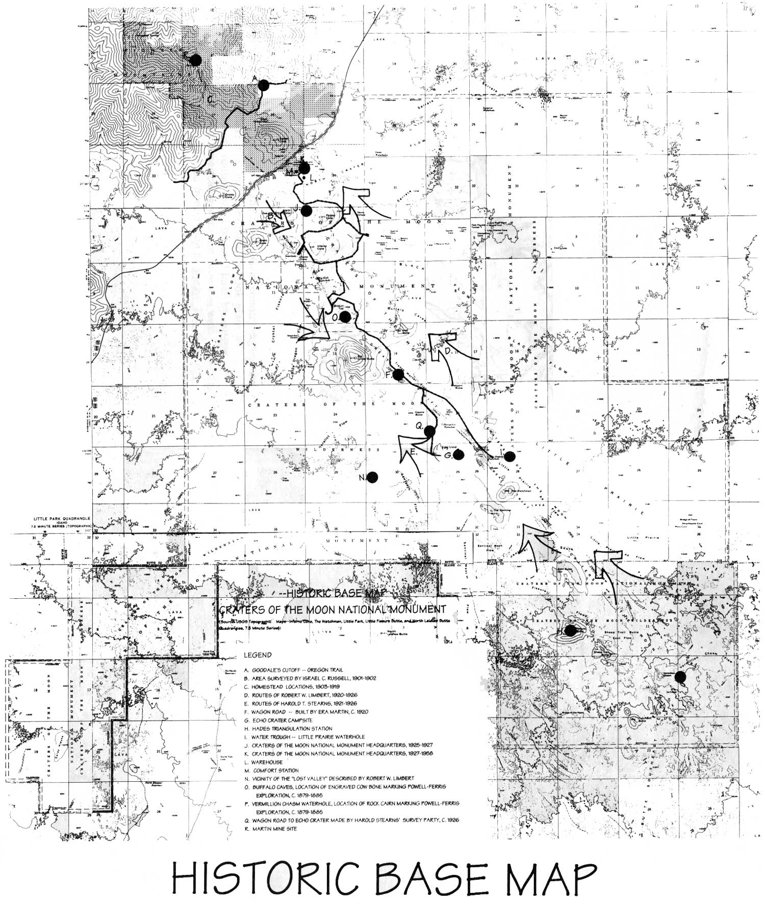
Historic Base Map. (click on image for an
enlargement in a new window)
|
FUR TRADE AND EXPLORATION
|
|
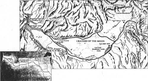
This map shows the general route of exploration in
the Snake River country during the first half of the nineteenth century. While most
of this exploration took place in connection with the fur trade, many of these routes
would be used later by settlers heading west. Areas important for Native American
groups are shown as well. Note the isolated position of Craters of the Moon. Adapted
from a map in Snake: The Plain and Its People, 124-125.
|
OVERLAND MIGRATION
|
|
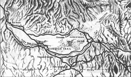
Showing the various branches of the Overland Trail
across the Snake River Plain, this map depicts the route of Goodale's Cutoff which
brought emigrants into contact with the volcanic environment of Craters of the Moon
in the 1850s and 1860s. Adapted from a map in Snake: The Plain and Its People,
136.
|
|
|
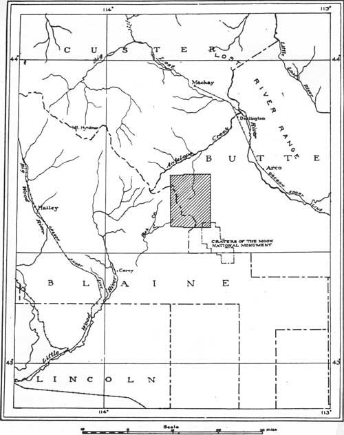
Mining brought gthe first economic boom and wave
and settlers to the region surrounding Craters of the Moon. The shaded area on
this map shows the location of the Lava Creek Mining District which thrived in
the mid-1880s. Adapted from Geology and Ore Deposits of the Lava Creek
District, Idaho, figure 1.
|
|
|
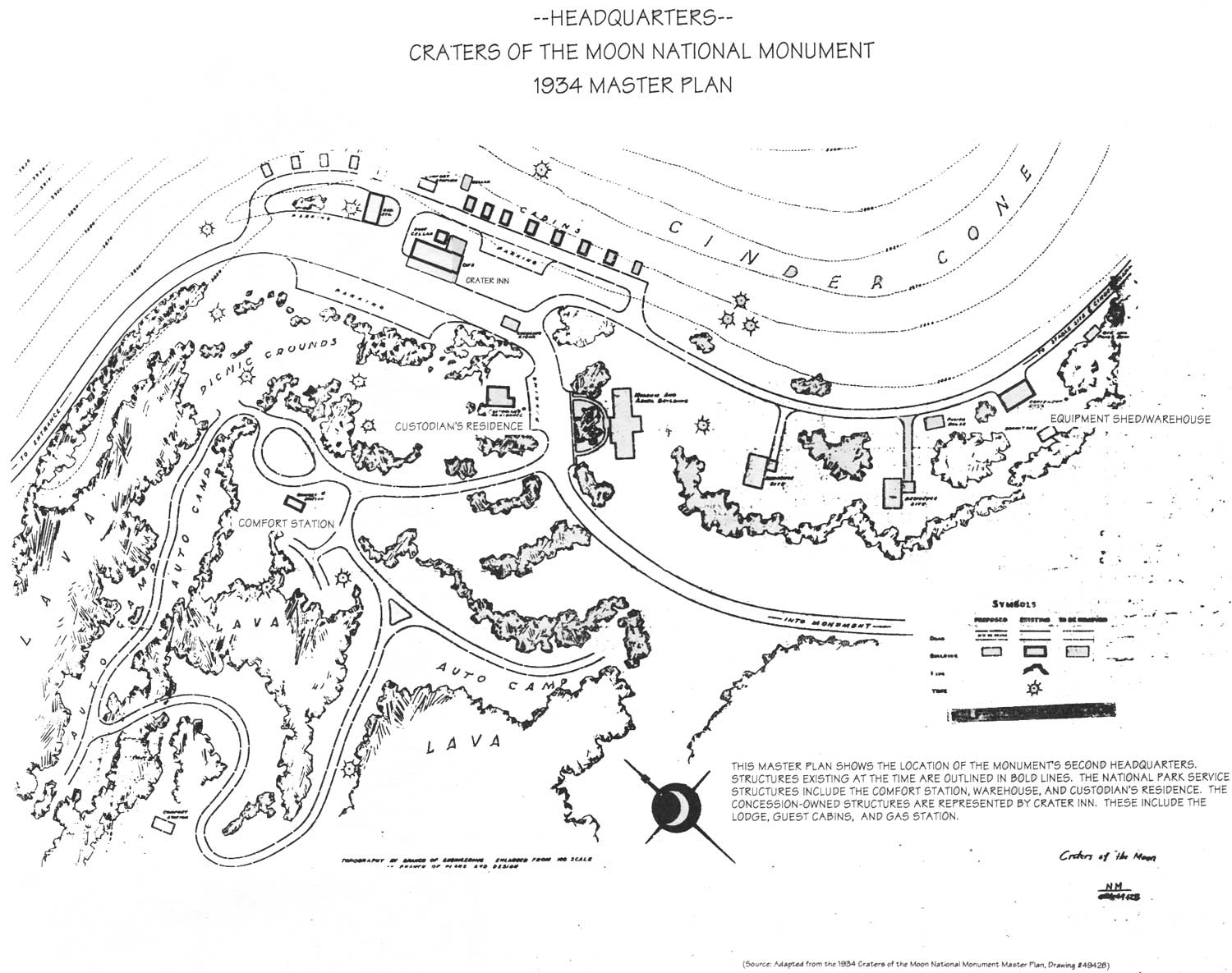
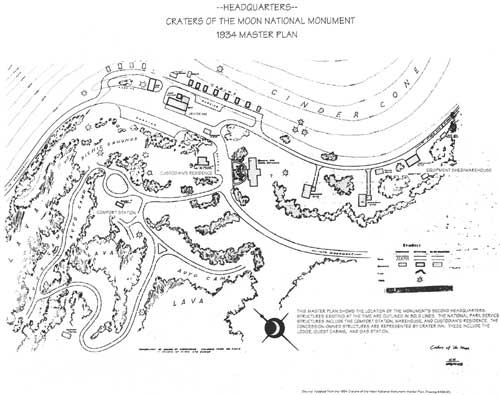
Headquarters, Craters of the Moon National Monument,
1934 Master Plan. (click on image for an enlargement in a new window)
|
hcs/maps.htm
Last Updated: 27-Aug-1999
|