
|
Geological Survey Bulletin 1161-D
Geologic Reconnaisance of the Antelope-Ashwood Area, North-Central Oregon |
INTRODUCTION
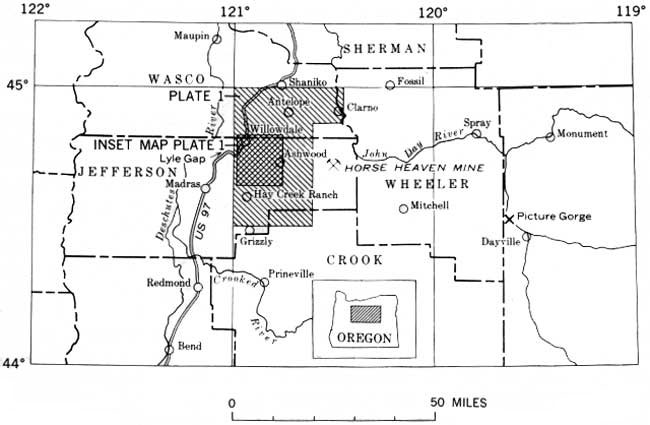
The area of this report covers about 750 square miles of Jefferson, Wasco, Crook, and Wheeler Counties in north-central Oregon (fig. 1). This sparcely populated area contains the small ranch communities of Ashwood and Antelope; the nearest town is Madras, some 20 miles west of Ashwood. A network of gravel and dirt roads covers the area, and U.S. Highway 97 crosses the northwestern part. The area lies at the southern edge of the Columbia Plateau in the foothills of the Ochoco Mountains, at an altitude of 1,600 to 5,500 feet, and forms the drainage divide between the John Day River on the east and the Deschutes and Crooked Rivers on the west and south. The climate is semiarid, and most of the hills are barren except for scattered sagebrush and juniper. Trees and brush line the permanent streams, however, and the higher parts of the country south and east of Ashwood are forested with yellow pine.
|
| FIGURE 1.—Index map of part of north-central Oregon. (click on image for an enlargement in a new window) |
A reconnaissance geologic map of the Antelope-Ashwood area was prepared as part of a continuing cooperative program with the Oregon Department of Geology and Mineral Industries to prepare a geologic map of Oregon. Rocks of the John Day Formation, and particularly the welded ash flows, were the only rocks studied in detail. The ash flows are well exposed in the central part of the Antelope-Ashwood area and currently are the subject of widespread interest. The geology was plotted on aerial photographs and on a 1:125,000-scale base map that was enlarged from a part of the Army Map Service Bend Sheet. A total of about 30 days was spent in the field during June, July, and August 1957 and August 1958. Richard Q. Lewis assisted in the mapping in July 1957. Francis G. Wells of the U.S. Geological Survey and Richard L. Hay of the University of California made many helpful suggestions during the course of the investigation. Specimens and information of the Priday agate deposit, supplied by Lynn A. Peck of Seattle Heights, Wash., are gratefully acknowledged. This study greatly depended on the stratigraphic framework provided by Aaron C. Waters, which is based on his years of study of the geology of north-central Oregon.
| <<< Previous | <<< Contents >>> | Next >>> |
bul/1161-D/intro.htm
Last Updated: 28-Mar-2006