|
Geological Survey Bulletin 613
Guidebook of the Western United States: Part C. The Santa Fe Route |
GUIDEBOOK OF THE WESTERN UNITED STATES.
PART C. THE SANTA FE ROUTE, WITH A SIDE TRIP TO THE GRAND CANYON OF THE COLORADO.
By N. H. DARTON and others.
INTRODUCTION
In going from Kansas City to Los Angeles, a distance of nearly 1,800 miles, by the Atchison, Topeka & Santa Fe Railway the traveler sees a wide diversity of geographic and industrial conditions. First he crosses the Great Plains, which extend for 500 miles, to the foothills of the Rocky Mountains. In the eastern part of these plains the rainfall is ample for crops, so that nearly all the land is in farms and the population is moderately dense. Toward the west the climate becomes increasingly arid and farms give place to scattered cattle ranches, except along some of the watercourses where irrigation is practicable. Running streams and groves of trees are numerous in the eastern part, but the watercourses in the western part are much smaller and many of them are dry in summer, and the principal trees are cottonwoods, which grow along some of the valleys.
The Rocky Mountain province is skirted by the railway from Trinidad, Colo., to Las Vegas, N. Mex., and is finally passed between Las Vegas and Lamy. It consists of a succession of high rocky ridges rising abruptly 4,000 to 6,000 feet above the Great Plains. On account of their great altitude these mountains receive considerable precipitation and in large part are forested up to timber line, which is at an elevation of about 11,000 feet. The rocks are steeply tilted, and in most of the area the granites and schists of the old earth crust have been pushed far upward and constitute the high central ranges. Over the higher parts of the uplift the sandstones and limestones under which the granites and schists were originally buried have been largely removed by the elements. Between Las Vegas and Lamy the railway crosses the north end of the great Corona Plateau, a high table-land between the Pecos and the Rio Grande which lies south of the Rocky Mountains and is related to the plateau province west of the Rio Grande.
Beyond the Rocky Mountains the traveler crosses the Rio Grande and enters the great Colorado Plateau province, which extends westward across New Mexico and far into Arizona, and many miles to the north and south. In this province sedimentary rocks predominate, in large part lying nearly horizontal, so that the harder layers constitute extensive plateaus. It contains also many great lava flows, some of which form the surface of the plateaus. Most of this province is more arid than the western part of the Great Plains. Toward the west, however, about Flagstaff, Ariz., and the Grand Canyon, where the altitude increases to 7,000 feet or more, the precipitation is much greater and luxuriant pine forests cover a wide area.
Still farther west this high plateau descends by a succession of great steps or westward-facing cliffs, and finally, near Colorado River, the traveler enters another, a very different province—the desert province of eastern California. This province consists of wide desert valleys, out of which rise long, narrow mountain ranges, most of them that lie north of the Santa Fe line trending north and south and some of them continuous for many miles. These mountains are particularly rocky and jagged and their meager vegetation is so scattered that they appear to be bare. The broad desert plains of gravel and sand likewise have but little soil and scant vegetation, for this is the most arid province in the whole country. It extends halfway across southern California to the foot of the San Bernardino Mountains and includes the Mohave Desert, a part of the vast area known as the Great Basin, whose streams do not reach the ocean but are lost in the desert. The San Bernardino Mountains and associated ranges rise as a high barrier on the west side of this basin, intercepting the moist air currents from the Pacific and thus causing the arid climate of the region to the east. These mountains are uplifted blocks of tilted rocks, largely granitic and metamorphic (altered).
The coastal-plain part of southern California extends from the western foot of these ranges to the Pacific Ocean, a distance of about 100 miles. Much of its surface is made up of coast and valley plains; its climate is mild, and although the precipitation is only moderate in amount the conditions for plant growth are so favorable that, with the help of irrigation from the streams that cross it and from water in the underlying sands and gravels, it has become one of the most productive agricultural districts in the United States.
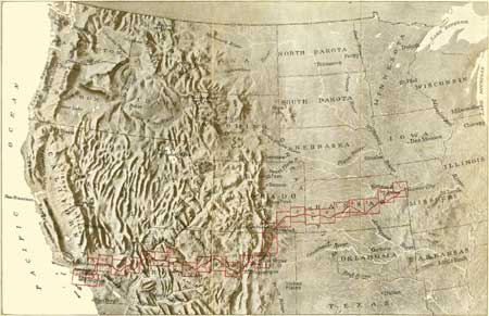
NOTE.—For the convenience of the traveler the sheets of the route map in this bulletin are so arranged that he can unfold them one by one and keep each one in view while he is reading the text relating to it. The contour lines, in brown, represent lines of equal elevation above sea level. Each line indicates the path that would be taken by one who walked over the country by a course always at the same level, curving in and out with the irregularities of the land surface. The lines are drawn at the vertical distances apart ("contour interval") stated on each map. Where close together they indicate a steep slope; where far apart, a gentle slope or plain. A reference is made in the text to each map at the place where it should be unfolded. The areas covered by these sheets are indicated on Plate I, and a list of the sheets and the other illustrations is given on pages 187-190. A glossary of geologic terms is given on pages 182-185, and an index of stations on pages 191-194.
| <<< Previous | <<< Contents >>> | Next >>> |
bul/613/intro.htm
Last Updated: 28-Nov-2006
