|
Geological Survey
The Channeled Scablands of Eastern Washington |
THE SPOKANE FLOOD

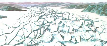
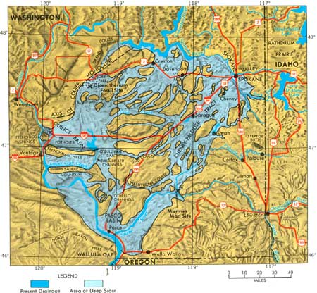
When the ice dam at the mouth of the Clark Fork River failed, the lake drained at a rate unmatched by any flood known and the water had only one place to go—south and southwestward across Rathdrum Prairie and down the Spokane Valley (Fig. 13) which by this time was probably ice free. As the lake basin drained, the water had to pass through narrow parts of the Clark Fork Canyon where current velocities are calculated to have reached 45 miles per hour. The maximum rate of flow is estimated to have been 9-1/2 cubic miles per hour—a rate of 386 million cubic feet per second, or about 10 times the combined flow of all the rivers of the world. For comparison, the rate of flow of the world's largest river, the Amazon, is 6 million cubic feet per second, and the Columbia averages about 255 thousand cubic feet per second.

|
| Fig. 13.—The Channeled Scablands. (click on image for an enlargement in a new window) |

|
| Fig. 14.—Giant ripple marks. Long gravel ridges formed by the powerful currents that flowed across Markle Pass, near Camas Hot Springs, Montana. The view is toward the northwest. |

|
| Fig. 15.—Deposit of flood debris exposed in a quarry near Coeur d'Alene, Idaho. |
From fragmentary evidence it appears that the Purcell lobe advanced and blocked the Clark Fork River and impounded water at least four times, perhaps as many as seven times. The largest lake, however, was formed about 18,000-20,000 years ago, and its draining produced the last great flood. The enormous volume of water and the violent currents of this flood modified or destroyed much of the evidence of earlier floods.
As the vast basin of Lake Missoula drained, local deposits were formed that bear striking testimony to the power of the moving water. Perhaps the most dramatic of these are the "giant ripple marks" that formed in many places. These gravel ridges are plainly visible on aerial photographs, but went unnoticed for many years simply because their immense size makes their pattern and symmetry almost indistinguishable from the ground. A series of these ripple marks is particularly well displayed on the south side of Markle Pass, less than a mile east of State Highway 28 between Perma and Camas Hot Springs.
Water poured across the ridge from the broad valley north of the pass in a cascade at least 800 feet deep, scoured the rocks at the ridge crest, and plucked away at the bedrock to form the two basins that now contain the Schmitz Lakes. South of the pass the currents deposited ridge after ridge of coarse gravel in great sweeping curves. These ridges are typical ripple marks in every respect except their great size. Covering an area of more than 6 square miles, they measure from 20 to 30 feet high and from 200 to 300 feet apart. Some of the individual ridges are nearly 2 miles long.
The powerful, turbulent currents of the flood moved material of all sizes including huge boulders. One characteristic of the flood boulders is the presence of percussion marks—chips and nicks made as the boulders collided with one another while suspended in the flood. Sediments ranging in size from clay particles to boulders were heaped together where the currents dropped them to form deposits of chaotic debris.
The water that poured out of the mouth of the Clark Fork Valley swept through Pend Oreille Lake, spread across Rathdrum Prairie, and roared down Spokane Valley. An arm of the flood surged up Coeur d'Alene Lake and spilled across the divide between Lake Creek and Rock Creek, but most of the water flowed down Spokane Valley to the north rim of the lava field.
| <<< Previous | <<< Contents >>> | Next >>> |
inf/72-2/sec4.htm
Last Updated: 28-Mar-2006