
|
California Division of Mines and Geology
Self-Guided Geologic Tour in Joshua Tree National Monument |
INTRODUCTION
Joshua Tree National Monument is a popular southern California tourist attraction. It is also a favored area to teach beginning earth science students about geologic processes. The Geology Tour Road log in this article is adapted from an eight page self-guided tour brochure titled Geology And Man (Wanrow, 1975), and is reprinted in part with permission of the author and the National Park Service. This brochure can be purchased for $0.25 at Monument Visitor Centers.. ..editor.
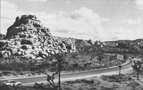
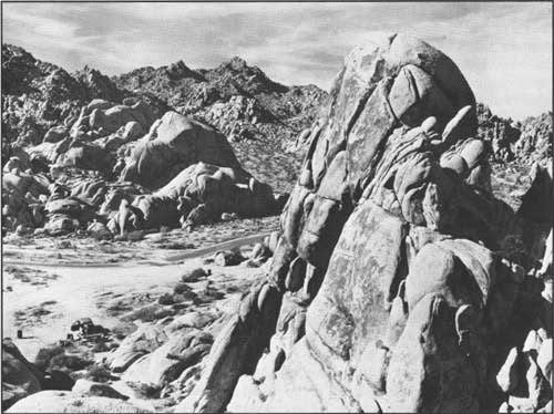
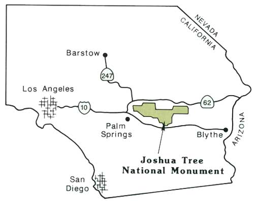
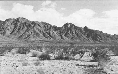
Joshua Tree National Monument was established in 1936 and contains 870 square miles, most of which is high desert. The Monument encompasses some of the most interesting desert geomorphic features in California. Rugged mountains, prominently exposed granitic monoliths, and exposed fault scarps reveal how geologic processes shaped, and continue to shape, this stark desert landscape (Photos 1 and 2). Much of the Monument is above 4,000 feet and steep mountain escarpments border this region to the north and south. The Monument is located about 140 miles east of Los Angeles and is accessible by highway from the north and from the south (Figure 1).
|
| Photo 1. View to the northeast along the main Monument road at Covington Flats showing outcrops of the Cretaceous White Tank monzonite. Note the horizontal pattern of joints in the outcrop to the left. Photos by author except as noted. |
|
| Photo 2. Southward view illustrating typical exposures of rounded and jointed White Tank monzonite in the Monument. Photo courtesy of the National Park Service. |
|
| Figure 1. General location map of Joshua Tree National Monument. |
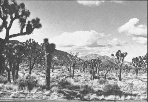
The name, Joshua Tree National Monument, is derived from the extensive stands of conspicuous Joshua trees that grow within its boundaries. Joshua trees grow at elevations of 2,000 to 6,000 feet and have keenly pointed bayonet-like leaves that bristle at the end of large club-like branches. Until young Joshua trees attain a height of six feet, their trunks have leaves that reach the ground. As the plant ages and grows in height, these first leaves droop, die, and become closely pressed into a thatch-like mat that covers the trunk and limbs. Some trees have reached heights of 54 feet. The Joshua tree is one of four species of yuccas that are native to California (Vasek and Barbour, 1988). Its unusual and sometimes bizarre shapes have made it a symbol of the California high desert (Photo 3).
|
| Photo 3. Joshua tree forest at the Monument. |
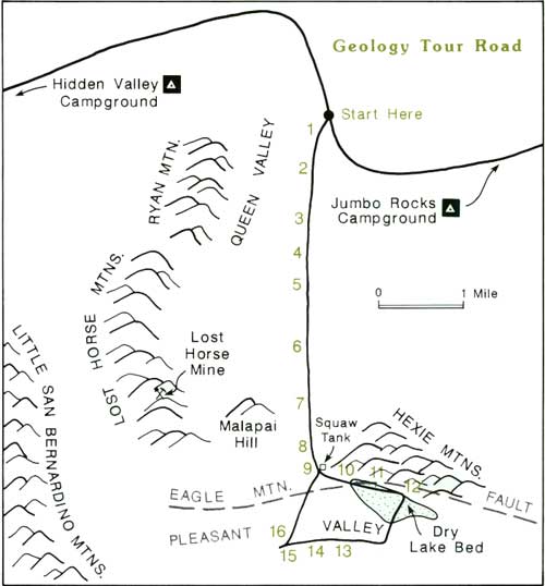
Much of the Monument is part of the Transverse Ranges, however its easternmost portion extends into the Mojave Desert. There are several distinct mountain ranges within the Monument (Figure 2). Valleys between these mountain ranges were formed by two different processes: (1) some valleys were formed over geologic time by erosion, and (2) some valleys were formed by down-dropped motion along faults that formed basins (called "graben valleys"). Queen Valley, at 4,400 feet in elevation in the central part of the Monument, is an example of a valley formed by erosion (Photo 4, Figure 2). Pleasant Valley, located between the Little San Bernardino and Hexie mountains, is an example of a graben valley formed by faulting. Both valleys are discussed in the Geology Tour Road log (Figure 2).
|
| Photo 4. View north across Queen Valley to the Pinto Mountains. This valley was caused by extensive weathering of the underlying rock. |
|
| Figure 2. Location maps showing some geomorphic features in the Monument and the route of the Geology Tour Road. |
| <<< Previous | <<< Contents >>> | Next >>> |
ca/cdmg-cg-44-9/intro.htm
Last Updated: 15-Sep-2011