 | ||
 | ||
 | ||
 | ||
 | ||
 | ||
 | ||
 | ||
 | ||
 | ||
 | ||
 | ||
 | ||
 | ||
 | ||
 | ||
 | ||
 |
 |
 |
Generals Highway Roads and Bridges
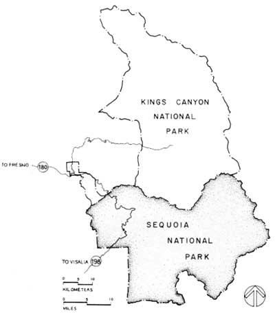
Sequoia National Park, California
GENERALS HIGHWAY
The Generals Highway travels through the western edge of both Sequoia and Kings Canyon National Parks. The highway extends for 32.5 miles within the Sequoia National Park boundary from the Ash Mountain entrance station in the Sierra Nevada foothills at an elevation of 1500 feet, to the forested sect of the park where the giant sequoias grow at an elevation of 6400 feet. After leaving Sequoia National Park the road travels north through Sequoia National Forest and Kings Canyon National Park, ending at "the Wye" in Grant Grove, 45.8 miles from Ash Mountain.
The Generals Highway is joined at the southern park boundary by California State Highway 198 from Visalia and at the northern park boundary by California State Highway 180 from Fresno.
| Introduction | Acadia | Blue Ridge Parkway | Chickamauga and Chattanooga | Colonial Parkway | Generals Highway | George Washington Memorial Parkway | Great Smoky Mountains | Mount Rainier | Rock Creek and Potomac Parkway | Shenandoah's Skyline Drive | Southwest Circle Tour | Vicksburg | Yellowstone | Yosemite |
