|
OREGON HISTORIC AND SCENIC HIGHWAY PROGRAM
|

|
DESCRIPTION OF HISTORIC AND SCENIC HIGHWAYS

COLUMBIA GORGE SCENIC HIGHWAY
Multnomah, Hood River, Wasco Counties
Section 1 State Highway 125
Mileposts 1.85-23.44
Section 2, 37.6 miles
Section 3 State Highway 292
Mileposts 0.37-14.99
73.8 miles
The Columbia River Highway, from Astoria to The Dalles, was started in 1913. The construction of this highway through the Columbia Gorge was considered an engineering achievement that was unequaled in its day. Steep escarpments and solid rock necessitated the construction of a series of bridges, viaducts, and tunnels along the narrow area between the river and bluffs. In addition to the engineering feat in designing the roadbed, great efforts were made to blend the highway into the magnificent scenery of the Gorge. The highway was completed in 1922.

The segment of this highway identified for historic and scenic designation extends from the Sandy River near Troutdale to the west city limits of The Dalles, a distance of 73.8 miles. This segment was included as a historic district in the National Register of Historic Places in December 1983. The highway is also recognized as a National Historic Civil Engineering Landmark by the American Society of Civil Engineers. The designation termini coincides with those of the district, which includes the original route through the cities of Troutdale, Cascade Locks, Hood River, and several unincorporated communities. Most of the original highway structures still exist, including 17 bridges, 7 viaducts, and 3 tunnels.

Coordination between the Department's Highway Division, State Parks Division, and U.S. Forest Service is essential to the preservation of the highway and its corridor. Wherever possible, efforts should be made to utilize similar materials and designs in carrying out maintenance activities. Attention should also be given to selective trimming of roadside trees to open views for the highway users.


FREMONT BRIDGE
Multnomah County, Portland
Mileposts 2.59-3.98
1.39 miles
This structure, a steel through tied arch type, was constructed across the Willamette River in Portland in 1973 at an approximate cost of $80 million. The bridge is a total length of 2,159 feet with a main span length of 1,255 feet.

The Fremont Bridge was designed by Parsons, Brinckerhoff, Quade, and Douglas of New York. Its graceful sweep across the Willamette is widely recognized as one of Portland's most distinctive visual landmarks.
Overall, this structure is in good condition. It will require routine maintenance of the asphaltic concrete wearing surface on the upper deck and painting of the structural steel.


WILLAMETTE FALLS
VIEWPOINT ROCKWORK
Clackamas County
Milepost 7.70
This portion of Interstate 205 was constructed during the early 1970s. A viewpoint was constructed on the west bank of the Willamette River near Willamette Falls. This viewpoint provides for parking and contains an interpretive sign which describes the historic development of the area.

A wall, constructed of native rock, extends across the length of the viewing area. Although there is no historic significance associated with the wall itself, its aesthetic qualities greatly enhance the highway and viewpoint, and is a fine example of present day attention to the need for highway beautification.


WILLAMETTE FALLS VIEWPOINT
ROCKWORK WALL
Clackamas County
Mileposts 12.90-13.01
13.17-13.23
13.72-14.03
0.48 mile
This section of Highway 99E, just south of Oregon City, was constructed during the mid-1920s and the viewpoint was constructed at a later date. The viewpoint overlooks Willamette Falls and contains interpretive signs which tell of the historic development of the area. Low rock walls extend for the entire length of the viewpoint.

There are actually three separate sections of highway that contain the rock walls between the highway and the Willamette River. The low wall is constructed of native rock and contains a series of arches which extend from the base.


ST. JOHN'S BRIDGE
Multnomah County, Portland
Mileposts 0.57-1.25
0.68 mile
This structure was built by Multnomah County in 1931 and became part of the state highway system in the 1970s. The steel suspension bridge was designed by the internationally known bridge engineer, David Steinman.
This bridge is well known for its innovative design. Steinman used the highest concrete rigid frame pier in the world, the first use of main steel towers without conventional bracing, the use of prestressed rope strands instead of the conventional parallel wire cable construction, and the use of riveted silicon steel plates in place of eyebars for anchorage chains.

The bridge is included in the recently completed ODOT Historic Highway Bridge Study and considered eligible for the National Register of Historic Places. The structure is also a designated Portland Historical Landmark.
A number of the hanger cables were replaced soon after the bridge was turned over to the State. It is anticipated that additional cable replacement will be needed. The concrete deck is in need of repair and resurfacing, and the structural steel will need repainting in the future. The overall condition of the structure is good.


CAPE FALCON ROCKWORK
Tillamook County
Mileposts 40.49-41.17
0.68 mile
The Oregon Coast Highway traverses the seaward side of Neahkahnie Mountain allowing for spectacular viewing of the coastline. Of special interest, around Cape Falcon, a large promontory, is a solid rockwork wall.

The wall continues for 0.68 mile above a series of half viaducts and the Neahkahnie Chasm Bridge providing several pull-outs for viewing. This section of highway also lies within the Oswald West State Park. The wall was constructed under the federal Public Works Administration Program during the 1930s.
This section of highway which skirts Neahkahnie Mountain provides some of the most spectacular views of the Oregon coastline. The solid parapet wall enhances the appearance of the highway and provides a sense of local history and beauty for travelers.


DEPOE BAY BRIDGE AND ROCKWORK
Lincoln County, Depoe Bay
Mileposts 127.35-127.63
0.28 mile
The Depoe Bay Bridge and adjoining rock wall is located within the Depoe Bay State Park.
This single span reinforced concrete arch structure was constructed across the mouth of Depoe Bay in 1927. In 1940 the bridge was widened to double its capacity and provide five foot sidewalks and a subway walk to permit pedestrians to cross under the roadway. The bridge has a total length of 312 feet.
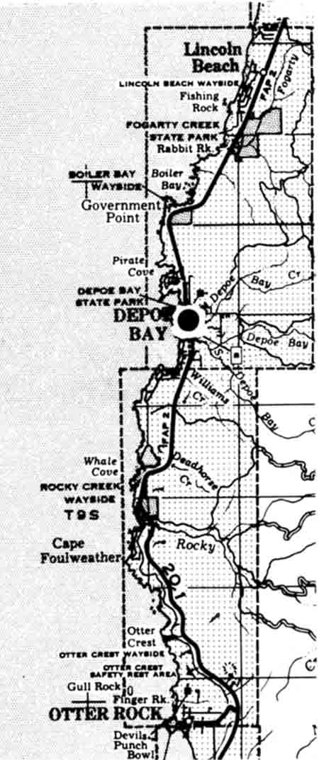
A solid rock wall continues from the north end of the bridge for a distance of 0.35 miles. The construction of this wall was carried out under the Federal Public Works Administration Program during the 1930s.
This structure is recognized for its structural and design compatibility with the environment of the coastline. The bridge is included in the recently completed ODOT Historic Highway Bridge Study and is considered eligible for the National Register of Historic Places.

The overall condition of this structure is below average. The bridge is experiencing localized deterioration of the reinforcing and spalling of the concrete. It will require fairly extensive repairs in the near future.


COASTAL HIGHWAY BRIDGE PROJECTS
Begun in 1914, the Roosevelt Highway (Oregon Coast Highway) was completed in 1932 from Astoria to California except for five bridges across major coastal estuaries. Construction of bridges across major waterways was all that was needed to provide continuous transportation along the entire coast, and thereby replace inadequate ferry service. The bridges still needed were across Alsea Bay in Waldport, Yaquina Bay in Newport, Siuslaw River in Florence, Umpqua River in Reedsport, and Coos Bay in North Bend.

Unable to finance the construction of these bridges with ordinary highway funds, the State arranged for financing with the Public Works Administration under the National Recovery Act. This federal program was developed primarily to finance the construction of public facilities while providing jobs for the unemployed. The state initially planned to finance the coast bridges through a federal grant and loan to be repaid by revenues from toll receipts. Shortly thereafter the state legislature removed the authority to establish toll bridges in the state so the bonds were sold on the open market. The total construction cost of the five bridges was $5,455,847.

Conde B. McCullough, Assistant State Highway Engineer and Bridge Engineer, was responsible for preparation of the bridge design and plans. McCullough directed the construction of the bridges until October, 1935. At this time he was granted a leave of absence to accept an appointment with the U.S. Bureau of Public Roads in Central America. In McCullough's absence, Glen Paxson, Acting Bridge Engineer, supervised the remaining construction. At the close of the 1934-36 biennium all five of the coast highway bridges were completed and open to traffic. These bridges today are all widely known for their aesthetic and historic values.

YAQUINA BAY BRIDGE
Lincoln County, Newport
Mileposts 141.37-141.98
0.61 mile
The Yaquina Bay Bridge is the most northerly of the five major coast bridges completed in 1936. Located in Newport, the structure spans the Yaquina Bay for a distance of 3,223 feet. The main spans of this structure consist of a 600-foot steel arch flanked on either side by a 350-foot structure with five concrete arch spans extending to the south approach, connecting to a concrete viaduct with a plaza. A shorter concrete viaduct with a similar plaza also connects the north approach of the structure.
Of special interest are the bridge's decorative elements, including ornamental spandrel deck railing and brackets, fluted entrance pylons, and a pedestrian plaza with elaborate stairways leading to observation areas.
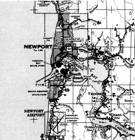
The deck, curb, and railing of the structure were replaced several years ago due to severe deterioration of the deck. There presently is some corrosion damage in the concrete spans at the north approach. The structural members are in need of minor repair and on-going painting is required. In general, considering the age of the structure, it is in average condition.
The bridge is included in the recently completed ODOT Historic Highway Bridge Study and considered eligible for the National Register of Historic Places.


ALSEA BAY BRIDGE
Lincoln County, Waldport
Mileposts 155.25-155.82
0.57 mile
Traveling south, the second of the five major coast bridges is a reinforced concrete through tied arch structure spanning the Alsea Bay for a distance of 3,028 feet. A 210-foot concrete arch stretches over the main channel, with smaller 154-foot concrete arches on each side. At both ends of the three main arches are three 150-foot concrete arches, with the arches placed below deck level.
Decorative features include ornamental railing and spandrel post brackets, fluted entrance pylons, obelisk spires at the arch portals, and a pedestrian observation plaza. The structure was officially determined eligible for the National Register of Historic Places in March, 1981.
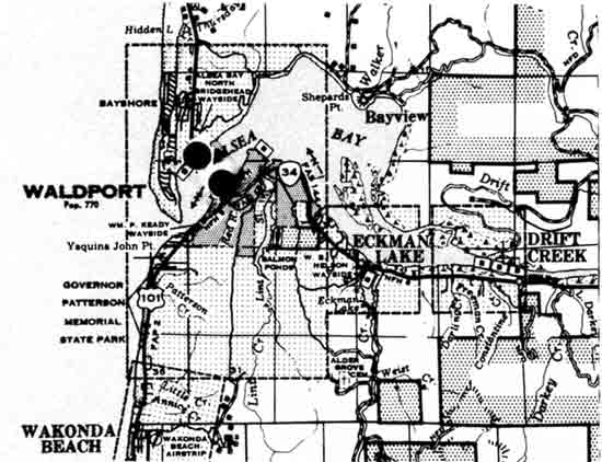
Because of extensive deterioration from the severe marine environment, the Highway Division has recommended replacement of the structure. In consideration of the public's concern for the structure's future, the Transportation Commission conducted an independent study of the bridge which concluded, "While preserving the structure would be desirable from a historic standpoint, the results of this rehabilitation study indicate that the replacement of the existing structure is the most suitable and effective course of action to take at Alsea Bay".
In response to a review of the rehabilitation study, the Historic and Scenic Highway Study's Citizen Advisory Committee recommends, "After review of the consultant's report, it is the opinion of the Historic and Scenic Highway Study Citizen Advisory Committee that it is not economically feasible to preserve the Alsea Bay Bridge. Furthermore, the committee strongly recommends that one of the principal criteria in the selection of a consultant be expertise in the aesthetic and architectural details of bridge construction." As of this writing, the Alsea Bay Bridge is scheduled for replacement and is being designed by a private consulting firm.


SIUSLAW RIVER BRIDGE
Lane County, Florence
Mileposts 190.84-191.15
0.31 mile
The third major coastal bridge, from the north, crosses the Siuslaw River at Florence. This structure consists of a double leaf steel bascule draw span for navigation purposes. On each side of the draw span is a concrete arch span with the arch ribs above the deck level. A concrete viaduct extends from the north and south approaches providing a total structure length of 1,568 feet.
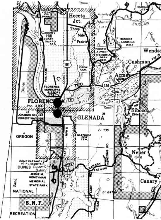
The overall condition rating of this bridge is average or above average. The machinery in the movable spans is old and will need rehabilitation sometime in the near future. The steel members require normal routine maintenance painting.
The Siuslaw Bridge is the smallest and least expensive of the five coast bridges. Interesting ornamental features include the detail on the approach pylons, ornate railing and the obelisk towers. The bridge is included in the recently completed ODOT Historic Highway Bridge Study and considered eligible for the National Register of Historic Places.


UMPQUA RIVER BRIDGE
Douglas County, Reedsport
Mileposts 211.00-211.42
0.42 mile
From the north, the Umpqua River Bridge at Reedsport is the fourth of the five major coast bridges. This structure is a 430-foot steel through truss central span, with two concrete through tied arch spans at both ends. It is the largest swing span bridge in Oregon.
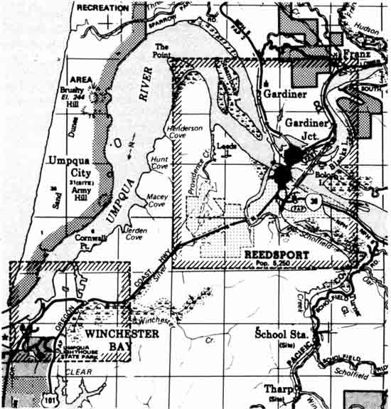
The condition of this structure is above average. There is no apparent corrosion damage in the concrete spans and the steel spans were painted in 1983.
Although not as ornate as some bridges designed by C. B. McCullough, the Umpqua Bridge contains decorative railings, bracketing, and approach pylons. The bridge is included in the recently completed ODOT Historic Highway Bridge Study and considered eligible for the National Register of Historic Places.


MCCULLOUGH MEMORIAL BRIDGE
Coos County, North Bend
Mileposts 233.48-234.50
1.12 mile
The most southern of the major coastal bridges, the Coos Bay Bridge, is a steel through truss type structure. The bridge consists of a 1,709 foot cantilever truss main span flanked by a series of concrete arches varying from 170 feet to 265 feet in length.
The construction of this bridge was accomplished through two contracts. The Northwest Roads Company of Portland built the piers and concrete approaches; and, the Virginia Bridge and Iron Company of Roanoke, Virginia built the structural steel of the cantilever span and concrete deck.
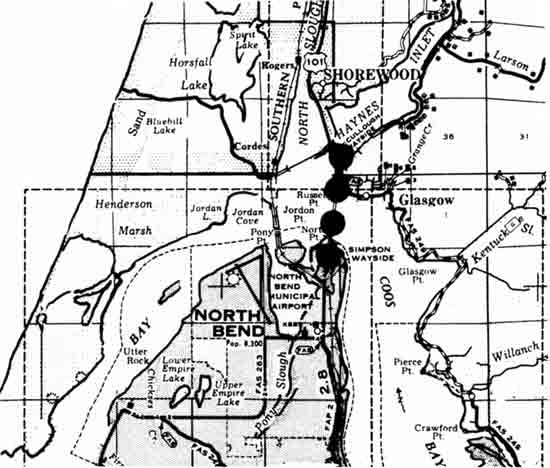
The general condition of this bridge is average to above average. Routine maintenance with a major expenditure for painting is required in the foreseeable future.
This structure has the distinction of being the longest of the coast bridges with a length of 5,305 feet, and, was most costly to construct at $2,143,391. The bridge's distinctive architectural and decorative features makes it one of the most widely known coastal bridges. The bridge is included in the recently completed ODOT Historic Highway Bridge Study and considered eligible for the National Register of Historic Places.


CAPE PERPETUA ROCKWORK
Lincoln County
Milepost 166.40
Construction of the Lincoln County section of the Roosevelt (Coast) Highway was completed in the early 1930s. The rockwork wall along this section was constructed of native rock under the federal Public Works Administration during the 1930s. The rockwork wall visually enhances the highway as it winds around the Cape, blending with the vertical exposed rock on the cliffs.


SEA LION POINT ROCKWORK
Lane County
Mileposts 178.82-179.18
0.36 mile
This section of rock wall extends around Sea Lion Point, providing a pull-out for viewing, to the entrance of the Sea Lion Caves parking lot. The wall is a low, solid structure and believed to have been built under the federal Public Works Administration Program during the early 1930s.
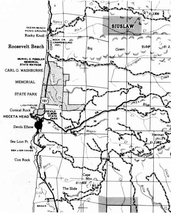
The wall is significant in that it is representative of the early development of the highway and accentuates the scenic beauty of the point.


CAPE CREEK BRIDGE
Lane County
Mileposts 178.29-178.42
0.13 mile
This reinforced concrete deck and structure was designed by C. B. McCullough and constructed in 1931. The structure consists of a 200-foot open-spandrel flanked by a double tier series of small arches. To gain a full appreciation of the structure and its architectural detail, it is best viewed from Devils Elbow State Park rather than from the highway.
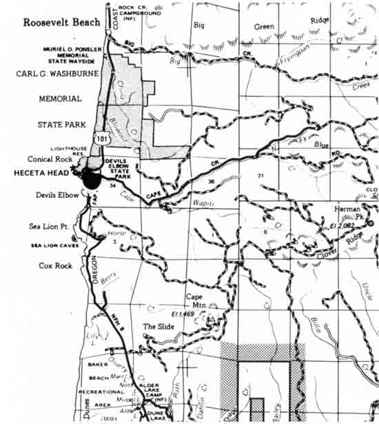
There is advancing deterioration of the concrete due to corrosion of the reinforcing steel. A repair contract is proposed for this structure. In general, the structure is in below average condition.
The bridge is included in the recently completed ODOT Historic Highway Bridge Study and considered eligible for the National Register of Historic Places.


ROGUE RIVER BRIDGE
Curry County, Gold Beach
Mileposts 327.51-327.88
0.37 mile
This structure, which crosses the Rogue River at Gold Beach, is yet another design of noted state bridge engineer, C. B. McCullough. The bridge consists of seven 230-foot reinforced concrete arch spans and 360 feet of reinforced concrete approach with sidewalks on either side.
The bridge was completed in 1931. At the time of construction this bridge had the distinction of being the largest structure on the state highway system. The bridge is nationally important because it was the first structure in America to be constructed with the Freysinnet method of arch decentering and stress control. The success of the bridge led to the wide use of prestressing techniques.
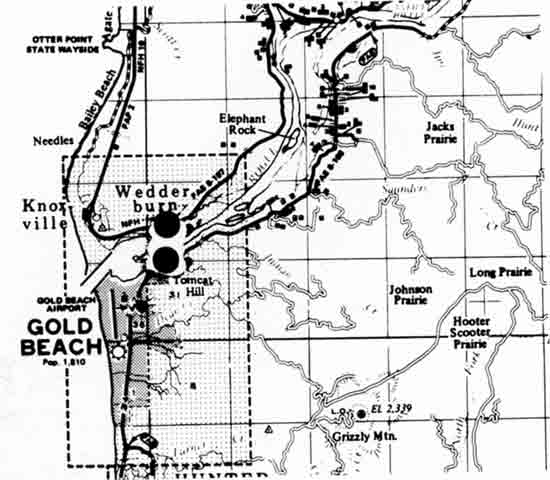
In consideration of its age, this structure is in above average condition. There is a local distress problem in the concrete which will require minor repair.
Architectural and decorative features include fluted, art-deco entrance pylons, dentils, ornate bracketing and sidewalk railing, fluted spandrel columns and detailed arched fascia curtain walls.
The bridge is included in the recently completed ODOT Historic Highway Bridge Study and considered eligible for the National Register of Historic Places. The bridge is also recognized as a National Historic Civil Engineering Landmark.


GREEN SPRINGS HIGHWAY
Jackson and Klamath Counties
Mileposts 8.45-49.66
41.21 miles
This route was officially designated during the 1917-18 biennium as a state highway known as the Ashland-Klamath Falls Highway. The road was initially constructed between 1868 and 1873, and was first known as the Southern Oregon Wagon Road. In places this road coincided with the Applegate Trail. Improvement of the road as a state highway commenced in 1919 and continued for several years.

The present highway maintains the integrity of the original construction, being a series of sharp curves and dips and rises. At its western terminus its descent into Bear Creek Valley affords travelers panoramic views of Ashland and the surrounding hills.


OREGON CAVES HIGHWAY
Josephine County
Mileposts 8.01-19.51
11.50 miles
This portion of the Oregon Caves Highway was completed in 1922 by the federal Bureau of Public Roads under a cooperative forest road agreement. With the completion of this project better access was provided for tourists to the Oregon Caves National Monument. Further improvement followed in 1929 when the Highway Department widened the road for two-way travel.
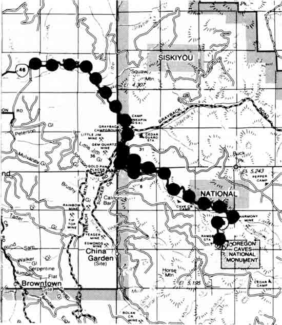
In traveling over this section of road between Cave Junction and the Caves, the highway passes through dense timber of the Siskiyou National Forest. The sharply winding road hugs the natural contours of the land producing a slow but enjoyable ride. The integrity of this highway should be maintained by retaining the existing alignment.


SISKIYOU HIGHWAY, OLD 99
Jackson County, near Siskiyou Summit
Mileposts 0.00-6.57
6.57 miles
This section of highway was part of the original Pacific Highway and was one of the first sections improved under the State Highway Commission established in 1913. Grading of this six and one-half mile section was completed in 1914, and pavement constructed in 1921. Subsequent construction of I-5 over the Siskiyou Summit bypassed this section, which now serves as a local access road.
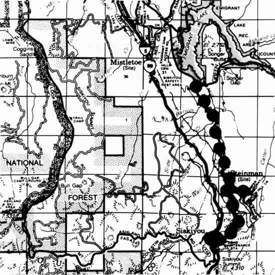
Historically this route followed the old north/south Indian Trail, the Siskiyou Wagon Road of the 1850s, and the California-Oregon Stage Road. The road winds its way up towards the summit providing spectacular views of the valley and surrounding mountains. After crossing the concrete bridge at Steinman, the road makes a complete loop, passing under the railroad.
Two structures are included within this segment, the Steinman and Dollarhide Overcrossings. Both structures are included in the recently completed ODOT Historic Highway Bridge Study and are considered eligible for the National Register of Historic Places.

McKENZIE HIGHWAY
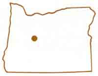
Lane and Deschutes Counties
Mileposts 61.80-83.81
22.01 miles
The McKenzie Highway was preceded by the McKenzie Toll Road opened by John Craig in 1872 and the Scott Trail which was blazed by Felix Scott in 1862. After the closure of the toll road Lane County assumed responsibility for the road until 1926 when it became part of the State Highway System.
Improvement of the road to state highway standards was completed in 1939. The engineering of a modern highway over the route was indeed an engineering challenge due to rough topography near the summit and lava beds, which the earlier routes had avoided.

Today this highway is widely recognized as one of the state's most significant historic and scenic highways. The route is used primarily for recreation purposes in the summer, and is closed during the winter months. The highway provides spectacular views of the McKenzie River, the Three Sisters Mountains, and Mt. Washington Wilderness Area.

The present highway near the summit is basically unchanged from the 1939 construction, consisting of a narrow roadway containing many hairpin curves, allowing the traveler to experience the highway's historic roots. Although routine improvements and maintenance must be carried out to ensure public safety, there are no plans to upgrade the highway to today's construction standards. The highway is adequate for the volume and type of use it receives.


CROOKED RIVER BRIDGE
Jefferson County
Milepost 141.68
This structure crosses the Crooked River Gorge near Terrebonne in the Peter Skene Ogden State Wayside Park, where the Gorge is approximately 300 feet across and 300 feet deep with nearly vertical walls.
Conde B. McCullough, noted state bridge engineer, designed this steel deck arch structure. The bridge was completed July 19, 1926.
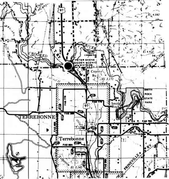
The condition of this bridge is above average. The structure is narrow, significantly below current safety levels, and may require widening in the future. Otherwise, only routine maintenance, painting, and minor repairs will be needed.
The aesthetic qualities of the structure are enhanced by the dramatic backdrop of the gorge setting. Architectural features of significance include ornamental bridge railing and rectangular entrance pylons.
The bridge is included in the recently completed ODOT Historic Highway Bridge Study and considered eligible for the National Register of Historic Places.


CROOKED RIVER HIGHWAY
(PALISADES)
Crook County
Mileposts 6.00-20.00
14.00 miles
As part of the early state highway system, grading of this section began during the 1919-1920 biennium however, paving did not occur until 1976. The highway is noted for its compatibility with the surrounding environment. The roadway was designed and constructed using a minimum of cutting and filling in order to preserve the natural contours of the land.
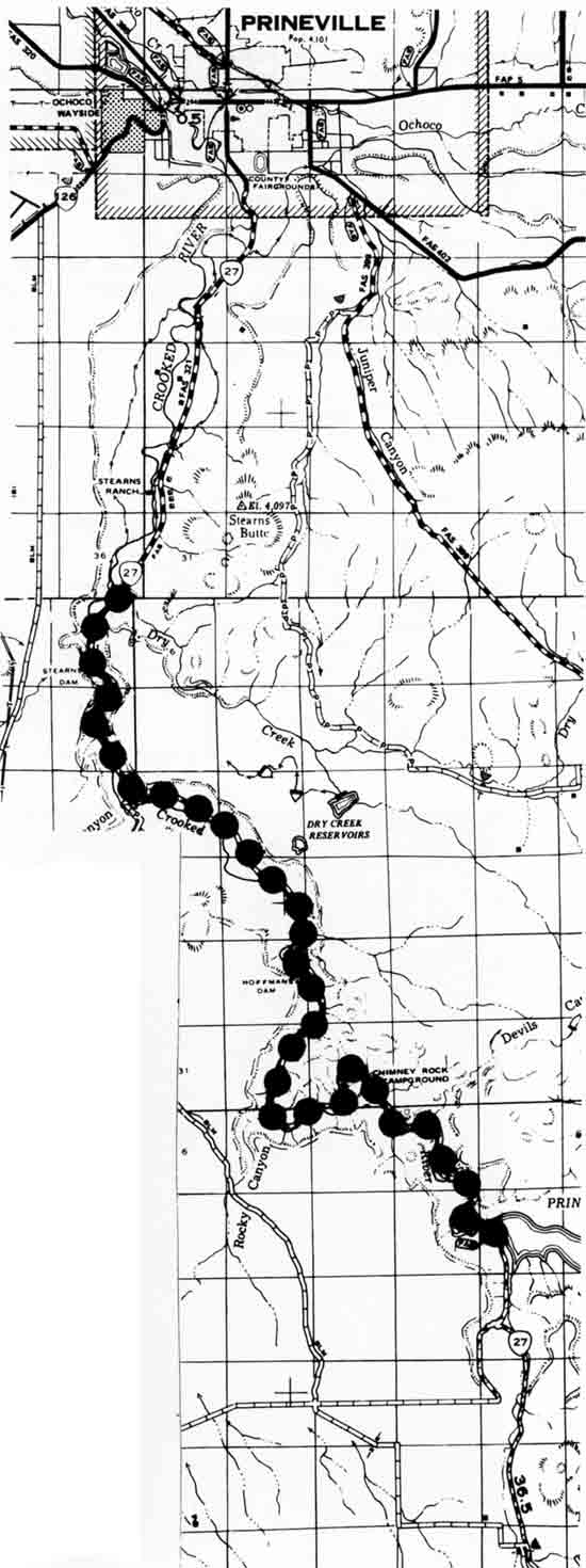
The highway provides views of unique geologic formations and eroded lava flows have formed naturally sculptured cliffs through a narrow, winding canyon. The Oregon Department of Transportation received a Federal Highway Administration award for the construction of this highway section.
This highway meets all current safety regulations. There are no foreseeable improvements other than routine maintenance.


JOHN DAY HIGHWAY - PICTOGRAPHS
Grant County
Mileposts 125.34-125.45
0.45 mile
Indian pictographs can be viewed from this section of the John Day Highway, most of which are beyond the right-of-way on federal land. On the north side of the highway, however, between the roadway and the river, are several pictographs that are within state highway rights-of-way.
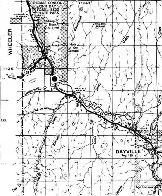
Highway construction and maintenance has been sensitive over the years to the presence of the pictographs within the right-of-way, recognizing the unique opportunity for viewing by travelers.


LA GRANDE-BAKER HIGHWAY - TREES
Baker County
Mileposts 44.67-48.00
3.33 miles
During the mid-1920s approximately 6,000 roadside trees were planted by the State Highway Department along some of the major highways in central and eastern Oregon; primarily along the Columbia River Highway and the Old Oregon Trail Highway. The trees provided a natural windbreak for the highway.
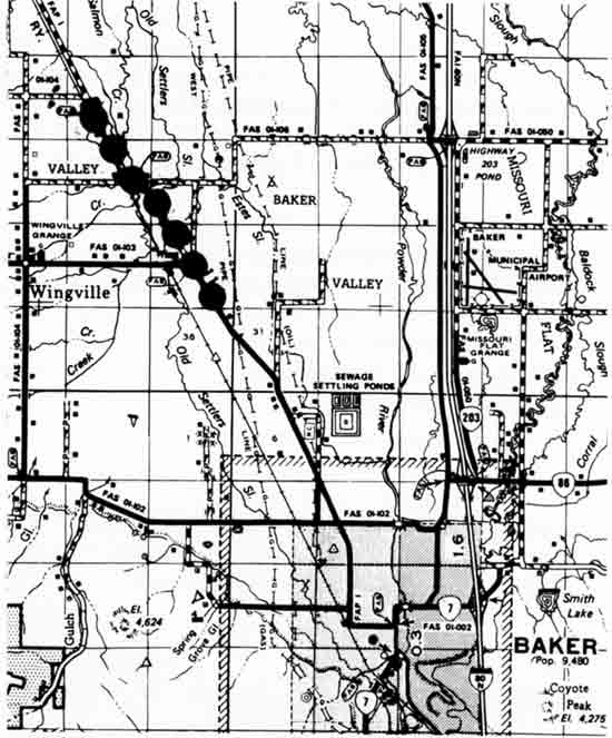
Originally, two rows of willow trees lined the highway between Baker and Haines. Today only a small segment of the roadway has a continuous row of the willows. The preservation of these trees maintain a link with the past and a remembrance of the effort to plant the trees in the arid areas of eastern Oregon. It is felt that this highway section represents the best example of what remains of the earlier tree planting effort.


DOOLEY MOUNTAIN HIGHWAY
Baker County
Mileposts 20.16-37.03
16.87 miles
In the mid 1860s, John Dooley bought a toll road from Dr. J.M. Boyd which ran from Baker to the Malheur and El Dorado Mines over what came to be known as Dooley Mountain. Dooley sold the road to Baker County in the early 1890s, and it became part of the State Highway System in 1920.
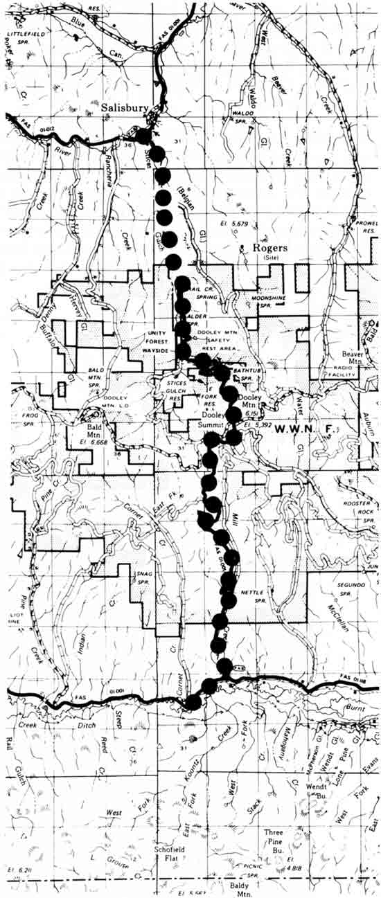
Today, this highway provides an excellent example of mountain road construction of its era, following a serpentine route traversing a series of steep flanks. The highway is no longer a vital transportation link and is used primarily by local residents. Efforts should be made to retain the roadway in its present design and condition.

| <<< Previous | <<< Contents>>> | Next >>> |
sec3.htm
Last Updated: 06-Aug-2008