|
HISTORY OF THE OREGON STATE PARKS: 1917-1963
|

|
Section 5
STATE PARKS AND WAYSIDES
Area Briefs
Ainsworth State Park
The original portion of Ainsworth State Park, a 40-acre tract, was donated to the state by J. C. and Alice H. Ainsworth of Portland. The Highway Commission accepted the generous gift on August 8, 1933. Mr. and Mrs. Ainsworth thought that this area would serve the traveler as a place to rest and leisurely examine the flora of the beautiful Columbia River Gorge. It has served that purpose for many years past and will continue for many years to come.
Logging operations were started in 1946 on some adjoining land to the east of the park. This served as an impetus for acquisition of a 6-acre tract lying between the original tract and the highway. This parcel contained a good stand of fir timber and it was deemed necessary as a part of the park. It was purchased from Joseph A. Bucher on May 6, 1947. At the close of 1963 a total of 46 acres comprised the park.
Ainsworth Park was named to honor the donors. It is a beautifully timbered area adjoining the original Columbia River Scenic Highway right of way about one-half mile west from Dodson in Multnomah County. On the area and near the highway is a good spring which was developed by the Civilian Conservation Corps with elaborate stone work, steps and a fountain. Tables were placed nearby and trails provided throughout the area.
The land is an alluvial fan formed by debris from the canyon wall. It rises upward on a gentle slope to the south beyond the park limits to the base of the canyon wall.
Attendance during 1962 totaled 54,990 day visitors. No count was made in 1963.
Alderwood Wayside
Alderwood Wayside is located along the Siuslaw Highway at mile post 52.5, approximately 12 miles south of Triangle Lake in Lane County. The 76.40-acre tract, excluding the right of way, was purchased from Lane County on March 21, 1931, at a cost of $193.87.
This wayside land is studded with white-barked alder trees, for which the area was named. There is a considerable growth of fir at the higher elevations.
The narrow valley which bisects the park is shared by the Long Tom River and the Siuslaw Highway, leaving a narrow strip, principally on the easterly side, for park use. The remainder of the land is moderately steep, furnishing an interesting background for nature studies. There are no geological or other such features of special interest in the park.
The facilities at Alderwood are not extensive, being a small area for parking cars, two foot bridges, trails, tables and sanitary facilities, all constructed by the Civilian Conservation Corps.
Use of the area was 8,526 visitors in 1962. No count was made in 1963. No special use by groups has been recorded.
Permits as follows affect this wayside:
| Number | Date | Name | Expiration |
| 3674 | 7-23-51 | Pacific Tel & Tel Co—pole line | Indefinite |
| 11940 | 12-3-35 | Water right 0.025 c.f.s. from unnamed creek, tributary of Long Tom River, and a roadside spring. |
Alsea Bay-North Bridgehead Wayside
The Alsea Bay-North Bridgehead Wayside consists of 7.11 acres lying on both sides of Highway 101 at the north end of the Alsea bridge in Lincoln County.
The first acquisition was 0.98 of an acre purchased from Jessie L. and Wallace G. Baker on January 17, 1935. Another area of 6.13 acres was acquired by condemnation proceedings from Frank H. and Gladys M. Hilton in June, 1938, at a price of $8,961.22. The purpose of these acquisitions was to prevent undesirable developments near the end of the bridge and to preserve the natural landscape.
The land west of the highway is a strip 100 feet wide extending from the water's edge northerly 580 feet. It is lower than the surface of the road and has been landscaped with indigenous stock. That portion east of the highway averages 400 feet in width and extends from the water's edge northerly approximately 800 feet. It is much higher than the road and slopes upward. It contains a natural growth of young, fir timber.
A county road has been constructed along the northerly side to serve land owners east of the highway.
Location of the park at the end of the Alsea bridge is indicative of its name.
There is no active use being made of the park.
Armitage State Park
Armitage State Park is located on Interstate Highway 5, at mile post 115, approximately five miles north of Eugene in Lane County. It adjoins the Coburg county road and lies on the left bank of the McKenzie River. It is one of the heaviest used areas in Lane County.
The terrain is somewhat level and, other than the playfield, is covered with a heavy growth of maple, fir, alder and poplar trees. The McKenzie River is an attraction, making the park a delightful place for a picnic or a weekend outing.
In 1935 the original area of 32.82 acres was offered as a gift for a state park by Sylvanus C. Armitage in memory of his wife, Henrietta, and his daughter, Frances. However, it was not accepted by the Commission until June, 1938, and the deed is dated October 1, 1938. The park was named for the donor.
The Highway Commission delayed acceptance of the area for park purposes because of its close proximity to the city of Eugene and the interpretation of the law wherein a state park is to be near a highway. The donor, Sylvanus C. (Van) Armitage, was an influential and persistent man. Insisting that the area was of state park caliber, he eventually overcame the objections of the Commission. He included a clause in the deed that the land must be used forever as a public park. A plaque was placed on a large stone at this park indicating that the land was donated by S. C. (Van) Armitage in memory and honor of his wife, Henrietta, and daughter, Frances.
The park was enlarged in 1956 by purchase of 6.82 acres of land upstream on the easterly side of the county road and Southern Pacific Railroad track at a cost of $6,549.38, and again in 1957 by purchase of a small triangular 1.34-acre tract at a cost of $1,124. In order to directly connect the areas on each side of the railroad and highway, the Public Utilities Commission and Lane County approved a two-way road under the approaches to the railroad and highway bridges over the McKenzie River. Acreage in this park totals 40.98 acres as of 1963.
Developments are a paved entrance road from the county road, a paved parking area for approximately 60 cars, a foreman's residence constructed in 1949, another residence on the easterly side of the railroad obtained with the land, two public toilets constructed on an elevated foundation above the usual high water line, picnic tables and two stove shelters. Suitable trails and a large playfield were provided for the use area. An overnight camping area was constructed in 1952 and a boat ramp 50 x 100 feet provided. Two fine, 6-inch wells, 85 and 65 feet deep, respectively, with a combined capacity of more than 100 gallons per minute were drilled and a water distribution system constructed.
River bank cutting was stopped by heavy riprap placed on the bank from the highway bridge downstream about 600 feet.
When the new Interstate 5 highway was constructed, a high bench was built near the east edge of the railroad right of way to which was moved a large, open-side shed from the new highway right of way.
Use of the park has been good. Day use has increased from 60,630 in 1952 to a total of 226,292 in 1963. Overnight camping for the same period increased from 842 to 8,999 visitors.
Azalea State Park
Azalea State Park is located on U. S. Highway 101 at the easterly edge of the city of Brookings. It is on the brow of the Chetco River Canyon in southern Curry County.
The first acquisition for this park was purchase of 23.87 acres from Brookings Land and Townsite Company on April 13, 1939, at a price of $2,466. That same year the company donated 1.50 acres, a part of the entrance road to the park. In 1951, Elmer Bankus donated 0.43 of an acre along this same entrance road, bringing the park acreage to 25.80 acres.
Each spring during the months of April, May and June, the park puts on its azalea-flowered Easter bonnet of many and varied colors for the enjoyment of its visitors. The area was obtained by reason of, and named for, the many indigenous azalea shrubs growing there, some of which are reported to be as much as 300 years old dating back to the time of the early Spanish explorers and fur traders operating along the West Coast of America.
Azaleas are the principal growth in the park, with some fir and a goodly quantity of California myrtle making up the coverage. The terrain is somewhat level, being cut by one small draw. It offers splendid views of the Chetco River and the timbered areas on the southeasterly side of the stream.
Improvements are an entrance road, car parking area, trails, modern sanitary facilities, stove shelter and a viewpoint cover.
Day visitors at this park totaled 38,148 during 1963. The average for the past five years is more than 58,000 annually, several thousands of which are attracted in May each year to attend the Azalea Festival sponsored by the community of Brookings.
A permanent waterline eastment #4926 was issued to the Brookings Land and Townsite Company on November 17, 1937.
Bald Peak State Park
Bald Peak State Park is located nine miles northwest of Newberg at the summit of Bald Peak, the highest point in the Chehalem Mountain Range in Yamhill County.
This 26.44-acre park has an elevation of 1,633 feet, which offers visitors superb views of the Cascade Mountains north to Mt. Rainier, the Tualatin Valley, the northern part of the Willamette Valley and the snow-capped mountains of the Coast Range. Its location is indicative of its name.
Bald Peak Park was purchased because of the urging of a large delegation which included the Yamhill County Court, State Senators from Yamhill and Washington Counties, and others who appeared before the Commission on May 14, 1931. The Highway Commission approved the acquisition and the cost of $1,373 on the same date. It was purchased from Samuel Otto and the deed is dated June 4, 1931.
Requests were made in 1949 and again in 1951 by the County Court and others for enlargement of the park and oiling the six miles of ridge road from Highway 219 to the park. After careful analysis and study, the Commission denied the requests. Denial was principally because water was not available at the park and none could be found, except in very small amounts as reported by the state geologists, thereby limiting the use, and because the cost of the additional land was too great.
A few picnic tables, sanitary facilities and a car parking area were provided by the Civilian Conservation Corps. The road leading to the park is under control of the county.
No count of park visitors has been made.
Permits as follows affect this park:
| Number | Date | Name | Expiration |
| 5501 | 3-18-59 | Portland General Electric Co. power line | Indefinite |
| 5588 | 7-14-59 | Portland General Electric Co. power line | " |
Bandon Ocean Wayside
Bandon Ocean Wayside is located on the shore of the Pacific Ocean approximately one-half mile south of the city of Bandon in Coos County. It is essentially tideland with 1,392 feet of fine sandy beach. It contains no land suitable for park facilities above the reach of the ocean waves.
J. F. (Jack) Kronenberg, a timber operator at Bandon, was the generous donor of this 9.74-acre tract of ocean shore. Deed is dated January 22, 1932.
Many attempts have been made to acquire nearby land on which facilities could be constructed. They have failed because of land prices. The city of Bandon offered in 1937 to donate 26 acres within the city if the state would construct a roadway from Highway 101 to the area. The offer was declined because it does not conform to Commission policy to acquire park lands lying within city boundaries.
The beach is used principally by local people. No count of the use has been made.
Bandon State Park
Bandon State Park is located one mile west of U. S. Highway 101, approximately four miles south of the city of Bandon and between the ocean and Bradley Lake Road in Coos County.
Acquisition of property to start this popular picnic park was at the urging of Mrs. L. M. Kranick, a Park Committee Chairman of the Westmost Grange #884 at Bandon. Mrs. Kranick first appeared before the Commission on May 26, 1952. After a thorough study of the proposed beach area, two parcels totaling 79.44 acres were purchased in 1954 and Coos County made a gift of 8.77 acres in 1955, bring the total to 88.21 acres.
Most of this park area is beach land. A beach foredune shelters approximately 20 acres from the northwest winds. Picnic facilities and a car parking area have been provided on this tract. Extension of the road to a low, sandy bench westward of the foredune provides another small area for car parking. All sandy areas have been planted to Holland beach grass and scotch broom. A few shore pines have been planted. Trails to the beach were constructed and water for the picnic area is supplied by a well.
The park was named for the city of Bandon. The city was named by a settler, George Bennett, who settled near the present city in 1873. Bennett was a native of Ireland and named the new city for Bandon on Bandon River in Ireland.
Use of the area was 92,862 visitors in 1963. There is no overnight use as the area is deemed to be unsuitable for this purpose.
Barview Wayside
Barview Wayside is a small area, 5.34 acres, located on South Slough, south of Coos Bay near the outlet of the bay to the ocean. It is on the opposite bank of the slough from the community of Charleston. The area fronts on both the slough and Cape Arago Secondary State Highway in Coos County.
The wayside is a part of the platted area of the community of Barview, for which it is named.
The land was given to the state in January, 1935, by the Peninsula Land Company, of which L. J. Simpson was Vice President.
The area is not being used and has not been developed.
Battle Mountain State Park and Battle Mountain Forest Wayside
Battle Mountain State Park actually includes the public use area and another area often referred to as Battle Mountain Wayside, or Battle Mountain Forest Wayside, as they are contiguous. It is located on both sides of the Pendleton-John Day Highway (U. S. 395), about nine miles north of Ukiah at the summit of the grade over a spur of the Blue Mountains. It is approximately 38 miles south of Pendleton in Umatilla County.
The combined acreage of 420.47 acres was acquired on January 10, 1930, as a forest wayside to preserve the pine and fir timber, at the urging of the Umatilla County Court, the Pendleton Commercial Association and many individuals.
It was purchased from Cunningham Sheep and Land Company at a cost of $5,807, of which amount the Pendleton Commercial Association donated $1,500, the Umatilla County Court $903.50 and Fred Falconer, a sheep rancher, $500, which in those days was a very generous gesture for a sheep owner.
The name Battle Mountain was first chosen for this park at a meeting of the citizens of south Umatilla County. A committee of the Pilot Rock Commercial Club forwarded it to the Umatilla County Court for consideration. The proposed name was approved by the Court and then transmitted to the State Highway Commission. It was officially adopted in 1934. This name was selected to commemorate the battles fought with the Indians in and around this park area in 1878 to control their nefarious activities. These battles are reputed to be the last general uprising of Indians in the United States.
The terrain at the northerly end of the park is rough, being cut by a deep canyon. The southerly end is moderately rough, cut by smaller gulches with a few comparatively level spots. The use area is on a ridge which affords a sufficiently large place for general day use. It includes an old CCC building suitable for indoor activities and shelter during inclement weather. A modern sanitary building and a storage shed to house equipment have been constructed, as well as a modern, four-room caretaker's cottage. A spring supplies the water for park use. A two-way road serves the day use area with room for parking approximately 50 cars. A guardrail was constructed to separate the use area and the road.
A large, outdoor fireplace has been constructed of native stone and several small fireplaces have been provided. Approximately 20 heavy, pine tables were constructed on permanent bases. Small pine trees were planted in an open area near the north end of the park.
Day use at this park was 28,696 visitors in 1963. Large groups, such as lodges and civic organizations from Pendleton and Pilot Rock, hold annual picnics at this park and find it a delightful area for such outings.
Water right #13073 for use of spring water at the park was issued on June 13, 1938. Permit to the Eastern Oregon Telephone Company to construct pole line across park issued January 30, 1958, for an indefinite period. Lease #457 from Cunningham Sheep and Land Company for use of spring issued to state for 50 year term expires March 14, 1989.
Battle Rock Wayside
Battle Rock Wayside is located on U. S. Highway 101, within the city limits of Port Orford in Curry County. The 3-acre wayside was obtained in order to perpetuate the memory of the historic landing of a small party of settlers at Battle Rock in 1851 and their subsequent encounter with the Indians.
The Highway Commission approved acquisition of the land between Battle Rock and the highway as a result of persistent demand on the part of citizens of Port Orford, the Chamber of Commerce and members of the Legislature. The first acquisition was one lot purchased from George E. Waters on May 20, 1930. This was followed by three additional purchases in 1930. There were two gifts toward this park, one being two-thirds of a lot in Block 29, from Thomas D. and Ellinor C. Davidson, brother and sister, in memory of their father on September 11, 1930, and the other was five lots from Louis L. Knapp on March 16, 1940. The Davidsons and Louis L. Knapp were residents of Port Orford. Total land in the park at the close of 1963 was 13 lots or approximately three acres.
Many discussions were had with proponents and landholders over a considerable period of time, beginning as early as March, 1927. One condemnation suit was filed during this time, the result of which was unsatisfactory to the Commission.
The land obtained does not include the "rock" itself, nor does it include all of the land between the rock and the highway. Lots 3, 4, 5 and 6, of Block 28, have not been acquired. Efforts have been made to obtain these lots, but to no avail. The total price paid for Block 29, two lots in Block 28 and five submerged lots in Block AA was $4,147.51.
Title to Blocks 9 and 10, which land includes the rock, was in the name of Curry County. The county refused to turn it over to the state as the Judge stated he "did not want to see the Government have title to more land in the County." These two blocks were later turned over to the city of Port Orford.
In the early 1930's the Civilian Conservation Corps constructed a stone toilet building at this wayside. In later years this facility proved unsatisfactory and was removed when the highway was realigned. It was never rebuilt because it is contrary to Commission policy to construct park facilities on land situated within the limits of a city or town. A temporary facility was constructed in 1959 but removed later that year.
Improvements consist of a large car parking area, guard fence constructed of large stones, trails to the beach and a large historical sign commemorating the engagement with the Indians.
Views of the ocean and stately offshore rocks are superb, attracting as many as 239,627 visitors to this park in 1963.
Beachside State Park
Beachside State Park is located between Highway 101 and the ocean four miles south of Newport in Lincoln County. It is sandy, level land with an elevation slightly above high tide.
The park is approximately one-half mile long and covered with a good growth of shore pine. It fronts on an excellent beach of smooth, hard sand extending for a number of miles both to the north and south.
The first acquisition for this park was 11.30 acres purchased in April, 1944. Later that year two small areas adjoining on the north were purchased, making a total of 16.70 acres in the park. Acquisition was to preserve the natural growth of shore pine and native shrubs, as well as to provide public access to the beach.
This area was originally named Big Creek State Park for the stream which flows into the ocean nearby. Considerable objection to this name was raised and, after a thorough study, the Commission changed the name to Beachside on August 8, 1957. This name has no particular significance other than the park is located on the edge of the beach.
Improvements were started in 1953 by providing an area with the necessary facilities for day use. Water was obtained from the local water district. An overnight camp area was started in 1954. It provides 77 camps, 20 of which contain trailer facilities. There is a car parking area, trails to the beach and sanitary facilities.
Day use in 1963 was 75,772 visitors and overnight use that year was 28,839.
Ben and Kay Dorris State Park
Ben and Kay Dorris State Park is located on both sides of the McKenzie River Highway, north of the river, about one-half mile east of the community of Vida in Lane County.
The first area for this park was a gift from Ben F. and Klysta C. Dorris of Eugene for the purpose of providing a boat launching place for fishermen and a picnic area. The deed for the 78.32-acre tract is dated July 7, 1942.
A heavy growth of timber covers all of the area except the westerly 20 acres. The timber consists of fir except in the low area, which is subject to overflow, where large maple trees predominate. The westerly 20-acre tract is open grassland.
The terrain in general is moderately sloping from a low bench area near the river, elevation only a few feet above the river, to the northerly side, elevation from 80 to 100 feet above the river.
Several years ago, about 1954, it was found that there was an encroachment on the westerly side of the park on which there were orchard trees from 20 to 25 years old. In settling the problem, it was agreed to deed to W. S. Hood, the orchardist, the 1.14 acres on which the trees were planted in exchange for 1.80 acres of river frontage land. This arrangement was approved by Mr. and Mrs. Dorris, the donors, and deeds were exchanged in 1954. This increased our park acreage to 78.98 acres.
Improvements are an entrance road extending to the river, a small boat launching ramp, several picnic tables and stoves, and a trail along the river bank for about one-third mile.
Day use of this park is approximately 30,000 visitors annually. Overnight use has been permitted but very few people have utilized the privilege. Many boats have been launched and removed from the river each year.
Permit #4441 for a water pipe line to York Thompson and York Thompson, Jr., is dated August 11, 1957, renewed on March 29, 1963, and runs for a period of five years.
Ben Hur Lampman Wayside
Ben Hur Lampman Wayside is located on the left bank of the Rogue River, opposite the city of Gold Hill in Jackson County. It lies along the newly aligned Interstate Highway 5 and occupies one-half mile of river frontage.
Realignment of the Pacific Highway past the city of Gold Hill in 1952 necessitated acquisition of a portion of a small city park named Ben Hur Lampman Park. Negotiations for the right of way culminated in the city donating to the state the entire 2-acre park, the state purchasing an adjoining area to the east and then developing the entire tract, outside of that used for highway, into a delightful picnic area and public access to the Rogue River. In 1953 the park was enlarged by five acres on the upstream side of the river, increasing the park acreage to 23.85 acres.
When the two acres were donated to the state, the city of Gold Hill requested, and the Highway Commission approved, that the park be named to honor a former editor of the Gold Hill newspaper, Ben Hur Lampman, for whom the city park had been named. Lampman was a writer of note as well as an ardent fisherman. Outdoor life and fishing formed the basis of his literary achievements.
Lampman Park, as it is commonly called, is essentially a fishing spot. A boat launching slide was constructed by the State Game Commission in 1953. There are trails along the bank of the stream for use by people who choose to fish from the shore.
Tables and fireplaces for the picnickers have been provided. A 6-inch, drilled well supplies a good quantity of pure water. A road into the area from the highway interchange about one mile south was constructed and a small area for parking cars has been provided.
Day use in 1963 was 47,984 visitors.
The Pacific Telephone and Telegraph Company's coaxial cable was constructed across the park area south of the highway prior to the time the state acquired the land, therefore the right of way crossing was accepted by the Commission.
Benson State Park
Benson State Park occupies the area between the Union Pacific Railroad track and the new Columbia River Highway, beginning at Multnomah Creek, near the lodge of the same name, and running westward approximately one mile in Multnomah County. It contains 84.3 acres of lowland timbered with ash, maple and willow trees.
The city of Portland proposed in 1938 to deed to the State Highway Commission for park and right of way purposes all of the land which it owned in the Columbia River Gorge. That is, the areas known as Multnomah, Benson, Shepperd's Dell, McLoughlin and Crown Point. The Commission chose at that time to accept only the area north of the Oregon-Washington Railroad and Navigation Company track. Since the Commission did not wish to accept all of the city-owned land in the gorge, the city of Portland, in December, 1938, deeded to the state all of its land north of the O.W.R. & N. track, which was parts of Multnomah, Wahkeena and Benson Parks. Another gift of 8.5 acres from Multnomah County was made on May 20, 1958. These gifts, totaling 84.3 acres, then became a state park which the Commission named Benson Park in honor of S. Benson who had given the land to the city.
Development was started in 1950 by construction of a standard latrine, car parking area, tables, stoves and trails. A swimming beach was provided at Multnomah Lake. A good supply of water was secured from U. S. Forest Service's system across the railroad track at Wahkeena Park.
The terrain at Benson Park is generally level with only two low areas in which small lakes were formed. One lake, Multnomah Creek Lake, is open to the river but the other lake, unnamed, is not open. The Highway Commission gave the State Fish Commission the right to use the closed lake for experimental purposes in the propagation of fish. This lease is dated August 13, 1959, and runs for 10 years.
Attendance at Benson Park during 1963 was 115,772 visitors.
The Union Pacific Railroad Company gave the Highway Commission an undeterminable permit #373 covering right of way for use of a water pipe line across the railroad right of way. Permit is dated June 11, 1951, and runs for an indefinite period.
The U. S. Forest Service gave the Highway Commission permission to tap its water line on the south side of the highway for water at Benson Park. Use permit is dated March 7, 1951, and runs for an indefinite period.
Beverly Beach State Park
Beverly Beach State Park was started on 16.72 acres of excess right of way land which was transferred to the Parks Division in 1942 and 1943. It is located on the easterly side of U. S. Highway 101, seven miles north of the city of Newport in Lincoln County.
The park area comprises all of the level land lying along Spencer Creek for a distance of two-thirds of a mile from the highway. It is covered with spruce, white-barked alder and other species of native growth, all of which give the park a distinctly woodsy appearance. The Commission approved naming the park Beverly Beach as the area had been known by that name for many years.
Beverly Beach now totals 68.66 acres. A former state highway serves as an entrance road to the park. This road is also used by the Oregon Pulp and Paper Company to serve its land located north and east of the park. The privilege to use this road was stipulated in the agreement covering that portion of the park land which was acquired from the Pulp and Paper Company.
An unusual feature of the park is its location. A highway bridge over Spencer Creek was constructed of sufficient span and height to permit visitors of the park to safely pass beneath it when going to and from the beach. Also, the park is so located as to have good protection from the strong northwest winds which are usually cool along the coast.
The terrain is nearly level as only the lowland was acquired. This provided sufficient space for large areas for picnicking and overnight camping. The facilities have been constructed subsequent to 1953 as use demanded. There are 216 overnight campsites, being 160 tent spaces and 56 trailer spaces, all with water, power and sanitary facilities. Also, there is a group camp which will accommodate 50 people. Other facilities are roads, car parking areas and day use area on the westerly side of the entrance road, equipped with tables, electric stoves, water and sanitary facilities.
A twenty thousand gallon water storage tank was constructed on high land to the north of the park which was leased from the Oregon Pulp and Paper Company.
Two old cottages obtained with the land serve as homes for caretakers. An equipment storage shed was built on the south side of Spencer Creek.
The stream channel of Spencer Creek was deepened and widened to prevent flooding and to permit better drainage of the land.
The area was fenced in 1958 under contract, using a chain link-type fence.
Day use at Beverly Beach totaled 144,700 visitors and overnight use totaled 72,831 camper nights during 1963.
Permits in force at Beverly Beach are as follows:
| Number | Date | Name | Expiration |
| 578 | 4-28-59 | Columbia River Paper Co—use of entrance road | 1-15-64 |
| 2011 | 8-14-58 | Central Lincoln PUD—electric service | Indefinite |
| 2017 | 9-1-58 | Pacific Tel & Tel Co—pay telephone | " |
| P-699 | 10-23-58 | Oregon Pulp and Paper Co—reservoir and line easement | 10-23-68 |
| B-71401 | 8-15-58 | Water right for domestic and irrigation use | |
| GR-2101 | 7-16-58 | Water right for 17-foot well |
Blachly Mountain Forest Wayside
Blachly Mountain Forest Wayside is located on the north side of Siuslaw Highway 36, at the summit of the Coast Range of mountains, between Cheshire and Triangle Lake, approximately 18 miles west of the junction of Highways 36 and 99 in Lane County.
This wayside contains two 40-acre tracts, less the highway right of way, in the NE1/4 of Section 12, Township 16 South, Range 7 West of Willamette Meridian, which were purchased from Lane County on March 21, 1931. The timber on this land, however, was purchased from Oliver LaDuke, et al, in 1930 to assure preservation of the good stand of fir trees.
Much of the adjoining land was owned by the federal government. In order to assure preservation of the timber on the adjoining land, the state negotiated a federal lease in 1931 covering 206.49 acres. However, in 1944 the government canceled the lease as a change in the law prohibited the leasing of O. & C. lands to states.
In revision of the highway, approximately 11.2 acres were taken for right of way, leaving 68.80 acres in the park at the close of 1963.
Blachly Wayside was so named because of its close proximity to Blachly Post Office which had been named to honor William Blachly a local resident who pioneered to Oregon in 1854.
No active use is made of the area.
Blue Mountain Forest Wayside
Blue Mountain Forest Wayside is about 20 miles in length, located along U. S. Highway 30 (Interstate 80N). It begins near the summit of the Blue Mountains in Umatilla County and extends easterly to a point one mile west of Hilgard in Union County. The two-county area contains 2,151.46 acres and consists of intermittent strips approximately 500 feet wide on each side of the Old Oregon Trail.
Land purchases for this wayside through the Blue Mountains began in 1927 and continued through 1937—a period of ten years. There were two gifts for this wayside, one was 5.04 acres on February 25, 1927, from G. W. and Frieda Klopfenstein and the other was a 40-acre tract from the State Land Board on April 28, 1931.
The primary reason for acquisition of these lands was to preserve the beautiful effect of the evergreen forest and to prevent cutting of the pine timber along the highway. Preservation of the timber was particularly desirable as it is the azure-like appearance of the forested areas that gives the unusual color to the mountains which caused the early voyagers to call them the Blue Mountains. This evergreen forest was particularly attractive to the weary occupants of the early-day wagon trains. The traveler today finds it equally attractive.
Few people realize that this is the only evergreen forest on U. S. Highway 30 South (Interstate 80N) between Salt Lake City in Utah and The Dalles in Oregon, and on U. S. 30 west of the Missouri River.
This mountain range was known as the Blue Mountains as early as 1811. David Thompson of the Northwest Company of Canada, while voyaging down the Columbia River, was impressed by the unusual blue of these forested mountains as they lifted against the sky. He is reputed to be the one who first called this range the Blue Mountains and noted their presence in his journals. Again in 1820, David Douglas, the botanist after whom the Douglas fir is named, used this term in reference to these mountains. It is obvious how the wayside acquired its name.
No attempt was made to acquire lands through these mountains on which there was no timber; therefore, there are five portions of the highway where no wayside land was acquired.
On the Indian land which was acquired in 1929 there was a small restaurant or inn, known as Sunset Inn. It was located near mile post 54. This restaurant was poorly patronized and did not prove to be a satisfactory business. It burned, however, about 1932.
Visitors at this wayside during 1962 totaled 10,983. No count was made in 1963.
Permits as follows have been issued:
| Number | Date | Name | Expiration |
| 5133 | 9-16-57 | Eastern Oregon Electric Company | Indefinite |
| 5190 | 10-30-57 | Eastern Oregon Electric Company | " |
| 5605 | 9-14-59 | Eastern Oregon Electric Company | " |
| 4402 | 6-26-57 | Salt Lake Pipe Line Company | " |
| 4415 | 6-28-57 | Salt Lake Pipe Line Company | " |
| 1795 | 11-2-56 | Happy Cat Bowman Club—archery range | 5-6-63 |
Boiler Bay Wayside
Boiler Bay Wayside is located on Highway 101, approximately one mile north of the community of Depoe Bay in Lincoln County.
This 31.99-acre wayside occupies a promontory jutting into the ocean at the south side of the opening to Boiler Bay. The bay acquired its name because of an old marine boiler which at low tide can be seen near the shore. The Oregon Geographic Names says, "the boiler and shaft are remains of a small freighter, the J. Marhoffer, lost on May 18, 1910." The wayside is named after the bay.
The first acquisition for this wayside was 5.83 acres purchased from Lumberman's Trust Company on January 19, 1926. An area of 26.16 acres on the easterly side of the highway was obtained from Lord Peal of London on March 17, 1936, at a cost of $50 per acre.
A loop service road allows cars to enter the park, thus permitting the traveler to view the spectacular wave action along the rocky shore, which is especially interesting during a period of heavy seas. During calm periods many people surf fish from the rocks.
About 50 feet back from the waters edge at the extreme point of this promontory, or headland, is what is called a blowhole. At high tide or during a storm at sea, water can often be seen spouting many feet into the air from this hole. Of course, this hole and the bluff at the northern edge of the promontory have been fenced to prevent accidents.
Several picnic tables, water and sanitary facilities have been provided at this interesting seashore viewpoint.
This popular wayside area had 249,388 visitors during 1963.
Permit #505 for a T.V. antenna and cable was issued to L. C. and M. E. Finley on November 8, 1957, at an annual cost of $100.
Bolon Island Tideways Wayside
Bolon Island Tideways Wayside comprises all of the higher land on Bolon Island west of U. S. Highway 101. The island is located in the Umpqua River immediately north of the city of Reedsport in Douglas County. It acquired its name from an early settler on the island whose name was Bolon, according to McArthur's book of Oregon Geographic Names.
Bolon Island Wayside contains 11.41 acres of steep timberland. It was given to the state in 1934 by William C. and Jennie D. Chamberlain in memory of their two deceased children. A plaque in memory of the children was installed by the Civilian Conservation Corps. The Chamberlains requested, and the Highway Commission approved, that the area be named Tideways Park.
The only improvement at this wayside is a small area for parking cars, from which a foot trail to the top of the hill has been constructed. A viewpoint at the top of the hill enables visitors to view the beautiful surrounding territory.
Visitors during 1962 totaled 60,615. No count was made in 1963.
Permit #1710-A, to Willamina and Grand Ronde Railway, dated December 21, 1951, for crossing. Indefinite period.
Historic sign located at car parking place.
Bonneville State Park
Bonneville State Park is located at Bonneville Dam on the Columbia River, approximately 40 miles east of Portland in Multnomah County. The park first consisted of a nice level, quite usable area which was obtained in January, 1931. However, this usable area was needed by the United States Government as a service area at the dam. The property was given to the government in 1933.
Bonneville Park now contains 51.05 acres, consisting of five fragmentary tracts ranging in size from 3.76 to 25.36 acres. The latter tract is a timbered area on the south side of the highway at Tooth Rock Tunnel.
On April 10, 1942, the federal government gave to the state 17.24 acres located on both sides of the highway. On that portion north of the road was a large home which had been built by the late Samuel Hill. This home was occupied intermittently for several years. At the time the Columbia River Highway was being rebuilt, in 1959, this home was sold. It was demolished and removed from the area because a portion of the land was needed in the construction of the new highway. To provide access to the remaining area would have been very expensive, if not impossible.
Flowage easements have been granted on all lands affected by the raising of the water level of Bonneville pool. Some were granted by the Highway Commission; others were granted by the previous owners of the lands.
There has been no active public use of the area.
Agreements as follows affect Bonneville Park:
| Number | Date | Name | Expiration |
| 2801 | 3-24-49 | Corps of Engineers—reservoir and pipe line easement | Indefinite |
| 9223 | 6-6-28 | Water right permit 8475—unnamed creek | |
| 14102 | 12-6-33 | Water right permit 11133—unnamed creek |
Booth Wayside
Booth Wayside is located on both sides of Klamath Falls-Lakeview Highway, approximately 25 miles west of the city of Lakeview in Lake County. It consists of eight tracts of land, approximately 40 acres each, staggered along Antelope Canyon on the easterly side of Quartz Mountain.
The first acquisition for Booth Wayside was a gift of 50 acres from R. A. Booth, President of the Oregon Land and Live Stock Company and a former Highway Commission Chairman, on October 3, 1928. Total acreage in the wayside at the close of 1963 was 311.26 acres, which includes a pipe line easement on 0.67 of an acre, another gift of 43.20 acres from Lake County and six purchased tracts.
The land is moderately covered with pine trees.
The water system for the picnic area is 0.8 of a mile northwest of the western end of the park area, located on the N-1/2 of Section 9, Township 39 South, Range 18 East of Willamette Meridian. It was completed in May, 1937.
Other improvements are an entrance road, small parking area, six overnight campsites, a few tables and stoves.
Day use in 1962 totaled 8,775 visitors. No count of overnight campers has been made except in 1960 and 1961 when there were 45 and 97 campers, respectively. No count of day visitors was made in 1963.
A perpetual pipe line easement #71-B from Oregon Land and Live Stock Company is dated September 30, 1936.
A water right permit #12268 was issued on September 22, 1936.
Bradley Wayside
Bradley Wayside is located on the lower Columbia River Highway about 22 miles east of Astoria at the summit of Clatsop Crest in Clatsop County.
This delightful area of 18.08 acres was first given to Clatsop County as a park by the heirs of the Bradley estate in 1921. By an agreement the Highway Commission obtained the area on March 25, 1922, but the deed giving title to the state was not signed until April 13, 1932. The Bradley heirs approved the deed subject to the same provisions as contained in the deed to Clatsop County.
Bradley Wayside is essentially a viewpoint overlooking the Columbia River and its Washington shore. It is covered with a good stand of fir timber and other indigenous species.
Developments are a car parking area, picnic area and a water system from a source some two miles to the west under permits #8454 and Q-748 from Kaiser Gypsum, Inc. Sanitary facilities and a caretaker's cottage were constructed in 1923.
A concessionaire was obtained who operated under a contract. Many extensions of the contract were made over a period of several years. This arrangement was never quite satisfactory neither financially nor from a park maintenance standpoint.
When the highway was reconstructed through Bradley Wayside, it was located south of the buildings. The moving of this road did not interfere with the viewpoint of this park nor did it affect the use of the picnic area. Instead, the provision of a good entrance road resulted in an increase of 15,000 visitors the following year.
The 1963 visitor count was 57,028.
The following permits affect this wayside:
Water right permit #9020, issued June 14, 1923 for 0.25 c.f.s.
Permit #393 for logging road issued to Kaiser Gypsum, Inc. on December 27, 1957, to expire March 4, 1965.
Permit 310 for power line, issued to Bonneville Power Administration on September 29, 1952, for an indefinite period.
Permit 1531 for pay telephone to Pacific Telephone and Telegraph Co., dated January 18, 1954, to expire when state requests.
Permit 8464 given by Kaiser Gypsum Company for water line, dated May 10, 1960, for indefinite term.
Permit Q-748 given by Kaiser Gypsum Company for water supply, dated June 2, 1960, for an indefinite term.
Buena Vista Ocean Wayside
Buena Vista Ocean Wayside is located on U. S. Highway 101 approximately two miles south of Gold Beach in Curry County. It is on both sides of a ridge at a saddle which is less than one-half mile south of Hunters Creek bridge.
The first acquisition for this wayside was a 6-acre tract purchased in June, 1930, at a cost of $300. An additional 52.36 acres were added from time to time, making a total of 58.36 acres at the close of 1963.
The newly constructed highway bisects this wayside at the saddle and continues in the same general area as did the old road. The western part of the tract is generally open, offering the traveler almost an unbroken view of the ocean. The top of the ridge and the eastern part of the tract are covered with young spruce timber and other native growth.
The spectacular views of the ocean and the desire to preserve the natural growth along this wayside prompted the Highway Commission to acquire this land.
The name Buena Vista is Spanish for beautiful view or good view. This wayside is appropriately named.
Day visitors during 1962 totaled 43,245. No count was made in 1963. There are no improvements at this wayside other than a small area for parking cars.
Easements and permits are as follows:
P-184, dated July 12, 1944, to Curry County for a road. Perpetual.
856, dated January 16, 1946, to S. O. Newhouse for private road. Perpetual.
3310, dated March 1, 1950, to Coos-Curry Electric for power line. Perpetual.
3380, dated June 19, 1950, to Coos-Curry Electric for power line. Perpetual.
4126, dated April 27, 1953, to Coos-Curry Electric for power line. Perpetual.
30385, dated March 10, 1961, to Oleta Walker for access to residence.
Bullards Beach State Park
Bullards Beach State Park is in the process of being acquired. It is located on U. S. Highway 101, approximately one mile north of Bandon in Coos County. The park area extends along the Coquille River from Bullards Highway bridge westerly to the Pacific Ocean.
The first acquisition for this park was 715.82 acres purchased from the Bureau of Land Management on March 13, 1962, at a cost of $1,790. Another area of 356.54 acres was purchased on November 15, 1962. Other lands are in the process of being acquired and three transactions were completed in 1963 covering 128.96 additional acres, making a total of 1,201.32 acres in the park at the close of 1963.
No use has been made of the area and no developments have yet been made.
Camas Mountain Wayside
Camas Mountain Wayside is located on both sides of the Coos Bay-Roseburg Highway 42 at its summit of Camas Mountain in Douglas County. It is 14 miles west from Winston and approximately two miles east from the community named Camas Valley.
The name Camas is taken from that of a favorite food of the western Indians, the Camassia bulb, a plant related to the scilla, according to McArthur's Oregon Geographic Names. The word was derived from the Nootka Indian word Chamass, meaning "fruit" or "sweet." It was adopted into the Chinook jargon as camas, kamass, lacmass, and laka-mass. The locality of Camas Valley, after which this wayside was named, is a place where the Indians gathered supplies of the sweetish bulbs of the blue-flowered "Lakamass."
This 160-acre tract of O. & C. land was leased from the federal government in 1930 for a term of 20 years. The federal Act did not allow sale of such lands, but it did allow exchanges. Therefore, Douglas County made an exchange with the federal government and, in turn, sold it to the state. The transaction was consummated in 1947 at a price of $2,437.80.
The area is covered with a good stand of fir trees. Other trees of minor importance are scattered throughout the area. A small portion of the 160 acres has been developed for a wayside stop. The one-half mile long corridor serves the purpose of a timbered wayside and rest area for the many travelers.
Oil, gas and sulphur lease #1699 to W. J. Adair, dated December 19, 1955, expires December 19, 1965.
Day use during 1962 totaled 4,023 visitors. No count was made in 1963.
Canyon Creek Forest Wayside
Canyon Creek Forest Wayside is located on both sides of Interstate Highway 5, approximately three miles south of Canyonville in Douglas County. Canyon Creek parallels the highway through the full length of the area.
The 80-acre tract, less highway right of way, was given to the state by Douglas County in 1943 for a wayside and to assure preservation of the heavy growth of moderately young fir trees on both sides of the canyon.
Developments at this wayside consist of an entrance road, small parking area, tables, water and sanitary facilities.
The area is heavily used but no actual count has been made.
Cape Arago State Park
Cape Arago State Park includes all of the southerly portion of the headland just south of the mouth of Coos Bay. It is at the end of the secondary State Highway 240, approximately 15 miles westerly from the city of Coos Bay in Coos County.
Lewis A. McArthur in his Oregon Geographic Names says, "Captain James Cook sighted it [Cape Arago] on March 12, 1778, and named it Cape Gregory for the saint of that day. Since 1850 this cape has been called Cape Arago, and is officially so known by the U. S. Board of Geographic Names. Dominique Francois Jean Arago (1786-1853) was a great French physicist and geographer. He was the intimate of Alexander von Humboldt." It seems obvious that William P. McArthur in his U. S. Coast Survey Chart prepared in 1850, applied the name Humboldt to the Bay in California and then the name Arago to the Cape in Oregon because of the well-known friendship between the two men, which friendship "lasted over forty years without a single cloud ever having troubled it."
The park area offers a commanding view in either direction of the magnificent coast line and offshore rocks as well as the broad expanse of ocean.
The entire 134-acre park was a gift in 1932 from L. J. Simpson and Lela G. Simpson, his wife, the Cape Arago Park Commission and Coos County. There are seven stipulations in the deed, one of which is that no timber shall be removed from the land. However, in 1933 Mr. Simpson decided that the timber, because of its age and deteriorating condition, should be removed. He approved a sale with the understanding that the proceeds would be expended in park improvement or the purchase of additional land. It was sold on August 15, 1935, to R. M. Counts at a price of $3,000. In 1937 another sale of down timber was made to Mr. Counts at a price of $750.
On February 6, 1936, the Highway Commission approved a lease to the U. S. Treasury Department covering five acres near the east side of the park for use by the Coast Guard to establish a radio station. The Coast Guard closed this park to the public on March 9, 1942, for the duration of hostilities. The Commission approved on April 27, 1943, entry and use by the United States Army for defense purposes.
A fire, possibly of incendiary origin, swept over a large portion of the park in September, 1944 and destroyed the newly started reforestation.
Cape Arago Park was vacated by the Army, Coast Guard and the radio group in 1945. They were relieved of further responsibility or obligation by paying an agreed price for cleanup and repairs. The price was $2,984, with an offset of $676 for equipment left in place, such as pipe line, motors, etc.
Telephone service at the park was provided in 1949 by use of the Coast Guard's line and was continued under agreement extensions from time to time. The Mountain States Power Company's line was extended to the park under an agreement signed February 7, 1950. The power company agreed to not only extend the power service to the park, but to repair and maintain the line as needed.
The Civilian Conservation Corps performed considerable work in the park during the period 1934-1937. This work included constructing roads, trails, fire breaks and fire hazard reduction, clearing a picnic area, setting up tables and stoves, constructing a water system and erecting a park foreman's cottage. The old sanitary facility was replaced in 1962.
Day use during 1963 was 138,596 visitors.
Cape Lookout State Park
Cape Lookout State Park has a special attraction to birdwatchers, trail trampers, and beach relaxers because there are trails, birds, and beaches aplenty in this 1,946.34-acre park. It is located off U. S. Highway 101, about 12 miles southwest of Tillamook, via Netarts and Whiskey Creek Road, along the northern part of the Oregon coast in Tillamook County.
The Wild Life Service has counted 154 species of birds in the park. A long trail leads to the summit of an 800-foot ridge and on down to the point of the cape. From this cape trail, birds can be seen flying to and from nesting and resting places. Each side of the west part of the cape falls abruptly to the sea, but is suitable for nesting by shore and sea birds. The northern part of the park is moderately level.
The beach is long and gently slopes into the water. This makes a fine stretch of beach for general use. The sand is hard and suitable for hiking, and the ocean here is suitable for bathing, fishing and clamming.
Main cover of the park consists of spruce and hemlock timber, with lesser species indigenous to the coast. Approximately 30 acres at the south end of the bay is flooded during winter at periods of high tides; hence tree growth is eliminated in that area.
First acquisition of land for Cape Lookout Park was a gift from the U. S. Lighthouse Service on September 3, 1935, of 975 acres. Six additional tracts were purchased, amounting to 381.63 acres, from 1938 to 1958, one of which was obtained from Crown Zellerbach Corporation in 1939 on which the company retained the timber for 25 years.
Another gift toward this park was 175 acres from the Hill Foundation of St. Paul, Minnesota, on August 9, 1951. The Foundation retained the mineral rights. That part donated by the Hill Foundation was named Louis W. Hill State Park as a subsection of the park.
An exchange of land with Crown Zellerbach Corporation was made in 1959 by giving to the Corporation an isolated 138.64-acre tract of stump land and $3,066 in exchange for 58.15 acres of heavily timbered land adjoining the park. The 138-acre tract had been purchased in 1958 from Tillamook County. Another exchange of lands on February 18, 1963, with Timber Services, Inc., increased the park by 495.20 acres in exchange for 63.60 acres from Cascadia State Park. This transaction resulted in a net park acreage of 1,946.34 acres at the close of 1963.
Cape Lookout Park takes its name from that of the cape. Historians claim that the name Lookout was applied by John Meares, a sea captain, in 1788 to an area approximately 10 miles to the north, now known as Cape Meares. The U. S. Coast Survey charts of 1850 and 1853 show this area to be Cape Lookout and that name still stands.
Park improvements started early in 1952 by constructing a road into the area, a caretaker's cottage, a large car parking area, a day-use camp with water and sanitary facilities, bathhouse and a large overnight camp with all the necessary facilities. Overnight campsites total 196, with trailer sites numbering 53, together with picnic tables, water supply, stoves, fireplaces and comfort stations. There is also a group camp which will accommodate 100 people.
The road was surfaced with rock by Tillamook County after the state completed the grading. The Mountain States Power Company constructed a line into the park in 1952 with the understanding the state would pay a minimum yearly bill of $335.76 for five years. Sand dune stabilization by planting of dune grass started in November, 1951, extending over a period of several years. Some dunes are as high as 50 feet. All bare, sandy areas have been planted. The planting was done by the boys from MacLaren School for Boys under an agreement whereby the state paid each boy $1 for each day worked. The U. S. Coast Guard was granted a permit on July 28, 1943, to construct a telephone line parallel to and about 400 feet from the shore.
A B-17 bomber on coastal patrol October 12, 1943, struck the top of the cape, leaving only one survivor. Later a plaque was placed on the cape to honor those who lost their lives on that patrol.
In late 1949, Jackson Creek was diverted from flowing directly into the ocean by changing the channel into Netarts Bay. The cost was borne by Tillamook County and the Netarts Bay Oyster Growers. The purpose of the creek diversion was to freshen the water in the bay and possibly start a run of salmon and trout in Jackson Creek.
Dedication of the Louis W. Hill State Park took place on September 23, 1954, with several notable guests. Louis W. Hill, Jr., made the presentation and Marshall Dana, personal representative of Governor Paul Patterson, accepted. Main speakers were Otto E. Effenberger, Tillamook County Judge, and C. H. Armstrong, then Oregon State Parks Superintendent.
Since the dedication, many persons have visited the park to see the coastal forest and enjoy the sandy beach. The use of the Louis Hill Park for recreation makes possible a permanent wildlife sanctuary on Cape Lookout. The cape itself, a finger-like projection about two miles long, is being kept in its primitive state with only a single trail leading to its northern tip.
A timber trespass by E. W. Homstad occurred in 1955 on the northeasterly part of the park for which he paid $376.
Attendance at Cape Lookout Park during 1963 was 147,964 day visitors, 74,682 overnight campers and 1,168 in the group camp.
Cape Lookout Park is affected by the following permits:
| Number | Date | Name | Expiration |
| 450 | 7-11-56 | Crown Zellerbach Corp—use park road | 7-11-64 |
| 1372 | 3-26-52 | Tillamook County—agreement for use of road | Indefinite |
| 1413 | 9-12-52 | Mountain States Power Co (now P.P.&L.) | " |
| 1814 | 1-7-57 | Pacific Tel & Tel Co—two pay phones | 30-day notice |
| 10-30-43 | U. S. Coast Guard—telephone line | Indefinite | |
| 11-1-62 | Tillamook County—easement road | Perpetual | |
| 21681 | State Engineer—water right 0.2 c.f.s. | ||
| 18861 | State Engineer—water right 0.5 c.f.s. |
Cape Meares State Park
Cape Meares State Park contains 138.51 acres of land leased from the United States Government in November, 1938, under a Special Use Permit (with restrictions) for the purpose of cooperating with the Bureau of Biological Survey in administering the area as a joint National Wildlife Refuge and a state park project. (The Bureau of Fish and Wild life is successor to the Bureau of Biological Survey.) It is part of the federally owned land at Cape Meares, located approximately 10 miles west of Tillamook in Tillamook County. It is timberland and lies on the north and easterly part of the cape. The remainder of the cape, containing Cape Meares Lighthouse, is owned by the U. S. Coast Guard.
Agreement #2468 with the U. S. Coast Guard, covering the use of 24.16 acres of land in Lot 3, Section 13, Township 1 South, Range 10 West W.M., was obtained on September 19, 1961. There are 13 provisions in this agreement relating to the use and responsibility of the U. S. Coast Guard and the state in the use of the land. Growing on this area is an unusually large, oddly branched spruce tree. Its diameter near the base is between nine and ten feet and each limb from three to five feet. Because of its unique shape and immense trunk size, this tree is known as the "Octopus Tree" and has created great interest. Total acreage in the park was 162.67 acres as of the close of 1963.
Cape Meares was so named to honor John Meares, who, in the latter part of the 18th century was a Lieutenant in the British Navy, a geographer, a Pacific coast explorer and a fur trader. He named several points on the Oregon Coast which later were difficult to identify. It is believed he applied the name Cape Lookout to the area now known as Cape Meares. However, George Davidson of the U. S. Coast Survey, who, believing the name Cape Lookout was well established to the promontory some 10 miles south, in 1857 applied the name Meares to the cape as we know it today. The park is named for the cape.
Views from the park cover the wide expanse of ocean, Three Arch Rocks, other offshore promontories, Tillamook Rock and Lighthouse, and the coastal refuge and breeding ground for migratory birds and other wildlife.
Improvements are an entrance road, small area for parking cars sanitary facilities, trails and the necessary fencing to protect the users of the area.
As of 1963 no count has been made of the park visitors.
Cape Sebastian State Park
Cape Sebastian State Park occupies the promontory known by the same name, sometimes referred to as Cape San Sebastian. It is located on both sides of Highway 101, seven miles south of Gold Beach in Curry County. There is one isolated tract included in the main area, located midway between the cape and Hunters Creek, known as Colvin Wayside.
The property east of the old highway on the north side of the cape is heavily timbered, but that on the south side of the cape is covered with low-growing brush. The terrain is generally rolling with high, steep bluffs on the ocean side. Canyons cut the area in two places.
Acquisition of this scenic, coastal park began in 1925 by purchase of 241.80 acres from George W. Henry. Several areas were acquired during the period 1925 to 1940, and an additional tract, containing 34.83 acres, was acquired on December 11, 1963, from C. R. Young and S. O. Newhouse at a cost of $1, bringing the total acreage in the park to 1,104.31 acres at the close of 1963.
Relocation of Highway 101 started in 1960. North of the cape the new road is in the vicinity of the old highway, then cuts through the ridge on which the entrance road was located midway between the overlook and the old highway and extends southerly near the ocean shore at Meyers Creek. A new connection to the overlook and car parking area was constructed.
The cape is essentially a scenic viewpoint on which there is a car parking area partially surrounded by a stone wall. From this headland and parking area, distant views may be had of the ocean and the coast line. On clear days, one can see to the north as far as Cape Blanco (43 miles) and to the south 50 miles, as far as Point St. George on the California coast.
Cape Sebastian got its name, and subsequently the park, from the fact that in January, 1603, Sebastian Viscaino, a Pacific explorer, sighted the white cliff and promontory. He named it in honor of the saint of that day, San Sebastian.
A permit was given to the Coos-Curry Power Co-op in 1950 to construct a power line across the park. The Co-op was charged $4,615, the value of the timber destroyed when the line was constructed.
Park visitors average 22,000 per year.
The following agreements affect this park:
| Number | Date | Name | Expiration |
| 3013 | 11-12-57 | Newhouse and Young—private road | Perpetual |
| 3308 | 3-1-50 | Coos-Curry Power Co-op—power line | " |
| 5773 | 9-16-60 | West Coast Telephone Co—telephone line | " |
Carl G. Washburne Memorial Park
Carl G. Washburne Memorial Park is located on U. S. Highway 101, midway between Yachats and Florence, about two miles north of Heceta Head in Lane County.
The 1,211-acre tract was a gift to the state on April 13, 1962, under the will of Narcissa J. Washburne in memory of her husband, Carl G. Washburne, a former State Highway Commissioner (1932-1935) and a Eugene investor and businessman.
The State Parks and Recreation Division had long desired that this beautiful area be in public ownership for the enjoyment and pleasure of the general public. As far back as 1936 attempts were made to acquire the land. The only stipulation connected with the gift is that the area be named Carl G. Washburne Memorial Park.
The gently rolling hills, which actually are ancient sand dunes, are covered principally with a new growth of spruce trees. The portion west of the highway has a heavy undergrowth of coast huckleberry. When these huckleberry bushes put forth new growth it has a bright coppery appearance or bronze color. Because of this beautiful coloration, people many times have referred to this area as the Persian Carpet.
The area is cut by China Creek flowing through it in a northwesterly direction into the ocean near the extreme northern edge. It is also divided by the Coast Highway 101 with the larger portion to the west toward the ocean.
The Carl G. Washburne family constructed a modest home near the northeast corner of the property. This will serve as a park personnel cottage. The sandy beach along a portion of the shore furnished great pleasure to the Washburnes and will be a delight to the future patrons of the park. Many rock hounds explore the beach seeking agates and other beautiful rocks.
No developments have been made as of the close of 1963.
Carpenterville-Brookings Forest Wayside
Carpenterville-Brookings Forest Wayside is located on the old route of U. S. Highway 101. It is comprised of five separate tracts located three, four, eight, nine and seventeen miles north of the city of Brookings in Curry County.
All five tracts in this wayside were obtained to preserve the unusual stand of fir timber each contained. The property was purchased from the Brookings Land and Townsite Company on January 29, 1943, at a price of $8,550 for the 510 acres. The area is generally cut by deep canyons forming steep, natural slopes.
The timberland has served to provide a natural setting for a pleasant, restful drive for the many travelers and visitors to the state.
After construction in 1962 of the new highway, located nearer the coast, the tortuous old route of Highway 101 was abandoned as a state responsibility. The old highway now serves the local travelers only.
Therefore, the Highway Commission believed the five tracts in this wayside should be sold as they would no longer serve the purpose for which the land had been acquired. To fulfill that thought, bids were called for on the five separate tracts in July, 1962. Satisfactory prices were received on four of them. No bids were received on the most northerly area. Bids for the four tracts totaled $386,000. The 76-acre tract located nine miles from Brookings was paid for and has been deeded to the buyer. The three remaining areas were sold under a contract agreement to be deeded to the buyers when all payments have been made.
A total of 434 acres remain in the wayside at the close of 1963.
The Coos-Curry Electric Cooperative was given permits 3311, 5069 and 5281 for extension of a high voltage power line across two of the tracts. In the construction it passed through a heavy stand of timber on the tract located nine miles from Brookings, leaving much exposed to wind damage, thus necessitating cutting all of the trees on the south or west side of the line. Records show the Electric Cooperative purchased 473M B.F. Douglas fir at $22, or $10,406.
Original section corners were not to be found in many cases. It resulted in six trespasses between 1954 and 1958 for which the state collected $1,888 during the expanded logging operations on adjoining lands.
There has been no active recreational use of the area.
Agreement #551, issued on November 18, 1958, gave Walter Haupt an access road. Agreement terminates on November 18, 1963.
Cascadia State Park
Cascadia State Park is located on the South Santiam Highway, about 28 miles east of Lebanon in Linn County. The South Santiam River and the highway parallel each other as they bisect this park property.
The park land is heavily timbered, except about 60 acres of meadow land on the right bank of the river. Fir is the principal species. A particularly heavy growth, estimated at four million FBM, covers the north hillside.
The first acquisition at Cascadia was 312.31 acres on February 22, 1941, from George Geisendorfer who had owned the land for many years. Mr. Geisendorfer had developed an area around the popular and fine soda mineral spring—Cascadia. He had erected a hotel to accommodate his guests, established a post office, constructed a camp area and developed a water system. The water supply was from a spring approximately one-quarter of a mile north of the northwest corner of his land. Mr. Geisendorfer had leased an area on the easterly side of his land to the Baptist Convention for a 50-year period and the Baptists had constructed facilities on the property.
After many years of negotiating for this property, Mr. Geisendorfer agreed to give title with the understanding that the state would pay him $50 per month for the remainder of his life, pay $15,000 to cover a mortgage against the property and $4,000 to satisfy the lease to the Baptist Convention. Mr. Geisendorfer was 77 years of age at that time and his life expectancy was not great. The $50 per month to him amounted to $4,100 over a period of 82 months.
There were narrow strips of land between the highway and the river which were needed to protect the park from undesirable developments. These strips aggregated 9.39 acres. One was acquired in 1941, two in 1942 and another in 1946, bringing the total acreage to 321.70, and placing in state ownership approximately one mile of frontage along the south bank of the Santiam River.
On March 11, 1962, the state traded 63.60 acres of land at Cascadia to Timber Services, Inc., in exchange for 495.20 acres at Cape Lookout State Park. This transaction reduced Cascadia State Park to 258.10 acres as of the close of 1963.
Two homes had been built on the Geisendorfer property without written agreements with Mr. Geisendorfer. One was owned by Reverend D. V. Poling and the other by F. H. Pfeiffer. No agreements have since been made. These people were notified by the Chief Counsel to vacate the property but the Highway Commission deferred action on November 18, 1941. Subsequent discussions have been had between these people and the Chief Counsel, without results. The present status of the land on which these homes stand is in state ownership but the buildings, it is presumed, are privately owned.
Permission was given in 1942 for W. L. Jackson, owner of the Albany Democrat-Herald, and others to erect a monument at this park to the memory of the late Joseph Ralston, a pioneer and great leader in promoting construction of the Santiam Highway.
The road leading into the park utilizing a bridge across the Santiam River is heavily used by loggers and land owners residing on the north side of the river as well as by the park patrons. On April 4, 1941, the Linn County Court and Engineer recommended, and the Commission approved, that the road be made a state secondary highway, as the bridge needed repairs.
Cascadia School District No. 58, the local district, was granted a permit on October 11, 1951, for use of water for domestic purposes in excess of the amount needed for the park.
Improvements at this park include rebuilding the bridge on the entrance road, constructing a complete day use area, including sanitary facilities, tables, stoves, etc., and rebuilding the water system, including the intercepting tank at the spring and holding reservoir. Also, constructing an up-to-date tent camping area, including sanitary facilities, entrance road and car parking spaces. The soda spring has been improved by stone paving around it and installation of a hand pump. All of the old structures on the north side of the river have been removed.
It is assumed that Mr. Geisendorfer named this area after the range of mountains in which it is located. It was widely known by that name so the state made no change after acquiring title.
The public day use at Cascadia in 1963 was 119,048 visitors and the overnight use was 3,012 for the same period.
The following permits affect this park area:
| Number | Date | Name | Expiration |
| 2456 | 11-11-61 | Ben Phillips—use of water from spring | Annually |
| 477 | 4-29-59 | Ben Phillips—T.V. antenna site | $25 monthly |
| 262 | 8-2-50 | William Munkers—logging and private road | Indefinite |
| 3655 & 1454 | 3-26-53 | Linn County School District #58—water use | 3-26-78 |
Case State Park
Casey State Park is located on the Crater Lake Highway about 29 miles northeast of the city of Medford in Jackson County. It is bisected by the beautiful Rogue River.
This 80-acre tract was leased from the federal government in 1932 and purchased in 1937. There were two squatters on the property when the lease was made. They were J. A. Casey, who had constructed a small restaurant and some other buildings, and E. H. Lamport, who had built a summer home near Casey's development. These people were given three-year leases, during which time they were to find other lands on which to move their buildings. Mr. Lamport was finally paid $500 for his rights in 0.13 of an acre of land in 1946 and given the privilege of removing the building. Mr. Casey was paid the same amount in 1947 upon vacating the property.
On August 1, 1948, the Commission gave a 15-year lease to the Oregon State Board of Forestry covering 1.7 acres in the southwest corner of the park on which to construct a firewarden's home.
The Commission purchased a home located three-quarters of a mile eastward from the park on the Crater Lake Highway for use as a foreman's home and park headquarters. It was purchased from the California-Oregon Power Company at a price of $7,500 on July 16, 1951. (See McLeod Wayside.)
Improvements at the park by the Civilian Conservation Corps were enlargement of the day use area and construction of sanitary facilities and central stove shelter. Other improvements are car parking area, additional tables, individual stoves, trails and a boat launching ramp.
An irrigation ditch running along side of and parallel to the highway was eliminated by a cash payment of $2,575 to the owner. The irrigationist was able to secure water for irrigation purposes from a point downstream and use of a pump, thereby eliminating a long irrigation ditch which was expensive to maintain.
A new standard sanitary facility was constructed at Casey Park in October, 1962.
Day use at this park in 1963 totaled 167,576 visitors.
Water right #12456 was issued on December 14, 1936 for domestic and irrigation use of 0.50 c.f.s. from a spring on the hill across the road.
Catherine Creek State Park
Catherine Creek State Park is located on Medical Springs Secondary Highway 203, approximately eight miles southeast of the city of Union in Union County. It is bisected by the highway and Catherine Creek.
The 160-acre tract was a gift from Union County and the heirs of the E. S. Collins Estate in 1947. It comprises the floor of a small valley and extends high upon the timbered slopes to the north and to the south. The area is covered with pine, cottonwood and larch timber.
At one time this area was known as Presbyterian Flat. It was later identified as Collins Park, possibly because the property was once owned by E. S. Collins. On May 14, 1932, Mr. Collins deeded the land to Union County for park purposes. The funds which the county could supply were not sufficient for proper maintenance of the area; therefore, it was deeded to the state.
At the time the title was acquired by the state, there was a small cottage on approximately one acre of the land near the southeast corner of the tract. This cottage was being occupied by a county indigent who was given a life tenancy by Mr. Collins. This cottage burned in March, 1956 and was never rebuilt.
The park was named for the creek which flows through the area.
Improvements at Catherine Creek include day use area, overnight camp, sanitary facilities, foot bridge across Catherine Creek and water system utilizing a spring located on the property.
Park usage in 1962 was 33,765 day visitors and 2,200 overnight campers. No count was made in 1963.
A permit to graze cattle on part of the park land was given to Royal Wilde in June, 1949. In consideration for this privilege Mr. Wilde was to construct a fence across the park land to keep the cattle out of the developed area. This permit, #2217, is now held by Oscar G. Rollins and can be canceled at any time upon 30-day notice.
Champoeg State Park
Champoeg State Park is located on the right bank of the Willamette River, seven miles downstream from the city of Newberg and 25 miles north of Salem in Marion County.
The first deed to the State of Oregon (Secretary of State) covering land in the present Champoeg park is dated June 15, 1901. It covers one square rod of land on which was placed a monument bearing the names of the 53 early-day settlers interested in forming a Provisional Government and petitioning Congress to extend federal jurisdiction over the Oregon Country. This parcel of land was a gift from John Hoofer and Casper Zorn.
An Act of the 1943 Legislature transferred the park land, 106.21 acres at that time, and the responsibility for the park from the Board of Control to the Highway Commission. Additional land acquisitions from time to time increased the area to 158.61 acres as of the close of 1963. These acquisitions include two purchases, one in 1956 and another in 1958, totaling 17 acres, and one gift in 1957 from Marion County of 35.4 acres including one mile of river frontage.
Champoeg park was built on part of the site of the old, flooded and washed out town of Champoeg. The park was named for the pioneer settlement.
According to McArthur's Oregon Geographic Names, it seems the name Champoeg is predominantly thought of as being of Indian origin. The meaning relates to plant or root. It could be of French origin in part, champ (field) and an Indian word probably pooich (root). Before the white man's arrival, the park site was the location of the largest village champooick of the Calapooya tribe. It was followed by the establishment of a warehouse and a gristmill by the Hudson's Bay Company by 1841. The French settlers, early employees of the Hudson's Bay Company living on the French Prairie near what is now Champoeg State Park, called the village Encampment du Sable (Campment of Sands), the only low approachable place to the river.
The present park site was chosen by the early settlers as a meeting place because of its accessibility by boat or other available means of transportation of that day. Many meetings were held from 1841 to May 2, 1843, resulting in a decision at the May 2nd meeting to establish a Provisional Government. It was formed that same year. A petition to establish a Territorial Government over the Oregon Country was made March 25, 1843. These resulted in the Territorial Government being established in 1848 and State Government in 1859.
The occurrences determined at Champoeg meetings give the area an important place in the historical events of the state and are the occasions for the establishment of the park. First, in 1901 as a memorial park under the jurisdiction of the Secretary of State. The authority was changed in 1912 to the Board of Control. It was again changed in 1943 to the State Highway Commission for a state park.
Improvements at Champoeg are roads, trails, large picnic area, tables, three sanitary facilities and a good well. A small overnight camp was constructed and a new headquarters building located on the south edge of the park near the county road. A family group camp to accommodate 50 people was constructed in the field west of the day use car parking area near one of the sanitary facilities. Several stoves and tables were constructed for use in the group camp. An arboretum was started in the open area south of the day use area. It is planted with trees indigenous to Oregon.
Much of the area along the river, possibly 500 feet in width, is planted to native Oregon flowers and shrubs. This was accomplished through the efforts of the Oregon Federation of Garden Clubs beginning early in 1957. In appreciation of the work of the garden clubs and the leadership of Mrs. R. E. Fowler, a plaque was placed on a bench near the river in the northeasterly part of the park.
A park pavilion was constructed by the Board of Control in about 1919.
Mrs. Alma E. Uzafovage made provision in her will for a gift of $1,500 to aid in the maintenance of Champoeg park facility. Mrs. Uzafovage was an Oregon pioneer who resided near Champoeg park for many years. The money was received in 1945.
The Daughters of American Revolution constructed a "Pioneer Mothers Home" and supplied the furniture of the early days in Oregon. The home was constructed by permission of the Board of Control in 1931. In 1953 an application was made, and the Commission approved, for the Daughters of American Revolution to construct a tearoom to serve the patrons. Along with the approval of the tearoom, a description of the area used by the DAR was agreed upon and signed by the DAR and the Commission.
Henry Zorn, a farmer whose land adjoins the park land on the east, leased the open area for a grass seed crop. This lease extended over a period of ten years, ending in 1955.
The Aurora Centennial Corporation prepared and re-enacted in 1959 one of the eventful 1843 Champoeg meetings—the meeting at which the voters approved the forming of a Provisional Government to continue until a Territorial Government established legal jurisdiction over the Oregon Country.
Power lines in the park were constructed by the state. In order to conform to the usual policy of line extensions, the Portland General Electric Company agreed in 1960 to pay $250 for the remaining life in the 15-year old line and to extend and serve power where needed on their own lines, thus eliminating the pole line maintenance by the state.
In 1959 an agreement was entered into with the National Park Service to make a report on the historical aspects of the park, including the events leading to the establishment of the state government, and to make recommendations for developing the historical features of the park. It was believed that such a study was necessary because of the demands made by various groups with divergent thinking relative to the type and kind of facilities necessary to show correctly the historical aspects. Also, interpretation of the 1959 law relating to historical interests permits greater stress to be placed on historical subjects. It was thought that the National Park Service, being a disinterested group, could do the job more acceptably to the majority of interests. The complete report was rendered in 1963.
The Sons and Daughters of Oregon Pioneers has maintained an interest in the park and its operation for many years. This organization has held its annual meetings on or near May 2nd of each year commemorating the May 2, 1843 meeting.
The Veterans Steamboatmen's Association has for many years met annually at Champoeg. The Association has been able to obtain many of the name boards of stern wheel river steamers long since out of service. These name boards were placed in the park pavilion for the benefit of the visitors.
Records indicate that attendance at Champoeg park during 1963 was 104,224 day visitors and 5,374 overnight campers.
Agreements as follows affect this park:
| Number | Date | Name | Expiration |
| 5781 | 10-4-60 | Pacific Power & Light Co. | Indefinite |
| 1478 | 8-26-53 | DAR—Use of land for Pioneer Mothers Home | Revocable |
| 1625 | 4-5-55 | DAR—Garage | Indefinite |
| 1897 | 9-5-57 | Aurora Mutual Telephone—booth | Rev. 30-day |
| 2312 | 12-12-60 | Publishers Paper Co—Log boom moorage | Rev. 6-mos. |
| G-950 | 7-28-58 | Water Right—6-inch well | |
| 17072 | 10-16-45 | Water Right—irrigation from river |
Chandler Wayside
Chandler Wayside flanks both sides of Fremont Highway 395 between Lakeview and Burns. It is located along Crooked Creek approximately 16 miles north of Lakeview in Lake County.
Two small tracts of land were given to the state in November, 1925, for park purposes only. One parcel was 1.30 acres from Mr. and Mrs. S. B. Chandler and the other was from Frank and Eva Loveless containing 0.90 of an acre. This was the beginning of Chandler Wayside. Three years later, July 1928, the Chandlers gave an additional 61 acres which adjoined their original gift.
Preservation of the good growth of pine timber in Crooked Creek Canyon prompted acceptance of these gifts.
Relocating and straightening the highway isolated a small portion of the park land. This isolated 6.61-acre tract was returned to the Chandlers by deed dated November 18, 1938, leaving a total of 56.59 acres in the park.
Improvements are a small area for parking cars, tables, stoves and a water system by gravity from a good spring located on the land first given by the Chandlers.
Day use during 1962 totaled 37,803 visitors and overnight use was 4,749 campers. No count was made in 1963.
Cline Falls State Park
Cline Falls State Park is located on the McKenzie Highway (U. S. 126) four miles west of the city of Redmond in Deschutes County.
A portion of the present park area was obtained in 1936 by the Road Division for use as a gravel pit. Many years later, 1956, it was transferred to the Parks Division along with other adjustments to comply with the realignment of the highway. An exchange of land was made with J. A. Struss whereby a fraction of an acre was given to him in exchange for 2.75 acres. This brought the park acreage to 9.04 acres.
Cline Falls Park has been developed into a delightful picnic wayside. It is a long, moderately narrow strip of land with about 1,000-foot frontage on the banks of the famous Deschutes River. The combination of green trees, mostly juniper, locust and the stately poplar, bordering the crystal clear water of the Deschutes River makes a desirable picnic area and adds to the pleasure of its visitors.
The name for this park was taken from the falls of the same name located a very short distance north of the park.
Developments consist of an improved entrance road with oiled surface, car parking area, tables, stoves, water and sanitary facilities. Many trees have been planted throughout the area.
Day use totaled 61,888 visitors during 1963. Overnight camping facilities have not been provided.
Collier Memorial State Park
Collier Memorial State Park is located on The Dalles-California Highway 97, approximately 30 miles north of the city of Klamath Falls in Klamath County. The land lies at the confluence of Williamson River and Spring Creek on the west and north sides of the river. Spring Creek flows through the park for a distance of one-half mile.
The land acquired first for this park was 146.06 acres in 1945. It was a gift from Alfred D. and Andrew Collier of Klamath Falls as a memorial to their father and mother, Charles Morse Collier and Janet McCornack Collier.
The Colliers' influence was manifest in the acquisition of four separate tracts of land, totaling 202.97 acres, in 1958, 1960 and 1961, enlarging the park to 349.03 acres.
The name Collier Memorial Park was chosen for the area because of the nature of the land gift and because of the several other gifts.
The area has become a delightfully interesting park in a beautiful setting. The stately ponderosa pine trees and the crystal clear water of Spring Creek, flanked by the spacious green lawn appropriately fenced, quietly invite the traveler to linger a while. The headquarters building and logging museum blend with the timbered area on the west side of the highway. A plaque was placed near Spring Creek to the memory of Charles M. and Janet M. Collier, father and mother of the donors of the park.
The Collier brothers have shown great generosity through the years by their munificent aid to the park of land, buildings, power line and the establishing of a museum that the park might have the benefit of the best facilities and conveniences for its thousands of annual visitors.
Spring Creek is fed by a large spring approximately three miles to the northwest. The clear, cold water boils out of the mountainside at a constant flow and even temperature throughout the year. The highway bridge across the stream where it flows through the park has a design altogether fitting to its location and surroundings. A fishermen's walk was placed on the creek side of the piers to enable those on a scouting venture to pass under the highway as well as those in search of the finny tribe. Some sit on the edge of the walk and dangle their feet in the cool, sparkling, tumbling water.
Alfred Collier was granted permission in November, 1947, to construct a logging museum on the west side of the highway. The six log buildings house the many pieces of old logging equipment which have been used in the woods from the early oxen-day period to the present time. The museum has on display hundreds of pieces, many of which were given to Mr. Collier by his friends, from oxen shoes to steam and gas powered tractors and locomotives. The theme of the museum is the evolution of logging equipment and a challenge to the visitor to do more with the vastly improved equipment of today. The number of display items and the museum continue to grow as interesting old pieces are acquired.
Andrew Collier, to satisfy his innermost desire to care for children's needs, installed at his own expense all of the play equipment in the park.
Cattle grazing in the park became a nuisance by 1956. The west side of the park property was fenced and a cattle guard placed on the local road to stop this intrusion.
The facilities at Collier Park include a logging museum, park cottage, day use and overnight camp areas with tables, benches, stoves, electric stove shelter, water, sanitary facilities, road and a car parking area. The overnight camp has 68 units.
The 186,892 day visitors and 6,740 overnight campers making use of the facilities at the park during 1963 are evidence of the popularity of this beautiful inland park.
Permits as follows affect this park:
| Number | Date | Name | Expiration |
| MC-1253 | 9-29-50 | Calif-Oregon Power Co—power line (Now Pacific Power & Light Co) | 60-day notice |
| 6323 | 4-18-63 | Pacific Power & Light Co—extend line |
Conde B. McCullough Bridgehead and Wayside
The Conde B. McCullough Bridgehead and Wayside is located along the westerly side of the old Coast Highway 101, beginning at a point 700 feet northerly from the end of the Coos Bay bridge and extending northerly along the old highway right of way approximately 6,300 feet. It contains 22.91 acres or all of the land between the highway and the Coos Bay-Haynes Inlet arm in Coos County.
The first acquisition for this wayside was 22.54 acres purchased in 1934. A small tract of land, 0.37 of an acre, was added in 1935, making a total of 22.91 acres.
The area was named in honor of Conde B. McCullough, a Highway Department Bridge Engineer, who was responsible for the design of the Coos Bay bridge, as well as all other bridge structures in the Oregon highway system from 1919 to 1935. After a short period of service in Costa Rica, Mr. McCullough was made Assistant Engineer and he continued in that capacity until his death in 1946.
The wayside area is a narrow, timbered strip with the usual native growth. Preservation of the native aspect of bridge approaches has been the policy of the Highway Department.
A boat launching ramp was constructed at the north end of the strip. No active use has been made of the wayside area.
Coquille Myrtle Grove State Park
Coquille Myrtle Grove State Park is located on the Powers Secondary Highway, approximately 11 miles south of the junction of the Coos Bay-Roseburg Highway near the railroad station at Gaylord in Coos County. The park land lies between the road and the south fork of the Coquille River.
This 7-acre park is one of three myrtle wood tracts given to the state for park purposes in 1950 by Save the Myrtle Woods, Inc. Preservation of the extraordinary stand of old myrtle trees prompted the giving of the tract, as well as its acceptance and the naming of the area by the Highway Commission. The park area comprises seven acres of low, flat land which is flooded occasionally by high water.
Developments are a car parking area, several tables, stoves and other picnic facilities.
Day use during 1962 totaled 23,754 visitors. No count was made in 1963. Swimming and picnicking are the main attractions.
Crown Point State Park
Crown Point State Park is located on the old Columbia River Highway, 24 miles east of Portland in Multnomah County.
The first area obtained for this park was a gift of 1.71 acres from Multnomah County and the city of Portland in 1938. On this land is the famous Vista House, located on a promontory jutting out from the south wall of the Columbia River Canyon. This gift was followed by two additional gifts from Multnomah County in 1952, another in 1958 and a fourth in 1962, totaling 18.02 acres. Nine areas, totaling 250.68 acres, were purchased between the years 1945 and 1962, making a total of 270.41 acres in the park at the close of 1963.
A log cabin located on the Dimmitt property, the most recently purchased parcel, was dismantled and the land was leveled in order to provide more use space.
The park land is covered with fir timber interspersed with some maple, alder, willow and other trees of lesser value.
The distinctive, picturesque, old Vista House at Crown Point was built in 1916 with funds supplied by the County, augmented by small donations from many school children and other interested parties. The building project was completed through the efforts of Samuel Lancaster, John B. Yeon, Marshall Dana and others. The Vista House has won the esteem of the thousands of people who visit it each year. Many have written to tell of their appreciation of the spectacular, panoramic views of the Columbia River and the canyon as viewed from the vantage point of the majestic, old Vista House.
A bronze plaque was installed in the Vista House in 1929 by the Trail Seekers Council to honor Lieutenant W. R. Broughton of Captain Vancouver's Expedition and the naming of Mt. Hood on October 30, 1792. Also, the Daughters of the American Revolution was given permission in December, 1940, to erect a plaque in the Vista House to the memory of Madam Dorion, who, with her husband, acted as Indian guide and interpreter for the Lewis and Clark Expedition at the beginning of the 19th century.
In 1918, while the property was still under the jurisdiction of Multnomah County and the city of Portland, a concession was started in the Vista House. Such items as tobacco, cigars, candy, gum, etc., were sold to the traveling public. This convenience was continued after the property was acquired by the state. The concessionaire was responsible for the maintenance of the building. This was an unsatisfactory arrangement as income to the state was no greater than the cost of the janitorial service and employment of the overseer.
Because of the badly run-down condition of the building in 1942, a contract was given to Jud Beardsley for extensive repairs to the Vista House. The job, Contract 2508, was completed in October, 1942. Installation of a heating plant was completed in 1955 at a cost of $7,178.39, which eliminated the moisture problem in the building.
The Highway Commission chose to advertise in 1947 for a new concessionaire. As a result of bids received February 3, 1947, the concession was let to the Multnomah Falls Gift Shop, the highest bidder. Mr. and Mrs. Jack Flaucher, owners of the Gift Shop, were to pay 10-1/2 % of gross take from sales at the concession and furnish the janitorial work and such necessary supplies. This arrangement resulted in $7,551.27 being paid for the year 1947. Revenue decreased each successive year. Due to this condition, permission was given the concessionaire to close the Vista House during the months of January and February of each year beginning in 1952. These were two months of slow business, due to little travel on the highway, and they were costly months for heating the building. The concessionaire was permitted to reduce his payments to the state by $250 to cover the cost of fuel, commencing the winter of 1954-55.
This lease arrangement was continued by the Flauchers until 1961, when they sold their contract. The purchaser, Kyle Smith, continued under the contract with no change in the terms.
A suit contesting the right of the state to lease the Vista House for a concession was filed in 1957 by M. R. and Janice M. Moore, owners of a similar business located on adjoining property. The Court found in favor of the state.
Water for this park is obtained from the Corbett Water District.
Visitors at Crown Point during 1963 totaled 380,114.
Dabney State Park
Dabney State Park is located on the scenic, old Columbia River Highway near its junction with Base Line Road, approximately 16 miles east of Portland in Multnomah County. The land lies on both sides of the highway along the north side of Sandy River.
The original area of 70 acres was a gift to the state from Multnomah County in 1945. It is a delightful area for public use, being moderately low land divided into two benches south of the road. The lower bench is subject to flooding during periods of heavy river flow. This area is extensively covered with maple and other indigenous species. The river shore furnishes an excellent beach for wading, swimming and fishing. The parcel north of the road is covered with a dense, young growth of fir trees.
The park acreage has been increased from time to time. At the close of 1963 there were 78.65 acres in this park.
Improvements are an entrance road, car parking area, sanitary facilities, tables, stoves, water from the local water district, trails, swimming beach, cottage and a completely facilitated overnight camp.
The river bank has been riprapped along the shore to prevent the stream cutting into the use area.
The name for this park was taken from the platted area comprising the same land and carrying the name of Dabney Park. All of the streets were vacated by the county in 1946.
Dabney Park is heavily used by residents of Portland and Multnomah County.
Attendance during 1963 was 260,680 day visitors and 9,251 overnight campers.
Water right #44807 covering 0.06 c.f.s. is dated October 30, 1947.
Darlingtonia Wayside
Darlingtonia Wayside is located on U. S. Highway 101, five miles north of the city of Florence in Lane County.
Purchase of a 16.54-acre tract from Arch B. and Leota L. Sanders on July 12, 1946, at a price of $1,250, was the beginning of this park. The land is covered with a heavy growth of shore pine, spruce and other species of lesser value. An additional 1.38-acre tract was purchased in 1963 from Ernest M. and Beatrice L. Hendrick at a cost of $1,750.
The original tract of land was acquired principally to preserve and show the unusual, bog-loving plants growing next to the highway and known as Darlingtonia plants.
This plant is a carnivorous type and often called the Cobra, or Pitcher Plant, because of its peculiar shape. It has a leaf, or cobra-like hood, from which it exudes an odor and secretes a nectar which is very alluring to flies, ants, bugs and other insects. Once its prey is inside the hood, it is impossible to leave as the hairy growth on the inside, pointing downward, successfully resists any turning back. A slick section of the tube, without glands or hairs, completes its downfall and the prey lands in the liquid that fills the bottom of the tube, or pitcher, where the insect eventually dies and is absorbed by the plant.
These spectacular plants grow only in damp, swampy places such as bogs where a continuous supply of moisture is assured throughout the year. They are native to a limited area in southern Oregon and northern California.
It is needless to mention why the area was named Darlingtonia Wayside.
No count has been made of visitors at this wayside.
Depoe Bay State Park
Depoe Bay State Park is located on U. S. Highway 101, in the community of Depoe Bay, approximately ten miles south of Oceanlake in Lincoln County. It is a long, narrow strip of land lying between the road and the bay just north of the entrance to the inner harbor.
The Sunset Investment Company donated the first parcel of land in this park. It was 2.90 acres deeded to the state on February 11, 1929. This placed in public ownership a parcel of land from which interested spectators may watch the coming and going of small fishing vessels as they pass beneath the highway bridge through a narrow rock-walled channel which connects the bay and a unique marine basin. The deep-sea fishing vessels entering and leaving this picturesque little harbor attract visitors to the community and the Oregon coast.
Lincoln County donated a small triangular parcel of land, only a fraction of an acre, lying on the south side of the entrance to the inner bay, on December 16, 1941. Additional land on the north has been added, giving the state approximately 1,900 lineal feet of ocean frontage. The total park area as of December 31, 1963, is 3.35 acres.
A small area, less than 100 feet in width, of privately owned land separates the park property from the entrance to the inner bay at the bridge end. Over a period of several years many attempts were made to purchase this land at a price which could be justified by the Commission. At one time a restaurant was constructed on this land; however, it burned in 1946 and was never rebuilt. Attempts were again made to acquire the property, and in 1949 condemnation proceedings were instituted. As a result of the trial, the jury placed a valuation of $14,500 on the property, which, once again, was too great for the Commission to justify.
The park land is very rugged and washed by wave action, leaving a very small area suitable for use. Near the northern end of the property, at times of moderate tides, the waves beating against the rocks create a spouting action casting spray as high as 30 feet into the air. This has been appropriately named the Spouting Horn.
Beginning in 1949, many demands were made for public rest-rooms at Depoe Bay. These demands continued repeatedly until 1956 when the Commission constructed a combined concession building and public rest-rooms to take care of the demands for such facilities and provide an income to offset the cost of operating the facility. The building was placed at the south end of the property near the entrance to the inner bay. The main floor of the building is occupied by the concession, the upstairs section provides an inclosed observation deck and the basement houses the sanitary facilities, heating plant and storage space.
Concession privileges were advertised and let to Oregon Gifts, Inc., on April 26, 1956, at a rate of 7% of the gross sales. The concessionaire is to pay all costs of operating the building. The Commission approved closing the facility during the months of January, February and March of each year, except Saturdays, Sundays and legal state holidays, beginning in 1958.
The Commission approved a sale of the concession lease to Mr. and Mrs. Richard Thomas on March 2, 1962, upon receipt of $1,000 surety bond.
No other public use of the area is possible. The following documents affect this park:
| Number | Date | Name | Expiration |
| 823 | 2-26-45 | Coast Guard for storm warning flags | Permanent |
| 1198 | 2-27-50 | Port of Newport—construction and maintenance of breakwater | " |
| 1729 | 9-5-58 | Oregon Gifts, Inc.—concession Sold to Richard Thomas 3-2-62 | 1-1-64 |
Deschutes State Park
Deschutes State Park is located on Interstate Highway 80N, at the confluence of the Deschutes and Columbia Rivers, 17 miles east of The Dalles at the Wasco-Sherman County line.
Discussions on this proposed project were started in 1955. Detailed studies were made in 1959 to determine possible use, entrances, construction costs, effect a possible power project with a large fluctuating discharge might have on the safety of the stream for park users, the sediment carried by the river, etc.
The prime movers in the project are The Dalles Chamber of Commerce and many interested people living along the banks and inland from the Columbia River.
The first land obtained was 30 acres, located on the east side of Deschutes River, purchased from the Columbia-Deschutes Power Company on January 25, 1963. An additional 5.10-acre tract was purchased on April 25, 1963, from Don and Dorathen Miller. These tracts adjoin and the latter contained a small home and some other buildings.
Detroit Lake State Park
Detroit Lake State Park is located on Highway 22, approximately 51 miles east of Salem in Marion County. It is on the north shore of the lake formed by Detroit Dam on the North Santiam River.
This captivating, lakeside park, nestled high in a canyon in the Cascade Mountains, is divided into two areas approximately one mile distant from each other. Lakeshore and Mongold are the names chosen for these areas. Lakeshore offers overnight camping facilities and Mongold is equipped for picnicking.
The entire acreage was obtained in 1955 from the Corps of Engineers and the U. S. Forest Service. An arrangement between the two agencies enabled the Forest Service, the owner of the larger portion of the land, to negotiate the Special Use Permit under which the state has use of the land. The original permit covered 100 acres of land for a period of 30 years. It was revised in 1959. The revised permit eliminated all land not being used at that time, leaving only 45 acres to be used by the state, but did not change the terms. The permit was again revised in April, 1963, to cover an enlarged area of 104 acres.
The park was named after Detroit Dam and the lake on which the park is located. McArthur's Oregon Geographic Names states that in 1891 the name Detroit was selected for a nearby post office because of several Michigan people residing in the area.
Drinking water is obtained under a special permit for use of water from Tumble Creek.
A heavy stand of young growth fir trees covers the park land and surrounding hillsides, making the park an enjoyable, restful place to camp or picnic. Boating, swimming and fishing are popular sports at this park.
Improvements at Detroit Lake Park are roads, car parking areas, swimming areas, trails, water and sanitary facilities. There is a wide boat ramp at Mongold, 400 x 200 feet, and a smaller one at Lakeshore, 50 x 350 feet.
Lakeshore area is equipped with complete overnight camping facilities, containing 32 trailer sites and 124 tent sites, or a total of 156 units with showers and laundry facilities.
Mongold area is equipped for picnicking. Overnight camping is not permitted.
Day visitors during 1963 totaled 173,328 and overnight campers totaled 44,295.
The following permits affect this park:
| Number | Date | Name | Expiration |
| 1633 | 4-12-55 | U. S. Forest Service—use of land | 30 years |
| 4-7-58 | Consumers Power Co.—electric service | 10 years |
Devil's Elbow State Park
Devil's Elbow State Park can be reached via U. S. Highway 101. It comprises land on both sides of Cape Creek, approximately 12 miles north of the city of Florence in Lane County.
The first acquisition for the park was 22.80 acres purchased from Laura T. and J. Hutchinson on November 20, 1930, at a cost of $2,000. This parcel of land is part of the headland west of the highway and south of Cape Creek. An additional 7.49-acre tract was a gift from the U. S. Lighthouse Service on September 3, 1935. Another gift of 4.06 acres was given by Annie Stonefield, and others, on June 8, 1931, three tracts were purchased in 1939, and an additional 12-acre tract was obtained under a license agreement with the U. S. Coast Guard on August 29, 1963, increasing the park to 108.87 acres as of the close of 1963.
The park boundaries are very irregular. The use area, the only level land in the park, lies west of the highway bridge and fronts on Cape Cove. The terrain south of the cape and south of Cape Creek is extremely steep and precipitous. It is covered with salal brush where not too steep. The land north of the creek is moderately steep. This portion of the park contains some spruce timber and a mixture of native shrubs of lesser value.
In 1939 a small area in the southeast corner of the park was exchanged for an area of equal value located immediately east of the highway right of way at the northern end of the highway bridge. This was a desirable exchange in order to prevent commercialization of land east of the road.
The Commission deeded to the U. S. Forest Service in September, 1944, a 66-foot right of way for a forest access road from the highway eastward along the north bank of Cape Creek.
Origin of the name Devil's Elbow is uncertain. It is assumed, however, that the park was given this name because of the shape of Cape Creek channel near its outlet or the headland at Heceta Head Lighthouse.
Improvements at Devil's Elbow are picnic tables, individual stoves, car parking area, trails, sanitary facilities, 950-gallon concrete water storage tank and an entrance road.
Park usage totaled 103,760 day visitors in 1963.
Water right #12025 was obtained for use of 0.022 c.f.s. of water from an unnamed spring.
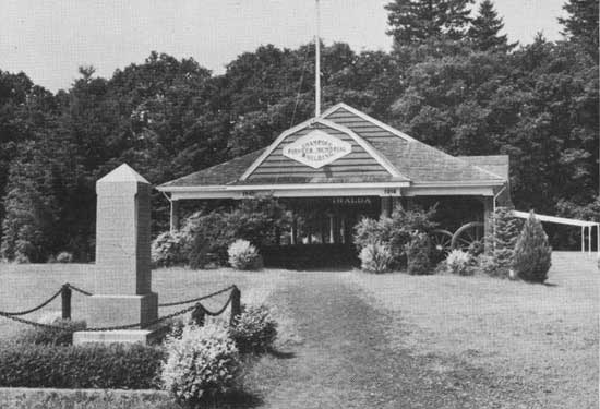
|
| Champoeg State Park—Champoeg pavilion and Pioneer monument. |

|
| Silver Falls State Park—Interior of concession dining room and myrtle wood furniture. |
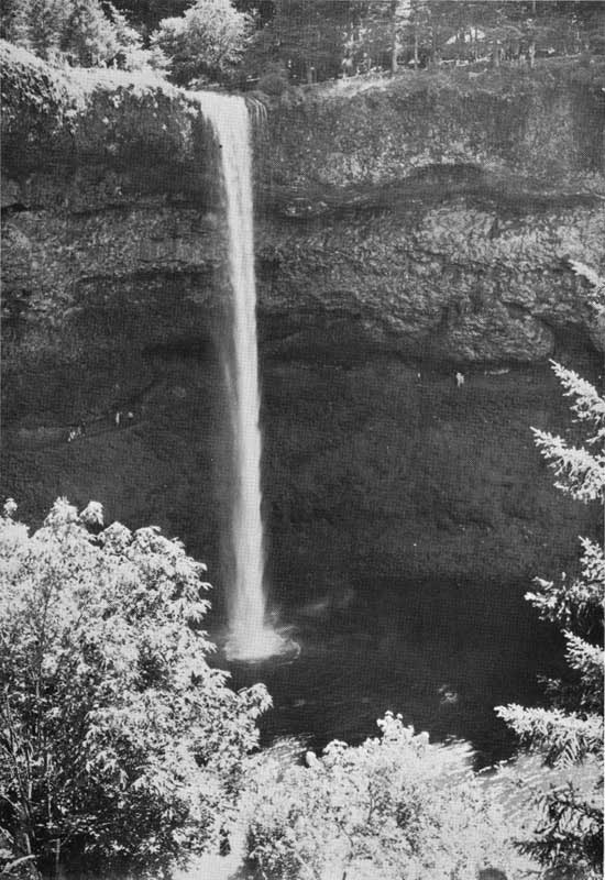
|
| Silver Falls State Park—Showing picnic area above and trail under the falls. |
|
| Silver Falls State Park—Youth Camp pool. |
|
| Cascadia State Park—Fern and tree-covered stream sides at mineral springs. |
|
| Detroit Lake State Park—Detroit Lake from boating facility. |
|
| Susan Creek State Park—Picnicking next to river. |
|
| Elk Creek Tunnel Wayside—Showing creek and heavy timber growth. |
|
| TouVelle State Park—Swimming in Rogue River. |
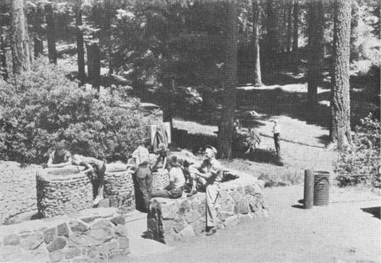
|
| Tub Springs Wayside—Showing spring outlet and picnic area. |
|
| The Cove Palisades State Park—The palisades. |
|
| The Cove Palisades State Park—Indian pictographs along Crooked River in the park. |
|
| Peter Skene Ogden Scenic Wayside—Parking area and canyon. |
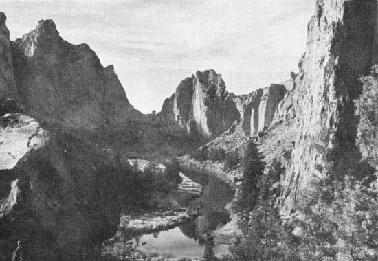
|
| Smith Rock State Park. |
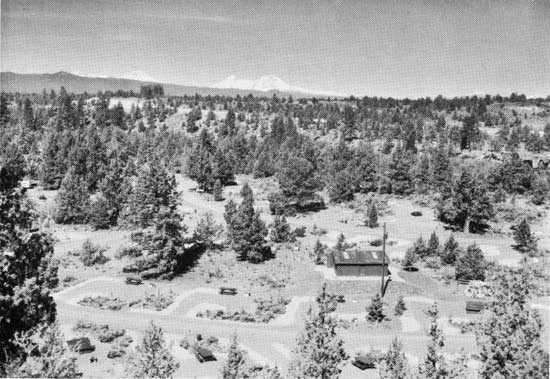
|
| Tumalo State Park—Overnight camp. |
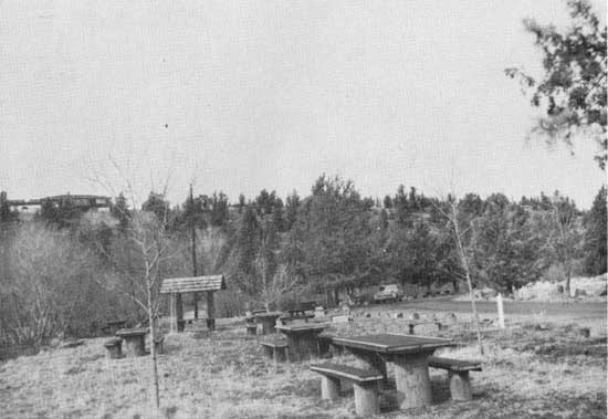
|
| Cline Falls State Park—Picnic facilities along the river. |
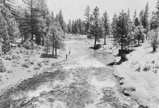
|
| Collier Memorial State Park—Spring Creek below highway bridge. |
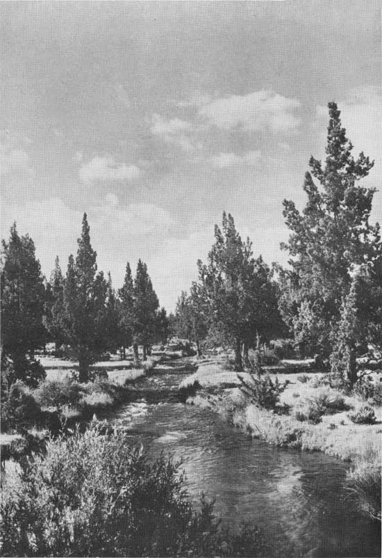
|
| Redmond-Bend Juniper Wayside. |
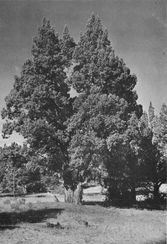
|
| Redmond-Bend Juniper Wayside—Typical Western juniper. |
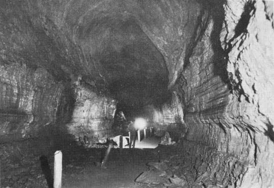
|
| Lava River Caves State Park—Cave showing lava markings and guide cable. |
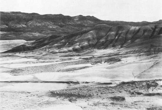
|
| Painted Hills State Park—Showing alternate layers of colored material. |
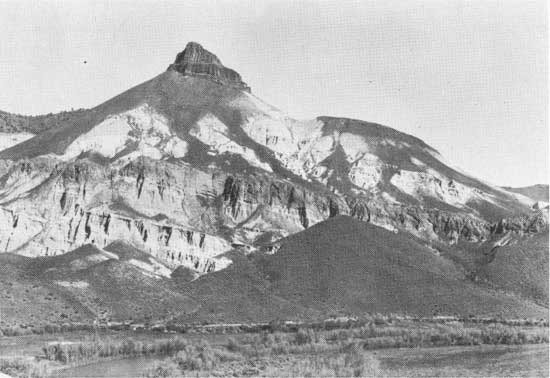
|
| Thomas Condon-John Day Fossil Beds State Park—Sheep Rock. |
|
| Collier Memorial State Park—Showing large logging wheel marker. |
|
| Collier Memorial State Park—Ancient stream locomotives. |
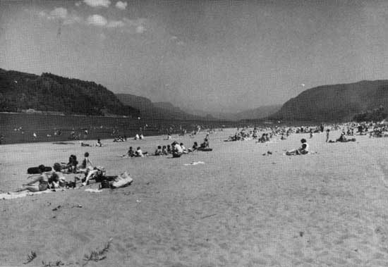
|
| Rooster Rock State Park—Swimming beach and Columbia River. |
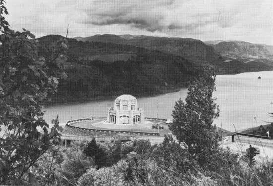
|
| Crown Point State Park—Vista House on brow of Columbia River Canyon. |
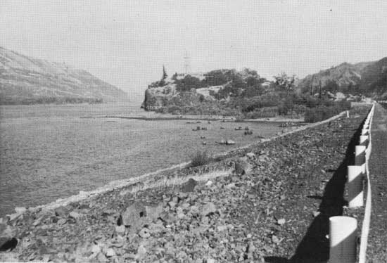
|
| Koberg Beach Wayside. |
Devil's Lake State Park
Devil's Lake State Park is located on the shores of Devil's Lake, adjoining the city of Delake in Lincoln County. The 109.34-acre park is divided into two areas known as Devil's Lake Overnight Camping Area and Devil's Lake Day Use Area. These areas are quite widely separated and more fully described as follows:
Overnight Camping Area
The Overnight Camping Area is located near the north side of "D" River—the outlet of Devil's Lake. Three sides of the camp—the west, north and east sides—adjoin the city of Delake. The area is approximately 250 feet east of U. S. Highway 101 and can be reached via Lake Drive. It is near the lake and approximately one-quarter mile distant from the ocean.
The first acquisition for the park was a gift of 29.10 acres from the city of Delake on September 3, 1957. An adjoining 1.24-acre tract and an additional 0.16-acre lot located on the north side of Lake Drive were purchased in 1957. The last above-mentioned tract was given to the city of Oceanlake in 1961 for use in connection with the disposal plant. The net acreage in this portion of the park was 30.34 acres at the close of 1963.
The northern half of the area is covered with shore pine, alder, crab apple, etc. The southern portion is quite low, just slightly higher than the lake level. It is covered with reeds. A house located near the entrance road on this parcel is being used as a park ranger's cottage.
Drainage from a stream in the northernmost corner of the park was undesirable. This drainage was diverted and the low places filled in order to stabilize the soil. The small area in the stream bed north of Lake Drive was acquired on which to place a drainage pipeline and a sewer line between the park disposal system and Oceanlake's sewage treatment plant. An agreement with the city of Oceanlake for treatment of park sewage was entered into on December 12, 1960.
Improvements in this portion of the park are an overnight camp containing 97 tent and trailer spaces, tables, benches and sanitary facilities with showers and trailer sanitary hookups. Water is obtained from the city of Delake at the usual rates.
The park name was taken from the lake on which the park is located. The lake was named Devil's Lake because of an Indian legend which is to the effect that a giant fish or marine monster lived in the lake and occasionally came to the surface to attack some hapless native.
Overnight use in 1963 was 30,630 campers. Picnicking is not permitted in this area.
Agreements as follows affect this area:
| Number | Date | Name | Expiration |
| Letter | 3-21-58 | Taft-Nelscott Water Dist.—water line | Annual |
| 1979 | 12-12-60 | City of Oceanlake—sewage disposal | " |
Day Use Area
Devil's Lake Day Use Area is located on the south shore of the lake, approximately one mile east of U. S. Highway 101 on East Devil's Lake county road.
The first acquisition for this portion of the park was 6.20 acres purchased from J. L. and Hilda Holton on November 13, 1957. Additional lands have been added and the area contains 79 acres as of the close of 1963.
Tree cover on this portion of the park is sparse. It is principally Sitka spruce, alder and salal. Lake tules grow in a shallow, 800-foot wide arm of the lake on the westerly side of the park. A smaller arm of the lake extends southward approximately 500 feet near the east line of the park. The land between these two arms is good, sandy soil and the park is developed on it.
An interesting feature of this portion of the park is the view to the north and east of the beautiful lake and the evergreen hillside as a background.
Improvements consist of an entrance road, car parking area, picnic facilities, sanitary facilities, electric stove shelter and a water system.
Day visitors during 1963 totaled 13,072. Overnight camping is not permitted in this area.
Permits as follows affect this area:
| Number | Date | Name | Expiration |
| 2117 | 7-2-59 | Pacific Power & Light—electric service | Indefinite |
| 2108 | 6-29-59 | Delake Water District | " |
| 2108 | 11-4-60 | Delake Water District—change in rate | " |
Devil's Punch Bowl State Park
Devil's Punch Bowl State Park is located on a point of land jutting into the ocean immediately west of the community of Otter Rock in Lincoln County. It is about eight miles north of the city of Newport and approximately one-quarter mile west of U. S. Highway 101.
The first acquisition for this park was 4.25 acres given to the state in 1929 by F. W. and Caroline P. Leadbetter of Portland. In 1935 the state purchased 0.19 of an acre adjoining the original tract. An additional 0.90 of an acre was donated to the state in 1952 by the Leadbetter estate. As of December 31, 1963, the park contains 5.34 acres, or all of the land which controls the view of Devil's Punch Bowl.
The area is essentially a viewpoint, particularly the southwest corner. It contains an unusual, yet very interesting feature—one from which the park name was taken. This special attraction is a large hole, or cavern, shaped like a punch bowl. There are two tunnel entrances into this bowl through which the wave action causes the water to flow in and out making a reverberating, thunder-like sound. The opening has been fenced to prevent accidents.
The entrance road into the park was made a State Secondary Highway in 1932.
The Civilian Conservation Corps constructed a water system for this park. They built a large concrete storage tank and piped water from a large spring at the edge of the old highway. Other improvements by the Corps are stone sanitary facility, trails, stoves, tables and a fence along the north, west and south sides of the park to prevent accidents.
Day visitors at Devil's Punch Bowl during 1963 totaled 228,528. Overnight camping facilities have not been provided.
Dyer Wayside
Dyer Wayside is located on the John Day Highway, approximately 10 miles south of the city of Condon in Gilliam County.
This wayside lies in Patill Canyon along a branch of Thirty Mile Creek. The deep, narrow canyon cuts through a thick layer of basalt rock, leaving vertical walls with an occasional accumulation of talus.
The park area contains only 0.6 of an acre and occupies all of the available space in the small narrow gorge. The land was a gift in 1931 from J. W. Dyer of Mayville and the area was named for him.
Providing pure water for this picnic area was a problem. A good spring on the property was used for many years, but sheep and cattle being driven through the narrow gorge would break down the fences and pollute the water by their presence in the area. A new source of water was found in 1950 from a spring approximately 520 feet southeast of the park. Permit 20479 was issued by the State Engineer for use of .02 c.f.s. of water from this unnamed spring in Ramsey Canyon.
Improvements at this wayside are fences, tables, stoves and basic sanitary facilities. A car parking area was provided by widening the highway shoulder.
Realignment of the highway in 1963 took the entire area and eliminated the wayside.
Ecola State Park
Ecola State Park is located off U. S. Highway 101, along the Pacific Ocean, adjoining the northern boundary of the city of Cannon Beach in Clatsop County. The park extends along the ocean shore line a distance of approximately six miles. It includes the most westerly promontory in Clatsop County, known as Tillamook Head, and two other view points—Ecola and Indian Points.
The first land acquired for this park was 451.18 acres in 1932 from Ecola Point and Indian Beach Corporation. Rodney Glisan, Florence Minott, Caroline W. and Louise Flanders donated their one-half interest in the property. The other one-half interest was purchased from Allen Lewis at a price of $17,500. Land for a trail over Tillamook Head was acquired, without cost, in December, 1947, by three easements as follows: 7.05 acres from Ida Fleming, 15 acres from Angora Club of Astoria and 1.95 acres from A. W. Kendall. A tract, containing 109.39 acres was acquired from the U. S. Government Land Office on July 20, 1942, at a cost of $1.25 per acre. Another tract of 80.62 acres, including the summit of Tillamook Head, was purchased from the government for $2,195, only 50% of the appraised value. Clatsop County presented 112.80 acres to the state in 1948, and three parcels of land totaling 329 acres were purchased from Crown Zellerbach Corporation in 1940, 1948 and 1954, respectively, making an aggregate of 1,106.99 acres in the park as of the close of 1963.
The land is covered with a heavy growth of timber and brush indigenous to the Oregon country. Tillamook Head contains a heavy stand of old growth fir trees.
The terrain is generally rolling to steep. Land fronting on the ocean is steep and shows signs of slides. The portion on which the use area was located moved oceanward in early 1961, causing loss of facilities roads and parking area.
The name Ecola is a part of the name of the corporation owning the land comprising the first acquisition for the park—Ecola Point and Indian Beach Corporation. However, Lewis A. McArthur in Oregon Geographic Names says, Captain William Clark on January 8, 1806, called the stream, now known as Elk Creek at Cannon Beach, Ecola or Whale Creek, but both names fell into disuse. Sometime prior to 1900 a promontory at the south edge of the park was named Ecola Point. He also states that a post office located at the mouth of Elk Creek was named Ecola in 1910, but the name was changed to Cannon Beach in 1922 because of confusion with Eola. The name Ecola came from the Chinook Indian word ekoli meaning whale. These reasons suggested the name Ecola, therefore the name Ecola was adopted for the park.
For many years a herd of Roosevelt elk as well as many deer have roamed through the park and the surrounding country with little fear.
Tillamook Head is one of the outstanding promontories of the Oregon coast line. Ocean views from several points in the park are superb. Sea Lion Rock, one of the many jagged rocks to dot the shoreline, is located one-half mile offshore and is a natural resting place for sea lions and shore birds. It is sometimes referred to as Arch Rock because of its shape. The setting sun lends an atmosphere of enchantment for the evening visitor.
The first real work in improving the park for public use was by the Civilian Conservation Corps. Starting in October, 1934, a camp for 200 men was established. The men located property lines and constructed roads, trails, car parking area, fire guards, camp buildings, caretaker's cottage and viewpoints. This was followed by a project under SERA doing similar work. Later, the roads were widened, car parking areas extended, picnic area enlarged and the water system improved to supply additional water.
The timber on the 1961 slide area was sold and the land drained. Because of the slide, the park was closed. It was opened for partial use in 1963.
A plaque was installed in Ecola Park to honor the donors of the land first acquired. However, the slide of 1961 damaged the base but the plaque itself was saved and is now in storage waiting to be relocated in the park. A rustic type sign giving information about Ecola and Oregon history was placed along Highway 101 about 300 feet south of the Cannon Beach junction. Still another rustic sign and a likeness of the cannon to which it has reference are located along Highway 101 at mile post 34.4.
Tillamook Lighthouse, located on an offshore rock, can be seen from the several viewpoints. The Corps of Engineers built a temporary road to Tillamook Head in 1944 and leased 25 acres on Tillamook Head for radar purposes during the war.
The boys from MacLaren School at Woodburn did cleanup jobs in the park, built trails to the beach at Indian Creek and improved existing trails. They started work in 1953 and continued till 1956.
A new road from the park use area to Indian Creek was constructed in 1954 after abandoning the old road. This project made a direct route from the park use area to Indian Creek and Tillamook Head.
A small overnight camp was placed in the park in 1953 but was abandoned in 1954 because of the objection by the donors, the Flander sisters, who thought it was not in accordance with their gift.
Day use at Ecola in 1963 was 177,052 visitors.
Permits as follows affect the park:
| Number | Date | Name | Expiration |
| 3-24-41 | Vernon William—pipeline across entrance road | ||
| P 492 | 5-29-46 | Crown Zellerbach Corp—Water line easement to state | |
| 10-30-43 | U. S. Coast Guard—telephone line | Indefinite | |
| 11596 | 2-26-35 | Water right 0.03 c.f.s. water | |
| 16921 | 3-7-46 | Water right 0.06 c.f.s. water |
Elk Creek Tunnel Wayside
Elk Creek Tunnel Wayside is located on the ridge at Elk Creek tunnel, three miles east of Elkton on Highway 38 in Douglas County.
The 200-acre tract was first leased from the federal government in October, 1932. Later, at the suggestion of the Highway Commission, negotiations were carried on by Douglas County to exchange county property for the desired federal O. & C. land. The tract was then purchased from Douglas County in April, 1947, at a price of $3,047.20.
The above-cited method of handling the exchange was necessary because of the federal law relative to disposal of O. & C. lands. In substance, the law required that lands in the same county and of equal value be exchanged for the desired tract. At that time the state owned no land in Douglas County.
This property was acquired to protect the entrances to the tunnel from undesirable developments and to preserve the natural aspects of the approaches and the ridge through which the roadway passes.
No active use is made of the area.
Elliott R. Corbett II Memorial State Park
Elliott R. Corbett II Memorial State Park is a pristine area located in Jefferson County near its western edge. It is off U. S. Highway 20 a short distance east of the summit of the Cascade mountain range. The park includes the southerly portion of Blue Lake located approximately one-half mile west of Suttle Lake.
The entire 63.01-acre park was donated by Henry L. and Gretchen Corbett of Portland as a memorial to their son, Elliott II, who was lost in action during World War II. The gift was in two parcels, one given in 1953 and the other in 1954. It was stipulated that the area be named Elliott R. Corbett II Memorial State Park.
The land was given to the state with the understanding that basic facilities only would be constructed, together with a memorial marker. It was also understood that the park is to be preserved as a wilderness area. The Henry Corbetts gave $2,000 to make the improvements in the park.
The old wagon road over the Cascade mountains passed through the park land. A small creek near the south side furnished drinking water and the nearby meadow land was used for overnight stays by the early-day wagon traveler. In later years, but prior to construction of the new road, it was used by a few of the hardy auto tourists.
The area is covered with lodgepole and ponderosa pine with a few lesser species of trees and shrubs found at that elevation. Deer are frequent visitors.
Only basic facilities have been provided, such as water, sanitary facilities, trails within the park and along the rim of the lake, and a good foot-trail from the road at the west end of Suttle Lake. The memorial plaque has been installed.
Use of the area has been small, probably by reason of the long trail to the facility. No count of visitors has been made as no adequate method of tabulating them has been found.
Ellmaker State Park
Ellmaker State Park is located on Highway 20, approximately one mile west of the community of Burnt Woods in the eastern part of Lincoln County.
The park land is cut by the highway and Tumtum River. A small stream from the northeast flows across the area to join the Tumtum River in almost the center of the park land.
The entire 80-acre park was given to the state for park purposes by Harlan D. Ellmaker on September 8, 1961. While Mr. Ellmaker often referred to this area as his "Garden of Eden," he asked that it be named Ellmaker Park.
The principal portion of the land is moderately level with some fringe areas extending onto the hills. A house, at one time Mr. Ellmaker's home, is located near the highway.
Approximately fifty percent of the area is suitable for cultivation and the remainder contains fir timber probably 30 years old.
The park has no development as of December 31, 1963.
Emigrant Hill Overlook Wayside
Emigrant Hill Overlook Wayside is located on the old Oregon Trail Highway near the top of Emigrant Hill in Umatilla County. It is approximately 14 miles east of Pendleton on the Umatilla Indian Reservation.
The 20.16-acre tract of land was obtained from an Indian allotment, a part of the Edgar Billy grant, in 1924, but the patent is dated September 6, 1940.
The land was obtained to provide a stopping place along the highway from which to view the checkerboard effect of the alternately cultivated and cropped lands over a broad area of Umatilla County.
A car parking area is the only development.
Little use is being made of the area now as the new highway, now Interstate 80N, has been constructed some distance to the west and south of this overlook.
Emigrant Springs State Park
Emigrant Springs State Park is located on what is seemingly the south side but actually the west side of the Old Oregon Trail, Interstate 80N, near the midway point between Pendleton and La Grande in Umatilla County.
The original tract of 14.10 acres was acquired by condemnation. The suit was instituted by Umatilla County Court and paid by the Highway Commission. The Court's award was $2,500. This action was completed in October, 1924. Deed dated July 1, 1925, was from the Umatilla County Court.
A small additional area of 0.12 of an acre was purchased from L. L. Mann of Pendleton on May 22, 1926. This brought the total acreage in the park to 14.22 acres at the close of 1963.
Many park-minded people of the early twenties felt that this particular area on the Old Oregon Trail at the summit of the beautiful Blue Mountains should be in public ownership so that preservation of its historical and aesthetic values might be assured.
On March 27, 1925, the Highway Commission approved the request of Colonel F. V. Holman, President of Oregon Historical Society and a representative of the Sons and Daughters of the Oregon Pioneers, that the park be named Emigrant Springs. It was their feeling that this was an appropriate name for the historical place on the route of the Old Oregon Trail so popular as a watering and camping place for the many westward-bound wagon trains.
The area in general is covered with a good stand of yellow, ponderosa and lodgepole pine with the usual undergrowth of brush, etc. The abundance of rainfall in these mountains makes it possible to grow large green forest trees and many of the lesser varieties of natural cover. It is the first forest of evergreen trees seen by the early-day emigrants on their westward-bound trek. The color of this forest from a distance has a bluish cast, thereby suggesting Blue Mountains as a fitting name.
Two unsuccessful attempts were made by concessionaires to operate a store and lodging facility on this property during the initial years of state ownership. The park lodge, built in 1927 at a cost of $19,314, burned in October, 1929. A replacement was constructed in 1930 at a cost of $3,920.
The Civilian Conservation Corps constructed a camp in the park in 1934 and made some improvements. This work included constructing camp buildings, clearing away unnecessary brush, constructing park roads, trails and car parking areas, drilling a 6-inch well 370 feet deep, and constructing a day use area with three latrines, water system and sanitary disposal tanks.
After the Civilian Conservation Corps abandoned the camp, the buildings were used by the public for community activities and large picnic gatherings. One small building which had been used as an office was given to the Boy Scouts of Walla Walla. After a few years use it was abandoned and later removed.
New construction by the Parks and Recreation Division is a 50-unit overnight camp with 18 trailer sites and 32 tent sites. Up-to-date facilities were constructed and a new 8-inch well 295 feet deep was drilled. Additional facilities include coin-operated electric stoves with water heaters, covered with sturdy shelters. A new standard latrine was built in 1952. Public use of the sanitary facility in the park cottage was discontinued and that building was converted into a residence for the park ranger.
Day use at Emigrant Springs during 1963 totaled 136,920 visitors and overnight use totaled 14,915 campers.
The following permits and water rights affect this park:
| Number | Date | Name | Expiration |
| 4472 | 10-5-54 | Eastern Oregon Elec Co-op—power line | Indefinite |
| 4543 | 1-20-55 | Eastern Oregon Elec Co-op—power line | " |
| 7752 | 12-31-26 | Water right—0.01 c.f.s. | Three small springs |
| Gr 2195 | 7-14-58 | Water right—28 gal. per min. | 6" well 370' deep |
| G 1847 | 6-6-60 & 8-18-60 | Water right—60 gal. per min. | 8" well 295' deep |
Erratic Rock Wayside
Erratic Rock Wayside is located north of Salmon River Highway in Yamhill County. Its location is further described as being approximately 1,100 feet north of the highway at a point six miles east of Sheridan.
The total acreage of 4.40 acres, including a strip of land 15 feet wide for a trail to the area, was purchased from Jacob and Anna Duerst and Marybelle and Lawrence Ramsby in 1956. Acquisition was at the suggestion and insistence of the Geological Society of the Oregon County, the reason being that the large rock on the property, weighing possibly 40 tons, is not of local origin.
The Geological Society further believed that the large rock embedded in the hillside should be of great interest to the public, since it has no characteristics of any local stones or of any found within a range of several hundred miles from its present location, and is, therefore, termed an "erratic." Geologists believe it to have been rafted in ice during the ice age, possibly 20,000 years ago, from a point in Canada. At that time water covered the entire Willamette Valley. When the iceberg raft melted, the rock was deposited at its present resting place.
Other erratics have been found in the Willamette Valley, some at a much higher elevation than the one under discussion. These rocks show no wear from rolling or moving, giving proof to the accepted transportation theory.
The rock is on a barren point approximately 100 feet above the highway. An oil-surfaced trail was constructed from the old highway to the rock. The area was enclosed with a good fence. A geological marker was placed on a widened shoulder of the highway right of way.
The use of the area is small; therefore, no count has been made.
Evergreen Ranch Wayside
Evergreen Ranch Wayside is located on both sides of Crater Lake Highway approximately 13 miles east from Trail in Jackson County.
The lightly timbered, 40-acre tract was obtained by the Highway Commission in 1930 from Dunn & Baker, the contractors who built the original highway in about 1920. A source of suitable rock for road surfacing was found on this property in a cut next to the highway.
The land was used as a road foreman's headquarters during approximately the first fifteen years it was in state ownership. Then, in 1951 it was transferred to the Parks and Recreation Division. The rolling, timbered area has since been preserved for its scenic value to the traveler.
A ranch home on land adjoining the park boundary to the east was used as a highway stopping place for many years by travelers. It was named Evergreen Ranch and was well-known. Public use of the place, however, was discontinued prior to acquisition of the park property by the state. To properly identify the location of the wayside, the state named it Evergreen Ranch.
The original plan for this area was to combine it with Laurelhurst into one park. No active use of the land has been made.
Agreements as follows affect this wayside
| Number | Date | Name | Expiration |
| 1455 | 3-7-53 | M. Bloomfield, C. H. Hickerson—pipe line | Perpetual |
Farewell Bend State Park
Farewell Bend State Park is located in Baker County at the Baker-Malheur county line. It lies between the Oregon Trail Highway (Interstate 80N) and the Snake River on the shores of Brownlee Reservoir approximately four miles south of Huntington.
The first land for this park was a gift of 45.73 acres from the Idaho Power Company. Deed is dated November 28, 1958. An additional 3.57 acres was given by the Power Company in 1960. The state purchased in 1959 a 16-acre tract lying between the highway and the property given to the state by the Power Company. Total acreage in the park is 65.30 acres at the close of 1963.
A good crop of alfalfa and grass was growing on the land at the time the state acquired it.
The name Farewell Bend has a historical reference. The original route of the Old Oregon Trail left the beautiful Snake River at this point and started over the Blue Mountains. The river was never seen again by the pioneer on his westward journey. This evoked the thought that the pioneer said farewell to the river.
The terrain of this park is quite level and very suitable for park development.
The Idaho Power Company constructed a dam on the Snake River about 40 miles downstream from the park property. This dam impounds water in a lake which extends upstream past the park, furnishing a large body of water for recreational purposes. Fishing and boating are enjoyed as well as views of the scenic beauty of the deep, narrow canyon starting a short distance from the park. The water level in the lake remains constant during the recreational period, allowing for the greatest possible use by the park patrons.
Improvements at this park are an entrance road, car parking area, tree planting, trails, paved boat launching ramp 100 x 300 feet, swimming beach and day use area complete with water, tables and sanitary facilities. A concession to serve the boaters and other patrons of the park has been provided under an agreement with a concessionaire.
Attendance in 1963 was a total of 129,288 day visitors and 7,573 camper nights.
Permits and agreements as follows affect this park:
| Number | Date | Name | Expiration |
| 5595 | 8-17-59 | Idaho Power Co—power line | Indefinite |
| 5771 | 9-8-60 | Idaho Power Co—power line to trailer and building | " |
| 2118 | 4-25-63 | Idaho Power Co—power line to concession | 4-25-73 |
| 2118 | 4-25-63 | Idaho Power Co—adjustment of annual charge | 4-25-73 |
| 2596 | 2-18-63 | Bruce Kirkpatrick—boat concession | 3-31-64 |
Fern Ridge State Park
Fern Ridge State Park is located on the shores of the lake formed by Fern Ridge Dam on Long Tom River west of Eugene in Lane County. It is composed of two areas known as Perkins Peninsula and Richardson Point.
Perkins Peninsula is approximately nine miles west of Eugene on the Eugene-Noti Highway. It is on a low peninsula jutting into the water at the southern end of the lake.
Richardson Point is about 17 miles west of Eugene at the northwest corner of the lake. It can be reached via Oregon Highway 220 to Elmira and then Territorial Road 200.
All of the land for the two areas was obtained from the Corps of Engineers under a lease agreement. The first lease was dated September 5, 1951, and covered 74 acres. However, this lease was revised on September 3, 1959, to cover only 54 acres. It excluded land which was not particularly desirable for park purposes.
The Corps of Engineers named the lake Fern Ridge and the park was named for the lake. Perkins Peninsula and Richardson Point areas have been known for many years by these names.
The terrain at each area is generally level. It is sparsely covered with oak, fir and pine trees. Most of the fir and pine trees were planted by the park crew in 1954.
The most interesting feature of the park is the lake. The recreational features include fishing, boating, water sports and hiking. Many visitors enjoy the distant views of the gently rolling hills and fertile fields of the surrounding country.
All of the major facilities were constructed by the Corps of Engineers. These include the water system, sanitary facilities, tables, stoves, car parking areas, trails and boat launching ramps 20 x 100 feet with suitable floats at each area. The Parks and Recreation Division did the tree planting, the paving of the boat ramps and car parking areas, and improved and constructed some additional facilities, such as tables, stoves, kitchen shelter, etc.
Day visitors during 1963 totaled 178,952 at Perkins Peninsula and 145,160 at Richardson Point. Overnight use is not permitted.
An agreement with the Department of the Army dated September 5, 1951, for a period of 25 years, gives the State Parks and Recreation Division permission to administer this land.
Floras Lake State Park
Floras Lake State Park is located west of U. S. Highway 101, approximately four miles southwest of the community of Langlois in northern Curry County. The park land borders the southwestern tip of Floras Lake for about one-half mile and has a two and one-half mile frontage on the ocean.
The first land for this park was 1,397.91 acres purchased from the Blacklock Sandstone Company of San Francisco on February 5, 1943, at a cost of $3,641. Another tract of 43 acres, completely surrounded by park land, was acquired in 1954 by an exchange of 21.76 acres from the southwest corner of the park land. An additional five acres were added in 1962 and further negotiations in 1963 resulted in the purchase of an additional 39.30 acres on April 2, 1963, from Genevieve R. Stewart, making a total of 1,463.45 acres in the park at the close of 1963.
A period of seven years was consumed in negotiating for the initial parcel of land. During that time the price was reduced from $20,000 to $3,641, which included approximately $2,900 in back taxes and $700 in miscellaneous costs. It is quite evident that the firm did not gain financially in the transaction.
The area was known for many years as Newburgh State Park. That name was used because Henry Newburgh, Secretary of the Blacklock Sandstone Company, was instrumental in the transaction whereby the state acquired the initial tract of land. The name was changed to Floras Lake State Park on April 3, 1962. Floras Creek flows into the ocean near the lake.
The terrain is generally level, in excess of the 100-foot elevation, with abrupt, steep slopes to the ocean. West of Floras Lake there is a gulch which runs in a northwesterly direction to the beach. The lake drains to the north, back of a sand dune and then empties into the ocean.
The entire area, outside of the flight strip, is covered with shore pine and the usual salal and huckleberry brush.
Approximately 560 acres, located in the southeasterly part of the park, were leased to Curry County on July 7, 1943. The lease is for a period of 25 years and will expire on July 6, 1968. Curry County subleased part of this land to the Civil Aeronautics Administration as the Navy wished to build an airport on the property. When the war ended, the government relinquished its lease with Curry County but the lease from the state to the county remains in effect. The air strip and entrance road were constructed in 1943-44.
No active use is being made of the park.
Permits as follows affect the park:
| Number | Date | Name | Expiration |
| 10-31-45 | U. S. Coast Guard—telephone line | Indefinite | |
| 744 | 7-7-43 | Curry County—land for air strip | 7-6-68 |
| 798 | 5-29-62 | U. S. Army—survey |
Fogarty Creek State Park
Fogarty Creek State Park is located on both sides of Oregon Coast Highway 101 where Fogarty Creek flows into the ocean, approximately 16 miles north of the city of Newport in Lincoln County.
The first acquisition for this enchanting picnic area was 34.40 acres purchased from Kina Ross on December 21, 1954. Additional areas were purchased from time to time until the park has 104.04 acres of land as of December 31, 1963.
Fogarty Creek Park was named for the stream which flows lazily through the property the entire length of the park. The stream was named to honor John Fogarty, a former Lincoln County Judge.
Acquisition was principally for use as an ocean beach park. The beach area had been used by the public as a park for many years prior to acquisition of the land by the state.
A road easement through the park was held by Fred H. and Edna Taylor for access to their property, the E1/2 of SW1/4 NW1/4 of Section 33, Township 8 South, Range 11 West. It was given to the state in exchange for a strip along the south edge of the park land.
The old highway was abandoned and is now used as an entrance road into the park.
Fogarty Creek Park contains all of the land in the floor of the gulch through which the stream flows and the slopes on the west and north sides. It is well protected from the strong ocean winds. The tree cover consists of alder, spruce, shore pine and a few hemlock.
The land along the stream is low and required draining and leveling to make it usable. The elevation is about 15 feet—high enough to permit drainage.
The boys from MacLaren School assisted in the original development of the area, clearing away the brush and logs, draining the land, etc.
Other improvements consist of draining and filling low areas, clearing away all unnecessary trees, stumps and logs, constructing sanitary facilities, water system, trails to the beach, etc., stream protection against wave action, a large area for car parking, improved entrance road, picnic tables, electric stoves and power lines.
The beach, a wide, smooth portion of a long, interesting shoreline, is suitable for sun bathing, hiking and fishing. The broad expanse of ocean offers many interesting views.
Day use at this picnic area is approximately 184,000 visitors annually. Provisions for overnight camping have not been made at Fogarty.
Permits and agreements as follows affect this park:
| Number | Date | Name | Expiration |
| P-634 | 4-23-56 | Fred H. & Edna Taylor—road | Indefinite |
| 1773 & 4867 | 7-30-56 | Central Lincoln PUD—Electric line and service | " |
| 4579 | 3-17-55 | Pacific Tel. & Tel. Co.—line | " |
| 620 | 12-11-59 | A. J. Druhl—road (Transferred to J. H. Miesen) | 12-1-63 |
Fort Rock State Monument
Fort Rock State Monument is located near the community by the same name. It is in the northwesterly part of Lake County, on a county road seven miles east of Fremont Highway 31, and 38 miles southeast of the city of Lapine.
The entire park area of 190 acres was obtained in 1962. The first was a gift of 30 acres from Reuben A. and Norma Long, who were early advocates of the establishment of a park at the site. The other was a gift of 160 acres with the usual 25-year reversionary clause from the Bureau of Land Management, first obtained by Lake County and then transferred to the state for use as a historical monument.
The supposed fort, remnants of an ancient volcanic crater, is about one-third of a mile across and lies in a somewhat crescent shape. One side of the fort is open and can be entered by car. The high side may be as much as 325 feet above the floor of the plain on which it stands, according to McArthur in Oregon Geographic Names. McArthur also says, "It has perpendicular cliffs 200 feet high in places." The old fort is a unique, picturesque monolith and an old landmark in the area. It can be seen for miles in all directions as it stands alone on the valley plain. The surrounding country is barren of trees but has an abundant growth of sagebrush.
There are a number of caves in the vicinity of Fort Rock, formed by volcanic action and in which has been found evidence of early habitation by man. Carbon tests of the artifacts found show them to be about 10,000 years old.
The Highway Commission approved the name of Fort Rock State Monument for the area on June 29, 1962.
Improvements are picnic facilities only and consist of a car parking area, sanitary facilities, tables and stoves.
No active use has been made of the area; therefore, there is no record of visitors for the year 1963.
Fort Stevens State Park
Fort Stevens State Park is located in the northwest corner of the state, off U. S. Highway 101 approximately 13-1/2 miles west of Astoria in Clatsop County. It adjoins the south end of the old Fort Stevens Military Reservation at the mouth of the Columbia River.
The entire 792.70-acre park, including a strip of land 500 feet wide to the beach, was given to the state by the Clatsop County Court. One parcel of 788 acres was a gift in 1955 and the other 4.70 acres was a gift in 1960.
The area was named Fort Stevens State Park for the adjoining historical military reservation and because the area was well known by that name. Clatsop County had previously made a small development on the north end of Coffenbury Lake and named it Fort Stevens Park.
Among the interesting features of the park are several long, shallow lakes suitable for boating, fishing and swimming; the remains of the old British sailing ship Peter Iredale which went ashore in 1906; the long, broad ocean beach extending north to the Columbia River jetty and south to Gearhart; and the old historic Fort Stevens Military Reservation with its shore gun batteries.
The park land has a new growth of many varieties of trees, most of which were planted by the Civilian Conservation Corps in the early thirties. These plantings have reached as much as 30 feet high. Dune grass and small trees were planted in the area west of the park.
Developments at the park include a complete overnight camp area of 380 units, containing 119 trailer sites and 261 tent spaces with the necessary conveniences, a group camp area suitable for 200 people, a large day use area including tables, stoves and sanitary facilities, two swimming beaches with protective log booms outlining a safe water depth and serving as a protection against motor boats and other water-craft, an entrance road to the park, roads to the ocean beach and to the park developments, and suitable car parking areas at the day use area and near the beach. A boat launching ramp, 33 x 40 feet, was constructed on Coffenbury Lake. Another boat ramp in the park, 18 x 75 feet, is located on Crabapple Lake and still another, 9 x 84 feet, was built on Creep and Crawl Lake.
An attempt was made in 1957 to obtain Battery Russell, a part of the old Fort Stevens Military Reservation. It was unsuccessful because of federal complications relating to the deeding of the area to the State Game Commission. The Game Commission was willing to dispose of the area or lease it to the state.
Provisions were made in 1958 for a concession to operate in the picnic area on the east side of Coffenbury Lake. It was unsuccessful and the operator gave it up at the end of the 1960 season.
A claim was made in 1960 for the remains of the Peter Iredale wreckage by a Mr. Caldwell on behalf of a Mr. Hendricks who claimed to be the owner. The claim was never followed up in any way.
Some difficulties were encountered at the water sports areas between fishermen, swimmers and motor boaters. They were reasonably controlled by regulations.
Park usage in 1963 was 399,958 day visitors and 102,767 overnight campers.
Gangloff Wayside
Gangloff Wayside is located on the Oregon Trail Highway and adjoins the western edge of the city of La Grande in Union County.
The 2.49-acre tract was a gift to the state in 1924 from Mrs. Mary T. Foley as a monument to the pioneers of Union County. She requested that the area be named Gangloff and the Commission approved.
Mary Foley, according to information from Charles Reynolds of La Grande, was a daughter of Augustine Gangloff, an emigrant from Alsace-Lorraine, who, as a lad, migrated to the United States and came to Western Oregon via the Oregon Trail. After having lived for several years at various places on the coast, Augustine Gangloff married in 1863, and with his wife, Anna, homesteaded 160 acres of land in the Grande Ronde Valley in 1864. Part of this homestead is now Gangloff Wayside and the rest of it is a part of the city of La Grande.
The Gangloffs built a log cabin on this homestead, raised livestock, planted an orchard and started the first nursery in the valley. Many of the present orchards came from this nursery. Early settlers who traveled the Oregon Trail passed this orchard and carried with them pleasant memories of its beauty and the fruit it bore.
For many years prior to state ownership of the land, the area had been used as an overlook or a point from which the traveler could view the beautiful Grande Ronde Valley and a portion of the thriving city of La Grande. It still serves the same purpose.
A bronze plaque on a large basalt stone was placed near the center of the wayside at the widest place in the parking area. It bears the following inscription:
GANGLOFF PARK. Dedicated
to the pioneers of Union County
by Mrs. J. E. Foley, 1924.
Use of the overlook has been heavy. No record of the number of visitors has been made as traffic is not channeled and therefore very difficult to count.
Gearhart Ocean Wayside
Gearhart Ocean Wayside is beach land located between the Pacific Ocean and the city of Gearhart in Clatsop County.
The entire area of 286.06 acres was purchased in 1939 from the Gearhart Park Company. It is tideland extending from Necanicum River north a distance of nearly two miles. It is the ocean front of the platted city of Gearhart.
Acquisition was to preserve the beach for public use. Its location is indicative of its name.
No record has been made of the attendance at this area.
Geisel Monument Wayside
Geisel Monument Wayside is located on U. S. Highway 101, five miles north of Wedderburn in Curry County.
The initial acquisition for this wayside was a gift of 2.15 acres from the Macleay Estate Company on December 24, 1930. An adjoining area of 1.90 acres was given to the state on January 6, 1931, by F. B. and Martha Postel. Total acreage in the wayside is 4.05 acres as of the close of 1963.
This wayside contains the graves of an Oregon pioneer, John Geisel, his wife and family. John Geisel and his three sons were massacred by the Indians in 1856 and McArthur in Oregon Geographic Names has this to say, "The Geisel massacre was the outstanding tragedy in the early history of Curry County."
The graves are marked with a monument and surrounded by an ornamental iron fence. A granite shaft is inscribed as follows:
"Sacred to the memory of John Geisel, also
his three sons, John, Henry, and Andrew who
were massacred by the Indians, February 22
A.D., 1856, ages respectively 45, 9, 7, and 5.
Also wife and mother died September 20,
1899, age 75 years."
Day visitors at this historical landmark totaled 11,919 during 1962. No count was made in 1963.
Permits as follows affect this wayside:
| Number | Date | Name | Expiration |
| 3292 | 2-3-50 | Coos-Curry Electric Co-op.—power line | Indefinite |
George W. Joseph State Park
George W. Joseph State Park is located in the scenic Columbia River Gorge, south of the old Columbia River Highway and five miles west of the community of Bridal Veil in Multnomah County.
The first acquisition for this park was 40 acres on September 11, 1934, a generous gift from George W. Joseph and his mother, Bertha L. Joseph. Another gift of 40 acres from the Josephs was received in 1942. The park was enlarged by purchase of an additional 70.12 acres from Multnomah County on February 5, 1959, increasing the park acreage to an aggregate total of 150.12 acres as of the close of 1963.
The Highway Commission decided that the Joseph family should be honored for these gifts, therefore the park was named George W. Joseph State Park.
A good stand of fir and maple trees on the property provides an area of dense shade, never touched by the rays of the sun, which is so ideal for a lush growth of sword fern, moss and other ground covers of a lichenous nature. This dell-like area is only a small part of the proposed acquisition to preserve the beautiful, pristine appearance of the Columbia River Gorge first suggested by the late Sam H. Boardman and later a project of the Columbia River Gorge Commission. Immediately north of this park land lies the Guy W. Talbot State Park and, insofar as use and the public are concerned, they are considered as one very interesting area.
Development at George W. Joseph Park consists of trails only, from which visitors may view nature's unusual display of shade-loving plants.
A separate record of park attendance has not been kept for Joseph Park.
Golden and Silver Falls State Park
Golden and Silver Falls State Park is located five miles beyond the end of Coos River Secondary Highway, about 24 miles northeast from Coos Bay in Coos County.
Preservation of the extraordinary stand of Douglas fir trees surrounding the two beautiful waterfalls was the motive for acquisition of the park.
The first land acquired was 112 acres, the Golden Falls area, from the Waterford Lumber Company on June 29, 1936, after Coos County made the road from Coos Bay toward the falls a secondary highway and the state agreed to spend $10,000 for improvement of the road. Two gifts from Coos County were made by deeds dated September 7, 1938, for 17.27 acres, the Silver Falls area, and May 11, 1955, for 28 acres, a timbered area, making a total of 157.27 acres for the park.
The park was named for the two falls within its boundaries, one on Silver Creek and the other on Glenn Creek. McArthur's Oregon Geographic Names says that Golden Falls was named to honor Dr. C. B. Golden, first Grand Chancellor of the Knights of Pythias of Oregon, one of the first visitors to the falls, and that Silver Falls was named in contradistinction to Golden Falls.
Much of the charm of this park lies in the canyon with the unusual falls on each creek and the thick stand of Douglas fir timber which not only surrounds the falls but covers the adjoining canyon walls in all directions.
The matter of improving the road for log-hauling purposes occupied the attention of the Commission from 1935 to 1940. The problem was solved by extending the secondary highway toward the falls and doing some improving. Rebuilding the steep, narrow and tortuous portion around the falls, after the bridge on Silver Creek collapsed, was discussed for two years, ending in 1959. The road was never rebuilt.
A bronze plaque was installed in the Silver Falls section of this park near the terminus of the trail to the falls in recognition of the generosity of the Weyerhaeuser Timber Company when giving the area to Coos County on August 14, 1935.
Improvements in the park consist of trails to the falls and a picnic area with the usual tables, fireplaces and sanitary facilities. A part of the work was done by the Civilian Conservation Corps in the mid-thirties.
Day use of the park in 1962 totaled 4,941 visitors. No count was made in 1963.
Governor Patterson Memorial State Park
Governor Patterson Memorial State Park is located on U. S. Highway 101, approximately 1-1/2 miles south of Waldport in Lincoln County. It includes all of the land between the highway and the ocean for a distance of approximately one mile.
The first acquisition for this memorial park was 9.40 acres in 1931. It was purchased as a memorial to the late Governor Isaac L. Patterson, to preserve the pristine appearance of the area with its shore pine and other native growth, and to provide a picnic area in the vicinity of the north end of the park land. The four deeds conveying this land to the state are as follows:
| Mary E. Patterson, a widow, one-third interest | $313.33 |
| Marion W. Donaldson, a widow, one-third interest | 313.33 |
| La Vena Bennett, unmarried, one-sixth interest | 156.67 |
| Walter Bennett and Marie Bennett, husband and wife, one-sixth interest | 156.67 |
| Total | $940.00 |
Two small contiguous tracts were purchased in 1945 and 1946, which increased the park acreage to 10.23 acres.
The area was named to honor Oregon's former Governor Isaac L. Patterson who died in office. This is believed to be justifiable even though it is in direct opposition to the plan presented by the first Park Committee and adopted by the Commission on April 19, 1926.
Governor Patterson was a strong believer in preservation of scenic areas for the enjoyment of the public and future generations. He strongly advocated expansion of park development. He was first to appoint a Park Commission—although it was short lived—and his interests and actions placed emphasis on the matter of stepping up the acquisition of land and broadening the park idea, eventually leading to a park system comparable to any in the nation.
The use area of this park is mostly level with a good, natural stand of indigenous evergreen trees. The long, wide, hard, sandy beach has proved to be of great interest to the park patrons.
Improvements are for day use purposes, consisting of car parking area, entrance road, trails, tables, stoves and sanitary facilities. Water was obtained from the local water district.
Park usage in 1963 totaled 85,143 day visitors.
Guy W. Talbot State Park
Guy W. Talbot State Park is located in the scenic Columbia River Gorge, on both sides of the old Columbia River Highway approximately five miles west of the community of Bridal Veil in Multnomah County.
A gift of 125 acres from Guy W. and Geraldine W. Talbot on March 9, 1929, was the beginning of this enjoyable park area. This parcel of land has the distinction of being the first tract in Multnomah County to be obtained for a state park. Multnomah County donated 62.75 acres on November 13, 1935. The purchase of five additional areas has increased the acreage in Talbot Park to 241.23 acres as of the close of 1963. The last parcel of land added to this park was the B. B. Bennett property, for which negotiations were started in 1944 and not completed until 1959. This acquisition placed the impressive Latourell Falls and the lively stream below the falls entirely on state-owned land.
Preservation of the natural beauty and scenic features of the Columbia River Gorge is the reason for acquiring this land.
A plaque to the memory of Mr. and Mrs. Guy W. Talbot was placed near the use area in 1938 by their friends. Another plaque, on the county road near the northeast corner of the picnic area, was installed by the Bridal Veil Pioneer Association in 1941 as a memorial to Bridal Veil Pioneers. The park was named Guy W. Talbot to honor the Talbot family.
Improvements by the state and the Civilian Conservation Corps at this park are a car parking area, picnic area, tables, stoves, water, trails, two cottages and sanitary facilities.
The 1963 attendance was 52,072 day visitors.
Permits as follows affect the Guy W. Talbot park:
| Number | Date | Name | Expiration |
| 8176 | 7-19-40 | B. L. & Geo. W. Joseph, Jr.—pipeline | Indefinite |
H. B. Van Duzer Forest Corridor Wayside
H. B. Van Duzer Forest Corridor Wayside consists of two sections located along both sides of State Highway 18 in Polk, Tillamook and Lincoln Counties. One section begins at Rogue River and continues westerly a distance of 4.1 miles to a point 1-1/2 miles east of the summit of the Coast Range of mountains. The other section begins at the summit of the Coast Range and runs westerly a distance of 6.8 miles to the first private development. The corridor varies in width from 400 to 2,000 feet from the center line of the highway.
Acquisition was principally to preserve the natural stand of fir timber for the enjoyment of the traveler. This particular stand of timber is especially interesting because it is one of the few remaining stands of native timber along Oregon's highways outside of U. S. Forests.
The suggestion to acquire and preserve the wayside came in 1932 from the Oceanlake Chamber of Commerce. The first area was 37.47 acres acquired in 1935. The land was not all obtained until 1963. The long acquisition period was necessary because of cost in relation to available funds for such purposes, combined with the information that a bill before Congress was intended to make funds available for such purposes. The bill failed to pass.
A total of 1,511.45 acres comprised the wayside at the close of 1963. The Highway Commission believed in early 1939 that it was appropriate to name some area to honor H. B. Van Duzer, a former Highway Commission Chairman and an active and ardent contender that outstanding timber waysides should be preserved so future generations might see a sample of what much of Western Oregon possessed before its landscape was altered by man. The Highway Commission believed this area appropriate to honor such an individual and, therefore, named it H. B. Van Duzer Forest Corridor Wayside.
In 1939 the Commission approved a conditional sale of 1.8 acres of land to the State Board of Forestry for a fireguard station. The station is located approximately 1-1/2 miles west of the summit of the Coast Range.
The U. S. Army from Camp Adair made use of the wayside for field experiences in 1943.
Winter winds have caused considerable damage, resulting in loss of many trees throughout the years. These trees have been promptly sold to the highest bidders at prices ranging from $3 to $23.50 per thousand.
There were several timber trespasses in the early 1950's and all offenders were dealt with according to the law. One trespasser paid $7,678. Such action seemed to curb the practice as there has been no trespass in recent years.
Many permits have been issued for roads across the Corridor to adjoining lands, a few of which were detailed in the deeds at the time the land was acquired. One permit for a private well was given to James H. Smith whose land adjoins the state property at Rogue River.
Fire roads have been constructed on the back of the property. All entrance roads are gated and locked by using the State's master locks. On private entrances, double locks are used. By use of this system fires have been prevented and trespassing discouraged. The Fire Warden is given a special key to the locks.
A small, standard, roadside rest area was established on both sides of the highway at a point four miles from the west end of the Corridor.
Attendance during 1963 totaled 51,108 day visitors.
Permits as follows affect this area:
| Number | Date | Name | Expiration |
| 11895 | 1-25-62 | Bonneville Power Adm.—Road crossing MP 18.38 | Indefinite |
| 440 | 5-16-56 | Matt Erickson—Road crossing | 5-3-66 |
| 1862 | 5-28-59 | Miama Corp.—Fire road | 5-28-82 |
| 1642 | 5-25-55 | Longview Fiber Co.—Road crossing | Indefinite |
| 1448 | 2-17-53 | James H. Smith—Well and pipeline | 2-17-78 |
| 817 | 8-9-62 | C. H. Winkel—Road crossing | 5-15-67 |
| 28223 | 7-30-62 | Water Right 0.08 c.f.s. |
Harris Beach State Park
Harris Beach State Park is located on U. S. Highway 101, at the north city limits of Brookings in Curry County. It contains land on both sides of the road from a point near Harris Creek south a distance of approximately one-half mile.
The first acquisition for this park was 17.58 acres purchased from Henry Cooper in 1926. An additional 123.40 acres were purchased from Carl Bauers in 1941. This area was acquired to provide an entrance to the ocean beach near Harris Creek, secure the viewpoint from the top of Harris Butte, preserve the azaleas and other interesting growth along the easterly side of the highway and to provide a place for overnight camping facilities.
A small area, 0.19 of an acre, was sold to the city of Brookings in 1960 for street purposes, leaving a net acreage in the park of 140.64 acres at the close of 1963.
Harris Beach Park is named to honor an early-day landholder who had owned the property for many years.
The overnight camp area is located on a moderately level bench at an elevation of approximately 160 feet above sea level. It is covered with low-growing azaleas, spruce, salal and other similar species indigenous to the coastal area.
Improvements include a two-way road to the beach, parking space and turn-around near the shore, trails, sanitary facilities, tables, stoves, headquarters building, cottage and a complete overnight camp with 84 tent sites and 26 trailer spaces.
Views of the majestic offshore rocks, the interesting bird rookery on Goat Island, the odd-shaped "Hunch Back" rock and many others are extraordinary. The fine, sandy beach is an enjoyable playground for visitors.
Day visitors at Harris Beach during 1963 totaled 386,328 and overnight campers totaled 43,322. Harris Beach Viewpoints recorded 6,639 visitors in 1962 but no count was made in 1963.
Permits as follows affect this park:
| Number | Date | Name | Expiration |
| 3309 | 3-1-50 | Coos-Curry Elec. Corp.—power line | Indefinite |
| 2939 | 7-22-49 | A. E. Anderson—pipe line crossing | 7-22-74 |
| 5153 | 2-13-58 | West Coast Tel. Co.—Tel. line | Indefinite |
Hat Rock State Park
Hat Rock State Park is located off U. S. Highway 730, on the south shore of the lake formed by McNary Dam on the Columbia River near Cold Springs in Umatilla County.
The first acquisition was 175 acres purchased from Charles and Eileen Kik in 1951 at a cost of $5,000. Later, in 1953, another tract of 191 acres was obtained from the Corps of Engineers under a lease agreement. Two other parcels of 0.16 of an acre and 3.07 acres were acquired for the park and the road, making a total of 369.23 acres in the park.
Acquisition and development of this area for recreational purposes was desirable because it is the area most suitable for development along the shore of McNary Lake.
The land obtained from the Corps of Engineers includes an arm of the lake about 1,600 feet in length and a large, prominent rock, a landmark of historical significance. This landmark, known at Hat Rock, was often referred to in diaries of the early-day western explorers and travelers. The rock itself is round with a flat top and vertical sides.
Hat Rock State Park was named after this large monolith, which, no doubt, acquired its name because of its likeness to a man's silk top hat.
The terrain is generally rolling, cut by an arm of the lake. The cover is sagebrush and of little or no value to the park. A road passes through the park to a home development on the shore of the lake north of the park.
A large, natural spring is located on the park land at normal water level near the southern tip of the arm of the lake. It flows at approximately 25 c.f.s., which furnishes plenty of water to supply the park and meet the present needs of the home development on the lake shore.
Improvements at Hat Rock include an entrance road, car parking area, trails, planting trees, swimming beach, bathhouse, guard fences, two sanitary facilities, water system, park cottage and headquarters building. All roads and car parking areas are oil surfaced. The Corps of Engineers constructed a road to the west side of the arm of the lake, a car parking area, boat ramp and a floating foot bridge, and prepared and seeded a nearby area to lawn, all as a part of the park facilities.
Park use in 1963 totaled 191,011 day visitors.
Permits as follows affect this park:
| Number | Date | Name | Expiration |
| 3809 | 12-3-51 | Umatilla Electric Co-op.—power line | Indefinite |
| 3792 | 4-12-56 | Hat Rock Water Co.—pipe line | 4-12-79 |
| 4155 | 3-24-53 | Pacific Tel. & Tel.—phone line | 3-24-78 |
| 22776 | 1954 | Water right—0.225 + 7.00 c.f.s.—spring | |
| G 1824 | 4-10-51 | Water right—0.26 c.f.s.—spring |
Hendricks Bridge Wayside
Hendricks Bridge Wayside is located on McKenzie River Highway 126, approximately 13 miles east of the city of Eugene in Lane County. It is at the east end of Hendricks Bridge across the McKenzie River.
A gift of 12.15 acres from Lane County in 1932 marks the beginning of this delightful picnic area. Another gift from the County in 1956 brought the total acreage to 12.18 acres. These areas are two of the many generous gifts from Lane County.
Acceptance of this land was desirable to provide facilities for picnicking on the banks of the beautiful McKenzie River and a place to launch and remove boats from the stream. The land is covered with a good stand of large maple and spreading myrtle trees with lesser numbers of fir and alder.
Origin of the name Hendricks, for which the bridge is named and subsequently the wayside, is not known. It is believed to have been the name of an early-day resident of the area.
Improvements consist of an entrance road, car parking area, tables, stoves, water, sanitary facilities and a boat ramp. A 6-inch well, 39 feet deep, with a capacity of 30 gallons per minute, was drilled in 1953.
Day use during 1963 totaled 75,579 visitors. Camping facilities have not been provided.
Hilgard Junction State Park
Hilgard Junction State Park is located on Interstate Highway 80N, at the Starkey Highway junction on the Grande Ronde River about eight miles west of La Grande in Union County.
The first land obtained for this small park was a lease on five acres in 1951 from the U. S. Forest Service. A year later an adjoining 1-acre tract was given to the state by Mt. Emily Lumber Company, making a total of six acres in the park at the close of 1963.
The park was named for the surrounding area and the Union Pacific Railroad siding nearby.
This restful, riverside area was obtained principally because it had been used for many years by the public for picnicking and overnight camping. The cool stream and surrounding countryside make this park an interesting, peaceful place for an outing.
The level, sparsely-timbered area now supports day use facilities and a small overnight camp. Other improvements are a good entrance road, car parking area, water and sanitary facilities.
Day visitors at this park in 1963 totaled 51,076.
Hoffman Memorial Wayside
Hoffman Memorial Wayside is a small strip of land lying between the Coos Bay-Roseburg Highway 42 and the South Fork of the Coquille River. It is located at the junction of Powers road approximately 12 miles south of the city of Coquille in Coos County.
The 4-acre tract was given to the state in 1948 by E. F. Hoffman of Myrtle Point and 20 other heirs of Henrietta Hoffman as a memorial to his mother. A covenant in the deed reserves unto the grantor the right to place and maintain an underground water pipeline between the river and the highway.
The park land is low and it usually floods during the months of December and January. It has a good stand of old myrtle trees which constitutes the entire tree cover.
Improvements at this wayside include tables, stoves, sanitary facilities, memorial plaque and widening of the highway shoulder to provide space for car parking.
Day use in 1962 was 8,355 visitors. No count was made in 1963.
Holman Wayside
Holman Wayside is located on the north side of Highway 22 at the eastern edge of the community of Eola in Polk County.
The 8.62 acres of timbered land was purchased from Thomas C. and Cora J. Holman for $1,000 on April 17, 1922. Its historical interests and acquisition of the moderately large spring on the land prompted the purchase.
The old military road of the 1830-40's passed through the property. The cold spring water was used for the needs of the men and their horses and the area as a resting place. A round metal tank was placed in the area for use as a watering trough for the thirsty draft and riding animals. It was used during most of the century before the automobiles and trucks replaced the horse-drawn vehicles.
By reason of Mr. Holman's long-time ownership of the land and his willingness for the public to continue to use the area and the spring, Herbert Nunn, a former Highway Engineer, recommended that the area be named Holman Wayside. The Commission approved.
The wayside, by reason of its cool, restful surroundings, including the nearby Willamette River with its natural green banks, has been a popular gathering place for community and family affairs.
Improvements include an entrance road, car parking area, guard fence, trails, improvement at the spring, sanitary facilities, tables and electric stoves.
Day use during 1963 totaled 71,558 visitors. There are no provisions for overnight stays.
Water right permit 7822, dated February 27, 1927, for use of 1.0 c.f.s. of water from a spring.
Howard J. Morton Memorial State Park
Howard J. Morton Memorial State Park is located on both sides of Highway 126, along the McKenzie River at Finn Rock, approximately 38 miles east of Eugene in Lane County.
The entire 24.40-acre park was a gift from Mrs. Winifred K. Morton in three separate tracts in three successive years—1955, 1956 and 1957. The property was given with the understanding that it would be perpetually set aside and maintained in its natural state for the use and enjoyment of the public. No improvements were to be made and no cutting of trees, except to clear the underbrush to improve the appearance of the property and to provide for a small picnic area. An appropriate, dignified-appearing sign designating the area was to be erected along the highway.
Mrs. Morton further requested that the area be named Howard J. Morton Memorial State Park in honor of her husband, a long-time forester of the McKenzie River area. The Mortons resided near the McKenzie River most of the years since 1900.
The densely forested, pie-shaped area extends some distance north of the river onto the hillsides. The river forms the hypotenuse of the triangle and gives the park about one-fourth mile of river frontage. A small island in the river, included in the park land, is accessible only at low water periods. A spring, located high upon the hillside in the northwest portion of the park land, forms a beautiful waterfall for the enjoyment of park patrons before the water ripples on down the hillside, beneath the highway and into the McKenzie River.
Tree coverage consists of fir, maple and alder with underbrush of various indigenous shrubs.
The picnic area is located along the bank between the river and the road. Improvements are the usual picnic facilities, an appropriate sign showing the name of the park and a car parking area made possible by widening the road.
Day use during 1963 totaled 7,960 visitors.
Hug Point State Park
Hug Point State Park is a strip of land 80 feet wide, lying between Highway 101 and the ocean beach in the southern portion of the community of Cannon Beach in Clatsop County.
The 1.30-acre park was at one time a right of way strip on which Clatsop County constructed a road that cars might drive on and off the fine beach south of a projecting rock, or point, known as Hug Point, around which point cars could pass only at low tides. The beach entrance ramp became difficult to repair and the use ceased. The County then donated the strip of land to the state as a park after grading and base surfacing the entire width of the property from the highway to near the bluff at the shore. It was accepted by the Commission by deed dated October 21, 1957.
Acceptance of this gift of land was to fulfill a need for a park in the area and to permit many people access to the small but very beautiful beach which otherwise would become a private beach for the local land owners.
The number of visitors, totaling 81,508 in 1963, affirm the need for a park in this vicinity.
The full width of the property is used for car parking. Picnic facilities were placed at the end near the beach for summertime use. They consist of pit latrines, tables and benches. There is no water.
Humbug Mountain State Park
Humbug Mountain State Park is located on both sides of U. S. Highway 101, approximately six miles south of the city of Port Orford in Curry County. It is also bisected by Brush Creek.
The first area obtained for this rugged, 1,820.74-acre park was 30.6 acres in 1926 from Carl White at a cost of $1,500. Eleven other purchases were made, the last one being 146 acres from the Oregon State Game Commission in 1950 at a price of $11,000. The park also includes 290 acres obtained from the General Land Office in 1931 at a cost of $1,450.
The land is covered with a good growth of moderately young fir timber, some low-growing brush and other species of ground cover indigenous to the coast region.
Much of the terrain at this park is steep. Two moderately level areas are suitable for park use. They are located approximately one mile apart, being the west mile of the floor of Brush Creek Canyon and the southeast one-quarter mile of park land. The floor of the long, narrow canyon separating these two areas is barely adequate for the highway and the stream.
Humbug Mountain State Park has nearly four miles of shore line, approximately one-half of which is not accessible because of the high, steep bluffs, such as the westerly side of Humbug Mountain at the southwest corner of the park.
The park was named for the 1,748-foot high Humbug Mountain, a prominent landmark in the community.
Nine permits were issued between the years 1928 and 1952 for logging road crossings. Annual permits were issued between 1939 and 1952 for grazing 50 and 100 head of sheep, primarily for the purpose of eliminating a fire hazard.
The burning of slashings on logged-off, privately owned property adjoining the park land spread out of control in 1950. The fire entered the park at the southeast corner, causing some loss of timber on the south and east slopes of Humbug Mountain. It destroyed most of the new growth and all of the brush in the burn area.
A sale of down and dead timber in 1957 netted $440. Another fire in 1959 destroyed all of the timber in the northern part of the park. Salvage timber was advertised and sold for a sum of $39,900.
A food concession contract, consisting of the sale of dairy products, etc., to park patrons, was awarded to J. B. Kosta in 1958. It was later transferred to H. Knapp who operated it during the 1959 and 1960 summer seasons. It was given up at the close of the 1960 season as an unprofitable venture.
Development of the park was started by the Civilian Conservation Corps in 1934 by constructing park buildings, roads and a trail to the top of Humbug Mountain, building tables, benches and fireplaces, and providing water for the park. These were enlarged by the Parks Division.
In 1952 an overnight camp was constructed with all facilities for an up-to-date camp. It became very popular, requiring extensions from year to year, and in so doing it was necessary to utilize the day use area for sufficient space. The day use area was then moved one mile to the southeast where a very delightful and interesting area was provided. The overnight camp provides a total of 93 units, 30 trailer sites and 63 tent spaces.
The park use in 1963 amounted to 26,861 overnight stays and 54,848 day visitors.
Permits as follows affect Humbug Mountain State Park:
| Number | Date | Name | Expiration |
| 3401 | 6-27-50 | Bonneville Power Adm.—power line | Indefinite |
| 3413 | 8-8-50 | Coos-Curry Elec. Co-op.—power line | " |
| 4129 | 4-29-53 | Coos-Curry Elec. Co-op.—power line | " |
| 5385 | 9-25-58 | West Coast Tel. Co.—telephone line | " |
| 6301 | 5-7-63 | West Coast Tel. Co.—telephone line | " |
Hutchinson Wayside
Hutchinson Wayside is located on Highway 225, approximately 10 miles southeast of the town of Elkton in Douglas County. It includes all of the land between the highway and the Umpqua River for a distance of one-half mile.
The 6-acre tract of native myrtle, ash, etc., was a gift in 1946 through the generosity of J. Ross Hutchinson and his wife, Ida May Hutchinson.
The land is relatively low and subject to floods during periods of high water. All facilities are removed during the winter months.
Naming this delightful picnic area Hutchinson Wayside was to honor the donor, a Douglas County Commissioner at the time.
Improvements consist of a car parking area which was made possible by the widening of the road, water supply, tables, stoves and sanitary facilities.
Day use in 1962 was 1,233 visitors. No count was made in 1963.
Illinois River State Park
Illinois River State Park is located west of Redwood Highway 199, at the confluence of East and West Forks of Illinois River, approximately one-half mile south of the city of Cave Junction in Josephine County.
Two parcels of land were purchased in 1961. The first was a one-acre tract with a small home. The house was later removed. The other was a 97-acre tract through which flows the West Fork of the Illinois River. A 20-year lease was entered into with the Bureau of Land Management on May 15, 1962, covering 80 acres adjoining the purchased land on the north. The lease is at the rate of 25 cents per acre per year. The East Fork of the river flows across this tract and joins the West Fork near the northwest corner of the park, forming the Illinois River. The total park area is 178 acres.
Acquisition of the area was to establish a usable park along the Redwood Highway. The park was named for the Illinois River on which it is located. McArthur in Oregon Geographic Names says the river was named for three miners who emigrated from the State of Illinois in 1847 and discovered gold on the river.
The terrain is quite level with somewhat higher land between the two streams rising above the winter flood level. The land near the East Fork of the river is bare, providing a suitable area for swimming and fishing.
The park in general is covered with a sparse stand of pine, fir, oak and other indigenous trees. There is very little undergrowth.
Developments include an entrance road, water system with a reservoir, car parking area 120 x 400 feet, sanitary facilities, tables, stoves, power line extension and clearing. The swimming area on the river has proven to be a popular spot.
Day visitors during 1963 totaled 27,096. Overnight camping facilities have not been provided.
Jackson F. Kimball State Park
Jackson F. Kimball State Park is located on a section of Secondary Highway 232, a short distance north of Fort Klamath Junction in Klamath County. It contains a large spring, the headwaters of the beautiful Wood River, noted for its transparency and deep blue coloration.
The 19-acre, fir and pine timbered tract was a gift to the state in 1955 by the State Board of Forestry. It was known at that time as the Jackson F. Kimball Park, named to honor a well-known, early-day timber man who advocated better practices for good forestry management. The Highway Commission accepted the recommendation of the Board of Forestry and adopted the name, Jackson F. Kimball State Park for the area.
An exchange of land with the State Board of Forestry was made in 1963 for road purposes. The Board of Forestry was given 0.65 of an acre in exchange for 1.09 acres. This increased the park acreage to 19.44 acres at the close of 1963.
Improvements in the park are a car parking area, entrance road and such basic facilities as tables, stoves and sanitary facilities. There are six tent sites in the overnight camp area.
Attendance during 1962 totaled 10,989 day visitors. No count was made of the day visitors in 1963. Overnight stays in 1963 totaled 1,321.
Jennie B. Harris Wayside
Jennie B. Harris Wayside is located on State Highway 26, a short distance east of McKenzie Bridge in Lane County.
The small, 4-acre tract was a gift in 1944 from Judge Lawrence T. Harris of Eugene as a memorial to his wife, Jennie B. Harris, with a request that the area bear her name.
The wayside extends from the highway north to the banks of the McKenzie River. It has a 333-foot frontage on both the highway and the river. This wayside is a beautifully timbered area and a delightful place to rest, fish and picnic.
Developments are an entrance road, trails, picnic tables and stoves. A bronze plaque was installed at the entrance with the following information:
JENNIE B. HARRIS
STATE PARK

THIS AREA WAS GIVEN
TO THE STATE OF OREGON
FOR PARK PURPOSES
by
LAWRENCE T. HARRIS
IN MEMORY OF HIS WIFE
FEBRUARY 1, 1944
Day use in 1962 totaled 1,821 visitors. No count was made in 1963.
Jessie M. Honeyman Memorial State Park
Jessie M. Honeyman Memorial State Park is located on U. S. Highway 101, approximately two miles south of the city of Florence in Lane County. It lies on both sides of the coast highway and on the shores of Woahink and Cleawox Lakes. The Canary county road, leading from the Coast Highway to the community of Canary, passes through the park north of Woahink Lake.
Acquisition of the area was to preserve the unusual shores of the two lakes for the enjoyment of the public and to provide an interesting playground for the traveler and the local people.
The park was named to honor Jessie M. Honeyman in recognition of her work and leadership throughout the state relative to highway beautification and the need for parks and rest areas along Oregon's highways.
The first area obtained was a 163-acre tract in 1930, purchased from Rena Robinson at a price of $5,000. Three other purchases make up the 522.39-acre park. The last purchase was in 1936. In order to clear an uncertain land description, a deed was issued, without the transfer of land, to T. J. Flippin in 1957.
The entire park area is covered with a heavy growth of fir, spruce and hemlock trees and a thick undergrowth of salal thimbleberry, huckleberry and rhododendrons. Water lilies grow in the smaller lakes and shallow sections of the larger bodies of water. The terrain is slightly rolling with ridges forming the higher land between the many, various size fingers of the lakes. The elevation of Cleawox Lake is 72 feet and of Woahink Lake is 36 feet.
An overnight camp with 242 tent sites and 61 trailer sites is located in a timbered draw extending south from Cleawox Lake. Evidence of the popularity of the area is the 1962 record showing a total of 101,865 overnight stays during that year. The day use area contains several tables, three electric stove shelters, interesting lakeside trails, playfield, large bathhouse and a float to which a springboard is attached. A fence was installed in 1954 to control visitors when the lifeguard is not on duty. Boat ramps were constructed on both of the lakes.
Charges for use and control of swimming facilities were instigated in 1940 with a fee of 10 cents for each person under 14 years of age and 15 cents for each adult. In 1946 the fee was raised to 10 cents and 20 cents, and again in 1953 it was raised to 20 cents and 40 cents. Season tickets were issued beginning in 1954 at $4 and $6 per year.
The high, stout fence constructed on both sides of the bathhouse building to points on the lake shore approximately 100 feet from the swimming beach was to control night swimmers and unauthorized beach guests which could cause legal problems. Many objections were registered by local people and city officials of Florence but the Commission believed such action to be necessary. As a result of the many objections raised by local residents and others, the Commission made a study of the swimming problem and what was being done elsewhere. The Commission then ordered that signs be placed at all places within the parks where such use was being made warning people that swimming was at their own risk. At Honeyman Park, where a lifeguard was provided, control was to continue as in the past.
The Civilian Conservation Corps did considerable work in the park in the 1930's. The Corps constructed a large, stone bathhouse (accommodating 10,016 people in 1958), day use area with stove shelters, shore line trails, water system, foreman's cottage, swimming beach and float, roads and car parking areas. They also planted shrubs along Highway 101 and Canary road within the park boundaries and widened the entrance road. The Corps also constructed a water level control dam at the outlet of Woahink Lake after an agreement was made with Mr. and Mrs. James Ford, owners of the lake shore. The CCC camp closed on June 1, 1941.
The Three Rivers Girl Scout Council constructed a camp on land owned by the U. S. Forest Service located west of the state park land. Entrance to the camp is via the park road and then across an arm of Cleawox Lake. The Girl Scouts were granted a 5-year permit in 1956 to use a small part of the park land adjoining their development. The permit was renewed for another 5-year period ending June 25, 1966.
There were many complaints, particularly in 1958, from owners of trailer courts and older motels in the vicinity that overnight camps in the park were competing with their businesses. This resulted in a study being made in which it was found that there was a shortage of such facilities in the vicinity. A count showed that 196 trailers were turned away from Honeyman park during the month of August, 1958.
The highway entrance to Honeyman park was channelized in 1962 for safety purposes.
After the Columbus Day storm on October 12, 1962, a sale was ordered of the blown-down timber.
Use in 1963 totaled 822,176 day visitors and 108,756 overnight stays.
Permits and agreements as follows affect this park:
| Number | Date | Name | Expiration |
| 2055 | 6-20-57 | Central Lincoln PUD—Elec. service | |
| 2186 | 2-23-60 | Pacific Tel. & Tel. Co.—phone lines | Indefinite |
| MP 383 | 11-26-54 | Three Rivers Girl Scouts—Boat house | 11-26-64 |
| 1753 | 6-25-56 | Three Rivers Girl Scouts—Use of land | 6-25-66 |
| Permit | 4-15-36 | James W. Ford, Jr.—Check dam on outlets to Woahink | |
| 5377 | 11-13-37 | J. W. & E. C. Ford—Easement for water regulator | Revocable |
| 2055 | 6-1-61 | Central Lincoln PUD—Service to overnight camp | Indefinite |
Joaquin Miller Forest Wayside
Joaquin Miller Forest Wayside is located on Highway 101, south of the Siuslaw River bridge, adjoining the southern edge of the community of Glenada in Lane County.
The first land acquired for this wayside was 108.16 acres, a gift from Lane County in 1935. Another gift from the county was 0.84 of an acre in 1959. The state purchased 4.55 acres from the county in 1936 at a cost of $100. In order that the county might construct a road along the southerly edge and across the southwest corner of the park the state deeded 1.80 acres to the county on March 6, 1959. The total acreage in the wayside at the close of 1963 was 111.75 acres.
This wayside was named to honor Joaquin Miller, a pioneer poet, who owned the land from 1906 to 1916 and who has been referred to in newspaper articles as the picturesque "Poet of the Sierras."
The terrain is moderately level to rolling and is partially timbered. The trees suffered much damage from winter winds in 1943 and again on October 12, 1962. Arrangements were made after each storm to salvage the logs. The remaining timber consists principally of hemlock and spruce with the usual heavy undergrowth of salal, thimbleberry, huckleberry, etc., so prevalent along this section of the coast.
No active use has been made of the area.
The following permits affect this area:
| Number | Date | Name | Expiration |
| 1308 | 9-24-51 | A. E. Hendrickson—road to private land | Indefinite |
John B. Yeon State Park
John B. Yeon State Park is located on both sides of the upper Columbia River Highway, approximately 37 miles east of Portland in Multnomah County. Its location is further described as beginning at a point near the community of Warrendale and extending eastward approximately two miles to Tanner Creek near the Bonneville Power Project.
Establishment of this park was begun in 1935 by the purchase of two parcels of land. One was an 8-acre tract from Eric Enquist and the other was 107 acres from Crown Willamette Paper Company. Additional acreage has been purchased through the years and as of the close of 1963 a total of 284.48 acres comprises this park.
The terrain is generally steep and heavily timbered but cut by several gulches. Preservation of the good stand of maple, fir and other trees of the less valuable varieties is the reason for acquisition of these lands. There is no desirable area of suitable size for park development, therefore, no active use of the park has been made.
Naming of this area was to honor John B. Yeon, a Portland citizen who gave generously of his energy, his experience and his wealth, and who deserves considerable credit for the forward-looking program which resulted in the development of the Columbia River Highway east of Portland. He also served as Oregon State Highway Commissioner from November, 1920 to March, 1923.
The picturesque falls on McCord Creek, which passes through the property, is the principal attraction. Trails to the falls and other scenic viewpoints have been provided.
As a result of a resolution passed by the 1929 Oregon Legislature, a parcel of land now at Bonneville Dam, the Waldo Alcorn property, was named to honor John B. Yeon. When the dam was being constructed in 1933-34, the area was needed by the government. The Highway Commission then transferred the name to an area approximately one-quarter mile westerly, which area is now known as the John B. Yeon State Park.
No count of visitors was made in 1963.
John Day River State Park
The proposed John Day River State Park is located on the south side of Interstate Highway 80N, near the confluence of John Day and Columbia Rivers, 23 miles west of Arlington at the Gilliam-Sherman County line.
Inasmuch as access is controlled by reason of federal participation in construction costs, discussions were had with the interstate highway authorities, beginning in about 1957, as to the possibilities of the project and participation in it.
A recreational study, a joint accomplishment with the Corps of Engineers, was made in 1958 relating to the development possibilities of nine areas between mile post 111 and the town of Boardman, all of which will be affected by the John Day Dam. Later, a comprehensive study of the John Day area was made by the Parks Planning Section. This study pointed out the possibilities of establishing a park, the objectionable features to be considered, the construction possibilities and access.
In March, 1959, the U. S. Army Corps of Engineers, advised it could develop the east side, on which a figure for cost of construction and access had been set up for the project. The participation by the U. S. Bureau of Public Roads was being determined. The schedule for completion of the dam indicates the park cannot be ready for public use earlier than 1969.
There have been many discussions from time to time, such as conferences with federal authorities and Army Engineers and hearings by the State Parks and Recreation Advisory Committee with local people and civic groups. Such meetings have continued when controversial points arose or some action seemed to be necessary.
No construction on the park project had been made at the close of 1963.
Juniper Waysides
Protection and preservation of the age-old juniper trees along Central Oregon highways was desirable for the benefit of ourselves and our visitors in future years.
This preservation was accomplished by an agreement in 1942 between the United States Grazing Service, then a division of the Department of the Interior, and the State Highway Commission for the protection of 2,760 acres of juniper waysides, or approximately eleven miles of timberland along three Central Oregon highways.
This agreement was the Grazing Service was continued until 1949, when it was changed to a Joint Statement of Policy signed by the Regional Administrator of the Bureau of Land Management and the State Highway Commission.
The joint statement of policy sets forth several things each party is to do to preserve these strips from sale, fire, cutting, disease, insect pests, etc., and the elimination of commercial advertising, waste or offensive material of any kind and all encroachments tending to defeat the purpose of the policy.
The joint policy is effective until canceled by either party.
Federally-owned strips of land covered by the joint statement of policy are along the following highways: One-fourth mile in depth on each side of the Oregon State Highway between Bend and Horse Ridge, the McKenzie Highway between Sisters and Redmond and the Ochoco Highway between Redmond and Prineville.
Klamath Falls-Lakeview Forest Wayside
Klamath Falls-Lakeview Forest Wayside is located on both sides of Klamath Falls-Lakeview Highway, 23 miles east of Klamath Falls in Klamath County.
The entire 80-acre wayside was obtained from the Bureau of Land Management by patent issued on April 14, 1958. The land was first leased from the BLM in 1932 at a cost of $10 per year. The lease expired in 1952 with no possibility of having it renewed. However, in 1956, the Bureau of Land Management needed two city lots owned by the state and located in the city of Lakeview. The Bureau proposed an exchange of lands. After due consideration it was determined that the lands were of equal value and an exchange of titles was completed in 1958.
The land acquired by the state is a part of a proposed forest wayside to extend over Quartz Mountain and was desired in order to preserve the stand of old, yellow or ponderosa pine trees. The location of the land suggested the name adopted for the area.
The terrain is rolling and cut by various small draws. The cover is a moderate growth of ponderosa pine trees in fine condition.
No active use has been made of the area.
Koberg Beach Wayside
Koberg Beach Wayside is located on Interstate Highway 80N and includes a basaltic promontory on the south side of the Columbia River about two miles east of Hood River in Hood River County.
The wayside comprises three areas totaling 87.55 acres purchased in 1951 in connection with construction of the Columbia River Highway. One tract of 22.57 acres was obtained from the Koberg family. On it is a large rock, approximately 100 feet high, from which a great quantity of road material was taken for use in constructing the adjoining freeway. An enjoyable beach area extends from this point downstream various distances, depending on the height of the water. The other two areas are excess right of way land. One is approximately one mile east of the Koberg tract and contains 54.58 acres and the other contains 10.40 acres located at the west edge of the town of Mosier. An easement was obtained on a strip of land 30 feet wide from a point 1,122 feet south of the railroad right of way to the park on which to place a water reservoir and a pipe line to furnish water for the park.
This wayside area was acquired for three principal reasons—to develop a swimming beach on the Koberg tract, to provide a wayside rest area for the weary traveler and to preserve the land in its present state so that no objectionable use could be made of it.
Realignment of the highway between Hood River and Mosier left the old highway blocked at Mitchell Tunnel. The old right of way was abandoned to the county, and by so doing, the wayside strip along this section of the road was given to the county. Deed was written in 1953.
The recreational area was owned for many years by the Koberg family who developed the beach as a commercial playground with swimming and other sports. They constructed a large, rustic type dance hall to furnish entertainment for the people of Hood River and the surrounding country. This recreational area was known as Koberg Beach, therefore the state continued that name. The dance hall was removed in 1954.
It was not until 1962 that the entrance road, parking area and sanitary facilities were constructed and the area made ready for full use.
Attendance in 1963 totaled 65,972 day visitors.
Permits as follows affect this wayside:
| Number | Date | Name | Expiration |
| 33687 | 7-11-61 | Apple Growers Assn.—water line | Perpetual |
| 2444 | 10-21-61 | Pacific Power & Light—electric facilities | " |
Lake Owyhee State Park
Lake Owyhee State Park is located off U. S. Highway 26, approximately 33 miles southwest of Nyssa in Malheur County. It lies on the shores of the lake formed by construction of a dam across Owyhee River near the eastern border of Oregon. This beautiful, scenic lake, being used for irrigation purposes, is approximately 52 miles long and hardly a mile wide at any point.
The park land, a total of 730 acres, was obtained under a lease agreement with the U. S. Bureau of Reclamation. The lease is dated April 28, 1958, and runs for a period of 50 years.
The terrain is rough, steep and covered with sagebrush. There are two places where the slope of the land is such as to allow construction of park facilities. One area is at Gorden Gulch and the other is on a point jutting into the lake a short distance north of Cherry Creek.
The park was named for the lake on which it is located and the lake, no doubt, was named for the river which forms the lake. Lewis A. McArthur in Oregon Geographic Names says, "there seems to be no doubt that Owyhee River was named for two Hawaiians who were killed by the Snake Indians in 1819. The name Owyhee was used a century ago for Hawaii. On February 18, 1826, Peter Skene Ogden, then on his second expedition into the area, used the word Owyhee for the river."
Developments include an entrance road constructed by the State, Malheur County and several individuals, at a cost to the state of $140,000. Two areas, known as Gorden Gulch and Cherry Creek, are partially developed. Car parking spaces have been provided at both areas, trees have been planted and boat ramps have been built. At the Cherry Creek site a picnic area was seeded to grass, and picnic tables, benches and stoves were provided. A small overnight camp with the usual facilities was constructed. Gorden Gulch area is equipped with picnic facilities. Water was piped to the area from a nearby spring.
The State Game Commission constructed a 600-foot long, concrete boat ramp approximately one-third of a mile south of the dam on the east side of the reservoir. Two boats can be launched at the same time and it permits access to the water even under extensive drawdown conditions.
A bronze plaque was installed at the Cherry Creek area honoring the late V. W. McCormack, one of the first members of the State Parks and Recreation Advisory Committee appointed in 1957. Lake Owyhee State Park was one of Mr. McCormack's principal interests.
A private development located immediately south of Cherry Creek includes an excellent motel, restaurant facilities and boat rentals.
The park development at Lake Owyhee is the result of insistent, long drawnout discussions, beginning in 1946, with members of the County Courts and the Portland, Ontario, Nyssa and Vale Chambers of Commerce. It is located on the shores of a long, narrow lake which displays an ever-changing picture. Many unusual, picturesque and colorful side canyons, each one seeming to be more beautiful than the last, dot the shoreline. The entire Owyhee Gorge with its honeycomb formations, massive cliffs, towering pinnacles and sharp, pointed spires of many brilliant colors and varying hues is a great joy to the visitor. Its scenery is more vast and quite different from that in other Oregon parks.
Attendance at the park during 1963 totaled 82,864 day visitors and 1,854 overnight stays.
Permits as follows affect Lake Owyhee park:
| Number | Date | Name | Expiration |
| 1959 | 4-28-58 | U. S. Bureau of Reclamation—use of area | 4-28-2008 |
Lane County Wood Tract State Park
Lane County Wood Tract State Park is located midway between U. S. Highway 101 and that part of the ocean shore line known as Heceta Beach, approximately three miles north of the city of Florence in Lane County.
The 40-acre tract was purchased from Lane County on November 17, 1941, ostensibly for the supply of wood growing thereon. It is a level, sandy tract on which an abundance of shore pine and rhododendrons are growing. The area was deeded back to Lane County in 1963.
Lang State Park
Lang State Park consists of five separate areas along Interstate Highway 80N, approximately 13.4, 13.8, 16.7, 17.7 and 18.1 miles west of Hood River in Hood River County.
These five tracts vary in size from as little as 1.14 acres to as much as 67.78 acres, with a total of 161.67 acres in the park. All of the land was excess right of way obtained before building the road.
Most of the land is not suitable for park development. Retaining it in public ownership does preserve the lush growth of green trees and shrubs in the Columbia River Canyon which has long been the expressed desire of the Columbia River Gorge Commission.
The terrain is generally steep, sloping upward south of the highway. The timber cover is fir, maple, alder and other indigenous trees and plants.
No active use is made of the area.
Laurelhurst State Park
Laurelhurst State Park is located on both sides of Crater Lake Highway 62, approximately 37 miles northeast of the city of Medford in Jackson County.
The great Rogue River cuts through the park land. The use area is located on the north bank of this famous river in a meadow-like area approximately 15 feet above the stream level. Access to the use area is via Laurelhurst county road from the Crater Lake Highway.
Laurelhurst Park has a beautiful setting along the rushing waters of the river and extending up the steep slopes of the heavily timbered hillsides past the highway. The swiftly moving stream flows so rapidly through the park that fishing is the principal use. Many park visitors enjoy the beautiful views of this turbulent stream as it rushes headlong on its journey toward the ocean.
The first acquisition for the park was 23.64 acres, purchased from Roy B. Vaughn on November 15, 1937, at a cost of $886.50. Four other parcels have been purchased, the last being in 1961, to make up the 316.88 acres in the park.
The Highway Commission approved on August 13, 1959, the transfer of a small parcel of land to Jackson County in order that the county road running through the park might be straightened.
The park was named Laurelhurst, presumably after the road by which it can be reached.
Improvements consist of a picnic area and an overnight camp with 36 tent sites and all necessary facilities, such as water, tables, stoves and sanitary facilities.
Day use during 1963 totaled 34,544 visitors and overnight use was 9,924 campers.
Permits as follows affect this park:
| Number | Date | Name | Expiration |
| 2126 | 7-20-59 | Copco—Electric service | By mutual agreement |
| 491 | 9-3-57 | U. S. Geological Survey—water gauging station | 8-12-82 |
Lava River Caves State Park
Lava River Caves State Park is located on the east side of U. S. Highway 97, approximately 12 miles south of the city of Bend in Deschutes County.
The 22.50-acre park was a gift from Shevlin-Hixon Lumber Company in 1926 in order that the area might be preserved for the benefit and enjoyment of the general public and future generations. The area contains a very unusual cave which, it is believed, was created thousands of years ago as the result of volcanic action. The late Ira A. Williams, a noted geologist, had the following to say:
"Lava River Tunnel is the conduit through which, while the supply lasted, the molten stream of lava continued to flow down the slope until it drained away, just where we do not know, though more than likely through some outlet at a lower level in the ancient canyon of the Deschutes River.
"The ceilings and walls of the cave were marked and glazed by the molten stream, which lowered in intermittent stages. Eventually the supply was exhausted and portions of the lava stream hardened against the cave walls, solidified in pools in the channel bed and in places covered the bed with the ragged remnants of the flow.
"Volcanic sand, which exists in various depths on the floor of the tunnel and finally chokes the bore completely, may have been raised by earthquake tremors through crevices from beds known to exist below the lava or it may have filtered in through cracks from above. Quite smooth in some instances, the sand surface changes in other locations to one of varied relief (Sand Gardens) caused by the eroding action of water dripping from the ceiling during the wetter seasons of the year.
"The tunnel opening was produced by the collapse of a portion of the roof, possibly as the result of an earthquake. Lava River Tunnel extends in two directions from this opening, the main tunnel extending northwestward on a gradual slope toward the Deschutes River and the other in an easterly direction. The east section is closed. The tunnel is from twenty to thirty-five feet in width and about the same in height. Throughout the year the temperature inside the cave remains about 40 degrees F. and freezing seldom occurs beyond the 1,200 foot mark."
A good stand of old ponderosa pine trees covers the land. There is the usual undergrowth indigenous to the region.
Judge Robert A. Sawyer, a former highway commissioner, was particularly interested in the Lava River Caves area. Through his urging the Bend Commercial Club built concrete steps and walks at the area. A rustic-type log building was constructed in 1927 by state forces at a cost of $840. It is located near the cave and has a cistern to hold water. No water is available in the area and it must be hauled from some distance away.
Lanterns were rented at 5 cents each to aid visitors in seeing inside the cave. At first these receipts were a part of the compensation paid to seasonal employees.
An effort was made to extend the mile-long cave to determine its use feasibility. No additional openings or points of interest were found so the project was abandoned.
The U. S. Forest Service removed approximately 50 diseased and dangerous trees from the park in 1948.
A guide to conduct tours into the cave was first employed in 1951 because of the many visitors and the hazards involved.
An informational sign with wording prepared by Lawrence C. Merriam, Jr., was placed near the opening to the cave to inform visitors about the cave and its formation.
A cave-in occurred on June 14, 1952, at a point 560 feet from the portal. Luckily, no one was in the cave at the time. The cave was blocked off at this point pending further possible damage.
A concession for the sale of novelties, gum, candy, etc., was permitted during the 1955 summer season. It was not successful and the operator discontinued the business at the close of the season.
Developments consist of trails, steps at the cave entrance and guide line throughout the cave, guard fences around the entrance, etc., roads, tables, benches, sanitary facilities and a log cabin for park use.
Day visitors during 1963 totaled 48,024. Overnight camping facilities have not been provided.
Lewis and Clark State Park
Lewis and Clark State Park is located on both sides of Sandy River at the east edge of the community of Troutdale in Multnomah County. It is bisected by the Union Pacific Railroad tracks and adjoins the right of way of Interstate Highway 80N.
The first land obtained for this 56.03-acre park was a gift of one acre from Multnomah County in 1936. Another gift of 0.4 of an acre was received from S. H. and Ellen B. Martin in 1961. There were seven purchases, three of which totaling 3.94 acres were from the State Land Board and the remainder was excess right of way land acquisitions with the costs proportioned.
Preservation of a popular smelt fishing site of long-time use and the interesting picnic and camping area prompted acquisition of this land.
The area was named in honor of the long-used camping place at the mouth of the Sandy River where the early 19th Century Explorers, Lewis and Clark, camped on November 3, 1805, for several days while examining the Sandy River. They called the stream Quicksand River. According to Oregon Geographic Names, it appears that the name was shortened about 1850 to Sandy River. The river, however, was originally named Barings River by Lt. W. R. Broughton of Vancouver's Expedition on October 30, 1792.
The area is generally open ground. Native trees grow along the river, on the steep banks above the use area and south of the railroad tracks.
During the spawning season of the tiny smelt in early spring, the park is overrun with visitors. This, however, is of short duration. During the short period when the smelt leave the Columbia River and enter the Sandy on their way to spawning grounds, thousands of people flock to this area to net a fair supply of these tiny fish. Nets fastened to the end of long poles are used to dip the finny denizens from the water. Buckets, kettles and such articles are sometimes used successfully when the run of fish is heavy.
Improvements at the park include a road through the use area on the east side of Sandy River, car parking space, tables, stoves and sanitary facilities. Many trees were planted in the area and a small overnight camp to accommodate 13 tents was facilitated.
Day visitors during 1963 totaled 233,454. Overnight camping was provided in 1961 and the total campers during 1963 was 5,540.
Permits as follows affect this park:
| Number | Date | Name | Expiration |
| RR 378 | 8-3-51 | Union Pacific RR Co.—Road under bridge | Indefinite |
Lincoln County Ocean Wayside
Lincoln County Ocean Wayside is located on the east side of U. S. Highway 101, a short distance south of the city of Waldport in Lincoln County.
The 41.04 acres of land in this wayside was purchased on October 22, 1938. It is that portion of the old, abandoned Spruce Production Railway right of way from a point approximately one-half mile south of Waldport to Big Creek, a distance of about four miles. The right of way varies in width from 60 to 130 feet.
Acquisition of this right of way was part of an original plan to acquire all of the land on the west side of the highway within the boundaries of this section of road, which together with the long stretch of fine, sandy beach suggested a park to be named Lincoln County Ocean Wayside. Exorbitant prices for the lands in this area prevented fulfillment of the original plan. However, two tracts of land between the highway and the ocean were acquired. One is now known as Governor Patterson Memorial Park and the other as Beachside Park.
If it becomes necessary at some time in the future, the railway right of way can be used for widening the highway.
The terrain is generally level to rolling. Shore pine, salal and other similar trees and shrubs cover the area.
No active use is made of the land.
Permits as follows affect this wayside:
| Number | Date | Name | Expiration |
| 2008 | 7-21-51 | G. F. Webb—road appr. to pvt. prop. | Indefinite |
| 9273 | 3-12-59 | W. R. Smalley—road appr. to pvt. prop. | " |
| 11056 | 2-3-61 | Clyde Smith—road appr. to pvt. prop. | " |
| 11437 | 6-29-61 | Harlan C. Zeek—road appr. to pvt. prop. | " |
| 790 | 11-27-61 | Leo Cox & Chas. Fry—leveling | " |
| 5556 | 6-10-59 | Central Lincoln PUD—crossing | " |
| 12182 | 5-15-62 | Allen Miller—road crossing | " |
Lincoln County Wood Tract
Entire tract returned to Lincoln County February 25, 1957. (See South Newport for details of transaction.)
Lindsey Creek State Park
Lindsey Creek State Park is located on the south side of Columbia River Highway (Interstate 80N), 14 miles west of the city of Hood River in Hood River County.
The first land in this park was 19.5 acres at a cost of $6,000, transferred to the Parks Division from the Right of Way Division. It was part of a tract purchased from Dan and Ruth Harper on November 17, 1943. Four additional tracts were acquired, one of which was a gift of 4.71 acres from Ruby Wells Mead on September 25, 1951, and the other three, containing a total of 110.8 acres, were transferred to the Parks from the Right of Way Division. The park contained a total of 135.01 acres at the close of 1963.
Preservation of the aesthetic value of that portion of the Columbia River Gorge prompted acquisition of the park land.
The Highway Commission gave to the Corps of Engineers, in February, 1940, the flowage rights of that portion of the park which would be covered by backwater from Bonneville Dam.
The park was named for Lindsey Creek which flows into the Columbia River at the park. McArthur says the stream is reported to have been named for one John Lindsey, who took up a claim near the creek. Lindsey was at one time a fireman on one of the river steamers.
Improvements consist of a small roadside picnic area with tables, stoves, benches, water and sanitary facilities. Overnight camping facilities have not been provided.
Attendance during 1962 totaled 38,628 day visitors. No count was made in 1963.
Loeb State Park
Loeb State Park is located on both sides of the Chetco River and both sides of the county road, approximately nine miles northeast of the city of Brookings in Curry County.
The first land acquired for this park was a gift of 160 acres from the State Board of Forestry on July 11, 1958. Another tract of 120.23 acres containing a good stand of redwood trees, was acquired from the U. S. Bureau of Land Management by a recreational patent on December 18, 1962, at a cost of $2.50 per acre. This tract was set aside by the federal authorities for recreational purposes in about 1908. These redwood trees are probably the most northerly grove of redwood trees in the United States.
An additional 40-acre tract was purchased on April 29, 1963, from Elmer Bankus at a cost of $15,000. It is described as the SE 1/4 of NE 1/4 of Section 13, Township 40 South, Range 13 West of Willamette Meridian. This acquisition made a total of 320.23 acres in the park at the close of 1963.
It is the expressed intention to acquire, if possible, a tract of land lying north of the original tract, in order to connect the two larger areas, and thus obtain for the benefit of the park a level, usable area on which is growing another fine stand of redwood trees.
The first area was obtained because of the heavy use of that portion of the tract lying between the road and the river for camping, fishing, swimming and boating purposes, and to preserve the unusual myrtle wood grove, particularly in the use area.
The Highway Commission objected to the acquisition because of the costly project of rebuilding and oiling the eight miles of entrance road, a county road, and an expensive survey to establish the property corners. The original corner markers of this land and those within a radius of several miles in each direction were lost during logging operations in the 1920's.
To overcome the Highway Commission's above-mentioned objections to acceptance of the area, Curry County improved and oiled the road to the park and the State Board of Forestry re-established the property corners.
Because of an agreement between the State Board of Forestry and Alfred A. Loeb of Portland, the previous owner of the land, the Board of Forestry requested that the park be named Loeb State Park. The Highway Commission approved.
A plaque relating to acquisition of the park by the State Board of Forestry was constructed between the highway and the river about one-fourth of a mile south of the use area.
The park land along the river has many moderately level areas but the land away from the river or along the canyon walls is steeply sloped. It does possess a good stand of growing timber.
The cover on the cut-over areas and the higher ground of the land first acquired is principally new growth fir; the lower elevations are covered with myrtle, maple, alder, etc. The land last acquired has a good cover of mature fir and redwood trees.
Developments at this park are the usual picnic facilities and a small overnight camp with 15 tent sites and the necessary facilities. Rate per night is 75 cents.
Attendance in 1963 totaled 21,986 day visitors and 4,951 overnight stays.
Lost Creek State Park
Lost Creek State Park is located on U. S. Highway 101, approximately six miles south of Newport in Lincoln County.
The park comprises the abandoned right of way of the old Spruce Production Railway from about Thiel Creek south a distance of two and one-half miles to a point near Beaver Creek, plus two strips of land between the highway and the ocean. The railway right of way is approximately 66+ feet wide.
Gifts in 1933 of two parcels of land, combined with a desire to preserve the natural growth of shore pine and other native shrubs on the land and an eagerness to conserve the beach for public use prompted the establishment of Lost Creek State Park. One gift was 0.69 of an acre from Lincoln County and the other was 0.12 of an acre from Ben E. Smith. Lincoln County gave two more gifts for this park—one small parcel of land in 1943 and another in 1945. Acquisitions continued through 1947. As of the close of 1963, acreage in the park aggregates 78.37 acres.
The railway right of way could eventually be used for highway widening if necessary.
The park was named for the creek which flows through the area.
Development of a park at this location was urged by the Isaac Walton League and others in 1952. After a study was made, the Commission approved developing it as a picnic area. Improvements include a car parking area, tables, stoves and sanitary facilities.
Day visitors in 1963 totaled 85,434.
Permits as follows affect this park:
| Number | Date | Name | Expiration |
| 9215 | 2-19-59 | C. R. Wilibanks—road to private land | Indefinite |
| 9776 | 8-4-59 | J. C. Plankington—road to private land | " |
| 10777 | 9-13-60 | E. M. Scott—road to private land | " |
| 700 | 1-11-61 | Harold Pruner—plantings | 12-31-68 |
Mackin Gulch Forest Wayside
Mackin Gulch Forest Wayside is located on both sides of Interstate Highway 5, about 30 miles north of the city of Grants Pass at the summit of the grade between Grave and Wolf Creeks in Josephine County.
The entire 430-acre area was given to the state in 1941 by Josephine County in order to preserve the natural growth of timber as a part of the wayside beautification idea prevailing at that time.
The wayside is divided into two areas. The larger area contains 360 acres and is located at the summit. It is covered with a good stand of fir trees and ground cover species of less value. The other area is to the north about one-half mile distant. It contains 70 acres and is covered largely with madrona trees and some smaller species.
The name for this wayside was taken from that of the gulch over which the road crosses. The gulch area is identified with the early mining period. Numerous piles of waste still stand as mute evidence of abandoned hopes of many a hapless miner in years past.
Several log-hauling permits have been issued to cross the area near the north end.
No active use is made of the wayside.
Permits as follows affect the area:
| Number | Date | Name | Expiration |
| 3452 | 10-5-50 | COPCO—power line | Indefinite |
| 4114 | 4-13-53 | COPCO—power line | " |
| 725 | 5-21-61 | BLM—maint. & use existing road | 12-31-64 |
Maria C. Jackson State Park
Maria C. Jackson State Park is located a short distance off Sitkum County Road, 22 miles east of Myrtle Point, near the community of Sitkum in Coos County. This county road is a part of the old Coos Bay Wagon Road, the promoters of which obtained a large amount of federal land. Much of it was later recovered by the government.
This 42-acre tract was given to the state on May 17, 1950, by Maria C. Jackson, a member of Save the Myrtle Woods, Inc. That organization requested the area be named for Maria C. Jackson because of her donation and her intense desire to preserve some of the natural stands of the beautiful, old myrtle trees in Oregon.
In general, the area is level with only a small portion extending onto the hillside at the southwest corner. Brummet Creek flows through the property.
The park has a good stand of virgin myrtle trees interspersed with some maple and alder.
An agreement with the Bureau of Land Management was entered into on June 4, 1956, wherein the Bureau was to construct a logging road across the westerly side of the park and extending south across an adjoining farm to the county road. The portion south of the park is always to be open for public use by agreement.
Improvements are a small picnic area with the usual facilities.
Attendance during 1962 was 1,128 day visitors. No count was made in 1963.
The following permits affect the park:
| Number | Date | Name | Expiration |
| 16014 | 6-4-56 | U. S. Bureau of Land Management—road | Indefinite |
Maud Williamson State Park
Maud Williamson State Park is located on the west side of Salem-Dayton Highway 221 at the junction of Hopewell County Road in Yamhill County.
The 20-acre tract first acquired was a gift from Maud Williamson by her will dated January 4, 1934. The bequest retained a life tenancy in the property for her brother, Albert Williamson. The wording of the will was such that legislative action was required in order to give full title to the Highway Commission. This was done at the 1937 legislative session and the transaction was completed on June 30, 1937.
A 50-foot strip of land along the west side of the park and a rectangular area at the southwest corner, a total of 3.9 acres, were purchased in 1961. These acquisitions squared the park area and increased the acreage to a total of 23.90 as of the close of 1963.
The terrain is level and covered with a good stand of Douglas fir trees. Much farm land surrounds this park.
One share of stock in the Hopewell Water District was purchased from the widow of Albert Williamson in 1944. Later is was found to be of little use to the state, so it was sold in 1954.
Maud Williamson State Park was named in honor of the donor who willed it to the state in memory of her mother, Ruby T. Williamson. A monument was placed in the park commemorating the gift.
The park is developed for both day and overnight use. The usual car parking area, tables, stoves, water and sanitary facilities have been provided. A horseshoe court and a ball diamond add to the recreational activities available to the park visitors.
An old house, for many years the home of the donor, was on the property at the time the state acquired title. It was rented for several years but later was used as a residence by the park caretaker.
Day use in 1963 was 34,832 visitors and overnight camping was 3,620 stays. Cost is 75 cents per car for tent camping.
Permits as follows affect this park:
| Number | Date | Name | |
| GR-2069 | 1958 | Water right—36 gal. P.M. | 6" casing, 93' deep |
Mayer State Park
Mayer State Park is part of an area known as Rowena Heights. It is located on Interstate Highway 80N, approximately 10 miles west of the city of The Dalles in Wasco County.
The first land acquired for Mayer Park was 260 acres given to the state by Mark A. Mayer in April, 1924. Negotiations were started as early as 1921 by Mr. Mayer to purchase land to be donated to the state for use as a park. He had difficulty in obtaining a part of the land he had selected, as the owner was holding out for an exorbitantly fantastic price, he claimed. However, late in 1921 the Highway Commission sanctioned a proposal of a condemnation suit through the Wasco County Court, which followed and favored Mr. Mayer. This culminated a very unusual transaction in order to enable Mr. Mayer to donate 260 acres of land to the state for park use.
There have been other acquisitions of small acreages for this park, such as two areas totaling 8.3 acres located on the north side of the railroad in 1952 and 1956 at a total cost of $2,872, and another 40-acre tract in 1961 at a cost of $26,570. These transactions brought the total area to 308.30 acres as of the close of 1963.
In general, the area is quite rough with a great difference in elevation between the land near the river and that on top of Rowena Point. The cover is scattered ponderosa pine and oak with indigenous brush as an undercover.
The park development is located on an arm of Bonneville Lake north of the Union Pacific Railroad Company track. It consists of a swimming area, boat ramp 40 x 55 feet, picnic tables, stoves, sanitary facilities and water. Entrance is via Lyle Ferry Road.
Day use at Mayer in 1963 totaled 74,728 visitors. Overnight camping facilities have not been provided.
Agreements as follows affect this park:
| Number | Date | Name | Expiration |
| 33604 | 1-29-62 | Robert J. Hatch—rental of house | 30-day notice |
McLeod Wayside
McLeod Wayside is located on Crater Lake Highway, approximately eight miles northeast of Shady Cove on the banks of the beautiful Rogue River about one mile east of the community of McLeod in Jackson County.
This 80-acre tract of land was obtained from Jackson County in March, 1948, at a cost of $360. It was intended to become a part of a large Rogue River park being contemplated at that time. The proposed park was to include all of the land in the canyon from Laurelhurst Park to Trail.
The land is moderately steep, except a small area along the river where a small development has been provided for day use.
The ground cover is scattered oak trees with a few maple and fir along the river.
The California-Oregon Power Company obtained permission to construct a home and other buildings on the property before it was acquired by the state. These buildings were later purchased from the company at a price of $7,500 and used as park headquarters and a foreman's home. (See Casey State Park.)
Developments are a small area for parking cars, picnic tables, stoves and comfort stations. The State Game Commission constructed a boat ramp and a car parking area.
Day use in 1963 totaled 30,154 visitors.
Permits as follows affect this wayside:
| Number | Date | Name | Expiration |
| 1736 | 4-27-56 | State Game Commission—boat ramp and parking area | 4-30-66 |
McLoughlin State Park
McLoughlin State Park is located south of Interstate Highway 80N, approximately 34 miles east of Portland at the community of Dodson in Multnomah County.
The first acquisition for this park was a gift of 82.3 acres, including the entrance road, from the city of Portland in 1957. Purchase of an additional 80 acres in 1961 increased the park land to 162.3 acres.
Sam J. and Jessie E. Gorman gave the initial tract of land in this park to the city of Portland in 1922 with the understanding that it would be forever used as a park and would be known and designated as McLaughlin Park, in honor of Dr. John McLaughlin, a Hudson's Bay Company factor of great influence in the early settlement of Oregon. Records show that Dr. John McLoughlin spelled his name with an "o" instead of an "a" as shown in the deed from the Gormans to the city of Portland. Therefore, the area was officially named McLoughlin State Park when the land was acquired by the state.
The land is covered with a moderately good growth of young fir trees and other species indigenous to the Columbia River area. It is gently sloping, except in the south portion where it becomes quite steep.
The land was offered to the state as a park in 1947 and again in 1951. However, it does serve the idea of preservation of the Columbia Gorge and was accepted in 1957.
Construction of tables, benches and fireplaces was done by the Civilian Conservation Corps. These facilities have long since succumbed to the elements.
No active use is being made of the park.
Millicoma Myrtle Grove State Park
Millicoma Myrtle Grove State Park is located on the East Fork of Millicoma River, approximately 18 miles east of Coos Bay and about one mile from the east end of State Secondary Highway 241 in Coos County. The area is bisected by the Coos River Secondary Highway 1.
The 15-acre tract of myrtle trees was a gift to the state in 1950 from Save the Myrtle Woods, Inc. Donating this land to the state was part of a plan of that organization to obtain and place in protective custody several good stands of old myrtle trees growing in the southwest corner of Oregon. Myrtle is a hard wood highly prized for use in manufacturing novelties.
The name Millicoma Myrtle Grove State Park was selected for this area because of its location and the beautiful myrtle trees thereon. Millicoma is an Indian name and, according to McArthur's Oregon Geographic. Names, the meaning is not known.
The terrain is quite steep, except for a small area near the river where a small day use facility has been provided.
The cover is principally myrtle with some maple, alder and other trees indigenous to southwestern Oregon.
A plaque was erected at this park indicating that the land was purchased by Save the Myrtle Woods, Inc., with money donated by the Oregon Federation of Garden Clubs, and given to the State of Oregon in 1949. (Deed is dated May 17, 1950.)
Day use in 1962 totaled 6,927 visitors. No count was made in 1963. Overnight camping facilities have not been provided. However, this area is often used in conjunction with an adjoining campground known as Nesika Park provided by Weyerhaeuser Company.
Muriel O. Ponsler Memorial Wayside
Muriel O. Ponsler Memorial Wayside is located on U. S. Highway 101, about 16 miles north of Florence in Lane County. It lies at the mouth of China Creek between Heceta Head and Cape Perpetua.
The entire area was a gift in 1939 from J. C. Ponsler of Florence as a memorial to his late wife, Muriel. It was given with the understanding that the area would be used forever as a park, would be known as Muriel O. Ponsler Memorial Park and would be open and free to the public at all times.
This two-acre wayside extends from the highway to the ocean and contains a small area east of the highway on which a good spring is located. The land slopes gently toward the beach and borders on China Creek where the creek empties into the sea. In the days of placer mining in the Northwest large colonies of Chinese panned for gold in many sections. China Creek was one of these areas and thus acquired its name.
The park land is covered with salal and huckleberry bushes.
Development of the area for picnic purposes was made by the Civilian Conservation Corps. Improvements are a circular entrance road, water system, sanitary facilities and an ornamental stone fence on each side of the park entrance.
A stone and cedar monument was erected showing the name of this park and a plaque of caste bronze material on a rock drinking fountain was installed indicating the area was a gift to the State of Oregon and the public from Jack C. Ponsler in memory of his wife, Muriel, in April, 1939.
Day use in 1963 totaled 60,429 visitors.
Permits as follows affect this wayside:
| Number | Date | Name | Expiration |
| 7732 | 12-29-39 | Carl G. & Narcissa J. Washburne—pipe line | Perpetual |
Myrtle Preserves
There are three myrtle tracts on highways in Coos and Douglas Counties where agreements have been written to preserve the beautiful myrtle trees growing within view of the traveler. They are as follows:
Norway Myrtle Preserve located on Highway 42, between Coquille and Myrtle Point in Coos County. Five agreements were written in 1946 and 1947, covering 56.98 acres.
Sweet Myrtle Preserve located on Bandon-Coquille Highway in Coos County with one agreement written in 1946, covering 16 acres. The agreement is with A. J. Sweet, the owner, thus giving the name to the preserve.
Umpqua Myrtle Preserve located along the Umpqua River on the Reedsport-Drain Highway 38 in Douglas County. There were two agreements written in 1947, covering 4.85 acres.
In order to preserve the stands of myrtle trees, agreements were entered into whereby the property owners would preserve the trees and the state would keep the undergrowth cut and removed, thereby furnishing an unusual attraction for Oregon visitors.
These myrtle preserves are a series of small tracts along the highways on which great numbers of the beautiful, symmetrically shaped, globular, evergreen trees (Umbelluria Californica) are growing. The leaves on these trees are thick and glossy, smooth on the edge and very aromatic when crushed. The white flower clusters are quite inconspicuous and have a waxy appearance. The wood is considered hard and, when dry, shows different shades of color. It is used extensively in the manufacture of various novelties.
The myrtle tree grows extensively along streams and the low portions of adjoining hillsides. Myrtle seeds have furnished food for wild animals and, in the early days, domestic hogs fattened on them.
The myrtle is one of the most beautiful evergreen trees indigenous to the southwestern part of Oregon and western California. In Oregon they are found in Coos, Curry and Douglas Counties.
Nehalem Bay State Park
Nehalem Bay State Park is located a short distance west of U. S. Highway 101 and comprises the entire sand spit lying north of the outlet of Nehalem Bay, between the bay and the ocean in Tillamook County. The spit lies immediately south of the ocean-beach community of Manzanita.
The first acquisition for this park was a gift of 497.63 acres from Tillamook County on July 23, 1938. This generous gift has been followed by seven more donations from Tillamook County, totaling 48.06 acres and ranging in size from a fraction of an acre to a 40-acre tract. Many more areas have been purchased. The acquisition period extended from 1938 through 1961 and involved 60 separate acquisitions. An additional 0.23 of an acre was purchased on December 28, 1963, at a cost of $6,250. Park acreage at the close of 1963 totaled 832.32 acres. Three townsites were involved, being Necarney City, Sunset Beach and Seabright.
The terrain is generally level with sand dunes, covered, in the main, with planted beach grass.
The area was obtained to preserve the sand dune and beach area for future public playgrounds. The beaches on both sides of the long spit are well formed for public use.
The area was first named Nehalem Sand Spit State Park. However, in May, 1957, the Commission changed the name to Nehalem Bay State Park.
A proposed new section of U. S. Highway 101 will pass through the park, providing a direct route for the road.
Tillamook County and the State Board of Aeronautics were given permission by an agreement dated January 16, 1958, to construct and maintain a 2,400-foot flight strip within the park and a road to the strip from the north. The tenure of this permit is 25 years. The Board of Aeronautics was to construct a fence along the westerly side of the strip.
A permit was issued to the U. S. Coast Guard on October 30, 1943, to construct a telephone line through the park land. This line is part of a system which spans the entire length of the Pacific Coast.
The boys from MacLaren School at Woodburn planted beach grass at the north end of the park. This was done during the wet seasons, beginning late in 1954 and extending over a period of several years. An area in the northernmost part of the park was provided for the boys camp. The school constructed the camp and the road leading to it.
A huge chunk of beeswax, 15 x 16 inches, was uncovered by the boys from the correctional school in 1955. It was partly shattered by a bulldozer. However, plainly marked on it are symbols of the little-known Spanish galleon trade between Mexico and the Philippines from 1565 to 1815. The seven-month voyage, a monopoly of the Spanish crown, was the most remote and hazardous in history.
Beeswax was used for candies in religious ceremonies. Chunks of beeswax found on the beaches bear Latin symbols, indicating religious significance.
The following is quoted from a story written by Ben Maxwell, Salem historian, relating to the finding of a block of beeswax in the park:
"In Oregon's prehistoric times, students believe, a Manila Galleon plying between the Philippines and Acapulco in Mexico was cast ashore here and that beeswax forming deck cargo was washed to the beach. The date of this wreck cannot be determined with certainty nor is the name of the old galleon positively known. There are those who believe this ship was the San Francisco Xavier, a galleon that cleared Manila in 1705 and failed to reach Acapulco.
"During the past century quantities of the wax have been discovered on Nehalem peninsula, many of the larger pieces being inscribed with symbols that long puzzled investigators. Now it is known that these were marks of trade understood by the consignor and the consignee in Mexico.
"The large piece recently unearthed by state park employees contains two common marks found on Nehalem beeswax, the N and a diamond. Other pieces bear markings implying an ecclesiastical significance. This may be explained by the fact that the church in the Philip pines during the 17th century also engaged in commerce and exported commodities from the East to Mexico. Odor of beeswax remains strong at a point of fracture in the state park specimen."
No active use has been made of the park.
Permits as follows affect this park:
| Number | Date | Name | Expiration |
| 4941 | 10-22-56 | Pacific Power & Light Co.—power line | |
| 2895 | 8-17-48 | Pacific Tel. & Tel. Co.—telephone line | Indefinite |
| 1935 | 1-16-58 | State Board of Aeronautics—flight strip | 1-16-83 |
Neptune State Park
Neptune State Park is located on both sides of U. S. Highway 101, approximately three miles south of Yachats in Lincoln and Lane Counties. It extends along the coast line from near Cape Perpetua south a distance of approximately two and one-half miles, almost to Bob Creek.
This two and one-half mile stretch of ocean front has an irregular shore line of rugged, craggy rock ledges and precipitous cliffs against which King Neptune angrily splashes the huge, white, frothy waves of the mighty Pacific at almost regular intervals during the winter season, thus suggesting the name Neptune for this park area.
The entire 331.22-acre tract was purchased from Viola Lee Pratt on June 11, 1938, at a cost of $60,000.
The terrain along this section of the Oregon coast is rough with only a few places suitable for park development. A small overnight camp on the east side of the highway and a picnic area on the west side have been provided near Cummins Creek.
Tree coverage on the entire tract is mostly spruce and alder with a few maple scattered throughout the area. The undergrowth is salal and salmonberry.
Improvements include a small camp with 14 tent sites arranged in a rather unique design. The irregularity and unevenness of the ground, combined with the density of the tree cover, gives the occupant a feeling of privacy and seclusion in a woodsy, ocean-front retreat. Comfort stations have been provided, and the usual facilities, such as water, tables, benches, stoves and suitable places for parking a car and pitching a tent are located at each camp site.
The picnic area, as previously mentioned, is located almost directly across the highway from the overnight camp. It contains tables, benches, stoves, sanitary facilities and a car parking area around which a stone fence has been built. Access to the beach and trails to viewpoints and choice fishing spots have been constructed.
Maintenance headquarters for Neptune Park is located at Gwynn Creek, approximately one-half mile north of the use area. It includes an equipment and storage shed and a small residence.
The U. S. Forest Service constructed a road across the park land in 1949, another in 1952 and a third one in 1962. All are covered by permits.
Attendance at Neptune State Park during 1963 totaled 79,312 day visitors and 4,755 overnight stays.
Permits as follows affect this park:
| Number | Date | Name | Expiration |
| 1153 | 8-2-49 | U. S. Forest Service—logging road | 30-day notice |
| 1377 | 4-21-52 | U. S. Forest Service—logging road | " |
| 824 | 9-19-62 | U. S. Forest Service—logging road | Indefinite |
| Agmt. | 7-13-39 | West Coast Power Co.—power line | " |
| 4351 | 4-16-54 | Central Lincoln PUD—power line (Trnsf. of West Coast & Mt. States permits) | " |
Nestucca Sand Spit State Park
Nestucca Sand Spit State Park is located at the end of a county road near Pacific City in Tillamook County. It comprises all of the spit south of the platted area of Pacific City, west of the Nestucca River and north of the outlet of the river.
The first land obtained for this park was 136.5 acres purchased from Carie Hultenburg, et al, in December, 1961, at a price of $10,660. Four other parcels have been purchased since that time, one of which was 38.68 acres from the Bureau of Land Management at a cost of $107.50, and another was 117.41 acres from the State Land Board at a cost of $3,500. Two other areas were purchased, one containing 45.15 acres at a cost of $5,000, and the other nine acres at $800. Total acreage in the park as of the close of 1963 was 346.74 acres.
An application to the U. S. Forest Service to acquire an additional 96 acres was still pending as of the close of 1963.
Improvements by the state consist of planting beach grass and shore pine trees. This was done to stabilize the sandy areas. Tillamook County was given permission to construct a boat ramp and car parking area on the land owned by the U. S. Forest Service.
No active use has been made of the park.
North Santiam State Park
North Santiam State Park is located one-half mile south of State Highway 22. approximately four miles west of Mill City in Marion County.
A gift of 61.08 acres from Marion County on August 30, 1937, was the first acquisition for this park. To this was added 3.26 acres in 1952 and another 10 acres in 1958, both parcels having been purchased from Keith and Margaret Phillips. This increased the park acreage to 74.34 acres as of the close of 1963.
The entire park area is wooded, being covered with fir, maple, alder and the usual underbrush so typical of the Santiam canyon. A small portion of the park land near the river was formed by the deposit of river gravel and sediment. The shoreline is covered with coarse rock.
North Santiam Park and the highway which serves it are named for the river. The Santiam River, according to Oregon Geographic Names, was named for the Santiam Indians, a Kalapooian tribe living near the Santiam River, the remnants of which were moved to the Grand Ronde Agency in 1906.
Much of the attractiveness of the park can be attributed to the beauty of the green timbered surroundings and the crystal clear water of the river. The park is a favorite spot on the river for fishermen to try their luck. The trail downstream, quite easily traversed, adds to the fisherman's enjoyment as well as the pleasure of those who wish to hike.
Park improvements include more than one-half mile of oiled entrance road, car parking area which has been fenced, trails in the park and downstream along the river, and the usual picnic facilities, such as tables, benches, stoves, water and sanitary facilities.
Attendance in 1963 totaled 37,676 day visitors. Overnight camping facilities have not been provided.
Norway Myrtle Preserve
See "Myrtle Preserves" for story regarding this area.
Ochoco Lake State Park
Ochoco Lake State Park is located on the south side of Highway 26, along the northern shore of Ochoco Lake, approximately seven and one-half miles east of Prineville in Crook County.
Ochoco Lake was created by construction of the Bureau of Reclamation's irrigation dam on Ochoco Creek, a tributary of Crooked River. Lewis A. McArthur says in Oregon Geographic Names that Ochoco Creek and other geographic features in Central Oregon are said to have been named for a Snake or Piute Indian Chief. It is said that the word "ochoco" was a local Indian word for willows. The park was named for the lake.
The entire 9.8 acres in the park were purchased from R. W. and Frances Lakin on December 9, 1954, at a cost of $8,750. The area contains a point of land jutting into the lake a short distance, the top of which is quite level but both sides slope sharply into the water. The park facilities are on the level area.
Tree cover is rather sparse. It is mostly juniper trees with a few scattered ponderosa pine and a variety of underbrush known locally as "grease brush."
Ochoco Lake is the principal feature of the park. It affords many pleasurable sports, such as fishing, boating, swimming, wading and water skiing. These activities, combined with the warm, dry climate of Central Oregon, draw many campers and picnickers to the area. The lake has been stocked with fish on several occasions by the State Game Commission.
Improvements are an overnight camp with 22 tent sites, a picnic area, entrance road, car parking area, boat ramp 45 x 400 feet, tables, stoves, benches, water and sanitary facilities.
A floating pier, constructed by the Prineville-Crook County Chamber of Commerce, is anchored to park land and is attended by park maintenance men during periods of rising and lowering of the water.
Attendance at the park during 1963 totaled 187,768 day visitors and 9,764 overnight stays.
Ochoco Wayside
Ochoco Wayside is located on both sides of Highway 126, near the west edge of the city of Prineville in Crook County.
The first acquisition was a gift of 32 acres from Columbus J. and Fannie Johnson on December 24, 1930. In fact this area is a moderately high promontory overlooking the city of Prineville, Crooked River Valley, Ochoco Valley and the Ochoco Mountains. Another gift of 219.19 acres from Crook County on July 5, 1939, brought the acreage in this wayside to 251.19 acres as of the close of 1963.
The area is a part of the barren slope extending from the plateau to Crooked River. The terrain is generally steep to moderately steep. A few scattered juniper trees are growing on the area.
This wayside was named after the beautiful Ochoco Valley, of which it offers a commanding view. The entire area is closely connected with Oregon history.
Improvements are an entrance road, small area for parking cars and a stone wall along the steep portion of the car parking area.
Attendance during 1962 totaled 31,236 day visitors. No count was made in 1963.
Permits as follows affect this wayside:
| Number | Date | Name | Expiration |
| 3476 | 10-19-50 | Central Electric Co-op—power line | Indefinite |
| 2199 | 5-16-60 | Crooked River Bowmen—archery range | " |
Ona Beach State Park
Ona Beach State Park is located on both sides of U. S. Highway 101, approximately eight miles south of the city of Newport, at the outlet of Beaver Creek, in Lincoln County.
The purchase of three parcels of land from Lorraine Randall, aggregating 126.84 acres, at a cost of $34,035 in the years 1958 and 1959, was the beginning of this seashore, riverside park. One gift from Lincoln County of 10 acres on January 23, 1963, and four purchases, two in 1959, a third in 1960 and a fourth in 1963, totaling 21.38 acres, increased the park to 148.22 acres.
Ona Beach State Park has a very unusual, attractive setting. The green timbered hillside on the south, a part of the park land, the tide-affected, slow moving Beaver Creek flowing through the area, and the long, broad, sandy beach contribute to the pleasures of the park visitor. The unhurried waters of the stream often entice the fisherman to try his luck or quietly invite the pleasure seeker to go canoeing. At one time clams were abundant along the beach but the many seekers of the bivalve have greatly reduced the number.
The name Ona was applied to a post office on Beaver Creek about three miles upstream from the present park location. Oregon Geographic Names says, "It is shown as a post office in 1890, and did not have an office in 1944 nor for some years prior. Ona may have been named with a Chinook jargon word. The jargon word Ona generally refers to the razor clam." These facts prompted naming the park Ona Beach.
In the stream valley the terrain is flat, but to the south the ground rises rapidly to an elevation of more than 100 feet. A good stand of trees, principally spruce, covers the southern hillside and an area along the stream where its course forms a loop.
Park improvements include three car parking areas with entrance roads to each. Two parking areas are located west of the highway on both sides of the creek and the third is on the east side of the highway and north of the stream. The one east of the highway is used principally by boat trailers and fishermen. A boat launching facility 50 x 75 feet is located at this place. Other improvements are trails throughout the park and a picnic area with tables, benches, electric stoves, water and sanitary facilities. Two small cottages for use by park employees were constructed on the high ground near the south line of the park land. Power lines were constructed to the park facilities.
A request from Charles Hart to purchase a 100-foot strip of land along the north side of the park was rejected in 1959 as the Highway Commission desired to wait until Mr. Hart had a definite plan for developing his land.
Attendance during 1963 totaled 108,970 day visitors. Overnight camping facilities have not been provided.
Permits as follows affect the park:
| Number | Date | Name | Expiration |
| 2011 | 4-16-59 | Central Lincoln PUD—electric service | (See combined contract) |
| 5226 | 5-22-61 | Seal Rock Water District—water line | Indefinite |
| 11831 | 12-31-61 | Lundy Bros. Inc.—road crossing to sawmill | " |
Oswald West State Park
Oswald West State Park is located on both sides of U. S. Highway 101, approximately ten miles south of Cannon Beach in Clatsop and Tillamook Counties. It comprises a considerable portion of Neahkahnie Mountain.
The first acquisition for this quiet, secluded and most delightful park was a gift of 120.37 acres from E. S. and Mary Collins on November 12, 1931. There were six additional gifts toward this park as follows:
| Donor | Acreage | Date | |
| George E. and Julia P. Huntley | 45.85 | acres | February, 1932 |
| Tillamook County | 120.00 | " | November, 1935 |
| Samuel and Beulah K. Reed | 97.30 | " | December, 1935 |
| Tillamook County | 32.84 | " | July, 1938 |
| Tillamook County | 10.00 | " | June, 1939 |
| Beulah K. Reed | 2.22 | " | February, 1943 |
Eighteen other parcels of land were purchased from 1935 to 1950 ranging in size from five acres to 354 acres. An exchange of lands with the State Board of Forestry in 1951 increased the park holdings by 111 acres of good timber land and gave to the Board of Forestry stump land of equal value along the Sunset and Wilson River Highways. (See reports on Sunset Highway and Wilson River Highway Forest Waysides.) Another exchange of lands was made in 1954 with Arch Cape Land Company in order to clearly establish the park boundaries. This transaction gave the Arch Cape Land Company 5.47 acres in exchange for 6.38 acres of equal value. These acquisitions and exchanges resulted in a total of 2,501.92 acres in the park as of the close of 1963.
In April, 1943, the timber from part of the land which had been given to the state by Mr. and Mrs. Sam Reed in December, 1935, was sold to Donaldson & Koppish, logging contractors, at a price of $767.40 and 320 acres of nearby stump land. Approval for the sale was given by Sam Reed's widow. The Commission believed the trees could not withstand the winter winds since all of the surrounding land had been logged.
The U. S. Coast Guard requested, and the Commission approved in 1944, permission to construct small shelters along the beach. These shelters were approximately 6 x 6 feet and were removed after the war.
To eliminate a fire hazard at Oswald West Park, the Commission approved a sale in 1951 of down and dead timber to Baty and Brown of Seaside at a price of $1,252.50.
Authority to construct and use a roadway across a portion of the park land was given to St. Helens Pulp and Paper Company in 1951, and in October, 1954, the State Board of Forestry was given an easement for use of the same road in connection with fire protection and timber management.
Many requests were received from local communities for construction of a road to the top of Neahkahnie Mountain. The Commission believed that it was not in the best interests to construct the road because of the steepness of the required grade, and that it was not justified because of the costs. The requests were not approved.
The name first selected for this area was Short Sand Beach State Park. It was changed to Oswald West State Park in March, 1956, to honor former Governor West (1911-1915) for his intense interest and great leadership toward legislative action in 1913 which set aside nearly 400 miles of Pacific Ocean shore line for public use and vested ownership in the State of Oregon. There were many urgent requests to restore the original name but the Commission was not convinced it was a proper move.
The terrain is rough and elevations are from sea level to 1,795 feet at the top of Neahkahnie Mountain. All of the park land, except the logged portions of Neahkahnie Mountain and its south slope, is covered with a good stand of timber. Two streams of notable size flow through the park and gradually converge at a point within the park above high tide line. These streams are named Short Sand Creek and Necarney Creek. Approximately one-quarter mile of fine, sandy beach extends northward from the outlet of these creeks. About midway of the four miles of shore line is a large promontory named Cape Falcon. Lewis A. McArthur in Oregon Geographic Names indicates that the cape was probably discovered and named by Captain Bruno Heceta in 1775 but the records are too meager to correctly identify the point. The entire area is a magnificent sea front made up of bold headlands and cliffed indentations with a single exception of Smugglers Cove at Short Sand Beach, a somewhat sheltered fiord which lies between protruding headlands sheltering the bay and the use area of Oswald West State Park.
The history of Oswald West State Park would not be complete without some reference to the romantic tales about Smugglers Cove and the mysterious treasures buried on Neahkahnie Mountain, two outstanding landmarks along the northern coast line, and the romantic, mysterious part these places might have played in the early history of Oregon.
When and how the name Smugglers Cove came to be applied to this particular location is obscure. There are many tales of smugglers using this cove for their illicit enterprises. McArthur in Oregon Geographic Names says, "This snug little harbor is between Cape Falcon and Neahkahnie Mountain and its short shore has been called Short Sand Beach for many years. It is not a landing place but fish boats sometimes anchor there in rough weather. The name Smugglers Cove is purely romantic as there is nothing to indicate that smugglers ever used the place."
Neahkahnie is an Indian name and there has been much controversy about the meaning. McArthur has this to say, "Neahkahnie Mountain is a place of romance and mystery. Tales of buried treasure, marooned Spaniards, galleons laden with beeswax candles and suchlike, have drawn the attention of the white man for three-quarters of a century. Chunks of engraved wax and curious letters on half-buried stones have been all the more mysterious. . . . Neahkahnie Mountain presents a bold front to the Pacific, and stands 1,795 feet above the water, an imposing sight."
Buried treasure on Neahkahnie Mountain? Whether fact or fiction, its summit presents a magnificent panorama of the ocean, its beaches, headlands, bays and streams. W. A. Langille wrote, "Superb views are offered of the forested mountains of the coast range, with Saddle Mountain, Humbug Mountain and Onion Peak to the north and northeast and a sweeping view of the array of lesser peaks to the east and southward. Along the coast line to the north, there is visible the mouth of the Columbia River, bold Tillamook Head and the offshore lighthouse and all the intervening points between it and protruding Cape Lookout."
Improvements at the park include a car parking area near the highway, a trail to the top of Neahkahnie Mountain, trails along the mossy, fern-covered banks of both creeks from the highway to the beach and another trail of equal interest near the shore from Short Sand Creek to Cape Falcon. The Civilian Conservation Corps did much of this trail construction during the late 1930's.
Day use facilities are located near the highway and along Short Sand Creek. They include tables, benches, stoves, water and sanitary facilities. An overnight camp area, unique in its site and design, is located between the two creeks, near their confluence and approximately one-quarter mile west of the highway. It is unusual because the camper must carry his needs from the highway to the camp or use the brightly-colored wheelbarrows which are provided for such use and wheel his equipment and supplies from the parking area to the camp, along a wide, paved foot trail which dips under the highway bridge and follows down the creek bank, amid tall, stately trees to a shaded, well protected site. Cars are restricted to the parking area at the highway. This overnight camp area is very primitive and quaint, yet pleasing. Its remoteness in reference to the highway and the accompanying traffic noises enhances a feeling of being many, many miles into the wilds, far from civilization with its hustle-bustle, hurry-scurry atmosphere. Water, stoves, tables, benches and latrines are provided.
Attendance during 1963 totaled 185,317 day visitors and 3,751 overnight stays.
Permits as follows affect this park:
| Number | Date | Name | Expiration |
| 569 | 3-26-59 | Crown Zellerbach—logging road | 12-31-64 |
| 452 | 3-8-39 | The Preston Co.—logging road crossing | Indefinite |
| 1609 | 12-8-54 | Board of Forestry & St. Helens P&P Co.—road | Perpetual |
| 1435 | 11-25-52 | Shults & Markham—pipe line crossing | 11-25-77 |
| 3897 | 10-19-54 | R. M. McLaughlin, Sr.—pipe line crossing | 10-19-79 |
Otter Crest Wayside
Otter Crest Wayside is located at the crest of Cape Foulweather, on the west side of the old route of U. S. Highway 101, approximately eight miles north of the city of Newport in Lincoln County.
The 1.48-acre tract was a gift from Wilbur S. and Florence C. Badley on February 20, 1928. It was their desire that the area be preserved as a viewpoint for use and enjoyment by the general public. The deed has a number of restrictive clauses.
Otter Crest, a bold flat-topped rock rising 453 feet above tide, has a splendid outlook of the rock-bound shore. Looking northward from this promontory there is a particularly fine view of near and distant surf bound shores and rock cliffs, backed by high, steep slopes. Looking southward there is a stretch of wide, sandy beach that reaches from Devil's Punch Bowl to the lighthouse. McArthur in Oregon Geographic Names says, "Sea Otter formerly inhabited the offshore rocks." Today seals, sea lions and countless sea fowl can be seen.
The location of this wayside at the crest of Cape Foulweather combined with the name of a low rock approximately one-half mile off shore, evoked the name Otter Crest for this outstanding viewpoint.
A car parking area, completely fenced for the safety of the visitor, is the only improvement at this wayside. The donor, Wilbur Badley, has a building at the northwest corner and operates a sales business catering to the public.
The property lines of this wayside have been a point of controversy for many years. Considerable time and money have been spent in an endeavor to correctly establish the north line, without results.
Attendance at the area during 1963 totaled 103,272 visitors.
Painted Hills State Park
Painted Hills State Park is located north of Ochoco Highway 26, along the banks of Bridge Creek about nine miles northwest of the town of Mitchell in Wheeler County.
The entire park-owned land, 13.2 acres, was purchased on June 23, 1947, from L. T. and Golda Howard, title holders, and R. R. and Dorothy Every, contract purchasers, at a cost of $66.
In connection with the park land transfer, the grantors who owned approximately 2,800 acres of land surrounding the park, granted and vested in the general public a right and privilege to go upon, visit, examine and enjoy the Painted Hills and the area surrounding the same and the privilege to explore the fossil deposits and other geological formations, but no fossils or other objects of interest, scientific or otherwise, may be removed for commercial purposes.
The Painted Hills area is a locality of exceptional scientific importance and one of great popular appeal. Fossils of tree leaves and plants that grew millions of years ago, considered to be of the Eocene period, are found here in the Clarno formation.
Ralph W. Chaney of the University of California, Department of Paleontology, on August 26, 1939, had this to say in a letter to the State Parks Superintendent: "I know of no place in the world where the contrast between the present and the past is more fully emphasized. From the junipers of today we may go back to the giant redwoods of the past by digging into the volcanic shale of the hilltop. Evidence of great volcanic activity may be seen on all sides, including the striking colors of the Painted Hills. A place so filled with the lore of Earth History should surely be set aside as a permanent possession of the State of Oregon."
John Merriam of Carnegie Institute of Washington, D. C., wrote the State Parks Superintendent on October 19, 1939, and said, "I have known the Painted Hills region near Bridge Creek for 40 years . . . In no other place do I know of a situation in which there is a finer expression of the change of climate and of life."
An interesting article about the area by Phil F. Brogan appeared in The Oregonian on January 27, 1946. It said in part:
"Blood-red water raced through a western tributary of Wheeler county's Bridge creek recently when torrential rains swept the storm-sculptured lands near Mitchell. But ranchers of the valley were not alarmed. Occasionally the Bridge creek tributaries run green. Frequently they are brown. Blue water is not uncommon, and even yellow floods have been reported. Occasionally the flows of the streams of many hues blend, then surge down the winding canyon to a junction with the turbulent John Day river. The colored waters originate in the Painted Hills, one of Oregon's most unique formations . . .
"The Painted Hills are predominantly red, and erosion has shaped the area into huge domes. These beds are soft, and even moderately heavy rains start the mud moving in streams. Bands of yellow cross some of the Painted Hills.
"Facing the red hills, with their bands of yellow, are the pinnacled bluffs of the middle John Day series, in which are sealed away the stony remains of rhinos and oreodons, three-toed horses and ancestral camels, giant pigs and great cats. The Painted Hills change in color with wet and dry seasons, and they alter their hues under sunshine and clouds. Scientists from far parts of the world have visited the area. Few Oregonians have ever heard of the locality."
From the foregoing description it is easily understood why the area was named Painted Hills.
Improvements include tables, benches, stoves and an entrance road. The 13.2-acre tract was fenced. It has been difficult to maintain facilities in the park as floods and stock grazing in the area do much damage.
Attendance during 1962 totaled 5,703 day visitors. No count was made in 1963.
Pass Creek Wayside
Pass Creek Wayside borders the west side of Interstate Highway 5, approximately five miles south of the city of Cottage Grove and one mile south of the community of Divide in Douglas County.
The entire 15 acres in this wayside was a gift from Douglas County on November 14, 1942, to assure preservation of the good stand of maple, aider, fir and cedar trees on the hillside and along the stream bed passing through the property.
Pass Creek is a descriptive name which was applied in the early days to the stream on which the wayside is located because of the fact it heads in a comparatively low divide between the waters flowing into the Willamette River and those flowing into the Umpqua River.
No improvements have been made at this area and no direct use is being made of lt.
Peter Skene Ogden Scenic Wayside
Peter Skene Ogden Scenic Wayside is located on both sides of The Dalles-California Highway 97, approximately nine miles north of the city of Redmond at the county line between Jefferson and Deschutes Counties. The land lies in both counties and is on both sides of the beautiful, picturesque Crooked River Gorge.
The first two parcels of land obtained for this scenic wayside were gifts from the Oregon Trunk Railway, one in 1925 and the other in 1926, aggregating 16.9 acres. The next parcel acquired was 45.96 acres from the Bureau of Reclamation on February 5, 1929. An additional 40-acre tract was purchased from the State Land Board on August 26, 1930, at a cost of $2.50 per acre. In order to clear an unintentional encroachment which took place prior to state ownership, five acres were deeded to an adjoining landowner who had erroneously placed his farm buildings on the park land, outside of his holdings. At the close of 1963 there was a total of 97.86 acres in Ogden Wayside.
The park land includes that part of the Crooked River Canyon where both the highway bridge and the railroad bridge span the deep gorge. The canyon is 400 feet wide and 304 feet deep from bridge deck to stream bed, with vertical walls. A masonry parapet wall skirts the south rim beside the parking place and extends from the highway bridge to within a short distance of the railroad bridge. A path along the wall provides easy access and a safe place from which to view the deep, narrow chasm of the geologically interesting Crooked River Canyon. The park setting is picturesque, the area commodious, comparatively level and exceptionally well situated for park development. The easterly half of the park land is covered with juniper but the westerly portion is contrastingly bare. The immediate locality and general surroundings possess many unusual scenic features that are of extraordinary geologic interest and there is an over-all historic background.
Water rights for 19 acres came with the land acquired from the Reclamation Service. In 1942 the Commission sold the rights for 14 acres, leaving five for the use of the park.
The area was named Peter Skene Ogden Scenic Wayside to honor the courageous man who rescued the survivors of the Whitman massacre in December, 1847, and to commemorate Ogden's explorations into Central Oregon in the days when hostile Snake Indians almost constantly harassed the White men when starvation continually threatened them.
McArthur's Oregon Geographic Names says that Peter Skene Ogden was born in Quebec in 1794; he entered the Oregon country in 1818 at the head of a trapping party with headquarters at what is now Astoria; he was one of the first to describe and name geographic features in Eastern Oregon; he died in Oregon City on September 27, 1853, and is buried in Mountain View cemetery in Oregon City.
Peter Ogden, known as "The Old Whitehead" to all the Indians west of the Rocky Mountains, or "M'sieu Pete" to his canoemen and servants, is credited with having discovered and named Mount Shasta, California, in 1827, the Humbolt River in Nevada in 1828, and the city of Ogden, Utah, which is named in his honor.
Improvements at the area consist of a parapet wall and path, as above mentioned, picnic tables and sanitary facilities. An informational sign has been placed near the car parking area relating to Peter Skene Ogden's trip through Central Oregon.
Attendance at the area during 1963 totaled 114,362 day visitors. Overnight camping facilities have not been provided.
Permits as follows affect Peter Skene Ogden Scenic Wayside:
| Number | Date | Name | Expiration |
| 282 | 10-17-51 | Bonneville Power Adm.—power line | Indefinite |
Pilot Butte State Park
Pilot Butte State Park borders the Bend-Burns Highway at the east edge of the city of Bend in Deschutes County.
The first acquisition for this park was a gift of 100 acres of land from Charles A. Brown of Chicago, Illinois, Kempster B. Miller of Pasadena, California, and Francis R. Welles of Bourre, France, through H. F. Shilling, Receiver of the First National Bank of Bend, in memory of Terrence Hardington Foley, a former resident of Bend, a highly respected, public-spirited person and a former business associate of the donors. The deed is dated November 3, 1927.
Two small additional areas were purchased in 1941, mainly to square the southeast corner of the park land. It has been ascertained, however, that a small triangular parcel of land lying south of Central Oregon Highway was erroneously included in the deed to the state. Park land as of December 31, 1963, totaled 100.74 acres.
Pilot Butte was named first by the early Oregon pioneers. It was a prominent landmark guiding their course for many miles westward across the desert plains of Central Oregon toward a suitable place to safely ford the deeply canyoned Deschutes River. Pilot Butte is actually a lone cinder cone reaching an elevation of 4,136 feet and rising approximately 500 feet above the surrounding lands. From its summit an impressive panorama may be seen. The tops of the Cascade Mountains with their several snow-capped peaks are visible, as well as many lower peaks such as Black Butte, Lava Butte, Pringle Butte, Round Butte, Smith Rocks, Ochoco Mountains, Paulina Mountains and the clear waters of the Deschutes River as it winds its way through the irrigated lands and the juniper and pine forested areas of the nearly level floor of the Central Oregon plains.
A bronze plaque set in a lava rock monument, 50 inches wide, 48 inches high and .16 of an inch thick, was placed at the summit of the butte honoring Mr. Foley and praising those who made it possible for the public to enjoy forever the beauties which can be seen from this wonderful observation point. Dedication was held on September 30, 1928.
Improvements include a two-way road spiraling to the summit of Pilot Butte, a small parking space, an area for turning and a pedestal upon which an alidade has been mounted with pointers indicating the many geological features and prominent points of interest dotting the surrounding countryside. Also, a single pole antenna was installed atop the butte for use by the state in its radio system.
An agreement was made in 1944 for the U. S. War Department to use the park as an airplane observation post. The agreement was terminated about a year later.
The city of Bend was granted an easement in 1959 for an access road across the northwest corner of the park from LaFayette Street to city-owned property on which is located a water tank.
Park use in 1963 was 44,354 day visitors.
Permits as follows affect this park:
| Number | Date | Name | Expiration |
| 2712 | 7-2-48 | Deschutes County—pipeline crossing | 7-2-73 |
Pistol River State Park
Pistol River State Park is located on the west side of U. S. Highway 101, between Pistol River and Crook Point, approximately 11 miles south of the city of Gold Beach in Curry County.
The first land for this park was 58 acres purchased from Haeckel Timeus on January 25, 1962, at a cost of $580. On April 30, 1962, a tract of 135.35 acres was acquired from the Bureau of Land Management at a cost of $339. Another tract of 7.9 acres was purchased from Charles Means, et al, on September 27, 1962, at a cost of $3,875.41. Two tracts, totaling 209.60 acres, were purchased in 1963 at a total cost of $41,575.68. As of the close of 1963 the park had a total of 410.85 acres.
The park land, lying between the highway and the Pacific Ocean, bounded on the north by Pistol River and on the south by Crook Point, is a long stretch of shore line possessing large sand dunes adjacent to a wide, sandy beach. It has a variety of interesting features. Its elevation is from sea level to a probable 100 feet, the result of moving sands. Nature has stabilized the sand in some places; others have been planted to grass. Sand Creek, an intermittent stream, flows through the area. The 160-foot high rock knoll at the southern border, known as Crook Point, is virtually a seashore vista for viewing the coast five miles north to Cape Sebastian and ten miles south to Cape Ferrelo. It also overlooks an unusually scenic cluster of protruding rocks immediately offshore.
The park was named for Pistol River which flows along the northern border and empties into the Pacific Ocean nearby. Lewis A. McArthur in Oregon Geographic Names says that Pistol River acquired its name in 1853 after a pistol was lost in the stream.
No improvements have been made at this park.
Port Orford Cedar Forest Wayside
Port Orford Cedar Forest Wayside is located seven miles north of the city of Port Orford, on both sides of U. S. Highway 101, at the junction of the airport road, approximately two miles north of Sixes River in Curry County.
The land first acquired for this wayside was 160 acres on the east side of the highway, purchased from Port Orford Commercial Company on July 22, 1930, at a cost of $2,400. The next parcel of land was a gift of 34 acres from Moore Mill and Lumber Company on January 21, 1931. This tract contained a good stand of old Port Orford cedar timber.
The 160-acre tract first mentioned above was sold for mining purposes in March, 1942, as the black sand found under the surface was needed in the war effort. The consideration was $2,400, plus a portion of the values obtained. In the transfer the Commission retained a strip of land 20 feet wide, or 1.20 acres, along the full length of the highway frontage. The company operated for a very short while before closing operations.
In February, 1944, an easement for the airport road, amounting to 1.4 acres, was given to Curry County. The extra right of way on the east side of the highway, amounting to 1.20 acres, was transferred to the Road Division as right of way. The net area in the park was 32.60 acres at the close of 1963.
A good stand of Port Orford cedar trees covered the remaining area and preservation of these beautiful trees for the enjoyment of the traveler was desired. A fire destroyed all of the timber in 1936. The area was later planted to cedar trees in the hope that no future destructive elements might occur.
The name Port Orford Cedar Forest Wayside is indicative of the area.
No active use has been made of the park land.
Portland Women's Forum State Park
Portland Women's Forum State Park is located at Chanticleer Point, on the north side of Scenic Columbia River Highway, approximately 22 miles east of Portland and one mile west of the Vista House at Crown Point in Multnomah County.
The 3.71-acre tract was a gift from the Portland Women's Forum by deed dated October 19, 1962. Preservation of the viewpoint at the west entrance of the Columbia River Gorge was the motive.
This property is the site of the old Chanticleer Inn which many years ago was located at a vantage point overlooking the great Columbia River, its magnificent canyon and the beautiful, green timbered mountains far to the north. The Inn was destroyed by fire nearly 40 years ago.
As a condition of the gift, the Forum requested that the area be named Portland Women's Forum State Park, and the Commission approved. On the level ground near the car parking area, the Forum installed a memorial with arrows pointing to various landmarks and a bronze plaque inscribed with names of life members of the organization. The remainder of the land is a sloping hillside, covered with low-growing brush indigenous to the area. An old roadway is used as a car parking area.
At the entrance to this park another monument has been placed to the memory of Samuel Hill, through whose efforts and influence the first road through the Gorge was constructed.
No count of the visitors to the area has been made.
Prineville Reservoir State Park
Prineville Reservoir State Park is located about 17 miles southeast of Prineville, on the northern shore of the lake created by construction of Prineville Dam on Crooked River in Crook County.
The entire 365-acre park was acquired in June, 1961, under a 50-year lease from the U. S. Bureau of Reclamation through the Crook County Court which holds the principal lease from the Bureau covering all of the land around the lake.
The terrain of the park area is rolling and slopes toward the reservoir. There is no tree cover. Crook County constructed a paved road to the park in 1961.
Park facilities include a boat ramp, oiled car parking area, picnic facilities, 69-unit overnight camp with 47 tent sites and 22 trailer camps, a well, 20,000 gallon water storage tank, bathhouse, tables, stoves, benches and sanitary facilities. All roads in the camp area are oil surfaced, as well as the boat parking area. An electric power line to serve the overnight camp area was constructed in 1962. The Central Electric Co-op furnished the line extension and power demands are for a minimum of $108 per year.
Attendance during 1963 totaled 147,000 day visitors and 23,702 overnight stays.
Permits as follows affect this park:
| Number | Date | Name | Expiration |
| 2326 | 6-27-61 | Crook County—development as State Park | 6-27-2011 |
| 8-9-62 | Central Electric Co-op—electric service | 8-9-72 |
Prospect Wayside
Prospect Wayside is located on the Crater Lake Highway at the Rogue River bridge, approximately 44 miles northeast of Medford in Jackson County. It borders the relocated section of highway and includes the abandoned portion of the road between the Rogue River and the south edge of the community of Prospect.
Two oddly-shaped tracts of timberland, containing 10.70 acres, comprise this wayside. One tract, containing 5.70 acres, was purchased on March 2, 1931, from the Rogue River Timber Company. An adjoining tract, containing five acres, was purchased on October 3, 1957, from California-Oregon Power Company.
Acquisition was to preserve the fine stand of old trees growing on the property and to safeguard the natural effect along the route of the relocated highway.
It is needless to mention that the area was named Prospect Wayside because of its nearness to the community of the same name.
No active use has been made of the wayside.
Red Bridge State Park
Red Bridge State Park is located 7.4 miles south of Interstate Highway 80N, on Hilgard-Starkey Secondary Highway, at the crossing of Grande Ronde River in Union County.
An area, containing 35.2 acres, was obtained from Mt. Emily Lumber Company in March, 1951, in exchange for ten acres of land owned by the Highway Commission. An additional 2-acre tract, the abandoned railroad right of way through the property, was a gift from Boise Cascade Corporation in July, 1961, making a total of 37.20 acres in the park at the close of 1963.
The park land is quite level, except the moderately steep westerly one-third which is a part of the canyon wall. The area is cut by the highway and the Grande Ronde River. Tree coverage is principally ponderosa pine with an abundance of poplar, cottonwood and willows near the stream. The beautiful Grande Ronde River flowing through the area furnishes great interest to park visitors as well as to fishermen and hunters;
The area was named Red Bridge many years ago, no doubt from the fact that Union County kept the bridge painted red long before the highway became a part of the secondary system. The park perpetuates the name.
Developments are an entrance road, car parking space, playfield and the usual picnic facilities, including tables, benches, stoves and sanitary facilities. At one time a small overnight camp was constructed but the use was small and the camp was discontinued. Water was obtained from three springs located on U. S. Forest Service land west of the park and utilization of a 5,000-gallon, steel, water-storage tank acquired from the abandoned railroad company. Water right #23884 was obtained for this park.
Attendance at the park during 1963 totaled 32,632 day visitors.
Redmond-Bend Juniper Wayside
Redmond-Bend Juniper Wayside contains ten separate tracts of land totaling 635.16 acres, located between Redmond and Bend, all adjacent to or bisected by The Dalles-California Highway 97 in Deschutes County.
All ten tracts of land were acquired through the State Land Board in 1945 after seven years of arduous and tedious negotiations. The State Land Board, at the request of the State Highway Commission, exchanged lands in Harney County for these tracts held by the United States Grazing Service. The Highway Commission then purchased the tracts from the State Land Board at a cost of $2.50 per acre, or a total of $1,587.90.
Acquisition of this land was for the primary purpose of preserving the good stand of old-growth juniper trees, many of which are several hundred years old. The tree growth along the highway provides a restful section of road for the traveler instead of what might otherwise be only a desert, sand-blown area.
The name chosen for this wayside is indicative of the location and the beautiful juniper trees which adorn the roadside.
No active use has been made of these tracts.
Permits as follows affect this wayside:
| Number | Date | Name | Expiration |
| Letter | 2-7-52 | Central Electric Co-op.—const. capacitor | Indefinite |
Robert W. Sawyer State Park
Robert W. Sawyer State Park is located on the old route of The Dalles-California Highway 97, near the northern edge of the city of Bend in Deschutes County.
The first acquisition for this park was a 40-acre tract from the State Land Board at a cost of $100 on April 28, 1931. An additional tract, containing 1.04 acres, was purchased in 1949 from Wilbur Samples at a cost of $7,500. This small tract is located on the east side of the road and contains a modest home which is being used as a residence by the park ranger. The total acreage in the park was 41.04 acres as of the close of 1963.
Obtaining the land and naming this park was principally to honor Robert W. Sawyer, a former highway commissioner (8-1-27 to 5-28-30), a newspaper publisher in the city of Bend and a civic-minded citizen who did much in furthering the idea of state parks and the planning of the organization.
The park terrain is somewhat level and is covered with juniper and pine trees. The Deschutes River cuts through the area, forming a deep gorge through the basalt rock in the westerly one-half of the park. The easterly portion along the right bank of the stream is low and provides a delightful area for park patrons to picnic.
Two easements across adjacent property were obtained. One was to secure drinking water from Bend's city system and the other to acquire irrigation water from the Deschutes Reclamation and Irrigation Company for the park needs and for use at the ranger's residence.
Improvements include an entrance road, car parking area, trails and picnic facilities on both sides of the river, a foot bridge over the stream, water, sanitary facilities, tables, benches and stoves.
Attendance during 1963 totaled 37,027 day visitors.
Permits as follows affect this park area:
| Number | Date | Name | Expiration |
| 2560 | 9-20-62 | Pacific Power & Light Co.—elec. service | Indefinite |
| Water right for one acre—Deschutes Reclamation & Irrigation Co. | |||
Rocky Creek Wayside
Rocky Creek Wayside is located on both sides of U. S. Highway 101, between Whale Cove and Rocky Creek, approximately two miles south of Depoe Bay in Lincoln County.
The first area obtained for this coast line wayside was 33.05 acres in June, 1926. It was purchased from an Indian family, Louis Klamath Jane Butler, et al, through the U. S. Indian Agent, at a cost of $600. A gift of 22.75 acres was received from the U. S. General Land Office in September, 1926. An additional 2.27-acre tract was purchased in 1936 and another 0.61 of an acre in 1953. Realignment of U. S. Highway 101 necessitated relinquishing, in 1954, one-fourth of an acre at the northeast corner of the wayside to an adjoining landowner in order that he might provide sufficient car parking space for patrons of his restaurant. These transactions left a total of 58.43 acres remaining in the wayside as of the close of 1963.
Attempts have been made to enlarge the park but the price of land in this vicinity has been a deterring factor.
The terrain is rolling with a gradual slope toward the edge of the steep, rocky shore where waves break heavily against the rocky cliffs. Tree cover is mostly spruce with salal and thimbleberry for the low-growing cover. The principal attraction of this wayside is the marine views of the turbulent ocean with its outlying, surf-bound reefs and rock islets along the three-quarter mile shore line.
The area was named for Rocky Creek, a small stream which closely parallels the south boundary line, mostly outside of the park, and enters the sea at the extreme southwest corner of the tract.
Improvements include a circular entrance road and complete day use facilities.
Attendance during 1963 totaled 81,886 day visitors.
Permits as follows affect this wayside:
| Number | Date | Name | Expiration |
| 1009 | 3-8-38 | Highway Dept.—pipe line crossing U. S. 101 | 3-8-63 |
Rogue River Forest Wayside
Rogue River Forest Wayside is located on the south side of Crater Lake Highway 62, approximately ten miles north of Trail in Jackson County. The southeast corner of the wayside touches the highway right of way.
The 40-acre tract comprising this wayside was purchased on March 22, 1948, from Jackson County at a cost of $180. Preservation of the timber thereon was part of the reason for purchasing this land. Development of a large park along the banks of upper Rogue River was planned and this tract would then become a part of that large park. The cost of other areas in the vicinity changed this plan.
The terrain is generally steep and is cut by Lost Creek. The cover is oak and fir trees with a few other minor species.
The name Rogue River Forest Wayside was chosen for this area because of its location and tree cover.
No improvements have been made and no use is being made of the area.
Rogue River Overlook Wayside
Rogue River Overlook Wayside is located on the south side of Crater Lake Highway 62, approximately five miles southwest of Prospect in Jackson County.
The 40 acres in this wayside was purchased from Jackson County on March 22, 1948, at a cost of $360. This overlook is a tract of land which was intended to become a part of a large park along the banks of the upper Rogue River. Near the highway on this tract is an abrupt precipice dropping into the deep Rogue River canyon hundreds of feet below. From the brink of the canyon wall, superb views can be had of the canyon and the mighty Rogue River as it restlessly surges along the floor of the canyon on its way toward the sea.
The narrow strip of level land between the highway and the canyon is sufficiently large to allow the traveler to park his car while viewing the scenery. A few oak and fir trees are growing on the area.
No improvements have been made. The use is not sufficient to warrant recording the number of visitors.
Rooster Rock State Park
Rooster Rock State Park is located 23 miles east of the city of Portland, on the Columbia River Highway (Interstate 80N), near the west entrance to the Columbia River Gorge in Multnomah County. The Union Pacific Railroad tracks and the Columbia River form the boundaries of the park.
The first area acquired was 54.38 acres of overflow land lying below the meander line of the Columbia River. It was obtained from the State Land Board at a cost of $271.90 on June 8, 1937. There were seven other land purchases ranging in size from 17 to 280 acres at costs from $410 to $9,000 for the tracts. These properties were acquired with highway rights of way between 1937 and 1946. The land had been used in connection with a fish seining and canning industry on the Columbia River. An exchange of land was completed in 1954 whereby Fritz Luscher was given 12 acres from the southeast corner of the park and the state received 6.25 acres of timberland at Shepperd's Dell State Park. The total acreage in Rooster Rock State Park was 812.65 acres at the close of 1963.
The area was obtained to provide a swimming beach and picnic area and to promote boating interests that could be developed. The views of the Columbia River and the canyon walls are good, the walls displaying an evergreen coat throughout the year and an occasional splash of white when the dogwood trees are flowering.
The terrain is low and a great portion of it floods during extremely high water periods. The waters from Youngs Creek and Latourell Creek form a lake between the highway and the railroad. The higher lands within the park are covered with maple, alder, willow, cottonwood and various other species of native shrubs.
Rooster Rock State Park has slightly more than three and one-half miles of frontage along the Columbia River. This long, sandy, gently sloping river frontage furnishes a dune-like playground and an excellent swimming beach for park patrons. The rock itself is a tall, columnar, basaltic spire rising to a height of several hundred feet. It is located near the west end of the park and serves many river boatmen as a guide mark. It attracts the eye of the artist, geologist and rock climber. The rock, with its 28.54 acres of surrounding land, was acquired in 1938 at a cost of $10,000, 75% of which was charged to the park.
Rooster Rock State Park was named after this tall, shapely monolith. This area has a direct connection with history, as Lewis A. McArthur in his Oregon Geographic Names say about Rooster Rock: "This is probably the rock mentioned by Lewis and Clark as their camping place on the night of Saturday, November 2, 1805." To further substantiate its connection with history, Universal Picture Corporation obtained authority on August 3, 1951, to utilize an area at Rooster Rock to film a historic picture relating to early travel in the settlement of the west.
Plans for an entrance road, including a traffic interchange, and construction of park facilities were ordered by the Highway Commission in August, 1955. The contract was completed in 1956 and dedication of the park was on July 25, 1957. The Portland Chamber of Commerce and Visitors Service Committee were instrumental in the dedication program.
In order to obtain drinking water for the park, a contract was entered into with the Corbett Water District to tap its lines near the Vista House high on the hill to the south of the park. In connection with this work, two easements were obtained in order to cross lands near the Vista House.
Latourell Creek channel from near Rooster Rock to the Columbia River, a distance of approximately one-half a mile, was dredged to a depth of four feet and width of 40 feet to accommodate small boats. Provision was made for a paved boat launching ramp 40 x 100 feet.
The Multnomah County Sheriff reported that there was heavy traffic into the park almost daily and on Sunday, July 28, 1957, there were 10,836 visitors. Lifeguards were placed in the park and six loud speakers have been properly placed and connected to the police office located in the concession building. One of the so-called walkie-talkie radios was given to each lifeguard. A telephone booth was placed in the park near the concession building.
Two bids for leasing 72 acres of grazing land between the highway and railroad tracks were received by the Commission on January 16, 1958. The successful bidder was Multnomah Falls Gift Shop at an annual fee of $505.50. The lease ran for five years and was not renewed.
A large concession building was built in 1956 to accommodate the concession facilities, lavatories and baths. It also provides office space for the police force.
Bids were called for operation of the concession and P. & A. Enterprises was the high bidder. A lease was entered into on March 27, 1958, at 20% of the gross take. In 1960 P. & A. Enterprises became dissatisfied with the lease and demanded that the rate be reduced. The Commission, not wishing to revise the lease as requested, cancelled it in September, 1960. A new agreement was entered into with Otha Jones of Portland under the same terms after again having called for bids.
Improvements consist of entrance road, curbed parking area ample for 3,000 cars, picnic areas with many tables, benches, electric stoves and water, trails, four sanitary facilities, swimming beach, concession building with shower baths, toilets and space for the police office, boat launching ramp and boat trailer parking space. Approximately 1,000 lineal feet of shore line was protected with riprapping.
Attendance during 1963 was 319,936 day visitors. Overnight camping facilities have not been provided.
Permits as follows affect this park:
| Number | Date | Name | Expiration |
| 4906 | 8-14-56 | Portland Gen. Elec.—line crossing | Indefinite |
| 5437 | 12-22-58 | Portland Gen. Elec.—line crossing | " |
| 654 | 4-18-56 from | Mary M. Gilbaugh—pipe line | Perpetual |
| 653 | 4-19-56 from | O. L. and A. L. Dimmitt—pipe line | " |
| 662 | 6-14-56 from | U. P. Railroad Co.—pipe line | Indefinite |
| 1-11-57 from | Corps of Engineers—deepen Latourell Creek | " | |
| 5-13-57 from | Corps of Engineers—floating log boom | " | |
| 1922 | 12-17-57 | Columbia Tel. Co.—pay phone | 30-day notice |
| 2366 | 5-9-61 | Otha A. Jones—concession area | 12-31-63 |
Roseburg State Park
Roseburg State Park is located in the city of Roseburg, on the south fork of the Umpqua River, between Interstate Highway 5 and the Southern Pacific Railroad in Douglas County.
The 16.34-acre tract was obtained from the Department of Veterans Affairs, through the General Services Administration, on December 7, 1956, at a cost of $4,362.06.
The area was purchased because (1) the land was suitable for park development, and (2) the land was offered for sale by the Veterans Administration with access to the freeway. The city of Roseburg wanted the land but did not have the necessary funds to purchase it, so, to overcome the situation of an unwanted access to the freeway, the Highway Commission agreed to pay for the land if the city of Roseburg would develop it. The transfer was approved by the federal authorities.
However, in 1959 the business section of the city of Roseburg was badly wrecked by an explosion of a heavily laden truck of explosives. Repairing the damage took all of the city's available funds so the city asked for a three year extension of time for development of the park. This met with approval by the proper federal authorities.
The state renders biennial reports to the National Park Service relative to the area.
No use has been made of this park.
Rough and Ready Wayside
Rough and Ready Wayside is located on Redwood Highway 199, at the crossing of Rough and Ready Creek, approximately seven miles south of Kerby in Josephine County.
A federally-owned tract of land, containing 70 acres, was leased in 1937 for a 20-year period. Renewal of the lease was not possible as part of the land was O. & C. lands and could no longer be leased. Negotiations were started for the state to acquire that portion of the land under the jurisdiction of the Bureau of Land Management, and on March 19, 1962, a patent was received covering 30 acres of the original tract. This 30-acre tract has been divided, 11 acres to the Parks Division and the balance under the jurisdiction of the Road Division as highway right of way. This 11-acre park tract comprises the wayside as of the close of 1963.
Preservation of the native plant material growing on Rough and Ready Wayside, for the public to enjoy the beauty of the early spring-blooming flowers and shrubs, was urged by the Illinois Valley Garden Club, then under the direction of Mrs. Harry O. Smith.
Rough and Ready Wayside was named for the nearby stream. Oregon Geographic Names says, "The creek was named in the mining excitement of the fifties. . . Rough and Ready was the affectionate nickname given to General, later President, Zachary Taylor. The stream was probably named by a veteran of the Mexican War who admired General Taylor. General Taylor died in 1850 and the Josephine County gold rush began but a few years later."
No active use has been made of the area and no improvements have been made.
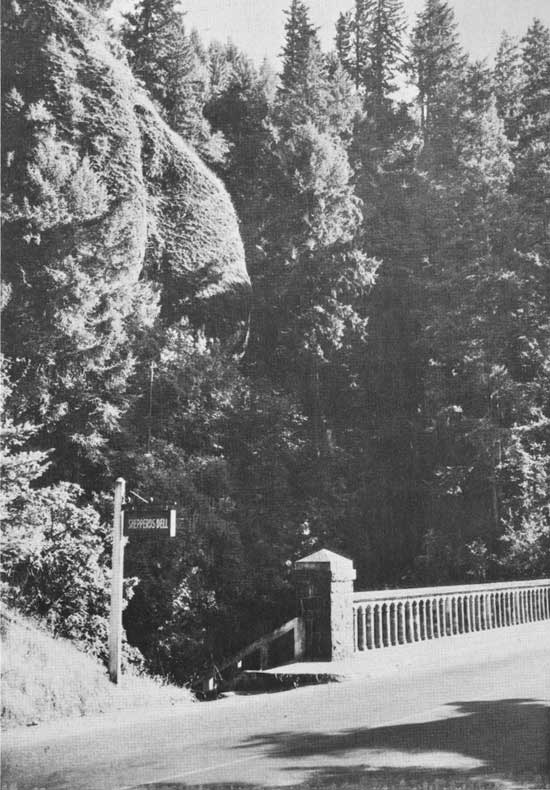
|
| Shepperd's Dell State Park and old highway bridge. |
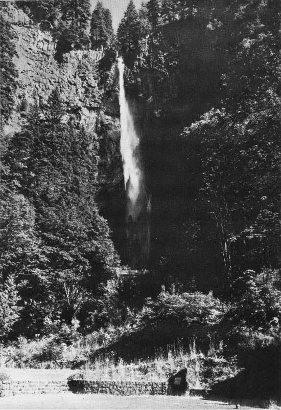
|
| Multnomah Falls. |
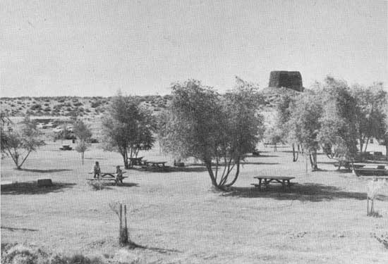
|
| Hat Rock State Park—Picnic area and rock. |
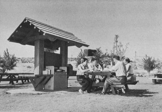
|
| Hat Rock State Park—Picnic area, rock and gas stove. |
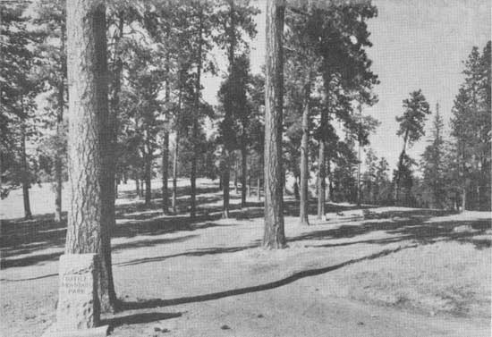
|
| Battle Mountain State Park—Use area. |
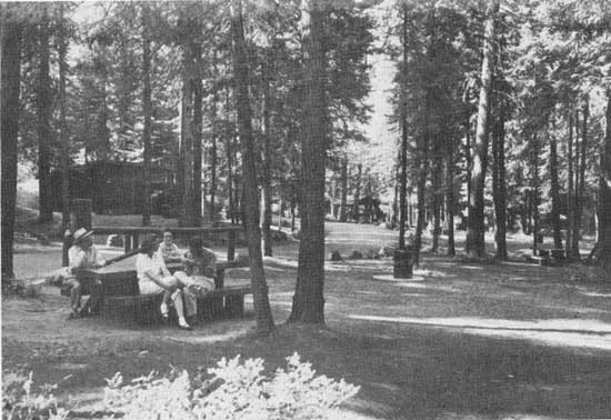
|
| Emigrant Springs State Park—Picnic area. |
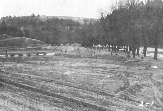
|
| Hilgard Junction State Park—Picnic area and Grande Ronde River. |
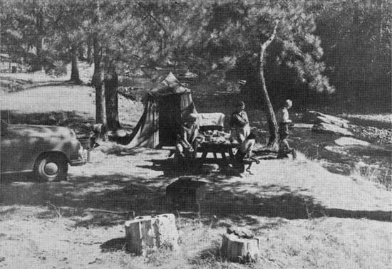
|
| Catherine Creek State Park—Overnight tent site on Catherine Creek. |
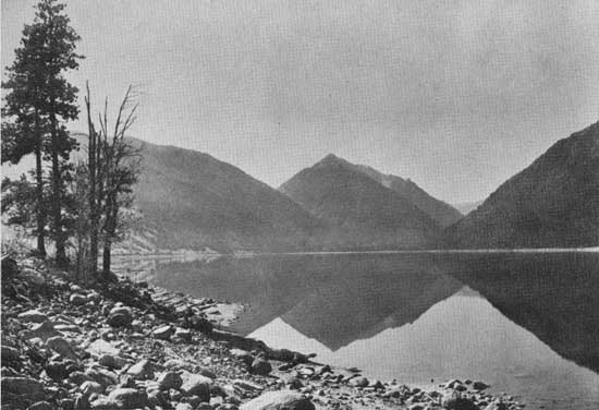
|
| Wallowa Lake State Park—Wallowa Lake. |
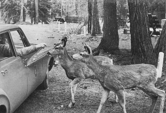
|
| Wallowa Lake State Park—Local park visitors. |
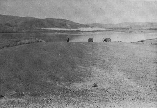
|
| Farewell Bend State Park—Boat Ramp and Snake River. |
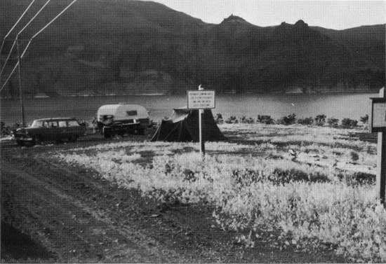
|
| Lake Owyhee State Park—Overnight camp near Cherry Creek area. |
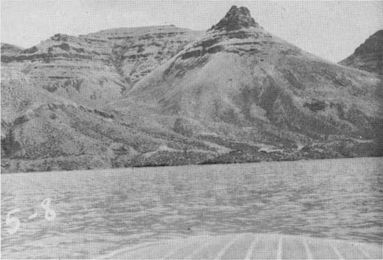
|
| Lake Owyhee State Park—Canyon wall and lake. |
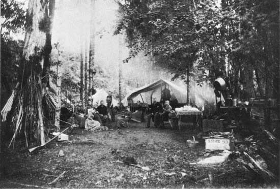
|
| State parks weren't so numerous in earlier days but they were still popular places for family outings. |
Saddle Mountain State Park
Saddle Mountain State Park is located at the end of Saddle Mountain Road in central Clatsop County, approximately seven miles north from a point on Sunset Highway 26 near Necanicum Junction. The park contains the high peak known as Saddle Mountain.
The first land acquired for this park was a gift of 1,280 acres from O. W. and Nellie Taylor on November 21, 1928. Another gift of 1,401.96 acres was received from the State Land Board on December 5, 1935. Five purchases were made, amounting to 372.05 acres, increasing the park land to a total of 3,054.01 acres at the close of 1963.
The land received from the State Land Board was a gift to the state from the U. S. Government. It had been set aside by the government on August 11, 1916, to be preserved as a park area. The State Land Board believed that the Highway Commission, through its Parks Division, was in a much better position to care for the area.
The state leased 15 acres of land near the junction of Saddle Mountain Road and Sunset Highway for use as a Civilian Conservation Corps camp in June, 1935, at a cost of $250 per year for a two year period. The CCC's did considerable work in the park during their stay, including the 7.25-mile entrance road and a trail to the top of Saddle Mountain.
Several applications to haul logs over the park entrance road have been rejected as the road is not suitable for that purpose.
The principal attraction of this park, one from which the area derived its name, is Saddle Mountain, an unusually descriptive name for the 3,283-foot double peak. Splendid views can be had in all directions from the mountain top. Several snow-capped mountains in Washington and Oregon are plainly visible on clear days, as well as miles of shore line along the Pacific and the broad mouth of the Columbia River with its boat traffic moving in and out to sea. Approximately 100 feet below the highest peak of Saddle Mountain is a spring from which a forest lookout station atop the mountain gets its water. The spring flows very steadily all year, while other springs and creeks down the gulches of the mountain dry up soon after the end of the rainy season.
After a visit to the park and a climb to the top of Saddle Mountain Peak on June 19, 1947, (the leisurely trail climbing time was two hours and fifteen minutes), W. A. Langille wrote the following about the flora on the mountain: "The broken slopes of Saddle Mountain are reputed to be a favorite hunting ground for botanists. It is alleged that some 2,000 specimens of flora have been classified. Many growing there are not found elsewhere in this region. Most notable among these is the highly prized, exceedingly rare Crucifer, Cardamine pattersonii, which scientists declare grows nowhere else but on this mountain, where it was first found by the indefatigable Professor Henderson."
Logging activities in the vicinity of the park and to the very base of the mountain, during the years 1920 to 1930, greatly reduced the splendid forests of spruce, hemlock, fir and cedar which once covered the land. State laws required the burning of debris. Reproduction was making a good showing when several fires in the area, one in particular which occurred on Thanksgiving Day 1936 and another in 1939, caused considerable damage to the young trees and the few remaining stands of older trees. Reforestation has since been very good.
As many as 70 elk in one herd have been counted as recently as 1950 as they roamed the mountain slopes. Even the Albino elk, now a rarity, have been seen in the herd. This number, however, may have been reduced through natural causes or hunting.
Improvements at the park include the entrance road, car parking area, trail to the top of the mountain, sanitary facilities and a small picnic area with tables, benches and stoves, all constructed by the CCC. The state forces constructed a Quonset hut in 1948, a water storage reservoir and a small overnight camp with six tent sites, and developed a water source.
Attendance during 1963 totaled 26,492 day visitors and 463 overnight stays.
Permits as follows affect this park:
| Number | Date | Name | Expiration |
| PF 242 | 8-7-53 | State Board of Forestry—fire lookout building | As long as needed |
| 448 | 12-1-61 | Crown Zellerbach Corp.—road crossing | Perpetual |
Samuel H. Boardman State Park
Samuel H. Boardman State Park is located north of the city of Brookings in Curry County. It begins approximately four miles north of the city and extends northerly approximately 11 miles to Crook Ranch.
The first acquisition for this coast line park was 121 acres, purchased in May, 1949, from Geneva Bell Nichols at a cost of $12,159. Twelve other purchases followed, the most recent of which was 83 acres from the Bureau of Land Management in May, 1957, at a cost of $14,860. One small tract, being 3.6 acres lying on the east side of the highway and of no value to the park, was sold in December, 1958.
Another tract, 304.10 acres to parks and 62.90 to right of way, was a gift from the Borax Consolidated, Limited, of London, England, in 1950. Milo K. McIver, a State Highway Commissioner at the time, honored the officials of Borax Consolidated in November, 1950, by personally accepting, at their London office, the deed from the English concern conveying the land to the State of Oregon, and at the same time delivering to them a letter from the Highway Commission accepting their generous gift.
Among the reservations in the deed from Borax Consolidated is a proviso retaining all under-surface minerals and the right to mine for such minerals. The Borax Consolidated had acquired the land in the early 1880's for the purpose of mining certain minerals.
Total acreage in the park at the close of 1963 was 1,473.33 acres.
The park land extends from the highway to the ocean and includes the offshore rocks. Panoramic views of the ocean are excellent from a number of widened places along the highway. There are several short streams flowing across the park land, none of which is of importance to recreation. Part of the area is covered intermittently with trees and other indigenous growth. A large portion is bare.
The rough, craggy coast line is broken by some short, sandy beaches which can be reached by trails, particularly at the southern end of the park. The principal attractions are the ocean views, sea birds, sea mammals and offshore rocks, including Mack Arch, opposite the northern end of the park land.
A plaque has been placed in the park commemorating the gift from Borax Consolidated, Limited, of London, England. It was placed near Lone Ranch Creek at the southern end of the gift area. Dedication was in May, 1962. The gift from Borax Consolidated bears the distinction of being the first grant made by an alien owner in the history of the Commission.
An existing grazing lease on the Borax land was extended for a 10-year period subject to vacating when needed. The lease terminated on September 30, 1961, and was not renewed.
The State Highway Commission named this park in August, 1950, to honor Samuel H. Boardman, Oregon's first State Parks Superintendent, who promoted and developed from infancy many parks and recreational areas within the boundaries of the state.
Improvements at Boardman park include several widened places along the highway, extension of roads to viewpoints, construction of roads to such outstanding viewpoints as the one near the beach at Lone Ranch Creek and another at Whales Head Creek. Complete picnic facilities have been installed at three places—Lone Ranch Creek, Whales Head Creek and House Rock, sometimes referred to as Windy Point, located two miles north of Whales Head. Picnic facilities include car parking area, water and sanitary facilities, tables, stoves and trails to the ocean beaches.
Attendance during 1963 at the three facilitated areas in the park totals as follows:
| Lone Ranch | 56,768 day visitors |
| House Rock (Windy Point) | 35,472 day visitors |
| Whales Head | 56,344 day visitors |
| Total | 148,584 day visitors |
Overnight camping facilities have not been provided.
Permits as follows affect the park:
| Number | Date | Name | Expiration |
| 15881 | 9-30-51 | Borax Consolidated—residence, farming and grazing | 9-30-61 (not renewed) |
Sarah Helmick State Park
Sarah Helmick State Park is located on the old route of Pacific Highway 99W, six miles south of Monmouth, on the banks of the Luckiamute River in Polk County.
Sarah Helmick Park has the distinction of containing the first land given to the State Highway Commission for park purposes. This gift was two tracts of land totaling 5.46 acres from Sarah Helmick and James Helmick, mother and son, on February 15, 1922. An additional 23.65-acre tract was purchased in February, 1948, and still another tract, containing 1.70 acres, was a gift from William and Mary Weist in October of that same year. The park contained a total of 30.81 acres at the close of 1963.
Acceptance of this early-day gift was principally to provide the traveling public a place to rest or stop overnight. The wooded area beside the clear, cool water of the Luckiamute River was a delightful place for such purposes. Tree cover is mostly maple, fir, ash and willow, with such small shrubs as salmonberry and snowberry for undergrowth. There is one large yew tree growing in the park area which measures 37 inches in diameter. It is said to be one of the largest of its species known to man.
The terrain is fairly level, except where the Luckiamute River cuts through the park land forming abrupt banks approximately 20 feet high. During the winter rainy season the area usually floods for a few days. These floods generally occur during the month of January.
The park was named in honor of the donor and the Helmick family. Sarah Helmick, or Grandma as she was known to all her friends and acquaintances, was a pioneer to Oregon, having crossed the plains from Iowa by oxen-drawn covered wagon in 1845. It is said they lost all of their possessions at Cascade Rapids.
The United States Army was given a permit dated October 14, 1940, to use the area for the duration of the war and six months thereafter. It terminated on July 13, 1949.
A well was drilled at this park during 1937 but the water could not be used because of its salt content.
Improvements are an entrance road and circular road throughout the park, car parking spaces, guard fences, electric stoves, tables, benches and sanitary facilities. Water is pumped from the river through a filtration plant. Underbrush was cleared away and the picnic area seeded to grass. A swimming place in the river was prepared. For many years a small area was used for overnight camping by large groups but the demand for such use diminished greatly so the area is now used in connection with the picnic facilities.
Attendance at the park during 1963 was 89,032 day visitors. No overnight camping facilities are provided.
Seal Rock Wayside
Seal Rock Wayside is located on the west side of U. S. Highway 101, approximately ten miles south of the city of Newport in Lincoln County.
The first area acquired for this wayside was a gift of 0.24 of an acre in 1929 from Lincoln County. Two purchases were added, one in September, 1936, containing 4.69 acres, and the other in June, 1942, of 2.87 acres, making a total of 7.8 acres in the wayside at the close of 1963.
These lands were acquired to preserve the scenic viewpoint for enjoyment by the public. The panoramic views of the ocean, the coast line and the many offshore rocks which have long been a resting place for seals, sea lions and sea birds are outstanding. Extending north and south from the westernmost part of the park land is a chain of rocks paralleling the shore line for a distance of about two and one-half miles. This ledge of partly submerged rocks is known as Seal Rocks. Three of the larger rocks in the chain are known as Castle Rock, Tourist Rock and Elephant Rock, all of which were obtained by an Act of the 70th Congress on February 25, 1928.
Seal Rock Wayside was named for the chain of rocks fronting the area.
The park terrain is quite level and has a good covering of jack pine with creeping juniper, salal and similar shrubs as undergrowth. The abrupt, steep sides fronting along the ocean enhance the seascape views. South of the use area, the beach is rocky and can be reached via a good trail from the park land. The beach north of the park is exceptionally good. It is wide and lengthy, extending northward to Beaver Creek. Access to this northern beach, however, is not good.
Improvements consist of an entrance road, car parking area, trails and day use area with tables, benches, stoves and water. Water is supplied from a spring on state-owned land about 400 feet east of the highway and is piped to the picnic area.
Attendance during 1963 totaled 125,174 day visitors. Overnight camping facilities have not been provided.
Permits as follows affect this wayside:
| Number | Date | Name | Expiration |
| 400 | 3-2-38 | Lincoln County—pipe line | Indefinite |
| 1010 | 3-12-38 | O.S.H.D.—pipe line crossing | 3-12-63 |
Seneca Fouts Memorial State Park
Seneca Fouts Memorial State Park is located on U. S. Highway 30, (Interstate 80N), at Mitchell Point, approximately four miles west of the city of Hood River in Hood River County.
The initial acquisition of land for this park was a gift of 150.50 acres from Seneca Fouts, a Portland attorney, for development as a state park. The gift was made on his birthday, August 26, 1944, as a memorial to himself and he asked that the park be named Seneca Fouts Memorial State Park. The deed stipulates that an appropriate marker or plaque be erected and maintained on the property, that it is the wish and desire of this grantor that no person of Japanese blood be employed on said premises in any capacity, and that preference be given to veterans of the United States military service as employees in the development and maintenance of said park. The Highway Commission agreed.
Three additions have been purchased for this park. The first was 48 acres from the Oregon State Board of Forestry on March 10, 1959. The second was a 27-acre tract lying between the highway and the Seneca Fouts land west of Mitchell Point. It was purchased from Lawrence C. and Edna M. Johnson on January 14, 1961. The third was a 90-acre tract purchased from Albert W. and Maude M. Peters on December 17, 1963, at a cost of $3,189.06. Total acreage in the park at the close of 1963 was 315.50 acres.
Preservation of the timbered hillside and other scenic aspects of that part of the Columbia River Gorge prompted acquisition of this park land. Mitchell Point, a high rock promontory overlooking the Columbia River at the north edge of the park land, offers panoramic views of the surrounding country, such as Mt. Adams, Beacon Rock and other high points on the Washington side of the Columbia River.
The only development at this park is a trail to the top of Mitchell Point. The marker, as stipulated in the deed, has not been erected.
No active use is made of the area; therefore, visitor attendance has not been recorded.
Shelton Wayside
Shelton Wayside is located on both sides of John Day Highway 19, approximately 11.5 miles south of the city of Fossil, on the southern slope of a ridge, or spur, of the Blue Mountains between the John Day River and Lone Rock Creek in Wheeler County.
One parcel of land, containing 3.38 acres, was a gift from the Kinzua Lumber Company in April, 1927. The deed states that the land shall be forever used only as a public park and the area shall be forever known as Shelton Park. A few other stipulations are cited in the deed. Another tract, containing 176.62 acres, was purchased from the Kinzua Lumber Company in January, 1930, at a cost of $5,000. A total of 180 acres comprised the wayside as of the close of 1963.
Preservation of the stand of beautiful evergreen trees on the property prompted both the gift and the purchase of the land comprising the wayside.
The terrain is gently rolling, sloping toward a branch of Service Creek which flows the entire length of the park land. The tree cover is mostly ponderosa pine with a few scattered juniper and Douglas fir trees and some native shrubs as underbrush. This wayside, located in a beautiful setting, is used quite extensively by hunters as well as highway users.
Improvements are an entrance road, car parking space, tables, benches, fireplaces, water and sanitary facilities. Basic facilities for an overnight camp, containing 20 tent sites, have been constructed. A logging road was constructed across the park land in compliance with the deed.
A plaque was erected at the use area in compliance with a request of the Kinzua Lumber Company that the park be named in honor of L. D. W. Shelton, an Oregon Pioneer of 1847 and a resident of the area who was a surveyor, soldier and a gentleman. An arch was placed on the north side of the road honoring Oregon Pioneers but it has been removed and not replaced.
Attendance during 1962 was 7,176 day visitors and 1,697 overnight stays. Day visitors were not counted in 1963, but a total of 2,143 overnight stays were recorded in 1963.
Permits as follows affect this wayside:
| Number | Date | Name | Expiration |
| 355 | 2-26-54 | Kinzua Corp.—road crossing | 12-31-63 |
| 5500 | 3-18-59 | Fossil Tel. Ex.—telephone line | Indefinite |
Shepperd's Dell State Park
Shepperd's Dell State Park is located at Youngs Creek, approximately 27 miles east of the city of Portland, on the Columbia River Scenic Highway in Multnomah County.
The first area obtained for this park was 10.03 acres, first given to the city of Portland by George G. Shepperd on May 6, 1915, as a memorial to his wife, and then from the city to the state on September 4, 1940. Seven additional areas were purchased from 1952 to 1962, ranging in size from one acre to 187 acres. One exchange of land was made with Fritz Luscher, whereby Mr. Luscher gave to the state 6.25 acres of timberland in exchange for 12 acres of grazing land from the Rooster Rock State Park area. These transactions made a total of 292.29 acres in the park at the close of 1963.
Preservation of the small, picturesque area, which had long been known as Shepperd's Dell, was the reason for acquiring the first parcel of land. The park is named for this area. The idea was expanded in about 1953 to include preservation of the scenic features of the Columbia River Gorge.
Shepperd's Dell itself is a comely, rock-bound, sheltered nook, located near the highway, through which flows Youngs Creek in a series of rapid cascades and small falls that tumble in almost every direction in the stream's course. The tree-shaded, fern-covered slopes of the creek gorge, dotted with an outcropping of dark-colored rocks, are surprising to the highway traveler going in either direction as he emerges into the area from along the side of an almost vertical wall of massive basalt. The highway bridge, a narrow, early-type, arched structure with high railings spanning Youngs Creek, offers excellent views of the creek, the dell and the Columbia River.
Improvements include a small roadside car parking area, trails along the creek to the larger falls and a marker indicating that George Shepperd donated the original tract to the city of Portland in 1915.
No active use has been made of the area.
Sheridan State Park
Sheridan State Park is located on both sides of Interstate Highway 80N, approximately 40.6 miles east of the city of Portland, between Bonneville Dam and the city of Cascade Locks in Hood River County.
The entire park land, 11.5 acres, was purchased from Oregon-Washington Railway and Navigation Company on April 24, 1923, at a cost of $1,080.
Acquisition of the area was to assure preservation of the historic point where Philip Henry Sheridan, who, as a lieutenant with a small force of soldiers and civilian volunteers, crossed from the Oregon shore to assist the beleaguered citizens on Bradford Island who had been attacked by some two or three hundred Yakima Indians on March 26, 1856, two days previous to Sheridan's arrival. As told by Captain Lawrence Coe in Gaston's Centennial History of Oregon, Lieutenant Sheridan came up from Fort Vancouver on the steamer Belle, picking up a group of civilians on the way who readily volunteered to join him in the conflict. Troops also came from Fort Dalles and were joined by volunteers from Portland and elsewhere. The Indians were soon defeated, but not until there had been a considerable number of casualties on both sides.
Sheridan State Park was selected as a name for this area partially because it was a fitting name to mark the historic river crossing and to honor the brave and fearless lieutenant who did such efficient and courageous work against the Indians and who later was made a General for his great work in the Civil War.
The park area offers excellent views of the Bonneville Administration site toward the west, the Bridge of the Gods toward the east and the Columbia River Gorge which confines the huge body of water behind Bonneville Dam and completely obliterates the Cascade Rapids.
Improvements are trails throughout the area and a few picnic tables and benches.
Use of the area has been small; therefore, no count of the visitors has been made.
Shore Acres State Park
Shore Acres State Park is located on both sides of Cape Arago Secondary Highway, adjoining Cape Arago State Park, approximately 12 miles west of the city of North Bend in Coos County. It is on the seaward side of the Seven Devils peninsula which lies between South Slough and the ocean.
The first acquisition for this maritime park was 637.03 acres, purchased from Louis J. and Lela G. Simpson on December 10, 1942, at a cost of $29,000. An additional tract, containing 46.39 acres, was purchased from a family of Indians through the U. S. Department of Indian Affairs on July 31, 1954, at a cost of $10,043.50 for a fraction ownership. Two persons, not Indians, representing 33/105 shares, were never found and probably never will be located; therefore, deeds covering their shares were not secured. Park land on December 31, 1963, totaled 683.42 acres.
A small parcel of land owned by John B. and Julia Keizer, lying west of the Indian land, was not purchased because of the uncertainty of its size and the inability to determine whether the land had or had not been entirely eroded by wave action. Mr. Keizer did not care to establish the lines, and unless the lines were established the Commission did not wish to pay the $20,000 requested.
This spectacular stretch of ocean shore line was once an estate noted for its unusual botanical gardens. Many of its flowering trees, shrubs and plants were brought from far places in the sailing schooners made famous by the "Cappy Ricks" sea tales. Sam H. Boardman, Oregon's first State Parks Superintendent, described it as follows: "The shore line is distinctive in character. A sandstone bluff some forty to fifty feet in height challenges the sea in its onward rush. Through incessant attacks, the sea has undermined large slabs of sandstone, tilting them seaward at a reclining angle of forty-five degrees. In this formation is the setting for one of the most spectacular wave-breaking actions found on our coastline. The waves break against the reclining slab, spray high into the air, then cascade down the slab into the hollow, its final fury spent against the mother bluff. With a turbulent sea, a norther, wind flaking the comber tops, Father Neptune puts on a breath-taking show. Spray fifty feet in the air accompanied by the roar of the breakers will long linger in your memory. For seascape photographers, the Rembrandt of the sea awaits the click of your camera."
An observation shelter located on level ground less than one hundred feet away from the brink of this sandstone bluff supplies the park visitor a grandstand view of the ocean's spectacular exhibition. An extensive garden area borders the ocean, occupying a portion of the fairly level land which gradually narrows in its southern trend and is bounded on the east by an elevated, fire-scarred and snag-ridden ridge that swings westward and merges into the bold Cape Arago promontory with its challenging coastal views. Reforestation has been started and the northern end of the park land is covered with spruce trees.
W. A. Langille, Oregon's first State Parks Historian, had the following to say regarding this park: "Shore Acres is the name given to the property by its former owners, members of the well-known Asa M. Simpson family, who were prominent, early day lumbermen and ship builders in the Coos Bay area. These former owners were aesthetic minded people with a penchant for the beautiful things of nature. At the end of a flowered and tree-bordered garden lane which leads to a high promontory at the southern end of the park, once stood the Simpson home mansion. This large, unpainted, three story structure was over one hundred feet long, had fifteen guest rooms, a large living room with a huge fireplace that radiated cheer, a dining room, appurtenant housekeeping quarters, and a large, concrete swimming pool in the basement with a connected heating plant for tempering the water and also providing hot water for showers and domestic use." This home was acquired with the purchase of the land.
Soon after the property was acquired by the state in 1942, it was taken over by the military defense forces, and the Simpson manor was occupied as their local headquarters during 1943, 1944 and a part of 1945. During this period lookouts were continuously stationed on the high Cape Arago Park promontory to the south, and an around-the-clock sentry post was maintained on the park road covering the important observation point which protected the southerly approach to the entrance of Coos Bay from which almost steady lumber shipments were being made. Rapid deterioration of the large structure during this period, combined with the great expense of restoration and maintenance brought about the decision in 1948 to raze the building.
Reconditioning the long-neglected gardens was undertaken by the state in 1942 under the skillful guidance of Anton Jensen, a qualified florist and gardener already on the state's payroll. The beautiful flowers, trees and shrubs decorating the park today are mute evidence of his success with the aid of many others in this chore. C. Lee Wilson of Oswego generously gave 2,000 small camelia plants to adorn the attractive garden in 1948.
A small meadow lying south of the developed area in the park produced a hay crop each year from 1943 to 1948. Revenue from the sale of the hay netted from $68 to $120 annually.
The Commission entered into an agreement in 1960 for the West Coast Telephone Company to extend its telephone line a distance of approximately one mile, at an estimated cost to the state of $1,000, and to render future service for the entire line to the park. The state, for many years previous, had been utilizing poles owned by the U. S. Coast Guard, and such use was no longer possible as the telephone company could not service the state's line on Coast Guard poles.
A small parcel of land was leased to the U. S. Navy for experimental radio work during the years 1956, 1957 and part of 1958.
Improvements include entrance roads, two car parking areas, tables, benches, stoves, sanitary facilities, two residences for park personnel, glassed observation building, trails, two water storage reservoirs and pipe lines to the park, fences, reforestation and the planting of many flowers and shrubs.
Attendance at the park during 1963 totaled 151,104 day visitors. Overnight camping facilities have not been provided.
Silver Falls State Park
Silver Falls State Park is located on both sides of Highway 214, approximately 28 miles east of Salem and 15 miles southeast of Silverton in Marion County.
The first acquisition for this park was 90 acres, purchased from George and Anna Parkhurst on April 3, 1931, at a cost of $2,000. It was followed by 34 more purchases and gifts. There were two gifts from Marion County, one was 0.11 of an acre and the other was the right of way for a park entrance road near the South Falls. The National Park Service gave 5,989.58 acres to the state in 1948 and 1949, of which 2,000 acres were O. & C. land obtained by Congressional action. The deeds contain a reversionary clause relating to the continued use of the land for recreation purposes. This O. & C. land was the recreation demonstration project on which was constructed two youth camps—one camp for boys with a capacity of 121, the other for girls with a capacity of 65. The park contained a total of 8,059.27 acres at the close of 1963.
A proposal to consolidate the park holdings at Silver Falls in 1951 had the approval of the Highway Commission and the National Parks Service. It was proposed to sell, or trade, part of the isolated tracts located east of the park and acquire all of the land located within the park boundary. The land surrounded by park land was acquired and a reversionary clause in favor of the U. S. Government was included in order to satisfy the federal requirements. This reversionary clause was later removed from a 40-acre tract in Section 7 and the N1/2 of NE1/4 of Section 17, Township 8 South, Range 2 East of Willamette Meridian. These transactions were in accordance with a 1950 federal law relating to straightening of park boundaries of lands originally purchased from the federal government. All of the timber on the west one-half of the area in Section 17, except a seed block, was sold in September, 1953.
Acquisition was to preserve a natural, scenic attraction located in the deep gorges cut in the lava rock by the north and south forks of Silver Creek. The dominant and most attractive physical features of the park are its two beautiful canyons with their 14 waterfalls grouped in a comparatively small and readily accessible area. The focal points of the area are nine of the waterfalls which are classed as outstanding, each with a drop from a few feet to 178 feet. The canyons are narrow and V shaped. North Silver Creek canyon contains five falls, and one each on the small tributaries Winter Creek and Hullt Creek. South Silver Creek canyon contains two falls, and there are five minor falls below the junction of these two main streams.
It has been said that people have a fondness for falling waters and, great or small, they are everywhere given recognition, holding a degree of interest corresponding to their accessibility, height and water volume. All the water falls in Silver Falls Park, individually and collectively, have their charm and appeal, yet unquestionably South Falls has first place in the hearts and minds of the visiting public. Most of the park improvements are centralized at South Falls. With these thoughts in mind, the Highway Commission named the area Silver Falls State Park on December 3, 1931, thus continuing the name by which the area was already well known.
The terrain is rolling to mountainous. The elevation varies from approximately 700 feet at the bottom of the canyons to nearly 3,000 feet on the hilltops near the northeast and southeast corners.
Drainage is by Silver Creek, through its gorges below the first falls on each fork of the stream. A softer strata of rock beneath the basaltic rock has easily eroded to an extent that a cave-like formation has occurred under both the North and South Falls. This has caused some people to believe that caves exist elsewhere, but, at the present time, there is no other evidence to substantiate the thought.
The Silver Creek watershed area was at one time heavily forested with a splendid stand of evergreens. Logging operations and subsequent fires have greatly reduced the forest. The tree coverage on the park land is dominantly Douglas fir. Others such as White fir, Western hemlock, Western red cedar, maple, alder and a few Western yew can be found within the bounds of the park. The undercover is salal, huckleberry, thimbleberry, rhododendron, fern and a lush growth of the colorful vine maple. An abundance of wild flowers can be found in the park.
An agreement with the Works Progress Administration to construct some myrtlewood furniture for use at Silver Falls Park lodge was signed in November, 1939. The project was completed the following year.
Two leases to a concessionaire on land located near the park entrance were purchased by the state in May, 1941, at a cost of $1,000.
A lease on the large concession building, constructed in the park by the Civilian Conservation Corps, was given in 1949. The concessionaire continued on an annual basis until 1953, at which time the lease was relinquished. Another contract, also on an annual basis, was entered into with J. L. Campbell in 1954. Mr. Campbell still operates the concession.
The Salem Y.M.C.A. was granted a continuing lease to operate Silver Creek Youth Camp at rates sufficient to cover the cost of operation. The fee schedule is adopted annually. The lease was first granted by the National Parks Service about 1946 and continued to the present time by the Oregon State Highway Commission.
The Silver Creek Youth Camp was favored with a swimming pool constructed by the Y.M.C.A. under an agreement of March, 1956. A $700 credit was allowed the Y.M.C.A. each year for ten years, after which the pool will become state-owned property.
An unintentional encroachment onto park land was made by a logging company and settlement was made in May, 1955, for the timber cut. An encroachment by another company was made in 1949 and collection was pursued but settlement never received.
The camp buildings used by the Civilian Conservation Corps were turned over to the state in December, 1942. These buildings were later remodeled into a youth camp with 200 capacity. Summer use of this camp, now the North Falls area, was granted on a day or week basis to church organizations in 1947 at a cost of 15 cents per person.
The Conservative Baptist Association contracted in 1955 to manage the North Falls Youth Camp and arrange for other group use during a part of the summer vacation season. The church also agreed in April, 1955, to construct a swimming pool at an estimated cost of $8,000. Credit for the construction was to be made so the cost would be written off in ten years. It has been a pleasing and successful operation. The pool is to be state property at the end of the 10-year period.
The state built a recreation hall at the North Falls Youth Camp in 1956.
In order to serve the expanding needs for electric power at the park, an agreement with Portland General Electric Company was entered into in May, 1941, for extension of the line. The state paid the costs. The Portland General Electric Company purchased this line from the state in December, 1949, and also contracted to extend their power lines to serve each youth camp. Construction costs were paid by the state but the Electric Company is to maintain the line.
An agreement with Valley Telephone Company of Silverton was entered into in 1960 to extend service to the three youth camps. The state reimbursed the company for such cost to the extent of $2,000, and sold to the company all salvageable material from the old abandoned line.
The Commission approved the bids and let a contract for construction of an overnight camp in May, 1951.
The National Fish and Wild Life Service was granted permission in November, 1948, to trap predatory animals in Silver Falls Park.
That portion of County Road No. 884 lying within the park boundaries was vacated by the County Court on September 12, 1957, and the state is to maintain the vacated portion.
The Commission approved a request from the Bureau of Land Management in August, 1959, for a road easement across the south and west edges of the park.
Park improvements include four youth camps, two of which were constructed by the Works Progress Administration (WPA) through the National Parks Service. The third camp utilizes the old Civilian Conservation Corps (CCC) buildings, and the fourth is the farm buildings in the central part of the park. There is a 50-unit overnight camp, containing 41 tent sites and 9 trailer sites; also a group camp to accommodate 50 people. These camps are fully equipped.
Other improvements include a large concession building, sanitary facilities, sewer system, electric stoves and stove shelters, tables, benches, water system with reservoirs, park headquarters, three residences and the necessary storage buildings. There are two small homes near the CCC camp, fire roads and fire breaks throughout the timbered area, property fences, service roads and trails. A four and one-half mile trail was constructed down the South Fork canyon and up the North Fork canyon to North Falls, and short trails were built to Upper North Falls and Winter Falls, and from Winter Falls to North Fork trail.
Attendance during 1963 totaled 305,560 day visitors and 12,797 overnight stays.
Permits as follows affect the park:
| Number | Date | Name | Expiration |
| P-525 | 5-6-53 | L. D. Gibby?—log road-forest protection | Perpetual |
| 603 | 8-13-59 | Bureau of Land Mgmt.—logging road | 12-31-63 |
| 2200 | 3-25-60 | P.G.E.—elec. service all youth camps | |
| 10-28-38 | P.G.E.—power and power lines | ||
| 2-29-51 | P.G.E.—power line const. | ||
| 12-11-53 | P.G.E.—brush control | ||
| 5754 | 8-5-60 | P.G.E.—power line | Indefinite |
| Letters | 12-10-57 | Interurban Tel. Lines—phone line | " |
| 2220 | 5-16-60 | Valley Telephone Co.—Metallic circuit-Youth Camps | " |
| 1695 | 9-20-55 | Conservative Baptists—swim pool North Falls | 9-20-65 |
| 1760 | 7-6-56 | Salem Y.M.C.A.—swim pool Silver Creek | 7-6-66 |
| Letter | 1-6-59 | State School for Deaf—use of pool tables and other equipment | Revocable |
| 1821 | 1-17-61 | J. L. Campbell—Silver Falls Lodge | 12-31-64 |
| 18503 | 1-19-62 | Bureau of Land Mgmt.—road easement and forest protection | 1-19-67 |
Simpson Wayside
Simpson Wayside is located on the northern end of the peninsula forming a part of the city of North Bend in Coos County. It lies on both sides of Coast Highway 101 at the south end of Coos Bay bridge.
The first area obtained was a gift of 44.30 acres from L. J. Simpson through the city of North Bend on May 12, 1936. It was a city park, with no improvements, located in the city of North Bend. The area had been known for some time as Simpson Park so the Commission continued that name.
At the request of North Bend, two areas were returned to the city. One parcel, containing 3.51 acres located east of the 200-foot highway right of way line and south of the old ferry road, was deeded to the city in 1937. The other parcel, containing 16.5 acres located between the old ferry slip and a circular road near the east edge of the highway right of way, was deeded to the city in 1957. These two transactions left 24.29 acres remaining in the park at the close of 1963.
The area is covered with a heavy growth of cedar, fir and spruce. The undergrowth is rhododendrons, huckleberry and similar shrubs.
The terrain is level with abrupt, precipitous slopes toward the bay on the north and west sides. A deep cut for the Southern Pacific Railway forms the south boundary.
Heavy storms during the winter of 1951-52 felled many trees in the area. The timber was sold to the highest bidder on March 7, 1952, at a price of $220.
Improvements consist of a circular road through the west area, continuing on beneath the bridge and returning via the semi-circular road along the east side of the park. Rhododendrons, azaleas and many other shrubs were planted. The usual picnic facilities were installed.
Attendance during 1962 totaled 12,792 day visitors. No count was made in 1963.
The following permits affect this property:
| Number | Date | Name | Expiration |
| 3081 | 10-12-54 | Weyerhaeuser Timber Co.—road crossing | Indefinite |
| 4873 | 7-30-56 | Pacific Power & Light Co.—line crossing | " |
Sisters State Park
Sisters State Park is located at the junction of Highways 20 and 126, adjoining the east edge of the town of Sisters in Deschutes County.
This 41.38-acre park was purchased from Louis W. Hill on December 4, 1939, at a price of $1,532. The cost was figured at the rate of $4 per thousand for 383M B.M. of yellow pine timber growing on the land. The deed states that the area must be used as a state park or for public purposes only.
A twofold motive prompted acquisition of this timbered area. One was to preserve the fine stand of large yellow pine trees for the enjoyment of the present as well as future generations. Large yellow ponderosa pines are an unusual sight to many people. The second reason was to prevent undesirable use of the area which might create a traffic hazard.
The soil in this park is an alluvial formation and is quite level with only a slight slope toward Squaw Creek which flows through the picnic area. Early Indian trails converge in this vicinity. One came from the northeast, Tumalo Creek, another from the north, The Dalles a third from the southwest, Sparks and Green Lakes, and the fourth from the west, or Scott Trail as it was later known.
The park was named for the adjoining town. The town, Sisters located east of the summit of the Cascade Range of Mountains, was named for the imposing nearby peaks—Three Sisters.
Improvements consist of an entrance road, small area for car parking, tables, stoves, benches, fireplaces and lavatory facilities. Trails have been constructed throughout the area and a foot bridge across the stream connects the picnic areas.
Attendance in 1962 was 14,778 day visitors. No count was made in 1963. Overnight camping facilities have not been provided.
Smith Rock State Park
Smith Rock State Park is located seven miles northeast of the city of Redmond and three miles east, via a county road, from U. S. Highway 97 at Terrebonne in Deschutes County.
The first area acquired for this scenic park was 218.40 acres on May 9, 1960, purchased from the Lowell E. and W. E. Dent families at a cost of $4,350. Four additional tracts were purchased during 1960 and one in 1962, ranging in size from 0.28 of an acre to 80 acres. A gift of 76 acres from Harry H. and Diane C. Kem, Jr., was received December 28, 1962.
Negotiations had been started, however, to secure an additional 120 acres of Bureau of Land Management property for which the city of Redmond had already made application to acquire. These negotiations were completed on January 24, 1963, and the state reimbursed the city of Redmond the sum of $192, its cost in acquiring the land. As of the close of 1963 the park contained a total of 518.38 acres.
Incorporating the Smith Rock area into the state park system was urged by the Redmond Chamber of Commerce and supported by many Central Oregon Chambers of Commerce, city officials and private individuals. Preservation of the spectacular geological formations was the motive. These picturesque rocks, pinnacles and crags, chiseled by the storms of centuries, are much photographed by amateurs and professionals alike.
Israel C. Russell's U. S. Geological Survey report of 1905 makes reference to this particular part of the lower Crooked River as "Monument Canyon." In an article written by Joe Van Wormer after his first visit to the Smith Rock area he had the following to say: "In the bottom of the canyon, Crooked River winds and twists its way around the base of massive, everchanging, multicolored rocks that tower hundreds of feet in the air. There are great, slabsided rocks whose vertical walls look as if they had been cut with a knife, and in the brilliant sun they glow with a rich orange color. A short distance away there are dark, burnt-red slabs and farther downstream they pick up greens and purples."
These imposing rocks figured in the early history of Central Oregon. McArthur in Oregon Geographic Names states that in about 1863 a company of soldiers was camped nearby, during Indian troubles, and a soldier named Smith climbed upon the rock to get a view. A boulder that he stood on rolled from under his feet, and he fell and was killed. The rock was named Smith Rock because of this unfortunate incident. The park was named for this rock which it embraces.
A small, level area on the south side of Crooked River has been developed for public use. Improvements consist of an entrance road, a small area for car parking, tables, benches, stoves and trails throughout the park and onto the rocks. A large irrigation canal is tunneled through the northeast corner of the park land.
Attendance during 1963 totaled 31,552 day visitors.
Sodaville Springs State Park
Sodaville Springs State Park is located in the town of Sodaville, being all of Block 8 on the east side of County Road 31 in Linn County.
The State Highway Commission obtained the land from the Board of Control by Legislative Joint Resolution #6. The deed is dated January 20, 1947.
The property was first dedicated for perpetual public use on May 4, 1871, by Thomas Summers. The Legislature granted a charter in 1880 to the town of Sodaville and gave its three trustees authority to take possession of Block 8 containing a soda mineral spring. The State Board of Control assumed jurisdiction over the park in 1890 and managed it through committees appointed by the Governor. From time to time the Legislature appropriated funds in sums ranging from $500 to $2,000 for the perpetuation, improvement and maintenance of the area containing the public soda mineral spring. A square building with multiple floors was constructed over the spring in the year 1891. The lower floor is open-sided and at an elevation where water from the soda spring can be obtained by gravity flow.
The town of Sodaville was built around the mineral spring. Many visitors came to enjoy the therapeutic values of the water which they believed to be the elixir of life. Patronage was at its height in the 1890's, when, we are told, there were two hotels in the town and camping places were at a premium. People came from far and near and many made regular pilgrimages to drink the health-giving water.
Years ago when the town was dedicated, the area was named Sodaville Springs and the park has carried that title since that date.
The one block of land, containing one acre, slopes upward toward the east. It is covered with grass and a few trees are growing thereon.
A plaque honoring Thomas S. Summers was erected on the north side of the building in 1926.
The building has been used as the town office and by women's organizations and other group gatherings.
Visitors to the area in 1962 totaled 5,638. No count was made in 1963.
The following permits affect the area:
| Number | Date | Name | Expiration |
| 1479 | 9-14-53 | Sodaville—use of upper floor of bldg. | Revocable |
South Beach Wayside
South Beach Wayside is located on both sides of U. S. Highway 101, across the bay from the city of Newport, beginning at the south end of Yaquina Bay bridge and extending on south a distance of approximately 2,000 feet in Lincoln County.
The first area obtained was a gift of 11.26 acres from Lincoln County on December 5, 1933. There were nine other small areas acquired, two of which were gifts from Lincoln County, being a block in the platted area of Harborton and the vacated streets of that addition. A total of 15.65 acres comprised this wayside as of the close of 1963.
Acquisition of the area was for three principal purposes: (1) to protect the south bridgehead from undesirable developments, (2) to preserve the many large rhododendrons growing on the ridge west of the highway and south of the bridge, and (3) to retain the sandy beach area near Yaquina Bay for the enjoyment of the public.
The terrain south of the bridge is rolling sand dunes but the land to the north is level and sandy. The tree cover is second growth fir spruce, pine and rhododendrons.
A permit to use a small area, 50 x 200 feet, near the bay and east of the highway was given to Georgia-Pacific Plywood Company, a Georgia corporation doing business in Oregon under the assumed name of C. D. Johnson Lumber Company, in January, 1954, so that workmen loading lumber-carrying boats in the main channel might park their cars there during working hours.
The wayside was named after the adjoining platted South Beach area, a descriptive name for a community near the south side of Yaquina Bay.
No active use has been made of the property; therefore, no count of visitors has been made.
Permits as follows affect the wayside:
| Number | Date | Name | Expiration |
| 384 | 11-19-54 | Reuel A. Herb—road to private property | Indefinite |
| 397 | 6-27-55 | Reuel A. Herb—road to boat landing (Not utilized as of 12-31-62) | " |
| 4483 | 11-1-54 | Pioneer Telephone Corp.—telephone line | " |
| 351 | 1-11-54 | C. D. Johnson Lumber Co.—parking lot (Georgia-Pacific Plywood Co.) | " |
South Newport State Park
South Newport State Park is located between U. S. Highway 101 and the Pacific Ocean, approximately one mile south of Yaquina Bay at Newport in Lincoln County. It includes the original platted area of South Newport.
The park comprises approximately 214.74 acres as of the close of 1963. It includes the old platted area of South Newport and the platted area known as Pacific View.
The first land obtained comprised most of the platted area of South Newport and the accretion westerly of the U. S. Meander Line, amounting to 84 acres, purchased from Beatrice Crawford Drury and James C. Drury, at a price of $12,489 on May 26, 1955. Lands given to the state for this park are as follows:
| Donor | Acreage | Date | |
| Edith M. Bowman | 0.23 | acres in Pacific View | 10-14-55 |
| Lincoln County | 5.34 | acres in Pacific View | 12-4-57 |
| Wm. J. & Janet Wineberg | 11.23 | acres in Pacific View | 12-24-57 |
| Wm. J. & Janet Wineberg | 1.66 | acres in Pacific View | 5-12-58 |
| Wm. J. & Janet Wineberg | 0.28 | acres in South Newport | 5-12-58 |
| Wm. J. & Janet Wineberg | 0.23 | acres in Pacific View | 12-29-58 |
| Robert & Cherie Kiewel | 0.057 | acres in Pacific View | 2-21-61 |
| Lincoln County | 0.057 | acres in Pacific View | 9-28-60 |
| Lincoln County | 1.19 | acres in Pacific View | 7-5-62 |
| Lincoln County | 40.00 | acres tidelands | 1-23-63 |
An exchange of lands with Lincoln County in 1957 added 34.5 acres in the Pacific View area to this park and returned to the county a 40-acre tract, known as the Lincoln County Wood tract, which the county had donated to the state in 1940. The land returned to the county is described as NE1/4 of NE1/4 of Section 20, Township 11 South, Range 11 West of Willamette Meridian. One 0.50-acre tract was deeded back to the donor in order to correct the records.
There were 96 other purchases ranging in size from a fraction of an acre, one 25 x 100-foot lot, to as much as 7.35 acres. One 3.99-acre tract cost $10,000. Provisions have been made for two entrances into the park, one at the southeast corner and the other about one-fourth of a mile south from the northeast corner. The park contained a total of 173.508 acres at the close of 1962. One gift and six purchases added in 1963 increased the area to 214.748 acres at the close of 1963. The matter of acquisition is continuing as there are many lots yet to be purchased.
These lands are being acquired to preserve a broad expanse of sandy beach and to provide a highly desirable park in an area where more people wish to vacation than any like area on the Oregon coast, according to the studies made in recent years.
The name South Newport has not had the approval of the Highway Commission. It is presumed that the Commission may wish to adopt that name since it is a place name desirable for designating the park area.
The terrain is generally level with a reasonably high sand dune separating the proposed camp area from the beach. The dune is much higher at the northern end than at the southern part.
East of the sand dune, the cover is spruce and shore pine with an undercover of salal and other low-growing species indigenous to the coast.
The beach extends the full length of the property, plus several miles on south.
The principal attractions of the area are the sand dunes, the panoramic views of the ocean, views of the boat traffic to and from the Port of Newport and the fishing activities in Yaquina harbor.
No improvements have been made at this park as many of the lots to be acquired are scattered throughout the park area. No visitors have been counted as of the close of 1963.
Permits as follows affect this park:
| Number | Date | Name | Expiration |
| 5998 | 12-21-61 | Central Lincoln PUD—hwy. crossing & pole line | Indefinite |
Stage Coach Forest Wayside
Stage Coach Forest Wayside is located on both sides of Interstate Highway 5, at the Josephine-Douglas county line, near the summit at Stage Coach Pass, approximately 40 miles north of the city of Grants Pass in Josephine and Douglas Counties.
The first land in this wayside was a gift of 80 acres from Douglas County on October 16, 1945. The second acquisition was 151 acres purchased from Hazel B. Hewitt, and others, on October 20, 1945, at a cost of $6,000. A total of 231 acres comprised the wayside at the close of 1963.
Preservation of the beautiful stand of evergreen trees along the highway and adjacent hillsides for the benefit and enjoyment of the traveler prompted acquisition of this wayside as a roadside timbered tract. Such stands of roadside trees are always a joy to the daily traveler as well as to the tourist.
The terrain is generally rolling, but in some places becomes quite steep. Its cover is a good stand of Douglas fir trees.
The name Stage Coach Forest Wayside is indicative of the area. It is what the name implies, a forest wayside, and Stage Coach denotes the route of the early-day stagecoach road across the summit of the mountains between Wolf Creek and Cow Creek.
No active use has been made of the area.
Starvation Creek State Park
Starvation Creek State Park is located on the south side of Old Oregon Trail (Interstate Highway 80N), opposite mile post 53.2, approximately 10 miles west of Hood River in Hood River County.
The first land purchased for this roadside picnic area was 74.56 acres from Clara Nelson on August 7, 1930, at a cost of $1,864. Another tract, containing 72.26 acres, was purchased from Mrs. Nelson on July 18, 1938, at a cost of $230. The Highway Commission deeded 0.8 of an acre of land from the NE1/4 of Section 4, Township 2 North, Range 9 East W.M., to the Oregon-Washington Railroad and Navigation Company on April 9, 1940, for use in the realignment of their railroad tracks. Total acreage in the park at the close of 1963 was 146.02 acres.
Acquisition of this park land was to preserve for posterity the beautiful falls on Starvation Creek and the surrounding hillsides with their evergreen cover of fir timber. Almost the entire area is on the steep slope of the south side of the Columbia Gorge. Picnic facilities are nestled in a small nook not far from the base of Starvation Falls, an unusual, picturesque cataract which flows over a basalt ledge nearly 200 feet high, its fall being broken three times by protruding rocks.
Starvation Creek State Park was named for the creek and the falls by the same name. Oregon Geographic Names says, "Starvation Falls were so named because it was the place west of Dog (Hood) River that a party of pioneer travelers suffered because of some defection in their commissary." W. A. Langille once wrote "the original name of this creek was Starveout, so designated in the winter of 1884-85 when a deep snow stalled two trains in the immediate vicinity. Hood River men, using home made skis, were employed to carry food to the snow-bound passengers."
Improvements are an entrance road, car parking area, trail to the falls, and a small picnic area with tables, benches, fireplaces, water and sanitary facilities. The Civilian Conservation Corps did some of this work at the park.
Attendance during 1963 totaled 10,588 day visitors. Overnight camping facilities have not been provided.
Sunset Bay State Park
Sunset Bay State Park is located on both sides of Cape Arago Secondary Highway, immediately south of Cape Arago Lighthouse, 11 miles southwest of the city of Coos Bay in Coos County.
A gift of 48 acres from Coos County on February 19, 1948, was the beginning of this popular, bay-front, recreational area. Another gift of 0.46 of an acre from Ralph Barker on February 15, 1954, provided a site from which water was secured for the park. The purchase of 17.1 acres for use as an overnight camp site was completed on August 6, 1957, at a cost of $6,500 after a condemnation suit in 1952 set a price of $25,000 for the land. An additional 22.08-acre tract was acquired from the U. S. Bureau of Land Management in October, 1957, at a cost of $7,931.40, after many years of negotiating with that organization. This was a much-needed, pine-covered tract, the southern half of the peninsula on which the lighthouse is located. An additional 47-acre tract was purchased on June 28, 1963, at a cost of $33,500. The park contained a total of 134.64 acres at the close of 1963.
A desire to place the land surrounding beautiful Sunset Bay in public ownership for use and enjoyment by the general public impelled the Highway Commission to acquire this area. The bay itself is a wind protected cove, miniature in size, with precipitous sandstone bluffs, a narrow passageway to the open sea and a sandy beach packed hard by the tides. The park land is generally level with abrupt slopes toward the bay at both the northwestern and southwestern parts of the park. The camper, the swimmer, the hiker, the sunbather, the water sports enthusiast and the picnicker, all find much enjoyment at this park.
A permit to operate a boat concession was given on June 21, 1948, for exclusive use of a small portion of the beach area. The business was not successful; therefore, the concession ceased operation at the end of the first season.
Improvements include entrance roads, car parking area, trails, foot bridge over Big Creek, 20 x 100-foot boat launching ramp, picnic facilities and overnight camp, complete with tables, benches, electric stoves, water and sanitary facilities. The overnight camp has 137 units, including 28 trailer sites and 109 tent sites.
Attendance during 1963 totaled 565,212 day visitors and 42,115 overnight stays.
Sunset Highway Forest Wayside
Sunset Highway Forest Wayside contains many tracts of land located at intermittent places on both sides of Sunset Highway 26, in Clatsop Tillamook, Columbia and Washington Counties. These tracts are more particularly described as being located at M.P. 10.1, M.P. 16.2 to 17.5, M.P. 18.1, M.P. 21.8, M.P. 23.0 to 35.2, M.P. 35.9 and intermittently from M.P. 37.88 to 45.08. The tracts between M.P. 37.88 and 45.08 were acquired to provide a right of way width on each side of the road from 100 to 350 feet.
The first tract acquired was 258 acres from Properties Corporation in 1937 at a price of $14,501.51. One gift of 61.43 acres was from the Sunset Logging Company in 1941. These acquisitions were followed by 61 purchases of tracts ranging in size from a fraction of an acre to 403.20 acres. Only a small portion of the lands contained standing, old growth, green timber. The remainder was stump land or land on which a considerable amount of reforestation was well established but not yet of marketable size.
As acquisition of these lands progressed, it became evident that they presented a large management problem. The State Board of Forestry was interested, as it had extensive holdings adjoining the park lands. Also, the Board of Forestry owned 111 acres of timberland adjoining Oswald West State Park which the Parks Division needed in order to protect the park. Arrangements were made for the Board of Forestry to accept certain areas of park stump land along the Sunset and Wilson River Highways in exchange for the 111 acres needed at Oswald West Park. Deeds are dated August 21, 1951, covering the lands in question. The Parks Division deeded the following lands to the State Board of Forestry:
| County | Highway | Acreage | |
| Clatsop | Sunset Highway | 1,089 | acres |
| Columbia | Sunset Highway | 250 | " |
| Tillamook | Sunset Highway | 640 | " |
| Washington | Sunset Highway | 190 | " |
| Tillamook & Washington | Wilson River Highway | 2,426 | " |
| Total | 4,595 | acres | |
An isolated 80-acre tract was sold on January 10, 1941, to Sunset Logging Company, at a price of $2,796.25. The land is located in Sections 2 and 11, Township 3 North, Range 6 West of W.M.
Sunset Highway Forest Wayside contained a total of 1,099.60 acres at the close of 1963.
Acquisition was to preserve a natural appearance along the highway by protecting the many trees and shrubs growing on the land.
The dead and down timber on park lands was sold in small lots from time to time.
The West Coast Lumbermen's Association arranged for the planting of 80,000 seedling fir trees in Clatsop County by students from a local high school. The Lumbermen's Association paid the expense and furnished transportation.
The name Sunset Highway Forest Wayside is indicative of the area.
No active use has been made of the area.
Permits as follows affect this wayside:
| Number | Date | Name | Expiration |
| Letter | 10-19-50 | West Oregon Elec. Co-op—power line | Indefinite |
| 6274 | 3-12-63 | West Oregon Elec. Co-op—power line | " |
Susan Creek State Park
Susan Creek State Park is located on both sides of North Umpqua Forest Highway, approximately 29 miles northeast of the city of Roseburg in Douglas County.
A gift of 27.91 acres from Douglas County on August 29, 1955, was the start of this delightful riverside park. Another tract, containing 51.05 acres, under lease to Douglas County by the U. S. Bureau of Land Management, was turned over to the state on April 26, 1956. A new lease with the BLM for a 20-year period was entered into on April 10, 1962, covering 147.98 acres, which included the 51.05 acres under the original lease. Park acreage at the close of 1963 was 27.91 acres of state-owned land and 147.98 acres of leased land, or a total of 175.89 acres in the park.
A summer home owned by E. K. Jones on the leased land was acquired by the state in 1955 and it is being used as a residence by the park foreman.
Acquisition of the park land was to preserve the scenic values of the extraordinary stand of stately evergreen trees, and to provide public park facilities in the attractive canyon setting and quiet atmosphere.
The name for this park was taken from that of the adjoining summer homesite area along Susan Creek in the Umpqua National Forest. This homesite area was probably named for Susan Creek which flows into the North Umpqua River near the western boundary of the park. The park area had been known for many years prior to its acquisition by the state as Susan Creek, therefore the name was continued.
The major attractions of this park are the scenic views, the serene atmosphere and the fishing prospects. The nature-loving camper relaxes amid calm, peaceful surroundings, the arduous fisherman tries his luck in the clear, cool rapids of the rushing stream, and the ambitious hiker explores the forest trails to visit remote points of interest.
An area investigation by the Parks Division in 1952 revealed that at one time Zane Grey, the noted western author, had a camp on the Umpqua River below Steamboat, only a few miles from this park. Regarding the two-mile stretch of river bordering the park, Zane Grey had the following to say in one of his stories: "This stretch of the Umpqua River is one of the finest white water areas in the world and is worthy of national attention."
The terrain is generally level, an alluvial formation, covered with an excellent stand of old growth Douglas fir, cedar, yew, hemlock, chinquapin and white fir, with a light undercover of huckleberry, salal and fern. An exceptionally large chinquapin tree in the overnight camp area adds to the beauty.
Improvements include roads, car parking areas, trails, picnic area complete with the usual facilities, and an overnight camp with 26 tent sites, tables, stoves, benches, water and sanitary facilities. The cottage acquired in 1955 has been enlarged.
Attendance during 1963 totaled 18,292 day visitors and approximately 5,000 overnight stays.
Permits as follows affect this park:
| Number | Date | Name | Expiration |
| 23303 | 4-10-62 | Bureau of Land Mgmt.—land lease | 4-10-82 |
Sweet Myrtle Preserve
See "Myrtle Preserves" for story regarding this area.
The Cove Palisades State Park
The Cove Palisades State Park is located off U. S. Highway 97, between Madras and Redmond, approximately six miles west of the community of Culver in Jefferson County. It is at the confluence of the Crooked and Deschutes Rivers.
Negotiations were completed on April 19, 1940, for a license agreement with the federal government covering 2,980 acres of land in Crooked River Canyon. An additional 640 acres were purchased from Jefferson County on March 5, 1941, at a cost of $1,600. These transactions mark the beginning of The Cove Palisades State Park.
During the following seven years 11 additional transactions were made, one of which was a gift of eight acres from the U. S. Department of Agriculture on October 8, 1946. These transactions increased the park land to 4,533 acres.
When construction of the Round Butte Dam by the Portland General Electric Company was begun in 1961, deeds were exchanged with the power company. The land owned by the state which would be inundated when the lake was filled was deeded to the power company in exchange for land suitable for park purposes. This resulted in the state deeding to the Portland General Electric Company a total of 269.90 acres, decreasing the state's federally leased acreage by 302.34 acres and the state acquiring 68.15 acres. The park's total acreage at the close of 1963 was 4,028.91 acres.
At the bottom of the beautiful Crooked River Canyon, between 800 and 900 feet deep, lies the present park use area. It is approximately two miles south of the confluence of the Deschutes and Crooked Rivers. The use area occupies the somewhat level land on both sides of the river. These strips give the thought to the expression "Cove" and the high west wall forms a part of the palisades on both sides of the canyon. These are the features from which the park name is derived.
The clear, tumbling water of Crooked River swiftly passes through the park to join the Deschutes. These two streams flow approximately parallel for several miles before uniting. The higher park areas are generally flat, level plains. The lands are generally barren with only a few scattered junipers. Other species of trees, such as willow, poplar and red stemmed dogwood line the streams.
The Portland General Electric Company started negotiations in 1954 for state and federal approval of a proposed dam on the Deschutes River a short distance below its confluence with the Crooked River. This dam is known as Round Butte Dam. The necessary hearings were held and permits were issued for the structure to start in late 1960. The proposed lake level will be at an elevation of 1,945 feet, flooding the present use area of The Cove.
The Portland General Electric Company and the State Parks and Recreation Division agreed that the best place, and the only place, to which the park can be moved is an area on the shores of the proposed lake about midway between the Deschutes and Crooked Rivers, plus another small area on the easterly side of the new lake at the place where the old road meets the lake. Considerable exploration work was done to ascertain if unstable soil might exist. Drilling to a depth of 150 feet in various places encountered only stable materials.
In August, 1960, the PGE offered $350,000 for the state to move the park facilities to the proposed new site. This figure did not include the cost of the preliminary work, such as exploration, studies and early planning. This offer was accepted by the Highway Commission after it was determined to be a fair one and had the approval of the State Parks and Recreation Advisory Committee. The designing of the new area and construction of the necessary facilities to replace the old area is underway and will be completed prior to the raising of the water in the lake to its normal level.
Items of great interest to the public are the Indian writings on several large stones along the streams in the area to be flooded.
Northeast of the main use area is an isolated, 240-acre tract comprising the Round Butte cinder cone. Splendid views in every direction of the surrounding mountains and valleys may be enjoyed from this cone. The summit of Round Butte can be reached by a good road from the south terminating at the car parking area. Cinders taken from the north side of the cone in 1943 used in construction of the Madras Air Base left a large pit. Removal of cinders for public use, excluding commercial purposes, has been permitted by agreement with the federal authorities and the Highway Commission. However, in 1951, Sam Rawson started removal of cinders from Round Butte on a commercial basis. His authority, he claimed, was based on six mining claims he had filed for that purpose. However, the Court at Bend ruled against him in 1954.
A request to purchase 23.8 acres on the easterly edge of the park at a price of $10 per acre was received in 1952. An appraisal of the property placed the value at $110 per acre. This was more than the party wished to pay.
An orchard on the farm land near Crooked River produced $778 worth of fruit in 1944. Lesser amounts were produced the following years because of the deteriorating condition of the orchard.
A fire in 1945 destroyed a cottage located near Crooked River in the use area. The insurance company paid $3,739. A replacement building was constructed as soon thereafter as was possible.
The facilities at the park include a day use area and a 59-unit overnight camping area. They include tables, stoves, trails, water, roads, sanitary facilities and car parking spaces.
Attendance at The Cove during 1963 was 159,028 day visitors and 18,046 overnight campers.
The following list of permits affect The Cove Palisades Park:
| Number | Date | Name | Expiration |
| 1853 | 5-13-57 | Bonneville Power Administration | Indefinite |
| 134 | 2-3-45 | USGS Gauging Station | 2-1-70 |
| 5266 | 7-26-61 | Deschutes Water District | 25 years |
| 6244 | 2-19-61 | Pacific Power & Light Co.—power line | Indefinite |
| 2334 | 2-14-61 | From Portland General Electric Co. (Relocation of park) | Perpetual |
Thomas Condon-John Day Fossil Beds State Park
Thomas Condon-John Day Fossil Beds State Park is located on both sides of the South Fork of John Day River and John Day Highway 19, at mile posts 109, 115, 117 and 119, between mile posts 120 and 125, and two small areas opposite mile posts 127 and 135 in Grant and Wheeler Counties.
The first area obtained was a gift of 1.50 acres from Eastern Oregon Land Company on January 31, 1930. This tract is located three miles east of the town of Dayville, at mile post 135. It contains ancient Indian pictographs. Acquisition of this tract marks the beginning of the preservation of the larger area recommended by Professor J. P. Buwalda of California Institute of Technology and for many years on the staff of University of Oregon, and Dr. John Merriam, President of Carnegie Institute, Washington, D. C., containing such notable areas as Picture Gorge, Turtle Cove, Sheep Rock, Cathedral Rock and the Mascall formation.
An application to purchase 1,600 acres of federally-owned land at a cost of $1.25 per acre was made in 1930. Only 1,361.68 acres of this land was obtained from the Bureau of Land Management on May 20, 1931. Other federal lands purchased under the Recreational Act of 1926, as amended at the time of acquisition, are as follows:
| 240 | acres | May, 1931 |
| 200 | " | January, 1939 |
| 40 | " | June, 1939 |
| 640.44 | " | June, 1956 |
| 40 | " | May, 1962 |
A gift of 3.8 acres from W. R. Mascall a local rancher, in September, 1935, is located some distance from the highway at mile post 127. This gift included a car parking area, an overlook and a road leading to it. The road leading to this overlook, containing 2.1 acres, was deeded to Grant County in 1956 in order to provide access to farms located some distance south of the highway. It is to be maintained by the county. The viewpoint and parking area were left intact. The high viewpoint overlooks a valley extending south from the John Day River and the higher lands to the west and north.
Another small isolated tract, containing three acres, located on both sides of the road at mile post 109, was purchased from Michael E. and Rachel M. Griffin in June, 1945.
Six additional purchases between 1935 and 1962, ranging in size from 4.59 acres to 878.91 acres, increased the park land to 3,543.56 acres at the close of 1963.
Acquisition of this park land was to preserve an area which has yielded so abundantly of animal and plant remains, an area of delicately tinted cliffs and massive peaks deeply cut by gorges and canyons, an area rich in scenic and historic features and an area which has attracted scientists from afar.
There is evidence that Reverend Thomas Condon, a missionary who moved from Forest Grove to The Dalles in 1862, was the first to introduce the John Day Fossil Beds to the earth scientists of the nation, and through them to the world, although he did not personally visit the area until 1865 or 1866. Reverend Thomas Condon's biography, written by his daughter, Mrs. Ellen Condon McCornack, establishes a definite date of the finding of invertebrate fossils on a tributary of Crooked River. It states in part as follows: "A letter by Captain John M. Drake, in command of a troop of cavalry temporarily encamped on a tributary of the . . . river, to Reverend Condon, dated July 19, 1864, states: 'While away from camp in pursuit of some Snake Indians some soldiers made a discovery that I take to be of interest geologically. On my return I found our camp converted into a vast geological cabinet; everybody had been gathering "rocks" from a point some thirty miles distant.' These specimens collected by Captain Drake's command in 1864, are noted as probably the first fossils Mr. Condon received from east of The Dalles."
The park was named for this distinguished geologist and scientist, Thomas Condon, who is credited with making known the discovery of these important fossil beds located along the John Day River. These beds, estimated to be 30 million years old, yield remains of extinct animals from horses of sheep size, to mastodons.
Grass, sagebrush and a scattering of juniper trees cover the valley lands in the park and extend, in many places, onto the rolling hillsides. The local ranchers graze stock throughout the lands. The steep, multicolored walls of the picturesque canyons are without vegetation.
To the scientist, the value of the ancient specimens unearthed at Turtle Cove is beyond measure. To the geologist, the various land formations found throughout the park are just as valuable; but to the tourist, untrained in either field, the multicolored strata formations found at Picture Gorge, Sheep Rock, Turtle Cove, Cathedral Rock and many other parts of the park are striking natural features and attract the attention of any visitor. The ancient Indian pictographs in Picture Gorge also arouse the interest of many.
Developments include a car parking area and viewpoint on the stream side of the highway approximately two miles north of the junction of Ochoco Highway 26 and John Day Highway 19. A textboard, giving information relating to the fossils to be found in the area, is located at the car parking area. The Geological Society of the Oregon Country erected a plaque on this area to the memory of Thomas Condon, "a geologist, teacher, author and clergyman."
Other improvements by the state include an entrance road, car parking area and limited camping facilities at Turtle Cove and near Foree Ranch. An entrance road and car parking area at Mascall overlook have been constructed.
No count of visitors to the park has been made.
Permits as follows affect this park:
| Number | Date | Name | Expiration |
| 30257 | 8-9-61 | Alexander T. & Nellie Munro—trails | Indefinite |
| 30940 | 5-18-60 | Walter J. & Bessie Foree—entrance road | Permanent |
TouVelle State Park
TouVelle State Park is located on both sides of Table Rock road and the Rogue River at Bybee Bridge, approximately seven miles north of the city of Medford in Jackson County.
The entire park land, a total of 35.29 acres, was a gift from Frank LeBlond TouVelle. One tract, containing 9.85 acres on the north side of the river and west of the road, was deeded to the state on April 3, 1946. The remainder of the park land, situated on the south side of the river and east of the road, was given by two deeds, one covering 24.71 acres on January 23, 1946, and the other 0.73 of an acre on May 31, 1947.
Frank TouVelle a former Jackson County Judge (1913-1919) and a former State Highway Commissioner (1935-1939), deeded this park land to the state as a memorial to his wife and asked that it be named "Elizabeth Blosser TouVelle and Frank LeBlond TouVelle State Park." The Highway Commission approved this name on February 25, 1946.
Mr. TouVelle further stated that he was prompted to make the gift "through a desire to leave a recreational heritage to my people of Jackson County and the State of Oregon. I desire also, as a former member of the State Highway Commission, to express my deep interest in the furtherance of the parks and highways of the State."
An unsuccessful attempt was made in 1946 to acquire some additional land for the park. It was government-owned land located along the Rogue River in the Camp White area, upstream a short distance from the park.
The park terrain is fairly level. A gradual rise to an upper level of land along the 1,500-foot southern boundary of the tract south of the river is the only variation. A fringe of shapely oak trees, supporting large clumps of mistletoe, lines the south bank of the river and covers the slope along the southern boundary. Poplar and oak trees cover the land north of the river.
The California-Oregon Power Company, very generously and without cost to the state, extended a power line into the park in 1950 in order to supply the much-needed electrical energy for use of the many park patrons. Reimbursement for the electricity used is the state's only obligation for this service.
The Medford Mail Tribune of March 4, 1946, stated as follows: "The people of Oregon generally and of Jackson county particularly are grateful to Judge Frank TouVelle for the gift of a beautiful 25-acre park on Rogue River near Bybee Bridge. This generous and thoughtful gesture on the part of one of southern Oregon's best known and loved citizens, will bring pleasure and wholesome recreation to this and future generations, and secure for lasting public use one of the finest steelhead and salmon fishing areas on the Rogue and, as a matter of fact, in the entire nation."
Improvements consist of picnic areas on both sides of the river, fully equipped with the usual facilities, a 20 x 100-foot boat ramp at the northern area, water and sanitary facilities.
Attendance during 1963 totaled 158,816 day visitors. Overnight camping facilities have not been provided.
Permits as follows affect this park:
| Number | Date | Name | Expiration |
| M-1901 | 9-29-50 | California-Oregon Power Co.—elec. service | 60-day notice |
| Letter | 6-6-55 | Central Point Mutual Tel. Co.—phone service | Indefinite |
| 754 | 10-11-61 | M. C. Lininger & Sons—use of road | 4-20-63 |
Tub Springs Wayside
Tub Springs Wayside is located on Ashland-Klamath Falls Highway 66, approximately 18 miles east of Ashland in Jackson County.
The 40-acre tract of land in this wayside was purchased from Arthur L. and May G. Coggins on August 1, 1939, at a cost of $800.
A need for better picnic facilities along Highway 66 and the good drinking water available from the roadside spring prompted the Commission to acquire the Tub Springs area. For many years people had been using this wayside for picnicking and camping purposes.
The terrain is rolling with upward slopes from the highway. It has good stands of fir and pine trees.
This area had been known as Tub Springs for many years, no doubt because of the three old, concrete, tub-like basins along the roadside. The name was continued after the area became state owned. Research indicates that the name should be spelled with a single letter "b"—Tub Springs.
The main attraction of this wayside is the excellent drinking water available from a fountain constructed at the highway in the series of three concrete tubs, or basins, with water flowing through each. Other improvements are picnic tables, benches and sanitary facilities.
Attendance during 1962 was 7,635 day visitors. No count was made in 1963.
Permits as follows affect this wayside:
| Number | Date | Name | Expiration |
| 4443 | 8-17-54 | California-Oregon Power Co.—power line | Indefinite |
Tumalo State Park
Tumalo State Park is located on U. S. Highway 20, on both sides of Deschutes River, approximately five miles northwest of the city of Bend in Deschutes County.
The first acquisition for this scenic, riverside park was a gift of 115 acres from Deschutes County on January 6, 1954. An additional 3.5-acre tract was purchased on January 29, 1960. Right of way for a road, containing 1.07 acres, running south from the old highway across the southern part of the park, was deeded to Deschutes County in April, 1959, to serve residences to the south of the park land. Another road easement, covering 0.78 of an acre, known as the Johnson Road, was given to the county in 1961 across the west corner of the park. Deschutes County was given 0.73 of an acre on June 10, 1963, for right of way purposes, reducing the park land to 115.92 acres as of the close of 1963.
Preservation of this portion of the Deschutes River, a particularly scenic portion, for enjoyment by the public prompted acquisition of the park in order that much-needed picnic and camping facilities might be provided.
The land along the right bank of the river and east of the old road is quite level, with a gentle upward slope that becomes steep at the eastern edge. The terrain west of the river is level.
Tree cover in the area is rather sparse. There is a light covering of alder and willows along the river, but the remainder of the area is principally sagebrush with a few juniper and pine trees.
Improvements include roads, trails, car parking area, fully facilitated picnic area and an overnight camp with 68 tent sites and 20 trailer sites, or a total of 88 units, all located east of the river. A group camp area will accommodate 50 people. The picnic area is located south of the old highway and the overnight camp is north of the road. A swimming hole at the bend of the river has been a favorite area of the community for many years.
Attendance during 1963 was 65,900 day visitors and 30,512 overnight stays.
Permits as follows affect this park:
| Number | Date | Name | Expiration |
| 560 | 1-21-59 | C. F. Kindall—road to pvt. property | Indefinite |
| 21202 | 10-4-61 | Deschutes County—road right of way | Perpetual |
Ukiah-Dale Forest Wayside
Ukiah-Dale Forest Wayside is located on both sides of Camas Creek and the Pendleton-John Day Highway 395, between mile posts 50 and 64, at the North Fork of John Day River in Umatilla County.
The first area acquired for this forest wayside was 117.6 acres, purchased from Oscar C. and Maude D. Hilbert on May 4, 1944. This was followed by the purchase of nine additional tracts between 1944 and 1947, ranging in size from 75.30 acres to 682.80 acres. A small tract, containing eight acres, on which the Pilot Rock Lumber Company constructed its headquarters while the land was under lease from the state, was sold to the Lumber Company for $2,000 after advertising the sale. This left a net of 2,986.8 acres in the wayside at the close of 1963.
The Columbia Power Co-op, without the formality of a permit or in any way indicating its intentions, trespassed on this wayside in 1954 and cut trees to the extent of 12,685 FBM. A charge of $824.66 was made for the damage.
Logging road permit #1344, issued to Pilot Rock Lumber Company in 1952, was assigned to Georgia Pacific Pine Mill Company in 1962.
Preservation of the scenic beauty along the road was the prime purpose of acquiring the area. The deep, narrow canyon, through which flows Camas Creek closely paralleled by the road, has a naturalness and appealing beauty. The grass-covered banks of the lively stream, flanked by forested hillsides, attract many species of wildlife, which in turn attract the hunters.
Tree coverage in the lower areas is mostly yellow pine and Douglas fir, with larch, or tamarack as it is commonly called, on the higher slopes.
The name Ukiah-Dale Forest Wayside is indicative of the area and its location, a forested wayside along the road between Ukiah and Dale.
A small picnic area, located between the highway and Camas Creek, at mile post 52, was developed. Improvements include tables, benches and sanitary facilities for the day use area and an overnight camp with nine tent sites. A log cabin located on land about two miles north of Bridge Creek was dismantled and moved to Battle Mountain State Park.
Overnight stays at the park during 1963 totaled 2,112. No count of the day visitors was made in 1962 or 1963; however, there were 14,460 in 1961.
Permits as follows affect this park:
| Number | Date | Name | Expiration |
| 371 & 1344 | 8-1-52 | Pilot Rock Lumber Co.—logging road (Assigned to Georgia Pacific 10-24-62) | 8-25-64 |
| 4474 | 10-12-54 | Columbia River Power Co-op—power line | Indefinite |
| 4126 | 1-23-56 | Pilot Rock Lumber Co.—pipe line | 1-23-81 |
| 341 | 8-27-58 | Georgia Pacific Corp.—logging road | 8-15-64 |
| 821 | 6-19-61 | Allen Sheff—logging road (not renewed) | 9-1-62 |
| 9473 | 4-25-63 | U.S.D.A.-Pendleton—logging road | 4-25-68 |
| 5701 | 5-1-63 | Georgia Pacific—water line | 25 years |
| 6334 | 6-25-63 | Georgia Pacific—power to pump | Indefinite |
Umpqua Lighthouse State Park
Umpqua Lighthouse State Park is located between U. S. Highway 101 and the ocean, beginning approximately one mile south of the town of Winchester Bay and extending south a distance of nearly four miles. A small part is located on the east side of the highway, fronting on Clear Lake in Douglas County.
A gift of 200 acres from Douglas County on September 4, 1930, was the beginning of this delightful, ocean-front park. This was followed by three more gifts from Douglas County, as follows: A tract containing 371.80 acres in 1939, another 472.38 acres in 1940 and a third, containing 200 acres, in 1941, or a total of 1,244.18 acres from Douglas County. Another gift of 111.81 acres was received from Menasha Wooden Ware Company in March, 1951.
Two tracts were purchased from the U. S. Government—one from the U. S. Lighthouse Service, through an Act of Congress, in November, 1939, containing 110 acres at a cost of $1,000, and another from the General Land Office in April, 1940, containing 1,097.85 acres at a cost of $1,646.78. Two other purchases were added to this park—one in 1942 of 140.08 acres and another in 1944, containing 43.62 acres.
A deed covering a road right of way was given to Douglas County in January, 1960, covering 0.52 of an acre, and other deed covering 0.69 of an acre was given to Julius Siller in January, 1955, in order to ease a right of way situation in relocation of the Coast Highway. An easement for a pipe line from a spring to the park, covering 0.55 of an acre, was received from the Menasha Wooden Ware Company in January, 1939. In the development of the park, this spring did not flow a sufficient quantity of water for the park's needs; therefore, water was taken from the lake. Total park land at the close of 1963 was 2,746.88 acres.
Preservation of these lands in public ownership had a fourfold purpose. 1) To save and protect the reforestation on the land next to the highway. 2) To preserve a large timbered area for posterity and provide public facilities on the shores of Lake Marie. 3) To save and reserve the long stretch of sandy beach for public enjoyment. 4) To protect the elephantine sand dunes and surrounding area which are so outstanding as to attract the attention of federal authorities in planning for a national monument not as yet completed.
The Bonneville Power Administration maintains a Micro-Wave Telephone system tower on a hill in the south-central part of the park. An agreement with Bonneville Power in March, 1954, stipulates that the state will cut or top such trees in the area that interfere with the system.
To meet the sanitary needs of the park, an agreement with the U. S. Coast Guard was entered into in November, 1956, whereby the Coast Guard may use excess water from the state's drinking water source in exchange for sufficient water from the Coast Guard's supply from Lake Marie within the park boundaries.
Umpqua Lighthouse State Park was so named because of its closeness to Umpqua Lighthouse. Oregon Geographic Names says, "Umpqua was the Indian name of the locality of Umpqua River, and the name came to be applied both to the river and to an Indian tribe." The Umpqua Lighthouse and nearby U. S. Coast Guard Station are attractions in themselves. Information furnished by direction of the Commandant of the United States Coast Guard, Washington, D. C., under date of October 11, 1943, regarding the history of this lighthouse, states in part:
"The original Umpqua Lighthouse was placed in commission on October 10, 1857, on the south side of the entrance to the Umpqua River, a short distance away from the bluff and on the beach, which was of shifting sand. On February 8, 1861, during a heavy freshet in the river, the base of the tower was undermined and the structure fell. The present lighthouse was completed and placed in operation on December 31, 1894. The only change since then was that the illuminant of the light was changed from incandescent oil vapor to electric and increased in candle power."
Much of the western shore line of Clear Lake, the source of Reedsport's municipal water supply, forms the east boundary of the park for a half mile or so and is followed closely by the highway. To the west of the lake, ancient sand dunes rise to a maximum elevation of 545 feet (U.S.G.S.), with the general elevation of the high ground somewhat less for most of the park length. Steep, wind-blown slopes line the ocean front and the wide sand dunes near the ocean broaden in the southern portion of the park. Near the north end of the park, close to Umpqua Lighthouse and U. S. Coast Guard Station, is beautiful Lake Marie, lying entirely within the park boundaries. This small, irregular shaped lake of about three acres is a gem nestled in a heavily wooded area. Steep, brushy sides of the lake are lined with tall, luxuriant rhododendrons which blossom profusely in season.
Other than the dunes and the ocean shore, the park land has been covered with indigenous varieties of conifers, made up of Douglas fir, Sitka spruce, Western red cedar, Western hemlock and coast pine. The western one-third of the timber still stands, but the remainder is cut over land and now has a good stand of new reforestation.
Improvements at this park area were begun by the Civilian Conservation Corps as early as 1934, when crews from Woahink Lake CCC Camp planted Holland grass and native pine trees to stabilize a loose sand area above the highway, about midway of the Clear Lake shore. The CCC crews also made a trail up the steep, brushy ridge west of Lake Marie to a high point which offers wide, sweeping views of the sand dunes, the mouth of the Umpqua River and its jetties, and miles of ocean shore line in both directions. This high point is now occupied by the Coast Guard patrol as a defense lookout post.
Other improvements made by the state after acquisition of the park land include an entrance road, day use area and overnight camp site at Lake Marie, swimming area, trails around the lake and to the beach, car parking area, tables, electric stoves, benches, water and sanitary facilities. The overnight camp has 41 tent sites and 22 trailer camps, a total of 63 units.
A plaque was installed on a wide place of an abandoned section of highway honoring the Menasha Wooden Ware Company for the gift of 111.81 acres of land for this park.
Attendance during 1963 totaled 308,395 day visitors and 21,823 overnight stays.
Permits as follows affect this park:
| Number | Date | Name | Expiration |
| Letter | 1-5-60 | Douglas County to State Parks—2 driveways | Indefinite |
| 2011 | 5-8-58 | Central Lincoln PUD—electric service | Gen. Agmt. |
| 1459 | 4-9-53 | U. S. Coast Guard—water line | 4-9-78 |
| P-127-B | 1-26-39 | Manasha Wooden Ware Co.—pipe line crossing | Perpetual |
| 6267 | 3-28-63 | Dept. of Army—underground cables | 30-day notice |
Umpqua Myrtle Preserve
See "Myrtle Preserves" for story regarding this area.
Umpqua Wayside
Umpqua Wayside is comprised of five separate tracts of land along Highway 38, located between Reedsport and Scottsburg in Douglas County. These timbered tracts are located between Umpqua River and the highway at the following mile posts: 9.40 to 10.02, 11.44 to 11.76 on both sides of the road, 12.59 to 13.55, 14.15 to 14.38 and 28.28 to 30.12.
Two tracts were acquired from Douglas County. The first was 11.32 acres, purchased on February 15, 1936, at a cost of $44.92, and the second was a gift of 7.08 acres on May 2, 1946, ten years later. Four additional areas were purchased between 1946 and 1953, ranging in size from 1.8 acres to 3.92 acres. One of these tracts contained a good stand of old myrtle trees. Save the Myrtle Woods, Inc., an organization greatly interested in preserving the beautiful myrtle trees in Oregon contributed $500 toward the purchase of this tract. A total of 31.22 acres comprised the wayside as of December 31, 1963.
Acquisition of these lands was for the purpose of protecting the good stands of myrtle, maple and other native trees growing on the area, which increase the attractiveness of the valley and enhance the scenic aspects of the highway. All of the tracts, except one, are located between the highway and the river.
The name Umpqua Wayside was selected for these tracts and it is indicative of their location.
Picnic facilities have been placed near the west end of the series, on the tract at mile post 9.40, consisting of tables, stoves and sanitary facilities. A paved boat-launching ramp, 20 x 75 feet, has been constructed.
Attendance during 1962 totaled 101,580 day visitors. It dropped to 39,796 during 1963.
Unity Forest Wayside
Unity Forest Wayside is located on both sides of Highway 26, beginning approximately two miles north of Eldorado Pass and extending toward the town of Unity a distance of one and one-half miles on the west side of the highway and three-quarters of a mile on the east side along Camp Creek. It also includes an isolated tract on the south side of Dooley Mountain Highway 7, approximately 15 miles south of Baker, all in Baker County.
The area on Highway 26, containing 60.27 acres, was purchased from Carl and Elsie Storzbach on October 31, 1928, at a cost of $180.81. The area on Highway 7, containing 25 acres, was purchased in 1931 from the General Land Office through the State Land Board at a cost of $2.50 per acre, or a total of $62.50. Total acreage in the wayside at the close of 1963 was 85.27 acres.
The first acquisition was to preserve a good stand of trees along Camp Creek for the pleasure of the traveler. The latter acquisition was to serve dual purposes, one to preserve the stand of ponderosa pine trees growing thereon and the second to supply certain road material which was available on the area.
The terrain of the area along Highway 26 is mostly rolling hills with one small, level, grass-floored valley. The area on Highway 7 is comparatively steep.
Unity Forest Wayside was so named because of its close proximity to the community of Unity.
Very little direct use has been made of the wayside so no count has been made of the visitors.
Unity Lake State Park
Unity Lake State Park is located on a peninsula on the south shore of Unity Reservoir, about one-quarter of a mile north of Baker-Unity Highway and about three miles north of Unity junction in Baker County. Unity Reservoir is an irrigation impoundment which was formed when the U. S. Bureau of Reclamation constructed a dam on Burnt River to supply water to the farmers of Baker County.
The first acquisition of park land was 30 acres on March 6, 1959, under a lease agreement with the Bureau of Reclamation and approval of the Burnt River Irrigation District. The lease is for 50 years and may be renewed for another 50-year period. An additional 9-acre tract was purchased from the John Rouse family on May 20, 1959, at a cost of $45. At the close of 1963 the park contained 39 acres.
Acquisition was for the purpose of providing public access to the lake for the pleasure and enjoyment of the public, such as fishermen, boaters, swimmers, bird hunters and other water sports enthusiasts, as well as picnickers and campers. Users are principally from Baker County with a few from Malheur and Grant Counties.
The park was named for the lake on which it is located and the nearby community of Unity.
The terrain is rolling, with side slopes extending into the lake. The area is barren of trees and has only a light covering of sagebrush. Elevation is approximately 4,000 feet, which eliminates the growth of many trees and shrubs.
Improvements include a complete day use area, small overnight camp with five tent sites, tables, electric stoves, water and sanitary facilities. A boat launching ramp, 30 x 50 feet, has been constructed.
Attendance during 1963 totaled 34,156 day visitors and 1,207 overnight stays.
Permits as follows affect this park:
| Number | Date | Name | Expiration |
| 2110 | 3-6-59 | U. S. Bureau of Reclamation to state—park | 50 years |
Valley of the Rogue State Park
Valley of the Rogue State Park is located on Interstate Highway 5, between the highway and the Rogue River, beginning at the river crossing near Gold Hill and extending northwesterly a distance of two miles in Jackson County.
The first area acquired was 140.2 acres purchased from Harry L. and Elizabeth P. White on August 9, 1960, at a cost of $45,500, reserving unto the grantors a life tenancy in a 2-acre tract and a nonexelusive easement for ingress and egress to their home. Two adjoining tracts, aggregating 69 acres, were purchased from Frances Elizabeth White, one in 1960 and the other in 1961, at a total cost of $34,418. Irrigation water rights were included with these purchases. As of December 31, 1963, the park contained a total of 209.2 acres.
Valley of the Rogue was chosen as a name for this park because of its central location to all cities in the Rogue River Valley and because it is on the banks of the Rogue River.
The need for a large park, centrally located in the valley, with access available from Interstate Highway 5 as well as from local roads, prompted acquisition of this area.
In general the terrain is nearly level with a slight slope toward the river. The easterly portion is sparsely covered with oak trees and the westerly part is irrigated farm land.
River frontage of more than two miles in this park attracts many water sports enthusiasts, such as boaters and fishermen. The boat launching ramp adds to the attraction. Also, the former owner claims that the area has historical interest. Harry White claims that Indians once used the area temporarily as a reservation and that a fort was formerly located across the river. To substantiate this, Mrs. White claims she found Indian graves and artifacts on the White property.
Improvements include on and off ramps from Interstate Highway 5, a road constructed by the Parks Division to connect with Stagecoach county road, lawns, day use area equipped with tables, benches, electric stoves, water and sanitary facilities, and an overnight camp, ready for use in 1963, with 20 tent sites, car parking space, water and sanitary facilities. Trails throughout the park and a 20 x 100-foot boat launching ramp were constructed. An additional 49-unit overnight camp area is being constructed.
Attendance during 1963 totaled 89,232 day visitors and 16,692 overnight stays.
Permits as follows affect this park:
| Number | Date | Name | Expiration |
| 10-4-61 | Southern Pacific—RR crossing—ent. road | ||
| 11-30-62 | Edward Martin—hay cutting | 11-1-63 | |
| 5656 | 2-25-63 | Cal-Pac Utilities—gas line | 2-25-88 |
| Sale | 4-25-63 | Pac. P.&L. Co.—Pvt. line #282—part of park system |
Viento State Park
Viento State Park is located on both sides of Interstate Highway 80N, at mile post 54.36, approximately eight miles west of Hood River in Hood River County.
The first land in this park was a 3.6-acre tract, purchased on May 13, 1925, from J. O. and Theresa D. Jones at a cost of $3,000. This sum was paid by the Pacific Telephone and Telegraph Company to make amends for damages by the company's clearing crews cutting trees in park areas. The next addition to the park was 25 years later when seven tracts, aggregating 240.23 acres, were purchased. The park contained a total of 243.83 acres at the close of 1963.
Acquisition of the area was to provide a resting place and picnic facilities for the motoring public in the cool, shady grove of young fir and maple trees growing along the banks of Viento Creek, a small, rippling, mountain stream flowing through the area.
Viento park was named after the stream, which, no doubt, was named after a nearby railroad station. According to Lewis A. McArthur in Oregon Geographic Names, the name Viento was coined by taking the first two letters of the names Villard, Endicott and Tollman. Endicott was a Boston capitalist who was heavily interested in Villard's railroad enterprise. Tollman was a railroad contractor. McArthur further states that Viento is also a Spanish word meaning wind, but the Spanish origin had nothing to do with the naming of the railroad station.
The terrain north of the highway slopes gently toward the Columbia River. South of the highway the gradient rises steeply and becomes abrupt some distance back from the road. Tree cover is fir and maple with the usual native shrubs for undergrowth.
The first developing done in the park was by the Civilian Conservation Corps. It included an entrance road, picnic tables, benches, stoves and water supply. They built a rustic foot bridge over Viento Creek and controlled menacing stream erosion. Sanitary facilities were constructed in 1927 and the drinking fountain with its grotesque face was erected by the parks crew.
After the highway was revised, small overnight camps were constructed on both sides of the highway in order to accommodate travelers of the divided highway. The 45 overnight tent sites are equipped with the usual facilities, such as roads, car parking spots, tables, stoves, benches, water and sanitary facilities. The stone drinking fountain is located at the picnic area north of the highway.
A residence and a few cabins on the property when it was acquired are now being used as park headquarters.
Park attendance during 1963 totaled 90,584 day visitors and 12,045 overnight stays.
Vinzenz Lausmann Memorial State Park
Vinzenz Lausmann Memorial State Park is located on Interstate Highway 80N, near Mitchell Point, approximately five miles west of the city of Hood River in Hood River County.
The entire park area, 126 acres, was a gift from the Columbia River Gorge Commission on August 14, 1961. It was first a gift to the Gorge Commission from the Lausmann family on December 28, 1954, as a memorial to Vinzenz Lausmann and to be used for park purposes. The document relinquishing title to the state specifies that title is given upon the condition that said land shall be designated and forever known as "Vinzenz Lausmann Memorial Park."
Preservation of the scenic aspects of the Columbia River Gorge prompted the Commission to accept this generous gift. The Lausmann tract is located in a scenic section of the gorge and joins Seneca Fouts State Park to the north and east and Wygant State Park to the west.
The terrain in general is quite steep, and south of the old highway it rises abruptly. The coverage is small fir trees intermingled with maple and alder, two varieties which add greatly to the beauty of the gorge when fall turns their green leaves to many brilliant colors.
A plaque giving information about Mr. Lausmann and his gift to the public is to be erected at this park. Mr. Lausmann supplied $753.45 to the Columbia Gorge Commission toward the plaque.
No improvements have been added to this area.
Wallowa Lake Highway Forest Wayside
Wallowa Lake Highway Forest Wayside is comprised of four strips of land located on both sides of Wallowa Lake Highway 82, beginning two miles east of the community of Minam and extending east to Rock Creek, a distance of nearly five miles in Wallowa County.
The purchase of 47 acres on December 15, 1925, from Ernest F. and Myrtle S. Johnson at a cost of $1,386.60 was the beginning of this forest wayside. This tract contained a good stand of ponderosa pine timber. Four additional purchases were made between 1927 and 1958, containing from 10 to 125 acres, at costs ranging from $308.15 to $3,300. The wayside contained a total of 313.66 acres at the close of 1963.
Preservation of the natural beauty along the highway through the Wallowa River Canyon prompted acquisition of these four strips of timbered land. The steep canyon walls, with their covering of ponderosa pine, form a valley through which flows the winding Wallowa River. The river is closely paralleled by the railroad and the highway, all sharing the floor of this valley for a distance of nearly five miles of scenic beauty.
Wallowa Lake Highway Forest Wayside was named for the river and highway along which it is located. Wallowa is a Nez Perce Indian word.
A roadside rest area has been constructed at this wayside, including tables, benches, water and sanitary facilities.
No count has been made of the visitors.
Permits as follows affect this wayside:
| Number | Date | Name | Expiration |
| 159 | 10-14-55 | Blue Mt. Council, Boy Scouts—pipe line | Indefinite |
Wallowa Lake State Park
Wallowa Lake State Park contains two separate areas. One is at the south end of Wallowa Lake and the other is located one mile farther south, at the end of Joseph-Wallowa Lake Highway 82, approximately 80 miles from La Grande and six miles south from Joseph in Wallowa County.
The first area, containing two acres, was obtained from Harley and Agnes Hamilton on December 7, 1946, at a cost of $1,000. Six additional areas were purchased from 1947 to 1954, covering 145.8 acres of land, at a total cost of $71,600. The Pacific Power and Light Company leased 18 acres of land to the state in August, 1954, for a 30-year period, without cost. It is located near their power house at the south end of the valley, one mile south of the principal part of the park. Deeds to the area extending between the low and high water lines of the lake are subject to the flooding rights of both the power company and Allied Ditch Company. The park contained a total of 165.80 acres at the close of 1963.
Acquisition of the land was to preserve the unusual lake situated at the base of the scenic, rugged, alpine-type mountain area, the only such area in the state of Oregon. Wallowa Lake was formed by the creeping action of a glacier formed on the Wallowa Mountains, slowly moving downward and pushing up lateral and terminal moraines. The great mass of ice dug deep into sediments below. The receding glacier left a large, deep hole in which the lake was formed.
Since the glacial period, rock, gravel, sand and debris have been washed down through the canyons to form the present valley floor south of the lake. The land is gradually being extended into the south end of the lake.
Wallowa Lake State Park was named for the lake near which it is located. Oregon Geographic Names says, "Wallowa is a Nez Perce Indian word used to describe a structure of stakes set in a triangle, used to support a net work of sticks called lacallas, for catching fish."
A 15-year lease to the State Board of Forestry, covering 0.58 of an acre for their local headquarters, was entered into on August 1, 1948. The lease has been renewed for a 15-year period and will expire on July 31, 1978.
The Highway Commission agreed on October 28, 1954, to construct, when needed, a temporary road on the west side of Wallowa River from the park entrance road south along the river to the park boundary, to accommodate a few of the summer homes in the area adjoining the park land. This road will not inferfere in any way with the overnight camp area.
A boat concession, part of the acquisition agreement, was given in May, 1947, to Mrs. Irene Wiggins who operates the nearby Wallowa Lake Lodge. The agreement has been renewed from time to time. A boat mooring channel, a boat float and a boat launching ramp were constructed in 1949. Later, all were enlarged and extended.
A horse concession which was obtained with the land in 1953 was discontinued in 1955. It was not satisfactory.
Improvements were started in 1948. They include an entrance road, car parking area, trails, road to the lake, employee cottage, channel improvement, stream control and picnic area with tables, benches, electric stoves, water and sanitary facilities. Also, there is a large, 147-unit, overnight camp with 106 tent sites and 41 trailer sites with direct sanitary connections, and a group camp to accommodate 100 people.
The isolated area located one mile south of the main park area was improved in 1954 for day use. It contains a car parking area, tables, stoves, water and sanitary facilities.
Attendance during 1963 totaled 462,220 day visitors and 44,285 overnight stays.
Permits as follows affect this park:
| Number | Date | Name | Expiration |
| 4767 | 2-28-56 | West Coast Telephone Co.—phone line | Indefinite |
| 15661 | 1-17-55 | Idaho Conference Methodist Church—irrig. ditch | " |
| 1915 | 1-27-61 | Wallowa Lake Lodge, Inc.—boat concession | 12-31-65 |
| 1100 | 4-25-63 | State Board of Forestry—Warden's quarters | 7-31-78 |
| Esmt. | 10-14-55 | From Blue Mt. Council, Boy Scouts—park water | Indefinite |
Washburne Wayside
Washburne Wayside is located on U. S. Highway 99W at the Benton-Lane County line, about midway between Monroe and Junction City in both Benton and Lane Counties.
The 37.30-acre tract was purchased from William C. and Mae E. Washburne on October 4, 1926, at a cost of $5,000, for use as a wayside. The area is covered with a dense growth of moderately large fir trees which provides a shaded area suitable for picnicking or resting. The wind storm of October 12, 1962, did considerable damage at this wayside.
Improvements include a picnic area, well with a hand pump, car parking area parallel to the highway and a stone fence extending a short distance along the highway.
Attendance during 1963 totaled 11,212 day visitors. Overnight camping facilities have not been provided.
W. B. Nelson State Park
W. B. Nelson State Park is located on the south side of Highway 34, one mile east of the city of Waldport, bordering the west side of Eckman Slough in Lincoln County.
The 2-acre tract was a gift in March, 1959, from W. B. Nelson, an elderly gentleman who had owned it and adjacent lands for many years. It was Mr. Nelson's desire to leave a small area to the state for the purpose of supplying the outdoor recreation needs of the community and its visitors.
This park land is a long, narrow strip, lying between Eckman Slough and a county road running south from the highway. A good stand of spruce trees adds beauty to the area and makes picnicking a joy.
The park was named W. B. Nelson State Park in compliance with Mr. Nelson's request.
Improvements are a small picnic area, bathing beach, car parking area, tables, stoves, water and sanitary facilities. A boat launching facility is located nearby but not on the state-owned tract.
Attendance in 1963 totaled 33,404 day visitors.
Willamette Stone State Park
Willamette Stone State Park is located on Skyline Boulevard in the westerly part of the city of Portland, four miles from the downtown business center in Multnomah County.
The land was obtained by three deeds dated in January and February, 1945, covering a total of 1.60 acres.
The property was obtained to preserve the origin of the grid system used in the United States land surveys of Oregon and Washington. The park surrounds the established point marked by a small, square, stone stake surrounded by a concrete apron in which is embedded bronze squares indicating the manner of numbering the Sections and Townships. It marks the Willamette Meridian (122° 44' 33."551 West Longitude) and Base Line (45° 31' 10."831 North Latitude) as established on June 4, 1851.
The Highway Commission accepted the suggestion of Lewis A. McArthur that this area be named Willamette Stone as he advised the Commission that was the name which had been used for many years for the surveyor's monument marking the point of origin of land surveys in the two states.
This small tract of land is covered with a good growth of young fir and maple trees.
Improvements are a surfaced trail from the car parking area at the street to the stone, the apron around the stone and the markings thereon, and a textboard at the car parking area citing information regarding the marker. A small car parking area was constructed by Multnomah County.
No record of park use has been kept.
William M. Tugman State Park
William M. Tugman State Park is located on the east side of U. S. Highway 101, approximately eight miles south of the city of Reedsport, a bi-county area at the Douglas-Coos County line.
A gift from the Oregon State Game Commission on May 23, 1962, of 460 acres, 210 in Coos County and 250 in Douglas County, containing the west half of Eel Lake, was the beginning of this beautiful park. The purchase of three additional tracts totaling 20.3 acres in 1963 increased the acreage in the park to a total of 480.3 acres as of December 31, 1963.
Safeguarding public access to beautiful Eel Lake impelled acceptance of the gift of the land bordering the sprawling, ell-shaped, fresh water lake which had been used for many years by the State Game Commission as a brood lake for coastal cutthroat trout. Over a period of many years, logs had become submerged and a vast amount of debris had accumulated in the lake. As the demand for fishing areas increased it became apparent that something had to be done to restore the lake to its natural condition. A program to clear the lake of all debris began which was a monumental task, and was completed as a pre-park project by the State Game Commission.
The park was named and dedicated on June 6, 1962, to honor the late William M. Tugman, a newspaper career man, a highway and park enthusiast who, for many years, found time to head the State Travel and Information Advisory Committee and the State Parks and Recreation Advisory Committee. William Tugman was known as a "rugged character" who championed the wise use and development of Oregon's natural resources. As a tribute from the people of Oregon, in appreciation of the many years he devoted to recreation and conservation, the State Highway Commission named this park in his memory.
Improvements include a paved entrance road and car parking area, water and sanitary facilities, electric stoves and shelters, tables, benches, trails and a paved boat launching ramp 100 x 150 feet.
Once restored to its natural scenic beauty, the lake and area began to receive heavy use by visitors and tourists. No count was made of visitors during 1962, but during 1963 a total of 97,748 day visitors was recorded.
Permits as follows affect this park:
| Number | Date | Name | Expiration |
| 6216 | 12-26-62 | West Coast Telephone Co.—pole line | Indefinite |
| 6297 | 5-3-63 | Central Lincoln PUD—pole line | " |
William P. Keady Wayside
William P. Keady Wayside is located on U. S. Highway 101, at the southern edge of the city of Waldport in Lincoln County.
The area is deeded tideland lying between the highway and Alsea Bay. It was originally owned by William P. Keady, who obtained it from the United States Government by means of a Commissioner's Certificate. The 10.2-acre tract comprising this wayside was a gift on April 20, 1937, from William F. and Maud C. Keady, son and daughter-in-law of the former title holder. It was given to the state to provide and assure public access to the beach for the people of Waldport.
At the request of the donors, the area was named William P. Keady Wayside, to honor the first owner, or patentee, of the land, a public-spirited, early-day resident of the community.
Permission was given about 1954 for the Civilian Plane Observation Corps to use a small area at the northeast corner of the wayside. Such use continued only a year or two.
The Waldport Chamber of Commerce was granted permission on July 23, 1941, to erect a concrete monument honoring soldiers, sailors and marines, but it was never erected.
No improvements have been made at this wayside.
Wilson River Highway Forest Wayside
Wilson River Highway Forest Wayside is located along four different sections of Wilson River Highway 6, in Tillamook and Washington Counties. All of the tracts are burnt-over stump land. The locations of the strips by mile posts are as follows: M. P. 14.02 to 17.96, a distance of 3.94 miles, M.P. 18.91 to 22.71, a distance of 10.65 miles, M.P. 24.87 to 27.57, a distance of 2.70 miles, and M.P. 28.07 to 38.72, a distance of 10.65 miles, or a total of 21.09 miles.
The area first acquired was 1,220.65 acres, purchased at a cost of $4,597.75 in April, 1931, from the Consolidated Timber Company. It is located along Lake Creek fork of the Wilson River. The Tillamook County Court was interested in the proposed park strips and when sponsoring Works Progress Administration (WPA) projects for developing areas along the river, the County donated 1,750.63 acres to aid the acquisition project. These gifts were made in July, 1943, and December, 1950. Also, Consolidated Timber Company gave 119.8 acres located near Glenwood in Washington County in June, 1939. Another 75.45-acre tract was purchased from Properties Corporation in January, 1941, at a cost of $50. This made a total of 3,166.53 acres in the wayside at the close of 1950.
Arrangements were made in 1951 for the Highway Commission to give to the State Board of Forestry 2,426 acres of stump land along the Wilson River Highway and 2,169 acres along the Sunset Highway (a total of 4,595 acres) in exchange for 111 acres of timberland adjoining Oswald West State Park and 31.76 acres in 12 parcels lying between Wilson River Highway and the river. The deeds from the State Board of Forestry covering the 31.76-acre tract added to this wayside and the 111-acre tract at Oswald West Park are dated June 26, 1951. The deed from the Highway Commission to the State Board of Forestry covering the 4,595 acres is dated August 21, 1951. The exchange of these lands resulted in the Highway Commission retaining a minimum 200-foot right of way and acquiring all of the land lying between the highway and Wilson River in areas affected by the transfer. Wilson River Highway Forest Wayside contained a total of 772.29 acres at the close of 1963.
All down timber and standing dead timber were sold to the highest bidder at times when the possibility of sales was good.
Tillamook County school children planted many seedling trees along the highway between the years 1950 and 1953 to enhance reforestation.
The name Wilson River Highway Forest Wayside is indicative of the area.
No active use has been made of the wayside.
Permits as follows affect the wayside:
| Number | Date | Name | Expiration |
| 5207 | 12-18-57 | Portland General Electric Co.—power line | Indefinite |
Wygant State Park
Wygant State Park is located on the south side of Old Oregon Trail (Interstate Highway 80N), opposite mile post 55.96, approximately six miles west of the city of Hood River in Hood River County.
The first land acquired for this park was a gift of 251.50 acres from Simeon R. and Olivia F. Winch of Portland, in honor of his grandparents, Theodore and Margaret Wygant. The Highway Commission accepted the gift on December 13, 1932, and agreed to name the park "Wygant Park." The deed is dated January 13, 1933. This was an unusually well-timbered tract adjoining the highway on the south. Flowage rights on 26.27 acres of this tract were given to the Corps of Engineers in February, 1940.
There have been five additional acquisitions for this park, three of which were gifts from Hood River County and two were purchases. The first of the County gifts was 80 acres on October 4, 1933, the second was 360 acres on September 4, 1935, and the third was 40 acres on October 3, 1945. A 40-acre tract was deeded back to Hood River County on August 3, 1945, and another tract, containing 80 acres, was returned to the county on October 17, 1945. The two areas purchased for this park total 105.5 acres at a cost of $6,340. The park contained a total of 690.73 acres at the close of 1963.
Acquisition of these lands was part of an over-all plan to acquire and preserve the aesthetic aspects of the Columbia River Gorge. Perham Creek, which originates in the high reaches of the Columbia Gorge, flows across this park land, then under the highway and into the Columbia River. A good trail, built by the Civilian Conservation Corps in 1934, ascends the stream for a distance, crossing and recrossing it on three substantial rustic bridges, then on an easy grade climbs a steep sloping ridge on the west side of the creek. From the top of this unnamed ridge, elevation 2,300 feet and approximately three miles from the highway, superb views can be had of the river and the scenic walls of the Gorge.
Improvements include a small picnic area, car parking area, trails, tables, benches, one stove, water reservoir, drinking fountain and sanitary facilities. Much of this work was done by the Civilian Conservation Corps.
Attendance during 1963 totaled 38,384 day visitors.
Yachats Ocean Road Wayside
Yachats Ocean Road Wayside is located west of U. S. Highway 101, south of Yachats River, at the town of Yachats in Lincoln County.
The wayside is a scenic road (100-foot right of way) which leaves U. S. Highway 101 at the south end of Yachats River bridge and continues south on the high ground along the ocean shore line a distance of approximately 3,100 feet before re-uniting with Highway 101. It includes all the tide and overflow lands fronting on Section 34, beginning at a point approximately 2,300 feet up the Yachats River and extending south along the ocean approximately 5,000 feet.
The entire wayside is comprised of gifts from three donors. The first gift was 8.60 acres from Equitable Trust Company on March 11, 1931. The second was 0.40 of an acre from George P. Stonefield on April 26, 1951, and the third was 70 acres of tide and overflow lands from Lincoln County on June 21, 1962. A total of 79 acres comprised this wayside at the close of 1963.
Acceptance of these gifts was for the purpose of providing public access to the beach, public access to the high land south of Yachats River and to preserve the scenic road along the ocean shore line for the use and pleasure of the general public. The panoramic views from this roadside of the ocean and its interesting shore line are pleasing to the traveler. Many visitors fish from the high rocks south of Yachats River.
The name Yachats Ocean Road Wayside is indicative of the area.
Improvements include the road, picnic tables, benches, car parking areas, sanitary facilities and trails to the beach.
Attendance during 1963 totaled 52,056 day visitors.
Permits as follows affect this wayside:
| Number | Date | Name | Expiration |
| 758 | 10-31-61 | Victor R. Walder—land use and acc. road | Indefinite |
| R44811 | 3-24-54 | Mrs. Harold Axley—road to private land | " |
| RAP9073 | 11-20-58 | W. G. Imrie—road to private land | " |
Yachats State Park
Yachats State Park is located on the west edge of the city of Yachats, bordering the Pacific Ocean and Yachats River in Lincoln County. It includes the tide and overflow lands fronting on Sections 22, 27 and 34, Township 14 South, Range 12 West of Willamette Meridian, located north of Yachats River in Lincoln County.
The first acquisition was 16 lots from Lumberman's Trust Company on September 11, 1928, at a cost of $1,600. This purchase was followed by a gift of one lot on October 6, 1928, from Charles A. Lounsburg, and six purchases, containing nine lots priced at $3,385.50. A gift of 0.33 of an acre was made in 1951 by George C. Stonefield. Lincoln County gave 90 acres of tide and overflow lands fronting on Sections 22, 27 and 34, beginning at a point approximately 1,800 feet up the Yachats River to a point one and one-half miles north along the beach, in June, 1962. Park land at the close of 1963 totaled 93.33 acres.
Acquisition of the area was for three principal reasons: 1) To preserve for public use a popular salmon and steelhead fishing place at the mouth of Yachats River near the south edge of the park land. 2) To provide public access to the small sandy beach which is used extensively by the public for catching small fish during spawning season. These fish, we are told, are grunion, but known locally as smelt. The smelt use the sand in which to spawn during the summer months. 3) To control removal of the sand for commercial uses. The sands of Yachats beach are of such quality as to be desirable for use in concrete work in buildings and other structures. A controversy developed in 1948 wherein there was indication that the fish run would discontinue if such use of the sand was not stopped. No permits for use of the beach sands in the vicinity of Yachats have been issued by the Commission since that time.
This park is not only a popular fishing spot but many users enjoy the convenient picnic facilities in peaceful, comfortable surroundings and the picturesque views of the broad expanse of ocean with its waves dashing against the rocky shore.
Yachats State Park was named for the town and river near which it is located. Oregon Geographic Names says, "Yachats is an Indian name. It is pronounced Ya-hats. Indians say that the word means 'at the foot of the mountain.' This interpretation fits the facts."
Improvements include a circular road, tables, benches, stone fences, and trails for use by fishermen. The local residents constructed a stone marker at this park.
Attendance during 1963 totaled 197,670 day visitors.
Yaquina Bay State Park
Yaquina Bay State Park is located on both sides of U. S. Highway 101, at the southwest corner of the city of Newport, overlooking Yaquina Bay and the ocean, in Lincoln County.
The 32-acre tract was a gift from the United States Department of Commerce, Lighthouse Service, on September 1, 1934. In the acquisition of the property it was necessary to obtain a special Act of Congress. The bill was introduced at the recommendation of the Department of Commerce. The Lighthouse Service retained a lookout tower located near the old lighthouse.
Acquisition of the area was desired because of its unique location, the splendid views it offers of the ocean, the jetty, the many shipping and fishing boats moving in and out of Yaquina Bay and the ocean beach and because of the pleasing picnic areas that could be provided for public use.
The terrain is somewhere near the 100-foot elevation, with steep slopes to the bay and to the beach. The surface is rolling and covered with a good stand of shore pine. Rhododendrons, during blooming season, add beauty to the area.
The Yaquina Bay Lighthouse is an old landmark. It was constructed in 1874, but it is not in use today. It does furnish a certain amount of historical interest and color to the area. The park touches both bay and ocean beach and adjoins the city of Newport, a popular coast resort since 1865. Nearby agate beaches lure many visitors.
Lewis A. McArthur suggested the area be named Yaquina Bay State Park. The Highway Commission approved on June 5, 1935. Yaquina is the name of an Indian tribe.
Improvements include a circular road, car parking areas, stone walls along the west and southwest portion and near the highway bridge, trails through the park and to the beach, and picnic areas facilitated with electric stoves and shelters, tables, benches and toilet facilities. A park cottage, workshed and storage yard have also been constructed.
Attendance during 1963 totaled 602,012 day visitors.
Permits as follows affect the park:
| Number | Date | Name | Expiration |
| 5546 | 5-29-59 | Central Lincoln PUD—power line | Indefinite |
| 4980 | 12-19-56 | U. S. Coast Guard—telephone cable | 12-19-81 |
| Letter | 5-13-63 | U. S. Army Engineers—jetty work | 12-31-66 |
Ziba Dimmick State Park
Ziba Dimmick State Park is located on both sides of Mount Hood Highway 35, approximately 15 miles south of the city of Hood River, cornering on the east fork of Hood River in Hood River County.
The 23.10-acre park was purchased from George L. and Ruth E. Aubert via two transactions. One tract, containing 18.10 acres, was acquired on August 25, 1930, and the other, containing five acres, on March 7, 1950, at a total cost of $3,000. Hood River County paid one-half the purchase price of both tracts, or $1,500.
The land is well timbered, except approximately six acres in the southeast corner of the park, which tract is being used as a playground. The terrain is nearly level with but a slight slope toward the stream. The natural greenery growing on the area, combined with the rather high altitude and the lively stream draining a portion of the slopes of Mount Hood, create a delightful picnic spot.
Upon recommendation of Hood River County Court the park was named to honor Ziba Dimmick, an 1853 immigrant to Hood River County and a public-spirited person who did much toward development of the area surrounding the city of Hood River.
Down timber on the area, amounting to 57M B.F., was sold to the highest bidder in January, 1959, for $760.
Improvements include an entrance road, car parking area, tables, stoves, benches, water and sanitary facilities, trails and a playground suitable for various games or sports.
Attendance during 1963 totaled 16,856 day visitors. Overnight camping facilities have not been provided.
Permits as follows affect this park:
| Number | Date | Name | Expiration |
| 1328 | 8-11-51 | Geo. Aubert—pipe line crossing | Indefinite |
| <<< Previous | <<< Contents>>> | Next >>> |
sec5.htm
Last Updated: 06-Aug-2008