|
NATIONAL PARK SERVICE
Great Lakes Shoreline Recreation Area Survey |

|
REMAINING OPPORTUNITIES ALONG THE MICHIGAN LOWER PENINSULA (Lake Huron Shoreline)
|
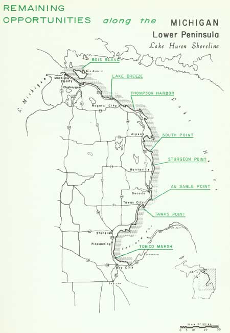
| Remaining Opportunities along the Michigan Lower Peninsula — Lake Huron Shoreline (Vicinity Map) (click on image for an enlargement in a new window) |
SUMMARY
Though lying near the geographical center of these great inland seas, Lake Huron has the distinction of being the first to be seen by white man. It was Samuel de Champlain, emerging from the wilds along Georgian Bay in 1615, who first recorded the experience of gazing across one of the Great Lakes. He named it the Freshwater Sea, but today its name bears an association with the Indians who frequented its shores.
Once traversed by the frail Indian canoe, today Lake Huron is the trail of Great Lakes freighters as well as ocean-going vessels bound from the far-flung lake and world ports. Occasionally, these vessels put into port along the lake's northern shore to take on one of the region's principal minerals--limestone. Gathered from quarries found along the northern Lake Huron and southern Upper Peninsula shores, the limestone is destined to fulfill its important roll in the production of steel. But, limestone in other forms than that found in the quarries has fashioned this shoreline, providing the setting for a second important resource use--recreation.
The lake's recreational wealth is due to an accessible, low shoreline with sandy beaches bordered by shallow, offshore waters. Here, opportunities to find a restful, inviting campsite, a beach to explore, or clear, invigorating water for the hardy swimmer attest to the region's public use values.
The serrated northern shoreline stretches nearly 290 miles from the Straits of Mackinac south to the Bay-Tuscola County line and includes 51 miles of offshore island shore. This region possesses a variety of lakefront sites suited to recreation and wildlife conservation, a number of which have already been recognized and set aside. Publicly owned frontage along this portion of the lake includes approximately 24 miles in state forests, wildlife areas and fishing sites and 3.3 miles in state parks.
To this public shoreline, it is recommended that 25 miles of additional frontage be placed in public ownership. This seven percent of the lakeshore would bring to 15 percent the amount set aside for public use. To assure the future availability of this segment of the shore, immediate action should be taken since the shoreline within these study areas represents nearly all that remains suitable for public use.
Lake Huron, by virtue of the ready access provided by U.S. Highway 23, has been the target for considerable private development. The level nature of the shore provided ideal sites for cottage construction and, being a lee shore, the general eastward movement of Great Lakes storms carried their destructive power away from the western Huron beaches. Finally, the proximity of the populous Detroit area has hastened the spread of development along its shore. Thus today, Lake Huron lies on the threshold between the development that has engulfed the eastern lakes and that now threatens to move northward to overrun the remaining undeveloped shore.
| Lower Peninsula of MICHIGAN (Lake Huron Shoreline) |
BOIS BLANC
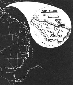
LOCATION Bois Blanc Island emerges from northwestern Lake Huron at the east end of the Straits of Mackinac. The island, which may be reached by ferry from Cheboygan, has gravel roads providing access to various shore points. The study area's 3.8-mile shoreline and 695 acres comprise most of the Lighthouse Point peninsula.
DESCRIPTION Bois Blanc Island, particularly the Lighthouse Point peninsula, contains a representation of some of the Great Lakes' finest forest types. Of primary importance is the occurrence of a stand of mature white pine estimated to be 180 to 250 years old. Though white pine may be found in many parts of the Great Lakes region, nevertheless those of Bois Blanc represent some of the largest individual trees and the most concentrated groupings observed on this survey. Equally important is the value of the stand for educational and research purposes. These pines occur interspersed with red pine, balsam fir, white cedar and spruce, together with such deciduous trees as aspen and white birch.
The shallow, marshy Deer Lake near the base of the peninsula provides a suitable habitat for many wet site plants, such as pitcher plant, and various orchids. Elsewhere in drier limestone soils, many other characteristic Great Lakes wildflowers can be found.
The island presents several interesting faunal situations that are represented on the peninsula. A sizable deer herd affords an opportunity to study the carrying capacity of various vegetative types. Suitable cover exists for pileated woodpeckers, though strangely enough, skunks and porcupines are not reported on the island. An isolated colony of rattlesnakes occurring here is of interest because this is the northern limit of this species in Michigan.
Limestone cobbles form the peninsula's beaches, creating well defined terraces along the eastern shore. Offshore, the lake bottom falls off sharply from the beach line.
PRESENT USE All of the land in this study area is in public ownership under the control of the U.S. Forest Service. Currently, consideration is favorably given by the Forest Service to exchange this property for other state forest holdings.
ANALYSIS Because of its natural values, particularly the white pine and other forest associates, this site should be preserved as a natural area for the education and enjoyment of the public.

|
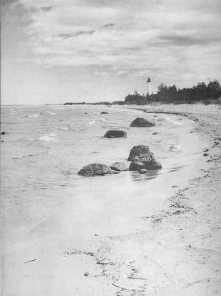
| Bois Blanc |
| Lower Peninsula of MICHIGAN (Lake Huron Shoreline) |
LAKE BREEZE
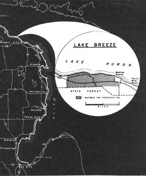
LOCATION The Lake Breeze beach lies 2 miles east of Hammond Bay and 1 mile west of Forty Mile Point along the northwestern shores of Lake Huron. From Rogers City, 7 miles to the southeast, U.S. Highway 23 passes less than a mile south of the shoreline. The study area's 3-mile shoreline spans an inland area of nearly 1,000 acres.
DESCRIPTION Bordering the blue-green waters of Lake Huron are the unusually fine shore features of Lake Breeze. Its beaches are composed of fine limestone sands with a scattered occurrence of small pebbles. Varying in widths up to 50 feet, these beaches front on shallow waters whose six-foot depth lies up to 125 feet from shore. These beaches are interspersed with small shore points of cobbles and boulders.
A somewhat limited, but scenic area of sand dunes parallels this shoreline. Most of the dunes have been stabilized except in several instances where their slopes have been laid bare by the buffeting shore winds. Low juniper and bearberry occur extensively over the low barrier dune back to the forest line, clutching the loose sand in small mounds.
A coniferous forest dominates the area immediately behind the beach and open dune environment. Considerable white and red pine can be found here as well as balsam fir and white cedar. Associated deciduous trees that become more numerous farther inland are aspen, birch, poplar and red oak. On the forest floor in old shoreline swales, large numbers of pitcher plant and sundew occur. Ranging through this region, an observer may catch a glimpse of deer or bobcat as well as representative birds of the northern forests.
PRESENT USE Private development has taken place at the east and west extremities of the study area, with some penetration being made from the west. A sizable area covered by unrecorded property ownership plats broken into small lots has prevented additional development due to the difficulties of determining ownership and clearing title. Some state property administered as part of the Black Lake State Forest lies behind the beach.
ANALYSIS Because of its exceptional scenic values, combined with an area possessing one of the few remaining fine sand beaches on Lake Huron, Lake Breeze should be acquired to insure its availability for future public use. In addition, its status as one of Lake Huron's outstanding shore areas is bolstered by its desirability for camping, hiking and nature study.

|
| Lake Breeze |
| Lower Peninsula of MICHIGAN (Lake Huron Shoreline) |
THOMPSONS HARBOR
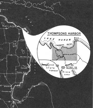
LOCATION The Thompsons Harbor shore winds westward from Black Point along one of the irregular sections of Lake Huron shoreline. Located approximately 15 miles southeast of Rogers City via U.S. Highway 23, the harbor is accessible by connecting gravel roads. The 3 miles of shoreline encompassing part of this harbor intercepts an inland area of nearly 1,200 acres.
DESCRIPTION This is an area with a scenic appeal based on its limestone points and beaches as viewed from atop the inland dunes. Resistive rock points protrude prominently from this shore, fashioning the series of harbors and bays that are unique along the western Lake Huron shoreline. Occupying many of the protected harbors are beaches composed of sand and cobbles. These are the components of the narrow beaches behind Thompsons Harbor, while offshore an occasional boulder lies awash amid a cobble-covered bottom.
Sweeping up southward from the beach, the sandy soils culminate in an uneven outline of dunes. These low sand hills have been virtually stabilized by a mantle of grasses, bearberry, low junipers and other recumbent plants. Persistent winds have, however, cut into the sands and an occasional raw sand slope lies exposed. It is these "blowouts" that add materially to the contrasting scene along this shore.
Only scattered white birch, red pine and white cedar occur in the open dune terrain. Behind the dunes and covering most of the shore points are typical northern mixed coniferous-hardwood forests. These are nearly all second growth stands.
PRESENT USE The majority of this region is owned by an industrial corporation interested in limestone. Several private parties own property within the area, including frontage on part of Thompsons Harbor. State property belonging to the Black Lake State Forest lies near the study site.
ANALYSIS Though lacking a suitable bathing beach, Thompsons Harbor possesses areas suitable for camping and picnicking, and further study may indicate the feasibility of developing boating facilities in the harbor. The area's potential for serving these various public use activities, particularly in its scenic setting, indicates the desirability of setting this shoreline aside for the public's benefit and enjoyment.

|
| Thompsons Harbor |
| Lower Peninsula of MICHIGAN (Lake Huron Shoreline) |
SOUTH POINT
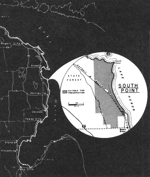
LOCATION South Point marks the southerly limit of Thunder Bay, the latter being one of two prominent indentations along Lake Huron's west shore. Though the Detroit and Mackinac Railway parallels the shoreline 1/4 to 2 miles inland, the region is virtually inaccessible by automobile. A county road, passing through the settlement of Black River, comes within a mile of the study area's south limit while U.S. Highway 23 passes up to 5 miles west of the shore between Alpena and Harrisville. The 5-mile shoreline and its 3,400 inland acres spread into both Alpena and Alcona Counties.
DESCRIPTION This region is characterized by a low, level topography extending many miles inland. Only the old beach lines left by higher lake levels ages ago alter the face of the level plain. Toward the lake, the low terrain extends beyond the shore for one-quarter to two miles before it is submerged by six feet of water. Occasional boulders lie awash in the shallow waters, particularly in the vicinity of shore points responsible for the irregular shoreline.
North of South Point, beaches and the offshore bottom contain a high percentage of cobbles and boulders. In contrast, several of the beaches south of the Point are composed of fine sand. These beaches may measure up to 100 feet in width before terminating in a low grass-covered barrier dune. Offshore, a sandy bottom associated with these beaches offers ideal bathing conditions.
A second growth forest composed largely of aspen and birch covers the area behind the beach. Red maple, white cedar and an occasional white pine are common woodland associates. The wet swales between beach lines favor the growth of orchids as well as other interesting flowers of this habitat.
PRESENT USE All of the study area is embraced within one unit of the Alpena State Forest. At least one-half mile of northern Alcona County shoreline has been platted for private, small tract development, while elsewhere the property pattern is in large tract single ownerships.
ANALYSIS Public acquisition of private lands remaining in this unit of the Alpena State Forest is desirable to assure public access to and use of the shoreline. Such access and use can be adequately met by the continued administration of the area as a state forest.

|
| South Point |
| Lower Peninsula of MICHIGAN (Lake Huron Shoreline) |
STURGEON POINT
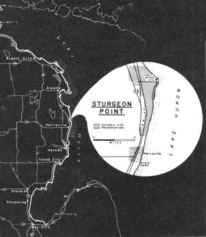
LOCATION The 4 miles of shoreline associated with Sturgeon Point reach southward to within 1 mile of Harrisville. Access to the shore is possible via several gravel roads that lead off U.S. Highway 23 as it parallels the lake approximately a mile inland. Behind the shoreline, the study area includes approximately 1,000 acres.
DESCRIPTION Sturgeon Point is the most easterly point along the shoreline between Thunder and Saginaw Bays. Protruding lakeward from the point is a long, narrow cobble strand that frequently lies awash during lake storms while in calm weather it is a haven for gulls.
The shoreline is a series of shallow arcs separated by small points of cobbles and boulders. Occasionally, boulders also protrude from the beach sands as well as lying in the shallow water offshore. Here, the lake bottom follows a gentle slope for over 200 feet before reaching the six-foot water depth.
In the south portion of the study site, several rather extensive beaches of fine sand are backed by a low, grass-stabilized barrier dune. Vegetation, primarily in the form of beach grasses, frequently penetrates the beach area in front of the barrier dune, sometimes to within a few yards of the water line.
Behind the shoreline lies a series of old beach lines, separated by low marshy swales. This zone of low terrain terminates less than a mile from the shore when the land rises, sometimes abruptly, to a higher inland plain. A second growth forest clothes this region with conifers, such as tamarack, fir and pine, occurring primarily along the shoreline and in scattered patches inland. Willow, alder, aspen and maple, together with other deciduous trees, comprise the major portion of the inland forest.
PRESENT USE Most of the study site is divided among a number of small private ownerships with public property limited to a Coast Guard tract in the vicinity of Sturgeon Point. Some private shoreline development has occurred in at least three separate locations along the lake front.
ANALYSIS In order to provide an additional park to serve eastern Michigan and to relieve the overtaxed facilities at Harrisville State Park, the Coast Guard property should be retained in public ownership and the additional private land in the study area should be acquired.

|
| Sturgeon Point |
| Lower Peninsula of MICHIGAN (Lake Huron Shoreline) |
AU SABLE POINT
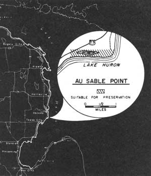
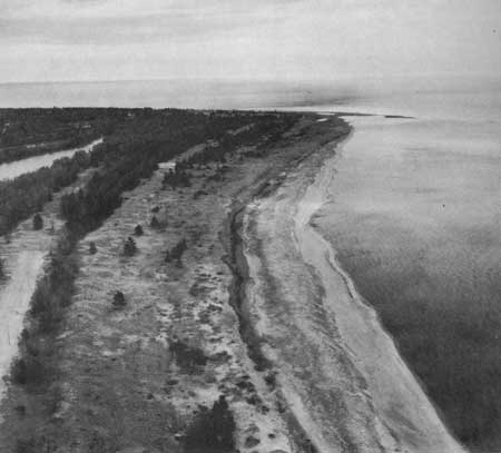
LOCATION Au Sable Point is the northern limit of Saginaw Bay. Passing within one mile of the Point, U. S. Highway 23 continues 8 miles southwest to the community of East Tawas. Several gravel roads designed to serve cottage developments approach the Point as spurs from the highway. This shoreline, stretching 1.5 miles westward from the Point, spans an inland area of nearly 300 acres.
DESCRIPTION The low, level topography around Au Sable Point is the result of its evolution from an earlier lakebed ages ago. The occurrence of paralleling low sand ridges and intervening swales attests to the location of beach lines at various lake levels in the past. An elongated small lake lies in one of the depressions between two of the beach lines. Several other small ponds occur in similar situations.
The beaches west of the Point are composed primarily of sand with some scattered fine gravel. Measuring over 50 feet in width, these beaches terminate along a low barrier dune stabilized by beach grasses and a few scattered shrubs. Offshore, the sandy bottom slopes gently for nearly 200 feet before reaching the six-foot water depth.
Tree growth is sparse near the beach with only small patches of conifers occupying the area between the first two barrier dunes. Farther inland, more deciduous trees, particularly birch and aspen, are associated with scattered tamarack, white and jack pine.
PRESENT USE Au Sable Point lies within the boundary of the Huron National Forest; however, no public lands lie within the study area. The major portion of this site is in a single ownership, but small tract subdivision development is squeezing in from both sides. Already a portion of the western shore of the study area has been staked for subdividing, while an access road and power line have been constructed to serve these building sites. Because of the desirability of this region for cabin development, this shore is in immediate danger of being lost for public use purposes.
ANALYSIS Under the present rate of development, public access to the better portions of Lake Huron's lower shoreline will soon be gone. Undeveloped segments of beach, as represented by the quality found at Au Sable Point, should be set aside for public use and enjoyment in recognition of future recreation needs.
|
| Au Sable Point |
| Lower Peninsula of MICHIGAN (Lake Huron Shoreline) |
TAWAS POINT
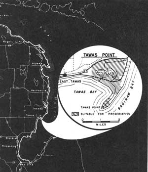
LOCATION Lying along Saginaw Bay's north shore, Tawas Point is less than 5 miles east of the community of East Tawas. Ready access to most of the shore is provided by the Tawas Beach Road which takes off from U.S. Highway 23 near the town's eastern limit. This 1,500-acre study area spans a shoreline of 4 miles.
DESCRIPTION Tawas Point is a sand neck that swings southwesterly in a gentle arc to separate Tawas and Saginaw Bays. This sand spit boasts good beaches, some exceeding 100 feet in width, both on the Tawas Bay and Lake Huron (Saginaw Bay) sides. Fine sands with only a light scattering of small pebbles compose the textural quality of the shore as well as the gentle slope of the offshore bottom. Here, the six-foot water depth may lie as much as 400 feet from shore on the bay side. The northeastern bay shores, unlike the Point, are frequently littered with driftwood.
Behind the beach, particularly on the Lake Huron side, are several low barrier dunes, typical of the relic beach lines that are prominent north of the Point. Beach grasses along with copses of red and jack pine have succeeded in stabilizing much of the sand near the Point.
North of the Point, Lake Solitude rests amid second growth forests with in a half mile of Tawas Bay. The lake occupies a marshy habitat supporting numerous wet site plants, the most notable being the tamaracks along the boggy eastern shore. Elsewhere, in the vicinity of the lake and on drier sites, the shaggy outline of an occasional white pine may be seen rising above a forest canopy of aspen, ash, birch and other hardwoods.
PRESENT USE Private subdivision development has eliminated a major portion of the Lake Huron shoreline and threatens to occupy all but Tawas Point. Elsewhere, most of the inland area and a portion of Tawas Bay are owned by a private club. Only Tawas Point is currently owned by the U.S. Coast Guard.
ANALYSIS By virtue of the exceptional lake frontage on Tawas Point, this segment of Lake Huron should be retained in public ownership. In addition, the Lake Solitude area has significant natural values that warrant its preservation for public use and enjoyment.

|
| Tawas Point |
| Lower Peninsula of MICHIGAN (Lake Huron Shoreline) |
TOBICO MARSH
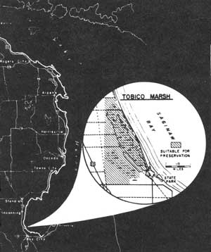
LOCATION Tobico Marsh lies adjacent to and north of Bay City State Park, six miles north of Bay City. It may be reached by several roads running west of U.S. Highway 23 and by roads leading north from the state park.
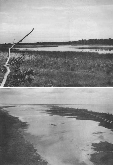
DESCRIPTION The study area lies on the lake plain of Saginaw Bay. It is composed of a major lagoon of 326 acres surrounded by a marsh of 191 acres. The marsh is separated from Saginaw Bay by a barrier beach given over to cottage development. West of the lagoon, a series of swales and barrier beaches mark recessional stages in the lowering of Lake Huron to its present level. The sand ridges are vegetated with a variety of deciduous trees and scattered white pine. The area provides a sanctuary for an impressive number of water and marsh birds and other aquatic life. Within the marsh, lagoon and woodland is preserved a highly representative remnant of the indigenous flora of Bay County.
PRESENT USE The Division of Game has or is in the process of acquiring the marsh as a State Game Area for the purpose of assisting waterfowl production and use, including public hunting in season.
ANALYSIS As a State Game Area, Tobico Marsh is fulfilling its most obvious economic purpose. However, in a larger sense, the area has diverse natural values in a highly populated region largely devoid of these features. Appreciation of the area's scenery, study of aquatic biology and ecology, nature study and field trips originating from the adjoining state park, ornithological and botanical studies, and related uses, not inimical to waterfowl propagation, would guarantee the greatest possible use of the area on a recreational, aesthetic and scientific basis.
Acknowledging the jurisdictional authority of the Division of Game of the Department of Conservation, here is an opportunity to work out intensive maximum use of an area through cooperation with the Division of Parks and Recreation, local schools and scouting organizations, sportsmen's groups and the Michigan Natural Areas Council. By maximum use is implied production and perpetuation of waterfowl, protection of non-game species, preservation of botanical elements, and the recreational, educational and interpretive use of the area's aesthetic and natural values.
|
| Tobico Marsh |
| <<< Previous | <<< Contents>>> | Next >>> |
rec_area_survey/gl/mi5.htm
Last Updated: 27-Jun-2007