|
Forest Reserve Manual
|
|
DUTIES OF FOREST OFFICERS.
The work of forest officers, supervisors, and rangers may be enumerated as follows:
1. Protective duty, guarding against fire and trespass, fighting fires and stopping trespass, as well as assisting the State authorities in the protection of game.
2. Care and propagation of the forest by a judicious management of timber sales and cases of "free use" of timber, and actual propagation by seeding and planting.
3. Special work in attending to grazing, to the supervision of the construction of roads and other improvements, and in examining into and, reporting upon the numerous claims and applications for special privileges, etc.
4. Permanent improvements carried out by the reserve force, such as making surveys of land and timber, and the construction of trails, cabins, bridges, and other improvements.
PROTECTIVE DUTY.
1. PREVENTING AND FIGHTING FIRES.
It is expected that every ranger and other forest officer is constantly on the lookout for fires.
Fire notices.—An ample supply of fire-warning posters will be furnished at all times, and it is imperative that the reserves be thoroughly "posted" with these useful notices. The fact that, in a few rare cases, malicious persons destroy them, is no excuse for neglecting this important preventive effort. In many cases the warning can be combined with some useful information, such as a signboard to indicate the trail or distance to nearby or important points, to indicate the reserve line, limits of districts, or excluded parts in grazing ranges, etc. The destruction of the notices is willful trespass.
Camp fires.—Forest officers should inform transients and others concerning the rules and regulations governing camp and other fires. This should be done cheerfully and politely; and an officer who is unable to talk with persons who, from ignorance concerning the rules, or from lack of experience in camping, appear to do wrong, without losing his temper or without using improper language, fails to that extent in one of his principal duties. In cases where inexperienced persons build a fire against a large rotten log merely to cook a cup of coffee, or where a fire is built in a mass of dry duff, etc., and where the work of putting out such a fire is beyond ordinary effort, a forest officer should call their attention to such mistake and instruct them in the proper way of building and handling fires. The two main points in this connection are always:
(a) Do not start a fire where it will be difficult to put it out.
(b) Never leave a fire without putting it out. This is law.
The puerile desire to see a fine balsam or spruce burn and show like a huge candle in the night, which has so often been expressed and carried out, must, of course, never be tolerated. It is malicious burning, and may bring a fine of $5,000.
Lightning fires.—Fires from this source are not rare, especially in our dry mountain regions, and it is necessary after every electric storm to make a special effort to locate and extinguish any such fires before they are well under way.
Fighting fires.—When once a fire has spread over an acre or more, especially on difficult ground where a large amount of dead and down material makes it a real hot fire, the matter is frequently beyond the possibilities of one ranger alone. In such cases it is often best to seek for help.
In fighting fires of this kind the character and conditions of the woods, the weather, and even the time of day have so much to do with the case that a set of general directions has little value, and the experience and good judgment of the ranger mean everything.
Generally, it may be said that the proper tools to fight the fire are the shovel, mattock, and ax.
For this reason the ranger should always carry at least shovel and ax during all the dangerous season, so that he is never unarmed against this archenemy of the woods.
In humid, heavy timber the fire usually travels slowly, and a few men, if persistent, can keep it in check by trenching, though they can never extinguish it, and must therefore watch it until a rain helps them out.
In dry, open pine woods the fire travels faster, and it is often best to go some distance and hunt the most open and clean ground, trench, and back fire from there.
In handling back fires great care is required to avoid the useless burning of forest.
In all kinds of fires, the night or the early morning hours are the best time to work, whenever any choice of time exists; for nearly all forest fires die down more or less during the cool of the night, and then flare up again during the heat of the day.
Generally, we may say:
(a) Protect the valuable timber rather than the brush or waste.
(b) Never leave a fire unless driven out, or until it is put out.
(c) Young sapling thickets suffer more than old mature timber.
(d) A surface fire in open pine woods, though not dangerous, does great harm in destroying the seedling growth.
(e) A fire rushes up hill, crosses a crest slowly, and is more or less retarded in traveling down. Therefore, if possible, use the crest of the ridge and the bottom as your lines of attack.
(f) A good trail, a road, a stream, an open park, check or "bring down" the fire. Use them whenever possible.
(g) A bit of thinking often saves labor and makes work successful. Ill-planned efforts suggested by haste and excitement rarely lead to success.
Expenses.—While the Government is willing and anxious to prevent and fight fires, and is willing to go to considerable expense therefor, it is unreasonable to suppose that an unlimited amount of money is to be devoted to this effort. Experience has proven conclusively that in most cases a reasonable effort is all that is justified, and that a fire which can not be controlled by 20 to 40 men will run away from 100 or even more men, since heat and smoke in such cases make the direct fight an impossibility.
Unusual expenditures will not be tolerated. They are unnecessary, wasteful, and even mischievous. For it is claimed, in not a few cases, that the fire was started and thrived because of the opportunity for a job. In and about nearly every reserve it is possible to enlist the cooperation of the better citizens, and thus to have such an agreement that in time of need there can be had a sufficient number of men, and men of the proper kind. A crowd of men hastily gathered about the taverns, etc., of a town, without organization, without interest, and without experience, is usually a poor makeshift with which to battle a fire.
Accounts.—Every person who is entitled to compensation for services rendered at a forest fire must sign duplicate vouchers for the amount received for such services. The original voucher is transmitted with the forest officer's (supervisor or superintendent) regular monthly account for the month in which the expense of the fire was incurred. The duplicate should be retained for future reference by the officer submitting the account.
Full directions for preparing vouchers and accounts will be found in circular of March 1, 1900, regulating the traveling expenses and other allowances of field employees of this office.
Government employees and parties who have been granted grazing permits or other privileges within a forest reserve, are not entitled to compensation for services rendered in extinguishing a forest fire.
2. GUARDING AGAINST TRESPASS.
Every kind of trespass, but particularly trespass in timber, must be prevented, or reported and stopped.
Whenever a ranger or supervisor passes by a place where timber cutting is in progress, whether under permit or not, he should, if possible, take the time to examine the cutting. He should see that the timber, if cut under permit, is marked; that the block is blazed and marked; that the logs being hauled away are stamped; in general, that the cutting is done according to the rules of the Department set forth in the following pages.
If the cutting is without permit, the ranger should ascertain by what authority the timber is being cut; and if the authority is sufficient he should ascertain if the lines limiting the area are clear, and that no cutting is being done across such lines.
If he finds that the cutting is without permit or without authority, or finds irregularities or violation of the rules, he should at once collect the facts as required by the form of report on trespass in timber and prepare such a report. This report he will transmit to the supervisor. If the case appears to be unquestionably a trespass, the ranger will notify the persons to stop cutting and hauling, taking care to note time of day, date, and place of such notice, giving such notice, if possible, only in presence of a witness.
Where the case requires prompt action the supervisor will seize all material cut under trespass and invoke such assistance as appears necessary.
If the nature of the case warrants such procedure, the trespasser is asked to settle, and his offer of settlement can accompany the report. In all offers of this kind a certified check for the amount offered should accompany the report.
Forest officers will note the above enumeration of trespasses and will guard against all of them. In no case should the officer pass any work, etc., without ascertaining whether or not it is done under proper authority. In reporting the different trespasses the form for general trespass, on page 75, is to be followed.
In all cases of trespass, the supervisor has the right to administer the oath in taking testimony in the case.
CARE AND PROPAGATION OF THE FOREST.
In dealing with cases of timber sales the following instructions should be followed, and should be amplified wherever experience and future study indicate such improvement.
INSTRUCTIONS IN CASES OF SALES AND ALSO IN CASES OF
"FREE USE" OF TIMBER IN FOREST RESERVES.
Forest reserves have two chief functions: Continued production of timber and regulation of the water supply; and since timber constantly grows scarcer and in greater demand, and as the industries which depend upon a sure and sustained water flow are certain to increase, the future capability of the reserves is of even greater importance than their present condition. For this reason all questions concerning their management must be decided with regard for future effects as well as immediate results.
The relative importance of the functions referred to varies in different reserves. Protection of the water supply should never be lost sight of, even in the regions of heavy rainfall where lumber production is most important; in mountainous reserves of the arid States it is paramount. It can only be insured where the ground is covered by vegetation, which prevents rapid run-off, and is best attained by a dense growth of vigorous timber.
For this reason, the first question to arise when the removal of any timber is discussed is whether or not it can be spared, and to decide this question, the forest officer must know whether another growth of timber will replace the one removed or whether the land will become waste.
The foremost point to be studied in this connection is the reproduction of the forest under various conditions. The number of small trees, their kind, their vigor, the seed-bearing capacity of those which would be left after cutting, the possible destruction of the young growth by logging or fire—all these points must be considered fully. The growths on similar areas which have been burned or logged afford the best guides in this study.
If it seems certain that the timber may be cut safely, the best method of cutting must be decided—whether the trees below a certain diameter should be left to form the next crop, whether a number of seed trees should be left, whether the surrounding timber will furnish enough and the right kind of seed, whether the cutting may be unrestricted or confined to strips—or, in other words, what system will be surest to bring about satisfactory reproduction.
In unsurveyed territory no attempt to follow the regular square-mile section system need be made. The block should conform to the lay of the land and the conditions which regulate cutting. Ridges and streams should indicate boundaries wherever practicable, and at least one boundary or corner, serving as a starting point, should be identified, with some easily found natural object. Roads or streams should be used as base lines where possible. The boundary lines need not run north and south by east and west, but may take such angles as may be necessary to follow the natural outlines referred to. The compass bearing and length of each line must be recorded to admit of proper mapping of the block. All corners must be marked by posts and witness trees bearing the marks of the district and the block; as D-3, B-1, meaning district No. 3 and block No. 1. The boundary lines must be clearly blazed and reenforced by the marking hammer.
The sketch map of the block must include such details as buildings, roads, and trails, fences, mill sites, and mining or other claims. Each block should be mapped on a separate sheet, and all maps must be made on a scale of 12 inches to the mile.
DESCRIPTION AND ESTIMATE.
Complete information concerning each block must be recorded on the blank form, as indicated in the following imaginary case:
Division 3.
District 8, Block 5.
(In case of surveyed land, description by township, range, meridian, section, and quarter.)
1. Topography. Steep slope on north side of Cougar Creek.
2. Surface. Rough, rocky, difficult to log.
3. Soil. Compact loam.
4. Acreage. Total, 180; timbered, 155; logged, 120; burned, 5.
5. Character of timber. Dense stand of pure bull pine except narrow strip along creek in which spruce forms half.
6. Condition of timber. Pine unusually sound, except along north edge, which was injured by fire in 1899. Spruce badly ground-rotten and falling constantly. Little dead material of any value on block.
7. Reproduction. Pine seedling growth sparse, but there are about 50 trees to acre just under merchantable size. Spruce reproduction good throughout a 10-rod strip along creek. On the whole, second crop is well assured.
8. Accessibility. Block lies 4 miles from nearest mill, which is at Red Dog, on the railroad. Good down-hill road all the way, and creek could be made drivable at small expense. The mill referred to is apparently permanent and timber will always be in demand. Can be logged and hauled for $5 per thousand.
9. Old cuttings. About 20 acres in extreme northeast corner was cut in 1899 under sale case No. 40. This cutting is in poor condition, covered with rubbish, and reproduction is poor.
10. Private interests. Nothing of the kind but one placer claim on creek near southwest corner of block, apparently abandoned. Practically no timber on this claim.
11. Proposed cuttings. (This space is to be used when blank accompanies application.)
12. Additional information and recommendations. The burn which to touches the north side of the block is covered with rubbish and apt to burn at any time. The prevailing winds are from the north. For this reason believe it safer to cut the block as soon as possible in spite of the good condition of the timber. Since there is a heavy stand of small trees, advise reducing the diameter limit from 12 to 10 inches, and do not think it necessary to leave any trees above this size for seed. The cutting should be made with special precaution against fire.
If different portions of the block vary so greatly in character that a single description is impracticable, two or more sections may be indicated on the map by dotted lines and each described on a separate blank.
All estimates of timber, whether for entire blocks or fractions thereof, should be submitted upon the following form, and the method of estimating must be stated.
ESTIMATE SHEET.
Estimated stand per acre on Block 5, District 8, Division 3— [Here state whether for entire block, portions of block, or tract applied for only.]— Covers entire block.
LIVING TIMBER.
| Species. (To be written in) | Bull Pine. |
TOTAL. | ||||
| Number of trees above 8 inches, per acre | 70 | 70 | ||||
| Average height of trees | 55 | 55 | ||||
| Average number of trees per M | 16 | 16 | ||||
| Average stand, B. M., per acre | 4400 | 4400 | ||||
| Per cent deduction for defect | 5% | 5% | ||||
DEAD TIMBER SOUND ENOUGH FOR USE. | ||||||
| Number of trees above 5 inches per acre 2 | 2 | |||||
| Average stand, B. M., per acre | ||||||
| Cords down timber, per acre | 1 | |||||
| Cords standing timber per acre, suitable for fuel only | 1 | |||||
What per cent of total was actually estimated and what system was used? 10 per cent of the timbered area (155 acres), 1/4-acre circle method.
JOHN DOE,
Head Ranger.
HANDLING OF APPLICATIONS.
If, after examining a tract applied for, the forest officer decides to recommend the sale, he explains to the applicant all the requirements which will be demanded of him by the regulations, adding such as he may think necessary in the instance at hand, and these are agreed to in the signed application. To avoid misunderstanding later, it is important that all points concerning the proposed cutting be discussed fully before the application is submitted. Following are a number which must be included in all applications, and the forest officer is expected to add others when advisable:
1. To what minimum diameter on the stump will cutting be allowed?
2. How many seed trees per acre shall be left?
3. To what diameter in the tops must trees be utilized?
4. Should the brush be piled, and in what manner?
5. Will any extra work, such as cleaning up down stuff not cut by the purchaser or burning brush, etc., be required of him?
6. How high are the stumps to be (usually not higher than the tree is thick, and in valuable stuff not above 18 inches)?
7. Should felling be done with saws?
8. Will hewing be allowed except at skidways and openings?
9. Will cutting be allowed throughout the year?
10. What material may be used for skidways, road material, and camps, and shall it be paid for?
11. Where will applicant be allowed to locate camps, roads, dams, etc.?
CASE OF DEAD TIMBER.
This includes only wood, standing or down, which is actually dead, and in no case trees which are apparently dying. In the case of evergreen species, all trees having any green leaves are classed as living timber. Since deciduous species, such as tamarack and most hard woods, have no foliage in winter, special attention must be given during this season. Trees dead at the top and green below, generally called spike-topped trees, are classed as living, and must never be cut under dead-timber permits. The dead portion may, however, be scaled and charged for as dead timber.
In considering applications for dead timber, the following points should be discussed in addition, to those enumerated above:
1. Should all, or only standing, dead timber be taken?
2. Should all sound enough for fuel be taken? a
3. Should all above a given size (what size?) be given?
4. Should purchaser pile the unsound portions of down trees from which he uses the sound parts?
aNOTE.—The purchaser shall not be bound to cut timber which may die after the date of sale, or to dispose of unsound material which was sound at that time; unless it is shown that reasonable diligence on his part would have prevented the loss.
If the applicant agrees to the conditions of cutting, as explained to him by the head ranger or other forest officer who has made the preliminary examination, such officer must at once prepare, upon the proper blank form, a report embodying a description of the tract in question, an estimate of the timber upon it, and his recommendations regarding the proposed sale or permit. The application will not be considered unless accompanied by this report, and in most cases it will be desirable to defer filling that portion of the application blank devoted to the amount and location of the desired timber until the forest officer has completed his examination and estimate. With this definite information, the applicant can state exactly the amount and situation of the timber, make his offer of price, and sign the application.
4—178.
No. ______.
______ Forest Reserve.
APPLICATION.
I hereby make application for the sale and purchase of timber located and described as follows: ______ M feet B. M., saw timber, green or dry; ______ M feet B. M., mining timber, green or dry; ______ railroad ties, ______ green, ______ dry; ______ cordwood, ______ green, ______ dry; and is located ______. To be used at ______.
I promise to deposit with the Receiver of Public Moneys at the United States Land Office ______ at such sum as may be required at the time of filing my bid for the above-described timber, and I further promise that in case my application is favorably considered I will deposit with the said Receiver such sum as may be required to cover the cost of advertising for bids for the purchase of this timber, and in the event that the timber is awarded to me as the successful bidder I promise to pay to the said Receiver the amount covered by my bid [here insert the condition of payment, whether full cash payment or one-third down and the balance in thirty, sixty, and ninety days, as the case may be] ______, credit being given for the sums heretofore deposited with the said Receiver by me in connection with this sale and purchase; which, otherwise, will be refunded to me.
And I further agree and promise to conduct the work of cutting and removing said timber in accordance with the following specifications:
1. I will comply strictly with the laws and regulations governing forest reserves.
2. Submit all timber and wood to measurement by the forest officer before the same is removed.
3. Pay in advance for all timber before cutting the same.
4. To cut only timber on the area agreed upon and blazed and marked, and not to cut any of the live trees bounding this area.
5. To leave no logs, ties, lagging, or other material in the woods, and to pay double the agreed price for any material thus left in the woods.
6. To pay for all material used in shanties or buildings of any kind; also for material used in construction of skidways, corduroy, log roads, bridges, and other improvements.
7. To cut only marked timber, and to cut all marked timber.
8. To leave no trees lodged in process of felling.
9. That all material is marked on skidway or in pile, the amount to be placed in plain figures at the top or on blaze near by, and that no material will be piled on such skidway or pile after the scaling has been finished.
10. All felling and cutting with saw ______.
11. Stumps ______ high; none higher than ______.
12. Shaft of tree to be used to diameter of ______ inches, ______.
13. Cordwood to be cut from all tops down to a diameter of ______ inches ______.
14. Tops to be dragged bodily into openings ready for burning ______.
15. Tops to be lopped and brush piled ______.
16. No hewing, except at skidways in openings ______.
17. No cutting of timber in summer season between months of ______ and ______.
18. Cut all dead material sound enough for fuel ______.
19. Cut only standing dead material ______.
20. Cut only and all dead material ______.
21. Build camps at place agreed upon, located ______, as per map ______.
22. Construct dam at point agreed upon, located at ______, as per map ______.
23. To pile or skid all material before measuring ______.
24. Scaling to be done ______ [once a week or month, continuously, to keep up with cutting], the maximum to be not over ______ M feet B. M., and ______ cords, ______ ties per day or week.
I further agree that in case my bid for this timber is accepted, I will execute a contract embodying the above provisions for the purchase of said timber, and deliver therewith a bond which shall be satisfactory to the forest officers for the faithful performance of the conditions imposed in said contract; and I further agree that in case of failure on my part to fulfill, all and singular, the requirements of said contract I will forfeit the said bond and all moneys paid to the Receiver of Public Moneys herein mentioned.
______ ______.
Dated at ______, ______, 190—.
ESTIMATE, DESCRIPTION, AND REPORT.
Unless part of such information has been previously secured, the examination of the tract by the forest officer must include:
1. Surveying, mapping, and blazing out the block or blocks on which the cutting will be located.
2. Locating definitely enough to permit estimate, description, and locating on map, of cutting area itself.
3. Measuring and estimating of timber on proposed cutting area, and on entire block when practicable.
4. Description of block and cutting area.
5. Recommendations concerning proposed sale, with reasons for them. These should embrace such points as the probable effect on the future composition of the forest and the water flow of the region; the condition of the timber in so far as it affects the policy of holding it for advance in price; the need for the timber applied for; the possibility or difficulty of getting it in some better place; the reliability of the applicant, and the price which should be obtained. The latter point is one of great importance, and should be decided, not by general precedent in the region, but by the actual value of the timber as determined by its character, difficulty to log, and distance from market. Timber on a gentle slope and near a mill or drivable stream may be worth more than twice that made inaccessible by canyons or distance. The forest officer should determine the cost of marketing all material and recommend prices which will make it approximately equally desirable.
The report upon the foregoing points must be made upon the blank for block description already described. If it provides insufficient space, additional matter may be affixed. If the tract applied for is less than a block, and the estimate for the latter can not be relied upon for the small area in question, a separate estimate should be made and submitted upon another blank.
MARKING AND CUTTING.
If the application is approved, the head ranger or supervisor (with assistance, if necessary) will mark at once all trees to be cut. This is imperative in all cases involving living timber. Where only dead timber is purchased, and there is no danger of confounding it with timber in various stages of injury or disease, the marking of individual trees will be dispensed with. In such instances the forest officer may simply blaze and mark the boundary of the cutting area and instruct the purchaser in the manner of cutting.
The marking of standing timber must be done with the "U. S." stamping hammer, and all trees must be marked near the ground in order that the stumps may afford positive evidence of the marking. Where snow may conceal such marking from the cutters, it will be necessary to mark each tree at a point several feet from the ground also.
Unless an emergency is declared by the Secretary of the Interior, no cutting shall be permitted until the advertisement of sale has run its course and the district ranger has been notified by the supervisor that the successful bidder has made the required advance payment and is entitled to the timber. Upon receiving this notice the ranger will permit cutting, and as soon as it begins will report the date thereof to the supervisor. This statement will be upon the regular scale-report blank and will begin the ranger's periodical report upon the cutting.
The head ranger will visit the cutting as often as possible, and will report fully upon its condition (using blank No. 4—484)
It is the duty of the ranger to see that the cutting is confined to the least possible area and not distributed here and there over the entire tract; also, that, so far as reasonable, all branches of the logging operations keep pace with each other. In no instance will the brush piling be allowed to fall behind the manufacture and removal of logs, ties, and other material. The ground must be cleared as fast as the work proceeds.
The manner of piling brush may be varied according to conditions, but the object is always to insure ready and clean burning, as soon as possible, with the least injury to standing timber and seedlings. The piles should be compact and large enough to kindle easily and burn clean without repiling. When possible, they should not be nearer than 15 feet from standing green trees or dead trees having many branches or a covering of moss which might be ignited. Where the density of the standing timber makes the above rule impracticable, openings should be made by cutting, or, if this is not feasible, the piling should be near the least valuable trees and where there is least danger of the fire spreading. All chunks, knotty sections, or other unutilized portions of trees, as well as the branches, must be piled, and as much of such material as possible should be piled together to insure clean burning. Where the contract does not oblige the purchaser to utilize the trees into the extreme tops, all the remaining portions must be cut up and piled or dragged full size into openings where large piles may be burned safely.
SCALING.
When possible all timber should be scaled at skidway or landing, and not as it lies in the woods. In all reserves the Scribner rule will be used for lagging and saw logs, and each stick must be scaled and stamped separately. Hasty methods of averaging different sizes will not be allowed.
Railway ties are rated as follows:
8-foot ties, 33-1/3 feet B. M. each.
6-foot ties, 25 feet B. M. each.
Posts, poles, and piles are measured by linear feet, the valuation per foot increasing with the length and size of the stick.
Shake and shingle-bolt material is measured by the cord.
Square material is scaled like lumber, at its actual contents B. M., making no allowance for saw kerf. Thus, an 8 by 12 inch 16-foot stick contains 128 feet B. M.
Where green logs 8 inches and over in diameter are made into cord wood, they are paid for as saw timber at the rate of 2 cords to the 1,000 feet B. M.
All wood and timber must be scaled before removal from the tract or landing, and every stick of timber and pile of wood must be stamped with the "U. S." marking hammer.
In cases of "free use" of timber the same precautions are necessary as in the cases of sale of timber.
Every application, whether approved by the supervisor or by the Department, should be accompanied by a definite report giving sufficient information to enable a proper decision. The blank form provided for such report (see p. 62) should be followed.
The sowing of tree seeds has been carried on experimentally in some of the reserves in California. There are many places where an expenditure of money for that purpose may, at some future time, be warranted. Generally, however, the great extent of the reserve forests, the limited market, the uncertainty of success in the very places where this method is most called for, indicate a conservative attitude, and not until a far more liberal appropriation of money is assured is there reason for introducing seeding and planting methods won more than an experimental scale.
SPECIAL INSTRUCTIONS IN TIMBER SURVEYING AND
SCALING.
The system of subdivision and description of reserve timber herein outlined is designed to enable purchasers and forest officers to conduct sales with certainty and dispatch. Not only does ability two refer accurately to the location, character, and amount of any timber applied for save much time in the handling of the application by those in the field, but it is of the utmost importance in order that the central office may be prompt in final action upon the proposed sale.
For this reason all land within the reserves which bears commercial timber applied for, is to be surveyed into "blocks" and "districts" and mapped, estimated, and described in a systematic manner. This work is to be done by the supervisors or head rangers, with such assistance from the ranger force as is necessary.
Compasses, chains, blanks, and other necessary equipment will be supplied the supervisors or head rangers, who will be held responsible for them in case of loss, but not for unavoidable wear or breakage. In case the supervisor is not able to do the required surveying and mapping, or has no rangers who can do it, he should promptly inform the central office and request the provision of a competent assistant.
DISTRICTS AND DIVISIONS.
The chief object in the creation of districts, is to simplify specifications relative to the location of the blocks, each to contain approximately 160 acres, the reference to which, without classification into larger divisions, would entail unnecessary numbering and confusion. The district should seldom contain more than 100 blocks, except when the region has been legally subdivided into townships and sections, in which case the district will consist of one township, 6 miles square, containing 144 blocks of a quarter section each.
In the case of unsurveyed land the form of the block should be determined by the topography of the region. Valleys or drainage basins usually form the best limits, not only because they are easily mapped and referred to, but because all blocks thus included are apt to be reached by the same road or driving stream. For instance, one of the simplest and most desirable forms is that of a district 2 or 3 miles wide from rim rock to rim rock, and about 10 miles long, the stream running longitudinally through the center. Should the valley be much wider than this, it is better two make a long district on either side the stream, each comprising one slope from stream two top of ridge, than two attempt to make the districts reach entirely across the valley by shortening their length. In much-broken country, however, where small ravines are numerous, several may be included in one district. In such cases the natural outlet of the timber must be considered, and canyons leading away from each other should not go into the same district.
As a rule, districts should not be less than 2 miles wide or more than 10 miles long, and, except in the case of surveyed land, when townships are considered districts, should not contain more than 25 or 30 square miles.
In order to insure permanence and ease in finding them, as well as to save work in blazing, wherever possible, streams, roads, bare ridges, cliffs, or burns should form the boundaries of both blocks and districts. Where, however, the uniformity of the region makes artificial lines necessary, they should be plainly blazed and all blazes stamped with the United States marking hammer, to identify them as the work of forest officers.
In all cases corners must be marked by posts or monuments and witness trees. The side of the post toward each district should be faced and marked with the initial and number of the district, viz, "D—20." The witness tree bears the same mark.
The areas of the districts need not be computed, nor the boundaries actually measured, although for the purpose of mapping it may often be necessary to record the compass direction of the latter. When a fairly accurate map of the reserve already exists it will be sufficient to outline the districts upon it, accepting the correctness of the streams and ridges forming the natural boundaries. The surveyed and blazed boundaries may be drawn from their recorded distance and compass direction from some known point on the map, if, for instance, a district is bounded on the east by a stream and on the west by the summit of a parallel ridge, both of which features are shown upon the map, the north and south boundaries should be run by compass and located by measurement to some object, such as a fork or bend of the stream, or a road or building, also shown on the map. If no good map of the region exists, a map must be made for each district. Measurement of distances will not be required, but approximations should be made with great care, and triangulation should be done wherever possible.
In reserves containing great areas of unsurveyed timber land it is necessary, in order to prevent multiplicity and confusion in the number of districts, to combine these into still larger areas, called divisions. These have been determined and numbered by the central office, and each supervisor will be furnished with a map of his reserve, showing their outlines. All applications, reports, and other correspondence referring to timber on land not legally subdivided into townships and sections, therefore, must mention division, district, and block by initial, as Div. 3, D-1, B-6.
BLOCKS.
The district and division are merely combinations of blocks, and will never be described or estimated as a whole. The block constitutes the unit of measurement, and must be mapped, estimated, and described accurately, for this information will guide the central office in approving or rejecting applications of all kinds.
In surveyed land each quarter section constitutes a block, and the only surveying required will be the occasional reblazing of obliterated section lines, remarking of corners, and division into quarter sections by blazed lines from quarter post to quarter post. In the center of the section should be set a post having the side toward each quarter faced and marked with the number of the quarter, as NE. 1/4 sec. 2.
These quarter sections, while considered as blocks, will be described by land-survey nomenclature, as NE. 1/4 sec. 2, T. 3 N., R. 5 W., etc. (See sample map, fig. 1.)
In unsurveyed land the blocks need not be of uniform shape or size, although, as a rule, they should not contain more than 160 acres. They should conform to the lay of the land and the conditions which regulate cutting. Ridges, roads, and streams should form boundaries wherever practicable, and at least one boundary or corner should be identified with some easily-found natural object. Boundary lines need not run north and south or east and west, but may take such angles as are necessary in order to follow the natural outlines referred to. It is desirable to avoid including in one block greatly differing classes of timber or timber which, by reason of ridges or canyons, will not have the same outlet.
Squads of four men, consisting of compassman, two chainmen and axman, will usually be found most convenient in laying out blocks. Since the work does not require absolute accuracy no rodman is necessary, the axman simply being kept in line as he blazes ahead of the others.
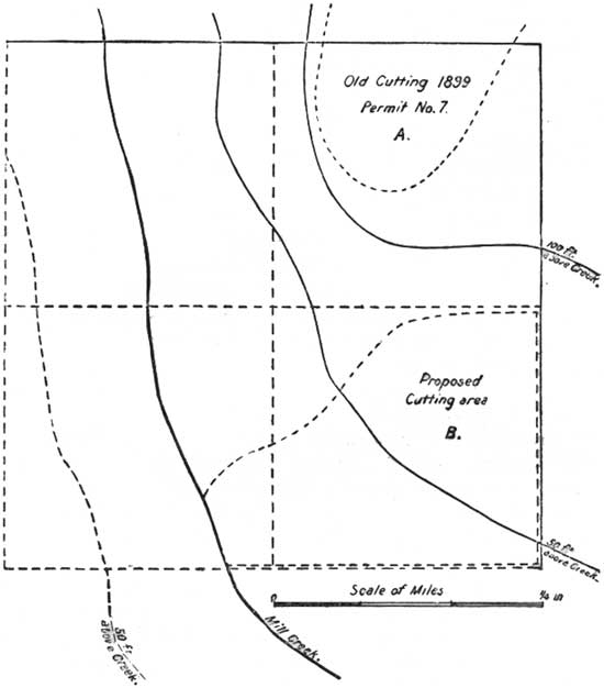
FIG. 1.—Black Hills Reserve. NE1/4 Sec. 14, T. 2 N., R. 3 E.
In chaining boundaries the chain need not be broken in order to secure horizontal measurement, as in ordinary land and railway surveying. In most cases it will be sufficient to allow it to drag loosely on the ground, although more care must be taken in exceedingly steep or rocky places.
In the absence of a surveyor's chain a strong cord may be used, the quarters and halves being marked by knots or bits of cloth. Whether full chains (66 feet) or half chains (33 feet) should be used depends largely upon the character of the region.
In emergency cases, when receipt of an application makes it necessary to lay out a block at once, two men may do the work, running and blazing the boundaries first and measuring them later.
As a rule, the method of surveying each block will be as follows:
Select a beginning point which can be accurately located, preferably the corner of some previously surveyed block, or, if such is wanting, a point on some stream, road, trail, or cutting which can be definitely described or located on already existing maps. Forks of roads or streams, or intersections of such, afford simple means of location. If no such features exist within or on the boundary of the block, the distance and direction of one given corner of the block from some known point outside should be established. The object of this care in location is not only to facilitate finding the block in the woods, but to allow accurate mapping. The beginning point will usually form one corner of the block, and should be distinctly marked by post and witness tree.
From this point run, chain, and blaze around the tract, noting the length and direction of the line between each corner and the distance to the crossing of all roads, streams, cliffs, and similar features; also the positions of buildings, clearings, or other objects which should appear on the map. Where the boundary of the block follows irregular lines, such as roads, streams, or ridges, the line must never curve, but may be meandered by as many angles and offsets as necessary to follow the general direction. Boundaries formed by roads, streams, open ground, or other unmistakable objects need not be blazed, but in such cases the corners must be clearly marked. (See sample map, fig. 2.)
All blazing must be reenforced by the United States mark. Block corners will be marked by posts, monuments, and witness trees, as in the case of districts, except that the marking must show the number of both block and district, as D-1, B-3.
Since, in many instances, it will be impossible to subdivide an entire district at one time, and the laying out of blocks will follow the receipt of applications, there will be considerable difficulty in numbering them by any definite system. For instance, application for timber in the southern end of a district, and the consequent survey of the block from which it is to be taken, may be followed by a similar requirement in the north end, while the intermediate portion remains unsurveyed. In such a ease it will be necessary to number the blocks as they are surveyed, without reference to their position in the district. If, however, there is an opportunity to subdivide the whole district, it is desirable that the numbering commence in the north end and proceed southward in regular order.
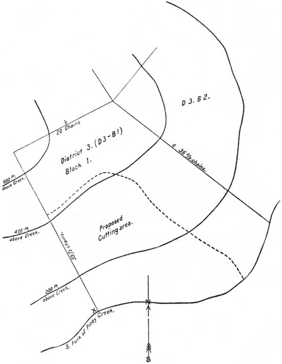
FIG. 2.—Big Horn Reserve. Piney Creek Drainage Basin, valley of
south Piney, District No. 3, Block No. 1.
For this reason, and also to utilize the advantage of a complete surveying squad as long as possible, before other reserve work requires the breaking up of the party, the work of districting and blocking should be pushed as fast as practicable. The mapping, estimating, and description may be left for a time when fewer men can be spared. The districting may proceed independently of the blocking and should, preferably, keep well ahead of it, though a district may be established before all of its boundaries are run out and marked.
MAPPING.
Block maps should include such details as buildings, roads, trails, streams, cuttings, fences, and mining or other claims. The topography may be shown by dotted contour lines, of which, to avoid confusion, there should never be more than four in one block. This rule will prevent the use of a regular interval between them, and the height of each should be marked, the lowest portion of the block representing zero.
If the block is surveyed especially to enable description of a tract covered by application, the proposed cutting area must be outlined on the map.
Block maps should be drawn with a hard, sharp pencil upon ruled sheets furnished for the purpose by the Department. In the absence of this, plain 8 by 10 paper may be used. A scale of 12 inches to the mile should be adhered to in all cases, and only one block is mapped on one sheet.
The original map will be forwarded, through the supervisor, to the central office, where copies will be made for the use of the supervisor and rangers.
ESTIMATING.
No forest officer will be considered competent who can not estimate standing timber. All work of this kind in the reserves will be required to be done systematically and accurately, and in all cases estimates must be accompanied by a description of the method used.
Most systems require knowledge of the contents, in cords and in board feet, of trees of any given height and diameter. The estimator should be able to approximate at a glance the number of logs of any length in a tree, the average diameter of these logs, and the number required to make 1,000 feet B. M. Where the timber is to be used for sawed lumber, he should note the probable proportion of the tree which will furnish clear material. In all cases the probable percentage of cullf or decay should, at least, be approximated. Forest officers should familiarize themselves with the condition of each species within their district, and endeavor, by observations at mills and logging camps, to learn the average proportion of unsound in each. Little timber will cull less than 10 per cent., and 30 to 40 per cent. is not uncommon in certain species. The outward signs of defect, such as "conks," "punk knots," exudations of resin, etc., should be carefully studied.
While officers, familiar with some particular methods of estimating, may often do more accurate work by them than if they attempt to learn entirely new systems, they should at least acquaint themselves with as many as possible. Since for many species of reserve timber the Government has prepared volume tables based on height and diameter at breast-high (4-1/2 feet from ground), it is important to be able to estimate the latter dimension readily. Given the number of trees of each diameter upon a tract and a table showing the average contents in board feet for these diameters, accurate computation of the stand is simple.
When these tables are not available, the breast-high diameter may still be used by estimating the number of logs and allowing a taper of about 1-inch in diameter to every 10 feet in length. This taper varies slightly with the height and species of timber, and the estimator should verify it by measurements of fallen trees.
Assuming, for illustration, that the estimator finds his tract averages to the acre 25 14-inch trees, 13 16-inch trees, 14 18-inch trees, etc.; also that all trees below 18 inches have an average log length of 22 feet, and those above 18 inches a log length of 26 feet, and, allowing a 2-foot stump and a taper of 1 inch to 8 feet, he finds that the average 14-inch tree contains a 22-foot log 11-1/2 inches in diameter (outside bark) at the small end. Or, if he wishes to reckon by smaller logs, it will make one log 12 feet long by 12-1/2 inches at the small end and one 10 feet by 11-1/2 inches. By deducting the probable thickness of bark and scaling these logs by the rule, he obtains the board-foot contents of the average 14-inch tree, and, multiplying this by 25, has the total contents of all trees on the acre in the 14-inch Class. By using the same process for the other diameters and adding the results, he has the total stand per acre.
The forest officer should know the probable yield of cord wood from the tops of trees of given diameter; also the amount from the tops and tops of 1,000 feet of saw logs or mining timber, in many cases where an estimate of both cord wood and logs is required, it will be sufficient to find the amount of logs and reckon the wood at the rate of so many cords to the 1,000 feet.
Given ability to judge of the contents of single trees, the estimator has choice of several methods for ascertaining the number of trees on his tract and therefore the total stand. The simplest of these, known as the quarteracre circle method, which may be used when time does not permit more accurate work, is as follows:
The estimate is made on circles of 20 yards radius, each of which contains quarter of an acre. These are taken at regular intervals throughout the tract and should actually cover as large a portion of it as possible. Less than 5 per cent of the area is not worth doing at all.
An experienced man can determine at a glance the area included within a 20-yard radius. An officer unfamiliar with the method will insure accuracy by placing a stick in the ground and pacing 20 yards in several directions until the size of the circle is learned. He then counts all trees within the circle which are of merchantable size, estimates the contents of the average tree or the number of trees to the thousand feet board measure, and notes the condition of the timber, per cent, clear and defective, etc. If he is familiar with breast-high measurements this system should be used, in which case he tallies separately the trees of different diameters, entering them in 2-inch classes, as 12-inch, 14-inch, etc. He can then compute the stand later according to the system previously described.
The figures for each circle should be kept separate, and, with a diagram showing the location of the circles in the tract, be forwarded with the total estimate upon the regular blank.
A more accurate method than the above, but which requires more work, is the estimating by strips about 4 rods wide taken at frequent intervals entirely across the tract. The counting and estimating of the trees is done in the same way as before. These strips should always run across, not parallel with, ridges and ravines, and their location on a diagram of the tract is similarly required.
When practicable, the entire-area method is preferable to either of the above. In this system the entire tract is estimated by going through it a sufficient number of times to see all the timber. To work to the best advantage, there should be two men—one to keep a straight line with the compass and to pace the distances and the other to estimate and tally the trees. This method is especially desirable in case of surveyed land, where the estimate should be made by "forties."
In ordinary practice it is usual to cross each "forty" four times, tallying by the strip method already described. It is better, however, to go through each block (in the case of surveyed land a quarter section) on lines not over 100 yards apart, making a halt at every 100 yards, and estimating the 100-yard square around this station. The figures for each square should be kept separate, and the location on the diagram will permit the averaging to be made for the entire block, or for each "forty," as desired.
The circle method first described should never be used in large timber, or where the trees stand far apart, since the area is too small to get a fair average of the number of trees on an acre.
Estimates of all tracts, whether entire blocks or areas covered by applications, should be reduced to average acres and entered upon the blank form furnished for this purpose. The size of the tract is stated in the space at the top of the blank and the total stand may be computed in the office. The diagram of the circles, strips, or squares, and the figures for each, forwarded with the total estimate on the blank form will enable the office, should it subsequently be desired, to obtain the stand on any portion of the tract which may differ from an average of the total.
SCALING.
Each stick of saw logs, timbers, poles, and lagging must be scaled separately. Hasty methods or averaging diameters or lengths will not be allowed. The Old Scribner rule will be used in all cases.
Ties need only to be counted; and are reckoned as follows:
8-foot ties, standard face, 33-1/3 feet B. M., each;
6-foot ties, standard face, 25 feet B. M., each.
Posts, poles, and piles are measured by linear feet, the valuation per foot increasing according to the length and size of the stick.
Shake and shingle-bolt material is measured by the cord.
Squared timbers are scaled by their actual contents in board feet with no allowance for saw kerf. Thus, an 8 by 12 inch 16-foot stick contains 128 feet B. M.
Unsound or crooked logs should be scaled down to represent their actual contents of merchantable material. In order, however, to restrain purchasers from unnecessary waste, all partially unsound but merchantable stuff should be scaled, whether removed or not. In ground-rotten timber, butts which, though decayed at heart, contain good lumber toward the outside are frequently left in the woods. Where such material will pay for sawing, the forest officer will scale it at what he considers its true value and include it in the amount purchased.
Logs with elliptical cross section should be scaled on the average diameter; flats and lagging on the widest diameter. All scaling is inside of bark.
In the absence of a log rule, or where the position of logs in the pile makes its use difficult, the diameters and lengths may be tallied and the contents figured from a scale table later.
When possible the purchaser shall be required to mark top ends of logs to avoid question when they are scaled in the pile. The forest officer should insist on having one end of piles or skidways even, so that ends of logs may be easily accessible. Where there is difficulty in ascertaining lengths of piled logs, two men should work together.
When scaled, each stick of saw logs, timbers, ties, lagging, posts, poles, or piles must be stamped with the United States mark on at least one end, and on both when possible. Cord material, such as wood or bolts, must be stamped at both top and bottom of piles and at least 12 pieces in each cord must be stamped.
When green logs 8 inches and over in diameter are made into cordwood they are paid for as saw timber at the rate of 2 cords to the 1,000 feet B. M.
The butt diameter of a 16-foot log is usually from an inch to 2 inches greater than that of the top end; yet if this log is sawed into lumber the amount of material obtained depends entirely upon the smaller diameter, because there is generally no way of utilizing the wedge-shaped slabs. For this reason logs are scaled at the small end, and in ordinary practice the same method is applied to logs of all lengths.
While this is approximately just in the case of short logs, it does not give fair valuation on long ones. By most rules a log 48 feet long measuring 12 inches at the small end is credited the same as three 16-foot logs of 12 inches diameter, or, taking the Scribner rule, 192 board feet. In reality, the 48-foot stick can be cut into three 16-foot logs of 12, 14, and 16 inch diameters, respectively. These will scale, by the same rule, 64, 100, and 144, or a total of 308 board feet, which is 51% more than is given by scaling the whole log. A mill man buying a 24-foot by 20-inch log pays for 420 board feet. But by cutting it in two he has a 12-foot log of 20 inches diameter and one of about 22 inches. These two logs contain 461 feet by the Scribner rule, and they are of an ordinary and profitable stock length. Again, he can saw the 24-foot log full length, but by taking 1-inch slabs which can be trimmed and edged into 12, 16, or perhaps 18 foot boards, still get more than the log scaled.
For this reason, in forest reserves, only logs 18 feet or less in length may be scaled at the small end alone. For those above that length the following system is prescribed:
| A 20-foot log | 1 10-foot log with top diameter. 1 10-foot log with top diameter + 1 inch. |
| A 22-foot log | 1 10-foot log with top diameter. 1 12-foot log with top diameter + 1 inch. |
| A 24-foot log | 1 12-foot log with top diameter. 1 12-foot log with top diameter + 1 inch. |
| A 26-foot log | 1 12-foot log with top diameter. 1 14-foot log with top diameter + 1 inch. |
| A 28-foot log | 1 14-foot log with top diameter. 1 14-foot log with top diameter + 2 inch. 1 10-foot log with top diameter. |
| A 30-foot log | 1 10-foot log with top diameter + 1 inch. 1 10-foot log with top diameter + 2 inch. |
Longer lengths may be computed in the same way, dividing the stick into 10-foot lengths, as near as convenient, and allowing about an inch taper to each 10 feet. This may vary somewhat, and if a greater taper is required the scaler must use his own judgment.
When a log is sawed there is a large waste in the form of sawdust and the proportion thus wasted depends both upon the thickness of saw used and the number of pieces made. It is clear that there is twice as much waste in cutting 1-inch boards as in sawing 2-inch planks.
It is also evident that for these reasons there can be no scale showing accurately how much lumber will be cut from any given log. Consequently there are a great number of scales, each devised for a special class of logs or for the manufacture of a special kind of stock. For the present the Old Scribner scale will be used in all reserve work.
Where the scale or stick is too short the contents of a sound log are figured according to the formula of the much-used Scribner-Doyle rule, which says:
Contents in board feet =
(Diameter—4)2; for example, an 18-inch log 16 feet long is computed thus:
Contents = (18—4)2 or 14 X 14=196 feet B. M.
Wherever the purchaser desires, timber will be sold by the cubic foot, which is an absolutely impartial measurement. In this case the area of each end of the log is found and the average of the two multiplied by the length of the stick in feet. This process gives the contents of the log in cubic feet. Tables giving areas of circles with any given diameter are easily available.
4. SPECIAL WORK.
This includes work incidental to grazing by sheep and cattle; examination of rights of way for roads, railways, canals, reservoirs, telephone and telegraph lines; the examination of agricultural claims, mining claims, sawmills, and other plants, and examinations necessary in attending to cases of special privileges, such as hotels, stopping places, stores, etc.
Generally, work of this kind is ordered specially, or arises in connection with special applications. It is important that examinations be thorough, complete, and correct in matters of detail, and that the report be full and clear. Mistakes, omissions, and unsatisfactory reports are sure to result in delay, and lead, in many cases, to a refusal in what is really a meritorious case. The forest officer should ever remember that the Department, generally, has no information in the premises save his report.
5. PERMANENT IMPROVEMENTS.
Under this head falls the work of timber survey, outlined in connection with instructions in the matter of timber sales. The laying out of every block is a permanent improvement, useful as long as the landmarks and map are in existence.
This kind of work is supposed to be carried on whenever circumstances permit, as, for instance, during damp weather. In summer, when danger from fire is small; also, during fall, winter, and spring, whenever other work is not too pressing. In judging this it may be said generally that the importance of the several kinds of work is as follows:
(a) Protection against fire.
(b) Protection against trespass.
(c) Special orders.
(d) Regular work in timber (sales and "free-use" cases).
(e) Trail work, etc.
(f) Survey work.
In many localities the work of timber survey is carried on fully as well on snowshoes in winter as on dry ground in summer, and forest officers will act accordingly.
The construction of trails, placing of signboards, and similar work must necessarily depend on conditions which the forest officers alone can know.
In any case a random blazing through the woods should be avoided. If the trail is worth making it is usually worth doing well, and should therefore be properly planned, laid out, and then cut out and worked. The custom of leaving trails "hidden," as it were, by avoiding to mark their terminal points and by leaving off signboards is considered inadvisable. Every improvement of this kind should be made with a view to doing as much good as possible.
The construction of shelters, cabins, etc., should be done economically, and should, like all work of this kind, be done only with the approval of the supervisor. All work done should be reported promptly and intelligently.
6. PROTECTION OF GAME.
In the protection of game the forest officer acts as an assistant to the game wardens of the State or Territory in which be is located. It is his duty to discover violators of the game laws and help to stop their depredations.
Reports on violations of the game laws are made to the central office and to the local or State game warden, and if the case seems to warrant, a copy of such report is sent to the governor of the State.
| <<< Previous | <<< Contents>>> | Next >>> |
|
forest-reserve-manual/sec7.htm Last Updated: 10-Nov-2008 |