|
National Forests in Michigan
|
|
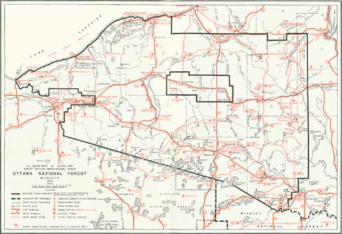
Ottawa National Forest
IN THE EXTREME western part of the Upper Peninsula are the 1,743,000 acres of the Ottawa National Forest, dotted by 400 lakes and veined by 1,200 miles of streams. The largest national forest in Michigan derives its name from the Indian word "adawe," meaning trade. The first authentic record of a white man in this territory is found in the history of Rene Menard, a French priest who came to the Upper Peninsula in 1659. While traveling over the old Indian trail from L'Anse to LacVieux Desert on the Wisconsin-Michigan line, Father Menard became separated from his companions and disappeared. Because of its historical interest, the Forest Service has retraced and marked parts of the old Indian trail which still exist.
|
|
OTTAWA NATIONAL FOREST (click on image for a PDF version) |
Timber.
Up to and including 1939, 63,900 acres were planted on the Ottawa to red, jack, and white pine, and to white and Norway spruce. Approximately 73,000 acres remain to be planted with seedlings supplied by the 83-acre nursery at Watersmeet.
Timber on the Ottawa National Forest will be managed for saw timber as the final crop, but intermediate crops are pulpwood, chemical wood, cross ties, box bolts, fence posts, and fuel wood. The present annual yield of 10,000,000 feet is expected to increase as younger stands reach merchantable size.
|
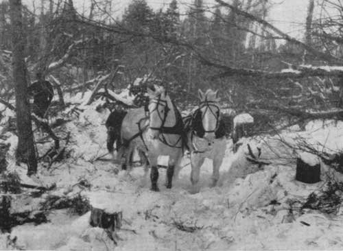
| THE FOREST IS A RESERVOIR OF EMPLOYMENT. F—300815 |
Hunting and Fishing.
Fish and game management consists of stream and lake improvement; stocking lakes and streams; planting food and cover for waterfowl, deer, upland game birds, and fur bearers; and the treatment of various areas by thinning and by timber sales to increase food and cover.
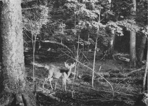
The principal big-game species is the Virginia white-tailed deer. Bears are not uncommon. Beaver, coyotes, timber wolves, bobcats, fox, otter, skunk, mink, muskrat, and porcupine range from scarce to abundant throughout the forest.
Various species of waterfowl make their breeding grounds in this locality. They include the bluebills, mallards, black duck, teal, and many others.
Lake trout, muskellunge, great northern and wall-eyed pike, bluegills, black bass, sunfish, perch, bullheads, and crappies are found in the Ottawa's lakes; and brook, rainbow, and brown trout are abundant in most streams within the forest.
|
| A WHITE-TAILED DEER AT HOME ON THE OTTAWA NATIONAL FOREST. F—371800 |
|
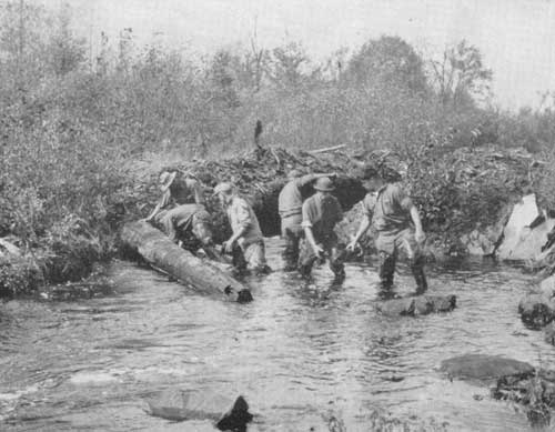
| THE FOREST SERVICE LEADS THE CCC IN IMPROVING TROUT STREAMS. F—293655 |
Recreation.
A vast area of virgin wilderness contributes to the appeal of the Ottawa. Four major highways pass through the forest, and a system of county and Forest Service roads reaches into many more inaccessible areas.
Developments for the use of picnicking and camping visitors have been completed at nine desirable locations, and more will be provided as need requires. Here, in forest settings but little disturbed by the conveniences installed, all kinds of outdoor recreation are available. Other smaller areas throughout the forest allow the vacationist a variety of sites and developments.
|
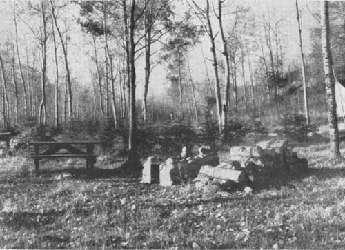
| STATE QUARRY CAMPGROUND. F—364644 |
On Nesbit Lake, south of Sidnaw, is the Nesbit Lake Organization Camp, with accommodations for 96 campers. It is available to organized groups such as the Boy Scouts, 4—H Clubs, church organizations, and private non-profit organizations at a nominal rental to cover upkeep. It is completely equipped with buildings, water and power systems, and bathing and play facilities.
In the northern part of the forest on Lake Superior, 22 miles west of Ontonagon, lie the Porcupine Mountains, a rough, rugged, timbered wilderness of some 100,000 acres. Roads have not penetrated this area, and it is accessible only by foot trails.
Some of the grandest scenery in the Upper Peninsula of Michigan is within the boundaries of the Ottawa National Forest. Black River Falls, north of Bessemer, Lake of the Clouds, about a 20-minute drive west of Ontonagon, and Bonds Falls, west of Paulding, are three beauty spots. At Black River Park, at the mouth of Black River, about 20 miles north of Bessemer, and at Little Girls' Point, 18 miles north of Ironwood, boats and guides maybe engaged for trout fishing in the deep waters of Lake Superior, from which the big ones come, fresh and hard.
|
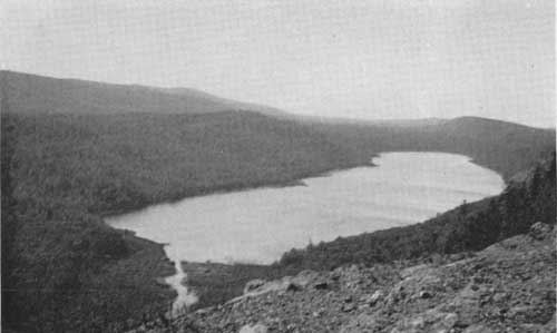
| LAKE OF THE CLOUDS IN THE RUGGED PORCUPINE MOUNTAINS, HIGHEST LAKE AND HIGHEST LAND IN MICHIGAN. F—362655 |
Presque Isle River and the deep valley through which it rushes over cascades and falls, just before it flows swiftly into Lake Superior, possess unusual scenic attraction. Comparatively few persons have seen and enjoyed this beauty for the only way of reaching it is by boat from the mouth of the Black River or by canoe from the point where the river crosses Highway M—28 east of Tula. Most of those who have visited this spot have traveled by boat on Lake Superior from Black River. The more adventurous persons, if they have several days to spend on the trip, take the route by canoe from Tula.
Many other recreational possibilities are offered to the visitor on the Ottawa. Visitors are welcome to stop at camps, climb fire towers, visit the nursery, and call at the supervisor's office at Ironwood and the ranger stations at Bergland, Bessemer, Iron River, Kenton, Ontonagon, and Watersmeet.
| IF YOU DON'T KNOW—ASK THE FOREST RANGER |
| <<< Previous | <<< Contents>>> | Next >>> |
|
handbooks/michigan/sec5.htm Last Updated: 19-Nov-2010 |