|
San Juan National Forest |
|
San Juan National Forest
SAN JUAN NATIONAL FOREST is located in the southwestern part of Colorado, south and west of the Continental Divide, and extends, from the headwaters of the Navajo River westward to the La Plata Mountains. It is named after the San Juan River, the principal river drainage in this section of the State, which, with its tributaries in Colorado, drains the entire area within the forest. It contains a gross area of 1,444,953 acres, of which 1,255,977 are Government land under Forest Service administration, and 188,976 are State and privately owned. The forest was created by proclamation of President Theodore Roosevelt on June 3, 1905.
|
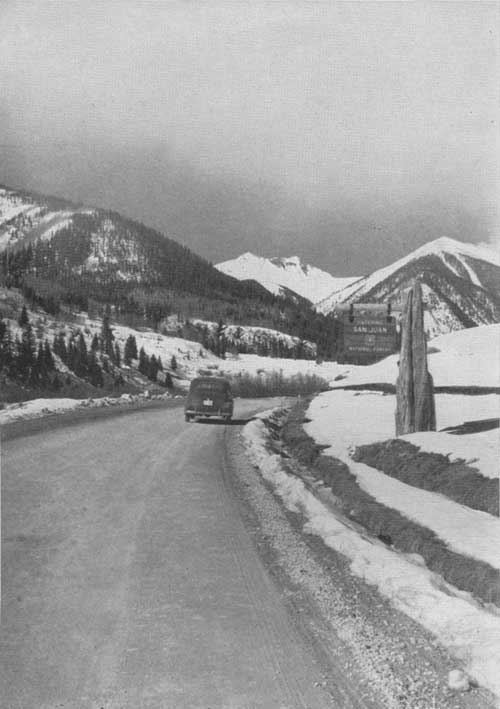
| San Juan National Forest boundary entrance portal, west of Silverton, Colo. F—414624 |
RICH IN HISTORY
The San Juan country records the march of time from prehistoric man through the days of early explorers and the exploits of modern pioneers, each group of which has left its mark upon the land. The earliest signs of habitation by man were left by the cliff and mound dwellers. Currently with or following this period the inhabitants were the ancestors of the present tribes of Indians, the Navajos and the Utes. After the middle of the eighteenth century the early Spanish explorers and traders made their advent into this section of the new world in increasing numbers.
The earliest definitely recorded expedition by white men into this country was made by Capt. Juan Marie de Rivera in 1765, and the second, by Padre Francisco Escalante in 1776. Both of the expeditions followed the same route from Santa Fe, skirting the southern boundary of what is now the San Juan National Forest, thence westward to the Mancos River; northward to the present town of Placerville, on the San Miguel River; and by way of the Dallas Divide to the Uncompahgre and Gunnison River valleys. De Rivera's route beyond that locality is uncertain. Escalante however, is known to have continued westward through Colorado and Utah, returning to Sante Fe by way of Arizona and New Mexico. During this expedition Father Escalante is credited with giving Spanish names to the larger streams of this region—the Rio San Juan (St. John River), Rio de las Piedras (Stony River), Rio de los Pinos (Pine River), Rio Florida (River of Flowers), and Rio de las Animas Perdidas (River of Lost Souls). Modern usage has shortened these names to San Juan, Piedra, Pine, Florida, and Animas.
Other expeditions include one led by "Commodore" William G. Walton in 1831; General Freeman in 1848; R. E. Stewart, U. S. cavalryman, in 1860; and Charles Baker in 1860-61.
The Baker expedition was the forerunner of and largely responsible for the influx of prospectors and settlers shortly thereafter, largely because of the publicity it received. The expedition, which included 200 men under the leadership of Charles Baker, entered the San Juan Basin from the San Luis Valley via Stony Pass and established camp in Bakers Park, the present site of Silverton. From this location the members of the party thoroughly explored the region. Here it was that in 1861 the members suffered privation and starvation. Many of the men perished, and Baker himself narrowly escaped death at the hands of his mutinous band.
A treaty with the United States Government in 1868 established the Southern Ute Indian Reservation. This was superseded by the treaty of 1874, which released the greater part of the original reservation for settlement and mineral development, and was followed by an influx of pioneers who established the towns and the farming and mining communities throughout the San Juan Basin.
MINING
Prospectors who entered the San Juan country 10 years after Charles Baker's unsuccessful trip found gold ore in Arrastra Gulch, near Bakers Park. In 1873, these mines began to produce and soon other strikes were made throughout the San Juan Basin, causing several "booms" in that region. According to the Bureau of Mines, the output of ores from San Juan Country for the years 1873-1940 was $109,609,229. Of this amount, 29 percent was gold, 24 percent silver, 23 percent lead, 14 percent zinc, and 10 percent copper. La Plata County, a part of which is also in the San Juan National Forest, has produced during the same period $5,975,822 in the 5 principal ores. Mining continues to he a thriving industry in the Silverton region.
A RUGGED MOUNTAIN COUNTRY
The more mountainous sections of the forest are particularly rugged and formidable, with scenery that is seldom equaled. They include the La Plata, Silverton, Needle, Grenadier Range, and San Juan Mountain groups, with peaks rising more than 13,000 feet above sea level.
Perhaps the outstanding topographic feature is the Needle Mountain group, which lies between the Animas and Vallecito drainages, some 25 miles north and east of Durango. The United States Geological Survey describes this group as "a range of extremely rugged mountains of granite and schist from which rise sharp peaks, the summits of 4 of which are over 14,000 feet in elevation, while 6,000 feet below the Animas River rushes through a canyon which separates the West Needles from the main group. From Needle Creek on the south to Elk Creek on the north, and from the Vallecito to the Animas, they form a group of peaks almost unequaled in this country in altitude and in boldness of their forms."
Through this group the Animas River follows an irregular course "in a gorge nearly 15 miles long and from 3,000 to 4,000 feet deep. At a few places the river flows between rock walls and on a rock bottom, and at such points the roadbed of the railroad (Durango-Silverton branch of the Denver and Rio Grande Western) has been blasted from the solid rock. The canyon itself is an almost impassible barrier between the East and West Needles. A few trails extend up into the mountains to the east, following the larger streams, but the western wall is almost without a break and can be surmounted only on foot after long and arduous climbing."
Almost equally spectacular and standing aloof from other neighboring mountains is the La Plata Mountain group, located in the extreme southwest corner of the forest. Bold in outline, the several peaks may be distinguished by the wayfarer on the New Mexico desert scores of miles to the south and serve to guide his travels to the locality. The La Plata River through an indeterminable period of years has cut a gash through this mountain of rocks, and formed the La Plata Canyon, an area of singular beauty.
Other mountain groups within the San Juan National Forest worthy of mention are the Silverton Mountains, surrounding the town of Silverton; the Grenadiers, extending from the Animas to the headwaters of the Vallecito; the San Juan Mountains, north of Pagosa Springs; and the Continental Divide Range extending north and south from Wolf Creek Pass.
|
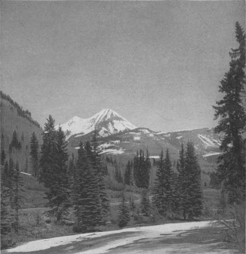
| Engineer Mountain seen from the Million Dollar Highway between Durango and Silverton. F—393444 |
HIGHWAYS AND RAILROADS
Towns and points of interest within or adjacent to the San Juan National Forest may be reached over improved automobile highways or by railroad. U S 160, crossing the Continental Divide at Wolf Creek Pass from the east, passes through the center of the San Juan Basin via Pagosa Springs, Bayfield, and Durango, and thence extends westward via Mancos and Cortez to Salt Lake City and the west coast. U S 550, long known as the Million Dollar Highway, extends southward from Montrose to Ouray, across Red Mountain Pass, through Silverton and to Durango, thence to Aztec, N. Mex., where it joins other highways leading to Albuquerque, or to Gallup, via Farmington and Shiprock.
Another highway leading from the San Juan Basin begins at Pagosa Springs and extends southeastward to Chama, N. Mex., thence to Santa Fe or via the Cumbres Pass Highway to the San Luis Valley. A number of branch roads connect these main highways with various points in the interior of the forest.
The narrow-gauge lines of the Denver and Rio Grande Western and Rio Grande Southern Railroads, leading to Durango from the east and west, respectively, closely parallel the southern boundary of the forest.
The more inaccessible parts of the forest can be reached only by foot and horse trails, built and maintained by the Forest Service. These trails, totaling 1,213 miles, provide satisfactory routes of travel for those who wish to take advantage of horseback or hiking trips.
WHY NATIONAL FORESTS
There are 160 national forests within the United States, located in 36 States, Alaska, and Puerto Rico. They contain approximately 176,000,000 acres of public land and are administered by the Forest Service, of the United States Department of Agriculture.
The national forests were established and are administered for the purpose of making the many resources which they contain of largest service to the local communities, the State, and the Nation. Forest administration includes the growing and conservative use of successive crops of timber and forage; the prevention and suppression of forest fires; the preservation of an adequate forest cover to regulate the flow of streams, retard excessive runoff, and prevent erosion; and the use of all forest resources in the ways which will make them of greatest good to the greatest number of citizens throughout the years.
TIMBER RESOURCES AND MANAGEMENT
The San Juan National Forest contains a total volume of merchantable sawtimber estimated at 4,530,000,000 feet, board measure, the largest for any national forest in Colorado. Ponderosa pine, Engelmann spruce, and Douglas fir are the most important species of trees found on this forest and make up about 93 percent of the total volume of the merchantable stand. Other species containing merchantable sawtimber are alpine, corkbark and white fir, blue spruce, and limber pine. Lumber and railroad ties are the principal forest products manufactured at the present time; however, the Engelmann spruce stands constitute a valuable potential supply of pulpwood.
Mature timber may be purchased from national forests. All timber sold is cut in accordance with approved forestry practices, which provide for the removal of defective, diseased, mature, and overcrowded trees from the stand. Such selective cutting removes from 50 to 75 percent of the volume of the stand and leaves the thrifty younger trees, ranging from saplings to those which will mature in the next cutting cycle. Properly spaced trees in a thinned forest respond to the influence of additional light, food, and soil moisture with increased growth, and produce seed to reforest the open spaces. A forest unit such as a working circle, may include all the timber on a certain watershed and is managed so that the timber removed each year does not exceed the amount added through annual growth. With good management, including protection from fires and insect infestations, such forest units will produce a constant volume of timber for all time.

|
| Ponderosa pine logs cut in a Forest Service timber sate. F—412137 |
| <<< Previous | <<< Contents>>> | Next >>> |
|
handbooks/sanjuan/sec1.htm Last Updated: 19-Nov-2010 |