|
San Juan National Forest |
|
CAMP AND PICNIC GROUNDS
Forest visitors are invited to use any of the following camp sites for reasonable lengths of time. There is no charge for such use, but campers should take care of the improvements and keep the premises clean.
Piedra.—Located on Piedra Park road, 20 miles northwest of Pagosa Springs in Piedra Park, near the Piedra Ranger Station and Piedra River. Fishing in nearby streams; saddle horses and pack outfits available at ranches 1-1/2 miles north.
Williams Creek.—Twenty-seven miles northwest of Pagosa Springs, on the Piedra Park road, on Williams Creek, a tributary of the Piedra River. Fishing; saddle horses and pack outfits available at ranches 2 miles from the campground, on Weminuche Creek.
Wolf Creek.—On U S 160, 16 miles northeast of Pagosa Springs. Boating, fishing, and transportation facilities at Born's Lake, 3 miles northeast of campground. Fishing in west fork of San Juan River and tributaries.
Lime Creek.—On U S 550, 36 miles north of Durango and 17 miles southwest of Silverton. Fishing and mountain climbing in the Needles Mountains.
South Mineral.—On county road 7 miles west of Silverton. Good fishing in South Mineral Creek, Ice Lake, and Clear Lake. Mountain climbing in some of the highest and roughest scenic country in Colorado.
Columbine.—On U S 550, 27 miles north of Durango and 28 miles south of Silverton. Adjacent to the Hermosa elk country. Saddle horses procurable for 1-day rides or pack trips, at ranch 1 mile below the campground.
Lower Piedra.—Twenty-two miles west of Pagosa Springs, 1 mile north of U S 160, on the Piedra River. Fishing in the Lower Piedra; saddle horses for 1-day rides available at nearby ranches.
West Fork.—Seventeen miles north of Pagosa Springs on the West Fork of the San Juan River, 1-1/2 miles from U S 160, at the foot of Wolf Creek Pass. Fishing in west fork of San Juan River. Boating and fishing at Born's Lake resort, 2 miles from campground; horses available for 1-day and pack trips, 1 mile from campground.
East Fork.—Located 11 miles north of Pagosa Spring, 1/2-mile off U S 160, on the East Fork of the San Juan River. Good fishing in the East Fork, San Juan River, and Sand Creek.
Pine River.—Twenty-one miles north of Bayfield, on Pine River, at end of road passable to automobiles. Fishing in the Pine River; saddle horses procurable for trips of any duration from resort 1 mile south, from a ranch 3 miles south, and from a ranch 9 miles south on road leading to campgrounds.
Emerald Lake.—Thirty miles north of Bayfield, at Emerald Lake, on Emerald Lake trail. This is a pack or horse trip from the Pine River campgrounds, 9 miles by trail. Fishing in Emerald Lake and Lake Fork Creek; saddle and pack horses procurable from resort 1 mile south and ranch 3 miles south, also ranch 9 miles south on road leading to Pine River campgrounds.
Waterfall, Blue Spruce, Lower Willow Park, Upper Willow Park.—A series of camping and picnic grounds located 28 to 30 miles from Bayfield, on Pine River, reached by automobile to Pine River campgrounds, thence by saddle horse and pack from there. Saddle and pack stock can be procured from nearby ranches with or without a guide.
Flint Lakes and the Head of Pine River.—These two fishing waters can best be reached from Ludwig ranch on Weminuche Creek or Rio Grande Reservoir, on the Rio Grande River. Saddle and pack stock procurable from the dude ranch at Rio Grande Reservoir.
|
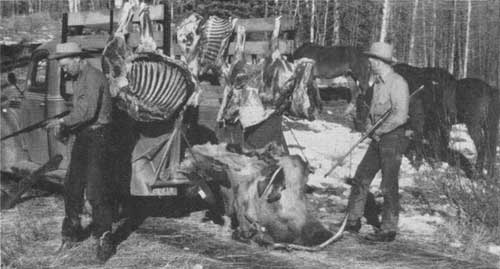
| Two successful hunters. F—414622 |
SAN JUAN WILDERNESS AREA
The San Juan Wilderness Area includes approximately 250,000 acres of scenic alpine territory extending along the Continental Divide from the East Needle Mountains to the headwaters of the West Fork of the San Juan River. Within this rugged region, there are several mountain ranges in which peaks tower in excess of 13,000 feet. The crags, spires, and pinnacles of the Needle Mountains within this area have been described as "terribly beautiful." Three of the highest are: Windom Peak, 14,091; Mount Eolus, 14,086; and Sun-light Peak, 14,060 feet. These three, surrounded by a score of peaks of but slightly lower elevation, make this area a mecca for the mountain climber and the outdoor enthusiast seeking primitive conditions. Banks of perpetual snow, from which flow streams that drop over rock ledges forming inspiring waterfalls, canyons carved through granite beds, colorful mountain meadows, and spruce-covered slopes all combine to make an unusually attractive region, unsurpassed in the rough upheavals of the Colorado Rockies.
This is essentially a wilderness, as it contains no man-made improvements, except the few trails required for administration of the area and for its protection from forest fires. Its only practicable means of access is by trail with saddle horse and pack outfit. Its purpose is to preserve the natural environment for the enjoyment of this and future generations, unmarred by roads, summer homes, resorts, and similar improvements.
PREHISTORIC RUINS
Within and adjacent to the forest are many interesting archaeological ruins. These have been traced back to the period of the post-basketmakers' culture, or approximately the beginning of the Christian Era. The most extensive ruins within the forest are located on Chimney Rock Mesa, 22 miles west of Pagosa Springs, which may be reached by a walk of 1-1/2 miles over a trail leading from U S 160. The community occupied an area approximately a mile square. In 1925, the ruins were partially excavated by the Colorado State Historical Society, which uncovered one chamber 209 feet long by 80 feet wide. Excavation of prehistoric ruins is allowed only under permit granted to scientific and educational institutions or their authorized agents.
| <<< Previous | <<< Contents>>> | Next >>> |
|
handbooks/sanjuan/sec4.htm Last Updated: 19-Nov-2010 |