The Historical Role of Fire on the Bitterroot National Forest
Research Paper INT-187
|

|
Appendix A
FIRE FREQUENCIES AND SAMPLE TREE LOCATIONS
|
|
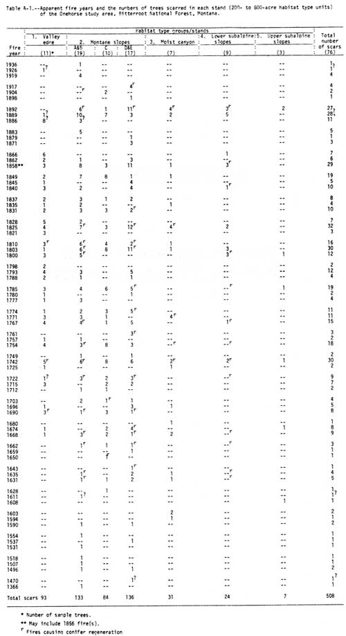
Table A-1.—Apparent fire years and the numbers of trees scarred in
each stand (200- to 800-acre habitat type units) of the Onehorse study
area, Bitterroot National Forest, Montana. (click on image for a PDF version)
|
|
|
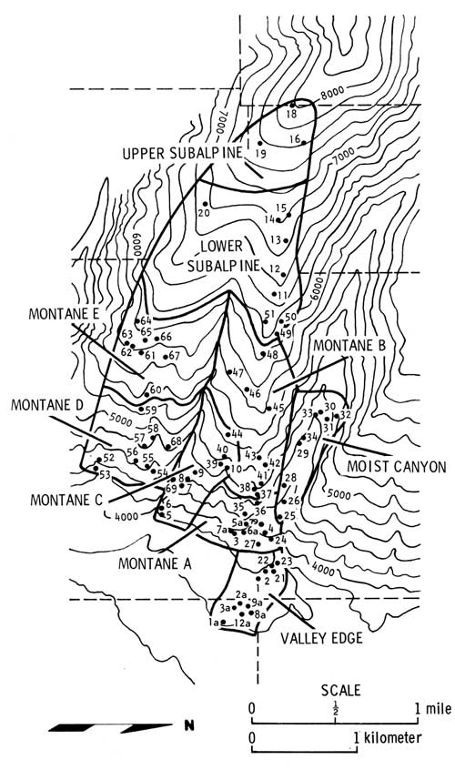
Figure A-1.—Topographic map of the Onehorse study area showing the
geomorphic units and sample-tree locations. (click on image for a PDF version)
|
|
|
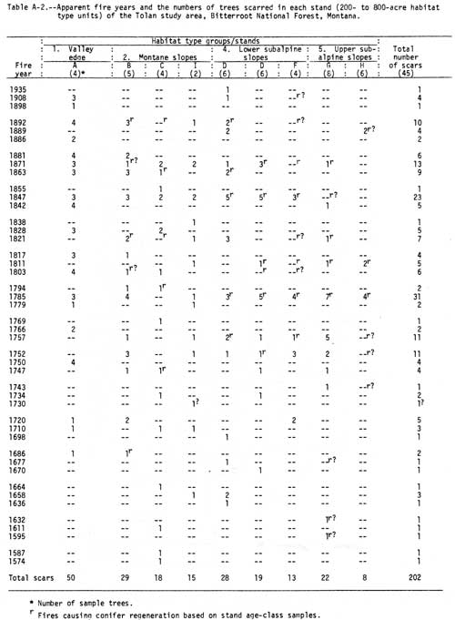
Table A-2.—Apparent fire years and the numbers of trees scarred in
each stand (200- to 800-acre habitat type units) of the Tolan study
area, Bitterroot National Forest, Montana. (click on image for a PDF version)
|
|
|
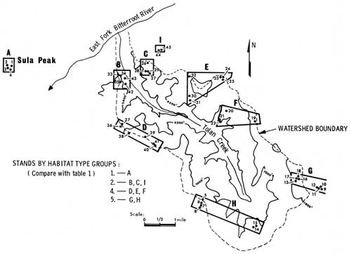
Figure A-2.—Topographic map of Tolan Creek study area (800-ft
contour interval) showing sampel tree locations. (click on image for a PDF version)
|
|
|
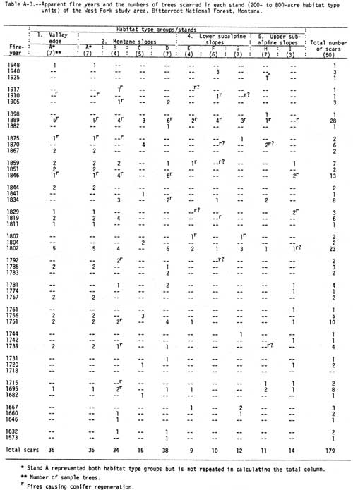
Table A-3.—Apparent fire years and the numbers of trees scarred in
each stand (200- to 800-acre habitat type units) of the West Fork study
area, Bitterroot National Forest, Montana. (click on image for a PDF version)
|
|
|
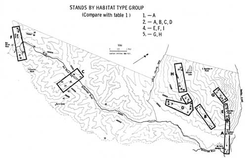
Figure A-3.—Topographic map of West Fork study area, Ravalli
County, Montana, showing sample tree locations. (click on image for a PDF version)
|
|
|
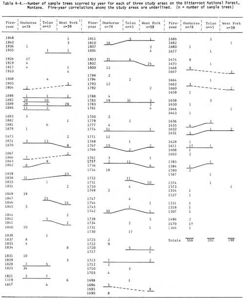
Table A-4.—Number of sample trees scarred by year for each
of three study areas on the Bitterroot National Forest, Montana.
Fire-year correlations among the study areas are underlined.
(n = number of sample trees) (click on image for a PDF version)
|
int-187/appa.htm
LaLast Updated: 12-Sep-2011 |
|