|
The Clearwater Story: A History of the Clearwater National Forest |
|
Appendix B
Geographic Names
Almost every geographic feature on the Clearwater Forest has a name. The origin of many of these names in unknown. There are also many names that were arbitrarily given to a feature without a historical reason.
The first people to name geographic features were, of course, the Indians. Generally the white men chose their own names and disregarded those of the Indians. Few Indian names, or even their translations, exist today. When they do, they are usually misspelled or mispronounced. Lewis and Clark named a number of rivers and creeks, but their names are not used today except for Hungery Creek which was renamed in 1959. Next came the miners following the discovery of gold at Pierce in 1860. They spread out across the country and most of the major streams and many of the mountains have names given them by the prospectors. Settlers named a great many of the features especially on the edge of the forest and almost all of the features on the Palouse District.
Finally the Forest Service took over and members of that organization are responsible for a great majority of the names. Survey crews, Rangers, cruisers and others all had a hand in the naming process. They are continuing to add names.
Names originate in a number of ways. Some come from things that can be seen on the ground such as bald, flat, cliff, greenside, castle, barren, avalanche, etc. Names of trees, shrubs or other plants growing in the area are used such as pine, cedar, willow, alder, tamarack, syringa, spruce, hemlock, etc. Many features are named for people both in and out of the Forest Service.
Frequently some feature is named and then others in the same locality have a variation of it, such as Liz Point, Liz Creek, and Liz Cabin. When more than one feature has the same name I will give the origin of the first one named.
Animal names are common. Almost every animal that's found on Clearwater has its name on the map at least once. I will omit these names as they are obvious.
There are a large number of names placed on the map without any reason except to give it a name. I ran a survey crew in the Lochsa country in 1924. Charles Fox was the draftsman and when we put a creek on the map that wasn't named he thought one up. He had no idea that these names would become permanent but many of them were adopted. Then there was Ranger O.A. Knapp who supplied many names. There was to be a new map printed in 1931. It was urged that unnamed features be named. O.A. Knapp was placed at the head of the project and he really went to work. He put a lot of names on the map. Few of them had any historical background. Any name he could think of was used. Girl names were his favorites. Some say he used the names of the sporting gals of Pierce, but with all the girl names he used and the number of girls in Pierce at that time there was bound to be some duplication.
In listing geographic names I have omitted names of animals, trees, shrubs, those of no historical background and those named for obvious reasons. There are quite a large number for which the origin is unknown.
Here are the names with a historical background that I could trace:
Andy's Lake - Named for "Andy" Hjort.
Apgar Creek - Named for Bill Apgar by Adolph Weholt. Bill was a fire man on the Lochsa District and was helping Weholt map the bar at the mouth of the creek.
Aquarius - Named by an army officer in the CCC days when a campground was being built here.
Armstrong Gulch - Named for John Armstrong who mined it in the placer mining days.
Army Mule Saddle - An expedition headed by Ranger William Bell was enroute to Bear Mountain to attack the flank of the Bald Mountain Fire in 1929. A string of army mules was in the outfit. The string rolled at this saddle and one mule was killed.
Ashpile Peak - Named by Charles Fox while on a timber survey in 1924. Named this because from the west the top of the peak looks like a pile of ash.
Austin - Named for John Austin, a trapper and Forest Service employee for many years.
Bald Mountain - The Indians also used this name. It appears on early maps. Because of its grass it was a favorite place to camp.
Barnard Creek - Named by Lunde for one of his map makers.
Bear Creek - A branch of Kelly Creek was in a burn when the first miners came to the Moose City country. The hunters would go there in the early spring to hunt bear, according to Ernest Hansen. The branches of Bear Creek having names of Kodiak, Cub, and Polar are arbitrary names given to these streams by Ranger Gaffney.
Bear Mountain - The one which overlooks the Lochsa River was called Bear Grass Mountain. The name was changed to avoid conflict with another Bear Grass Mountain at the head of O'Hara Creek.
Big Sand Lake - This lake was originally White Sand Lake. A lake near Grave Peak was called Big Sand Lake. Somehow the names became confused.
Bimerick Creek - Named for George Bimerick, a ranger and trapper who had a cabin at Bimerick Meadows.
Black Mountain - This mountain is forested with mountain hemlock, giving it a darker green color than the surrounding mountains.
Boundary Peak - This peak was on the boundary between the Lochsa and Pierce Ranger Districts when named.
Bowl Mountain - A glacial cirque hollows the top of this mountain into a bowl.
Bradford - Named for a prospector who had a cabin on Lolo Creek.
Brady Creek - Mr. Brady homesteaded Crane Meadows. The name is sometimes erroneously spelled Brody.
Broken Nose Creek - When installing a culvert here there was an accident in which Ranger Bernie Glaus received a broken nose.
Browns Creek - Named for Jim Brown, an early-day prospector.
Buck Ridge - Named for Buck Davis, a sheep permittee.
Buckner Creek - An engineer for the Forest Service on the timber survey of the Musselshell country in 1913-14.
Buckingham Peak - Named for Ranger Bill Buckingham.
Bungalow - In 1906 Nat Brown, when employed by the Weyerhaeuser interests, built a bungalow-type cabin here. The site became known as the bungalow. The cabin burned August 19, 1919. There was a Ranger Station and supply base here for many years.
Burn Creek - A large part of the Weitas drainage was green before the 1910 and 1919 fires. However, this drainage had been burned about 1896.
Cabin Creek - A branch of the Weitas. Deadshot Smith had a cabin at the head of this creek called the Hunch Cabin. Hunch was the name of a mining prospector. Cabin Creek on the Powell was given this name by the early mappers because there was a cabin near its mouth.
Cache Creek - Named for Frank Cash, a helper on Adamson's survey crew which located the road to the Bungalow in 1919. It was called Cash Creek for a number of years before Ranger Diehl put the name on the map in 1929. Not knowing the origin of the name, he spelled it "Cache" Creek.
California Lake - Two men from California working for Ranger Parry named this lake for their home state.
Camp Creek - This name comes from Camp Marten at its head.
Camp George - George Engelhorn had a trapper's cabin near the head of this creek.
Camp Martin - Bill Martin, who did some trapping, had a cabin here and a homestead at Musselshell Meadows.
Cantaloupe Creek - This is one of the names Charles Fox put on the map. He did it in fun believing it would never be adopted.
Castle Butte - First called Castle Rocks. Before the top was flattened for a building, the rocks were said to resemble a castle.
Castle Rock - On the east side of the North Fork of the Clearwater River, and about one half mile downstream from Pack Creek, is a bluff which was first known as Eagle Rock because of a supposed eagle's nest on top of it. Walter Sewell told me that it was actually an osprey nest. In the 1919 fire which burned the Bungalow the nest was burned and was never rebuilt. Later this rock became known as Castle Rock. Many people assume that this name came from the shape of the rock. Actually it was named for Ralph Castle, a trail foreman who carved his name and the date in the rock when a trail was blasted through it. This rock went straight down into the water so the trail was carved into its face.
During the CCC days when there was a CCC camp across the river from the mouth of Orogrande Creek, a narrow road was started down the river. When it neared Castle Rock work was halted because of the hard work and expense involved in drilling and shooting a road through this hard, quartzite rock. The road ended there until I came to the forest in 1954.
In 1955 it was decided to build a road downriver from the Bungalow at the mouth of Orogrande Creek. The engineers soon ran into the problem of what to do about Castle Rock. There were two choices; either blast a road through the face of the rock or go around it by filling out into the river. Both were expensive, but it was slightly costlier to fill into the river. There were also objections to putting a fill in the river. The engineers asked me for a decision. Bernie Glaus, Forest Engineer, Norman Allison, Road Locator, and I went to the rock. I studied the engineers plans and the rock formation. I found that at the back of this huge mass of rock there is a fault or line of cleavage. It was possible that blasting a road through its face might cause it to break off and fall into the river. I therefore, decided that the rock should not be disturbed. It is there today and if you will look closely at the edge of the road a part of Ralph Castle's name can be seen.
Cave Creek - There is a rock cavern on this creek.
Cayuse Creek - When Crane and Altmiller left the Blacklead country in the spring of 1887 to work their way to Pierce, they dropped down into what is now known as Cayuse Creek. There they found a pony or cayuse that had spent the winter there. They called the stream Cayuse.
Chamberlain Meadows - Named for a trapper, prospector, and miner.
Chamook Creek - Chamook is Nez Perce for black.
Chauteau - Jimmy Clarke named this point. From Clarke Mountain the top of this rocky point reminded him of a chateau.
Chimney Butte - This point is topped with some loose slabs of flat rock. Years ago several rock cairns were built here. One looks like a chimney. Why they were built is unknown but I surmise they were trail markers to assist in crossing Sherman Saddle from the west.
China Creek - Named for the Chinese miners.
Clarke Mountain - Named by Ranger Clover for Jimmy Clarke, fireman and lookout on this point for several years. It was first called East Elk.
Clayton Creek - Named for Clayton Shoecraft, one of the men who died of scurvy at Cayuse Landing Field.
Cole Creek - Named for Frank (Daddy) Cole who had mining claims on Gold and Musselshell Creeks.
Colgate Warm Springs - Was originally called Jerry Johnson Hot Spring. It was renamed after George Colegate was buried here (see chapter on Carlin Party).
Collins Creek - Named for John (Jack) Collins a well-known woodsman who was packer and guide for Lunde's mapping crew.
Colt Creek - There is some disagreement on the origin of this name but I accept Koch's version. He says the creek was named for Mr. Cott who was head of a cruising party of the Northern Pacific Railroad Company when it was examining lands in this area for acquisition. The mappers erroneously changed the name to Colt.
Comet Creek - The Clearwater Forest once had a saddle horse called Comet that was particularly good at getting through country where there were no trails. Paul Gerrard rode Comet from Moose Mountain to the river down this creek. It was a remarkable feat, and the stream was named Comet.
Cook Mountain - In 1907 a G.L.O. survey party was surveying in this locality. Their cook became ill and died. He was buried in the mountains. For many years it was thought that he was buried on Cook Mountain, hence the name. Actually he was buried on Junction Mountain.
Coolwater - This is an Indian name and was originally Cold Water.
Cooperation Mountain - To cooperate with the Clearwater Forest the Lolo Forest built a lookout on this point for detection of fires in the Warm Springs Area.
Crater Meadows - These meadows are in a basin formed by glacial action. Many people with little or no training in geology assumed that the glacial cirques were craters caused by volcanic action.
Crystal Creek - Named for the crystals found at the headwaters of this stream.
Dan Lee - A prospector and homesteader at a meadow on this creek.
Davis Creek - Named for Buck Davis, a sheepman who ran sheep in the Cook Mountain area.
Deadhorse Mountain - John Swanson's horse died near this point.
Deadman Creek - A dead man was found in a cabin at the forks of this creek in 1908. No one knew who he was.
Dead Mule - A hunter shot a buckskinned mule out of a packstring going up the trail near this creek.
Death Creek - It was at the head of this creek that Jack Sprague found a man who had died of exposure in 1908. He could not be identified and was buried near where he was found.
Deception Creek - Starts out running south as if to flow into Independence Creek then ten makes a U turn and runs into the North Fork.
Dee Dee Creek - Named for D.D. Oud. The Ouds had a summer home on state land near its mouth.
Dennison Creek - Named for Walter Dennison of Pierce. It was formerly called Hay Creek.
Devils Chair - There is a large column of rock along the Lolo Trail. One part is separate from the main column and a little lower. It is not difficult to jump down to this rock, but to get back up isn't so easy. The top of the lower column is shaped like a huge easy chair, hence the name.
Dog Creek - The dog salmon once spawned in this creek in great numbers.
Dollar Creek - Named by the early miners for an unknown reason. The names Sixbit, Fourbit, and Twobit are takeoffs of this original name applied to them by the cruising party of 1913.
Dolph Creek - Named for Adolph Weholt an early-day Ranger.
Doubt Creek - The Lewis and Clark Party was in great difficulty when it arrived at this place. Some people seem to think they were lost even though they were following an old Indian trail. The creek gets its name from the doubts about their status.
Elbow Creek - Named for a sharp switchback in the old road.
Eldorado Creek - Lewis and Clark called this stream Fish Creek for the large fish they saw there and which they tried to catch with little success. Eldorado is a place of great riches in mining lore. The miners gave it the name, but it produced little gold.
Felix Creek - Named for Felix Ranta, a smokechaser, by Ranger Knapp.
Fenn - A number of features are named for Major Frank Fenn, pioneer, soldier and Forest Supervisor.
Fire Creek - One of 1910's very bad fires started in Fire Creek.
Fisher Creek - Named for Charles Fisher, the first Supervisor at Orofino, Idaho.
Five Islands - This was named by members of the railroad survey crew. There were five islands in the Lochsa River here before the highway was built.
Fix Creek - Named for Joe Fix, a trapper and Forest Service employee.
Freezeout Creek - Named by Ranger Hand. He and Madison in 1929 were camped in the deep saddle between Bear and McConnell Mountains in the late fall. George Case was doing the packing. Their stock ran away to the Lochsa Station and George went after them. A snow storm set in and Hand and Madison finally froze out. They hung their camp in a tree and walked out. They encountered six feet of snow on Lathe Creek Saddle.
Friday Pass - There is some disagreement as to how this name originated. I will take Elers Koch's statement that it was named for R.C.W. Friday an early day employee in that area and later a Ranger on the Clearwater.
Florence Lake - Named for Mrs. Frank Fenn.
Fourth of July Creek - It was considered unsafe to ford the North Fork at the old crossing at the mouth of this creek before the Fourth of July.
Fox Butte - The Cook Mountain District had a bell horse called Fox. This horse was very clever at hiding out in places where he was hard to find. He would also stand perfectly still so that his bell would not ring. Fox Butte was one of his hideouts.
French Creek - In 1861 a group of Frenchmen had claims in the head of French Creek.
Gass Creek - Named by Ranger Hartig for Sargeant Gass of the Lewis and Clark Expedition.
George Creek - Named for George Gorman, one of the men who died of scurvy at Cayuse Landing.
Ginger Creek - While on a land use planning trip in 1924 Ralph Hand and Fred McKibbin found considerable wild ginger near their camp at the mouth of this creek.
Glover Creek and Saddle - Henry C. Glover built a cabin a short distance east of the bottom of the saddle in about 1900.
Gold Meadows - Indians camped here had some gold. It was commonly believed this was connected with Isaac's mine.
Gorman Creek - George Gorman was one of the men who died of scurvy at Cayuse Landing Field.
Gospel Mountain - When the Ranger Station was located at Chamberlain Meadows the supply base was at Superior, Montana. One man at the station was quite religious and the excesses the men indulged in when in town bothered him so much that he put up a sign along side of the trail that read "Prepare to meet thy God". Hence the name Gospel.
Governor Rapids - Governor Brady went with one of Nat Brown's parties from the Bungalow to Ahsahka by raft. He was washed off the raft at the rapids, but was quickly rescued.
Greer Creek - Named for miner Henry Greer.
Grave Peak - This peak was named for the grave of Isaac Hill who was buried by Jerry Johnson. The grave is between Tom Beall Park and Grave Peak.
Gravey Creek - Originally the name was Grave Creek for the Indian grave along the Lolo Trail. Since there is an Indian Grave Creek and this creek does not arise near the grave, Lunde's mappers changed the name by adding a Y.
Hanson Creek and Ridge - Named for the Hansen Brothers who prospected and trapped around Kelly Creek from about 1902 to 1914. (Note the correct way to spell Hansen.).
High Creek- Has the appearance of running down a ridge at its mouth.
Hjort Lake - Named for Deputy State Game Warden "Andy" Hjort. He planted the first fish in many of the back country lakes starting about 1920.
Hoodoo Lake - First called Summit Lake. The name was changed by Albert Hammond, a guide and hunter who lived at Darby. He was a very successful and popular guide into the Clearwater country in the 1890's. In his first trips to Elk Summit he had good success. His luck finally failed him and after taking several parties to the lake without success he became disgusted and called it Hoodoo Lake.
Hornby Creek - Named for Lloyd Hornby, Forest Supervisor.
Horseshoe Lake - Named because its shaped like a horseshoe. The mountain and Lake were named by Ranger Cochrell.
Hungery Creek - Named by Captain Clark. The name became Obia Creek, but was changed back to Hungery at my request in 1959. Clark was a notoriously poor speller.
Idaho Point - So named because its top has the shape of the map of Idaho.
Independence Creek - Gold was first discovered along this creek Independence Day, 1861 or 1862.
Indian Grave Peak - A Parsons family of Kamiah was camped here in about 1892. The whole family became ill and a son Albert, died. He is buried near the Lolo Trail.
Indian Post Office - There are two cairns a few yards south of the Lolo Trail about one half mile northeast of where the road branches off to go to the old Indian Post Office Lookout. These cairns are called the Indian Post Office. They received their name from the supposition that the Indians transmitted messages to each other by piling these stones in various arrangements. Just when this name was first applied or how the story originated is unknown. However, it is quite an old name. The mountain is named Indian Post Office on a map of the Bitter Root Reserve, dated 1898.
Why were these stones placed at this location? Let us examine the reason given on the signboard erected by the Forest Service. This sign states that these mounds, established by the Indians before Lewis and Clark, mark the route to hunting grounds. The mounds may be that old but Lewis and Clark do not mention them in their journals. They do mention a rock mound, but it was near Indian Grave.
Lewis and Clark turned off the main divide, down into Moon Creek, either at or close to these mounds. Just west of them there are two lakes, in the head of Indian Post Office Creek. One of the lakes is plainly visible from the ridge where the road now runs. Lewis and Clark do not mention this lake.
Had they seen it, these men who described the country in great detail would, in all probability have entered it in their log. The Indian trail to the hunting grounds was about two miles further east, unless the sign is alluding to the Lolo Trail itself. This Indian trail left the Lolo Trail near where the present road turns off the Jerry Johnson Lookout and descended the same ridge. It came to the Lochsa River near the old Jerry Johnson cabin. When I first traveled this trail (1924), it was commonly referred to as the Corkscrew Trail because of its crookedness. This is the same trail the Carlin party took to the Lochsa in 1893.
That the Indians used stones to convey messages of more than the simplest kind is doubtful. Nez Perce Indians state that they had no such form of communication. They do say that, in addition to giving directional signs and numbers in the party, they would place a flower in bloom under a rock. This would give those following a rough idea of when they passed since they would have a knowledge of the time the flower blossomed.
Charles Adams, grandson of Twistedhair, once told Walter Sewell that the Indians built the mounds to mark the place where the Lolo Trail turned off the divide. He also stated that the Indians had no means of conveying messages by stones other than pure direction. O.R. Wheeler in 1902 also stated that these mounds were trail markers. He obtained his information from James Stuart, an Indian at Kooskia. Since Adams' story ties in with the travels of Lewis and Clark and is further confirmed by Wheeler, it appears the most logical explanation is that these mounds were trail markers. Someone exercised a lively imagination in naming them "Indian Post Office". Just who is not known, but since Major Truax and party named other features along this trail, it may be that they also named this one.
Isabella Creek - During the early days of mining at Pierce a man staked some mining claims, called the Isabella Group on this creek. He tried without success to sell shares in his claims.
Jazz Creek - Named for the way this creek flows into the Orogrande in the spring runoff.
Jeanne and Joan Creeks - Named for Ranger Glaus' daughters.
Jerry Johnson - Was a prospector who looked for Isaac's mine. He built a cabin on the Lochsa in 1893.
Johnny Creek - Named for Ranger John Durant.
Johnagan Creek - Johnagan was either a packer or a foreman for the Forest Service.
Jug Creek - Smith and Larkin had a trappers shelter at the mouth of this creek. There were some jugs at the cabin from which the creek got its name.
Kelly Creek - Named for a prospector in the area about the time Moose City was in its glory.
Kelly's Thumb - A shaft of rock extending high into the air. It was named for the prospector Kelly.
Kerr Creek - Named for the Kerr Cedar Co. which cut poles here.
Kid Lake - The Hansen Brothers prospected in the Blacklead and Kelly Creek areas. There were five brothers the youngest of which they called kid. They named the lake for him.
Kinnikinnick Creek - Named in 1923 for Charles Kinnick who was a carpenter and lookout at Bear Mountain. Charley was highly respected by everyone and it was generally desired that a feature be named in his honor. The policy however, was not to name features for living people, consequently the name was modified to Kinnikinnick.
Kooskooskia Meadows - This name was placed on the meadows a long time ago. Somehow the people around Kooskia believed that the term Kooskoosthia meant clear water in NezPerce. Lewis and Clark used the word when they attempted to spell Kluteskluteskia, meaning "little river".
Kube Park - Franz Kube was a trapper in the Powell Country.
Larkin - A homesteader on the North Fork. His homestead is now under water.
Larson - A riverman, woodsman, and homesteader on the North Forth. His place was later a landing field but it is now under water.
Leanto - Eugene (Deadshot) Smith built a leanto shelter on a small branch of Hemlock Creek. The leanto burned in 1919.
Little Cabin Meadows - John Englehorn had a stop-over cabin at these meadows.
Liz Butte - Liz was a pack mule.
Lloyd Lake - Named for Lloyd Fenn, a son of Frank Fenn, and at one time a Ranger.
Lolo Creek - Called Nawah by the Nezperce Indians. It had no meaning. Lewis and Clark called it Collins Creek for a member of their party. It takes its name indirectly from the Lolo Trail. It was named by the early miners.
Long Creek - Named for Ranger John Long.
Lost Creek - It was near the mouth of Lost Creek that the Carlin Party abandoned their cook, George Colegate. Actually the Carlin Party was not lost.
Lost Pete - Named for Pete Olson, a trail laborer who got lost there.
Lost Knife Meadows - Kalitee told Sister Alfreda that Bill Parry lost a jackknife here in 1910 when surrounded by the big fire. It is likely that Parry did lose a knife here and the meadows got their name that way, but the meadows were named before 1910. In his diary of 1905, Ranger Stuart used the name Knife Meadows. Mrs. Walde, Bill Parry's daughter, in a letter to Louis Hartig tells about her and her parents being surrounded by fire at a little lake in the Elk Summit locality.
Lottie Lake - Named for a daughter of Bill Parry, Mrs. Walde.
Lowell - A man by this name had a homestead and ran the post office at the junction of the Lochsa and Selway Rivers.
Lunde Peak - Lunde was the head of a party that mapped a large part of the Clearwater Forest.
Macaroni Creek - I have heard two stories of how this creek got its name and they are the same except for the people involved. Tim Edwards, who worked on the railroad survey, said that there was a survey camp at the mouth of this creek. The members of this camp accused other camps through which the supplies went of taking everything but the macaroni. Ranger Hand tells practically the same story about the crews who built the trail through the Black Canyon.
Magary or McGerry - The latter is correct. Jack McGerry was a trapper in the Cook Mountain country. He sold out to George Englehorn in 1906.
Maggie Creek - Named for Margaret Hill who was part Delaware, white and Nez Perce. She was the wife of Joe Ebberly, trapper, prospector and Forest Ranger.
Marquette Creek - Named for Frank Marquette who had a mining claim and a cabin ere.
Maud and Maude Creeks and Lake - Maude was the wife of Ranger Bill Parry.
McConnell Peak - Named for Benjamin (Ben) McConnell, a ranger and prospector. The son of Governor McConnell.
McLendon Mt. - McLendon was a trail foreman.
Milk Creek - During the spring runoff the water in this creek has a milky color.
Mill Creek - The Forest Service had a small sawmill here that sawed lumber and timbers to build the Bungalow Ranger Station.
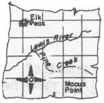
Mocus Point - Mocus is a word the mountain men used for an ardent desire for sex. A common statement about a mountain man who was lonesome for female companionship was "He'd better go to town. He's got the mocus."
Monroe Creek - Roy Monroe was a Forest Ranger.
Morgan Creek - Morgan had a timber claim in the head of this creek.
Moscow Bar - So called because some people from Moscow, Idaho formed a company and started to placer here. They soon found it unprofitable.
Mush Saddle - A small trail crew was camped here in 1913. They ran short of food and were eating mostly corn meal mush. Albert Cochrell, a member of the crew, put up a sign, "Mush Camp".
Musselshell Creek - This is a translation of the Indian name for this creek.
Mystery Creek - From almost anywhere you look at this drainage you would think that it empties into Fourbit Creek, but it makes a turn and goes into Canyon Creek.
Noe - A bulldozer operator for the Forest Service.
North Creek - Gets its name from being north of the Bungalow.
Noseeum Meadows - This place was called "many springs" by the Nez Perce. Small springs and a swampy meadow here make a good breeding area for mosquitoes and midges (noseeums).
The Nub - The top of this mountain is a sharp rocky point called The Nub.
Obia Creek - There are two stories about this name. Mr. Kalitee told Sister Alfreda that "two hunters, one of them a Russian, came upon some elk here. The Russian called out 'I got obia', meaning I got two." The other story, given to me by Ed Gaffney, is that it was named for an early prospector in the area. Since there were no elk in that locality until about 1924 and since the name is much older, I go along with Ed Gaffney's story. The early miners named almost all the larger streams in that locality.
Old Man - There are three stories about this name which originated with the Nez Perce Indians. Harry Wheeler told me that it was so named because the old men, women and children were left here because of the rough going when hunting parties went further east. Another story is that a grizzly, known as the "old man", once frequented the area. Still another story is that there is a rock in the locality that has the appearance of an old man. James Stuart, early day Ranger and an Indian, called the lake Old Mans Lake. I believe it is logical to assume that he used the correct interpretation of the Indian name. Since he used the word "mans" instead of "mens" it appears that either the story of the grizzly bear or the rock image is correct. Most Indians give the rock story. I have never seen this rock formation, but when I was there I had not heard about it so never looked for it. If anyone should look for it they should look at both the lake and the meadows as both were used as camps by the Indians.
Orofino Creek - Lewis and Clark called it Rock Dam Creek for a small rock dam built at its mouth by the Indians. The early miners gave it the name of Oro Fino which is Spanish for "fine gold". Much of the placer gold found at Pierce was dust.
Orogrande Creek - Named by Pierce miners. The gold was supposed to be more coarse grained than that found on Oro Fino Creek, but actually it was no different.
Osier Mountain and Ridge - Named for a group from the Hoosier State, Indiana.
Packer Meadows - Lewis and Clark called them Quamash Meadows for the camas that grows there. It gets its name from a man named Packer who once planned to homestead the meadows and built a cabin there.
Parachute Hill - Clyde Harrison, who worked on the railroad survey in 1909, told me that the old trail down the Lochsa left the river at the mouth of Cold Storage Creek and wound up over the hills coming back to the river near the mouth of Badger Creek. The trail was so steep that packers said you needed a parachute to get down the grades. The hill became known as Parachute Hill. The name is misplaced.
Pass Creek - This creek gets its name for the low pass between it and Boulder Creek.
Pedro Creek - This creek was named by trail foreman George Bagley in 1922 just because he liked the name.
Pete King Creek - Pete King was a miner and a homesteader at the mouth of this creek.
Pete Ott Creek - Pete Ott was a trail foreman.
Pileup Creek - Sheepman Ayres had a band of sheep pile up here when frightened by a bear. About 200 sheep were killed.
Pollock Hill - Named by John Gaffney for Frank Pollock, fireman on the Kelly Creek District.
Post Office - There are some rock cairns which were trail markers on top of this mountain. Someone years ago got the idea they were used by the Indians to send messages but the Indians say this is not true. (see "Indian Post Office")
Pot Mountain - An old name given to the mountain by the miners. Originally "Piss Pot". There is a glacial cirque on the northeast side which hollows the mountain into a pot.
Potlatch Creek - Lewis and Clark named this stream Colter for a member of their party, but like most of their names it never became established. Old maps show the name of Yaaktoin which Angus Wilson tells me is Nez Perce, but he knows of no translation. A map of 1876 gives the name of Potlatch.
Potlatch is a Chinook word meaning gift or give. According to the miners, including my father, the stream got its name in the following manner: Two men during the gold rush to Pierce came afoot up the Clearwater River to what is now Potlatch Creek. It was spring and the water was very high and they could not get across. They negotiated with an Indian to take them across in a boat for fifty cents. In the attempted crossing the Indian lost control of the boat and it upset. All of them made it to shore, the miners on the upriver side and the Indian on the opposite shore. The Indian yelled across to them "Potlatch four bits", but under the circumstances the miners did not believe they owed the Indian anything and went away in spite of his repeated demands for pay. They told their story to other miners and the stream became known as Potlatch Creek.
Powell Ranger Station - Named for Charley Powell, a trapper, who built a trappers cabin there about 1903.
Rawhide - Named for a rawhide camera case left by McCracken on the trail to lighten his pack load.
Rhodes Creek and Mountain - Named for Billy Rhodes, a famous prospector and miner.
Rocky Ridge - An old name likely given by Truax and Bird when they worked on the Lolo Trail.
Rosebud Creek - First named the North Fork of Oro Fino Creek by the early miners. The Rosebud Mine caused a change in the name in about 1895.
Ruby Creek - Named for the rubies found along the creek.
Rye Patch - An old Ranger stopover place. It was named for the tall grass there.
Sardine Creek - One of Charley Fox's names. He said the creek close by was Fish Creek and the size of this small creek suggested sardine.
Savage Ridge - Named for Milt Savage who trapped in this area about 1910.
Seven Mile - The creek is seven miles form the Bungalow.
Shake Creek - The shake bolts for buildings at the Oxford Ranger Station were cut on this creek.
Shanghai Creek - It is commonly believed to be named for the Chinese, but was named in 1861 before there were any Chinese in Pierce.
Shattuck Mountain - Named for Dr. Shattuck, first Dean of the University of Idaho School of Forestry, who visited the area in 1910.
Sherman Peak - Kalitee told Sister Alfreda that this peak was named for an early settler, but I can't believe this. There were no settlers in this area. It is a very old name. Ed Gaffney told me it was named by Major Truax when he worked on Lolo Trail improvements in 1866. Later the map makers got badly mixed up and moved the name of Sherman Peak to another point about a mile further east. They also moved Sherman and Noseeum Creeks east one drainage. They finally got Sherman Peak where it belongs, but the creeks are still out of place.
Shoecraft Creek - Named for Clayton Shoecraft who died of scurvy at Cayuse Landing Field.
Skookum Creek - In the Chinook jargon skookum means "good or big". I do not know how the name happened to be applied to this creek. It is a old name.
Skull Creek - This stream got its name from a human skull found in the river near its mouth.
Smith Creeks - There are three so named. One on the Middle Fork of Clearwater River for a man who cut cedar there and rafted it down the river. There is a Smith Creek which is a branch of the Weitas which was named for Eugene (Deadshot) Smith, a trapper. The Smith Creek on the North Fork was named for Charley Smith who had a homestead at the mouth of Milk Creek. He was also a trapper and had a cabin at the mouth of Isabella Creek.
Sneak Rapids - This rapids in the North Forth of the Clearwater is claimed to take boatmen going down the river by surprise if they are not acquainted with the river.
Sneakfoot Meadow - Named by early Forest Service men because of the tundra type surface and unstable sod.
Snoden Creek - Named for Snoden Snyder who drowned near this creek in the North Fork in 1919.
Snyder Creek - Some say this creek was named for Ranger Snider, but others say it was named for Blayne Snyder who worked for the Forest Service for many years.
Sourdough Creek - Named for "Sourdough Jack" Pons, a lookout on Sheep Mountain for a number of years.
Split Creek - Gets its name for its two entrances into the Lochsa River.
Sprague Creek - Named for Jack Sprague, a trapper, who drowned in the North Forth near the Bungalow.
Spring Hill - Lewis and Clark camped here on their way east in the spring of 1806.
Star Point - The hour control map of this point resembled a star.
Storm Creek - The old name for this creek was Tenas. Than Wilkerson wrote that Abbot Silva made a map of the Upper Selway Forest in 1915 and changed the name to Storm because a fierce storm raged in that area while he was mapping there.
Surprise Creek - Ranger Hand in 1923 or 24 was going to locate a trail up this creek to Stanley Butte. From the mouth of the creek it looked like it would be a difficult trail to build due to rock outcroppings. Much to his surprise he found that the rock could be avoided and the trail was easy to build.
Survival Island - It was on this island that two packers, two packstrings, two Indians and some wild animals took refuge during the 1919 fire.
Sutter Creek - Named for a homesteader on the Middle Fork of the Clearwater.
Swan Creek - Named for a homesteader and miner on the Middle Fork of the Clearwater. He had a mining claim on this creek.
Swanson Creek - John Swanson was a trail foreman and logger.
Swede Creek - Named for Pete Peterson who had a ranch on Browns Creek.
Switchback Hill - Gets its name from the switchbacks encountered going down the mountain to Scurvy Saddle.
Tepee Creek - Named for T.P. Jones, a cruiser for the Clearwater Timber Co.
Three Devils Rapids - At one time there were three large boulders in the Middle Fork at this rapids. The homesteaders called them "The Mormons", from the thought of a Mormon and his two wives. However, because of the hazards these rocks posed to boating and log driving, rivermen called them the Three Devils. The log drive of 1917 jammed on these rocks. To break the jam the rivermen drilled and dynamited the boulders. The name has persisted although the boulders are gone.
Toboggan Ridge - The Hansen brothers started from their mine in the Black country for the lower country in the early spring. They put their packs on a toboggan and pulled it down the ridge until they ran out of snow. They hung the toboggan in a tree. Ranger Cochrell found the toboggan and named the ridge.
Tom Beal Park - Named for Tom Beall, a miner and prospector in the mining camps of Oro Fino and Pierce. How his name became attached to this area near Powell is unknown, but it is likely he camped there looking for Isaac's Mine.
The Irish Railroad Rapids - An irishman built a ladder-like device out of poles to take boats over a point and past this rapids. It was built about 1900 and burned in the 1919 fire, but by then was in bad condition.
Thompson Point - Named for Henry Thompson, a woodsman, cruiser, and fire control employee.
Van Camp - In 1920 there was an early spring fire on this ridge. Some of the fire guards suppressed it, but since the trails were not yet opened they had difficulty in getting supplies. They wound up with mostly pork and beans. Before they left one member of the crew took the end of a box which read Van Camps Pork and Beans and nailed it to a tree. He struck out the pork and beans. This sign stood until the fire of 1934.
Walde Mountain - Named for Ranger Walde.
Weir Creek - Named this because of an Indian fishing weir here in the early days.
Wallow Mountain - There was at one time, and there may still be, a bear and elk wallow near where the lookout would go for water.
Weitas Meadows - This name was purified by the map makers from "Wet Ass". There are a number of features carrying this name but it appears that the meadow was named first. The long grass and swampy ground with a creek running through brought about the name.
Wendover Creek - Named for Bert Wendover, a trapper who had a cabin at its mouth.
White and Mike White Creeks - Named for a miner who had a placer mine on Lolo Creek at the mouth of these streams.
White Sand Creek - What is now called Big Sand Lake was first called White Sand Lake because of a white beach there. The creek through it was also called White Sand Creek. Later the name was changed to Big Sand Lake. White Sand Lake is now a smaller lake nearer the Bitterroot Divide.
Williams Peak - L.F. (Lafe) Williams was interested in some mining prospects in the Blacklead country.
Windy Bill Camp - Bill Johnson and a small crew were camped in this saddle working on a sheep driveway. Bill was doing the cooking. It was quite windy and Bill complained about it. One member of the crew remarked that it would be less windy if the cook talked less. Bill then took a box board on which he wrote "Windy Bill Camp".
Yackus Creek - Was once the South Fork of Lolo. To avoid the use of south, north, and other directions in names, the Nez Perce word for south was used.
Yokum Creek - Harry Yokum was a trail foreman.
| <<< Previous | <<< Contents>>> |
|
clearwater/story/appb.htm Last Updated: 29-Feb-2012 |