|
History of the Rogue River National Forest Volume 2 — 1933-1969 |
|
CHAPTER NINE
FOREST SUPERVISOR CARROLL BROWN
1957
PERSONNEL
| Forest Supervisor | Jack H. Wood (until June) |
| Carroll E. Brown (EOD June) | |
| Fire Control, Recreation, & Range Management Staff | Spencer T. Moore |
| Forest Engineer | Hector Langdon |
| Timber Management Staff | Jay F. Grant (until Feb.) |
| Howard G. Hopkins (EOD March) | |
| Administrative Assistant | Janie V. Smith |
District Rangers
| District | Name | Location |
| Applegate | Vernal E. Taylor | Star Ranger Station |
| Ashland | Harold A. Thomas | Ashland |
| Butte Falls | Brittain H. Ash (until Aug.) | Butte Falls |
| Ralph A. Wiese (EOD Oct.) | ||
| Klamath | Robert L. Cooper (until Dec.) | Klamath Falls |
| Vern E. Smith (Acting Dist. Ranger, (12-57 to 3-58) | ||
| Union Creek | George W. Kansky (until March) | Union Creek |
| Rexford A. Resler (EOD May) |
|
|
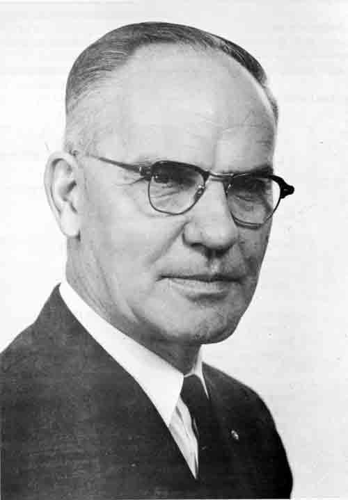
Carroll E. Brown Forest Supervisor (June 1957 - December 1967) |
PERSONNEL AND ORGANIZATION
Supervisory Jack H. Wood was transferred to Washington, D. C., in June. He was replaced by Carroll E. Brown.
Brown, a native of Vancouver, Washington, began his Forest Service career with seasonal work on the Gifford Pinchot and Mt. Hood National Forests, 1928-33.
A 1933 graduate of Oregon State University, he received a forester appointment in 1934 on the Nicolet National Forest in Wisconsin. He served on the Nicolet and Chequamegon National Forests as foreman and camp superintendent in the Civilian Conservation Corps and as assistant ranger.
He returned to the Pacific Northwest Region in 1938, working on the Wenatchee, Mt. Hood and Gifford Pinchot National Forests and in the Portland Regional Office in the State and Private Forestry Division before being named district ranger at Hebo on the Siuslaw National Forest in 1940. In 1943 he was promoted to staff officer on the Olympic National Forest and later served as a staff officer also on the Fremont and Gifford Pinchot Forests. At the time of his appointment as Supervisor of the Rogue River National Forest he was in the Recreation Division of the Regional Office.
Jay F. Grant, staff assistant in timber management, was transferred to Washington in early 1957 and was replaced by Howard G. Hopkins.
Ranger George Kansky, Union Creek, was transferred to the Mt. Hood National Forest in the spring, and replaced by Rex Resler.
Ranger Brittain Ash, Butte Falls, transferred to Ketchican, Alaska, in August. His replacement was Ralph A. Wiese from the Mt. Hood National Forest.
Charles R. King retired. He had been Forestry Aid (TM), Union Creek, since 1951. He started with blister rust control in 1943 in Supervisor's Office.
The Forest worked 268,150 man-hours during the year without a lost-time accident.
Due to increased volume of business in all activities on the Forest, the Rogue River Forest was reclassified as GS-13 in September. This resulted in raising the grade level of Janie V. Smith, Administrative Assistant to GS-11 with the title of Administrative Officer. The Timber Management Staff and the Fire Control Staff positions in the Supervisor's Office were raised to GS-12 in December. A new staff position was established to handle the Recreation and Lands activities in the Supervisor's Office. Wallace R. Robinson was appointed to fill this new position in December. The Timber Management Staff Officer formerly performed these duties.
RANGE AND WILDLIFE MANAGEMENT
Forage was furnished for 3,750 cattle and 2,550 sheep, representing 89 ranchers.
Field work was completed on an intensive examination of 325,000 acres on ten range allotments to determine the condition of existing forage areas, potential capacity, location of new water holes, drift fences, salt logs, etc., and type of management needed to perpetuate these forage areas.
TIMBER MANAGEMENT
A total of 100,933,000 board feet valued at $2,196,971 was cut. Timber sold was 107,469,000 board feet valued at $2,288,027.
There were 1,120 acres of cut-over land planted with 900,000 tree seedlings. There were also 388 acres of land seeded with endrin-treated seed.
Timber reinventory was completed on 250,000 acres with establishment of 133 permanent sample plots.
A slow lumber market in the last half of the year accounted for the drop in cut and sold volumes. Planting, seeding, and pruning were done through the collection of $69,556 for "Sale, Area Development" under the Knutsen Vandenburg Act on timber sale contracts. This work provided about 2,000 man-days of employment for Forest personnel.
A new allowable annual cut was to be calculated in 1958 on the portion of the Forest covered by reinventory. Reinventory work extended to the Butte Falls and Klamath Districts, and the Dead Indian unit of the Ashland District in 1957.
More small salvage sales were to be planned to cut out the dead, down, and infected timber and, at the same time sell enough timber to have twice the allowable cut under contract at all times in order to harvest the allowable cut each year.
Carroll Brown and Howard Hopkins went to Portland November 22 for a meeting of representatives from the Oregon Forests and Regional Forester Stone and his staff concerning plans to step up the timber sale program with additional funds recently released to the Forest Service by the Bureau of the Budget.
Mr. Stone told the group that we are now faced with the challenge to sell more timber at prices in line with current market conditions so purchasers can afford to operate and thereby help relieve the critical unemployment situation in Western Oregon.
On December 3 the Rangers met with Supervisor Brown and staff to firm up this program for the Forest. Plans are being made to sell about 150 million board feet during the balance of the Fiscal Year 1958. This is somewhat in excess of allowable cut, but is necessary to get an adequate backlog of timber under contract in order to sustain the full allowable cut of green timber. Included in the planned sales will be considerable dead timber which does not count against the allowable cut.
RECREATION AND LANDS
"Operation Outdoors" got under way on the Forest and tract plans were completed for the expansion and rehabilitation of nine campgrounds, namely: Aspen, Rainbow, Fish Lake, McKee, Farewell Bend, Natural Bridge, Woodruff Meadows and Muir Creek.
New campground roads were built at Fish Lake, Aspen, Rainbow and Union Creek.
A new National Forest boundary had been proposed as a result of the O&C-Forest Service land exchange, eliminating about 226,000 acres of private and other lands within the then present boundaries. New acreages for the Forest as a result of the O & C Exchange were:
| Gross area within National Forest boundaries | 988,000 | acres |
| Net National Forest land | 804,179 | acres |
| National Forest - O & C lands | 62,880 | acres |
| Ashland Watershed lands | 20,952 | |
| Private lands | 99,989 |
FIRE CONTROL
The 1957 fire season had appreciably more severe fire weather than the preceding 3 years. The fire season was longer than the previous 3 years. The number of lightning storms and their severity was much less than the previous 2 years, as indicated by the total of five lightning-caused fires. Some severe lightning activity in October was accompanied by heavy rains and caused no fires. The increased number of man-caused fires, 22, might have been attributed to a greater number of recreationists, together with the unusually high burning index prevailing for most of the season. Total burned area was held to an all-time low, 3.3 acres National Forest land.
A helicopter under Regional Office contract was used to acquaint Forest personnel with its use and for helispot reconnaissance. No use was made on going fires or on fire reconnaissance.
SOIL AND WATER
High lead cable logging was initiated on steep slopes in the Siskiyou Mountains to distribute the water evenly over the slopes and to prevent soil erosion.
The Forest cooperated with the Bureau of Reclamation by selling the timber on the rights-of-way across National Forest land for the collection canals for the Howard Prairie Reservoir.
The Forest continued cooperation with the City of Medford on its watershed near Butte Falls, as it had since 1952.
Salvage logging to remove undesirable trees was completed; 2,238 trees were pruned on 168 acres, and 51,000 ponderosa pine seelings were planted on 155 acres on City of Medford lands.
IMPROVEMENTS
Construction was completed of new residences at Fort Klamath and Butte Falls in December. A new tower was erected at Cinnabar Lookout replacing the old wooden tower. A 20-foot steel tower was built at Fort Klamath and a new flat roof type lookout house finished on Halls Point Lookout near Prospect.
1958
PERSONNEL
| Forest Supervisor | Carroll E. Brown |
| Fire Control, Recreation & Range Management Staff | Spencer T. Moore |
| Forest Engineer | Hector Langdon |
| Timber Management Staff | Howard G. Hopkins |
| Administrative Officer | Janie V. Smith |
District Rangers
| District | Name | Location |
| Applegate | Vernal E. Taylor (until Nov.) | Star Ranger Station |
| Neil G. Suttell (EOD Dec.) | ||
| Ashland | Harold A. Thomas | Ashland |
| Butte Falls | Ralph A. Wiese | Butte Falls |
| Klamath | Darroll K. Frewing (EOD March) | Klamath Falls |
| Prospect | Douglas H. Baker (EOD Jan.) | Prospect (Temporary Quarters) |
| Union Creek | Rexford A. Resler | Union Creek |
PERSONNEL AND ORGANIZATION
An increase in timber management activities, including a stepped-up program for timber sales; and "Operation Outdoors," which provided for rehabilitation of existing campgrounds and construction of new camp ground facilities, increased the workload on the Union Creek District to a point where the District Ranger could no longer give adequate supervision to all activities. This brought about the formation of the new Prospect Ranger District with temporary headquarters in Prospect. The new District was made up of the south and west sections of the Union Creek District and the northern portion of the Butte Falls District. Douglas H. Baker, Senior Timber Management Assistant and Robert L. Gilmore, Forestry Aid, transferred from the Union Creek District as District Ranger and District Assistant respectively.
Robert L. Cooper, Klamath District Ranger for 10 years, accepted a transfer in January to Juneau, Alaska; Darroll K. Frewing arrived in March from the Ochoco National Forest as his replacement.
Vernal Taylor, Applegate District Ranger since 1955, transferred to the Fremont National Forest and was replaced by Neil G. Suttell from Lewis River Ranger District, Gifford Pinchot National Forest.
A Tucker Sno-Cat with trailer was purchased for use on the Butte Falls District to make all sections in the District accessible to timber stand improvement crews during the winter months.
New forester appointments included Eugene Fontenot, Butte Falls; Herman Walitalo; Charles R. Niver, Applegate; Paul J. Brady, Klamath; James D. Lunsford, Prospect; Wayne E. Bausefield, Union Creek; Herbert E. Barth, Supervisor's Office.
Student Trainees Fred C. Weaver (Forester), Paul G. Sloan and Robert F. Wood (Engineers) all at Union Creek.
Other transfers included: Samuel S. Poirier, Highway Engineer from the Olympic Forest to fill a new position; Maurice Rocheleau, Engineering Assistant, transferred to the Regional Office; and Albert O. Hanson, office manager, transferred to the Chugash National Forest, Anchorage, Alaska. Robert E. Taylor, Willamette National Forest, to Ashland; Robert K. Krell, Siuslaw, to Prospect; and Herbert L. Pratt, Willamette, to Union Creek; all as assistant rangers. This was a new position on all Districts approved in the spring.
Assistant rangers Robert P. Sorber, Applegate; Randall F. Perkins, Butte Falls; and Vern E. Smith, Klamath. All promoted in place.
Other changes were: Douglas Baker from Union Creek to Prospect as District Ranger of the new Prospect District; Robert Gilmore from Union Creek to Prospect as District Assistant; Al Pugge, Union Creek, to Willamette; Kay J. Finch, Union Creek, to Mt. Hood; Robert Latzy, Ashland, to Klamath District; Vern E. Smith, Assistant Ranger, Klamath, to San Bernardino Forest in California; and Douglas B. Shaw, Ashland, to Klamath, Assistant Ranger replacing Vern Smith. Edward T. Cobo resigned in September to continue his education in theology in Massachusetts. Fred Zumbrum, Scaler, Klamath, resigned in December and later applied for retirement.
A General Integrating Inspection was made this year by Assistant Regional Forester Avon Denham and Regional Fiscal Agent Reed Jensen. As part of the inspection, they made a three-day horseback trip. The first day they went from O'Brien Creek, at the foot of Greyback Mountain, over the summit to Bigelow Cabin. The next day the seven-man party, with nine horses, proceeded to Sucker Gap, thence to Fir Glades for another overnight stay. The third day the group rode around Hinkle Lake, Arnold Mine, and down the Middlefork of the Applegate where they were met by trucks and cars.
FIRE CONTROL
The 1958 fire season approached the critical stage. Fire danger was appreciably higher than normal, exceeding normal for 33 days on the Butte Falls District. This was about average for the entire Forest although fire danger was more severe than this in the southwest portion of the Forest, and less severe in the north part.
Lightning occurred on 15 days during the season and accounted for 59 fires. Quite a bit of precipitation fell with most of the storms, which materially aided in control of lightning-caused fires. Twenty-one man-caused fires, in addition to the 59 lightning-caused fires, gave a total of 80 fires for the year; however, burned area was held to 78 acres.
The fire season was the longest in 10 years. Fire weather began May 1 and fall rains did not soak the woods until October 31. Critical fire weather occurred in September and again in October causing some trouble in slash burning operation.
Fire training of industrial overhead continued in cooperation with Oregon State Forestry Department and the forest industry.
A new tool in fire suppression was used on the Forest for the first time. This was the aerial application of sodium calcium borate "slurry" to small, inaccessible fires. The result was to retard the spread of fire until ground crews or smokejumpers could arrive on the scene. This method of attack by tanker planes based at Medford was used on two lightning-caused fires on the Applegate District August 2. In addition, materials, planes, and personnel from Medford were used on Siskiyou and Willamette National Forest fires. Twenty-eight thousand gallons of retardent was used during the season.
A small jet-type mixer and a 1,000-gallon canvas tank were used to mix the slurry at the Medford Airport. When the slurry was needed on a fire the canvas tank and mixer were set up, using a 3/4-inch garden hose for water supply from a nearby hangar. Dick Hart, warehouseman, Frank McDowell his assistant, and Daid Thompson's road crew mixed the slurry, and filled the two PV-2 tankers operated by William E. Rosenbalm. No shelter was available. All work was done on one of the taxiways at the airport. The City of Medford street watering tanker was hired when available to give a better supply of water.
In order to reduce the fire hazard resulting from timber sales and to prepare a seed bed for reforestation, 1,835 acres of National Forest clearcut logging slash and 975 acres of piled slash were burned.
RANGE AND WILDLIFE
Summer range was furnished to 3,500 cattle and 2,150 head of sheep representing 89 ranches.
Field work on 243,000 acres on nine allotments was done to determine the condition of the range, potential capacity, and type of management needed. Seventy percent of the usable grazing area of the Forest had been covered by the field phase of the analysis.
Ten miles of fence were built to aid in the management of stock; 190 acres of depleted range were reseeded.
TIMBER MANAGEMENT
High demand and extreme competition for National Forest timber offered for sale accompanied a resurgence of the lumber market.
A total of 171,255,340 board feet valued at $3,548,840.52 was cut. Timber sold consisted of 177,925,450 board feet valued at $3,605,112.01. In addition, 18,911 Christmas trees with a value of $8,084.95 were cut. The Johns Manville sale progressed during the year. Grant Marsh of Klamath Falls did the logging of the lodgepole pine. He had a special machine built that handled the tree-length material, cutting it into eight-foot lengths and loading it onto trucks and trailers. The Forest Service people and Johns Manville foresters worked together to arrive at a converting factor to be used in measuring the cords on the trucks and trailers. Each load was weighed at the Johns Manville plant and plans were made to use the converting factors the next year. This would eliminate the measuring of the load on each truck and trailer to determine the number of cords on the load.
Demand for timber sales continues strong with very active building on most recent sales. Red Blanket Lumber Company was high bidder for the Dead Soldier sale (Union Creek District) and Red Blanket Creek sale (Prospect District). Louis Biden stayed on top of many bidders to take Bybee Creek (Union Creek District).
Southern Oregon Plywood had to go from the appraised price of about fifty thousand dollars to $110 thousand to take Willow Prairie No. 7. One recent sale with no competition was Tolman Creek on Ashland District - Timber Conservation Company associate of Cheney Studs took it at appraised price and 11 small sales sold by sealed bid on June 2 gave many of the small loggers work for a month or more. Butte Falls and Ashland Districts have been competing for the record in most small and salvage sales. So far Butte Falls is ahead in total number and Ashland in sales of pine salvage (dead timber only).
During May the three southern districts of the Rogue were covered by an aerial mapping team from the Experimental Station in Portland. The teams of Buckhorn and John Hunt mapped the areas showing serious current timber killing from Douglas-fir dwarfmistletoe. We now consider dwarfmistletoe our most serious forest pest. The aerial survey will be followed up by a ground survey after July 1.
Bids were received this month for construction of two timber access roads on the Forest. One will be the Imnaha project about 5.6 miles on the Butte Falls District. The other will be an extension of the Tolman Creek sale road in the Ashland District for about 5-1/2 miles into the Ashland Creek watershed. The Imnaha project will include a 160-foot reinforced concrete bridge over Middle Fork of Rogue River.
The Butte Falls Aerial spray job for brush-field reclamation covering 4 areas totaling 120 acres was done during the morning of June 10. Medford Air Service was the successful bidder at $4.87 per acre for flying. The cost of the spray materials was about $4.15 per acre. Four different dosage mixtures of 2,4-D and 2,4,5-T in diesel oil and water were used at a rate of 7 gallons per acre. The principal brush cover of 3 of the areas is Manzanita and the fourth area in the Cat Hill Burn is a diverse mixture of brush species.
Those participating in the project were Howard Hopkins, Ralph Wiese, Vern Taylor, Randall Perkins, Henry Gratkowski and Lyle Anderson. It was the feeling of all present that a fine job of flying and ground coverage was accomplished by Pilot Dick Foy. Weather conditions were ideal.
Killing results of the sprays will not be very conclusive until late fall or next spring.
Present plans are to do some tree planting and tree seeding this fall on a small portion of the areas if spray results look promising. June 19, 1958, Newsletter.
RECREATION AND LANDS
Operation Outdoors construction included 115 camp tables, 14 new type toilets, and 45 grate type camp stoves. These were installed at Fish Lake, Lake of the Woods, and other popular sites.
A dam to maintain the water level of Lake of the Woods was completed.
This dam was about 1,000 feet long and averaged about 10 feet high. David hompson was in charge and his road crew did the work during the fall and winter months.
The Lake of the Woods road, from the Forest boundary, east of Eagle Point, to Pelican Bay was approved as a Forest Highway by the Forest Service State Highway Commission and the Bureau of Public Roads. The Medford and Klamath Falls Chambers of Commerce actively supported and pushed this project to completion. This will mean early construction of an all-weather highway past Fish Lake and Lake of the Woods and consequently a better route to Klamath Falls.
SOIL AND WATER
Contour trenching and seeding to grass were accomplished on 30 acres at the head of Silver Fork Creek on the Applegate District to stabilize soil and revegetate barren ground on a steep hillside. This was the first attempt made on the Forest for this purpose.
A Finn mulching machine was purchased for road cuts and fills stabilization.
OTHER
Excerpts from the Forest Organization Plan of January 30, 1958:
RESPONSIBILITIES
To insure complete understanding for the dispatch of responsibility in administering the Forest, the following is a brief summary of the tasks assigned within the Supervisor's staff organization.
A. C. E. BROWN, Forest Supervisor
1. Approve all resource management plans.
2. Approve all inspection reports and sign memorandum transmitting them.
3. Review and approve all financial operating plans.
4. Approve all personnel actions of appointed personnel and approve changes in organization.
5. Plan and supervise the training of line staff officers, rangers and foresters.
6. Direct the analyzing of job loads and preparation of executive work plans.
7. Approve press releases, and prepare and maintain forest public relations plan.
8. Represent the forest in public gatherings where there is need for policy presentation and with the help of all personnel be alert to prevent misunderstanding.
9. Read correspondence which pertains to policy or which is critical or which denies a request.
10. Approve special use permits for resorts, road use, and other major uses.
11. Receive and present to employees all notices of awards, e.g. length of service, etc.
12. Review manual amendments pertaining to changes in policy, personnel management, work plans and information and education.
B. S. T. MOORE. Fire Control, Range and Wildlife Manaqement
1. All fire control activities including but not limited to:
(a) prevention, (b) presuppression, (c) suppression (inspect action on fires, advise rangers, and keep supervisor informed), (d) reports and records, (e) hazard reduction, (f) station fire plans.
2. All range and wildlife management activities.
3. All phases of telephone and radio communication.
4. Safety officer - inspect accidents.
5. State and Private Forestry - fire control phase.
6. Research cooperation with Experiment Station on fire control, range and wildlife activities.
7. Fire control, range and wildlife improvements (plans, standards and location).
8. Chairman, Forest Board of Survey.
9. Chairman, Forest Welfare Committee.
10. Perform Information and Education (I&E) work as assigned.
11. Supervise and train Howard and Harshman.
12. Work plans and Training Officer.
C. H. G. HOPKINS, Timber Management
1. Timber management, all phases, except access roads.
2. Blister rust control work, forest diseases, insect and rodent control.
3. State and Private Forestry - timber management phase.
4. Improvements, timber management (plans, standards and location).
5. Research cooperation with Experiment Station on timber management activities.
6. Perform I & E work as assigned.
7. Supervise and train Lyle Anderson and other assigned project staff.
8. Supervise training of foresters as assigned.
9. Member, Forest Board of Survey.
D. HECTOR LANGDON, Engineering
1. Construction, betterment and maintenance for all Forest development roads and trails.
2. Transportation plans, road location and design, road rights-of-way.
3. Liaison with B.P.R. on all matters.
4. Equipment management — all phases.
5. Saddle, pack stock — winter pasture, maintenance and replacement.
6. Other improvements (fire control, timber management, range management, wildlife, recreation, construction phases).
7. Site plans - ranger and guard stations.
8. Act as Contracting Officer's Designated Representative (CODR).
9. Supervise the C.S.C. driver's examinations.
10. Supervise Forest road crew, road locators, draftsmen, project staff, etc.
11. Perform I & E work as assigned.
12. Chairman of Forest Management Improvement Program.
13. Member, Forest Board of Survey.
14. Maintain records and reports on all above subjects.
E. JANIE V. SMITH, Administrative and Business Management
1. Administrative and business management
(a) General over-all supervision.
(b) Recruitment, training and orientation of personnel.
(c) Purchasing, storage of supplies and equipment.
(d) Fiscal control.
(e) Accounting procedures.
2. Financial management - all phases.
3. Management improvement (develop operating techniques which increase effectiveness of personnel and facilities).
4. Inspection and field contacts, including but not limited to:
(a) Inspect Ranger Districts for compliance with all regulations affecting the functions of the section, and adherence to established policy and approved work plans.
(b) Detect and prevent fiscal or administrative irregularity.
(c) Maintain familiarity with all Forest activities.
(d) Internal audits.
5. Serve as Acting Forest Supervisor in all fiscal, supply and routine matters. Keep supervisor and staff informed of current changes in fiscal or administrative regulations.
(a) Signing mail (see number V above)
(b) Prepare and/or approve all leases, bonds, rental agreements, etc.
(c) Sign as Acting all letters of award to contracts.
(d) Review all cooperative agreements and other instruments including special use permits and timber sale contracts for legal and fiscal sufficiency.
6. Employment officer including appointment actions.
7. Perform I & E work as assigned.
8. Maintain land status book.
9. Serve as Forest historian.
In absence of Janie Smith, the above duties will be assumed by Albert Hansen.
F. WALLACE R. ROBINSON, Recreation, Lands, Soil and Water Management
1. Recreation and lands, all phases, including but not limited to:
(a) Mining, determination of surface rights, mineral materials.
(b) Land use planning.
(c) All special use permits.
(d) Operation Outdoors.
(e) Land acquisition.
(f) Boundary marking.
(g) Withdrawals.
2. Soil and water management, all phases, including P.L. 566 (Small Watershed Act).
3. Liaison with Bureau of Reclamation on all matters.
4. Improvements - recreation, lands, soil and water (plans, standards and location).
5. Cooperate with Soil Conservation Service on snow surveys.
6. Federal Power Commission power permits.
7. Perform I & E work as assigned.
8. Erosion control, including road bank stabilization.
1959
PERSONNEL
| Forest Supervisor | Carroll E. Brown |
| Fire Control, Range & Wildlife Management Staff | Spencer T. Moore (until Aug.) |
| Robert H. Torheim (EOD Sept.) | |
| Forest Engineer | Hector Langdon |
| Timber Management Staff | Howard G. Hopkins |
| Land Uses & Recreation Staff | Ralph A. Wiese (EOD June) |
| Administrative Officer | Janie V. Smith (retired May) |
| Merlin C. Shipley (EOD June) |
District Rangers
| District | Name | Location |
| Applegate | Neil G. Suttell | Star Ranger Station |
| Ashland | Harold A. Thomas | Ashland |
| Butte Falls | Ralph A. Wiese (until June) | Butte Falls |
| Donald L. Strong (EOD June) | ||
| Klamath | Darroll K. Frewing | Klamath Falls |
| Prospect | Douglas H. Baker | Prospect |
| Union Creek | Rexford A. Resler (until Feb.) | Union Creek |
| Asa D. Twombly (EOD Mar.) |
PERSONNEL AND ORGANIZATION CHANGES
Janie V. Smith retired in May as Administrative Officer, with more than 39 years of service. Her replacement was Merlin C. Shipley, transferred from Siuslaw National Forest.
Rexford Resler, Union Creek District Ranger, transferred to the Willamette National Forest as Timber Management Staff Officer. His replacement was Asa D. (Bud) Twombly from the Zigzag District of the Mt. Hood National Forest.
Robert H. Torheim, former District Ranger on the Quinault Ranger District, Olympic National Forest, replaced S. T. Moore, who transferred to Region 2.
Prospect District personnel moved from temporary quarters to a new ranger station in May.
New appointments
Foresters - Douglas McClelland, Applegate; Junior D. Helvey, Alfred A. McCorquadale, Butte Falls; Edmund J. Vandermillen, William C. Aldrich, Johnny C. McLain, Jr., Klamath; Donald E. Vaughn, Prospect; William E. Butler, Union Creek.
Engineers - Gordon L. Anderson, Richard B. Cullen, Supervisor's Office.
The positions formerly referred to as District Assistants on the Ranger Districts were abolished and due to additional responsibilities, the positions were upgraded to GS-9 and called Fire Control Officer. Robert B. Webb, Applegate; Douglas B. Finch, Butte Falls and Lowell W. Ash, Union Creek were promoted to these positions in August. The other three Districts could not qualify this year so their positions remained as Fire Control officer, GS-7. This was a major breakthrough for the non-professionals and resulted in higher morale in this group.
RANGE AND WILDLIFE MANAGEMENT
During 1959, 3,400 cattle and 2,100 sheep grazed on the Forest. Livestock grazed on 35 allotments under paid permits which were issued to 74 stockmen.
During the summer, 118,600 acres of range land were surveyed to determine the condition of the range, its potential carrying capacity, and the type of management needed. Field work for management plans to be prepared for each grazing allotment on the Forest was expected to be completed during the summer of 1960.
As an aid to managing range livestock, 5 miles of fences, one water development, one stock bridge, and 1/2 mile of stock driveway were constructed.
FIRE CONTROL
In terms of fire danger, the 1959 season was critical. A mild winter, with a lower than normal snow pack, followed by a dry spring, resulted in one of the driest, most hazardous seasons on record.
A total of 43 fires occurred on National Forest protected lands. Thirty-five of these were man-caused. Fortunately, the number of thunderstorms was much below average; only eight lightning fires occurred. Within the Forest's protective area, 926 acres were burned.
Aerial tankers played an important role in assisting fire suppression crews. Borate "slurry" applied by airplanes retarded the spread of fires, enabling ground crews and smokejumpers to extinguish many of them while they were small. From the Medford Airport base, 99 flights were made on 23 fires for the Rogue River, Siskiyou, Umpqua and Fremont National Forests, the State of Oregon, and the Klamath Forest Protective Association.
The disastrous Ashland Creek Fire burned over 885 acres of National Forest land and 3,700 acres of private and other public land. Incendiary in origin, it was set on private land and ran onto the National Forest. Both the City of Ashland and the City's watershed were threatened before it was controlled.
Following are excerpts from the Medford Mail Tribune on the Ashland Fire of August 10, 1959:
The stubborn fire above Ashland that has burned through an estimated 4,800 to 5,000 acres (actually 4,585 acres) since it erupted Saturday afternoon appeared to be nearing control late this morning. . .
An estimated 430 State and Federal fire fighters were engaged in backfiring, fire suppression and mop-up operations this morning. . .
An estimated 1,200 acres were burned yesterday, most of them in the Rogue River National Forest and some of them in backfires that were set to help combat the bigger fire. . .
Yesterday's burn, Federal officials said, was all within the Ashland Watershed, but below the reservoir. The critical area this morning was on top of a ridge about 2 miles below the Wagner Butte Lookout. . . .
The blaze, which started about 1:00 P.M. Saturday as two relatively small fires erupted and burned toward each other to combine, burning rapidly through manzanita and brush in the area above Jackson Hot Springs shortly after it started.
It appeared to be nearing control late Saturday afternoon, but it blew up early Saturday evening and flashed through an estimated 1,000 acres in one hour. By late Saturday it had moved into Douglas fir and pine forests and almost 2,000 acres were involved as the flames looked as if they were going to move right into Ashland itself.
Fire lines were manned by about 300 men by that time and the blaze once again seemed to be nearing containment. Fifteen loads of borate were dropped on the fire Saturday. . . .
TIMBER MANAGEMENT
High demand and extreme competition for National Forest stumpage continued throughout 1959.
A total of 178,697,000 board feet valued at $3,810,152 was cut. Timber sold amounted to 133,300,000 board feet valued at $4,036,720.
For the second year in a row, actual cut exceeded the allowable annual cut, thus eliminating a credit backlog from undercutting in the first part of the 5-year budget period. Purchasers cut more than was sold, eating into the volume of timber under contract.
More sales were made of scattered overmature and diseased overstory trees. This progress in better forestry accomplishments was largely the result of more adequate financing provided by Congress for handling the timber sale job. Provision was made in the budget for Fiscal Year 1960 to finance four "Small and Salvage Sale Foresters" on the Forest.
RECREATION AND LANDS
"Operation Outdoors" program was continued by adding improvements to many of the campgrounds. The National Forest Recreation Survey was in "high gear" and was planned for completion by September 1960.
A snag-falling program at Fish Lake resulted in a snag-free lake. This was accomplished when the water level reached the lowest point in many years.
The examination of 470,000 acres of the Forest, for determination of surface rights, was completed under the Multiple Use Mining Act of July 23, 1955.
Union Creek Resort changed hands February 17 when the special-use permit for the resort was transferred from C. P. and Dottie V. Yundt to Arnold L. Kittlestad and Ezra L. Tedrick.
SOIL AND WATERSHED MANAGEMENT
The main project in soil and watershed management was the result of the Ashland Creek Fire. All of the 885 acres of burned National Forest land was reseeded to grass, 28 miles of contour trenches and 196 check dams were constructed. An additional 152 acres of land were seeded, five check dams built, and eight miles of contour trenches were constructed on City of Ashland and Bureau of Land Management lands under cooperative agreements.
The Finn mulching machine was used for road bank stabilization on 33 miles of the Union Creek and Ashland Districts.
SEED ORCHARD
A white pine seed orchard was started at Jim Creek on the Prospect District. Over 400 scions from what were believed to be blister rust-resistant white pines from the Umpqua National Forest were field grafted to nursery grown, 3- to 5-feet tall root stock. Overhead irrigation and fertilizers were used to speed growth and to secure early cone formation.
Preliminary testing of the antibiotic, Acti-dione, was encouraging in the treatment of cankered five-needled pines. Over 9,000 trees were treated with a based stem treatment using 200 gallons of spray at a total cost of only 6 cents a tree. Tests using the new product, Pytoactin, were also made as a similar canker treatment.
OTHER
Below are excerpts from District Historical Reports for this year:
Applegate:
Water Management and Erosion Control
1. A series of water control contour trenches were constructed in the Silver Fork and Glade Creek basins to hold the water and decrease erosion. The trenches were seeded with grass. A total of 29 acres were treated.
2. A log jam was removed from Beaver Creek to protect the Hanley Gulch bridge and minimize the possibility of flash floods.
3. Ten acres of roadside seeding was done to control erosion and stream siltation.
Butte Falls:
A Tucker Sno Cat with trailer was purchased in order to make all sections in the District accessable to our timber stand improvement crews during the winter months.
Cooperative management of the City of Medford Watershed has resulted in the following:
| Volume of timber sold | 76.0 | M board feet |
| Volume of timber cut | 126.0 | M board feet |
| Acres cut over | 19.5 | |
| Acres planted | 140.0 | |
| Seedlings | 55,000 | ponderosa pine |
Klamath Falls:
Information and Education
The information and education activity for the District was designed to serve the needs of the entire Forest Service program. T.V. was used for one planned 15-minute program presented over K.O.T.I. - TV by six of our staff giving basic information on each of our important activities.
The Forest Service constructed a dam across the outlet of Lake of the Woods to stabilize the water level. This dam is over 600 feet long and cost $11,000. The Salvation Army Organization Camp was terminated and the area added to Aspen Campground. This addition will open up a fine swimming beach to the public and allow the preparation of 50 additional camp sites. The Lake of the Woods Resort did a record-breaking business while the Rocky Point Resort had only moderate patronage.
Union Creek:
Recreation
Recreational activity reached an all time high on the Union Creek District during 1958. The annual statistical report of visits show that 236,000 people were on the District during the year. Work on enlarging the Farewell Bend Campground got underway and when completed will add over 30 new overnight camping sites to this one campground. The Prospect Ski Club spent several weekends in the fall improving their special use ski area which is located just north of the Ranger Station. These two steps forward plus additional campground developments which are being planned should help make Union Creek an even more popular year-around playground in the future. The presence of so many people on the District, as it always does, provided the District personnel with a few highpoints which will be long remembered. We had a death, a heart attack and numerous minor scrapes, but the night, day and second night which some of us spent on the Rogue-Umpqua Divide looking for a lost Huckleberry picker will provide a lasting memory.
FOREST ADVISORY COUNCIL
A Forest Advisory Council was established in April. Its purpose and functions are set forth in the accompanying charter. The names of the charter members of this Council are also included. Harlan P. Bosworth, Jr. was elected chairman at the first organizational meeting April 8. Howard G. Hopkins, Timber Management Staff, was appointed Secretary.
Council members visited the Ashland Watershed area during the summer and considered the matter of providing camping and picnic areas within the watershed area. They recommended that this not be done except in the existing Bull Gap picnic area on the southeast border of the watershed.
ROGUE RIVER NATIONAL FOREST
1959
ADVISORY BOARD MEMBERS
| Name and Address | Representing |
| Bernard (Bud) L. Nutting | Large timber operator |
| Manager, Medford Corporation | |
| North Pacific Highway, Medford | |
| Lawrence L. Shaw | Small timber operator |
| President and General Manager | |
| Modoc Lumber Company | |
| 112 North Fifth | |
| Klamath Falls | |
| Dr. Elmo N. Stevenson | Education |
| President, Southern Oregon College | |
| Ashland | |
| Katheryn Heffernan (Mrs.) | Water resources |
| Ross Lane, Medford | |
| Frank Drew | Recreation sporting goods |
| Owner, Gun Store | |
| 714 Main | |
| Klamath Falls | |
| Tom Watters | Business and industry |
| Realtor, 107 South Seventh | |
| Klamath Falls | |
| Part-owner, Wi-ne-ma Hotel | |
| 1111 Main, Klamath Falls | |
| Frank Van Dyke | Business and industry |
| Partner, Van Dyke, Dellenback and | |
| McGoodwin, 110 East Sixth, Medford | |
| Erick W. Allen, Jr. | Business and industry |
| Managing editor, Medford Mail Tribune | |
| 27 North Fir, Medford | |
| F. Aubrey Norris | Business and industry |
| Partner, Norfield Shoe Company | |
| 221 East Main, Medford | |
| Armin Richter | Rancher and grange |
| Contractor, 766 South Grape, Medford | |
| Harlan P. Bosworth, Jr. | Water power |
| Vice-Pres. and Asst. to Gen. Mgr. | |
| California Oregon Power Company | |
| 216 West Main Medford | |
| Bill Hallin | Experiment Station |
| Leader, Siskiyou-Cascade Research Center | |
| P. O. Box 389, Roseburg | |
| Col. Paul H. Weiland | Sportsmens organization |
| 2431 East Main, Medford | |
| Eugene Burrill | Small timber operator |
| Owner, Eugene Burrill Logging Company | |
| Agate Road, White City | |
Buildings constructed during the year were: 1 residence, Star Ranger Station; 4 residences, Prospect; storage shed and warehouse, office, gas and oil building, and a water tank storage shed at Prospect Ranger Station.
|
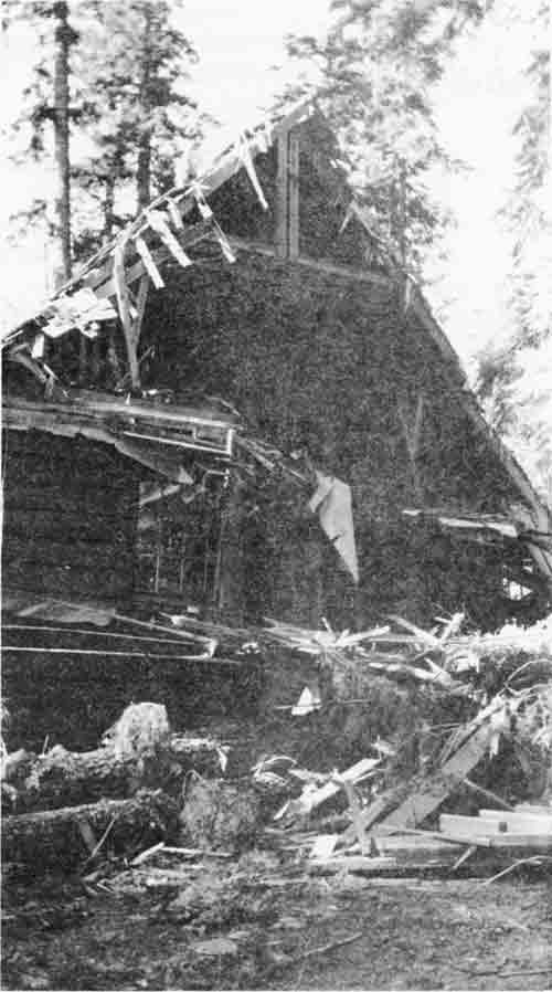
| Lake of the Woods warehouse damaged by Douglas-fir windthrow. |
1960
PERSONNEL
| Forest Supervisor | Carroll E. Brown |
| Fire Control, Range & Wildlife Staff | Robert H. Torheim |
| Forest Engineer | Hector Langdon |
| Timber Management Staff | Howard G. Hopkins |
| Land Uses & Recreation Staff | Ralph A. Wiese |
| Administrative Officer | Merlin C. Shipley |
District Rangers
| District | Name | Location |
| Applegate | Neil G. Suttell | Star Ranger Station |
| Ashland | Harold A. Thomas | Ashland |
| Butte Falls | Donald L. Strong (until June) | Butte Falls |
| Randall F. Perkins (EOD June) | ||
| Klamath | Darroll K. Frewing (until Nov.) | Klamath Falls |
| Earl M. Karlinger (EOD Nov.) | ||
| Prospect | Douglas H. Baker | Prospect |
| Union Creek | Asa D. Twombly | Union Creek |
|
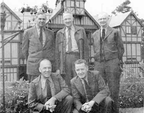
| Back Row: Chief Forester Richard McArdle, Ashland Ranger Harold Thomas, Regional Forester Herb Stone, Front Row: Timber Staffman Howard Hopkins and Recreation Staffman Ralph Wiese in front of the Ashland Shakespearean Theatre. The occasion was a stop and tour of the Forest while Chief McArdle was on a visit to Region 6. McArdle's visit on August 24 was to inspect the Ashland Fire Area, and the Tolman Creek timber sales. |
RANGE AND WILDLIFE MANAGEMENT
During 1960, 3,600 cattle and 2,100 sheep were grazed on the Forest range land. The livestock grazed on 35 allotments under paid permits issued to 75 stockmen.
Field work for the range allotment analysis program was completed by Ed Harshman during the summer. Management plans for all grazing allotments continued.
In order to manage livestock ranges more intensively, 6 miles of fences and two water developments were constructed. Twenty-two acres of range lands were reseeded.
Eight transects were laid out on the Forest in cooperation with the State Game Commission to determine the amount of deer use in critical areas and to enable the State Game Commission to better manage the deer herds.
OPERATION
By 1960, Forest receipts had increased to an amount more than seven times larger than the receipts had been 10 years before; from $507,751.60 to $3,619,378.27. The increase from Fiscal Year 1933, when Crater National Forest became Rogue River National Forest, was over 600 times greater (from $5,780.38).
Improvements constructed included new residences at Butte Falls and Union Creek; and two bunkhouses at Union Creek Work Camp.
The Bureau of Public Roads awarded a contract to Floyd L. Somers Company of Medford for the construction of 11 miles of the Lake of the Woods Forest Highway, from the western boundary of the Forest to Lake of the Woods.
FIRE ACTIVITIES
The 1960 fire season was critical but less severe than 1959. For the second consecutive year, the winter was mild with a below normal snow pack. June, a normally wet month, had no rainfall. There was virtually no precipitation from the last week in May until the middle of October. General soaking rains terminated the fire season the second week of November.
Ninety-two fires were suppressed; 47 of these were caused by lightning, 45 were man-caused. Of special significance was the low acreage burned compared with the number of fires and the severity of the fire danger. Within the Forest's protective area only 63 acres were burned. This was attributed to quick, decisive, and effective initial attack.
Aircraft played an important role in suppression. Sixty fire retardant flights were made from Medford; 27 were made on eight fires on the Forest. The Medford Airport Aerial Tanker Base was expanded and strengthened during the year. Installations at the borate plant now provide for 6,000 gallons of borate storage. A 500-gallon batch mixer and a high volume pump enables faster service. Personnel at the base include: Air Service Manager, Bob Foster; Mixmaster, Cecil Taunton; Crewmen, Jerry Braziel, Terry Whitford, Hank Maser, and John Norris.
The establishment of a new 25-man suppression crew to be stationed on the Applegate District has been approved by the Regional Office. The crew will be available for suppression work anywhere in the United States. The crew members will be well trained in fire behavior, suppression and most of all — safety. They can do any type of gainful work while not on fire, but they need to be within one hour's travel time to the Medford Airport.
TIMBER AND TIMBER PRODUCTS
High demands and extreme competition for National Forest timber stumpage continued in 1960. During the first half of the year demand for timber was high and bidding for timber was very competitive. Competition for sales slacked off as the lumber and plywood market softened during the second half of the year.
A total of 168,975,280 board feet valued at $3,815,352.25 was cut. Timber sold consisted of 263,936,270 board feet valued at $6,244,352.71. In addition, 4,641 Christmas trees were cut, valued at $2,770.
The volume sold materially exceeded the allowable annual cut and brought the volume under contract to a satisfactory level.
OTHER
A new Marden brush cutter recently purchased for the Klamath District is currently being used on the 500-acre Johns Manville sale area.
The Applegate District has caught the last of the wild horses on the District. According to Ranger Suttell, "A sharp decline is expected in the cost per meal of the Applegate mess operation."
|
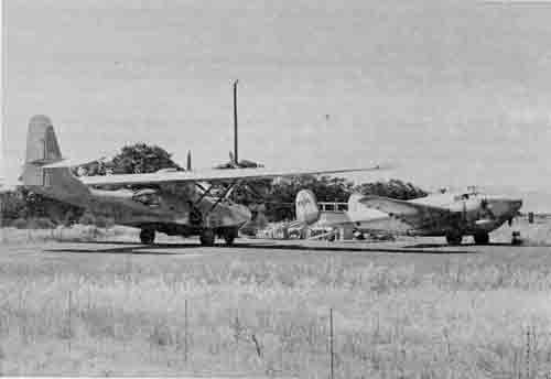
| Two tanker planes from Rosenbalm Aviation wait on landing pad to be loaded with fire retardant. Each plane holds a 1000-gallon payload. |
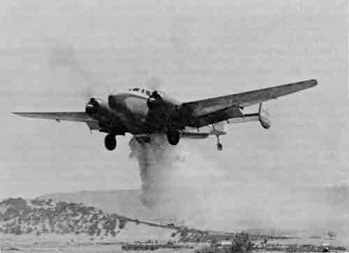
|
| A PV-2 drops a load of water in a test run on the Medford Airport. The coverage is laid down in a pattern approximately 50 feet wide and 100 feet long. |
The following article was prepared by the Forest Products Industry for the annual Forest Products Week and published in a special issue of "Tree Farm News Notes" by the Southern Oregon Conservation and Tree Farm Association.
The lumber industry in southern Oregon had its beginnings with the settlement of Jacksonville. Logs were first whipsawed by hand into rough lumber for the thriving gold town.
In 1852 J. S. Howard is credited with building and operating the first planning mill in town. It was located near where the McCully house is.
A. V. Gillette of Ashland originated the first sawmill in that town in 1852. The first home erected there was for Hargadine and Pease. The second building was another sawmill.
The growth of Jacksonville and the influx of miners and farmers in 1853-54 resulted in more construction in the valley. James C. Burpee constructed a furniture manufacturing plant in Jacksonville. The Methodist Church was built of hand-hewn logs and had a split shake roof. The Catholic Church built there was also frame construction.
Two flour mills, constructed in Ashland in the year 1854 grew out of the need to mill the valley-grown grains for local consumption.
From these early beginnings, the timber industry was launched in the Rogue Valley. Due to the poorly developed means of transportation, the sawmills were located near the forests. The plants originated in such places as Jacksonville, Ashland, Eagle Point and Brownsboro.
Chaparrall City, or Medford, as it is now known, originated as a cluster of some 40 wooden buildings located along a proposed railroad right-of-way in 1883. Medford grew rapidly when the railroad was completed to Phoenix in 1884.
With the completion of the line over the Siskiyous into California in 1888, Medford and Jackson County sawmilling developed rapidly. It was not until the early 1920's, however, that the city started to be known as a mill town.
The Butte Falls area with its vast stands of merchantable timber lured the struggling industry and in the mid-1920's a spur railroad was finally completed from Medford. This spur was operated as a common carrier for many years until it became a private railroad operated by the Owen-Oregon Lumber Company in 1931.
Over the years the forest industry has been built by men who were farsighted enough to have confidence in the wonderful productivity of forest lands for today and forever.
Jackson County produces about 600,000,000 board feet of lumber annually. Regeneration and annual growth may push this figure even higher since lumber is a renewable resource. The lumber industry generates an estimated 80 million dollars to the economy of the area.
There are 25 lumber mills in the immediate area. There are 10 plywood or veneer plants and about 10-15 wood re-manufacturing plants here.
More than 20 million dollars is paid out in wages alone in the forest industry in Jackson County. Some 4,000 workers in this area are employed in woods or mill operations. Hundreds more receive their income indirectly from the lumber industry.
Lumber is truly the "mainspring of the Rogue Valley economy". For every $1 of stumpage value that tree farmers produce...the community receives $17.60 more from values added to the value of the wood by the time it reaches the consumer.
There are 1-1/2 million acres of forest lands in Jackson County. Of this, 60% is owned by State or Federal governmental agencies. The balance is owned and managed by private owners.
Tree Farming, a voluntary private industry program of forest management to produce more and better forest products, has about 260,000 acres of private forest lands in Jackson County enrolled. The balance is under management in one form or another, for best utilization. Primary species harvested in this area include: Douglas-fir, shasta fir, white fir, spruce, ponderosa pine, sugar pine, white pine, hemlock and incense cedar. Some harvesting of black and white oak and other species is also being carried on.
Southern Oregon is part of what is known as "the Douglas-fir region". This region can grow enough timber to build one million homes a year . . . forever.
Products of this area from the lumber industry in addition to lumber, plywood and veneer are: lathe, boxes, window and door frames, bark mulch, by-product fuel, compressed sawdust fuel, refrigerator cases, office desks and cabinetry, millwork, fencing, toothpicks, pencil stock, arrow shafts, pine-fabricated cabins, dowels, spindles, toy stock, shoe heels and numerous other items.
Jackson County received more than TWO AND THREE QUARTER MILLION DOLLARS from O&C and Federal timber sales during 1959. If it weren't for this money your tax bill would be staggering.
The Forest Advisory Council considered the reclassification of the Sky Lakes Limited Area. This high mountain area extending from the south boundary of Crater Lake National Park southerly along the crest of the Cascades to Fourmile Lake was to be studied for reclassification as a Wild Area, Scenic Area, etc., or managed under the principles of multiple use management. Criteria for each major classification were presented to the Council members at the spring meeting March 16. They made an airplane trip over the area on August 10.
On August 17 and 18 eight members rented horses from Clyde Wilhelm's string at Lake of the Woods and took a horseback trip from Sevenmile Marsh over the Oregon Skyline Trail to Fourmile Lake, camping overnight at Lake Margaret.
At the fall meeting of the Council the members recommended that a Wild Area be established to include as much of the original Limited Area as would qualify under present standards. This recommendation was followed in later reports on the area.
There were no changes this year in the membership of the Forest Advisory Council.
KLAMATH INDIAN FOREST
The Congressional Act of August 13, 1954, provided for the termination of the Klamath Indian Reservation. This Act also provided that the tribal lands be sold to the highest bidder.
Senator Richard L. Neuberger from Oregon opposed this provision and was able to get a revision to the original Termination Act. The revised Act of August 23, 1958, Public Law 85-731, provided that the tribal lands, not needed to sustain those Indians remaining in the tribe, be added to the National Forest System. The revision referred to these lands as the Klamath Indian Forest. The date of the transfer was to be July 1, 1961.
During the summer of 1960, Supervisor Brown recommended that some advance sale preparation be done in order to have some timber sales ready for advertisement soon after the effective date of the transfer, and organizational studies be accomplished to determine the disposition of the Klamath Indian Forest. Regional Forester J. Herbert Stone approved these recommendations and James C. Iler, Assistant Regional Forester in the Division of operation, headed the group assisted by Marvin L. Smith, Iler's assistant; Alex E. Smith of the Division of Information and Education; Clayton Weaver, Fremont National Forest; and Supervisor Brown.
Darroll K. Frewing, District Ranger of the Klamath District, was placed in charge of the field work on the Klamath Indian Forest in November 1960. Earl M. Karlinger succeeded Frewing as District Ranger. Chester M. Beil, Forester from the Fremont Forest, was assigned to assist Frewing with recreation and other plans.
(See additional writeup in 1961)
1961
PERSONNEL
| Forest Supervisor | Carroll E. Brown |
| Land Uses & Fire Control Staff | Robert H. Torheim |
| Forest Engineer | Hector Langdon |
| Timber Management Staff | Howard G. Hopkins (until June) |
| David F. Keiser (EOD June) | |
| Range, Wildlife, Watershed, & Recreation Staff | Ralph A. Wiese |
| Administrative Officer | Merlin C. Shipley |
District Rangers
| District | Name | |
| Applegate | Neil G. Suttell | Star Ranger Station |
| Ashland | Harold A. Thomas (until Mar.) | Ashland |
| Robert E. Taylor (Acting: Mar.-June) | ||
| Glendon K. Jefferies (EOD June) | ||
| Butte Falls | Randall F. Perkins | Butte Falls |
| Klamath | Earl M. Karlinger | Klamath Falls |
| Prospect | Douglas H. Baker | Prospect |
| Union Creek | Asa D. Twombly | Union Creek |
PERSONNEL AND ORGANIZATION CHANGES
The most significant change in 1961 was the transfer, on July 1, of the entire Klamath Ranger District to the newly created Winema National Forest. The area transferred covered 265,901 acres and left the Rogue River National Forest a total of 621,020 acres; 571,760 acres in the State of Oregon and 49,260 acres in the State of California.
James A. Butler transferred from Willamette National Forest as finance officer. G. K. Jefferies from District Ranger, Paulina Ranger District, Ochoco National Forest, to District Ranger, Ashland District; David F. Keiser from District Ranger, Zigzag Ranger District, Mt. Hood National Forest, vice Hopkins; Howard G. Hopkins to Timber Management Division, Regional Office.
RANGE AND WILDLIFE MANAGEMENT
During 1961, 3,800 cattle grazed on 320,000 acres of Forest range land. The livestock grazed on 24 allotments under paid permit to 48 stockmen.
In cooperation with the State Game Commission, a program to reintroduce the fisher, a fur-bearing animal, on the Rogue River National Forest was initiated through the efforts of O. K. Puckett, Klamath Falls. The animal, which was once common on the Forest, was thought to be capable of controlling, through predatism, the over-population of tree destroying porcupines on the Forest. In January, 11 fishers were released in the Mountain Lakes Wild Area by the Game Commission with plans to release nine more later in the area. It was expected that in time the fisher would reproduce and extend its range over a wide area, restoring the animal to its native environment and reducing the porcupine population to normal.
FIRE ACTIVITIES
The 1961 fire season would be classed as critical; even more severe than the 1960 season. The first fire of the year occurred January 20 and the last one occurred November 9. Both of them were man-caused and were Class B in size.
For the third consecutive year the winter was mild with a below-normal snowpack in the hills. The last precipitation in the spring was on June 7. Some light rain with thundershowers occurred during the early summer, but did not materially ease the fire danger. Soaking rains did not come to the south portion of the Forest until November 10.
There was a total of 90 fires with 64 lightning- and 26 man-caused. Again, the low acreage burned figure, 27 acres, is significant; attributed to decisive, fast action on the part of ground crews and accurate drops by the air tanker pilots.
Retardant missions flown from the Medford Airport Tanker Base numbered 112; nearly double the number during the previous year. There were 21,000 gallons of retardant dropped on nine fires on the Rogue River National Forest, and 114,000 gallons were dropped on adjacent Forests and State protected lands.
TIMBER MANAGEMENT
Timber was harvested at a brisk rate in spite of a weak lumber market. Two hundred ninety-four new sales were made with 168,990,280 board feet cut giving an income of $3,815,798.50. Allowable cut for the Forest was set at 135 million board feet per year. Timber sold consisted of 263,951,270 board feet valued at $6,244,798.96. Also sold were 6,500 Christmas trees valued at $4,246.53.
Planting of seedling trees on 3,575 acres, and hand seeding on 665 acres, prepared 4,240 acres of Forest land for the next crop of timber.
The project of clearing brush from the old Cat Hill, Peavine and Huckleberry Mountain burns resulted in the clearing of 265 acres for reforestation.
RECREATION
An estimated 318,000 people used the Rogue River National Forest for recreation in 1961.
There were 58 new camp units built in Forest campgrounds during the year.
OTHER
Below are excerpts from the February 12, 1961, "Medford Mail Tribune" on the Cat Hill Burn rehabilitation.
Sixty Acres of Cat Hill Burn Being Replanted to Restore Production.
Sixty acres of dense brush, a portion of the Cat Hill burn brushfield in the Butte Falls District, Rogue River National Forest was recently prepared for reforestation in an experimental clearing project, according to District Forest Ranger Randell Perkins. . . .
The carpet is made up of a practically impenetrable thicket of many species of hardwood brush, in most places 10' - 20' high. Manzanita and chinkapin predominate but varnishleaf snowbrush, serviceberry, willow, cherry, scrub oak, hazel, snowberry and other species are also present.
The Cat Hill Burn resulted from one of the disastrous forest fires that raged across the entire Northwest in 1910. Fragments of the area were reforested soon afterwards.
The Snowshoe plantation of 60 acres planted in 1912 is now a thriving young forest of ponderosa pine trees from a foot to 2 feet in diameter and about 50 feet tall. Portions of the burned area reforested naturally but about 8,500 acres are still an unproductive brushfield 50 years later. It is the largest potentially productive patch of idle land on the Rogue River National Forest.
Over the years various attempts have been made to reforest the Cat Hill Burn. During the years 1937 to 1940, 19 miles of cleared lanes were bulldozed through the brush, and ponderosa pine seedlings were planted. Foresters then hoped these trees would grow, overtop the brush and shade it out. Natural vegetation over several generations would then reclaim the area as a productive forest.
The plan was only partially successful. The cleared lanes became game ways. The rabbits, deer and other rodents ate off many of the new trees while the brush crowded back in from the sides.
A few of the pine trees did get their tops above the brush and are now thriving, but most succumbed to browsing by animals and crowding by brush.
Later aerial spraying with herbicides was tried. It also was only partially successful, killing some species, only the top branches of other species, and leaving some to flourish. Further it didn't disturb the thick carpet of duff and dry leaves that prevented tree seeds from finding a seed bed of mineral soil.
Trials with various types of specialized machines for brushfield clearing were conducted. Although proven effective elsewhere, the brush was too dense and tough for either a brushcutter or a root plow pulled by a tractor.
The most effective tool for clearing the brush found to date is the bulldozer brushrake mounted in the front of a large tractor. The Caterpiller Tractor Company has cooperated with the Forest Service in some of these trials and has demonstrated that the brush can be removed, and when cleared away, good forest soil is uncovered.
On the 60 acres recently treated the soil resembles a plowed field between the long rows of piled brush.
Little white fir trees are being planted in the cleared areas, under the direction of Donald A. Perala, project forester. White fir is a fast growing, productive tree at this high elevation. A small portion of the area will be planted with white fir seed as an experiment. Although seeding has a lesser chance of success than planting, it is advantageous in that it can be used in the absence of available planting stock. . . .
The cost is high, running $60 to $70 per acre for clearing and planting, but he (Perkins) says it is well justified by the highly productive capacity of the soil.
He (Perkins) questions whether in a community dependent to a large measure on timber processing, such productive land as this can be left idle. Converting Cat Hill Burn to productive forest is a means of increasing the growth, sustained yield capacity and allowable cut of timber in the Rogue Basin.
Buildings constructed during the year; two residences at Star Ranger Station, two at Union Creek and one bunkhouse at Butte Falls.
KLAMATH INDIAN FOREST
(Continued From 1960)
Darrel Frewing organized a field crew and succeeded in getting the field work done on two timber sale areas - the Yah-whee and Switchback sales. Forester Paul J. Brady, Klamath District, and Forester Charles R. Niver, Applegate, were transferred to the Klamath Indian Forest organization early in the year. Forester, Edward T. Cobo, Ashland District, was detailed to the organization to help Chester Beil with recreation plans.
In the meantime, organizational studies were being made to determine the disposition of the Klamath Indian Forest.
The Division of Operation (Regional Office) prepared a systematic analysis designed to assist in determining whether to create a new Forest or transfer the Klamath Indian Forest to the Deschutes, Fremont and Rogue River Forests. Many meetings were held in Klamath Falls and Portland. The study showed that the least impact and the most economical method would result if the lands were added to the three adjacent Forests. However, Supervisor Brown recommended that the Regional Forester consider other factors in making his decision. The most important one was that the people in Klamath Falls wanted a National Forest headquartered in their town. They approved of Senator Neuberger's revision to the Termination Act with this in mind. The Klamath Falls Chamber of Commerce worked hard on this issue. Tom Watters, one of the original Management Specialists for the Klamath Indian Reservation, also favored the transfer to the National Forests and he played a major role in getting Senator Neuberger's revision passed. The Regional Forester agreed and referred the case to the Washington Office where final approval was given. The Rogue River Forest staff suggested the name "Winema" be given to the new Forest. This was also approved and about March 1, 1961, the Winema National Forest was activated. It was made official by President Kennedy's Proclamation #3423 on July 26, 1961. The Klamath District was assigned to the Winema in July. Supervisor and staff of the new Winema National Forest were as follows:
| Alex E. Smith | Forest Supervisor |
| Norman E. Gould | Timber Management Staff |
| Chester M. Beil | Timber Management Assistant |
| Dan B. Abraham | Fire Control and Lands Staff |
| Robert D. Stockton | Fire Control Assistant Staff |
| John V. Grove | Forest Dispatcher |
| Charles B. Waldron | Range and Wildlife Staff |
| Keith W. Zobell | Assistant Staff |
| Kjell M. Bakke | Forest Engineer |
| Stanley Scurlock | Assistant Engineer |
| William A. North | Administrative Officer |
| Robert E. Crittenden | Administrative Assistant |
The field force of the Winema National Forest consisted of three ranger districts. They were:
Chemult
Douglas B. ShawDistrict Ranger Chiloquin
Homer G. FaulknerDistrict Ranger Klamath
Earl M. KarlingerDistrict Ranger
THE ROGUE BASIN PROJECT
The Army Corps of Engineers had planned for the Rogue Basin Project for several years. This called for the multiple purpose dams on the Rogue River at McCloud; Elk Creek near the mouth of West Branch; and the Applegate River, downstream from French Gulch. The latter was the only one affecting the Rogue River Forest.
The Corps was ready to prepare their project document for Congressional approval. It was therefore necessary for the Forest to prepare an impact report for the Applegate Dam and Reservoir. This report would describe any impact it would have on the Forest, such as road and trail replacement, recreation improvements needed on the reservoir, changes in grazing allotments, etc.
Ranger Suttell and his crew did an outstanding job in preparing this impact report. It received approval, with only minor revisions, in the Supervisor's Office and Regional Office. It was included in the Corps' Project Report for the Rogue River Basin and later was approved as House Document 566 Eighty-Seventh Congress. Later in the year Ranger Suttell received a cash award for his leadership in this report.
THE FOREST ADVISORY COUNCIL
Members were changed to allow more citizens an opportunity to serve. Eugene Burrill was replaced by S. V. "Duke" McQueen, General Manager of Kogap Industries; B. L. "Bud" Nutting was replaced by Tom K. Oliver, General Manager of Timber Products; and Mrs. Pauline La Plane was appointed to represent labor interests.
The organization of the new Winema National Forest and its impact on the Rogue River Forest was discussed by the Council members. At request of some of the members the appraisal system for selling National Forest timber was explained to them.
1962
PERSONNEL
| Forest Supervisor | Carroll E. Brown |
| Land Uses & Fire Control Staff | Robert H. Torheim |
| Forest Engineer | Hector Langdon |
| Timber Management Staff | David F. Keiser |
| Range, Wildlife, Watershed, & Recreation Staff | Ralph A. Wiese |
| Administrative Officer | Merlin C. Shipley |
District Rangers
| District | Name | Location |
| Applegate | Neil G. Suttell | Star Ranger Station |
| Ashland | Glendon K. Jefferies | Ashland |
| Butte Falls | Randall F. Perkins | Butte Falls |
| Prospect | Douglas H. Baker (Until May) | Prospect |
| Robert K. Krell, Acting (May-Dec.) | ||
| Vernon D. Pritchard (EOD Dec.) | ||
| Union Creek | Asa D. Twombly (until Sept.) | Union Creek |
| Emil M. Sabol (EOD (Sept.) |
ORGANIZATION
The Supervisor's Office Business Management section was reorganized during the year to more fully expedite the increased delegations to the Forests.
Budget and Finance - James A. Butler was placed in charge. The accounts clerical staff was under his supervision.
Resource and Personnel - M. Royce Bunch transferred from the Mt. Hood Forest to head this section early in the year.
Administrative Services - Richard G. Foster was transferred from the Ashland District to head up this section. Increased contracting and general clerical work necessitated the organization of this section.
All of these sectionheads were under the supervision of Merlin C. Shipley, Administrative Officer. More authorizations and responsibilities were transferred to the Forests from the Regional Office. Contracting work increased, and delegations in all activities, especially Budget and Finance and Personnel, were added.
The Ranger Districts were also reorganized. The Assistant Ranger position was abolished and District Assistant positions established to handle the increased workload in all activities.
The District Assistant positions were generally as follows:
Timber Management Assistant - Responsible for all activities in timber management.
Other Resource Assistant - Responsible for all activities in range, wildlife, recreation and lands.
Engineering Assistant - Responsible for all engineering work.
Fire Control Assistant - Responsible for all fire control work.
Administrative Assistant - Responsible for all business management activities.
Some modifications were made depending on the workload at the individual Districts. For instance, the Applegate Districts had two resource assistants to handle the impact of the proposed Applegate Dam to be constructed by the Army Corps of Engineers.
TIMBER MANAGEMENT
The Columbus Day storm prematurely "harvested" about 113 million board feet of timber on the Rogue River National Forest. This represents 64 per cent of one year's allowable cut. On one area which had been previously marked for selective logging, all of the good thrifty leave trees blew down, while the poor-risk, thin-crowned trees that had been marked for cutting remained standing. This was typical of the whims of the storm which cut a wide swath across the Forest and left the Forest Service and the loggers with a mammoth cleanup job.
Many salvage sales have already been made, and by June 30, 1963, 81.5 million board feet of the blowdown will have been sold in commercial sales. The remainder of the blowdown is scattered over the Forest in inaccessible areas and cannot be reached from existing roads. This is the timber which will attract and encourage bark beetles. Aerial and ground surveillance of the Forest will continue for several years to detect any epidemic outbreak that may threaten. The sign of beetle infestation in standing trees is sudden change of needle color from green to red when the beetle larvae completely girdle the trunk.
A new Timber Management Plan was approved by the Chief of the Forest Service. This plan provides for cutting of timber on a sustained yield basis in the following amounts:
Allowable Annual Cut
Harvest cut - 165 million board feet
Restricted area cut - 10 million board feet
Thinning cut - 1 million board feet
The harvest cut will come from areas where timber is the key value: the restricted area cut from partial cuts to improve areas with recreation or other key values; and the thinning cuts from stands below rotation age.
The new allowable cut is 30% higher than the old cut. This increase was the result of up-to-date timber volume figures based on the Forest inventory started in 1958 and completed in 1960, improved utilization of the timber by the forest industry, and shortening of the rotation to take advantage of the most rapid growth portions of the growth cycle.
The calendar year 1962 timber cut and sold record is listed below:
| Number of new sales | - 405 |
| Volume sold | - 178,577 million board feet |
| Volume cut | - 203,100 million board feet |
| Commercial Area | 543,585 acres |
| Total volume of commercial timber species | 14.8 billion bd. ft. |
| Total volume available for cutting | 13.7 billion bd.ft. |
| Approved allowable annual cut on sustained yield basis | 176.0 million bd. ft. |
Reforestation: Planting of 3,845 acres using over 1-1/2 million seedling trees, and hand seeding 821 acres using 330 pounds of tree seed prepared 4,666 acres of forest land for growing the next timber crop.
Brush Clearing: Clearing the old Cat Hill Peavine, and Huckleberry Mountain burns was accelerated with 1,263 acres of brush removal.
These areas are being reforested immediately to avoid excessive brush encroachment.
Timber Stand Improvement: Overstocked young stands were thinned to provide release of desirable trees on 486 acres. A helicopter was used to aerially spray 180 acres of overtopping hardwoods.
To increase the quality of selected dominant, preferred species, more than 22,000 trees on 771 acres were pruned. This practice provides a ring of valuable clear wood.
Blister Rust Control: Early indications are that the canker killing antibiotics, Phytoactin and Acti-dione, are producing encouraging results in the control of this disease on young sugar and white pine stands of this Forest. An additional 63,550 trees on 771 acres were given this treatment in 1962. Hand eradication of the host ribes plants was continued on 1,611 acres of pine plantations and of high-value growing sites.
White Pine Grafting: Grafting of selected branches (scions) to Jim Creek stock was 66 per cent successful in 1962. These are by far the best results to date.
FIRE CONTROL
Thirty-one forest fires occurred with only 18 acres burned. The number of fires was about half the annual average. The acreage burned was one of the lowest on record.
The 1962 fire season, in terms of fire danger, was moderately severe. Summer weather was mostly warm and dry; however, the number of lightning storms was below normal.
A 25-man fire fighting crew was headquartered at Star Ranger Station during the summer. This specially-trained crew, traveling mostly by airplane, was dispatched to eight large fires in four western states. The crew will be based at Star Ranger Station each summer.
ENGINEERING
Forest Roads: One hundred and nineteen miles were surveyed including two bridge sites; 102 miles were staked for construction; 139 miles were designed including 8 miles of double-lane highway to serve the Mt. Ashland Ski Area. Present plans include contracting this construction in July 1963 and surfacing it in 1964.
Forest Trails: One and nine-tenths miles were surveyed for relocation in 1963.
Other Projects: Seven building sites were surveyed, two trailer courts and two campground water systems were surveyed and designed. The Medford air tanker base was laid out and a retardant pumping system designed.
Buildings constructed were new office, kitchen and messhall - Star Ranger Station; Boundary Scaling Station - Prospect; and Wagner Butte Lookout house.
Maintenance: Four hundred and ninety-five miles of trail and 447 miles of road were maintained.
The Rogue River opened 288 miles of road after the Columbus Day storm.
Timber purchasers maintained 379 miles of Rogue River Forest roads.
Roads: Seventy-nine miles of timber purchaser roads were constructed and an additional 32 miles are being built by timber sale contract.
Miscellaneous Construction: A 12,000-gallon water tank and distribution system was installed at Star Gulch work camp.
The Fire Retardant Base was relocated at the Medford Airport and a new taxiway built and oiled.
WATERSHED
Mean Temperature and Precipitation:
| Temperature | Precipitation | |
| Ashland | 52.6 | 20.15 |
| Fish Lake | -- | 44.59 |
| Medford | 54.0 | 18.15 |
| Prospect | 49.8 | 41.64 |
| Acres under irrigation in Jackson County | 53,000 |
| Hydroelectric power produced annually in Jackson County | 410,000,000 KWH |
| Communities obtaining domestic water supply from the National Forest: Medford, Ashland, Central Point, Jacksonville, and Eagle Point. Population served | 37,000 |
Domestic water consumption:
| Medford: Peak, 23 million gallons; average, | 9.2 million daily |
| Ashland: Peak, 7.6 million gallons; average | 3.9 million daily |
| Total daily | 13.1 million gallons |
Acreage set aside for special treatment as municipal watershed:
| Acres | |
| Ashland | 11,342 |
| Medford | 2,876 |
| Total | 14,218 |
Capacity of present storage reservoirs fed by National Forest:
| Acre-Feet | |
| Emigrant | 45,200 |
| Fish Lake | 7,800 |
| Howard Prairie | 60,600 |
| Willow | 10,000 |
| Total | 123,600 |
RANGE MANAGEMENT
| Total usable grazing area (National Forest land only) | 566,000 acres |
| Permitted cattle | 5,288 head |
| Stockmen using National Forest range under paid permit | 70 |
LAND STATUS
(These figures are from the official acreage report of July 1, 1962.)
| Per Cent |
County | Nat'l Forest Land |
Nat'l Forest O&C |
O&C (W) |
Total Gov't Land |
Private | Gross Area |
| 9.68 | Douglas | 54,012 | 1,237 | 55,249 | 55,249 | ||
| 64.64 | Jackson | 360,784 | 22,172 | 20,952 | 403,908 | 49,483 | 453,391 |
| 2.54 | Josephine | 14,166 | 16,408 | 30,574 | 30,574 | ||
| 14.31 | Klamath | 79,883 | 2,152 | 82,035 | 118 | 82,153 | |
| 91.17 | Oregon Total | 508,845 | 41,969 | 20,952 | 571,766 | 49,601 | 621,367 |
| 8.83 | Siskiyou | 49,261 | 49,261 | 6,945 | 56,206 | ||
| 100.00 | Forest Total | 558,106 | 41,969 | 20,952 | 621,027 | 56,546 | 677,573 |
GENERAL
The past year has been a busy one. The fire season was less severe than average. Thirty-one fires occurred, burning over 18 acres. The average number of fires has been 60 for the past 5 years. The October 12 windstorm blew down about 115 million board feet of timber, mainly in the Prospect and Union Creek Districts. Timber disposal plans were revised to sell and remove this down timber as soon as possible before it became a breeding ground for insects, and a fire hazard.
The rainstorm of late November which ended December 2 dumped another several inches of rain, mainly in the Ashland area. About 3.7 inches fell in a 24-hour period. A cloudburst occurred in Tolman Creek, breaching the road in four places resulting in considerable damage to roads within the Ashland Watershed. There was some sloughing of soil, and several fills gave way. The diligent patrol of all roads in the watershed by crews from Ashland and by the Forest road crew prevented additional damage. They were able to keep culverts open, which was necessary.
Below are excerpts from the Weather Bureau report in October 1962.
OREGON - OCTOBER 1962
SPECIAL WEATHER SUMMARY
COLUMBUS DAY WIND STORM
The most destructive storm ever recorded in this state, in terms of the dollar value of resulting damage, moved across western Oregon during the afternoon and evening of October 12. Preliminary estimates indicate that between $175 million and $200 million immediate damage resulted. Losses of orchards will seriously affect agricultural production for years to come. It was the direct cause of a known loss of 24 lives. Its hurricane force winds that continued for several hours were responsible for practically all destruction.
I. METEOROLOGICAL DEVELOPMENT - Two features distinguish this storm from the many severe disturbances that approach the Pacific Cost each year: (1) It was several weeks earlier in the season than normal for this type of storm. (2) Within periods of record, the fury of the wind in interior valleys of western Oregon was unprecedented.
A wave of cold air moving rapidly southeastward from near the Aleutian Islands was encountering a warm tropical marine air off the California coast. As a result of the encounter of these two strongly contrasting air masses, a severe storm formed and was centered approximately 500 miles west of San Francisco by 4:00 a.m. on October 12. It was then turning on a northeasterly course around the semi-permanent Gulf of Alaska low pressure area. At or shortly after 4:00 a.m. it began to intensify rapidly and turn to a more northerly course. Its surface speeds increased to about 60 m.p.h.
By 1:00 p.m. the storm center had moved to a point approximately 150 miles west of North Bend, Oregon. Relatively strong winds had moved inland to a North Bend - Medford - Klamath Falls line. By 4:00 p.m. the center was about 110 miles west of Newport, Oregon, and strengthening winds were being felt from Eugene to Astoria in Oregon. By 10:00 p.m. the storm center was approximately 100 miles north of Vancouver Island and the storm was beginning to weaken.
The occurrence of winds higher than anything previously recorded in inland western valleys was due to: (1) the extremely low pressure at the center of the storm; (2) the fact that as it moved northward the center was located much closer to the Oregon coast than usual; (3) the pressure pattern was aligned to bring the most intense pressure gradient (and, therefore, strongest winds) directly over this area. This very low pressure was in part brought about by the fact that as the low pressure center of the storm began its northward movement the low pressure system in the Gulf of Alaska moved eastward. The combined effect was to further reduce pressure at the center of the storm. The lowest sea level pressures, given in inches, officially observed at several Oregon locations includes: Astoria, 28.62; Eugene, 28.86; Klamath Falls, 29.21; Medford, 29.02; North Bend, 28.74; Portland WBAS, 28.84; Roseburg, 28.86 and Salem, 28.90. At Portland, this was still several hundredths of an inch above the record low of 28.56 inches observed in January, 1880.
Table 1. Speeds and Time of Occurrence
at WBO and FAA Stations.
| Station | Fastest Minute |
Time of Occurrence |
Peak Gust |
#Time PST |
| Astoria WBAS | 44 | 7:57 p.m. | 96 | 7:30 p.m. |
| Eugene WBAS | 63 | 3:56 p.m. | 86 | 3:56 p.m. |
| Medford WBAS | 40 | 2:40 p.m. | 58 | 2:40 p.m. |
| North Bend FAA | 35 | 3:40 p.m. | 81 | 3:40 p.m. |
| Pendleton WBAS | 42 | 7:34 p.m. | 53 | 7:34 p.m. |
| Portland WBAS | 73 | 5:00 p.m. | 79 | 5:00 p.m. |
| (88) | (7:00 p.m.) | |||
| Roseburg WBAS | 33 | 3:58 p.m. | 62 | 3:58 p.m. |
| (50) | (4:50 p.m.) | |||
| Salem WBAS | 58 | 5:33 p.m. | 90 | 5:33 p.m. |
| Troutdale FAA | 66 | 7:07 p.m. | 106 | 7:10 p.m. |
| # Peak gust may have occurred any time within 5 minutes of the time shown. | ||||
III. STORM DAMAGE - There were 84 homes completely destroyed, 5,262 suffering major damage and 46,672 damaged to a lesser degree according to official figures released by the American Red Cross. In several counties 90 to 95% of the farm buildings suffered damage varying from only minor roof losses to total destruction. Thousands of public and industrial buildings were damaged throughout western Oregon.
The U. S. Forest Service Timber Management Unit in a preliminary estimate placed the blow down of Oregon timber at 2,638,000,000 board feet. Some part of this, no doubt, will be saved. This can only be a fraction of the total as large portions of it are inaccessible and much of the rest is too badly shattered to be usable. Not included in the above total were several million dollars worth of timber destroyed in agricultural wood lots. Neither does this include large numbers of ornamental trees in homes and parks. In the city parks of Portland alone more than 4,000 trees came down, some of them 2 to 3 feet in diameter at the ground. An additional approximately 6,000 fell elsewhere within the city. It takes little imagination to visualize the results of these piling up across walks, streets, highways, power and telephone lines and homes.
FOREST ADVISORY COUNCIL
Harlan Cantrall, Applegate rancher; Jean Eberhart, Ashland, representing recreation; and Jack Hanel, Pacific Power and Light, representing wildlife interests, were appointed to the Council replacing Paul Weiland, Frank Drew and Larry Shaw.
Tom Watters of Klamath Falls, resigned due to the Winema Forest being headquartered in Klamath Falls.
The Council discussed range management plans and the progress made in achieving better management of all livestock ranges. A field trip to Union Creek District was made in August. The calculation of the annual allowable cut of timber was explained at the fall meeting.
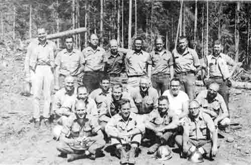
|
| Fire Overhead Meeting on July 19. Back Row (L-R) Bob Krell, Jim Lungsford, Art McKee, Charlie Hayes, David Keiser, John Shallenberger, George Berscheid and Truman Puchbauer. Middle Row: Carroll Brown, Louis Cernick, Don Vaughn, Bob Snoich, "Red" Thomas, Jim Butler, Lyle Anderson. Seated: Neil Suttell, Randy Perkins, Bud Twombly and Doug Baker. |
RECEIPTS AND EXPENDITURES - FISCAL YEAR 1962
ROGUE RIVER NATIONAL FOREST
| EXPENDITURES | ||||
| RECEIPTS | Operating | Investments | ||
| National Forest Protection and Management | $ 670,019 | $ 205,639 | ||
| Fighting Forest Fires | 191,669 | --- | ||
| Pest Control | 696 | --- | ||
| Blister Rust Control | 57,777 | --- | ||
| Road and Trail System | 147,107 | 250,094 | ||
| Brush Disposal | $ 281,000 | 198,755 | 8,608 | |
| Cooperative Deposits (Including timber deposits for stand improvement) | ||||
| Operating | $ 42,277 | 339,334 | 74,402 | 154,188 |
| Investment | 297,057 | |||
| National Forest Receipts: | ||||
| National Forest Fund | 2,675,631 | |||
| Oregon and Calif. Lands | 133,558 | |||
| Other miscellaneous receipts | 15,710 | |||
| Totals | $3,445,233 | $1,340,425 | $ 618,529 | |
| Less Cooperative Deposits | ||||
| Investment Receipts | -297,057 | |||
| Total Operating Receipts and Expenditures |
$3,148,176 | $1,958,954 | ||
| a. Operating Expenditures | $1,340,425 | |||
| b. Estimated annual deprec. on roads, trails, and other improvements in place on June 30, 1962 | 321,586 | |||
| Total | $1,662,011 | |||
| Amount by which Receipts exceed operating expenditures plus est. depreciation |
$1,486,165 | |||
Note: Expenditures are on an obligation basis.
SOURCE OF RECEIPTS - F.Y. 1962
| Sale of Timber | $2,663,931 |
| Grazing Permits | 6,066 |
| Land Use Permits | 216 |
| Recreation Permits | 5,207 |
| Power Permits | 114 |
| Minerals | 97 |
| $2,675,631 |
Twenty-five per cent was paid to the States of Oregon and California for distribution to the following Counties having National Forest land:
| County | Net National Forest Area - Acres |
County Allocation |
| Douglas | 54,012 | $ 65,371 |
| Jackson | 360,784 | 436,662 |
| Josephine | 14,166 | 17,146 |
| Klamath | 79,883 | 96,684 |
| Siskiyou (California) | 49,261 | 53,044 |
| 558,106 | $668,907 |
Area under Forest Service Administration (includes O&c lands):
| County | Acres |
| Douglas | 55,249 |
| Jackson | 403,908 |
| Josephine | 30,574 |
| Klamath | 82,035 |
| Siskiyou (California) | 49,261 |
| 621,027 |
1963
PERSONNEL
| Forest Supervisor | Carroll E. Brown |
| Fire Control & Land Uses Staff | Robert H. Torheim |
| Forest Engineer | Hector Langdon |
| Timber Management Staff | David F. Keiser |
| Range, Wildlife, Recreation, & Lands Staff | Ralph A. Wiese |
| Administrative Officer | Merlin C. Shipley |
District Rangers
| District | Name | Location |
| Applegate | Neil G. Suttell | Star Ranger Station |
| Ashland | Glendon K. Jefferies | Ashland |
| Butte Falls | Randall F. Perkins (until Apr.) | Butte Falls |
| Robert G. Lewis (EOD Apr.) | ||
| Prospect | Vernon D. Pritchard | Prospect |
| Union Creek | Emil M. Sabol | Union Creek |
OPERATION
The Rogue River Forest received a General Integrating Inspection by Assistant Regional Forester, Marvin L. Smith and Robert W. Appleby, Forester, Division of Fire Control. A copy of the inspection report is in the files of the Forest Supervisor.
The Resource and Personnel Section of the Business Management, in the Supervisor's Office was reorganized. The Resource Section was headed by Grace Sprague and the Personnel Section headed by Royce Bunch.
Wallace R. Robinson retired March 1, and Harold A. Thomas retired on disability July 26.
Employee Awards
The following received incentive awards during 1963 for superior service:
| Dale M. Chapman | Austin E. Klahn | Grace E. Sprague |
| Eugene H. Bergmann | Hector Langdon | William C. Tarr |
| Eugene Fontenot | Floyd J. Marita | Donald E. Vaughan |
| Eva G. Gerhardt | Marion W. McKnight | Hazel L. Wright |
| Clair L. Killingsworth | Florence K. Renaker |
TIMBER MANAGEMENT
Disposal of the timber blowdown during the 1962 Columbus Day storm provided a busy and eventful year for both the Forest personnel and the timber purchasers. By the time the last day of 1963 had rolled around 112 blowdown sales totaling 145 million board feet had been made and 124 million board feet had been cut and removed. Only scattered parcels remained to be sold and the big job of saving the logs from deterioration, preventing beetle infestation, and removing fire hazardous slash and debris accumulations was nearly done.
Without the cooperation and hard work of the timber purchasers and loggers this job could not have been accomplished, and the Rogue River Forest personnel wish to thank them all for a fine job.
In addition to the blowdown, 375 sales were made, with 23 million board feet, for $4,340,000. Also sold were firewood, posts, and 4,651 Christmas trees, mostly to families for their personal use. The annual trek to the Forest to cut the family Christmas tree is becoming a ritual to an increasing number of families.
Reforestation
To keep new tree crops growing, 1,530,000 trees were planted on 2,908 acres, and 469 pounds of tree seed were sown on 1,467 acres; 1,280 acres of this being reforestation of old burns and brushfields.
A tree transplant bed was established near Sturgis Guard Station on the Applegate District. About 225,000 trees will be grown in this bed for an extra year to provide sturdy, acclimated planting stock for severe sites where plantations of regular trees would fail.
Brush Clearing
Clearing and planting operations continued in the Cat Hill, Peavine, and Huckleberry Mountain burns, with 1,275 acres of clearing accomplished to prepare the site for new crops of trees.
Timber Stand Improvement
Treatment of young timber stands to increase growth and improve quality of the final product is a technical forestry job that will yield substantial gains in the future. Pruning and thinning on 1,111 acres were completed.
Blister Rust Control
The Forest continued efforts to control white pine blister rust in white and sugar pine stands. Forest crews eradicated 1,812 acres. Evaluation of the results of antibiotic treatment of rust-infected trees continued, and 398 additional acres were treated with antibiotics.
The Forest was saddened in 1963 by the untimely death of William J. Roberts, Jr. whose scion grafting work at the Jim Creek Arboretum at Prospect shows promise of being successful preservation of rust-resistant parent material.
FIRE CONTROL
In terms of fire danger, the 1963 fire season was moderate. Intermittent light rains throughout the summer helped to prevent forest fuels from drying out severely. Lightning occurrence was close to normal, but showers accompanied every storm.
Forty-four fires occurred on lands protected by the Rogue River National Forest. Thirty-three of these were caused by lightning; eleven were man-caused. Only thirty-eight acres were burned.
The timber blowdown caused by the Columbus Day storm of 1962 created an unusually severe fire hazard. Extra fire prevention measures, along with excellent cooperation by forest users, resulted in no fire losses in the blowdown areas. This hazard will be a threat for 2 or 3 more years.
RANGE MANAGEMENT
Favorable weather and well-timed rains gave us one of the best forage years for quite some time.
The assignment of Range expert Austin Klahn was of great help this year. Range studies were carried out on six allotments and individual stockmen took a great interest in the work. Under this continuing program, six management plans were approved.
A general range tour last summer resulted in revised forage standards and better understanding of mutual problems. The next few years should bring better management and fuller use of the forage resource.
WILDLIFE
One of the resources managed under multiple use is wildlife. The Forest Service is mainly concerned with providing habitat to help insure fish and game for the future. To meet this aim planning has been carried on with State, County, and other agencies. A recent example is a cooperative program by Pacific Power and Light Company, the Forest Service, and the Oregon Game Commission to improve deer crossings over canals.
Studies have been made for several years to determine how fish and game habitat can be improved. These studies have resulted in plans for work next year.
RECREATION
Inventory of outstanding recreation sites has been completed.
Wells were drilled at Jackson, Beaver-Sulphur, Cook and Green, Abbott Creek, Farewell Bend, and Fish Lake Campgrounds, and Boundary Picnic area. All the wells produce good water except Fish Lake which produces medium cool air, and Beaver-Sulphur which has good water but it is strongly sulphurous.
Jackson Campground is finished and is being used heavily. Abbott Creek Campground will be completed next summer.
Coordination of recreation efforts has been accomplished with the National Park Service, the Bureau of Land Management, Jackson County, CORDA, and neighboring National Forests.
The Big Story for the year was the Mt. Ashland ski area. The Mt. Ashland Corporation accomplished two years' work in six months, and over 25,000 visitors enjoyed the results this winter. The new road should be ready for next winter's use.
WATERSHED MANAGEMENT
The Rogue River National Forest and the City of Medford began negotiations on an agreement to intensify management of the Big Butte Springs Watershed. The area will be managed under multiple-use principles, with water as the key value. The objective is to maintain the volume and quality of Medford's domestic water.
ENGINEERING
Forest Roads: 125.1 miles were surveyed including three bridge sites and 8 miles of the Butte Falls to Fish Lake Road; 101.7 miles were staked for construction; 73.6 miles were designed. The Forest Service maintained 580 miles and loggers maintained 372.
Forest Trails: 6.5 miles were surveyed for relocation in 1963 and 360 miles were maintained.
Construction: 2.9 miles of trails were restored and 4 miles were rebuilt. An Office was completed at the Union Creek Ranger Station. One house was completed at Prospect Ranger Station; 87 miles of timber purchaser roads were constructed or reconstructed and 37 miles additional are being built by timber sale contract. One mile of campground road was constructed by Forest crews. Eight miles of construction to a rough base stage was completed on the new access road to the Mt. Ashland Ski Area. This road will be completed and surfaced in the summer of 1964.
Miscellaneous Construction: Three cattleguards were installed and 450 rustic signs were erected. Four concrete bridges were constructed. One major culvert was installed cooperatively with a timber purchaser, and one by the Forest construction crew. Three 50' radio antenna towers were erected on high points to improve the Forest radio network. The taxiway at the Fire Retardant Base was surfaced. A trailer court was constructed at Prospect Ranger Station. A 53' treated timber tower was constructed at Blue Rock to replace the 30-year-old lookout. In addition, two building sites were surveyed and six campground water systems were surveyed and designed.
RECEIPTS AND EXPENDITURES - FISCAL YEAR 1963 NATIONAL FOREST PROGRAM
| EXPENDITURES | |||
| Receipts | Operating | Capital | |
| National Forest Protection | $ 955,993 | $240,814 | |
| Fighting Forest Fires | 190,693 | 429 | |
| Insect & Disease Control | 49,563 | 2,173 | |
| Road & Trail System | 230,411 | 416,032 | |
| Cooperative Work | $ 492,790 | 239,744 | |
| National Forest and Land Use Area Receipts | |||
| National Forest Fund | 2,565,393 | ||
| Oregon & California Lands | 254,179 | ||
| Other Miscellaneous Receipts | 5,431 | ||
| TOTAL RECEIPTS & EXPENDITURES | $3,317,793 | $1,426,660 | $899,192 |
| Less Cooperative Deposits - Receipts | 492,790 | ||
| Net Receipts | $2,825,003 | ||
Twenty-five per cent of the receipts was paid to Oregon and California for distribution to the following Counties:
| County | Net National Forest Area - Acres |
County Allocation |
| Douglas | 54,012 | $ 62,678.25 |
| Jackson | 360,784 | 418,671.97 |
| Josephine | 14,166 | 16,438.95 |
| Klamath | 79,883 | 92,700.27 |
| Siskiyou (California) | 49,261 | 50,859.00 |
| 558,106 | $641,348.44 |
GENERAL
Below is an excerpt from the "Multiple Use" report for 1963 by C. E. Brown:
It was a busy year. Timber Sale Plans were revised in the fall of 1962 to harvest the timber felled by the October 12, 1962, windstorm. The timber industry cooperated, and over ninety per cent of the blowdown was sold and logged. Road plans were revised to fit the needs of harvesting it. Considering the emergency nature of the entire development, the engineers and foresters did a tremendous job in preparing road plans and selling the blowdown.
There also were worthwhile accomplishments in all other activities. The devotion to duty, the will to get things done, and the loyalty of the people on the Forest made this possible.
FOREST ADVISORY COUNCIL
Archie Fries, U. S. National Bank, Ashland; Walter Hoffbuhr, Manager Talent Irrigation District; Henriette La Piniec, Applegate; and Robert Shaw, Business Agent, Teamsters and Chauffers Local #962, were appointed to the Council replacing Harlan P. Bosworth, Jr., Pauline La Plane and Frank Van Dyke, whose terms expired.
The Council members requested a special meeting in January to discuss and learn more about the two exchange cases which had been audited by the General accounting office and had received widespread publicity.
The High Mountain Area objectives and policies of the Pacific Northwest Region were presented to the members at the March meeting.
In August the members were invited on a field trip over the Ashland Loop road. They reviewed construction progress of facilities on Mt. Ashland Winter Sports Area, plans for revegetation of McDonald Basin, and accomplishments in the Silver Forks Basin.
Advisory Council Members
| Eric W. Allen, Jr. | Medford | Walter Hoffbuhr | Ashland |
| Harlan Cantrall | Jacksonville | Henriette Le Piniec | Jacksonville |
| Jean Eberhart | Ashland | S. V. McQueen | Medford |
| Archie C. Fries | Ashland | V. Aubrey Norris | Medford |
| William E. Hallin | Roseburg | Tom K. Oliver | Medford |
| C. Jack Hanel | Medford | Robert Shaw | Medford |
| Katheryn Heffernan | Medford | Dr. Elmo N. Stevenson | Ashland |
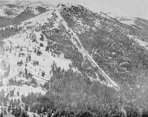
|
| The Mt. Ashland Ski Lodge and area as it looked in November 1963. The Mt. Ashland Loop Road was the main access route at this time. |
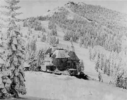
|
| The Mount Ashland Ski Lodge as it looked during construction. Picture was taken on November 21, 1963. |
1964
PERSONNEL
| Forest Supervisor | Carroll E. Brown |
| Fire Control & Watershed Staff | Robert H. Torheim |
| Forest Engineer | Hector Langdon |
| Timber Management Staff | David F. Keiser |
| Range, Wildlife, Recreation & Land Uses Staff | Ralph A. Wiese |
| Administrative Officer | Merlin C. Shipley |
District Rangers
| District | Name | Location |
| Applegate | Neil G. Suttell | Star Ranger Station |
| Ashland | Glendon K. Jefferies | Ashland |
| Butte Falls | Robert G. Lewis | Butte Falls |
| Prospect | Vernon D. Pritchard | Prospect |
| Union Creek | Emil M. Sabol | Union Creek |
FIRE CONTROL
The 1964 fire season was moderate in terms of fire danger. Some light rain was experienced during the forepart of the season, but it was drier for a longer period of time than for many years in the past.
During 1964, 29 fires occurred on lands protected by the Rogue River National Forest. Twelve of these were caused by lightning; 17 were man-caused. Only 91 acres were burned.
Due to the excellent cooperation received from Forest users, and extra fire prevention measures which were put into effect, there were no losses in the hazardous areas which resulted from the Columbus Day storm of 1962.
WATERSHED MANAGEMENT
This was the year of one of the worst storm and flood situations in Oregon's recorded history. Because of this and its impact on this Forest it will be discussed at length.
The Weather Bureau summary for December follows:
OREGON - DECEMBER 1964
SPECIAL WEATHER SUMMARY
Destruction in Oregon due to weather was greater in this December than in any previous month or storm in the State's recorded history. Low temperatures, almost unprecedented heavy snows this early in the season, and finally record-breaking rains all contributed. Practically every facet of the State's economy was seriously affected.
During the first two weeks of the month, temperatures were moderate, generally a few degrees higher than usual for December. Rains or showers were frequent, and precipitation totals for the first half of the month were also above normal.
The sequence of events that was to lead up to one of the State's greatest recorded weather disasters began with a strong push of arctic air into northeast Oregon on the 14th - 15th. On the 17th, this had spread over all of the State except for a narrow band along its southern edge. By the morning of the 18th, new December record low temperatures were being observed at many points and at most others, with the exception of the southern border area; the coldest December weather since 1919 was occurring. West of the Cascades minimums of 5° to 15° were general, while east of those mountains they ranged from 5° below zero to 38° below.
On the 18th, a major storm began moving onto the Oregon coast, bringing heavy snow to all but some warmer valley areas. In the next 24 to 36 hours near-record depths for this time of year accumulated on slopes of the Coastal and Cascade ranges and on the valley floors of the middle and lower Willamette Basin. Substantial snows also piled up in central and northeast Oregon. In the Columbia Gorge a nearly sea level passage through the Cascades was provided for the invasion of the cold arctic air from the east. As this met the incoming marine air from the Pacific Ocean, very violent blizzard conditions developed. Highways first became glazed, and then huge snowdrifts piled up. Hundreds of motorists were trapped and had to be rescued, leaving their cars behind. Even rail traffic was halted.
During the 19th-20th, temperatures rose rapidly, accompanied by heavy rains to practically the crest of the Cascades. Usually by mid-December this would have been snow at the higher levels. In the first several hours the pre-existing snow blanket retained the rain in storage, rather than permitting its gradual runoff. As the rains continued, their intensity increased until finally almost the entire snowpack collapsed in a matter of a few hours. Typical was Government Camp, on the upper slopes of the Cascades, at an elevation of 3,900 feet. Here, on the morning of the 20th, snow depth was 55 inches, with a water content of about 5.44 inches. In the next 24 hours this packed down to 45 inches and stored up another 1.57 inches of rain. By the morning of the 23rd only 6 inches of snow remained, and nearly 9 inches of additional rain had fallen since the 21st. This same pattern of snow, followed by heavy rains, was occurring over the entire State. New December high rainfall totals were established, in almost every part of Oregon, many at stations with 75-100 years of record. At a large number of places, this December total was from a half to two-thirds the expected annual amount. Numerous new 24-hour December records also were observed.
The top layer of earth had been frozen by the very low temperatures just preceding this storm. When the snowpack collapsed, the normal infiltration of significant amounts of this water could not take place. The result was immediate runoff into drainage streams of all stored snow and rainwater, plus that being added by the very heavy rains in progress. In the 5-day period, 19th-23rd or 20th-24th (depending upon when the storm reached the area), many places had 2 to 3 times as much rain as they normally have in the entire month of December. Rivers rose rapidly. In most tributary streams to the middle and lower Willamette, with very long period of observations, new record-high stages were set. Some peak discharges were over 150 percent of any previously measured. In the Willamette River at Portland harbor a new winter stage of 29.8 feet — within 0.2 foot of the peak stage here during the great Columbia River spring flood of 1948 — was observed. The same general situation prevailed in the rivers and creeks along the coast, in the southwestern valleys, south-central and north-eastern Oregon.
Tremendous property damage occurred and thousands of people were evacuated from the flood waters. At least 30 major state highway bridges were made impassable. Scores of others on lesser highways were destroyed or badly damaged. Miles of highways were washed out. At one time every major highway across the State was cut either by slides or high water and often both. Farmlands were heavily eroded in all areas. Low-lying orchards, hop yards, farm buildings and fences were badly damaged or totally lost. Some crops, fall grain and seed were washed out and will need replanting. Many mills and factories were inundated, and an even greater number were closed by damage to supporting facilities or services. Railroad bridges and roadbeds were washed out. At least two trains in Oregon were derailed by slides. Power and telephone companies experienced several millions of dollars damage. Many large communities were completely isolated as transportation and communication lines were severed on all sides. At least ten Oregon cities completely lost their water supply for several days due to damaged intake facilities and/or water mains. Hundreds of both large and small businesses suffered losses in varying degrees. Only the southeast corner of the State escaped major disaster. Here, rainfall was not quite as heavy. Also, sufficient reservoir storage was available to greatly reduce peak runoffs.
Fairly heavy snows in mountain areas and in valleys of south-central and southwestern Oregon during the last 2 to 3 days of December again disrupted travel across the State. Several hundred bus passengers were stranded overnight in Medford. Traffic generally was being delayed several hours by glaze-covered roads and deep snow. Most streams had, however, returned to within their banks, and danger of further flooding did not appear imminent as the month ended.
Local minimum temperatures and rainfalls are given below for Ashland, Medford, Butte Falls and Prospect for December 1964.
| Town: | Ashland | Medford | Butte Falls | Prospect | ||||
| Date | Temp.° | Ppt. | Temp.° | Ppt. | Temp.° | Ppt. | Temp.° | Ppt. |
| 1 | 44 | .29 | 44 | .31 | N | 1.25 | 43 | .72 |
| 2 | 40 | .30 | 40 | .19 | o | 1.05 | 38 | 1.03 |
| 3 | 34 | .04 | 38 | .03 | .38 | 32 | .13 | |
| 4 | 31 | .02 | 38 | T | R | .03 | 31 | .09 |
| 5 | 35 | .03 | 34 | T | e | .20 | 33 | .27 |
| 6 | 30 | .01 | 29 | T | p | -- | 27 | -- |
| 7 | 34 | .12 | 36 | .15 | o | T | 30 | .03 |
| 8 | 40 | 1.07 | 43 | .94 | r | .47 | 39 | 1.42 |
| 9 | 43 | .22 | 45 | .29 | t | .76 | 38 | .29 |
| 10 | 42 | .59 | 37 | .62 | 1.44 | 37 | 2.24 | |
| 11 | 32 | .01 | 34 | .01 | .96 | 30 | .12 | |
| 12 | 23 | -- | 25 | -- | -- | 19 | T | |
| 13 | 18 | -- | 23 | T | -- | 16 | -- | |
| 14 | 28 | .25 | 31 | .29 | .01 | 32 | .32 | |
| 15 | 32 | .02 | 33 | -- | .51 | 27 | .38 | |
| 16 | 31 | -- | 24 | -- | T | 28 | .03 | |
| 17 | 22 | -- | 20 | -- | .46 | 14 | -- | |
| 18 | 25 | -- | 27 | T | .52 | 24 | T | |
| 19 | 32 | .48 | 32 | .74 | .34 | 30 | .52 | |
| 20 | 38 | .60 | 37 | 1.01 | .28 | 32 | 1.38 | |
| 21 | 45 | 1.80 | 40 | 1.09 | 1.32 | 33 | 3.05 | |
| 22 | 51 | 3.00 | 50 | 3.20 | 3.98 | 44 | 4.39 | |
| 23 | 50 | .29 | 52 | .93 | 3.46 | 48 | 1.45 | |
| 24 | 48 | .40 | 51 | .19 | 1.29 | 46 | 1.34 | |
| 25 | 45 | .29 | 47 | .16 | .77 | 43 | 1.05 | |
| 26 | 35 | .37 | 41 | .50 | .27 | 37 | 1.35 | |
| 27 | 31 | .31 | 34. | .45 | .98 | 30 | .44 | |
| 28 | 27 | .26 | 31 | .20 | .37 | 27 | .22 | |
| 29 | 28 | .12 | 33 | .24 | .46 | 28 | .49 | |
| 30 | 26 | .30 | 26 | .37 | .74 | 27 | .74 | |
| 31 | 20 | .09 | 23 | T | .35 | 22 | .19 | |
| Total | 34.2 | 11.28 | 35.4 | 12.72 | 22.65 | 31.8 | 23.68 | |
Below is a copy of the estimated damages to the Rogue River National Forest from this December 1964 flood.
Flood Damage Repair Estimates
Total Forest Damage Summary
Below is an itemized summary of dollar damage to the Rogue River National Forest on forest lands in California and Oregon:
| A. | |
| Item 1 - Administrative & Fire Control Improvement | $ 10,000 |
| Item 2 - Recreation - Public Use | 41,000 |
| Item 3 - Range & Wildlife | 11,000 |
| Item 4 - Soil & Water Management | 122,000 |
| Item 5 - Timber Management | 12,000 |
| Item 6 - Engineering | 735,000 |
| Item 7 - Personnel Management | --- |
| Total Damage | $931,000 |
| B. Estimated damage to timber sale contract roads for which operator is liable | $16,000 |
| C. 909 General Expense - additional expense due to increased workload | |
| 1 clerk year | $4,900* |
(*FR&T $3,900, P&M $1,000)
During the normal part of the year watershed continued to progress as is shown in this excerpt from that year's Multiple Use bulletin.
A special Management Policy Statement for the use and protection of the Big Butte Springs Watershed has been approved by the Regional Forester. The 22,690-acre watershed, within the Butte Falls Ranger District, supplies all of the domestic and industrial water for the City of Medford.
The porous volcanic soils on the watershed are able to store great quantities of water and act as a large underground reservoir. Water from this natural reservoir comes to the surface in a series of large springs. The City of Medford has capped many of these springs and has constructed underground water collection facilities. Big Butte Springs has been the source of Medford's water supply since 1927.
The purpose of the Policy Statement is to establish special management practices and protection measures to maintain the quality and the flow characteristics of Medford's water supply. The timber, recreation, wildlife, and grazing resources on the watershed will be managed under multiple-use principles to provide for the protection and improvement of the high-value water resource.
WILDLIFE
This year a start was made on the Wildlife Habitat Improvement program. Fish and game habitat improvement programs are in various stages of completion of game protection devices and installation of crossings at canal sites.
RANGE MANAGEMENT
The results of better management are evident. Plans, improvement work, and the cooperation of the cattlemen have all combined to result in a full use of the range resource within the multiple-use concept. Fences, waterholes, trails, and removal of undesirable plants are all a part of this program.
RECREATION
As happened last year, most of this year's work was aimed at providing safe water at camp and picnic grounds. In addition, the new landscape architect has been busy making plans for future developments.
A fairly large clean-up project was accomplished at Fish Lake. Logs were boomed and after the lake was lowered in the fall they were bunched and burned. The Medford Irrigation District cooperated by controlling water levels, making the work much easier.
The ski area at Mt. Ashland is expanding rapidly. The Corporation now has a chair lift, two T-Bars, and a Pomalift. The new road to the ski area has been completed and the slopes are alive with skiers.
The parking area has been expanded to handle approximately 350 cars. The new Mt. Ashland Road will be in service this winter. It's a last year's skiers' dream, 8.2 miles from Highway 99 and less than an hour's drive from Medford to Mt. Ashland. Ski instructions are available for those who do not ski. A ski patrol well trained in first aid is also available.
The Rogue River National Forest Recreation Plan was approved. It is one of four in the Region to be approved, and culminates 5 years of work by the recreation staff.
The November 16 issue of the "Rogues Gallery" reported the following on Mt. Ashland:
Ashland
It appears that this year's skiing season is upon us, and sooner than we had anticipated. There still is plenty of work to be done at Mt. Ashland; however, the Mt. Ashland Corporation plans to open the season Thanksgiving weekend. Although the lodge is not completed, additional work has been done, such as windows, doors, wallboard, etc., and it will be in operation with a cafeteria, snack bar, lavatories, and baby sitting service. A new service building is nearing completion and will house "Buck's" Ski Shop, ticket sales, first aid, ski patrol, lavatories, maintenance garage for "cat" and sno-cat. Completion of the new chair lift is expected by Christmas, providing the weather isn't too severe.
GENERAL
All activities increased this past year due mainly to a larger number of people using the Forest. The Mt. Ashland road construction was completed to permit use this winter. Final surfacing is planned for next fiscal year.
A Productivity Increase Program was initiated in line with President Johnson's directive to all Government agencies. Our procedures were analyzed in an effort to increase efficiency at reduced costs. Goals are established each year for all activities to increase productivity. The year-end floods have disrupted the program of work and it may be necessary to establish new goals when the extent of the damage has been assessed.
This is the year MODE made its mechanical entrance into the Forest Service. The MODE system applied modern computer machine methods of data calculation and processing to the personnel and accounting departments. The data fed into these machines was to be used for a variety of purposes, but especially to make the work easier; however, while the Forest was fighting its floods the clerks were fighting the flood of forms to be filled out for this system.
MODE technically stands for Management of Objectives with Dollars through Employees.
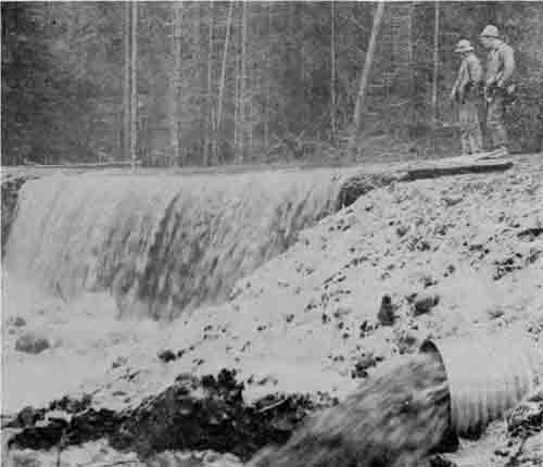
|
|
Photo of water scour across Parsnip Creek Road #344C from Titanic
Creek. This picture was taken before the road was breached. Note the
complete utilization of the culvert by flood waters. Cody Rambo and Terry Edmundson |
FOREST ADVISORY COUNCIL
The Secretary of Agriculture issued revised instructions pertaining to Advisory Councils. As a result, a revised charter for the Council was adopted, copy of which follows this writeup. Martin S. Grier, Applegate rancher, replaced Harlan Cantrall and Robert K. Hood, General Manager Timber Products, replaced Tom Oliver, who retired.
Subjects discussed this year were:
March 25 Reviewed progress made on range management plans. Considered use of motor scooters on trails. Recreation management on the Forest explained.
August 28 Field trip to Big Butte Springs and Medford Municipal Watershed accompanied by Robert Lee, Manager of the City Water Department.
November 12 The main subject was the Job Corps and the proposed camp on Bowen Creek, Butte Falls Ranger District. Discussed for Council members the intensified program of the Forest Service on watershed management. Reviewed the current fire season and plans for aerial detection versus fixed lookout stations.
C H A R T E R
ROGUE RIVER NATIONAL FOREST ADVISORY COUNCIL
Revised March 1964
The Forest Service needs and wants the counsel of informed leading citizens on policies and programs and their application. It believes that such counsel will be helpful in rendering more effective public service. For this purpose, a multiple-use Advisory Council for the Rogue River National Forest is established.
The function of the Council shall be to consider broad questions of policy, programs, and procedure affecting the administration of Forest Service activities on the Rogue River National Forest, and to give the Forest Supervisor the benefit of its opinion. The Forest Supervisor wishes the serious consideration of the Council on broad matters affecting his programs, but responsibility for final decisions must remain with the Forest Service in accordance with existing laws and regulations.
Members will serve without pay and without reimbursement for travel expense. For occasional field trips where Forest Service quarters and mess are available, these services will be provided without charge.
Council membership shall be kept small in the interest of effective working relationships. Initial selection of members, and replacement, shall be made by the Forest Supervisor.
Tenure of membership for a full term shall be 2 years.
Questions and problems for consideration of the Council will be presented by the Forest Supervisor, or developed by the Council members. Members will notify the Council Chairman in advance of any questions they might wish to discuss. It is intended that information bearing on questions or problems will be presented to members by informed persons, so that all aspects can be considered in the deliberations.
Regular meetings will be biannual. The first meeting will be called in the spring during March or April. The second meeting will be called in the fall during October or November. Special meetings may be called by the Chairman at his discretion.
The regular meeting place will be Medford, except for field trips which are deemed desirable.
The Chairman will notify members of meetings well in advance. The tentative agenda for the meeting, together with such supporting information as is available, will be submitted at the same time.
Deliberations of the Council will be recorded in the manner of a brief summary, giving the consensus of the group on matters discussed. The summary will be sent to Council members and retained in Forest Service files. There will be no restriction in releasing news of Council meetings.
The Forest Supervisor will act as Chairman of the Council, with a member of the Rogue River Forest staff serving as Secretary. Specific rules for conduct of business will be determined by the Council.
Advisory Council Members
| Eric W. Allen, Jr. | Medford | Robert K. Hood | Medford |
| Jean F. Eberhart | Ashland | Walter Hoffbuhr | Ashland |
| Archie C. Fries | Ashland | Henriette Le Piniec | Jacksonville |
| Martin S. Grier | Jacksonville | S. V. McQueen | Medford |
| William E. Hallin | Roseburg | V. Aubrey Norris | Medford |
| Jack C. Hanel | Medford | Robert Shaw | Medford |
| Katheryn Heffernan | Medford | Dr. Elmo N. Stevenson | Ashland |
RECEIPTS AND EXPENDITURES - FISCAL YEAR 1964 NATIONAL FOREST PROGRAM
| Expenditures | |||
| Receipts | Operating | Capital | |
| National Forest Protection | $1,044,208 | $251,933 | |
| Fighting Forest Fires | 147,242 | 319 | |
| Insect & Disease Control | 50,870 | 81 | |
| Road & Trail System | 241,962 | 322,000 | |
| Cooperative Work | $ 477,798 | 281,123 | |
| National Forest and Land Use Area Receipts | |||
| National Forest Fund | $3,987,375 | ||
| Oregon & California Lands | 231,963 | ||
| Other Miscellaneous Receipts | 3,922 | ||
| TOTAL RECEIPTS & EXPENDITURES | $4,223,260 | $1,484,282 | $855,456 |
| Less Cooperative Deposits - Receipts | 477,798 | ||
| Net Receipts | $3,745,462 | ||
Twenty-five percent of the receipts were paid to distribution to Oregon and California for the following counties:
| County | Net National Forest Area — Acres |
County Allocation |
| Douglas | 54,012 | $ 97,126.65 |
| Jackson | 362,325 | 651,548.12 |
| Josephine | 14,166 | 25,473.90 |
| Klamath | 79,881 | 143,645.39 |
| Siskiyou (California) | 49,241 | 79,049.71 |
| 559,625 | $996,843.77 |
1965
PERSONNEL
| Forest Supervisor | Carroll E. Brown |
| Fire Control & Watershed Staff | Robert H. Torheim (until Jan.) |
| T. Carl Juhl, Jr. (EOD Feb.) | |
| Forest Engineer | Hector Langdon |
| Timber Management Staff | David F. Keiser (until July) |
| Earl M. Karlinger (EOD Sept.) | |
| Range, Wildlife, Recreation & Lands Staff | Ralph A. Wiese |
| Administrative Officer | Merlin C. Shipley (retired Dec.) |
District Rangers
| District | Name | Location |
| Applegate | Neil G. Suttell (until May) | Applegate |
| L. Kent Mays, Jr. (EOD June) | ||
| Ashland | Glendon K. Jefferies | Ashland |
| Butte Falls | Robert G. Lewis (until Feb.) | Butte Falls |
| James C. Overbay (EOD Feb.) | ||
| Prospect | Vernon D. Pritchard | Prospect |
| Union Creek | Emil M. Sabol | Union Creek |
PERSONNEL CHANGES
Merlin C. Shipley, Administrative Officer and Ralph A. Wiese, Recreation and Range Staff Officer, retired from the Service December 31. Shipley had worked in the Forest Service for more than 34 years. He has been succeeded by William N. Stanaland. Wiese is now attending Southern Oregon College studying for his master's degree. Edwin B. Abbott has succeeded Wiese.
Work Performance Cash Awards
| Butler, James A. | Clark, Marjorie S. | Miller, Richard G. |
| Cougle, Betty J. | Staples, Rolo E. | Wilson, Firgil S. |
| Hale, Elaine M. | Lomax, H. Jean | Mather, Richard W. |
| Nelson, Kathryn E. | Hayes, Charlie E. | Pearson, Paul J. |
| Thompson, David T. | Lewis Ronald D. |
TIMBER MANAGEMENT
Timber cutting practices underwent considerable modification during the year. Partial cutting and over-story removal was favored wherever practical. Where clearcutting is practiced, an attempt was made to orient the cutting unit in an east-west direction. This has been done to favor the establishment of natural reproduction.
The log market continued active during the year. A total of 321 sales were accomplished for a total volume of 198,500,000 board feet. In 1965, 195,396,000 board feet of timber were cut from the Forest. The value of this timber was $4,250,000. Christmas tree harvest totaled 7,400 trees.
The Christmas-week storm of 1964 caused considerable damage to timber sale roads, bridges, and major culverts. Many of the loggers cooperated with the Forest Service in restoring roads before the normal logging season started.
The Forest is cooperating with the Pacific Northwest Experiment Station in a Douglas-fir lumber recovery study which will be run at the Timber Products Company mill in Medford. Other timber will be sampled from the Siskiyou National Forest and Bureau of Land Management lands in the southern Oregon area for the study. We are grateful to Timber Products for their willingness to run the study logs through their sawmill and veneer plant. Districts will be called upon to assist in the diagraming, sawing, and peeling phases. This provides excellent on-the-job training for some of our employees who have not had an opportunity to participate in this type of study. Diagraming of the logs will probably begin the second week of December, and the sawing and peeling phases will most likely be in January.
Reforestation
More than 1-1/2 million nursery-grown seedlings were used to plant 4,012 acres, and 662 pounds of tree seed were sown on 749 acres. Nearly 50 per cent of the work was done by local contractors.
Brush Clearing
Clearing and planting of three major burns - Cat Hill Peavine, and Huckleberry Mountain - are nearly complete. This has been a major undertaking, involving over 4,000 acres of old brushfields. A fine young forest is replacing what were once acres of impassable brush.
Timber Stand Improvement
Treatment of dense young stands of saplings and poles to increase growth and improve quality of the final product is a technical forestry job that will yield substantial gains in the future. Work was completed on 487 acres this year.
Blister Rust Control
Ribes eradication continued in the better stands and plantations of young white and sugar pines. Most of this work was done by contract.
The rust resistant program is being expanded with a 10-acre addition to the Jim Creek Seed Orchard.
Aerial Spraying
Approximately 1,000 acres of reproduction, over-topped by competing brush and hardwoods, was sprayed by helicopter. Tree release is rapid following a successful chemical application.
ENGINEERING
Forest Roads: 104 miles were surveyed, including 12 bridge sites; 86 miles were staked for construction and 99 miles designed for future construction. Maintenance was performed on 835 miles of road; 450 miles were maintained by Forest Service and 385 miles by timber purchasers and other forest users. Damage from floodwaters necessitated heavier than usual work. One hundred and seven miles of road were built or reconstructed by timber sale purchasers. A contract for paving 8.2 miles of the Mt. Ashland road was completed.
Forest Trails: The Forest Service maintained 466 miles, constructed 1.2 miles; reconstructed 29 miles; and 2.4 miles were surveyed for future construction.
Improvements: Two 16-man bunkhouses at Star Gulch Work Center, and a duplex residence at Star Ranger Station were constructed by contract. Three cattleguards were installed. Large portal signs were erected on three main roads entering the Forest and 430 rustic road and trail signs were installed. A 35-foot concrete bridge was constructed on contract. To provide better drinking water, six wells were drilled in recreation areas, and one at Star Ranger Station.
Flood Restoration
Considerable work was accomplished to repair damage from December 1964 floods. Twelve bridges were extensively repaired. Three bridges and four large culverts were replaced. Heavy restoration work such as replacing fills, rebuilding severely eroded sections, and replacing damaged or lost culverts, was contracted.
FIRE CONTROL
The 1965 fire season began drier than normal; then in early August 1.52 inches of rain fell at Medford, making it the wettest August in recorded history. September and October were again very dry.
There were 46 fires (28 lightning and 18 man-caused) with only 1 acre burned, until December 17 when an escaped debris fire burned an additional 4 acres.
For the first time aircraft were used for scheduled aerial detection flights. These air patrols reduced the need for manned detection stations, consequently only 5 of the 14 lookouts were manned on a regular schedule.
Five patrolmen, equipped with mobile pumpers and radio communications, were used in place of the 12 forest guards formerly employed. These patrolmen were able to contact many forest users, greatly aiding the fire prevention program. They also located and suppressed a number of small fires, which, had they gone unobserved, could have caused severe damage.
RANGE MANAGEMENT
A heavy snow pack and late spring rains have again invigorated the range. Cattlemen have done excellent work in controlling cattle movements and in constructive range improvements. At this time range analysis is almost complete and utilization studies are being conducted to fill some of the gaps in the data. As soon as needed fences are built, the range program will be on its way to being well managed.
Range Management Staff, Edwin Abbott, recently transferred to the Rogue River Forest from eastern Oregon. Ed will continue the leadership established in this program.
WILDLIFE
The Forest Service, in cooperation with other Federal Agencies, the State Game Commission, and Pacific Power & Light Company, conducted two trips during the past year. The "show-me" type tours were designed to point out problems, problem areas, and places where problems have been solved. The suggestions and comments received from members of the Southern Oregon Game Council were appreciated and will be considered in planning future programs.
RECREATION
During the past year most of the damage sustained by the recreation facilities, due to the Christmas-week flood of 1964 have been repaired. The landscape architect, Ole Swanson, brought most of the site plans up to date and prepared several new ones. Ole will soon transfer to the Umpqua National Forest.
The Mt. Ashland road is completed and the Mt. Ashland Winter Sports Site now has a chair lift, two T Bars, a Poma Lift and a rope tow. An attractive lodge, ski shop, ski school, and adequate parking facilities make this area one of the finest for winter sports.
The Mt. Ashland ski area will look different from last year. The siding has been nailed on the outside of the lodge, and additional parking space is being developed. The access road is being paved and two lifts (the Poma lift and rope tow) have been changed.
WATERSHED MANAGEMENT
During 1965, the Rogue River National Forest initiated a special watershed study program within the Ashland City Watershed. Examination of the influences and factors affecting production and quality of water are now being made. These complex factors involve the study of soils, climate, cover, timber, timber harvesting, grazing and other land uses.
The effect of these studies will result in the increase of water quantity and the maintenance of this area's fine water quality.
GENERAL
This was a busy year. Flood restoration work kept us busy but we were able to open all main roads for access early in the spring. The timber industry pitched in with their equipment, on rental agreements, and helped with this work.
Forty-three roads were damaged by the flood. Thirty-three restoration projects were started during the year. Sixteen of these have been completed; 17 will be completed and eight additional started in the spring. Damage to two of the roads was repaired by regular maintenance and did not require restoration projects.
Paving of the Mt. Ashland road was completed on November 17, just as the weather worsened. The road is being maintained by Jackson County this winter.
FOREST ADVISORY COUNCIL
No change was made in the membership as the new charter provides that all terms are on a 2-year tenure.
Items discussed this year were as follows:
March 31 Field trip to Mt. Ashland. No-host luncheon at the cafeteria. Discussion on operation of Mt. Ashland by William Dawkins, Executive Director of Mt. Ashland Corporation. Regional Forester J. Herbert Stone attended the meeting.
September 1 Field trip to Prospect Ranger District. The District organization and work programming was explained by Ranger Pritchard. Toured Boundary Scaling Station, Jim Creek Seed Orchard, and transplant bed. Lunch at Abbott Creek Campground.
November 17 Considered organization use for streamside and lakeside areas versus unrestricted use by the general public. Community acceptance of Job Corps Camps was also discussed.
Advisory Council Members
| Eric W. Allen, Jr. | Medford | Robert K. Hood | Medford |
| Jean F. Eberhart | Ashland | Walter Hoffbuhr | Ashland |
| Archie D. Fries | Ashland | Henriette Le Piniec | Jacksonville |
| Martin S. Grier | Jacksonville | S. V. McQueen | Medford |
| William E. Hallin | Roseburg | V. Aubrey Norris | Medford |
| Jack C. Hanel | Medford | Robert Shaw | Medford |
| Katheryn Heffernan | Medford | Dr. Elmo N. Stevenson | Ashland |
RECEIPTS AND EXPENDITURES - FISCAL YEAR 1965 NATIONAL FOREST PROGRAM
| Expenditures | |||
| Receipts | Operating | Capital | |
| National Forest Protection | $1,114,659 | $ 237,792 | |
| Fighting Forest Fires | 125,459 | 534 | |
| Insect and Disease Control | 55,966 | 34 | |
| Road and Trail System | 532,332 | 514,186 | |
| Flood Repairs | 10,509 | 1,965 | |
| Cooperative Work | $ 317,489 | 330,039 | |
| National Forest and Land Use Area Receipts | |||
| National Forest Fund | 4,095,800 | ||
| Oregon & California Lands | 316,249 | ||
| Other Miscellaneous Receipts | 3,276 | ||
| TOTAL RECEIPTS & EXPENDITURES | $4,732,814 | $1,838,925 | $1,084,550 |
| Less Cooperative Deposits - Improvement Receipts | 317,489 | ||
| Net Receipts | $4,415,325 | ||
Twenty-five per cent of the receipts were paid to for distribution to Oregon and California the following counties:
| County | Net National Forest Area — Acres |
County Allocation |
| Douglas | 54,012 | $ 99,768 |
| Jackson | 362,326 | 669,266 |
| Josephine | 14,166 | 26,167 |
| Klamath | 79,881 | 147,551 |
| Siskiyou (California) | 49,241 | 81,199 |
| 559,626 | $1,023,951 |

|
| Front Row: Eugene Fontenot, M. C. Shipley, Alvin Foote, Earl Karlinger, Carl Juhl, Doug Finch, Doug Baker, Ralph Wiese Second Row: Dick Foster, Cleo Baker, Eleanor Russell, Marjorie Clark, Jill Martin, Clair Killingsworth, Darlene Shoults, Carroll E. Brown, Forest Supervisor Third Row: Bob Healy, Rose Sims, Grace Andrews, Marlene Johnson, Peggy Sturgill, Grace Sprague, Florence Renaker, Elmer Reznicsek Fourth Row: Olaf Swanson, George Wooding, Dorothy Hearon, Audrey Parkinson, Elaine Hale, Kay Nelson, Jan Harley, Enid Brown, Mildred Rhodes, Kathy Wellman, Sam Poirier, Hector Langdon, Gordon Anderson |
1966
PERSONNEL
| Forest Supervisor | Carroll E. Brown |
| Fire Control and Watershed Staff | T. Carl Juhl |
| Forest Engineer | A. Jim Horne |
| Timber Management Staff | Earl M. Karlinger |
| Range, Wildlife & Watershed Staff | Edwin B Abbott |
| Rogue Basin Project Liaison Officer | Hillard M. Lilligren |
| Administrative Officer | William N. Stanaland |
District Rangers
| District | Name | Location |
| Applegate | L. Kent Mays | Star Ranger Station |
| Ashland | Glendon K. Jefferies | Ashland |
| Butte Falls | James C. Overbay | Butte Falls |
| Prospect | Vernon D. Pritchard | Prospect |
| Union Creek | Emil M. Sabol | Union Creek |
PERSONNEL
Personnel Changes
Hector Langdon transferred to the Regional Office and was succeeded by A. James Horne, Jr., as Forest Engineer. Robert C. McQuown, Union Creek District Ranger, succeeded Emil M. Sabol who transferred to the Olympic National Forest. Hillard M. Lilligren fills the new position of Rogue Basin Project Forester.
Employee Cash Awards
| Terry D. Edmondson | R. B. Taylor (Temporary employee) |
| James L. Hinks | Shirley A. Terry |
| Larry K. James | Daid T. Thompson |
| Lester W. Marshall | Gordon J. Walker |
| Kathryn E. Nelson | Carl W. Webb (Temporary employee) |
TIMBER MANAGEMENT
The depressed lumber market has had a direct bearing on logging throughout the year. A total of 233 million board feet of timber was sold with a value of $6,581,000. Volume cut amounted to 151.5 million board feet and volume under contract at the end of the calendar year amounted to 230.8 million board feet. There were 242 timber sales of all size classes. Less than 10 per cent of the acreage cut was in clearcuts.
Shasta red fir Christmas trees are in increasing demand by commercial cutters and the local home owners. More emphasis is being placed on planning and administering this type of sale as a timber stand improvement measure. Christmas trees sold increased from 7,400 in 1965 to 8,600 in 1966.
The timber inventory project is going full steam ahead. Six men are now remeasuring inventory plots on the Applegate, Ashland and Prospect Districts. Some trouble was experienced in finding the plots that were established in 1957 and 1958. Crews are becoming trained detectives in finding small aluminum and brass tags at the base of the measured trees.
Reforestation
Nearly 1.3 million 2- and 3-year-old seedlings were used to plant 2,880 acres. An additional 563 acres were seeded using nearly 500 pounds of tree seed.
Timber Stand Improvement
Pre-commercial thinning to provide added growing space for selected young trees involved over 800 acres of work.
The following range improvements were completed:
Brush control spraying 563 acres Reseeding 50 acres Poison plant control 81 acres Improved Range 694 acres
Two springs were developed, 10.3 miles of fence built, six cattleguards installed, and 2 miles of stock driveways were established.
WATERSHED
Work has progressed very satisfactorily on the Big Butte Springs brochure. This is an informational handout discussing the history and the multiple use of Forest Service lands on this extremely important watershed. The Big Butte Springs area provides water for the municipalities of Medford, Eagle Point. Central Point, Jacksonville, and White City.
Precipitation and stream gaging equipment has been purchased for installation in the Ashland City Watershed. This equipment will give pertinent data on management controls needed to continue wise and meaningful multiple use of lands in this area. These studies will help insure the continued production of Ashland Creek's high quality waters.
WILDLIFE
Managers from the Forest Service, Bureau of Land Management, Bureau of Sports Fisheries and Wildlife, and from the Oregon State Game Commission met with officials from the Pacific Power and Light Company to inspect their existing projects on the upper Rogue River tributaries. This resulted in excellent coordination between the agencies and PP&L personnel and greatly facilitated the discussion of problems needing correction for the renewal of the PP&L special use permit.
There was a good hunting season on the Forest this year. Hunters killed about 1,400 deer and 12 elk.
Jay Hoover, wildlife biologist, transferred to the Rogue in July from the Mt. Baker Forest in northwest Washington. Jay will work in fish and wildlife management and animal damage control.
RECREATION
Three modern comfort stations were constructed at the Farewell Bend Campground on the Union Creek District. These were the first constructed on this Forest.
Plans are being made for a new water system at the Fish Lake Campground on the Ashland Ranger District. Job Corpsmen helped prepare the site for the proposed Doe Point Campground, also at Fish Lake.
Over 1,100 carloads of people used the McKee Bridge picnic site on the Applegate District during the 4-day Fourth of July weekend. This site received very heavy picnic and swimming use all season.
Aerial Spraying
Releasing young conifers from severe brush competition accounted for 2,500 acres of helicopter spraying.
Aerial spraying using herbicides 2,4-D and 2,4,5-T as a dormant application releases desirable conifers from brush and hardwood competition. Western Helicopters Services, Inc., of Portland was awarded the contract with a bid of $2.19 per acre for the flying. The Applegate District will be spraying 545 acres followed by 1,113 acres on the Butte Falls District.
Blister Rust Control
H. H. Bynum, Zone Pathologist, transferred from Berkeley, California to Medford in May. His primary assignment involves the secondary screening of several recommended antibiotics for the control of blister rust infection on sugar pines.
The rust resistant sugar and white pine program is being intensified. Over 100 candidate trees are now available for the tree seeding program.
ENGINEERING
The Forest roads program included: 121 miles surveyed; 93 miles of line staked, 109 miles designed, and five bridge sites surveyed.
With Forest Service crews and equipment, 415 miles of road were maintained plus 50 miles of joint maintenance with operators. Sale operators maintained an additional 415 miles of road.
Sale operators constructed 74.7 miles and reconstructed 17.1 miles of road. Contracts for surfacing, construction, and paving were let for 14.7 miles of road for a total of $179,700. Two bridges were contracted for $35,100.
Approximately 12 miles of new trails were constructed and 368 miles maintained during the year. Seventeen miles of new trails were surveyed. Much of this was for relocation of the present Skyline Trail system to a more scenic location.
An addition to the Prospect Ranger Station office was completed. Other improvements consisted of placing six major signs in important travel routes and the construction of 1 mile of new campground road.
All work on flood restoration projects, the rebuilding of the roads, bridges, and culverts damaged in the December 1964 storm, has been completed.
RANGE
The Rogue River Forest grazed 4,785 head of cattle on its allotments this year. Paid permits on these cattle were for 2,624 animal use months with the additional 2,131 head on private land and exempt permits.
FIRE CONTROL
The 1966 fire season began much drier than normal. There were only .37 inches of rain in June. July was wetter than 1965, but only .19 inches of rain fell in August. September was wetter than last year and October was about the same as in 1965. The season would be classed as moderate to high fire danger, with August running mostly to extreme conditions.
Lightning caused 47 fires - more than in 1965, but still below the Forest average.
A total of 63 fires occurred on Rogue River National Forest land. There were 16 man-caused fires; three less than in 1965. A total of 39 acres were burned; 38 acres in one fire.
Scheduled aerial detection was used on the Forest for the second season. This program is working very well. The aerial observers found 13 fires before they were detected by anyone else. This affords quicker initial attack.
The interregional crew of 25 highly trained men was used on 12 fires this season in four different Regions. They were on fires a total of 47 days; over twice as many as in 1965. Increased use of trained crews on fires is resulting in faster and more efficient fire suppression.
Air tankers were used to good advantage where needed. There were 112,730 gallons of retardant flown from the Medford base this season on 27 fires. The aerial tanker program is just another tool in the never-ending battle to maintain and preserve our forest resources.
MINING
Activity was generally located in the Applegate area this year. High mercury prices caused increased prospecting and the building of a mill on claims in Bailey Creek.
Significant mining activity occurred on a placer mining operation on Elliott Creek. Forest Service crews constructed bypass roads that facilitated mining and permitted continuous hauling of forest products from the upper Elliott Creek area.
Following is an item from the Medford Mail Tribune" that enlarges on the foregoing paragraph. The article was written on or about April 17, 1967.
"Mining on Elliott
Creek Affects
Two Timber Sales"
A temporary shutdown of activity on two timber sales in the Rogue River National Forest, resulting from mining activity on Elliott Creek was reported today by Carroll E. Brown, forest supervisor.
A meeting was held Monday by forest representatives and the miner, Eldred T. Cobb, and his lawyers. Cobb indicated that he intended to continue cutting the Elliott Creek Road with his mining activity. The log haul will therefore be shut down until another route is established.
The forest service has the responsibility of constructing the bypass road in this area, Brown explained today. It is estimated to cost between $10,000 and $25,000, depending on the location, and will require three weeks to construct.
Brown said the forest service would do everything possible to aid the removal of timber on the Dutch Creek and Alex Creek timber sales, which are now shut down, and to ensure fair treatment to mining activities on the Cobb claims as specified in the condemnation action.
Interruptable Easement
In 1963, Brown stated, in reviewing the history of the case, the forest service received by condemnation an interruptable easement across several mining claims along Elliott Creek in the Upper Applegate drainage.
This was the first easement of this type secured in the Pacific Northwest on National Forest lands. It gave the miner the right to mine the mineral-bearing ore beneath the roadway in a planned and organized manner. It also provided that an alternate bypass route be constructed and used during the period the road is being mined.
The reason for securing an easement was to permit the sale and transportation of timber from national forest land. Two sales were made: one on Alex Creek, including 5,200,000 board feet of timber to Mountain Fir Company on May 28, 1965; and one on Dutch Creek, including 13,260,000 board feet, to Double Dee Lumber Company, Inc., on June 30, 1965.
Construction Started
Road construction started on both sales shortly after the sale dates. A minor amount of right-of-way timber was removed from the Dutch Creek sale late last fall.
With the recent favorable weather on the forest, the loggers began working on the two sales. Double Dee started logging on the Dutch Creek sale last week. The mill is in dire need of logs, Brown said.
On Tuesday, April 5, Cobb undercut the Elliott Creek Road as part of the mining operation and made the road impassable for logging trucks. Last Friday the forest service widened the road in the area to permit a safe road width for the heavy trucks.
Monday, Cobb announced his intention to keep cutting the road.
ROGUE BASIN PROJECT
A new staff position was added to assist the Forest Supervisor in developing joint project plans and agreements with the Corps of Engineers for the Rogue Basin Project.
The Forest has been and will continue doing cooperative planning with the Corps and other interested agencies. This interagency cooperation will aid in planning the best possible development and management of the Forest resources affected by the Applegate project.
A soil survey was recently completed on the Applegate Dam and Reservoir area. This data has helped in multiple use planning of the lands surrounding the reservoir.
GENERAL
Below is an article on the Forest's Mammoth Sugar Pine from the "Medford Mail Tribune" of July '66.
"Mammoth Sugar Pine, Victim of Beetles, to be Cut Down"
They are going to "cut down the old pine tree" but, contrary to the song, they will not haul it off to the mill.
Saturday morning, the mammoth sugar pine, located between Prospect and Union Creek on Oregon 62, will be felled. Its authentic age will then be known. Rogue River National Forest employes will count the growth rings in the old monarch of the forest which has been viewed by thousands of visitors.
Emil M. Sabol, Union Creek district ranger, yesterday announced the decision to fell the tree.
The beetles are to blame. Not the ones (spelled with an "A") that sing, but the ones that bore into pine wood and spell death to trees no matter how large they have grown to be.
Ten years ago the Ips beetles started the attack on the top of the tree. This particular beetle works only on the tops of trees, Ranger Sabol said. The tree was weakened by the onslaught, however, and made more susceptible to the invasion of the mountain pine beetle (dendroctamus ponderosae) which "finished it off."
The limbs of the tree are drying out. There is danger that they may fall on visitors so the mammoth pine listed as a tourist attraction for more than 30 years, must come down.
It will continue, however, as a special feature in the Rogue River National Forest program, Sabol said. The tree will be left on the ground if the insects have moved on, which is the current supposition. Signs will be installed to tell the story of timber management coordinated with recreational management in this forest.
Clinton (Slim) Snodgrass, timber faller for Luke Biden Logging Company, has been hired to fell the tree, estimated by foresters to be between 500 and 600 years old.
It is, according to the sign that has told its story through the years, 95 inches in diameter and 224 feet high.
It is not the "biggest" sugar pine, as its name might imply, in the national forests of the United States. One with much greater girth, 109-1/2 inches in diameter, grows in the Stanislaw National Forest which is northwest of Yosemite National Park.
The Rogue River National Forest 'mammoth sugar pine,' nevertheless, climbs higher in the sky. The Stanislaw tree is only 170 feet tall.
There has never been a counter installed to determine the number of persons who stopped to view the tree, Sabol said. There are always cars in the parking area, however, when the snows have melted and the travel season is on.
FOREST ADVISORY COUNCIL
Larry Espey, Pacific Power and Light Company replaced Jean Eberhart on recreation interests; Gordon Stanley, Lake Creek rancher, replaced Martin S. Grier; Sam Taylor, Woods Manager, Boise Cascade Corporation, replaced Robert K. Hood; Edd Rountree, Publisher, "Ashland Daily Tidings"; replaced Archie Fries. William Hallin resigned in June when he retired from his position with the Pacific Northwest Forest Experiment Station.
Items discussed this year were
March 30 Toured new quarters in Federal Office Building. Skyline logging - its advantages and disadvantages - was discussed by Earl Karlinger, Timber Staff Officer of the Rogue River National Forest.
September 2 Field trip to Applegate District, Star Ranger Station, Beaver Sulphur Campground, Jackson Gap, Fruit Growers Supply Company cutting on Dog Fork of Elliott Creek, and mining claims along Elliott Creek.
November 30 Reviewed plans for recreation and other developments around proposed Applegate Reservoir. Discussed Windy Peak Sale and our cooperative planning with the Corps of Engineers on the Rogue Basin Project.
Advisory Council Members
| Eric W. Allen, Jr. | Medford | V. Aubrey Norris | Medford |
| Laurence V. Espey | Medford | Henriette J. Picaud | Jacksonville |
| William E. Hallin | Roseburg | Edd E. Rountree | Ashland |
| Jack C. Hanel | Medford | Robert A. Shaw | Medford |
| Katheryn Heffernan | Medford | Gordon Stanley | Eagle Point |
| Walter H. Hoffbuhr | Ashland | Dr. Elmo N. Stevenson | Ashland |
| S. V. "Duke" McQueen | Medford | B. Sam Taylor | Central Point |
ROGUE RIVER NATIONAL FOREST RECEIPTS AND EXPENDITURES - FISCAL YEAR 1966
| Expenditures | |||
| Receipts | Operating | Capital | |
| National Forest Protection and Management and Land Use Projects | $1,223,522 | $188,517 | |
| Fighting Forest Fires | 88,806 | ||
| Insect and Disease Control | 75,281 | 2,756 | |
| Roads and Trail System | 577,266 | 454,583 | |
| Cooperative Work | $ 264,120 | 299,053 | |
| National Forest and Land Use Area Receipts | |||
| National Forest Fund | 4,225,083 | ||
| Oregon and California Lands | 334,788 | ||
| Other Miscellaneous Receipts | 17,813 | ||
| TOTAL RECEIPTS AND EXPENDITURES | $4,841,804 | $1,964,875 | $944,909 |
| Less Cooperative Deposits - Improvement Receipts | 264,120 | ||
| NET RECEIPTS | $4,577,684 | ||
Twenty-five per cent of the receipts were paid to distribution to Oregon and California for the following counties:
| County | Net National Forest Area — Acres |
County Allocation |
| Douglas | 54,012 | $ 102,917 |
| Jackson | 362,326 | 690,391 |
| Josephine | 14,166 | 26,992 |
| Klamath | 79,881 | 152,208 |
| Siskiyou (California) | 49,241 | 83,762 |
| 559,626 | $1,056,270 |
Supervisor's Office Moves
In March 1966 the new United States Post Office and Federal Building was ready for occupancy on Eighth Street between Holly and Ivy. The Forest headquarters moved to the third and fourth floors of the new building.
1967
PERSONNEL
| Forest Supervisor | Carroll E. Brown |
| Fire Control, Recreation and Lands Staff | T. Carl Juhl |
| Forest Engineer | A. Jim Horne, Jr. |
| Timber Management Staff | Earl M. Karlinger |
| Range, Wildlife & Watershed Staff | Edwin B Abbott |
| Rogue Basin Project Liaison Officer | Hillard M. Lilligren |
| Administrative Officer | William N. Stanaland |
District Rangers
| District | Name | Location |
| Applegate | Albert H. Leuthauser | Star Ranger Station |
| Ashland | Glendon K. Jefferies | Ashland |
| Butte Falls | Orin F. Palmer | Butte Falls |
| Prospect | Vernon D. Pritchard | Prospect |
| Union Creek | Robert C. McQuown | Union Creek |
OPERATION
The Rogue River Forest received a General Integrating Inspection this year by Assistant Regional Forester Thomas B. Glazebrook and John W. Lundgren, Management Analyst, Division of Operation. Copy of the inspection report is in the files of the Forest Supervisor.
FOREST SERVICE NEWS
Rogue River National Forest
P. O. Box 520
Medford, Oregon
Release date: August 31, 1967
From: C. E. Brown
Forest Supervisor
All National Forests in Oregon will be closed effective Midnight Thursday, it was announced this afternoon by Charles A. Connaughton, Regional Forester, U. S. Forest Service.
The unprecedented closure will be made because of the extreme fire danger, the long drouth, and uncontrolled fires in the State, Connaughton said.
The State Forester has been asked to recommend the closure to the Governor's Office under Provisions of State Forest Law. The closure will be lifted immediately upon an appreciable change in the weather, Connaughton assured. Some change is predicted for Northwestern Oregon Friday night or Saturday, but no helpful moisture is forecast.
The closure will stop any logging still being done in the National Forests of Oregon. Main highways will be open but most Forest access roads will be closed.
Recreationists will be hard hit. Some campgrounds and other facilities will be open for use. Back country and other undeveloped areas will be closed to all activity. Hikers, riders, berry pickers, fishermen, etc. will not be permitted in the woods.
Exceptions will be as follows:
Applegate District
Beaver Creek road to and including Beaver Sulphur Campground.
Main Applegate road to State line.
Carberry and Thompson Creek roads.
Jackson Campground and McKee Picnicground.
Ashland Ranger District
The Big Elk road, No. 3706, will be open for access through National Forest Land, and the Mount Ashland road to the summit of Mount Ashland will be open.
The Fish Lake Resort will be open. The Fish Lake Summer Homes will be open to home owners.
The Beaver Dam, North Fork, Daley Creek, and Fish Lake Picnic areas will be open as will the Dead Indian Methodist Church Camp.
Butte Falls Ranger District
The Butte Falls - Fish Lake Road including the Willow Lake Resort will be open.
Prospect Ranger District
Highway 62 will remain open.
The Woodruff road to and including the Woodruff Bridge Campground will remain open.
The Abbott Creek Campground including the road to Highway 62 is open.
The Prospect Sanitary Disposal Area, the Skeeter's Camp road, and the Baptist Church Camp will remain open.
Union Creek Ranger District
Foster Creek and Muir Creek Campground will remain open.
That portion lying between Highway 62 and the Rogue River from Natural Bridge Campground Access road North to and including Farewell Bend Campground will remain open.
The Union Creek Resort Area will remain open. Highways 62 and 230 will remain open for access across the National Forest. All other National Forest Land is closed to public entry.
All logging, road building, and woods activity will cease.
Permits to enter the closed area may be obtained from the Ranger Station personnel for local residents and other necessary forest users.
Ashland Daily Tidings
February 21, 1967
"To Clean Out Flood Debris"
"Massive Dredge Coming to Ashland Reservoir"
By Hasso HeringIf you think dredging is something that goes on in harbors and rivers, think again.
Next month, a massive dredge, not waiting till the mountain comes to it, will come to the mountain.
The dredge will be moved up along a winding mountain dirt road to Reeder Gulch Reservoir, main storage facility holding the city's water supply.
Once at the reservoir, which is being formed by 103-foot-high Hosler Dam about a mile above the city water filtration plant on Ashland Creek, the dredge will be lowered into the lake and will start dredging.
This procedure, dredging the reservoir, represents the last resort for city water officials who have tried for years - unsuccessfully - to get rid of a large amount of mud gathered at the bottom of the lake.
The mass of mud and silt was swept into the lake bed during the torrential downpours and floods of 1964.
City Public Works Director Allen Alsing said the mud is so deep it has risen above one of the gates in the dam through which the lake usually is drained every two years.
At these times, Alsing said, any sediment at the bottom of the lake is swept out through the sluice in the lower part of the dam.
But after the 1964 floods, the mud rose so high city crews bent on draining the lake couldn't open the outlet.
Alsing said that's when the city turned to the U. S. Army Corps of Engineers for help. The Corps suggested that the lake be dredged.
Another hangup had to be overcome before the project could get under way. City water needs dictate a regular schedule according to which the lake must be drained, if it is to be drained at all.
Time factors made the dredging impossible last year, but federal funds to aid citys in repairing flood damage would not be available this year.
Through the efforts of then-Governor Mark Hatfield and the legislature, federal authorities were induced to extend the deadline by which the project had to be completed to April 1.
With only a little more than a month before the deadline approaches, crews are now preparing to move the dredge up the mountain.
A series of wood bridges over Ashland Creek had been shored up earlier to carry the weight of a 40-foot flatbed semi which will lug the monster dredge up the hill.
Once on top, the dredge, owned and operated by H. G. Palmbury of Astoria, a dredging firm, will be lowered into the water by way of a specially bulldozed road.
Floating on the reservoir's surface, the big machine will dredge up the mud from the bottom and spill it over the dam, using lake water to do it.
When all the water is used up and the dredge sits on the bottom, crews will refill the lake until the dredge is back at a level where it can be taken ashore and readied for the ride down the hill.
Dredge crews, under pressure of the April 1 deadline, may have to work around the clock, once the project gets under way the second week in March.
City water users, meanwhile, are not expected to find the water running from their faucets dirty, Alsing said.
The city will be served from the creeks above the reservoir, he said.
Medford Mail Tribune
May 15, 1967
"Regional Forester Retires; Connaughton to Succeed Him"
Portland - J. Herbert Stone, Pacific Northwest regional forester for the U. S. Forest Service for the past 16 years, will retire effective June 2, it was announced today.
Charles A. Connaughton, California regional forester, was named to succeed Stone, 62. Stone held the post since 1951. He joined the Forest Service in 1926.
Connaughton has been the California regional forester since 1955. He will be replaced by John W. Deinema, who has been associated with the Job Corps program in Washington, D. C., for the past three years.
Seasonal Work
Stone's employment with the Forest Service started with seasonal work in the Allegheny National Forest in Pennsylvania while he was still studying for his Master's Degree in forestry at Yale University.
In the ensuing years, he advanced from ranger to forest supervisor to assistant regional forester in the East, the South and North Central Regions. He served for a short time as director of the Central States Forest Experiment Station, and in 1946 was named regional forester for the 12-state Southern Region of the Forest Service. Five years later he was appointed regional forester of the Pacific Northwest Region with offices in Portland.
Connaughton, the new regional forester in Portland, has a lifelong career in national forest management and forest research. For the past 11 years he has been regional forester in the California Region, serving as chief administrator for some 20 million acres of national forests in the state.
Lived in Idaho
Born and raised within the boundaries of the Boise National Forest in Idaho Connaughton graduated in 1928 from the University of Idaho with a bachelor's degree in forestry. During his first years with the Forest Service, he was assigned to forestry research and to forest administration. In 1934, he took a leave of absence to obtain his master's degree in forestry from Yale University.
Following a subsequent tour of duty as silviculturist with the Forest and Range Experiment Station at Fort Collins, Colo., Connaughton was appointed director of the station in 1940. Later he transferred to a similar position with the Southern Forest Experiment Station with headquarters at New Orleans, La. In both the Rocky Mountain and in the Southern areas, Connaughton became known as an authority on watershed research and management, and in highly efficient timber cutting methods.
Served in Atlanta
When Stone, then regional forester for the Southern Region, was named to head up the Forest Service Pacific Northwest Region, Connaughton succeeded him as regional forester in Atlanta. Here for six years he administered one of the largest and most complex Forest Service regions, transferring to California in 1955.
Connaughton is an active member and former president of both the Society of American Foresters and the American Forestry Association. In 1962, he received a superior service honor award from the Secretary of Agriculture in recognition of "dynamic leadership in applied forestry and the forestry profession." He is a member of Sigma Xi and Xi Sigma Pi and two years ago was awarded an honorary doctorate from his alma mater, the University of Idaho.
Succeeding Connaughton is Deinema, former assistant regional forester at Ogden, Utah.
ROGUE BASIN PROJECT
Construction of the three Corps of Engineer dams within the Rogue Basin Project is behind schedule because of overseas commitments. Construction has been started, however, on the Lost Creek Dam, and money is available to the Corps of Engineers for planning the Applegate Dam.
The Corps will probably do some road relocation survey and design on the Applegate early in 1968.
The Forest continues cooperative planning with the Corps and other agencies involved. Recreation planning is being done for the Applegate Dam and Reservoir area.
Plans are also being made to set up a water quality study in the headwaters of the three projects.
FIRE CONTROL
The Forest as well as the entire Region experienced one of the driest fire seasons on record. The first fire on the forest occurred March 5; the last November 25; with a total of 106 for the season. Only 29 acres were burned, 14 of which burned during one fire on the last day of October. Eighty-nine fires were held to one-quarter acre or less in size. The low burned acreage is attributed to quick discovery, fast initial action, and exceptional cooperation from other agencies and the general public.
Two lightning storms produced the majority of the 83 lightning fires. Suppression action was being taken simultaneously on 50 fires during one of the storms.
Twenty-three fires were man-caused - three by logging operations; and the remaining 20 by the general public, primarily smokers and recreationists.
The aerial detection program was on a cooperative basis this year. The Southwest Oregon District of the State Forestry Department, Crater Lake National Park, Winema National Forest, and the Rogue River National Forest entered into an agreement whereby each shared in the cost for aerial patrol for a proportionate share of the flight pattern.
The Medford-based aerial tankers were kept busy carrying 202, 155 gallons of retardant to 48 fires from the Jackson County - Medford Airport; and 172,000 gallons while flying from other bases in Oregon, Washington, and Alaska.
MINING
Mining activity dropped again this year on the Forest; however, several semi-active mines are still operating on the Applegate District. For the first time in several years, a miner was active in the Union Creek area.
RECREATION
Recreationists found themselves somewhat confined this past summer due to extreme fire danger weather causing Forest-wide closures during September and October. This particularly hampered huckleberry pickers and delayed opening of the general deer season by one week.
Forest recreation use at designated camp and picnic areas totaled 106,600 visitor-days. The Mt. Ashland ski development area had its best year with about 120,000 visits, of which some 90,000 were skiers. The bulk of recreation use on the Forest, however, is at undesignated areas; this includes camps with minimum development, Forest roads and trails, and general Forest areas. Total use during 1967 is estimated to be 1,424,000 visitor-days. A "visitor-day" is defined as one person using an area for a period of 12 hours, or any aggregate thereof.
WILDLIFE
Early this year our wildlife inventory programs went into full swing. The major program was a biological study of the high lakes, which was nearly completed this year. The other phase of this program consisted of stream fish surveys on the Forest. These are about 60 per cent completed. Rodent control programs have produced good results. One example is the marked decline of porcupine-infected damage on younger timber stands.
RANGE MANAGEMENT
Due to the need for reducing national administrative budgets, some of our range improvement programs did not progress as fast this year as in the past. We continue to have good relationships with our stockmen. Among our major accomplishments were removal of undesirable plants and construction of new fences and waterholes. A grass-tree planting study was started.
Range analysis was completed for the two recreation horse grazing allotments of Seven Lakes and Blue Canyon Basins. If recreation horses become abundant in the future, the horses may have to pack lunches in order not to destroy these few scenic mountain meadows.
In spite of the long, hot, dry summer, Forest ranges held up well. Some grazing permits have changed hands and we welcome these new permittees.
WATERSHED
The Big Butte Springs brochure was published early this year. It briefly explains the history and multiple use of Forest Service lands in this important watershed area. The brochure was well received by the public.
Three precipitation measuring stations were installed in the Ashland City Watershed. These stations were installed at elevations of 6,400; 4,900; and 3,100 feet to study precipitation differences in the area.
Stream measuring installations were constructed on both forks of Ashland Creek. These two stations will be instrumented in the early spring of 1968.
The precipitation stations and the stream gaging stations will greatly help us in understanding the factors affecting water production and quality in this important city watershed.
ENGINEERING
To keep up with multiple-use demands for additional and improved access into the Forest, 94 miles of roads were surveyed and designed, and 63 miles were staked for construction.
The South Fork of Little Butte Road to Dead Indian Soda Springs and the Tolman Creek Loop Road in the Ashland Watershed were constructed by formal contract. Three bridges were built across major streams.
Timber sale operators constructed or reconstructed 91 miles of road. They also maintained 410 miles of existing road and cooperated with financing 86 miles of road maintenance by separate contract.
Forest maintenance crews graded, brushed, and repaired drainages on approximately 950 miles of road not being used for timber hauling, and maintained an additional 120 miles of Forest road on which we have a joint responsibility with timber operators. Trail maintenance crews performed repair and upkeep on 544 miles of Forest trails.
A number of projects were completed to provide better facilities for recreationists and to modernize Ranger Stations. Foremost among these was construction of a new water line which furnishes water to the Union Creek Ranger Station and campground. At Star Ranger Station the sanitation system was reconstructed. A new water system was installed which will supply water to our new Doe Point Campground and the Fish Lake Campground.
TIMBER MANAGEMENT
During 1967 we sold 176.4 million board feet of timber in 345 separate sales valued at $4,777,000. Volume cut came to 212 million board feet with an additional 229 million still under contract.
Early fall snows hampered the Christmas tree sales; only 5,600 trees sold. This is a decrease of 2,000 from the previous year.
Reforestation
Over 3,100 acres were planted with trees, and an additional 318 acres seeded. A transplant bed has been started to improve seedling survival.
Timber Stand Impovement
Small, dense stands on 933 acres were thinned to increase growth and improve tree health.
Aerial Spraying
Helicopters sprayed 2,338 acres of brushfields to release young seedlings that were being crowded for growing room.
Blister Rust Control
Continued emphasis is being placed on developing a blister rust resistant strain of western white pine and sugar pine. Testing is being done on 200 potential disease-resistant trees.
Pathology
Disease detection, identification, and evaluation occupies much of our plant pathologist's time. A survey of dwarfmistletoe on Brewer spruce was started this year. Work continues in testing of chemicals for blister rust control.
PERSONNEL CHANGES
L. Kent Mays, Jr., and James C. Overbay transferred to the Siuslaw National Forest. Albert H. Leuthauser succeeded Mays as Applegate District Ranger. Orin F. Palmer succeeded Overbay as Butte Falls District Ranger.
| EMPLOYEE CASH AWARDS | |
| Albert A. Grabher | Melville J. Hornbuckle |
| Janet G. Grove | Earl M. Karlinger |
| Charlie E. Hayes | Ronald D. Lewis |
| Phillip C. Hicks | Peggy A. Sturgill (Approved 1967, awarded 1968) |
FOREST ADVISORY COUNCIL
No changes were made in the membership this year.
Subjects covered were:
March 29 Under consideration were: the land exchange plan for the Rogue River National Forest; the reservation principle as it affects water rights originating on the National Forests; and the proposed legislation relating to the Oregon Dunes Seashore area.
September 8 Field trip to Union Creek District. Cutting areas adjacent to Crater Lake National Park were viewed on the ground, but specific discussion was withheld until the fall meeting in November.
November 16 A review of the accomplishments of the Council was prepared and reviewed by Supervisor Brown. He expressed appreciation to the Council members for their open and candid expression on various issues brought before the Council. He also announced his plans for retirement on December 30.
Advisory Council
| Eric W. Allen, Jr. | Medford | V. Aubrey Norris | Medford |
| Laurance V. Espey | Medford | Henriette J. Picaud | Jacksonville |
| William E. Hallin | Roseburg | Edd E. Rountree | Ashland |
| Jack C. Hanel | Medford | Robert A. Shaw | Medford |
| Katheryn Heffernan | Medford | Gordon Stanley | Eagle Point |
| Walter H. Hoffbuhr | Ashland | Dr. Elmo N. Stevenson | Ashland |
| S. V. "Duke" McQueen | Medford | B. Sam Taylor | Central Point |
ROGUE RIVER NATIONAL FOREST RECEIPTS - FISCAL YEAR 1967
Twenty-five per cent of the National Forest Fund receipts ($2,882,000) was distributed to the following Oregon and California Counties:
| County | Net National Forest Area — Acres |
County Allocation |
| Douglas (Oregon) | 54,012 | $ 70,145 |
| Jackson (Oregon) | 362,326 | 471,154 |
| Josephine (Oregon) | 14,166 | 18,397 |
| Klamath (Oregon) | 79,881 | 103,740 |
| Siskiyou (California) | 49,241 | 57,064 |
| 559,626 | $720,500 |
Receipts from the Oregon and California grant lands (O&C), which we manage for the Bureau of Land Management, totaled $184,036 this year. Seventy-five per cent of this amount was distributed to the counties by BLM.
This edition ends with the retirement of Carroll E. Brown. It is only fitting to end this chapter with an editorial in the "Medford Mail Tribune" on December 7, 1967 which honors Carroll and yet personifies the dedication and careers of so many others in the U. S. Forest Service.
"An Earned Respect"
"It is not given to every man in the course of his life to have been of service to many.
Nor, to those who have performed such services, is it given to know precisely how much their work has benefited others.
But there are some happy men, who when they complete the public careers, can be sure of, not the degree, but the fact, of such service.
It is often the case that those who have given the most are the least pretentious about it.
THIS IS WRITTEN with one man in mind, although it could apply equally to others.
This man, through his qualities of mind and personality, through his technical and professional abilities, and through the spirit of dedication which moves him, has contributed to the happiness and welfare of every person in this area whether they know about it or not.
He is a quiet man, ordinarily, but he is not to be bluffed or badgered or bulldozed. He is a tenacious man. And he is, above all, a man who has put the over-all public welfare first in making decisions affecting the stewardship assignment with which he has been entrusted.
LIKE ALMOST ALL OTHERS of his kind, he has worked his way up through his organization, and knows its every problem, every policy, and - inevitably - every twist and turn of the evolving philosophy which governs it.
Southern Oregon is fortunate that, after relinquishing his career responsibilities with the Rogue River National Forest of which he has been supervisor for the past decade, he will remain here where his abilities can be called upon, and where he can continue to enjoy his fishing, his amateur radio radio communications, his genealogical studies, his friends, and the land he knows and loves so well.
Carroll E. Brown has earned the respect and good wishes of the whole community, and the affectionate regard of those who are aware of his contributions. - E.A.
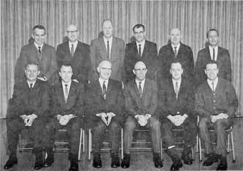
|
| Personnel (left to right): Top Row - Jim Horne, Edwin Abbott, Hillard Lilligren, William Stanaland, Carl Juhl, Earl Karlinger Bottom Row - Albert Leuthauser, Orin Palmer, Carroll Brown, Glendon Jefferies, Robert McQuown, Vernon Pritchard |
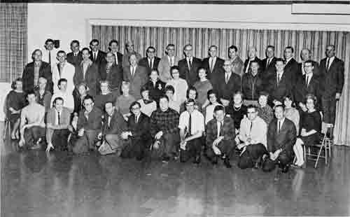
|
| Back Row: Jay Hoover, Jim Horne, Bill Stanaland, George Wooding, Sam Poirier, Paul Brugato, Doug Finch, Carroll Brown, Bob McQuown, Lyle Pope, Carl Juhl, Al Leuthauser, Orin Palmer, C. J. Taber, Glendon Jefferies Next Row: Kermit Thomas, Walt Stowman, Francis Wood, Don Stubbs, Hillard Lilligren, Cleo Baker, Kathy Wellman, Carolyn Chesnut, Ed Abbott, Gar Leyva, Roger Mendenhall, Herb Barth Next Row: Betty Duffield, Grace Andrews, Grace Sprague, Marj Clark, Jenny Messinger, Kay Nelson, Mary Heflin, Audrey Parkinson, Peggy Sturgill, Clair Killingsworth, Betty Gould, Dorothy Hearon, Sherry Downing, Millie Rhodes Front Row: Larry Thompson, Arnold Widmer, Colver Anderson, Hart Bynum. Gene Fontenot, Al Burkhardt, Dale Stadtmueller, Dick Foster, Bob Healy, Earl Karlinger |
| <<< Previous | <<< Contents>>> | Next >>> |
|
6/rogue_river/history/2/chap9.htm Last Updated: 15-Jun-2012 |