|
History of The Willamette National Forest
|
|
INTRODUCTION
DESCRIPTION OF THE WILLAMETTE NATIONAL FOREST
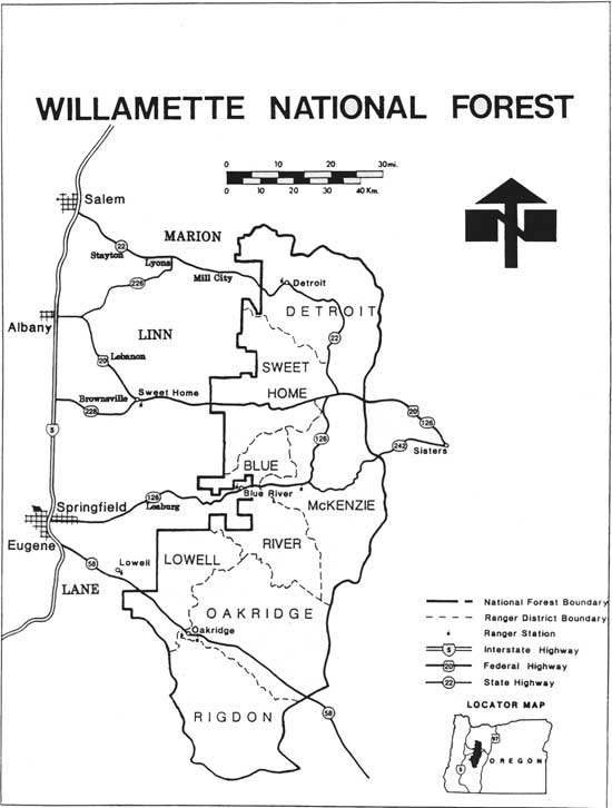
The Willamette National Forest is an administrative unit of the Pacific Northwest Region of the Forest Service, U.S. Department of Agriculture. The Forest headquarters is the Supervisor's Office located in Eugene, Oregon. There are seven Ranger Districts, with offices in Oakridge, Westfir, Lowell, Blue River, McKenzie Bridge, Sweet Home, and Detroit.
The Willamette National Forest stretches for 110 miles along the western slope of the Cascade Range. There are over 1.7 million acres within the Forest boundary—1,675,408 of national forest land and 123,330 acres of land in private ownership or managed by other public agencies. It lies primarily in Lane, Linn, and Marion Counties, but also extends south into Douglas County, east into Jefferson County, and north into Clackamas County. The Willamette National Forest is located within Oregon's Second, Fourth, and Fifth United States Congressional Districts. Principal highways providing access to the Forest are State Highways 22, 58, and 126, and U.S. Highway 20, all east-west routes.
|
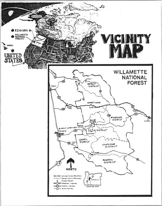
| Vicinity Map. (click on image for a PDF version) |
The western edge of the forest borders the Willamette Valley east of Salem, Albany, Eugene-Springfield, and Cottage Grove. The crest of the Cascade Range defines the eastern boundary of the forest from Mt. Jefferson southward past the Warm Springs Indian Reservation and along the Deschutes National Forest boundary to the Windigo Pass area north of Diamond Lake. The northern edge of the forest borders the Mt. Hood National Forest along the Santiam-Clackamas Rivers Divide, while the southern end borders the Umpqua National Forest and extends along the Willamette and Calapooya Divides east of Cottage Grove and northeast of Roseburg.
|
| Willamette National Forest. (click on image for a PDF version) |
The forest has many steep, deeply dissected valleys in its' western portions. Two-thirds of the Willamette National Forest lies within the Western Cascades geologic province and contains some of the most productive forest land in the United States. Broad plateaus, broken by a line of inactive volcanoes along the crest of the High Cascades, which comprise one-third of the forest. Alpine glaciation has left this terrain marked with U-shaped valleys, moraines, and glacial lakes. Elevations range from 900 feet along the Santiam River to over 10,000 feet at the summits of Mt. Jefferson and the Three Sisters. Most of the forest lies within an elevation range of 2,000 to 4,000 feet.
Over 380,000 acres of land within the forest have been set aside by Congress to preserve wilderness character and to conserve portions of the forest's natural scenery, flora, and fauna. Other dedicated areas include the H.J. Andrews Experimental Forest, the Oregon Cascades Recreation Area, the Lamb Butte Scenic Special Interest Area, and four research natural areas.
A variety of natural resource related products and services is produced on the forest. Wood, water, wildlife, and recreation are the primary categories of these. The amenity and commodity resources of the Willamette National Forest are important nationally, as well as to the people of Oregon.
Mild climate and abundant rainfall are extremely favorable to growing magnificent evergreen trees including Douglas-fir, western hemlock, and western red cedar. This forest is the top timber producer of the 156 national forests in the United States. The Willamette National Forest produces about eight percent of all timber cut on national forest lands and provides an average of 750 million board feet of timber to the nation's economy annually. The lumber and wood products industry is the state's number one manufacturing industry, with agriculture and tourism also playing a significant part in the economy of the State. Most of the timber sold by the forest is processed in counties adjacent to the forest.
Diverse forest environments provide habitat for a wide spectrum of wildlife. Nearly 300 vertebrate wildlife species inhabit the forest, including both game and nongame species. The forest has approximately 400 lakes and more than 2,700 miles of perennial streams and rivers. An anadromous fishery, including salmon and steelhead, is found in the forest's main tributaries. Surface water feeds seven major reservoirs that provide flood control, power generation, streamflow regulation, and recreation. Water for domestic use for rural communities and nearly 205,000 metropolitan users in the Willamette Valley also comes from the forest's system. The main stream systems of the forest are the Willamette, McKenzie, and Santiam Rivers and their tributaries.
The Willamette National Forest boasts having two river segments on the National Wild and Scenic Rivers System: 12.7 miles of the upper McKenzie River from Clear Lake down to Scott Creek and 42.5 miles of the North Fork of the Willamette River from Waldo Lake down to the Forest boundary. In addition, two other river segments are under study: Above and below Cougar Dam/Reservoir on the South Fork of the McKenzie River and Blue River above the Blue River Reservoir. In the fall of 1988, four river segments were added to the Oregon State Scenic Waterways system: The upper McKenzie River, the South Fork of the McKenzie River above Cougar Dam, the North Fork of the Willamette River downstream from Waldo Lake, and the Little North Santiam River.
During all seasons of the year and at all elevations, the forest environment provides for a variety of recreational experiences, including camping, boating, hunting, fishing, mountain climbing, downhill and cross country skiing. Over 25 percent of Oregon's population lives in urbanized communities located in Lane, Linn, Marion, Benton, and Polk counties, and a majority of this forest's recreation users comes from these areas.
| <<< Previous | <<< Contents>>> | Next >>> |
|
region/6/willamette/history/intro-1.htm Last Updated: 08-Dec-2008 |