|
Senate Document 84 Message from the President of the United States Transmitting A Report of the Secretary of Agriculture in Relation to the Forests, Rivers, and Mountains of the Southern Appalachian Region |

|
|
The Southern Appalachian Mountains, located in the States of Virginia, North Carolina, South Carolina, Tennessee, Georgia, and Alabama, stand out from and above the surrounding country as an elevated physiographic unit. They rise above the Piedmont Plateau, which borders them on the east and south, and above the valley of East Tennessee, which lies on their western flanks, to a height of from 2,000 to nearly 6,000 feet above sea level. | ||||||||||||||||||||||||||||||||||||||||||||||||||||||||||||||||||||||||||||||||||||||||||||||||||||||||||||||||||||||||||||||||||||
|
A well watered region. |
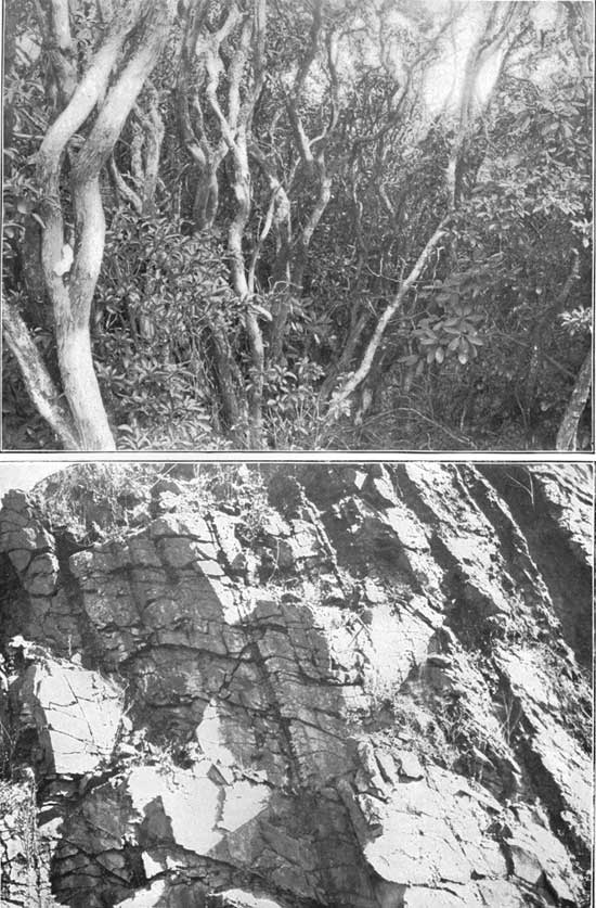
This is preeminently a region of mountains. (See Pl. IV.) The slopes are mostly covered with deep soil, which is kept in an open, porous condition by the humus that enters into its composition and is spread over the surface, and which is held in place by the myriads of roots of trees and shrubs and grasses growing upon it. (See Pl. LXIX a.) In this region the raindrops are battered to pieces by the twigs and leaves and the water is caught by the grasses, shrubs, and ferns below and soaks through the covering humus into the soil and rock fissures underneath. (See Pl. LXIX b.) The portion that is neither used by the vegetation nor evaporated from the surface emerges about the mountain slopes weeks or months after its fall in countless springs that feed with striking regularity the many brooks, creeks, and rivers which thus have their sources here. These conditions combine to make this one of the best watered regions on the continent. This region embraces an irregular, mountainous table-land, lying between the steep and well-defined escarpment of the Blue Ridge on the southeast and the less rugged, but higher and more massive Unaka chain on the northwest. Numerous cross ridges separated by narrow valleys and river gorges connect these two ranges or extend out between them. The region, taken as a whole, has an average elevation of more than 2,500 feet, but there are many peaks that rise to about 5,000 feet, and a considerable number to over 6,000 feet. The mountain slopes, though usually steep, are forest-covered, and have a deep, fertile soil of varying physical character, which is very readily eroded and washed away when the forest covering is removed. The Blue Ridge, though not so high as the mountains to the west, is an older range and constitutes the divide between the waters flowing to the east and those flowing to the west, the streams flowing in either direction having their head springs in or near the gaps of this divide. (Pls. LXIX, LXX.) | |||||||||||||||||||||||||||||||||||||||||||||||||||||||||||||||||||||||||||||||||||||||||||||||||||||||||||||||||||||||||||||||||||
| ||||||||||||||||||||||||||||||||||||||||||||||||||||||||||||||||||||||||||||||||||||||||||||||||||||||||||||||||||||||||||||||||||||
|
The Blue Ridge the great divide. |
In considering the Blue Ridge as the great divide of this region two portions of it are especially notable. (See Pl. XII.) Near Grandfather Mountain, the highest point on the Blue Ridge, the New or Kanawha River rises and flows northward through Virginia and thence northwestward into the Ohio; the Yadkin rises a few yards distant on the east and flows northeast and then southeast into the Atlantic; the Linville, a branch of the Catawba, rises on the west side and flows south-southeast, cutting across the Blue Ridge in a deep gorge, while a few miles farther west the Watauga and Nolichucky flow northwest and southwest, respectively, into the Tennessee and the Gulf. One hundred and fifty miles farther southwest, where the Blue Ridge is somewhat broken up near its junction with the Balsam cross ridge, the French Broad rises and flows eastward; the Saluda flows southeast; the Savannah south, and the Tuckasegee west-southwest, into the Tennessee. (Pl. LXXI.) The most striking characteristic of the Blue Ridge is the great apparent difference in height when viewed from its two sides, the streams flowing toward the east plunging down its sides in narrow V-shaped gorges for a thousand feet or more in a distance of a few miles until they reach the gentle slopes of the Piedmont Plain. (See Pl. XXVII). Those flowing westward have a much easier descent. | |||||||||||||||||||||||||||||||||||||||||||||||||||||||||||||||||||||||||||||||||||||||||||||||||||||||||||||||||||||||||||||||||||
| ||||||||||||||||||||||||||||||||||||||||||||||||||||||||||||||||||||||||||||||||||||||||||||||||||||||||||||||||||||||||||||||||||||
|
The river gorges. |
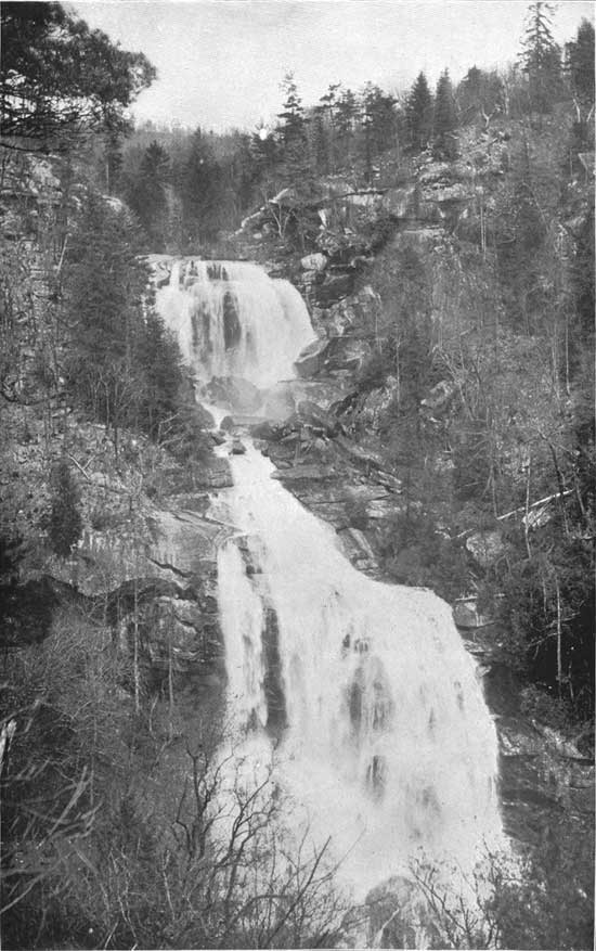
This is well shown by the great falls on the Linville River, which, rising on the western slopes of Grandfather Mountain, in Mitchell County, flows in a general southerly course to its junction with the Catawba River, near the southern end of the Linville Mountains. The falls proper, which are located about 3 miles below the Mitchell-Burke County line, have a perpendicular plunge of 40 feet, and the cascades above are about 50 feet in height, this fall of 90 feet occurring in a linear distance of about 100 feet. For a distance of about 10 miles below the falls the river flows in a series of cascades through a narrow gorge, whose sides are from 500 to nearly 2,000 feet high, the walls being cut down through the eroded Linville quartzites into the granite below. (See Pl. LXXII.) In the first 6 miles below the falls the descent averages 208 feet to the mile, and the total descent from the head of the falls to the lower end of the gorge, a distance of about 10 miles, is 1,800 feet, as determined by a line of levels. Along the upper 6 or 7 miles of this distance the bottom of the gorge is scarcely wider than the stream. The total fall of the stream from its source in Linville Gap to its mouth is about 3,030 feet in a distance of about 36-1/2 miles, the average fall per mile being about 83 feet. The Watauga River also rises near Linville Gap, and flows first in a northeasterly and then in a northwesterly direction, its length from its source to Butler, Tenn., where it leaves the mountainous region, being about 33 miles. The total fall in this distance is about 2,000 feet, and the average slope, therefore, about 61 feet per mile. Of this 2,000 feet, between 900 and 1,000 feet are found in the first 6 miles, where the stream rushes down the slopes of Grandfather Mountain. As is the case with most of the other streams rising on the western slope and flowing westward across the elevated plateau, this stream has its channel for a part of its course in a rather broad and smooth valley before entering the steep and rocky gorge of its middle course. Here it cuts its way through the Unaka mountains in a deep canyon, about 8 miles in length, where the fall averages about 65 feet per mile, but is very much greater at numerous places, the channel being extremely rough and broken. The depth of the gorge through the Unakas is nearly 2,000 feet, but the walls slope down much more gently than those of the Linville just described, though they often show precipitous rock cliffs several hundred feet in height. | |||||||||||||||||||||||||||||||||||||||||||||||||||||||||||||||||||||||||||||||||||||||||||||||||||||||||||||||||||||||||||||||||||
| ||||||||||||||||||||||||||||||||||||||||||||||||||||||||||||||||||||||||||||||||||||||||||||||||||||||||||||||||||||||||||||||||||||
|
Streams about the Unakas. |
The Unaka range on the western edge of this plateau, unlike the Blue Ridge, has slopes equally steep on both sides, descending often some 4,000 feet from the crest of the mountains to the stream beds. In the upper part of their courses all of the rivers of the Unakas partake of the nature of mountain torrents, with the greatest fall near their sources, and in their lower courses they flow in valleys where there has been much clearing, the amount of water increasing rapidly at the time of rain on the mountain sides. In many parts the stream valleys are simply mountain gorges, with steep, vertical sides, and with very small flood plains. Water powers could be developed at many places along these rivers, the fall in the upper part reaching, in some cases, 100 feet in an almost vertical drop, though the quantity of water at these points is comparatively small. When the rivers reach the plains lying at the edge of the mountain system their fall is very much less, yet at frequent intervals decided drops occur, and the flow is so increased by the numerous tributaries that water powers of considerable magnitude and value can be developed.
In this region the influence of elevation on climate is supreme; the summers are colder, the winters more severe, and the climate is drier and more salubrious than at points not far distant, but outside of the high mountain area. The trend of the mountains to the southwest influences the prevailing winds, while the great diversity in topographic features give rise to many interesting climatic peculiarities. On the mountains near the southern end of the Appalachian system the rainfall is very heavy, but, on the other hand, in many central valleys the rainfall is as light and the climate as mild as at many points east of the Blue Ridge. | |||||||||||||||||||||||||||||||||||||||||||||||||||||||||||||||||||||||||||||||||||||||||||||||||||||||||||||||||||||||||||||||||||
|
Climate described in Weather Bureau paper. |
The area embraced in the proposed reserve belongs to that portion of the eastern United States characterized by the greatest annual rainfall, there being places along the southeastern slopes of the Blue Ridge which receive an annual precipitation not exceeded elsewhere in the United States, except along the northwest Pacific coast. The average rainfall for a period of more than ten years at various places in the southern Appalachian Mountains in northern Georgia and western North Carolina and South Carolina has been nearly 73 inches, while at times the precipitation for a single month has been between 20 and 30 inches, the greatest amount falling in the three summer months and the least in autumn, the amounts in winter and spring being about the same. It is worthy of remark that the average precipitation at Asheville is only about 42 inches—the smallest rainfall record made at any station in the region. These and other facts concerning the general climatic conditions of this region are brought out in the accompanying paper by Professor Henry of the United States Weather Bureau, showing the records of temperature, rainfall, and humidity at the stations of the Weather Bureau between Lynchburg, Va., on the north, and Montgomery, Ala., on the south, and from Salisbury, on the east, to Knoxville, on the west. | |||||||||||||||||||||||||||||||||||||||||||||||||||||||||||||||||||||||||||||||||||||||||||||||||||||||||||||||||||||||||||||||||||
|
Heavy rainfall. |
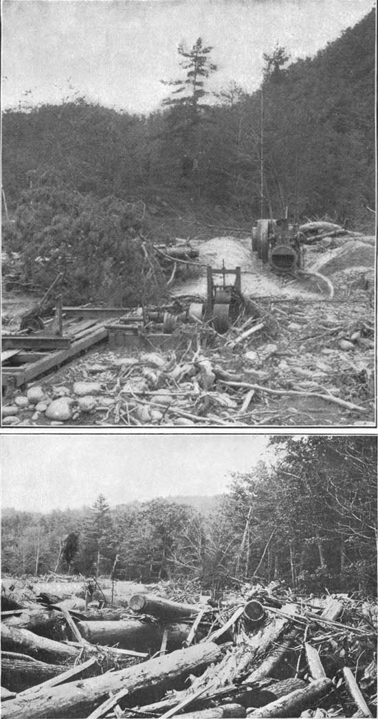
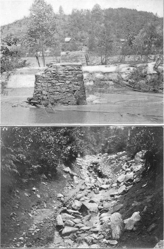
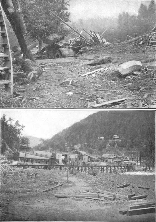
The entire region is characterized by extremely heavy rainfall in very short periods of time, and owing to the steep slopes and the absence of lakes, ponds, or marshes, which could act as reservoirs and hold back the storm waters, protracted heavy precipitation is followed by a rather rapid increase in the flow of the streams, the rise lasting generally for only a few hours, and the stream soon assuming its normal stage of flow. This is more especially the case where there are forest clearings. Consequently these violent rains, under certain conditions i. e., where rains are excessive and clearings extensive, or where forest areas are burned over so as to destroy the humus and undergrowth—give rise to floods which are very destructive to property and which cause occasionally the loss of human life. To a certain extent the forest acts as a reservoir, for it keeps the soil porous, allows it to absorb and hold the water for a time, and gradually gives it forth in the form of springs and rivulets. Where the areas have been deforested, however, the rain water forms small but swift-flowing torrents down the sides of the mountains, and quickly reaches the streams below. Deep channels are cut in the mountain sides, and all of the top fertile soil is carried off, leaving only the underlying clays, which are of poor quality and do not yield to cultivation. After a storm the streams rising in the deforested areas are extremely turbid with mud from the mountain sides, while those from the forest areas are comparatively clear. This erosion can be noted by the most casual observer, and it forms one of the greatest menaces to the region. The soil is deep and fertile, as is shown by the splendid growth of forest trees and by its yield under the first cultivation, but it is only a question of time, if the forests are wantonly cut, when all of the soil and vegetation will be washed from the mountain sides and nothing will remain but the bare rock. These floods, due to protracted rains, are also destructive in strips of valley lands bordering the streams in the mountain region and in the wider valleys along their courses across the lowlands beyond. Bridges, mills, settlements, public roads, dams for developing water power, indeed, everything in the course of such a mountain stream is liable to be swept away by its rapidly increasing force. | |||||||||||||||||||||||||||||||||||||||||||||||||||||||||||||||||||||||||||||||||||||||||||||||||||||||||||||||||||||||||||||||||||
|
Damages from floods. |
During the the spring of 1901 this region was visited by the most severe rain storm of its recent history. Many of the streams rose to unprecedented heights, and the flood damages to the farms, bridges, and dwellings on or near practically all of the streams flowing from these southern Appalachian Mountains were enormous. During the summer season later floods added largely to this destruction. Along the valley of the Catawba River in its course across the two Carolinas these flood damages to farms, bridges, highways, buildings, etc., during the high-water season of 1901, aggregated nearly two million dollars. The storm damages during the same season along the tributaries of the James, the Roanoke, the Yadkin, and the Broad, in Virginia and North Carolina, added a million dollars; and those on the tributaries of other streams rising about the Blue Ridge in South Carolina and Georgia add still another million, making four million in all for the streams flowing from the Blue Ridge across the Piedmont Plateau. Add to this the damages along the streams flowing out of the southern Appalachian Mountains to the north, west, and southwest, and we have another and a larger story of destruction:
This aggregate of $10,000,000 tells a story of destruction never before equaled in this region. Bridges were swept away by the score; houses by the hundred; thousands of miles of public roads were washed away almost beyond the possibility of repair. (See Pl. LXXVI.) The soil in the narrow, irregular, fringing valley lands in the mountain region was in many cases partially and in other cases completely washed away. In the lowlands beyond, the broader bordering valleys were damaged beyond recuperation. Some areas were denuded of soil, while others were covered with desert-like, almost barren white sand extending for miles along the course of a stream. (See Pl. XXXIV.) But while the damage from the storm of 1901 exceeds that of any preceding year, it is common knowledge among the mountaineers that annually the floods have risen irregularly but steadily higher, and that their destructive work has been increasing in proportion as the forest clearings and the forest burnings have proceeded. We may confidently expect that floods of the future will exceed those of the past. | |||||||||||||||||||||||||||||||||||||||||||||||||||||||||||||||||||||||||||||||||||||||||||||||||||||||||||||||||||||||||||||||||||
| ||||||||||||||||||||||||||||||||||||||||||||||||||||||||||||||||||||||||||||||||||||||||||||||||||||||||||||||||||||||||||||||||||||
|
Forest clearing and water powers. |
Many of these streams have fine water powers along their courses, the value of which is limited by their low-water flow. Deforestation means the destruction of the only source of natural storage in the region, and that the rainfall will reach the stream almost as soon as it falls, so that in the dry season there will be no reserve supply to augment the low-water flow, which is drawn principally from subsurface sources. These water powers are a potential source of prosperity to the region in which they are found, and since their value depends entirely upon the water available, anything tending to reduce its amount or to change its distribution by increasing the violence of the floods and at the same time diminishing the low-water flow, will work injury in precise proportion to the change produced. This result is inevitable upon the deforestation of the drainage basin, and on many of the streams has already become evident. It is the general testimony of the older inhabitants of the region that the streams are now much more irregular than they were before active and widespread clearing operations had been begun. And while the evidence of the "oldest inhabitant," as an individual, may not be quite all that can be desired, collectively it is entitled to large credence. Already 24 per cent of the total area of this region has been cleared of its forests. | |||||||||||||||||||||||||||||||||||||||||||||||||||||||||||||||||||||||||||||||||||||||||||||||||||||||||||||||||||||||||||||||||||
|
Forest destruction by lumbermen. |
Lumbering operations are at present rather widespread, and the forests in many regions already begin to show evidence of their effect. The large mills are usually steam sawmills, to which the logs are either transported by a system of tramroads radiating from the site of the mill, or, where the mill is located near a stream of sufficient size, the logs are brought down by splashing. A number of small sawmills have been erected which make use of the abundant water power furnished by the various streams. These are, as a rule, of small capacity, from 500 to 1,000 feet per day, and do mainly the custom sawing for the region near-by. In addition to these there are numerous small sawmills, owned for the most part by some firm holding extensive tracts of forest, and these are moved from place to place as the near-by timber becomes nearly exhausted. In any case the effect of the sawmill on the forests is the same. All the trees available for use in any manner are cut into plank, and the careless methods destroy the greater part of the young growth, which would otherwise in course of time replenish the supply. The logs when cut are "snaked" downhill by mule team, soon cutting a deep channel in the earth, which the waters from the first rain storm turn into a yawning gully that rapidly spreads in extent. (See Pl. LIII.) The tops and those parts of the trunk unsuitable for lumber are left on the ground to furnish fuel for the first fire or a breeding place for insects destructive to tree life. | |||||||||||||||||||||||||||||||||||||||||||||||||||||||||||||||||||||||||||||||||||||||||||||||||||||||||||||||||||||||||||||||||||
|
Forest destruction for tan-bark. |
In addition to the lumbering operations, the tan-bark industry is making great inroads on forest growth. Every year thousands of cords of bark are stripped in these mountains, and each load means that some giant of the forest has been felled and lies useless, for the trunks are rarely used for timber, the expense of transporting them to the mills from the high mountain slopes being in most cases prohibitive. | |||||||||||||||||||||||||||||||||||||||||||||||||||||||||||||||||||||||||||||||||||||||||||||||||||||||||||||||||||||||||||||||||||
|
Destructive work of forest fires. |
But great as is the work of the lumberman in this forest destruction, his part has in the past been small when compared with that of the forest fire and that of the farmer in clearing land for agricultural purposes. Forest fires have been one of the great curses in the southern Appalachians as truly as elsewhere in the country. They were common in the days of Indian occupation. Thus, they have preceded the lumberman, but they have also accompanied him and followed in his wake. Their work has been rendered far more destructive because the lumberman has left his brush scattered among the remaining growth in such way that in the burning it has fed the fire. In some regions these fires have destroyed the forests entirely. Especially has this been the case where the soil has been thin and composed largely of humus. The fire has destroyed this humus and the remaining soil has soon washed away, leaving the trees on the bare surface of rock, to dry out and die. (See Pl. XLVIII b.) Even under more favorable conditions these fires have destroyed the undergrowth, and the larger trees have been burned near their roots in such a way as to cause their destruction. (See Pl. XLVI.) The repeated fires have frequently exterminated the grasses and other forage plants, so that instead of improving the pasturage, which has often been the object in starting the forest fire, the result has been, in the course of years, its almost total destruction. | |||||||||||||||||||||||||||||||||||||||||||||||||||||||||||||||||||||||||||||||||||||||||||||||||||||||||||||||||||||||||||||||||||
|
Forest fires cause irregular flow in streams. |
This burning of the humus and the undergrowth in the forests always seriously affects the flow of the streams. No one who has ever been in a forest during a heavy rain storm can fail to realize this fact. In the virgin forests the raindrops are caught by the underbrush and pass downward through the humus into the less porous soil and the rock fissures beneath, to reappear weeks and months later in the form of numberless springs. But where this underbrush and humus have been burned away, one can not fail to see that during a heavy rain storm much less of the water soaks directly into the soil, and the remainder flows down the surface with a velocity varying with the slope, sometimes washing the soil into small furrows and gullies. Hence, the burning of this humus decreases the storage of water in the soil and causes the more rapid accumulation of this water in the brooks, and results in floods in the larger streams below. | |||||||||||||||||||||||||||||||||||||||||||||||||||||||||||||||||||||||||||||||||||||||||||||||||||||||||||||||||||||||||||||||||||
|
Forest clearing on mountain slopes causes irregular flow in streams. |
Following in the wake of the forest fire in this connection is the farmer who is continually clearing the mountain slopes for agricultural purposes. Instead of trying to improve his soil in the valley and on the adjacent slopes he has for years followed the policy of clearing additional patches on the mountain side as rapidly as others are worn out and abandoned. Each one of these hillside fields must be abandoned in from three to five years, as their productiveness is short lived. After the trees have been girdled and the underbrush has been destroyed, such a field may be planted in corn for one or two years, then in grain for a year, and one or two years in grass. Then it may be pastured for a year or two until with increased barrenness the grass gives place to weeds and the weeds to gullies. (See Pl. XLIX.) | |||||||||||||||||||||||||||||||||||||||||||||||||||||||||||||||||||||||||||||||||||||||||||||||||||||||||||||||||||||||||||||||||||
|
Forest clearings and floods. |
Within two or three years after these mountain-side fields have been cleared the soil loses its color, changing from dark gray or black to red, as the organic matter disappears. Meanwhile it is losing more and more its porous nature, and hence its capacity for absorbing water; and the rains being unable to soak into it wash it away. Thus, the lumberman, the forest fire, and the farmer cooperate in the work of forest destruction and the consequent disturbance of the regularity of the flow of the streams. This increases the floods which destroy the valley lands below, and as the irregularity of their flow increases the streams lose their value for water powers during the dry season, and during the season of rain the floods wash away the farming lands in the valleys and carry destruction along their courses across the lowlands. As the rains wash away the cleared fields on the mountain slopes and the farming lands in the valleys, these soils on their way toward the sea incidentally silt up the river channels and the harbors. Hence, it is strictly true that in destroying forests these agencies are removing the soils, ruining the rivers, and destroying the mountains themselves; and along the lower courses of these streams they are thus destroying agricultural and manufacturing interests, and incidentally seriously affecting important navigation facilities. | |||||||||||||||||||||||||||||||||||||||||||||||||||||||||||||||||||||||||||||||||||||||||||||||||||||||||||||||||||||||||||||||||||
|
The preservation of these mountain streams a forest problem. |
In New England and many of the Northern States the numerous lakes and glacial deposits of sand and gravel, spread out over the hills and valleys, serve as storehouses for the water and help materially to preserve uniformity in the flow of the streams. In this respect they cooperate largely with the forest cover in that region; and indeed they would accomplish much in that direction were the forest cover entirely removed. But in the southern Appalachian region there are no lakes and no glacial gravels and sands; the forest and the soil are the factors upon which the solution of the problem of water storage depends. And that the problem resolves itself largely into one of forest cover, with its undergrowth and humus, is seen by the fact that in the streams of the Piedmont Plain of the South Atlantic States the irregularity in flow, as observed for a number of years, has been almost directly proportional to the extent of forest clearings. Observations and measurements of the southern Appalachian mountain streams made during the last few years show that the same is true in that region. Hence, here the water problem is a forest problem.
The region is well watered, and from it several of the Southern Appalachian region largest rivers of the country receive their supply. (See a well-watered one. Pl. XII.) The chief rivers in the States of Virginia, North Carolina, South Carolina, Georgia, Alabama, Tennessee, and West Virginia rise in these mountains. One of the principal tributaries of the Ohio and one of the largest feeders of the Mississippi head here also. So that this region may justly be considered one of the important watersheds of the United States. The Yadkin, Catawba, Broad, Saluda, and Chattooga flow into the Atlantic. The Chattahoochet and the Coosa flow into the Gulf. New River flows to the north and enters the Kanawha, whose waters finally reach the Mississippi through the Ohio, while the Tennessee, with its large tributaries, the Holston, the Nolichucky, and the French Broad, flow to the west through the State of Tennessee, finally entering the Mississippi. The Cheoah, the Nantahala, the Oconalufty, and the Tuckasegee, all large streams from 50 to 100 yards wide, join their waters to the Tennessee and flow in a narrow and rocky gorge through the Great Smoky Mountains, while the Hiwassee unites with that river in the State of Tennessee beyond the mountains. An examination of the watersheds and a general investigation of the streams in this mountain region were made by the United States Geological Survey during the summer of 1900, the detailed results of which will be published in a series of Water-Supply and Irrigation Papers of the Survey. The following general facts are, however, presented for publication in this paper. | |||||||||||||||||||||||||||||||||||||||||||||||||||||||||||||||||||||||||||||||||||||||||||||||||||||||||||||||||||||||||||||||||||
|
Stream measurements. |
During the hydrographic investigation of this region, extending through 1900 and 1901, measurements of flow were made on the larger streams and more than one thousand of their upper tributaries, and 54 gauging stations were established. At each station a gauge was permanently placed, upon which the height of the water surface was read and recorded daily by a local observer, and to which were referred the current-meter measurements, which were made about every sixty days, or oftener, as circumstances demanded or permitted. From these data a curve was platted, according to the method usually followed by the Survey. From this curve, the mean of the daily gauge readings being known, the approximate daily discharge has been calculated. The great difficulty encountered at these stations was to obtain measurements at the time of high water, for after a rain the rivers rise rapidly and fall as quickly. Hence, unless the observer is on hand at the time, the high water passes before he can reach the point of measurement. A list of the gauging stations in this region from which data have been obtained is given in the following tables (see Pl. XII): Special gauging stations established by the United States Geological Survey on streams of the southern Appalachian region.
Besides the foregoing stations, which were established during the summer of 1900, the following gauging stations have been maintained for several years upon streams flowing from the southern Appalachian Mountains: Regular gauging stations on streams flowing from the Southern Appalachian Mountains.
These stations cover every stream rising in the southern Appalachian Mountain area. Besides measurements at the foregoing regular stations miscellaneous measurements were made in the watersheds of all of the larger rivers, on both the main streams and on their principal tributaries. The following large rivers were measured: Yadkin, Catawba, Broad (of the two Carolinas), Saluda, Tugaloo, Broad (of Georgia), Savannah, Oconee, Ocmulgee, Chattahoochee, Etowah, Coosawattee, Conasauga, Coosa, Tallapoosa, New, French Broad, Nolichucky, Holston, Watauga, Tennessee, Hiwassee, and Toccoa (or Okoee). A complete list of the measurements made, showing the discharge of the various rivers and their tributaries, has been published in Water Supply and Irrigation Paper of the United States Geological Survey No. 49. | |||||||||||||||||||||||||||||||||||||||||||||||||||||||||||||||||||||||||||||||||||||||||||||||||||||||||||||||||||||||||||||||||||
|
Stream conditions in 1900 and 1901. |
In some respects the summer of 1900 was a peculiar one in the Appalachian region. Rain was abundant during June, and the streams were moderately high during the early part of the summer, but later very little rain fell, and most of the rivers and their tributaries were at an extremely low stage, as low as they have been for a number of years. During the spring of 1901, however, the rivers were at a higher stage, and a number of high-water measurements were obtained, the results of which will be published in a later number of the Water-Supply Papers by the United States Geological Survey. With a view to making more than one measurement at the same place on each stream a bench mark was established at the time the first measurement was made, and the relative height of the water surface was noted at each succeeding gauging, so that in this way the relation between the rise of the stream and the discharge could be ascertained. Examinations were also made for the watermarks at the time of previous floods, and when the yearly fluctuations of the streams could be obtained they also were noted. With the numerous gauge heights, and measurements of flow that have now been made, fairly complete data of the flow from the various drainage basins are available.
| |||||||||||||||||||||||||||||||||||||||||||||||||||||||||||||||||||||||||||||||||||||||||||||||||||||||||||||||||||||||||||||||||||
|
Conditions favoring water-power development. |
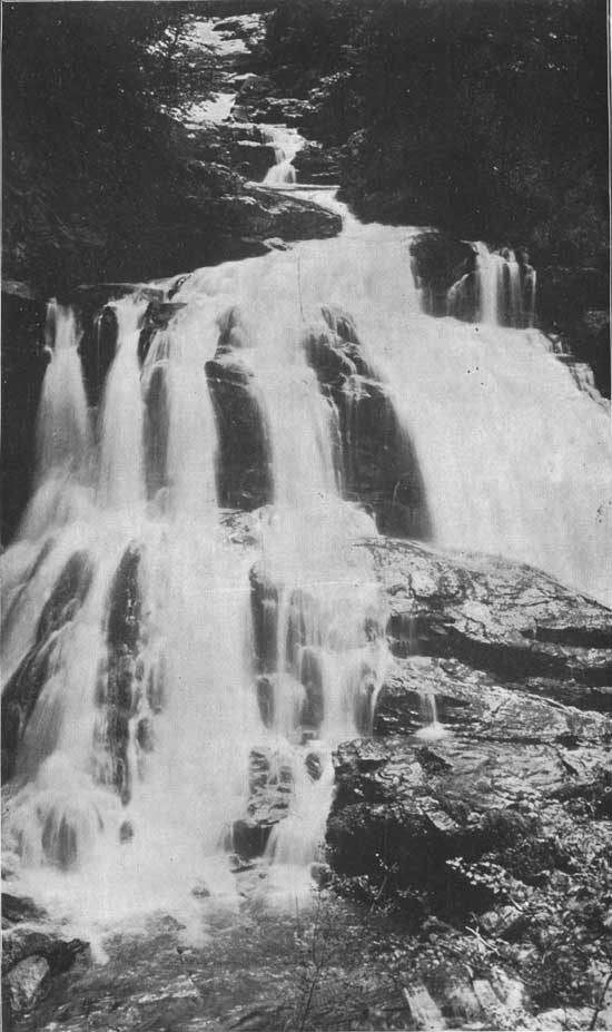
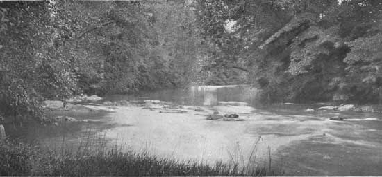
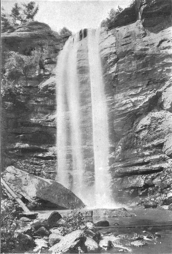
The greater part of this region is occupied by gneissic rocks, having for the most part a characteristic northeast-to-southwest strike, the irregular rock layers dipping beneath the surface at varying but generally steep angles. The southern half of the region has along its western border an irregular belt of bedded slates, limestones, quartzites, and conglomerates. These rocks, which make up the great bulk of the surface, have a general northeasterly strike and a steep but varying dip; while near the eastern border there is another, but narrow and more irregular, belt of rock of somewhat similar character, which follows approximately the general position of the Blue Ridge, and dips steeply southeastward. As stated above, the important streams rising in Virginia, the Carolinas, and Georgia have their origin on the slopes of the Blue Ridge. Those rising on the eastern slope, such as the James, Roanoke, Yadkin, Catawba, Broad, Savannah, and Chattahoochee, flow generally toward the southeast, their head streams plunging down the mountain slopes many hundreds of feet in short distances and soon reaching the gentle slope of the Piedmont Plain. (See Pls. XXVII and LXX.) The streams rising on the western slopes of the Blue Ridge—the Watauga, Nolichucky, French Broad, Pigeon, Little Tennessee, Tuckasegee, and Hiwassee rivers—flow in the general characteristic northwesterly direction across the upturned ridges of the gneiss and more recent bedded rocks, with frequent falls, into the great valley of East Tennessee. (See Pl. LXXI.) The Holston River, which flows along this valley from its upper end to its junction with the Tennessee system, forms an exception to the general direction of flow in this region, for its course lies toward the southwest; and the Coosa River, of Alabama, which has its headwaters on the southeastern slopes of the Blue Ridge, takes a similar direction. The New River, also, which rises in the cross ranges connecting the Unakas and the Blue Ridge, flows toward the northwest into the Ohio. The elevation of the country is so great and the descent of the stream is so rapid that the general course of the principal rivers has been but little modified by the geologic structure of the region, though they lie directly across the strike of the rocks. The resulting conditions produce occasional falls and cascades in the streams (see Pl. LXXVII); but the larger part of the courses of these streams consists of a succession of rapids (see Pl. LXXIII), furnishing ample opportunities for water-power development by the building of dams at intervals across the deep, narrow gorges. A number of the smaller tributary streams in North Carolina and in Virginia flow in either a northeast or southwest direction along the strike of the rocks, and at places give rise to conditions favorable to water-power development. This is the case for the most part where a change in the direction of flow causes a change in the character of the rock in the stream bed. | |||||||||||||||||||||||||||||||||||||||||||||||||||||||||||||||||||||||||||||||||||||||||||||||||||||||||||||||||||||||||||||||||||
| ||||||||||||||||||||||||||||||||||||||||||||||||||||||||||||||||||||||||||||||||||||||||||||||||||||||||||||||||||||||||||||||||||||
|
Waterfalls and cascades in the Georgia portion of the Southern Appalachians. |
In northern Georgia different conditions seem prevalent; the general course of the stream is southeast or southwest, and many shoals and cascades are to be found. Some of the cascades are of great height, and large water powers could be easily and cheaply developed. Notable among these are Tallulah Falls (see Pl. XXVIII), where the descent is 335 in about 4,000 feet: Duke's Creek Falls, Minnehaha Falls and Annie Ruby Falls, where the descent in each case is about 300 feet within a short distance. These are found on rather small streams. but illustrate the difference in the prevalent condition. | |||||||||||||||||||||||||||||||||||||||||||||||||||||||||||||||||||||||||||||||||||||||||||||||||||||||||||||||||||||||||||||||||||
|
Development of manufacturing enterprises. |
As before stated, this part of northern Georgia embraces the headwaters of three great drainage systems, the Coosa, the Chattahoochee, and the Savannah. At various points along their courses all of these streams possess magnificent water powers which present conditions favorable to development, and which at some future time will be made to supply the varied and growing industries of the nearby region with the power necessary for their continuance and growth. Any impairment of these powers by diminution of the low-water flow of these streams will most assuredly work great injury in future years to the industrial welfare of the region. The States through which flow the streams rising in the region of the proposed Appalachian Forest Reserve have for many years past been devoted mainly to agricultural pursuits; but within recent years a great a wakening has come, and a tendency to manufacture the raw material at home has become manifest. Already the results are to be seen in the increased prosperity of the region, resulting from the development of diversified industries. This tendency is growing with great rapidity, and while its beneficial effects will be felt most in the section where it has appeared, it can not fail to have a considerable influence on the prosperity of the entire country, for prosperity comes to those who produce sooner than to those who consume—to the seller who can supply the commercial needs of the world, rather than those who feel the want. | |||||||||||||||||||||||||||||||||||||||||||||||||||||||||||||||||||||||||||||||||||||||||||||||||||||||||||||||||||||||||||||||||||
|
Importance of water-power preservation. |
Water power is universally recognized as the cheapest power to be secured for any species of manufacture, for when once the constructional development is at an end the attendant expenses become very small, since, through the operation of the laws of nature, the water flows without cost by day and night, while every ton of coal that passes in at the furnace door represents a certain expenditure, and in plants requiring great power this fuel cost may come to represent a large proportion of the cost of manufacture. In the past the chief advantage of steam power over water power was the mobility of the former, for steam could be generated wherever fuel could be obtained and mills could be built and where the transportation facilities were such as to insure the quick disposal of the finished product. By reason of the great improvements in electrical transmission of power, steam has lost its advantage, for water power can now be brought to a mill for distances of many miles more cheaply than power can be obtained from coal at most points. The water powers, therefore, in the not far distant future, may become as valuable as coal mines, and as the local coal supply becomes more costly by reason of deeper mining, the water powers will increase in value. This wealth should not be wantonly wasted. Its present value can be conserved and its future value increased by the preservation of the forests about the headwaters of the streams; and this preservation would seem desirable, therefore, if for no other reason than this, entirely apart from the wealth-producing capabilities of the forests themselves. | |||||||||||||||||||||||||||||||||||||||||||||||||||||||||||||||||||||||||||||||||||||||||||||||||||||||||||||||||||||||||||||||||||
|
Aggregate water power in southern Appalachian region. |
It is impossible at this time to give an accurate statement of the total power available on all the streams rising in and flowing from this area, for the reason that the power on any stream can not be determined accurately without a survey of the entire course of the stream with this object in view, and any discussion of this, based on the total fall from source to mouth and the average quantity of water carried by the stream, would be worse than misleading; for the mere fact that there is on any stream a certain fall within a certain distance, over which flows a certain amount of water, does not mean that this locality constitutes an available water power. Theoretically the power is there, but practically it is nonexistent unless it can be developed and brought to use for a sum which is not prohibitive. In other words, the availability of a water power depends entirely on the economic situation at the point considered, and every location must be viewed by itself in such determination. It is, however, certain that on all of these streams large amounts of power can be easily and cheaply developed when the demand for it is sufficient, for the average fall in the streams is great, and is noticeably high at great numbers of points, while the low-water flow is fairly large on account of the large annual rainfall and the storage effect of the great forests. Furthermore, at many points, the conditions favorable for easy and cheap development are present; and on some of the streams surveys have been made which render approximate estimates easy. The more important of these are given below. | |||||||||||||||||||||||||||||||||||||||||||||||||||||||||||||||||||||||||||||||||||||||||||||||||||||||||||||||||||||||||||||||||||
| ||||||||||||||||||||||||||||||||||||||||||||||||||||||||||||||||||||||||||||||||||||||||||||||||||||||||||||||||||||||||||||||||||||
|
Water power available and that already developed on these streams. |
In regard to the power actually utilized conditions are more favorable, since such information can be readily obtained by letter and inquiry from the owners and users thereof, and such has been obtained and is presented below. The aggregate amount is very small, for the reasons that the entire region is largely agricultural in its pursuits and that manufacturing is only beginning. On the New (Kanawha) River and its tributaries, where the available horsepower amounts to 60,000, the amount actually reported as used is 8,700 horsepower, of which amount 2,500 is used by a single plant recently built. On the James River the amount of available power is estimated as 45,000 horsepower, the amount actually used being 14,000. On the Roanoke River the available horsepower is estimated as about 50,000, of which not more than 17,000 is actually in use. On the Yadkin River the available horsepower is estimated at 60,000, the amount actually used being about 2,500. The available power on the Catawba River is estimated at 57,000 horsepower, the amount in use being 4,000 horsepower. On Broad and Saluda rivers the available power is estimated at 43,000 horsepower, the amount actually used being about 25,000 horsepower. The available power on the Savannah River is estimated to be about 77,000 horsepower, the amount used being about 1,000 horsepower. Near the fall line the city of Augusta has developed about 11,000 horsepower. On the Chattahoochee River the available power is estimated by Mr. B. M. Hall to be 115,000 horsepower, the amount utilized being only about 10,000, while the available power on the Coosa River is about 140,000 horsepower, the amount in use being approximately 13,000. On the Tennessee River, in Alabama, there is available 100,000 horsepower, while on the tributaries of the Tennessee, in North Carolina and Tennessee, large amounts of power are available, as shown in the following paragraphs: On the Hiwassee and its tributaries the available power is estimated to be 75,000 horsepower, though the amount used is very small, the only users of power in the basin being some small plants. On the Little Tennessee system, including the Little Tennessee, Cheoah, Tuckasegee, Nantahala, Oconalufty, Tellico, Ellijay, and Little Pigeon rivers, the available power is 100,000, while the amount utilized is only 1,700. On the French Broad River and tributaries, rising in the southern Appalachian Mountains, the aggregate horsepower available is 50,000, while that used is about 3,500, though more than this will come into use in the near future when some developments which are now under way are completed. Others in this basin are projected. In the Nolichucky Basin about 700 horsepower is in use, and 35,000 is available. On the Watauga the amount of power available is 20,000, while only a few small powers have been developed, aggregating 450 horsepower. In the Holston Basin 4,700 horsepower has been utilized, and 40,000 remain undeveloped. It would he entirely safe to estimate the available but undeveloped water power on the streams rising among the southern Appalachian Mountains as equivalent to not less than 1,067,000 horsepower, and the developed power is 117,750. It would also be entirely correct to state that the future value of these water powers, as indeed the future value of almost everything of value about these mountains, depends largely upon the future preservation of the forests. | |||||||||||||||||||||||||||||||||||||||||||||||||||||||||||||||||||||||||||||||||||||||||||||||||||||||||||||||||||||||||||||||||||
| <<< Previous | <<< Contents>>> | Next >>> |
sen_doc_84/appc1.htm
Last Updated: 07-Apr-2008
