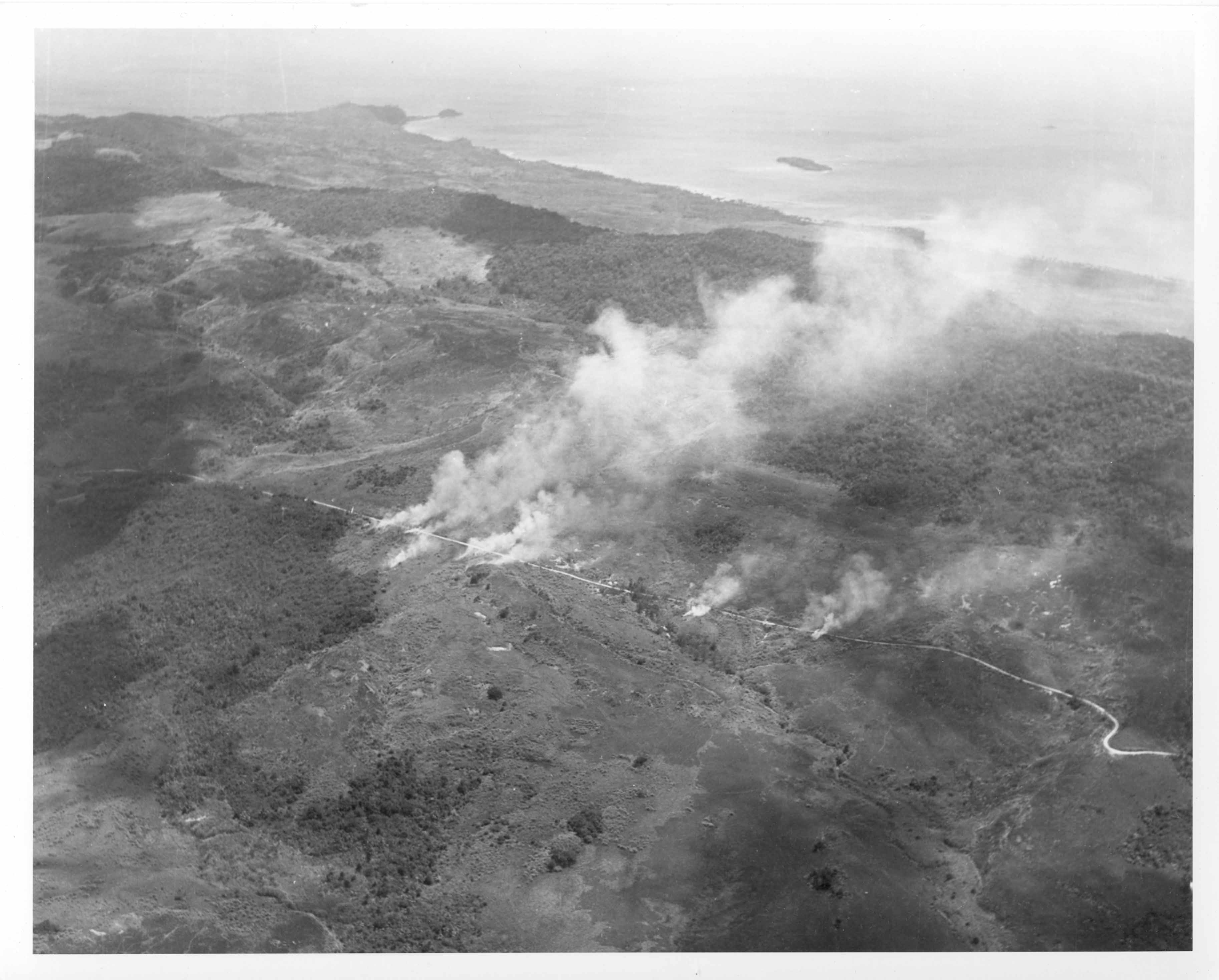
| Description: | Aerial view, altitude about 1,000 feet. Top left, Facpi point projects into sea, just beyond it is Facpi island, to the right and just off center is Anae Island. The beaches shown from left to right are Sagua, Taelayag, Nimitz Beach, Taleyac Bay. The Agat or Southern beachhead lays further north (to the right) of this view. Road in hills behind Agat. Installations set afire by US TBN's and F6F's sent to knock out Japanese heavy anti-aircraft batteries. Photo by a plane from the USS Chenango. July 22, 1944. (National Archive 80-G-242187). |
|