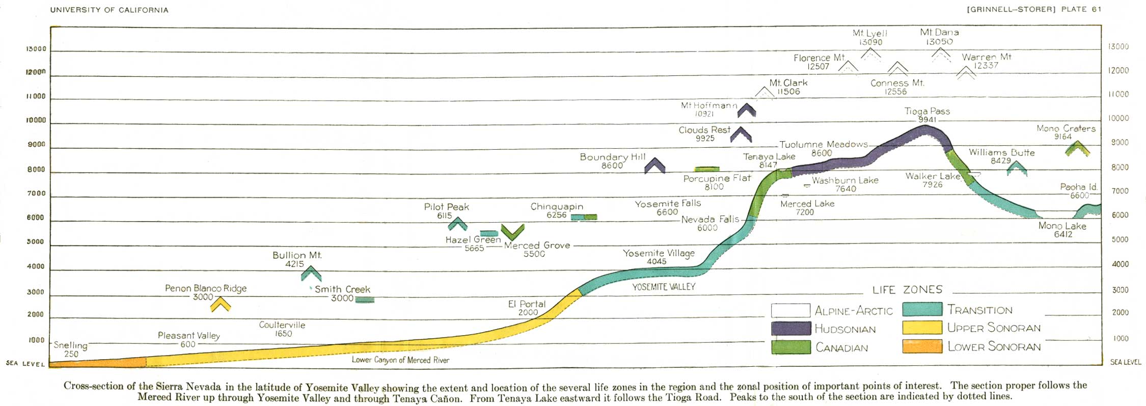
Cross-section of the Sierra Nevada in
the latitude of Yosemite Valley showing the extent and location of the
several life zones in the region and the zonal position of important
points of interest. The section proper follows the Merced River up
through Yosemite Valley and through Tenaya Cañon. From Tenaya
Lake eastward it follows the Tioga Road. Peaks to the south of the
section are indicated by dotted lines. (click on image for an
enlargement in a new window)
UNIVERSITY OF CALIFORNIA
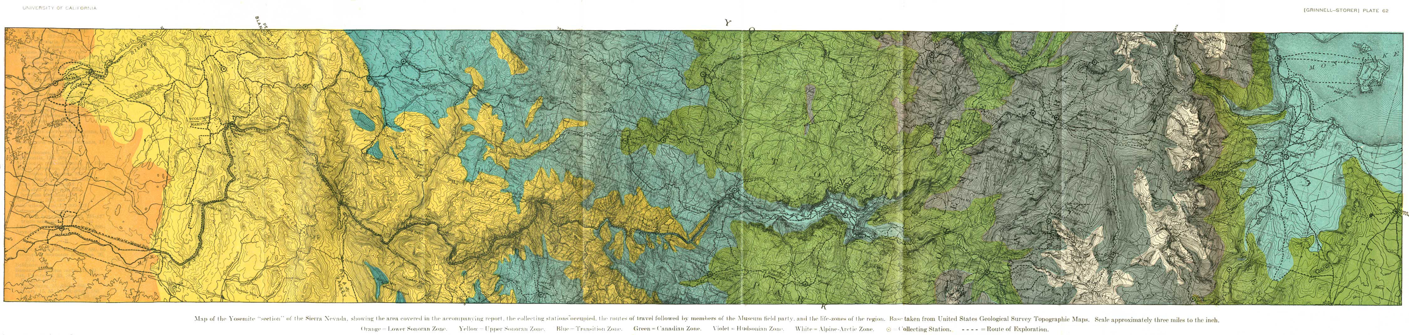
[GRINNELL-STORER] PLATE 62
Map of the Yosemite "section" of the
Sierra Nevada, showing the area covered in the accompanying report, the
collecting stations occupied, the routes of travel followed by members
of the Museum field party, and the life-zones of the region. Base taken
from United States Geological Survey Topographic Maps. Scale
approximately three miles to the inch. Orange=Lower Sonoran Zone.
Yellow=Upper Sonoran Zone. Blue=Transition Zone. Violet=Hudsonian Zone.
White=Alpine-Arctic Zone. =Collecting Station. ----=Route of Exploration. (click on
image for an enlargement in a new window, file size >1mb)

 =Collecting Station. ----=Route of Exploration. (click on
image for an enlargement in a new window, file size >1mb)
=Collecting Station. ----=Route of Exploration. (click on
image for an enlargement in a new window, file size >1mb)