|
National Park Service
Confinement and Ethnicity An Overview of World War II Japanese American Relocation Sites |

|
Chapter 5
Granada Relocation Center
The Granada Relocation Center was located in southeastern Colorado 140 miles east of Pueblo. The relocation center site is 16 miles east of the town of Lamar and 15 miles west of the Kansas border. The relocation center's common name was derived from the small town of Granada, less than a mile away. However, the postal designation was Amache, after a Cheyenne woman who was married to John W. Prowers, a nineteenth century rancher for whom the county is named.
Averaging about 3,600 feet in elevation, the relocation center is on a wind-swept prairie that slopes gently from south to north toward the Arkansas River, 2-1/2 miles north. Cottonwoods grow along the river, but without irrigation, the land is fairly arid, with wild grasses, sagebrush, and prickly pear cactus common.
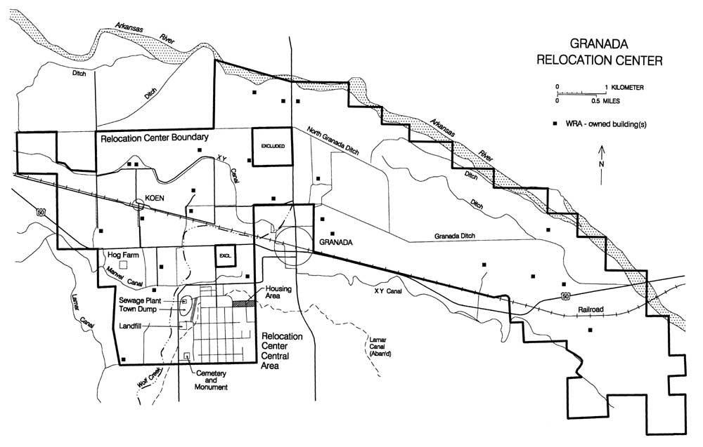 Figure 5.1 Granada Relocation Center. (click image for larger size) |
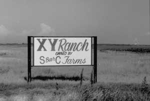 Figure 5.2 XY Ranch lands today. |
The 10,500 acres of the relocation center reserve had been 18 privately owned farms and ranches, acquired by the WRA through purchase or condemnation (Figure 5.1). The largest parcels included the former company town of Koen, owned by the American Crystal Sugar Company, and the XY Ranch, founded by Fred Harvey in 1889 (Figure 5.2). For the planned agricultural projects, the WRA also purchased water rights to parts of the Lamar, Manvel, and XY canals, which flowed through the reserve and fed existing irrigation ditches. The Wolf Creek drainage flows northeast to the river just west of the developed part of the relocation center, but the creek bed is currently dry most of the year.
Construction of the relocation center began June 12, 1942, with a crew of up to 1,000 hired workers and 50 evacuee volunteers; the general contractor was Lambie, Moss, Little, and James of Amarillo, Texas. The center was in operation by the end of August 1942, and reached the maximum population of 7,318 by October. Although Granada had the smallest population of the ten relocation centers, it was the tenth largest city in Colorado when it was occupied. Evacuees were from the Merced and Santa Anita assembly centers. There were over 560 buildings, including a few composed of sections of former Civilian Conservation Corps buildings transported to the site (Simmons and Simmons 1993).
The central or developed portion of the relocation enter was located on a low bluff overlooking the flood plain and farmlands, which extended to the north and east all the way to the Arkansas River. Like most of the relocation centers, buildings and streets were laid out on a north-south grid within an area about one mile square (Figure 5.3). East-west roads were consecutively numbered from 1st on the north to 12th Street on the south. North-south roads extended from "D" Street on the west to "L" Street on the east (I and J were not used). Shorter roads at a slight angle to the grid in the coal storage area were designated "A" and "B" Streets; "C" Street ran adjacent and parallel to A and B Streets before continuing due south next to the residential area.
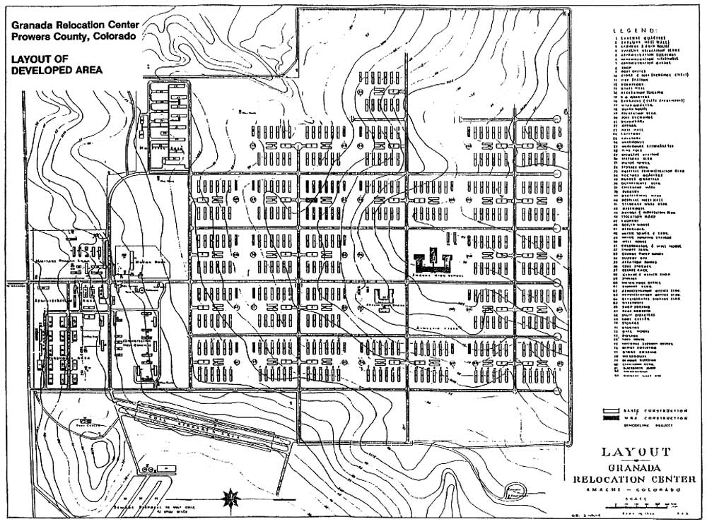 Figure 5.3 Granada Relocation Center central area. (from Simmons and Simmons 1993) (click image for larger size) |
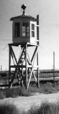 Figure 5.4 Watch tower at Granada. (Joe McClelland photograph, Bancroft Library, University of California, Berkeley) |
The entire developed area was surrounded by a four-strand barbed wire fence, with six watch towers along the perimeter. Equipped with searchlights and staffed by military police guards as were the guard towers at other relocation centers, the six at Granada were unique in their octagonal lookout enclosures (Figure 5.4). The only gate in the perimeter fence was at "G" Street, near the center of the north side, approximately one-half mile south of U.S. Highway 50. On the east side of the entrance was the Military Police compound, which included an administration building with a flagpole out front, a guardhouse, four barracks buildings, an officers quarters building, a mess hall, two recreation buildings, a dispensary, a post exchange, a garage, storage house, and a tool house. In the later stages of the center's operation when the military police detachment was greatly reduced in number, the WRA used some of the buildings in this area for staff housing and offices (Simmons and Simmons 1993).
A visitor center was located south of the Military Police compound at the southeast corner of 4th and "G" Streets. The motor pool area, which included an office, storage building, gas station, and one other building, was just to the south of the visitor center. Farther to the east was the hospital complex, with 17 buildings including an administration building, mess hall, doctors' and nurses' quarters, wards, storehouse, laundry, and heating plant.
On the west side of the entrance were the administration and warehouse areas. The administration area included several office buildings, a warehouse, a garage, a shop, a post office, a store, and a recreation building. A staff housing area, to the southwest of the administration area, included a mess hall, four dormitories, and ten staff apartment buildings (Figure 5.5). The center's water reservoir, a pump station, a well house, and the fire station were located east of the staff housing area, on the west side of "G" Street. The warehouse area (Figure 5.6), in the northwest corner of the developed area, included fifteen large warehouses, a butcher shop, two latrines, a storage building, and a lumber yard.
 Figure 5.5. Staff housing area at Granada. (Joe McClelland photograph, Bancroft Library, University of California, Berkeley) |
 Figure 5.6. Warehouse area at Granada. (Joe McClelland photograph, Bancroft Library, University of California, Berkeley) |
Domestic water was supplied by four 800-foot-deep wells and stored in a 200,000-gallon concrete reservoir located south of the staff housing area. To provide water pressure, water was then pumped to a 72-foot-high 25,000-gallon water tower in the southeast corner of Block 12K, in the evacuee residential area.
The evacuee residences were south of 6th street, and separated from the administration areas by more barbed wire fencing (Figure 5.7). There were 30 residential blocks, designated by a number and letter combination (such as 6B or 11H) which reflected the street intersection at the block's northwest corner. The WRA blueprint depicts only every other east-west street, suggesting some of these street intersections were only hypothetical, but given that the entire area was cleared before construction began, it seems likely these named streets could also have been used as thoroughfares, even if they weren't surfaced roads.
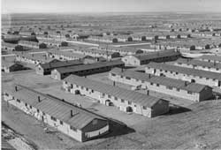 Figure 5.7. Evacuee residential area at Granada. (Joe McClelland photograph, Bancroft Library, University of California, Berkeley) |
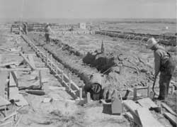 Figure 5.8. Preparing barracks foundations at Granada. (Tom Parker photograph, Bancroft Library, University of California, Berkeley) |
Each block was laid out according to standard plans, with 12 barracks each measuring 20 feet by 120 feet, a mess hall, a combination laundry, bath, and latrine building, and a recreation building. Construction of the evacuee buildings at Granada differed from the other relocation centers. Instead of post-and-pier foundations, barracks had slab foundations, or concrete perimeter foundations with brick floors (Figure 5.8; DeWitt 1943). The evacuee buildings also had fibre board or asbestos shingle siding, rather than the tarpaper common at most of the other relocation centers.
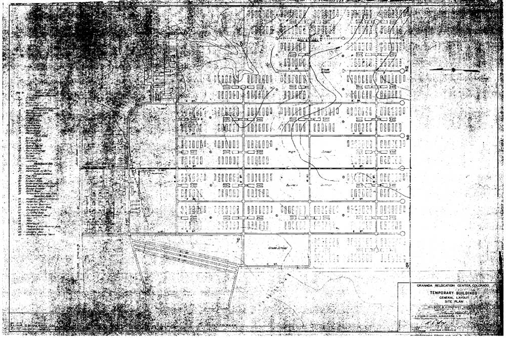 Figure 5.9 1942 layout plan of the central area at the Granada Relocation Center. (National Archives) (click image for larger size (~212K) ) |
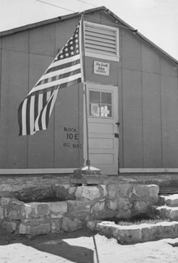 Figure 5.11 Boy Scout headquarters at Granada. (Joe McClelland photograph, Bancroft Library, University of California, Berkeley) |
Twenty-nine of the residential blocks were used for housing; the buildings in one of the blocks, 8H, were used for classrooms. A 1943 WRA blueprint indicates ten addition residential blocks were planned but never built (Figure 5.9). Two silk screening shops, the Red Cross, the YMCA, a town hall, five churches, a recreation office, scouts, and other groups were housed in recreation buildings (Figures 5.10 and 5.11). The silk screen shop produced color posters under contract to the U.S. Navy (Simmons and Simmons 1993).
Several blocks in the residential area were reserved for special uses, and therefore had different configurations of buildings, or were left undeveloped. The high school, in Block 10G, was completed in early 1943 of wood frame construction on cinder block and concrete foundations. In plan, the high school complex was shaped like an "E," with the main section over 300 feet long and 40 feet wide, and the two wings at either end approximately 180 feet by a maximum of 90 feet. The auditorium/gymnasium building, 68 by 144 feet in size, was located between the classroom wings, and was connected to the main section by a covered arcade (Figures 5.12 and 5.13). Locker rooms and a boiler room were located in the auditorium basement (Simmons and Simmons 1993). The high school was the most expensive building constructed in Prowers County up to that time, arousing the envy and ire of some local residents already resentful that private land had been condemned for the center. Politicians stopped construction of an elementary school, so that the existing barracks in Block 8H continued to be used (Simmons and Simmons 1993). Immediately west of the high school, Block 10F remained open as an athletic field, while Block 9G, to the north, was also vacant.
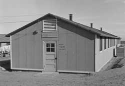 Figure 5.10. Recreation hall in Block 10H at Granada used as a church. (Tom Parker photograph, Bancroft Library, University of California, Berkeley) |
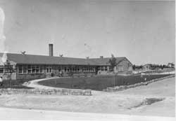 Figure 5.12. South entrance to Granada High School. (Joe McClelland photograph, Bancroft Library, University of California, Berkeley) |
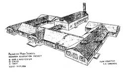 Figure 5.13. Proposed Granada High School. (from Granada Pioneeer 11/26/42) | |
Block 9F, northwest of the high school, contained the co-op store, a warehouse, the internal security office, and another office building. The U-shaped co-op store in Block 9F, constructed in 1943, was the second largest building at the center, with a 40 foot by 100 foot main section and two 40 foot by 60 foot wings. The co-op contained a dry goods store, variety store, shoe store, canteen, beauty shop, barber shop, shoe repair shop, watch repair shop, cleaning and pressing agency, a radio repair shop, an optometry dispensary, and a newspaper department (Simmons and Simmons 1993).
Historical photographs show that evacuees landscaped the barren surroundings with gardens, including transplanted trees (Figure 5.14 and 5.15). An unusual feature of the Granada center that also appears in the historical photographs is the presence of what look like small outhouses between the barracks area and the perimeter fence (Figure 5.16). These may be the privies used during the fall of 1943 when the evacuees arrived before the utilities were completed (Simmons and Simmons 1993). Joe Norikane recounts having to drive a water truck from latrine to latrine to flush the toilets (Personal communication, 1999).
More fencing enclosed the area west of the residential area, which included the cemetery, coal storage areas (Figure 5.17), root cellars, the landfill, and the sewage treatment plant. The sewage treatment plant included an "Imhoff" tank, a pump house, a sludge bed, and aeration ponds. Treated effluent was discharged towards Wolf Creek via an open ditch.
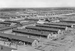 Figure 5.14. Evacuee barracks at Granada, view from water tower. (Joe McClelland photograph, Bancroft Library, University of California, Berkeley) |
 Figure 5.15. Evacuee barracks at Granada. (Joe McClelland photograph, Bancroft Library, University of California, Berkeley) |
 Figure 5.16. Evacuee barracks and outhouses at Granada. (Joe McClelland photograph, Bancroft Library, University of California, Berkeley) |
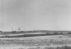 Figure 5.17. Coal storage area at Granada. (Joe McClelland photograph, Bancroft Library, University of California, Berkeley) |
In spite of its small population, Granada had one of the largest and most diversified agricultural enterprises of the ten relocation centers. The farm program included the raising of vegetable crops, feed crops, beef and dairy cattle, poultry, and hogs (Figures 5.18-5.23). Even the high school had a 500-acre farm, operated by vocational agriculture students (Granada Pioneer 5/19/43). Granada had an advantage over other centers in that its fields and canals were already in place, needing only minor repairs. Existing agricultural facilities were incorporated into the center's farm program: for example, the relocation center's dairy made use of an existing dairy farm, and the hotel at Koen was used as a mess hall for farm workers. A blacksmith shop located at Koen also utilized an existing facility (Figure 5.24). Expedient trench silos were used to store corn, celery, and other foods (Figure 5.25).
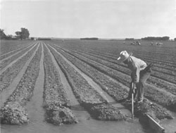 Figure 5.18. Irrigating lettuce field at Granda. (Joe McClelland photograph, Bancroft Library, University of California, Berkeley) |
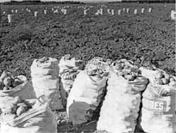 Figure 5.19. Potato harvest at Granada. (Joe McClelland photograph, Bancroft Library, University of California, Berkeley) |
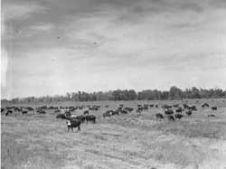 Figure 5.20. Cattle herd at Granada. (Joe McClelland photograph, Bancroft Library, University of California, Berkeley) |
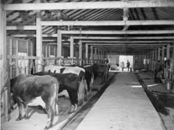 Figure 5.21. Milking shed at dairy farm at Granada. (Tom Parker photograph, Bancroft Library, University of California, Berkeley) |
 Figure 5.22. Chicken farm at Granada. (Joe McClelland photograph, Bancroft Library, University of California, Berkeley) |
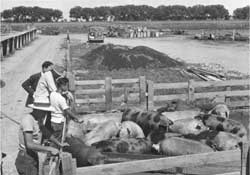 Figure 5.23. Hog farm at Granada. (Joe McClelland photograph, Bancroft Library, University of California, Berkeley) |
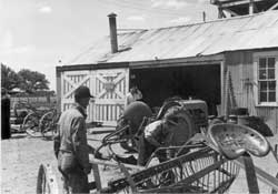 Figure 5.24. Evacuee-run blacksmith shop at Koen. (Joe McClelland photograph, Bancroft Library, University of California, Berkeley) |
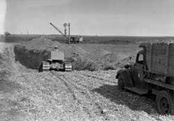 Figure 5.25. Constructing a trench silo at Granada. (Joe McClelland photograph, Bancroft Library, University of California, Berkeley) |
Fields and pastures, located to the north and east of the central developed area of the relocation center, extended to the Arkansas River and almost surrounded the town of Granada. Water for the fields was supplied by canals. Official WRA reports indicate that in 1943, 469 acres were farmed at Granada; in 1944, there were 505 acres of vegetables and 2,185 acres of field crops. A May 1943 WRA map produced at the relocation center, however, gives somewhat higher figures, with 540 acres of vegetables, 1,650 acres of grain, 515 acres of alfalfa, 2,895 acres of pasture, 340 fallow, and 855 wasteland (Figure 5.26). Some 2,380 acres of the relocation center holdings, mostly lands northwest of the town of Granada, are listed as licensed acres, probably indicating the areas were leased back to local farmers.
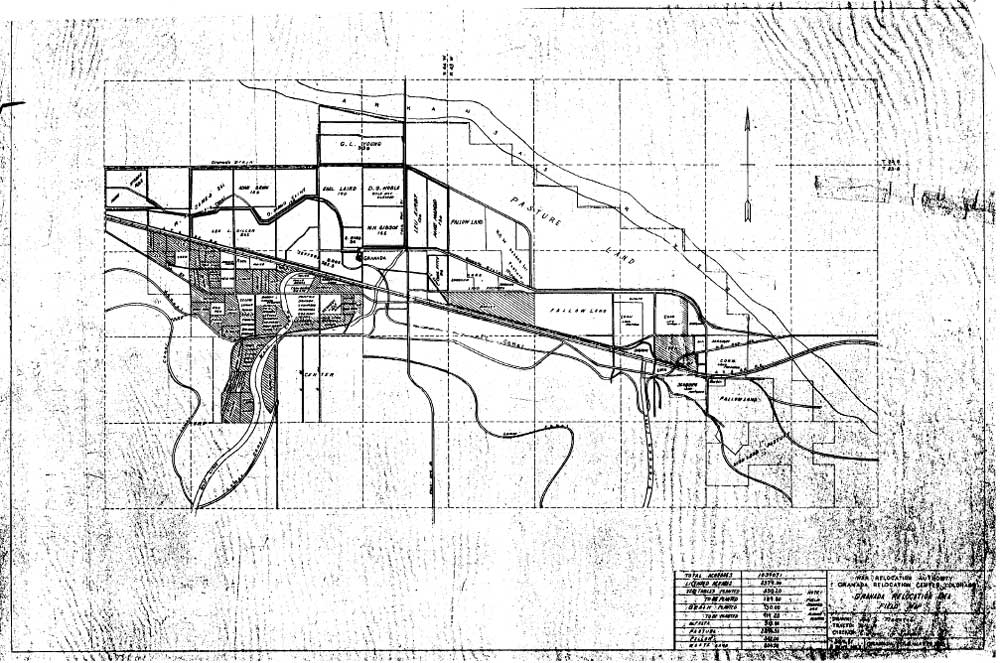 Figure 5.26. Farm fields at the Granada Relocation Center. (National Archives) (click image for larger size (~155K) ) |
WRA blueprints indicate the hog farm and at least one chicken farm were located northwest of the central area. Cattle ranch facilities may have been at the east end of the reserve, to make use of existing XY Ranch buildings. All agricultural activities likely used existing buildings, with new additions and repairs as needed. In 1944 the relocation center raised 456 cattle, 1,017 hogs, 4,712 chickens, and 2,210 egg chickens (WRA 1944).
The military police unit left the relocation center in mid-September 1945 and the Granada Relocation Center officially closed on October 15, 1945, when the last group of eighty-five evacuees departed (Simmons and Simmons 1993). The central area was sold to the town of Granada for $2,500. Through 1946 and 1947 buildings were dismantled and sold , some going to school districts in the area, some going to the town, and some hospital buildings going to the University of Denver. Other lands of the relocation center reserve were leased and then sold to local farmers, with the original buildings intact.
Central (Fenced) Area
Today, the site of the Granada Relocation Center is remarkably intact, compared to many of the other relocation center sites. The central area is presently owned by the town of Granada, and one of the relocation center wells is used as the water source for the town. The only standing structures remaining from the relocation center use are a poured concrete room which was part of the co-op store, a small brick building at the cemetery, and the water reservoir and associated pump and well houses. However, traces of the whole central area of the relocation center are present — slab and footer foundations for most of the buildings remain, underground utilities appear to be intact (Figure 5.27), and roads still delineate the original blocks (Figure 5.28). Many of these roads, surfaced with a light tan gravel, are still driveable. Chinese elms and cottonwoods planted by the evacuees still survive and are the dominant vegetation, showing up in orderly rectangles on the USGS topographic map on the otherwise treeless prairie. Even most of the original security perimeter fence around the central area is still in place.
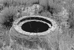 Figure 5.27. Manhole in Block 10E at Granada. |
 Figure 5.28. Relocation center road at Granada today. |
There appear to have been only four major disturbances to the site since the buildings were removed in the 1940s: (1) a housing complex built where the hospital had been; (2) the present town landfill north of the relocation center landfill in the sewage treatment plant area; (3) a cylindrical metal water tank in Block 11K, added in the late 1960s; and (4) a recent well in Block 11F.
Central (Fenced) Area
Hospital, Administration, and Warehouse Areas
There appear to have been only four major disturbances to the site since the buildings were removed in the 1940s: (1) a housing complex built where the hospital had been; (2) the present town landfill north of the relocation center landfill in the sewage treatment plant area; (3) a cylindrical metal water tank in Block 11K, added in the late 1960s; and (4) a recent well in Block 11F.
There are modern houses in the hospital area, in the northeast part of the central area (Figure 5.29). According to Simmons and Simmons (1993), existing foundations were cleared in 1968 and the "Vista Nueva" housing complex was constructed for migrant farm workers. Originally built by a group of growers, the project is now owned by the Colorado Rural Housing Development Corporation; because of a decreased need for migrant laborers, the buildings are up for sale for removal from the site (Simmons and Simmons 1993). North of the housing area the concrete foundations of the hospital laundry and the boiler house are still present (Figures 5.30 and 5.31).
In the administration area there are foundations, a few low sandstone and concrete retaining walls, and what may have been decorative planters (Figure 5.32). In the staff housing area the foundations of the four dormitories and the mess hall remain. There is no evidence of the staff apartments other than four large sandstone rock and concrete boxes adjacent to roads where the apartment buildings would have been located (Figure 5.33). These measure about 10 feet by 15 feet by 2 feet high and are in poor condition; the structures may have been decorative planters for the apartment buildings.
Some of the water system features south of the administration area are still standing, including the concrete reservoir, which is covered with wood and rolled roofing (Figure 5.34), a concrete block well house (Figure 5.35), and a pump house with partial concrete walls (Figure 5.36). Apparently the reservoir and well house are still used; the pump house, which once pumped water to the relocation center water tower, is no longer necessary, since gravity provides enough pressure for the water to reach town. Along the southern perimeter of the evacuee residential area the foundation blocks of the water tower are intact (Figure 5.37).
Near the water reservoir the fire station foundation is still present. Most of the warehouse foundations have been removed. Only two concrete slab foundations (Figure 5.38) and two other partial foundations remain. Some small pieces of rubble have been left around trees. In the motor pool area there are three foundations.
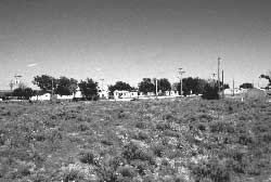 Figure 5.29. Housing complex within the former hospital area at Granada. |
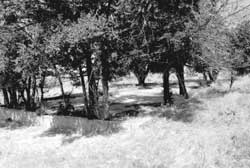 Figure 5.30. Foundation of hospital laundry building at Granada. |
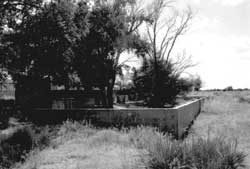 Figure 5.31. Foundation of hospital boiler house at Granada. |
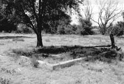 Figure 5.32. Foundation in the administration area at Granada. |
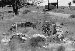 Figure 5.33. Remnants of a rock and concrete feature in the staff housing area at Granada. |
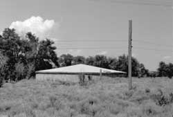 Figure 5.34. Water reservoir at Granada today. |
 Figure 5.35. Well house used by the town of Granada. |
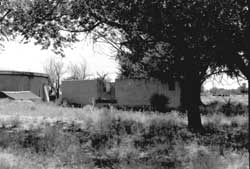 Figure 5.36. Ruins of pump house at Granada. |
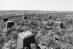 Figure 5.37. Foundation blocks of water tower at Granada. |
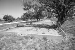 Figure 5.38. Concrete slab foundation of a warehouse at Granada. |
Central (Fenced) Area
Residential Area
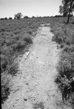 Figure 5.48 Foundation at the co-op location. |
The slab foundations of most of the mess halls and communal bathroom and laundry buildings are still in place (Figures 5.39-5.41). Foundations for barracks, too, are unusually intact. Although barracks at other relocation centers rested on concrete blocks, at Granada barracks have concrete perimeter foundations, some rising about two feet above the ground surface(Figure 5.42), or complete concrete slabs (Blocks 10E, 11E, 11H, 12H, and 12K; Figure 5.43). Bolts to attach the wooden portion of the structure project from the foundations. At least one foundation retains a brick and concrete support for a coal-burning heater (Figure 5.44). The foundations are overgrown and distorted by trees and brush, and some of those that were not present may have been buried by sheet wash silt. Others, however, are completely missing: according to Simmons and Simmons (1993), foundations along the western edge of the residential area were reportedly broken up and used as rip-rap in area canals.
In the high school area the concrete block foundations have been removed, probably for reuse, but there are several small entry slabs and a larger L-shaped patio-like slab that once wrapped around one of the corners of the school building (Figures 5.45 and 5.46). Remains of a baseball backstop were observed in the athletic field to the west of the school. Foundation remains and a small concrete vault similar to one remaining at the Heart Mountain Relocation Center are at the co-op store location (Figures 5.47 and 5.48). The vault measures about 12 feet square by 9 feet high.
Archaeological evidence of evacuee improvements, other than the relict trees, is rare. Concrete "stones" near one mess hall slab were probably part of a decorative garden (Figure 5.49). No inscriptions or graffiti were observed in any of the concrete slabs or footings.
 Figure 5.39. Concrete slab foundation of mess hall in Block 9L at Granada. |
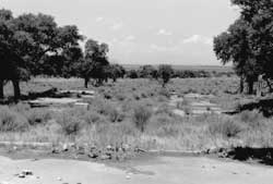 Figure 5.40. Concrete slab foundation of bathroom/ laundry building in Block 11K at Granada. |
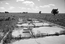 Figure 5.41. Detail of concrete bathroom slab in Block 10E at Granada. |
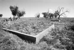 Figure 5.42. Concrete perimeter barracks foundation in Block 12F. |
 Figure 5.43. Concrete slab barracks foundation in Block 11H. |
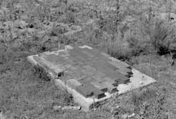 Figure 5.44. Brick and concrete pad for coal heater in Block 7E. |
 Figure 5.45. Concrete entries at the high school location. |
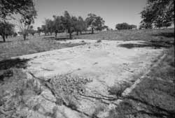 Figure 5.46. Concrete patio at the high school location. |
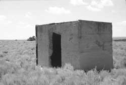 Figure 5.47. Concrete building at the co-op location. |
 Figure 5.49. Decorative landscaping at the Block 12F mess hall location. |
Central (Fenced) Area
Western Area
 Figure 5.54 Graves at the Granada Relocation Center cemetery. |
The fenced western portion of the central area encompasses the landfill, sewage treatment plant, coal storage area, root cellar, and the cemetery. Today the dump for the town of Granada is where the buildings of the sewage treatment plant were located.
The relocation center landfill has no apparent vandalism. Abundant artifacts include numerous glass bottles and ceramics, but not many Japanese ceramics (Figures 5.50 and 5.51). Adjacent to the landfill there is a large can and ceramic dump that likely dates to the abandonment of the center (Figure 5.52). The ponds and a few concrete walls from the sewage disposal system are still present in the northwest portion of the center (Figure 5.53). No evidence of the coal storage area was observed, but the root cellar is indicated by a slight depression, which even shows up on the USGS topographic map.
The WRA blueprint indicates that the original access to the cemetery was via a curving road approaching from the north, but the cemetery is now reached by an east-west road from the southwest corner of the evacuee housing area. Within a large fenced area at the cemetery there is a recent memorial monument, a small building, and a smaller fenced area with nine marked burials (Figures 5.54 and 5.55). The current grave markers are all of the same design and were apparently added in recent years, including one marker bearing the inscription "Evacuees Unknown."
The small building at the cemetery has a concrete foundation, brick walls, and a wood frame and corrugated metal roof. It is located where a "columbarium" is depicted on the September 1944 WRA map, just west of the grave sites. The building was apparently constructed by evacuees to store cremated remains; shortly before the camp was closed evacuees placed a polished granite slab inside to honor those who died at Granada. The slab is inscribed with Japanese text and the date September 1945 in English (Figure 5.56). The Japanese text reads "Memorial tower established in Showa 20 (1945) by the Japanese at Amache Relocation Center. The slab is chipped in several areas where rifle slugs have struck the surface.
 Figure 5.50. Granada Relocation Center landfill. |
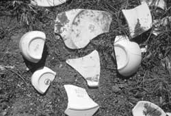 Figure 5.51. Ceramics at the Granada Relocation Center landfill. |
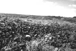 Figure 5.52. Can and ceramic dump at the Granada Relocation Center. |
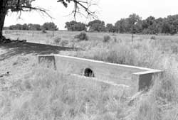 Figure 5.53. Remains at the Granada Relocation Center sewage treatment plant. |
 Figure 5.55. Monument and brick building at the Granada Relocation Center cemetery. |
 Figure 5.56. 1945 monument inside small building at the Granada Relocation Center cemetery. |
Security Features
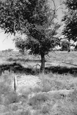 Figure 5.60. Foundation remains in the military police compound at Granada. |
The foundation blocks of all of six perimeter watch towers are intact (Figures 5.57 and 5.58). Each consists of four square blocks of poured concrete forming a square about 8 feet on a side; each block has metal straps to attach a support post for the tower. In the center of the square is a fifth piece of poured concrete, oblong instead of square, with straps to attach a ladder.
Much of the existing perimeter barbed wire fence around the central area is likely original, although it may have been repaired over the years. The original entrance gate area has been blocked off (Figure 5.59), and the current entrance to the site is via "E" Street, which provides access to the town dump. The fence that separated the evacuee residence area from the administration area has been removed.
In the military police compound, all of the foundations for the buildings marked on the WRA blueprints are still present, although some have been damaged by trees (Figure 5.60). The interior roads and driveways in the compound are discernible but overgrown with vegetation.
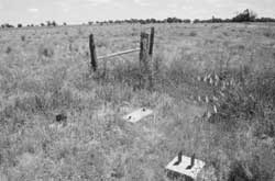 Figure 5.57. Southwest corner watch tower foundation blocks. |
 Figure 5.58. Southeast corner watch tower foundation blocks. |
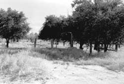 Figure 5.59. Original relocation center entrance today. | |
Outlying Area
The locations of the relocation center hog and chicken farms are now farm fields. Numerous other outlying buildings noted on WRA blueprints as WRA-owned are still present, and most are currently in use (Figure 5.61). None appear to have been built by the WRA; all are likely pre-existing buildings taken over when the WRA purchased the land. Except for the Lamar Canal, the fields and canals used by evacuees are still in use.
Some building locations now have mobile homes, which may be making use of old foundations or utilities. An old rock building and other ruins remain at the Koen townsite, and there is a rock house ruin just east of town in the same location as one of the WRA buildings depicted on the map. At the XY Ranch, there are two warehouses and two mobile homes. Several relocated barracks from the relocation center are still in the surrounding area (Figure 5.62).
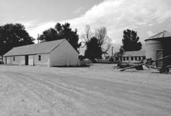 Figure 5.61. Farm at the location of formerly-owned WRA buildings. |
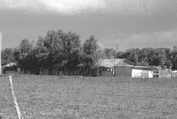 Figure 5.62. Relocated barracks east of the town of Granada. |
Interpretation
The Granada Relocation Center is marked on a large wall map at the State of Colorado Welcome Center in Lamar and it is mentioned in several tourist brochures available at the Welcome Center. The relocation center itself is 16 miles east of Lamar, one-half mile south of U.S. Highway 50. In 1994, the turnoff to the site was indicated by a small wood sign nailed to a tree (Figure 5.63).
The central area of the relocation center is completely fenced and is currently used for cattle grazing. In addition, the town of Granada operates a dump in the northwest corner of the parcel. Access into the site and to the memorial at the relocation center cemetery is through the dump entrance, which limits visiting to hours when the dump is open. Inside the fenced area nearly all of the relocation center roads are passable. Additional signs direct visitors to the relocation center cemetery, where there are marked graves, and the brick structure with the granite slab monument, described above.
A 10-foot-tall monument, with "Amache Remembered" inscribed at the top, was placed at the cemetery by the Denver Central Optimists Club in 1983 (Figure 5.64). The text says in English that the monument is "dedicated to the 31 patriotic Japanese Americans who volunteered from Amache and dutifully gave their lives in World War II, to the approximately 7000 persons who were relocated at Amache, and to the 120 who died there during this period of relocation, August 27, 1942, October 15, 1945." On the sides of the monument are the names of the 31 soldiers.
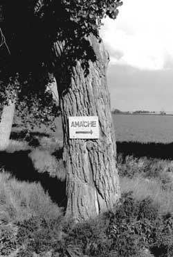 Figure 5.63. Sign along U.S. Highway 50 in 1994. |
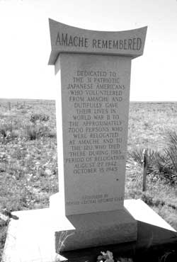 Figure 5.64. Monument placed at the Granada Relocation Center Cemetery in 1983. |
At nearby Granada High School, students under the direction of teacher John Hopper have researched the relocation center, contacted former evacuees for information, and constructed a scale model (Figure 5.65). The relocation center site was listed on the National Register of Historic Places in 1994; the nomination form, prepared by Simmons and Simmons (1993), summarizes the history of the relocation centers and provides many details about the camp layout and operations, and includes stories garnered from the local press about how the center was perceived by local residents.
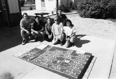 Figure 5.65. Scale model of the Granada Relocation Center built by Granada High School students Renee Bochatey, Mike Bridge, Greg Grasmick, Tommy Grasmick, Tonya Malone, Melissa Medina, and Brett Schnabel. |
In 1994 the state of Colorado provided funds to improve access and refurbish some of the site, and in 1998 the Denver Optimist Club received a grant from the Civil Liberties Public Education Fund to develop the site. Plans call for installation of interpretive signs, development of a walking/driving tour, and the construction of gravel paths, one through a typical barracks block and one at the cemetery.

| <<< Previous | <<< Contents>>> | Next >>> |
wacc/74/chap5.htm
Last Updated: 20-Feb-2004