|
SAGUARO National Park |
 |
The Extensive Back Country
Although it contains the most spectacular desert features and is the only part readily accessible by automobile, the Cactus Forest includes only a small part of the monument's area of about 100 square miles. The remainder consists of the extensive grass-and-chaparral-covered slopes of the Tanque Verde hills. These lead up to the imposing, forested highlands of the Rincon Mountains extending all the way across the eastern end of the monument. From Wrong Peak (7,767 feet above sea level) on the southern border to Mica Mountain (8,590 feet above sea level) just inside the northern boundary, the Rincon Range towers more than a mile above the surrounding desert. In winter, the crest of this lofty cloud-barrier is frequently whitened with a blanket of snow. In summer, the temperature at monument headquarters in the desert (3,090 feet) drops below 100° only at night, but high in the Rincons cool breezes whisper among the branches of firs, pines, and aspens.
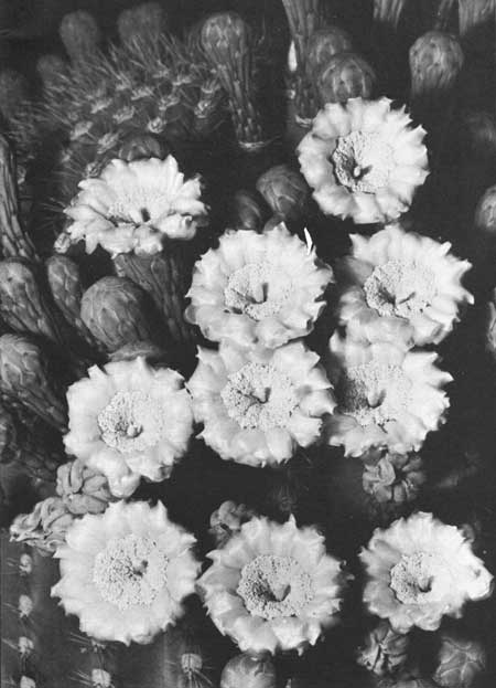
 The saguaro blossom, Arizona's state flower. |
The abrupt change of almost 6,000 feet from the level of the Cactus Forest to the summit of Mica Mountain has a profound influence on precipitation and temperature within the monument. This is reflected in the marked difference in type of vegetation you will find in going from the hot, dry desert at the foot of the mountains to the cool, moist forests along their crest. Much of Saguaro's back country has never been scientifically explored and accurate information about many of the plants and animals to be found there is extremely meager. This extensive hinterland affords an excellent opportunity for natural history research with National Park Service protection policies assuring the researcher that he will find undisturbed natural relationships among plants and animals.

|

|
|
|
|
Last Modified: Sat, Nov 4 2006 10:00:00 pm PST |


