Geological Points of Interest in the Stehekin Valley
Lake Chelan National Recreation Area
North Cascades National Park Complex
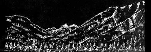
The Stehekin Valley lies at the heart of one of America's greatest geological wonders, the North Cascades. These are mountains of extreme relief, glacially carved valleys, active glaciers, and a collage of disparate geological terranes. The roots of the North Cascades are an ancient island arc, similar to today's Philippines or Japan. Other parts of the range are rocks from the ocean floor or other island arcs, sediments, crystalline rocks cooled from rising magma, and mysterious rocks from deep in the earth's mantle, The processes of plate tectonics, which constantly rearrange the puzzle-like pieces of the earth's surface, brought all of these different rocks together. Since their arrival here, these rocks have been subjected to millions of years of burial, upheaval, metamorphism, faulting, and erosion. More recently repeated advances of glaciers across the landscape have defined the topography of the North Cascades. A journey up the Stehekin Valley from the shore of Lake Chelan to Cascade Pass affords a glimpse of the amazing stories told in the rocks.
As you travel upvalley; refer to the map inside this guide to find where these geological points of interest are located. Each point of interest is numbered along with its corresponding text. Clicking on the italicized words display their definition in the glossary. Bringing along binoculars and a magnifying lens will help you see these features even better.
Geological Points of Interest
1 Jackson Memorial Picnic Area
2 Purple Point Roadcuts
3 Boulder Creek Debris Flow
4 Rainbow Falls
5 Harlequin Bridge Talus Field
6 Lower Field
7 Bullion Loop Trail
8 High Bridge
9 Sculptured Rocks and Slickensides
10 Bridge Creek Trailhead
11 Cascade Pass Trail
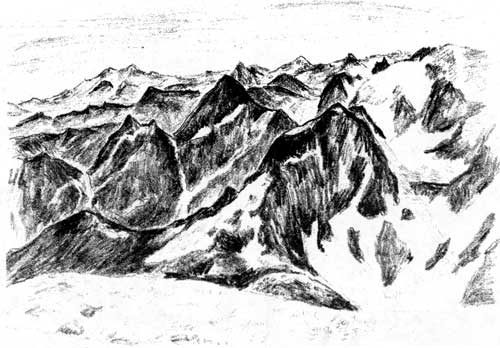
View from Sahale Arm

|
Written by David Bean Layout and Illustrations by Renée
Hudak Published by Northwest Interpretive Association in cooperation with North Cascades National Park Service Complex |

|
| 1 |
Jackson Memorial Picnic Area Location: Across the road from Stehekin Post Office |
This easily accessible viewpoint gives an overview of the shape of the Stehekin Valley and the head of Lake Chelan. Note the strikingly flat floor of the valley and the abruptly steep walls. This is an outstanding example of a U-shaped glacially carved trough. Cold temperatures and excesses of snowfall resulting from long-term climatic changes repeatedly built glaciers that advanced into this region. The most recent advance ended about 11,000 years ago. Glaciers thousands of feet thick carved the landscape as they flowed and slid away from the snow accumulation zone higher in the mountains or farther north. The cliff-bound walls of this valley are an indication of the extreme hardness of the rocks they are carved from.
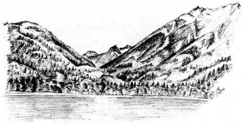
View of Stehekin Valley from Jackson Memorial
| 2 |
Purple Point Roadcuts Location: Roadside cliffs a few yards north of Purple Point Campground |
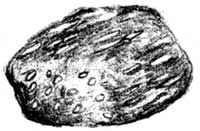 Metamorphic Rock |
Look closely at the texture of these rocks which form the valley walls (a magnifying lens is helpful). Notice the elongated white crystals of the mineral feldspar. These "stretched" crystals and the aligned pattern in which they are found indicate that these are metamorphic rocks, the product of intense heat and pressure deep within the earth. Metamorphic rocks at the core of the North Cascades were once buried as much as eighteen miles below the surface! The rocks have since risen to form surface features, and their tightly interwoven mineral fabric makes them resistant to erosion. They have developed into the precipitous valley walls and sharply chiseled peaks characteristic of the North Cascades.
| 3 |
Boulder Creek Flood Deposits Location: At the first creek crossing 2.3 miles up Stehekin Road from the landing. |
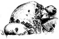
Not all geologic events are slow processes measured in millions of years. Dramatic events like earthquakes and volcanoes change the landscape in minutes or even seconds. The scattered boulders for which this creek is named are the remains of a spectacular flood. Boulder Creek cuts across a major fault zone about three miles upstream. Repeated grinding of these rocks by movement along the fault has weakened them. When the rocks are loosened by heavy rains or snowmelt, the water, mud and rock tear down the canyon and the debris settles on the gentler slope of the valley bottom. The whiter, fresher appearing boulders were deposited during a major flood in 1948.
| 4 |
Rainbow Falls Location: 3.4 miles upvalley from the landing |
Popular Rainbow Falls is a textbook example of a glacial hanging valley. During glacial advances, active glaciers filled the Rainbow Creek and Stehekin River valleys. The Stehekin valley glacier was much larger and capable of excavating a much deeper trough. After the glaciers melted, the valley of Rainbow Creek was left "hanging" above the deeper trough of the Stehekin Valley. Interestingly while other hanging valleys tributary to the Stehekin Valley now run through deep gorges carved by their streams, Rainbow Creek pours off in a spectacular 312 foot falls. Apparently, Rainbow Creek has changed its course since glacial times, so it has not had sufficient time to cut a slot all the way through the hard metamorphic rocks.
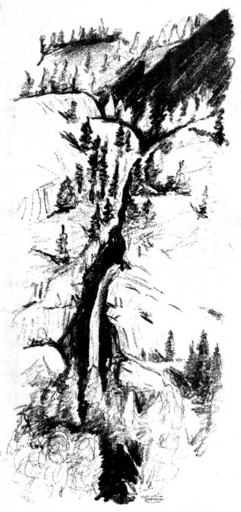
Rainbow Falls
| 5 |
Harlequin Bridge Talus Field Location: On valley wall north of Harlequin Bridge 4.4 miles from the landing. |
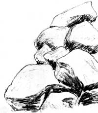 Talus Field |
Some geologic features owe their existence to a combination of long-term processes and rapid, catastrophic changes. While glaciers cut the nearly vertical valley wall here, the boulders have been loosened by other agents and have fallen to create this slope called a talus field. Earthquakes can precipitate gigantic rock falls. Single rocks are loosened by water repeatedly freezing in cracks within the cliffs above. Look for lighter colored faces on the cliffs. These are the sites of the most recent additions to the talus field. Take a moment to feel the cool breezes that come from some spaces between rocks. Sunshine warms the considerable air space within this talus field very slowly. The refreshing coolness of the air reflects the average air temperature over a long period of time, much cooler than the midday heat of summer!
| 6 |
Lower Field Location: 7.3 miles upvalley from the landing |
This opening in the forest cover allows close inspection of the slope of McGregor Mountain (8,122'). By midsummer, snow has melted enough to see the trace of faults on the upper slopes of the mountain. Shattered rocks within the fault zone are often stained red due to increased oxidation by water percolating through fractures. A prominent reddish talus field is visible on the upper left skyline where rocks have been eroded from a fault zone (binoculars are helpful).
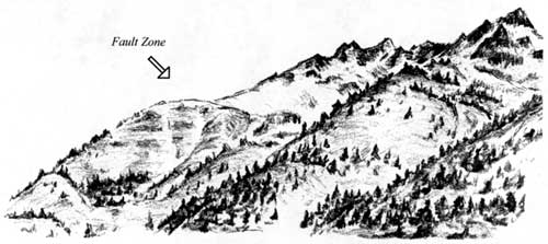
McGregor Mountain from Lower Field
| 7 |
Bullion Loop Trail Location: Loop trail begins 9.6 miles upvalley from the landing, but these features are visible from the road throughout this general area. |
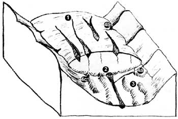
Glaciers not only carve into bedrock, they can also deposit material on top of it. The Bullion Loop Trail winds among, over, and through several terraces. These features were deposited by meltwaters that flowed within and around the glacier that filled the Stehekin Valley here. Look for rounded boulders (shaped mostly by tumbling within moving water) and faceted boulders (flattened sides shaped by being scraped across bedrock while frozen in a glacier).
|
Valley Glacier Meltwater System 1 Surface melting of snow and compacted ice percolates through tiny spaces in the snowpack and enters the glacier through crevasses and larger surface melt holes. 2 Large tunnel carries meltwater fed by a branching system of channels that get progressively smaller up-glacier and up-ice. 3 Eskers are winding ridges aligned with the flow of the glacier They grow where subglacial streams drop their sediment. Kames are mounds of debris and sediments deposited by meltwaters on the edges of glaciers 4a 4b or collected within a crevasse and later deposited when surrounding ice melted 4c |
| 8 |
High Bridge Location: 11.1 miles upvalley from the landing |
Located just above the confluence of Agnes Creek and the Stehekin River, High Bridge spans a deep gorge cut into hard metamorphic rock. Glaciers that separately filled the valleys of Agnes Creek and the upper Stehekin River merged at this confluence to create a giant ice tongue capable of gouging much more deeply than the two upper ice streams. Thus, the valley below the confluence was excavated much more deeply than those above. Since the glaciers melted, the rivers have cut gorges into their hanging valleys. At High Bridge. the gorge is approximately 50-70 feet deep. The river deepened the gorge about 1/16th inch per year for the past 11,000+ years to reach the present depth, although it likely' carved the gorge at a much higher rate during the period of initial glacial melting.
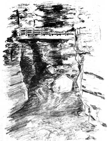
High Bridge
| 9 |
Sculptured Rocks and Slickensides Location: Sculptured Rocks - 3 miles upvalley from High Bridge; Slickensides - Last large roadcut before Shady Camp 3.4 miles upvalley from High Bridge |
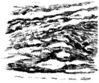 Slickenside |
These two sites illustrate different aspects of the formation of the Stehekin Valley. Slickensides are polished and striated rock surfaces that result from friction along a fault trace. This illuminates the reason that the Stehekin River has formed a valley here: the rocks along this fault have been weakened by the grinding action of the fault zone and are more easily eroded than other rocks. The river flows and erodes its valley along the easiest path. Sculptured rocks, illustrated below, are produced by the erosive action of the river itself. The passage of millions of gallons of water and the grinding of sand and gravel carried by the river polishes and sculpts the under lying bedrock. The fact that these rocks are well above the highest flood stage of the present river demonstrates the continuous downcutting of this powerful river.
| 10 |
Bridge Creek Trailhead Location: 4.8 miles upvalley from High Bridge |
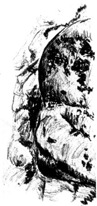 Sculptured Rocks |
Between Shady Camp and Bridge Creek Trailhead, the Stehekin Valley Road ascends sharply then traverses at an even grade well above the roar of the river. The reason for this is apparent from viewpoints on the Goode Ridge Trail. The Stehekin Valley above High Bridge contains broad benches above the river level, remnants of an ancient glacially carved valley floor into which the river has cut an inner gorge.
Standing atop the bench here at Bridge Creek Trailhead, we can see into the uppermost reaches of this mountain valley Spider Glacier, the crevassed hanging glacier clinging to the side of Spider Mountain (8,280' - the highest point seen looking directly upvalley) is typical of the more than 700 glaciers found in the North Cascades. Perched on a precipitous slope, it receives copious amounts of snow each winter. When the snow is compacted by succeeding accumulations into super-dense glacial ice, it flows and slides down the slope under its own weight, endlessly reshaping the mountain.
| 11 |
Cascade Pass Trail Location: Trail begins at the end of the Stehekin Valley Road and continues to the summit of Cascade Pass, where a spur trail leads to the edge of the Sahale Glacier. |
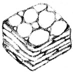 Metaconglomerate |
This popular trail gives access to the headwaters of the Stehekin River and spectacular scenery at the heart of the North Cascades. The head of the Stehekin Valley and Horseshoe Basin are both examples of cirques formed by repeated glaciation. Glaciers are currently sculpting the upper portions. The trail passes outcrops and vistas of many different rock types that tell the story of these mountains.
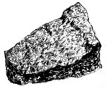 Gneiss |
Outcrops of gneiss near the Horseshoe Basin trail show well-aligned crystals of the dark mineral hornblende. These formed as molten magma welled up into surrounding rock, then slowly cooled. Boulders of metaconglomerate in Pelton Basin show pebbles from an ancient island arc beach, which have been squished by the weight of overlying rock. Sharply chiseled peaks south of the trail are carved from the crystalline roots of an ancient range of oceanic volcanoes. At the edge of the Sahale Glacier a magnificent vista unfolds of wave after wave of wild, rugged mountains at the heart of this geologic wonderland, the North Cascades.
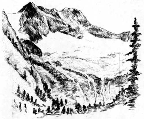
Cirque at Horseshoe Basin
Glossary
Accumulation zone: The part of a glacier in which the amount of snow accumulation exceeds the amount of melting.
Fault zone: A zone of fractured rocks resulting from the movement of the sides of the zone relative to each other and parallel to the fracture.
Island arc: A chain of volcanic islands situated close to a deep sea trench, formed by the collision of two oceanic plates (e.g. Aleutian Islands).
Mantle: The hot zone of the Earth below the crust and above the core.
Metamorphic rock: A changed rock formed by the recrystallization of minerals in an existing rock by heat and pressure.
Plate tectonics: A model of earth surface motion which explains earthquakes, volcanoes, continental drift and seafloor spreading.
Terranes: A group of rocks that appear to have a common geologic history distinct from neighboring rocks.
noca/stehekin-valley-geology/index.htm
Last Updated: 04-May-2001
