|
Saint Croix National Scenic Riverway
Time and the River: A History of the Saint Croix A Historic Resource Study of the Saint Croix National Scenic Riverway |

|
CHAPTER 4:
Up North: The Development of Recreation in the St. Croix Valley
Written with Rachel Franklin Weekley
In 1936, the twenty counties of northwest Wisconsin cooperated in a tourist brochure that promoted the region as "Indian Head Country." The name was derived from the shape of Wisconsin's St. Croix borderland that appeared to the imaginative as the silhouette of a human profile. Pierce County was the chin, St. Croix County the mouth, and Burnett County formed a prominent "Roman" nose. For the tourist boosters the choice of "Indian Head" was obvious. Not only did the large nose suggest the Indian profile on the "Buffalo" nickel then in circulation, the Indian was the symbol of all that was uniquely American. The Indian was a symbol of wild, unrestrained nature. Never for a moment did the tourist promoters think of labeling the twenty county area "Swedish Head," or "Polish Head" country. Such a label was, of course, ludicrous even if it did call to mind some of the people who had devoted their lives to the unsuccessful effort to bring agriculture to the cutover. That history was to too recent, too painful, too prosaic. It would be as untrampled nature — a romantic, even ridiculous impossibility given the history of logging and farming — that the St. Croix region would be sold to the public.
As the St. Croix River began its emergence from wilderness to a developed and settled region, American attitudes towards nature and the wilderness were in a process of transformation. During the colonial era, America was seen, on the one hand, as a land of abundance and a refuge from Old World ills, but its primeval forests were also seen as a hostile wilderness filled with savage beasts and men. While it bestowed bounty on those able to meet its challenges, nature was a harsh taskmaster and it extracted a heavy price from those less fit. What enabled Americans in the first half of the nineteenth century to change their perspective on nature was the industrial revolution. Man became the master of nature instead of its victim. The industrial revolution, however, also scarred and even destroyed nature's beauty and exposed its fragility. At the hands of man nature was no longer to be feared, but cherished. [1]
This appreciation of nature had its roots in the eighteenth century Enlightenment when the natural world was held up as inspiration and a model for social organization. If human society followed the laws of nature instead of the dictates of the artificial, superstitious inequalities stemming from the medieval world of feudalism and traditional religion, it could find peace and harmony. These beliefs found expression through political, economic, social, and artistic channels. But whatever the ultimate aim, nature had to be experienced first hand. In eighteenth century England the term "picturesque" came to describe a natural scene that depicted the beautiful and evoked the sublime. This perspective on nature inspired the popular artistic genre of landscape painting. This glorification of nature continued into the early nineteenth century Romantic Movement with its reaction against the ugliness of the industrial revolution. Nature was not only beautiful, sublime and a guide to social order, but also a source of spiritual renewal for people severed from their rural roots in ugly urban cities.
In the United States the Romantic Movement developed its own unique perspective on nature. The English writer William Gilpin introduced to Americans the practice of rambling about the countryside in search of the beautiful and sublime and made "picturesque travel" a popular recreational pastime. It was trumpeted as a way to exercise both the mind and the body. Gilpin's tours of England's North and Lake Countries were used as models for American expeditions. The sparsely settled American landscape was ripe for "picturesque travel." The unspoiled vistas, mountains, valleys, lakes, and rivers came to be considered America's cathedrals and works of art that rivaled the manmade art treasures of the Old World, and certainly equaled or excelled any scenic wonders in Europe. Americans expanded the definition of the picturesque and applied it to their more rugged and unspoiled wilderness. The American wilderness came to be seen as part of the country's unique heritage and a national treasure, and became the subject matter for the paintings of the Hudson River School, the poetry of Henry Wadsworth Longfellow, the prose of Ralph Waldo Emerson, and the philosophy of Henry David Thoreau. [2]
While the industrial revolution marred nature, it also ironically made nature more possible to enjoy. The invention of the steamboat and the railroad allowed people to experience natural wonders first-hand without forgoing many of the creature comforts of civilization. There they could experience spiritual renewal and regeneration from the more fast-paced and wearisome world of the city. While the wealthy had always been able to escape the city, their motivations had been chiefly to escape the heat, the smell, and the diseases that often plagued urban centers. Their country, mountain, or seashore retreats sought to duplicate the comforts of home, rather than lure them into the world of nature. But increasingly throughout the nineteenth century the wealthy were joined in these rural retreats by the expanding middle class who turned to the world of nature for health, recreation, and social activity.
This cultural context shaped the way late eighteenth and early nineteenth century white explorers and settlers perceived the St. Croix River Valley when they first ventured there. Its distinctive geographic formations, such as the "Old Man of the Dalles," provided explorers with navigation references, but also drew them into the unique splendors of the river valley. George Nelson, the Canadian fur trader who wintered in the valley in 1802-3, noted in his diary:
Whenever this country becomes settled how delightfully will the inhabitants pass their time. There is no place perhaps on this globe where nature has displayed & diversified lands & water as here. I have always felt as if invited to settle down & admire the beautiful views with a sort of joyful thankfulness for having been led to them. There is nothing romantic about them, frightful rock, & wild & dashing water falls. Nature is here calm, placid & serene, as if telling man, in language mute, indeed, -- not addressed to the Ears, but to heart & Soul: It is here man is to be happy: a genial & healthy climate — the rigour [sic] of winter scarcely three months, & in that time no very severe cold: I have diversified the land with hundreds of beautiful lakes all communicating with each other by equally beautiful streams, full of excellent fish, & ducks of twenty Species, Swans, & geese with abundance of rice for you & them. The borders well furnished with grapes, plums, thorn apples & butternut &c, &c. The Woods Swarming with Dears [sic] & bears & beavers: not one noxious or venomous animal insect or reptile: come my children, come & settle in this beautiful country I have prepared for you, & be happy. [3]
Nelson's paean to the Upper St. Croix Country was most likely added to his diary many years after his winter in the valley. It reflects the power of a picturesque landscape to overcome the realities of Nelson's last days on the river: cold, wet spring weather, rapids, portages, mosquitoes swarming, and king fear of a Dakota attack. Romanticism was necessary to transform a a truly wild landscape into a picturesque retreat and the mastery that came with technology and private property made possible the evolution of the Upper St. Croix from a battleground between the Chippewa and Dakota to the white man's "Indian Head" Country vacation destination.

Figure 29. The "sublime" and romantic Dalles of the St.
Croix was captured in this 1848 oil painting by Henry Lewis. Titled the
"Gorge of the St. Croix" the painting helped to promote the St. Croix as
an ante-bellum tourist destination.
Tourism in the Ante-bellum Years
Although it was the glowing accounts of the St. Croix's abundant natural resources that enticed the first permanent settlers to the region, tourists also began venturing into the St. Croix Valley to enjoy its natural splendors in the first half of the nineteenth century. "It was the Mississippi and its steamboats that inaugurated the trade and spread the fame of Minnesota as a vacation land," wrote historian Theodore C. Blegen, "promising to the enterprising tourist the adventure of a journey to a remote frontier coupled with the enjoyment of picturesque scenery and of good fishing and hunting." The first steamboat tourist to Minnesota was an Italian named Giacomo Beltrami who made the trip in 1823. He found the scenery and towering bluffs comparable to the beauty of the Rhine River. [4]
When Henry Schoolcraft documented the St. Croix River in 1832 for the U.S. Government, the river truly joined the ranks of the picturesque rivers of the world. "Its banks are high and afford a series of picturesque views," he wrote. In 1837, Joseph N. Nicollet, a French expatriate, followed Schoolcraft's path exploring and mapping the Northwest Territories. He, too, was struck by Lake St. Croix's beauty. "The shores are rugged and steep, interrupted by lovely, sheltering coves," he related. "The shallows are plentiful. It is indeed a picturesque river." [5]
The first person, however, to recommend the Upper Mississippi Valley to tourists was George Catlin, a self-trained artist from Philadelphia. Catlin's ambition was to visually record North American Indians in their natural environment before they "vanished." In 1835 and 1836, he ventured into the Old Northwest Territory to record the Sioux Indians. Catlin was so enamored by the country that he encouraged a "Fashionable Tour" of a steamboat trip from St. Louis to the Falls of St. Anthony. He wrote:
This Tour would comprehend but a small part of the great, "Far West;" but it will furnish to the traveler a fair sample, and being a part of it which is now made so easily accessible to the world, and the only part of it to which ladies can have access, I would recommend to all who have time and inclination to devote to the enjoyment of so splendid a Tour, to wait not, but make it while the subject is new, and capable of producing the greatest degree of pleasure. [6]
Many adventuresome travelers responded to Catlin's recommendation and began to take fashionable tours of the Upper Mississippi River. In 1837, the widow of Alexander Hamilton, Elizabeth Schuyler Hamilton, took the tour to Fort Snelling from the Falls of St. Anthony. She, of course, was given a royal welcome by the soldiers at the fort. When she returned to the East, she gave her stamp of approval for the "Fashionable Tour." It was, however, more the artists of the period who painted the Upper Mississippi Valley that enticed crowds to come here. In 1839, John Rowson Smith and John Risley painted a panorama of the Upper Valley, with which they then toured the country. The panorama was invented in England by Robert Barker in the latter half of the eighteenth century. There were several huge canvases done of landscapes. To transport them the canvases were rolled up into scrolls. These scrolls were then presented to the public by unrolling them in order one at a time or by displaying them in their entirety as a cyclorama. In the summer of 1848 Henry Lewis painted a panorama of the Mississippi between St. Louis and Fort Snelling that included scenes of the St. Croix. Lewis's painting "Gorge of the St. Croix," the first steamboat landing in the Dalles, and "Cheever's Mill," the beginnings of St. Croix Falls, were twelve feet high and twelve hundred yards long. His completed work of the Mississippi from the Falls of St. Anthony to New Orleans took up 45,000 square feet of canvas. Within a decade at least eight to ten panoramas of the Upper Mississippi toured the country. [7]
Honeymooning couples, small parties, and even groups of a hundred or more, soon made traveling the Upper Mississippi River a popular pastime. Some even chartered their own boats to avoid the immigrant throngs and freight stops common on the usual steamboat runs up river. Tourists came from as far south as New Orleans, and when rail service reached the Mississippi from Chicago, Pittsburgh, New York, Boston, and even Europe. Artists and writers found the region inspiring and prominent politicians and journalists, such as Millard Fillmore and Thurlow Weed of New York, as well as other dignitaries made the Upper Mississippi an important stop on their travel itineraries. River towns made them feel like honored guests by welcoming them with gala receptions. It was the rare exception for a traveler up the Mississippi not to be struck by the beauty and grandeur of the scenery both by day and night, and to be fascinated by the first-hand glimpse of Indians in their traditional life. [8] "Indian Watching" was a unique attraction of a trip up the Upper Mississippi and St. Croix River and could be done in "safety." A Dubuque newspaper advertised the trip as a "convenient and certain" way to watch Indians living in their native world. [9]
During the summer of 1849, the travel writer Ephraim S. Seymour of New York State made his "Fashionable Steamboat Tour" of the Upper Mississippi River. He followed the usual path of tourists by starting in St. Louis. He made a stop in Galena and then traveled up river to Fort Snelling and the Falls of St. Anthony. Unlike other tourists who stayed on the Mississippi, Seymour ventured into the St. Croix Valley and set about collecting information on Indians and lumbering as well as describing in detail the scenery from the Willow River to St. Croix Falls. In 1850, he published Sketches of Minnesota, the New England of the West, which introduced the scenic splendor of St. Croix Valley to the American reading public. Seymour was also the first to promote the healthful benefits of the climate from ills such as ague, which plagued more southern climes, as well as consumption. In his book, Seymour related an encounter he had with an old friend from Galena whose health had been impaired by repeated attacks of cholera. The friend hoped a trip up river to Minnesota might restore his health. "A few days spent in sporting and fishing among the brooks, rivers, and lakes of this bracing climate," Seymour proclaimed, "had rendered him quite robust and healthy." And he advised that, "Such excursions might be recommended to many invalids, as far superior to quack medicines and expensive nostrums." [10]
During the 1840s northerners began to lure southerners away from the lower latitude resorts that they had patronized, such as the Virginia Springs and the Harrodsburg Springs of Kentucky. Some venturesome southern residents had also escaped from the oppressive heat of the South into the Hudson Valley and Niagara Falls. In 1842, Daniel Drake wrote The Northern Lakes: A Summer Resort for Invalids of the South that encouraged southerners to explore the Great Lakes region aboard ship. Drake claimed that by coming north of the 44 degree line of latitude one could escape "the region of miasms, musquitos (sic), congestive fevers, liver diseases, jaundice, cholera morbus, dyspepsia, blue devil and duns!" The gentle rolling of the boat and cool lake breezes, he claimed, could cure hysteria and even hypochondraism. But before the era of widespread rail linkups, the Great Lakes were not easily accessible to those in the South. However, the Upper Mississippi River's "Fashionable Tour" was an attractive alternative with all the same healthful benefits. [11]
By the 1850s, the St. Croix attracted its share of travel writers and artists. In 1852, Edward Sullivan published Rambles and Scrambles in North and South America that described his adventurous canoe trip down the Brule and St. Croix Rivers. And in 1853, Elizabeth F. Ellet traveled up the St. Croix in the comfort of a side-wheeler steamboat with thirty staterooms to "explore" the frontier. Her explorations resulted in the travelogue, Summer Rambles in the West, which eloquently described in picturesque terminology the scenery of the Dalles and the Lower St. Croix Valley. She wrote of the Dalles:
Within a short distance of the termination of our voyage, a scene presented itself which nothing on the Upper Mississippi can parallel. The stream enters a wild, narrow gorge, so deep and dark, that the declining sun is quite shut out; perpendicular walls of traprock, scarlet and chocolate-colored, and gray with the mass of centuries, rising from the water, are piled in savage grandeur on either side, to a height of from one hundred to two hundred feet above our heads, their craggy summits thinly covered with tall cedars and pines, which stand upright at intervals on their sides, adding to the wild and picturesque effect; the river hemmed in and overhung by the rocky masses, rushes impetuously downward, and roars in the caverns and its worn by the action of the chafed waters. These sheer and awful precipices, mirrored in the waters, are here broken into massive fragments, there stand in architectural regularity, like vast columns reared by art; or some gigantic buttress uplifts itself in front of the cliffs, like a ruined tower of primeval days. [12]
Through the 1850s and into the 1880s, the St. Croix attracted local artists well versed in the picturesque. Robert Sweeny was a St. Paul pharmacist turned artist. In 1858, the Minnesota Historical Society commissioned him to paint flowers, plants, and Indian artifacts. He then turned his attention to the St. Croix and painted in a documentary-like fashion the lumber mill sloughs at St. Croix Falls, the wood arch bridge over the river at Taylors Falls, and Indians coming ashore on Lake St. Croix, and the Dalles. His paintings and sketches depict the picturesque qualities of the wilderness. Augustus O. Moore followed Sweeny. His sketches aimed to show that in the St. Croix Valley man and nature could live harmoniously. Another artist of the St. Croix was Elijah E. Edwards who was principal of the Chisago Seminary, as well as clergyman, professor, and writer. Many of his painting and sketches were of the Dalles with an eye for light and romantic views, but they also included sketches of the other rivers and water falls in the valley. Many of these paintings and sketches can by found in the Minnesota Historical Society collection. [13] While these artists recorded and interpreted the St. Croix River, their influence only extended to the local region in attracting visitors.
By the mid-nineteenth century many towns along the river, such as Prescott, Hudson, Stillwater, Osceola, and Taylors Falls provided hotel accommodations for both new settlers and some venturesome tourists. Tourism in the St. Croix Valley got a boost from the Twin Cities when John P. Owens, the editor of the St. Paul Minnesotan, took an excursion on the steamboat, Humbolt, in 1853. "The little Humbolt is a great accommodation to the people of the St. Croix," he wrote. "She stops anywhere along the river to do any and all kinds of business that may offer, and will give passengers a longer ride, so far as time is concerned, for a dollar, than any other craft we ever traveled upon." The boat graciously stopped at Marine Mills to allow its hungry travelers to lunch at the Marine House. Owen also stopped in Taylors Falls and made an assessment of this town's accommodations. "This Chisago House, is better furnished, and as well kept — barring the inconvenience of having no meat and vegetable market at hand — as any house in St. Paul, St. Anthony, or Stillwater," he wrote. "We never hated to leave a place so much in our life, when absent from home." [14]
By the mid-1850s, the St. Croix Valley had a good introduction to the traveling public. Minnesota, however, courted tourists more aggressively to its "Land of Ten Thousand Lakes" than did Wisconsin. Therefore, the valley remained off the beaten path for most tourists. As early as the 1850s Minnesota was determined to create recreational retreats that could rival eastern resorts, such as Saratoga Springs in New York State. Many hoped it would become the playground of the wealthy. Minnesota historian Theodore Blegen has written that tourism in Minnesota began with the establishment of journalism in the territory. "Every newspaper was a tourist bureau," he claimed. James M. Goodhue, the editor of the Minnesota Pioneer, was a leading booster of the recreational attractions of the territory. He made appeals to residents all along the Mississippi to escape the epidemics of cholera and malaria that plague southern climes for the healthy air and cool breezes of the North Country. "'Hurry along through the valley of the Mississippi, its shores studded with towns. . .flying by islands, prairies, woodlands, bluffs — an ever varied scene of beauty, away up into the land of the wild Dakota, and of cascades and pine forests, and cooling breezes.'" [15] John W. Bond, the premiere pamphlet promoter for Minnesota, wrote in 1853 "we have springs equal to any in the world." Rather than lure easterners, however, the ease of travel up the Mississippi made the target audience southerners. "Gentlemen residing in New Orleans can come here by a quick and delightful conveyance," Bond explained, "and bring all that is necessary to make their living comfortable in the summer months, and a trifling expense. For a small sum of money they can purchase a few acres of land on the river and build summer cottages." Bond intended to promote the Falls of St. Anthony, which he believed would "rank with Saratoga, Newport, and the White Mountains in New Hampshire. [16] In 1854, Earl S. Goodrich, the editor of the St. Paul Pioneer, beckoned southerners to the cooler, more refreshing northern retreats with biblical allusions. "Miserable sun-burned denizens of the torrid zone," he wrote, "come to Minnesota all ye that are roasting and heavy laden and we will give you rest." [17]
Travel writing, art, and real estate promotion all blended together in the effort to highlight Minnesota. By the late 1850s, Minnesota's beautiful lakes and streams were painted by Edwin Whitefield. Whitefield had also done landscapes and residences in the Hudson River Valley and the Mississippi River. By 1856, his travels brought him to St. Paul. As an artist and newly established land speculator, Whitefield captured the beauty and promoted Minnesota lakes and land through his paintings. Within the next few decades many tourists left the fashionable river tours and explored a Minnesota where ghosts of Indians and explorers still lingered. [18]
Despite its scenic beauty, however, the St. Croix was primarily a working river. The only means of travel was by steamboat, and what boats plied its waters were not luxury crafts, but packets and freight boats carrying supplies, livestock, export items, and pioneer settlers. The St. Croix Boom north of Stillwater also hindered the free flow of river traffic, as did the seemingly endless stream of logs floating down river. By summer's end the log run was finished, but the warmer, drier season lowered the water levels and exposed sandbars and narrower channels making excursions more difficult, but not impossible. In August 1859, an excursion steamer disembarked from Stillwater with thirty-five to forty citizens aboard. The Kate picked up more passengers at Marine and Osceola bringing its number to nearly a hundred. For the occasion, the boat was decorated with banners and evergreens. Although it left early in the day, the steamer did not reach the Dalles until the following morning due to "unavoidable detentions on account of the low stage of the water and heavy freight," and was hung up on bars. Apparently the passengers were not very put out by the long trip as the delay was "amply atoned for, in the privilege of passing through the "Dell' just as the sun was peeping over the mountains and dispelling the most beautiful mist and spray from that most beautiful and romantic spot." [19]
Despite the problems for travel on the St. Croix, the towns along the water still enthusiastically planned for and promoted their attractions, hoping to cash in on tourists venturing into the Old Northwest. In 1857, the four-story Sawyer House was built in Stillwater. It was considered the largest and finest hotel in the Minnesota Territory. Its "spacious rooms for social events made it one of the outstanding hostelries in the development of Minnesota." [20] Summer cottages were planned for the shores of Lake St. Croix. "The day is not far distant," claimed The Messenger, "when nice cottages. . .will reflect their white and dancing shadows from the bosom of Lake St. Croix." In June 1857, the St. Paul Advertiser gave Marine a boost claiming, "to the invalid, the pleasure seeker, as well as the sportsman, no place affords more ample inducements for sojourn and recreation." [21] In 1859, Stillwater welcomed regional visitors to its Fourth of July festivities. The steamer Itasca brought visitors from St. Paul and other stops along the Mississippi. The passengers enjoyed the annual parade, a German Singing Society, and tumblers from the Turner Society. After a cold supper in the armory, the visitors enjoyed a ball at the Sawyer House until the whistle from the boat summoned them for their late night journey home. [22]
Slavery and the Civil War put a damper on tourism in the late 1850s and early 1860s. While outright abolitionism was not much of a force in Wisconsin or Minnesota, "Free Soil, Free Labor, and Free Men" was. In the summer of 1860, a Mississippi slave owner vacationing at the popular Winslow House in St. Anthony brought along a slave woman named Eliza Winston. Winston had apparently been promised her freedom, and once on free soil she gained the support of an abolitionist and petitioned the Minnesota court for her release from bondage. The court sided with her and granted her request with no challenge from her master. Anti-abolitionist sentiment, however, had been aroused whereby a mob proposed to send Winston back to her master and tar-and-feather the abolitionist who aided her. The Undergrounded Railroad whisked her to Canada and the matter was legally ended. Hotel owners, however, feared the loss of southern tourists' patronage if they risked losing their slaves if they brought them along. The Stillwater Democrat warned that the "'intermeddling propensities of Abolition fanatics' would keep nearly a hundred of wealthy Southerners and the Negro servants from spending the summer along the shores of Lake St. Croix." But by the next spring the war had started and southern visitors stopped coming. [23]
While the Civil War brought a halt to the tourist trade, the local population found the river a delightful break from their daily toils. For many pioneers, a steamboat trip along the St. Croix was their first opportunity to view the panorama of the valley. "This was our first visit to the Upper St. Croix," wrote a member of an excursion party in 1859, "and we must admit that all our pre-conceived ideas of the beauty and grandeur of the Valley, fell far below the reality. To those fond of the wild and beautiful in Nature, we know of no place, East or West, where such a taste can be more fully gratified than in the vicinity of Taylor's Falls." [24] In August 1856, the editor of the Prescott Transcript rounded up a party to take a steamboat excursion trip up to Taylors Falls. "The weather was delightful," he reported, "the boat [was] provided by Capt. Martin and his obliging assistants with every possible accommodation, and all were in fine spirits. . .The scenery along the lake and river was observed with a pleasant interest by the party, to the most of whom it was new." The group was also intrigued "by the antics of some forty or fifty thousand big sturgeon that gave us a grand fancy dance around the boat as we passed along. . .They present one of the most interesting piscatory sights imaginable." [25] The abundance of game along the river not only provided sustenance for the first pioneers, but also supplied the sportsman with a wide variety of birds, animals, and fish. From its earliest days of settlement sportsmen were also attracted to the St. Croix Valley. In his 1849 book, Sketches of Minnesota, Seymour wrote to his nationwide audience that the lower St. Croix Valley was "a fine country for sportsmen. . .Deer are killed here in great numbers. . .The bear and the large gray wolf are often seen. Wild geese and ducks resort here in great numbers...The best trout fishing in the northwest is said to be on the Rush River. They are caught in immense quantities, not only with hooks, but also with scoop-nets." Seymour also noted that the St. Croix had groves of trees "alive with pigeons, which were constantly rising from the ground in large flocks." The birds he referred to are the now extinct passenger pigeons that once crowded midwestern skies in the nineteenth century. [26] "The country surrounding our city is filled with game," boasted the St. Croix Union in 1854. "Not infrequently do we hear a sportsman relate the experience of deer shooting. . .or what sport they had in ‘bagging' a drove of prairie chickens. Deer are so plentiful. . .Our hunters have become so well acquainted with the habits of this animal and so adept in the use of the rifle that it is a matter of no common occurrence to find their tables well supplied with venison. . .We have a great many streams filled with [trout], and it is fine sport for those who are disposed to engage in it." [27]
One unusual method to hunt deer was created by a Dutch hunter named Otto Neitge. In 1853, Neitge bought land in what is now Deer Park. Within five years he built a trap to catch deer with an eleven-foot palisade of posts. Deer could jump in but they could not get back out. Once a herd of one hundred became trapped inside the park, Neitge shot and slaughtered the annual increase, which he then sold in St. Paul and to Fort Snelling. Neitge also tried to do the same with bears, but they proved too troublesome. In 1874, the North Wisconsin railroad passed through Deer Park, and many people discovered Neitge's deer hunting secret. He developed a reputation as "a low, cowardly" sportsman who "shot, from between the poles of the stockade, many of the captive deer." This prompted Neitge to abandon this form of hunting, but his park lives on as a village name. [28]
In the 1850s, between Marine and Taylors Falls was an area valley residents called in the 1850s the "bear hunting ground." The innkeeper at the Marine Mills Hotel loved to serve this local delicacy to his visitors. From time to time a "General Bear Hunt" was organized out of Prescott for a two-day excursion for "all who desire to share in the sport." An amateur poet from Hudson enticed hunters with the following:
Come on then, ye sportsmen with high boots, rifle and blanket, and I will shortly conduct you to the forests where my forefathers, as they chased the swift elk and the huge black bear, would proudly exclaim,
No pent-up willow huts contain our powers,
But the unbounded wilderness is ours. [29]
Since winters were so cold and long, many hearty souls took to winter sports. In the winter of 1863, the Stillwater Messenger announced, "Members of the Skating Club and all others are invited to call and examine our stock of skates, skating caps, hoods, nubias, sontags, balmoral skirts, balmoral shoes, gloves, mitts, &c." [30] A year later the paper reported, "The warm days and cool nights we have had lately have made the skating good upon the lake, and large crowds are enjoying the sport during this pleasant weather." [31] Springtime brought out the baseball enthusiasts of the St. Croix Baseball Club. [32]
When the war was over, the St. Croix Valley returned to the national scene. Famed journalist Horace Greeley visited the St. Croix Valley in 1865. He was not only impressed by its wheat production, but also by its healthy climate, and recommended the area for those plagued by ague and chronic coughs. The Stillwater Messenger quickly echoed these sentiments. The paper even joined in the exaggerations that often accompanied the literature written about the health benefits of the area. "Pine emits an odor peculiarly healing and highly beneficial for invalids, hence it is no uncommon thing for small parties to take up their quarters in the wilderness, and spend the winter there with numerous gangs of lumbermen." [33] Consumption suffers, in particular could find relief in the pineries of the upper St. Croix. A poem was even written about the health-giving pine trees:
For health comes sparkling in the stream
From Namekagon stealing;
There's iron in our northern winds,
Our pines are trees of healing. [34]
Health seekers from the South and East were also enticed back to the region after the war by handbooks, such as Tourists' and Invalids' Complete Guide and Epitome of Travel. [35] By the end of the 1870s southerners began to come to the St. Croix again in noticeable numbers. "Capt. Jack Reaney came up on the steamer Knapp Tuesday, and has been rusticating in the upper St. Croix Valley for a few days," wrote the Burnett County Sentinel. He informs us that the tourists from the south are coming up in large numbers, and many of them find their way to the St. Croix river." [36]
By the 1860s, a new medium was developed that was able to portray the unique scenery of the St. Croix to a wider audience -- the stereograph. Between the 1860s and 1880s making and selling stereographs of the St. Croix became a profitable business. The most noted photographers of the St. Croix in this period were William Illingworth, Charles A. Zimmerman, William Jacoby, and Benjamin Upton, and Joel E. Whitney. Whitney was the first major commercial photographer in Minnesota. While he began his business taking daguerreotypes of people, in the 1850s he brought his camera along on a twenty-five mile hike around St. Paul and St. Anthony taking eighty landscape pictures. By the 1860s, the demand for landscape photographs became the "bread and butter" of commercial photographers, and the St. Croix Valley was included in the search for these picturesque and sublime pictures. [37]
In 1875, John P. Doremus of Patterson, New Jersey began photographing the river as part of a "floating gallery" on a boat that was "a little palace itself." "He started out from St. Anthony over a year ago," related the Lumberman, "with the intention of taking views along the Mississippi and its tributaries down to New Orleans." The paper expressed appreciation for his carefully considered photos. "He takes it leisurely and does his work in fine shape, the views he has of the St. Croix being the best we have ever seen." The charms of the St. Croix were now visually documented to attract more tourists looking to escape the oppressive heat, humidity, and illness of the lower Mississippi. [38] The St. Croix Valley's fame spread further when in 1885 Eastman's roll film was developed. In 1900, Kodak's Brownie camera made photography easier and cheaper for visitors to the St. Croix to share their experiences with friends back home. [39]

Figure 30. Steamboats provided tourists with easy access
to the Upper Mississippi Valley and allowed tourism to begin as early as
the 1830s and 1840s.
Railroads Promote Tourism and the Resort Industry
While the visual fame of the St. Croix Valley spread throughout the latter half of the nineteenth century, the tourist business on the St. Croix River took off in the 1870s ironically with the arrival of the railroad. Unfortunately train travel ended the "Fashionable Tour" by steamboat up the Mississippi. Taking a steamboat for other than a day trip came to be seen as "old fogyish." Steamboat day trips, however, remained the most attractive and unique tourist attraction in the St. Croix Valley. Boat owners realized early on they could enhance their profits by offering not only regular transportation for residents and newcomers, but also offer pleasure excursions. Inexpensive fares encouraged the locals to take advantage of the opportunity for a day trip into the beauty of their river valley.
With connections to St. Paul, Milwaukee, and Chicago local steamboats enjoyed a fairly steady stream of passengers. The trains brought visitors to the steamboat landings; and after a trip upriver from Hudson or Stillwater to Taylors Falls, tourists made the return trip by train when railroad connections were made in 1880. Stillwater's Cornet Band added to the gaiety of these outings. Steamboat owners also made moonlight cruises available for the more romantically inclined. Excursions provided church, social, and work groups trips with a more relaxed form of social interchange. For example, in June 1875 firemen from Red Wing, "accompanied by their ladies" boarded the steamer James Means for a trip up to the Dalles. Not only did they enjoy the scenery, but joined the Stillwater fire department in some social recreation. "In the evening the boat laid at the levee several hours," related the Stillwater Lumberman, "and allowed the firemen an opportunity to be entertained by the chief and members of the Stillwater department." [40]
Those who chose to stay in "the charmingly old-fashioned" town of Taylors Falls found comfortable accommodations at the local hotel. There they were "gladly welcomed and hospitably entertained." The president of the town council, L.K. Stannard, gave welcome addresses to St. Paul excursionists. Others found lodging in towns down river before they began their return home by rail. [41]
In 1877, the St. Louis, Minneapolis & St. Paul Short Line distributed a pamphlet entitled, The Summer Resorts of Minnesota: Information for Invalids, Tourists and Sportsmen. Train travel was promoted as fast and safe as well as being furnished with all the modern and luxurious conveniences. "While the summer resort business in the Northwest may be said to be yet in its incipient stage," related the railroad company, "there is but little more to be desired in railway service than is already furnished by the favorite line known as the 'ST. LOUIS, MINNEAPOLIS & ST. PAUL SHORT LINE.'" They offered reduced fares for anyone who made connections from other cities in the country at St. Louis. "There are but few people who have passed the summer months in Minnesota who will not agree with us in saying that there is no country in the world which offers so much that is pleasant and attractive to the tourist as that included within the boundaries of Minnesota." One of the chief selling points for a vacation in Minnesota was the weather. "The summer breezes that sweep across our wide prairies and through our great forests, bearing the perfume of wild flowers and aromatic pines, are laden with a magical tonic which quickens the pulse, and imparts new vigor to the enfeebled frame," wrote the promoters. "All the surroundings of our rural homes exert an influence for good, and attract the invalid to unwonted exercise in the open air, which creates an appetite for substantial food, and strengthens the digestion." [42]
The railroads also put the towns along the St. Croix on the entertainment circuit. In 1877, Stillwater businessmen persuaded P. T. Barnum to bring his circus to town. Other circuses followed such as the PA. Older's Museum, Circus, and Menagerie, and the W.W. Coles' Great New York and New Orleans Circus, Menagerie, Museum, and Congress of Living Wonders. Wealthy lumbermen also courted popular entertainers of the nineteenth century, such as Jenny Lind, Ole Bull, Adeline Patti, as well as the culturally influential Chautauqua Meetings. [43]
New guidebooks catered to this new class of travelers. They continued to stress many of the same themes of the earlier period. "Romantic beauty, historical incidents and legendary lore contributed towards making the Valley of the St. Croix River not only very interesting to the tourist," wrote guidebook author William Dunne, "but exceedingly valuable to students of either events or nature. Here within an hour's ride of the two leading cities of Minnesota, is a miniature Hudson, excelling, in some features, that famous river of the East. Along its shores fierce Indian battles have been fought, and its fertile, picturesque valley contains attractive cascades and waterfalls that rival the renowned ‘Falls of Minnehaha.'" Throughout the guide, Dunne recounted the basic history of the St. Croix Valley of Indians, explorers, missionaries, fur traders, lumbermen, and settlers to stir the imagination and conjure ghosts of yesteryear. "We traveled past battle grounds and fishing nooks, past the old home of the deer and the moose, past where Poor Lo held full sway but a generation ago and we had enjoyed the day." Interestingly, once they were pushed aside, Indians were portrayed as romantic and exotic creatures rather than threatening savages. [44]
The guidebook also contained poetic descriptions of the landscape. "The sunlight stole through the embowering trees of the glen just enough to brighten into sparkling crystals the falling waters of Osceola Creek," wrote Dunne, ". . .a very beautiful gem of nature." Of the Dalles he wrote, "Shadows from jutting rocks and tall trees fall upon the water in strange contrast with the sun-brightened portions where the tree-topped rock walls of the Dalles are distinctly reflected in the seemingly quiet stream, yet, of quietness, ‘tis but the semblance born far below the glassy surface. Between these two walls the river flows and eddies with depth and force." His description of Devil's Chair was especially evocative, "From a height of eighty feet his Satanic Majesty could view the whole extent of the beautiful landscape. Upon the footstool of his chair he could rest his weary feet or stand and address his kindred spirits of the Northwest during his councils with them." Dunne tempted the adventurous spirit of his readers with the suggestion that there were still the possibilities of new sights to discover. "In the attractive glens and curious ravines along the sides of the St. Croix there are yet to be found cascades and other scenic beauties that will, in the near future be noticed and highly appreciated." [45]
One notable side attraction a mile and a half from Stillwater was Fairy Falls, "a quiet but pretty work of nature." In 1880, William Dunne described the descent of the falls. "The water, coursing along to the shelving ledge of rocks, dashed down, in an almost unbroken stream, to its bed below." Locals enjoyed it as a popular picnic spot. [46]
While trains brought visitors to the St. Croix, they also made it possible for tourists to venture away from the river. Many discovered the charm and beauty of the Chisago Lakes region on their return trip by train from Taylors Falls. Dunne noted, "The excursionists were pleasantly surprised to see such delightful scenery in the Chisago lake region, through which they passed." [47] The advantage of the lakes over the river was that they could be enjoyed throughout the summer, free from the sights and sounds of logs and crude lumbermen on the river. Although many Swedish immigrants farmed the area, the lakes themselves remained sparsely populated throughout the nineteenth century even though the banks were largely prairie. After 1868 when the St. Paul-Duluth railroad skirted the western portion of Chisago County, towns such as Center City, Lindstrom, Forest Lake in Washington County, and St. Elmo Lake, became summer meccas for vacationers from the Twin Cities. Trains made frequent stops at Forest Lake to refuel thus making it easy for visitors to attend to business in the city and return to the rejuvenating lakes region with regularity. Railroads were not just anxious to promote the resort industry. They also hoped people would decide to buy a permanent house along the route. Before there were any permanent structures, early lake visitors pitched tents. When a certain area proved its popularity, enterprising businessmen started to build resorts. Forest Lake, for instance, became a resort city complete with prominent hotels, such as the Marsh and the Euclid. Yet, tents remained popular among the less well to do. Tents also made it possible for large parties of friends, church groups, social clubs, or businessmen to enjoy the great outdoors together without the expenses incurred in resorts and hotels. [48]
Lake Elmo also emerged by the late 1870s as a premiere vacation spot. It was halfway between St. Paul and Stillwater and was promoted by the St. Paul and Sioux City railroad. Many of St. Paul's fashionable class enjoyed boating, picnicking, and dancing under the stars. [49] Dunne's guidebook described Lake Elmo as "A handsomely situated body of water, such a delightful place as we would expect to find in the undulating wooded district. . .Its rustic seats and shaded walks, its neat pavilions, its boating and fishing make it a popular excursion resort for societies and schools." Elmo Lodge was equipped with "every modern accommodation and in the highest sense ‘cares for' its guests." Its "up to the times" comforts attracted repeat guests. [50]
White Bear Lake north of the Twin Cities and equidistant from Stillwater attracted those cities' elites. Vacationers started coming to the lake as soon as a road was built in the early 1850s from St. Paul. These seekers after refreshing summer breezes arrived by horse or carriage in just two hours. In 1857, an elegant Greek revival hotel was built to accommodate the fashionable, and less pretentious lodges housed more modest clientele. By the Civil War White Bear Lake, straddling Washington and Ramsey Counties, was a popular resort welcoming holiday and weekend pleasure-seekers and sportsmen. Once the railroad came after the war, the twenty-minute train ride turned White Bear Lake into a summer home retreat. It is "one of the brightest gems in the circle of lakes surrounding St. Paul and Minneapolis," wrote the St.L, Minn. & St.P. promotional pamphlet. "White Bear is the oldest summer resort in the State, and consequently, is far advanced in many of the conveniences required by fashionable people who do not care to indulge in the wild and sometimes inconvenient modes of life found at our less developed watering places." [51] Even Mark Twain wrote about White Bear Lake in his Life on the Mississippi. "There are a dozen minor summer resorts around about St. Paul and Minneapolis," Twain related, "but White Bear Lake is the resort." [52] It possessed " the largest fleet of sail boats and yachts to be found in Minnesota," wrote Dunne. "On the evenings of the "Regatta" and ‘open air' concerts, White Bear Lake assumes the appearance of a gala night at Manhattan Beach, more than of what is generally expected at a suburban summer resort." [53] By 1885, Northwest Magazine enthusiastically endorsed White Bear Lake as a resort area. "White Bear has pavilions, club houses and pleasure boats galore. But it has never become noisy and Coney-Islandised," the magazine noted. "It remains today a place for rest and pleasure rather than rioting and boisterous sports. It is fashionable without being fashion-ridden; popular and populous without being crowded." [54]
In 1884, the resort industry reached Lindstrom when Ida Van Horn Elstrom opened her Lake View House on the peninsula between the two Lindstrom lakes. Trains deposited guests at the nearby train station. When Miss Elstrom married John W. Nelson, the newlyweds changed the name to the Lake View Hotel. When the hotel burned down in 1900, the couple opened the Villa Cape Horn resort on the lakefront west of their old establishment complete with a dancing pavilion. The resort thrived well into the 1920s.
After the Nelson's success, other resorts began to appear on the local lakes. Besides the usual resort businesses, the Chisago Lakes area also attracted nonprofit camps. In 1906, the Minneapolis YMCA opened Camp Icaghowan on the eastern shore of Green Lake near Chisago City. The name of the camp derived from a Chippewa expression that meant "growing in every way." It was an apt phrase for a camp dedicated to providing disadvantaged urban boys with a week or two of summer fun. The cost was a dollar a day. Charitable Minneapolis businessmen picked up the cost. Camp Icaghowan won a special place in the hearts of the boys who summered there. The original camp lasted until World War II. After the war, the men who spent their youth there, built a new Camp Icaghowan on the Wisconsin side of the St. Croix near Amery. [55]
By 1880, fishermen and campers had made the Chisago Lakes a well-established sportsmen's locale. "Camping out at the numerous lakes with which Stillwater is surrounded is a growing practice with our citizens," noted the Stillwater Lumberman. "The practice is a good one. It is not expensive, and as a means of promoting health none better will be found. . .There are no fashionable calls to make or receive, no elaborate dressing for company. Everything is free and unrestrained. The male members of the family usually go out on the evening train or drive out. . .until the morning calls them back to business." [56]
The typical resort of this period in the north woods catered to the patterns of social interaction of the elite. They operated on what was called the "American Plan" in a largely self-contained world. There was a main lodge, where all meals and social activities took place. Lodges were usually constructed of local materials, such as logs, with a large field stone fireplace as a centerpiece. Guests slept in simple cottages. Maintenance buildings, barns, an icehouse, a small farm, and a boathouse supplied all the basic necessities to run the resort. [57] The single, family-owned cottage did not generally start to appear on the lakes until the turn of the century.
The well-advertised Minnesota resorts may also have siphoned off many potential long-term visitors to the St. Croix Valley. The St. Croix was advertised to Twin City residents as simply a day trip. "In the brief period of a single day," wrote a railroad advertisement, "the appreciative ‘sight seer' can here enjoy a variety of scenery, perhaps unequaled in America — if the world." [58] Although praising the wonders of the St. Croix River, the St. Louis, Minneapolis, and St. Paul Short Line promotional pamphlet noted that fact that the St. Croix was a working river. In 1869, 270 steamboats plied the river between Prescott and Taylors Falls. The logging companies, especially, increased the number of boats on the river. In 1878, they employed eight steamboats for rafting and towing, in 1882 there were seventy-seven, and by 1891 that number increased to 130. "Ever present among the islands and along the low shores for several miles. . .are the evidences of the vast traffic in lumber that is carried on in this valley," the promoters wrote. "The thousands of logs that lie ‘hung up' on the shores, at which gangs of men are laboring, tugging and rolling, to get them afloat in the river: the miles of booms, the vast number of piles that are driven to prevent the logs from stranding. . .the dozens of steamers for town. . .and the numbers of men employed, all combine to form an array of business that is not seen in the ordinary routes of travel elsewhere in the west, and probably not in the world." The pamphlet promoted the Upper St. Croix more for sportsmen where outfitters and guides were ready to assist that type of traveler rather than cater to the fashionable. [59]
The St. Croix Valley also faced competition from the growth in recreation to the south. Between 1873 and 1893, southern Wisconsin also experienced its own tourist boom that attracted residents from Chicago and other southern climes. In 1869, Colonel Richard Dunbar claimed that the Waukesha mineral spring had cured him of diabetes. Dunbar proceeded to organize the Bethesda Mineral Spring Company that promoted Waukesha as the "Saratoga of the West." The Chicago and Northwestern Railroad serviced the town and soon Waukesha had thirty hotels and dozens of boarding houses that catered to summer visitors. Spas had become so popular during this period with the middle class that nearly every spring bubbling out of a limestone substrata was being promoted as a spa, such as Madison, Beaver Dam, Sparta, Palmyra, Beloit, and Appleton. [60]
The St. Croix Valley did not sit idly by while watching Minnesota and southern Wisconsin develop into resort destinations. In 1873, in anticipation of a boom in tourism Ebenezer Moore embarked on a plan to turn Osceola into the "Saratoga of the West," and invited the public to his St. Croix Mineral Springs. The springs were located two miles south of Osceola near Buttermilk Falls. Moore hoped both tourists and health seekers would flock to its "healing" waters. Before his vision was realized, however, Moore sold his interests in the springs to a partner from Eau Claire. In the spring of 1875 the new owners laid a foundation for a "mammoth hotel" aptly named the Riverside Hotel. "Messrs. Stephens, Williams & Fletcher, the proprietors of this property, are determined to make the springs a popular resort for both invalids and pleasure seekers," wrote the Lumberman. [61] "The location selected for the hotel is a delightful one, overlooking the river and affording a picturesque view of the surrounding country." The dining room seated two hundred guests, and the grounds were complete with a croquet course, a trout pound, a deer park, and a half-mile circular racetrack. A hydraulic pump brought spring water into all parts of the hotel. "It promises to become on the most attractive summer resorts in the Northwest," boasted the Lumberman. This dream, however, never materialized. Although medical men endorsed the healthfulness of the waters, tourists never patronized the hotel. The year 1873 was also one of a financial panic. By the middle of the decade eastern and Midwest railroads experienced labor turmoil. Higher rates and strikes tied up everyone's travel plans and financial hardship reached every part of the country that relied on rail service. In 1885, the under-used hotel burned down. [62] In 1903 another entrepreneur experimented with a health elixir called "Osce-Kola, which was a concoction of spring waters, fruit juices, celery, and cola. The mineral springs, however, did not sell in this version either. [63]
Although tourists from more distant places did not venture so far north or stray from Minnesota's lakes, this did not stop residents along the river from recognizing and enjoying the pleasurable opportunities of the St. Croix. In the mid-1870s Stillwater established a boat club, as did many other towns along the St. Croix and Upper Mississippi. Stillwater's club proved to be a formidable challenger. "The character of the lumber business transacted at Stillwater naturally brings into action the full muscular force of the operatives engaged therein," boasted the Lumberman. "Here we have men who are continuously in the boat and at the oars. . .[who] are required to operate against wind, current, and all contending influences." The Stillwater club was so successful at beating local comers; they decided to challenge the Red Wing team. "The case with which they gained each successive victory emboldened them to believe that they had but to enter their shell and take the money, prize, and championship from any club that might choose to contest their skill." Many excursionists from the area made the trip by steamboat to watch the races. The Red Wing Team, however, resoundingly defeated the Stillwater club. They and their supporters took their defeat in good humor and enjoyed the return river journey home. [64]
St. Paul residents continued to patronize the St. Croix River and the Dalles during the second half of the nineteenth century because it was so close. In June 1877, a group from the Twin Cities arrived in Stillwater "on the natty little steam yacht Lulu. . .and were highly pleased with the romantic scenery of Lake St. Croix." On their way to the Dalles passengers enjoyed "the witty sallies elicited by the demonstrations of the river men, who lustily cheered as we passed them, waving their hats and handkerchiefs, and tossing up their pikes." The yacht also had to maneuver its way among "the great quantity of floating logs in the stream." The Lulu then remained at Taylors Falls where it picked up passengers from the St. Paul train, took them to see the Dalles, and then returned them when the evening train departed for the Twin Cities
One way to pass the time on the long, slow steamboat trips was to shoot geese from the boiler deck, which entertained both passengers and crew. Captain O.F. Knapp, of the steamer Enterprise, first introduced the practice in the mid-1860s. The sport caught on and by the 1870s and 1880s parties chartered steamboats for these hunting expeditions. [65] Southern tourists were especially enamored with this unique form of hunting. "Frequent notice has been made in these columns," wrote the Stillwater Lumberman, "of the rare sport furnished on the St. Croix by hunting geese with a steamboat. The time has now arrived for the full enjoyment of this sport and it is daily being indulged in." The paper provided a colorful description of how the sport was done. "As soon as the boat was headed down the lake a bulkhead was constructed around the forward guards of the lower deck so that the hunters could, if they choose, shoot from that place unobserved. Screens were constructed of blankets and placed around the railing in front on the boiler deck for the same purpose. All these precautions are rendered necessary as a boat cannot get within gun shot if any person's body or head is visible to them." [66]

Figure 31. The Devil's Chair in the Dalles was just one
of the picturesque sites that insured the establishment of the
Interstate Park. From Outing Magazine, March, 1890.
Hunting and Fishing for Sport
Besides geese, "Duck shooting on the St. Croix above Marine [was] the fashionable amusement," wrote the Stillwater Lumberman in 1877. [67] And in 1879 the Burnett County Sentinel noted, "Hunting and fishing parties are the order of the day in this vicinity." [68] "A party of 5 passed through here from Marine enroute for the upper Namekagon fishing and sporting," reported the Sentinel with interest and approval. [69] These comments, of course, imply that game was more than a daily sustenance requirement, but provided variety to the dinner table as well as enjoyment in the pursuit.
By the 1870s, popular sporting magazines, such as American Sportsman (1871), Forest and Stream (1873), Field and Stream (1874), and American Angler (1881), were published to encourage outdoor sports. The writings of their authors were certainly influenced by the Romantic Movement and its attitudes about nature, but they differed from earlier nature writers, who simply appreciated the splendor of the outdoors for its own sake. While the beauty of the scenery was certainly to be enjoyed, this new breed of outdoorsmen approached wildlife in a practical, utilitarian manner. It offered sport and prize catches. Beginning in the 1870s many railroads also organized hunting and fishing excursions. Some even owned their own resorts. [70]
Although the Wisconsin state legislature had established defined hunting seasons in order to protect, game, birds, and fish in 1851, by the 1870s over-hunting and the expansion of settlement made big game scarce in the Lower St. Croix. Conservationist ideas had not quite reached this frontier region. When a rare moose was spotted near Rush City in the fall of 1877, the pursuit was on. The following excerpt from the Stillwater Lumberman provides an insight into the attitudes of residents towards the sport of hunting:
A wild moose was foolish enough to call upon Frank La Suise, at that gentleman's residence. . .introducing himself to Frank's family by peering through the window of their residence. Frank not liking such familiarity, seized his gun and greeted the animal with a charge of buckshot, which caused the moose to take to the water, whence Frank followed in a canoe, blazing away at the "baste" as rapidly as he could load his gun. A broadside from Adam Dopp, who appeared on the scene, blinded the creature, so that Frank was enabled soon to dispatch it with a club. . .It was the means of furnishing a very tender article of fresh meat for our citizen's dinner last Sunday. [71]
By the 1880s, moose had even disappeared in the Upper St. Croix Valley. A killing of one was worthy of note. "A moose was killed near Clam Lake last week," the Burnett County Sentinel remarked with interest. "A very rare animal in these parts." [72] An old time settler reminisced in 1880 that the early days were his "happy days. Game was everywhere." In one fall season he had killed 130 deer, 16 elk, and 3 bears. [73] Clearly such a total exceeded his personal needs and he was engaged in market hunting — an activity that was roundly condemned by "true" sportsmen.
If moose and other big game were no longer plentiful in the north woods, fish, waterfowl, and deer still were. "Hunting and fishing at Bass Lake, Willow river and other noted points near at hand are leading sources of enjoyment" [74] In June of 1877, a fishing party from Hudson set out for the Clam River. They returned, "having caught seven hundred and fifty trout," recorded the Lumberman. [75] By the 1890s the number of fish caught was less important to true sportsmen than the size of the fish. "Last week, a Frenchman caught a sturgeon in the Namekagon river near Phipps, weighing 81 pounds," wrote the Burnett County Sentinel in 1891. "This is said to be the largest fish ever taken out of a stream in this locality." [76]
Unlike moose or other big game that were easily threatened by market hunters and habitat loss, fish stocks were easier to replenish. In 1866, the Wisconsin state legislature appointed a fish inspector. This eventually led to fish stocking in the state's waterways. In 1880, over a million brook trout were put into the streams of Wisconsin. In 1883, the U.S. Fish Commission deposited 250,000 white fish and lake trout eggs into Lake St. Croix. Sawdust that had been dumped in the river and the erosion of the river's banks by logs and upstream deforestation silted up the river and destroyed much of the natural habitat of fish. The federal government's initial interest in restocking rivers and streams was to preserve commercial fishing. Sport fishing was an indirect beneficiary of this program that kept the St. Croix and its tributaries teaming with fish. [77] In 1895, the Polk County Press bragged that, "There is no county in Wisconsin, outside of the lake Superior counties, were better, or a greater variety of fishing can be found than in Polk county. And in Polk county no better place than in the vicinity of Osceola. Within a circuit of ten miles there are fifteen lakes, and the St. Croix river, all well stocked with pickerel, bass, pike and other fish, besides three fine trout streams, well supplied with speckled and rainbow trout." The paper went on to report the size of recent catches from local fisherman. [78]
Unlike the moose, deer did not disappear from the St. Croix Valley with the retreat of the forest. Various kinds of berries flourished in the brush left in the loggers' path, which deer feasted on. Hunters in turn feasted on the deer. The importance of deer as food and sport is illustrated in the following Burnett County Sentinel article. "It is reported that there are some hunters camped just above Clam river who are hunting deer with dogs. This is against the law and they should be arrested and prosecuted." [79] Rules of sportsmanship were clearly of importance to the residents of the St. Croix Valley. Other animals were not considered so valuable. "The scalp of a lynx was brought in from Wood Lake Wednesday. They are worth. . .$3," reported the Sentinel. "There is a bounty of $6 on wolves, $3 on wild cats, and $2 on foxes." [80] This made hunting a lucrative sport that aided the farmer and settler in dealing with these pesky animals. Indians, too, often redeemed these animals for their reward.

Figure 32. Canoeists pass Angle Rock on the St. Croix.
From Outing Magazine, March, 1890.
Steamboat Excursions
Besides changes in the animal population, the late 1880s brought an end to the commercial boating industry. Residents and businesses came to depend on and prefer the year-round efficiency, comfort, and dependability of railroads. Commercial steam boating, which had once been the lifeblood of the St. Croix Valley by bringing in supplies and pioneers and then taking their produce to the world, could no longer compete against the iron horse. The river, however, did not lose its allure. If anything, its mystic grew. By the 1890s, the excursion boating business revived the "Fashionable Tour" -- at least in part. Aside from logs, the only traffic on the river was pleasure-seekers on steamboats. Although the railroads supplanted the transportation and commercial role of the river, they eagerly assisted the tourist trade by coordinating their schedules with boat excursions. A friendly rivalry developed between the towns along the St. Croix over who attracted the most excursionists. The day trip excursions offered from Minneapolis to Osceola made it the leading Soo Line city along the St. Croix. "Osceola largely leads the towns on the St. Croix," boasted the Polk County Press in October 1887. The Soo Line sold 335 excursion tickets out of Osceola that season. St. Croix Falls followed a distant second with 191 tickets sold. Marine was next with 130, and Dresser Junction sold a mere 56 tickets. [81]
With the growth of pleasure excursions, Osceola came into its own as a tourist town. It boasted that its waterfall was "unrivaled by any waterfall in the northwest." [82] For its Fourth of July celebrations the town attracted one thousand people who enjoyed a parade, a baseball game between Osceola and St. Croix Falls clubs (which Osceola won 24 to 23), and a picnic on Eagle Point Bluff, "a beautiful place for a picnic or celebration, and one of the finest groves in the valley." Other amusements visitors and residents engaged in to pass a lazy summer day were climbing a greased pole, a potato race, tug of war, cracker race, egg race, logrolling, sack race, foot race, a wheelbarrow race, and a 100-yard backward race. In the evening dances were held under the stars. [83]
In the late summer of 1888 Osceola also hosted a picnic for the veterans of the Grand Army of the Republic and their families. The town expected a thousand visitors, but threats of rain reduced the numbers to only four hundred picnickers. The rain, however, held off long enough for the usual speeches to be made, a picnic lunch served, and a late afternoon excursion made through the Dalles. "The day was pleasant but cool, and was heartily enjoyed by all the visitors," reported the Polk County Press. [84]
The next summer Osceola hosted a picnic for eight hundred Soo railroad employees. While they picnicked on Cascade Bluff, a cornet and a string band entertained them. Games and dancing followed. "A delightful day and enjoyable time was had," reported the Polk County Press. "Osceola is proving to be the most popular place on the river for railroad picnics." [85] These words were prophetic. By 1893, the town hosted one thousand railroad picnickers with the usual entertainment. [86] One interesting group that came to Osceola for a picnic in July 1891 was the Knights of Pythias, an African American group. Many people from Osceola joined them for dancing and baseball. Later they took a trip up river together. "As many white people as colored attended the picnic," noted the Polk County Press. "All danced and rode together and a real nice time was enjoyed." [87]

Figure 33. The lower St. Croix in the 1890s. Note the
numerous logs washed up on sand bars. These logs posed a major hazard
to recreational use of the river. From the State Historical Society of
Wisconsin.
The Nineteenth Century Conservation Movement and Recreation
By the 1890s, many Americans were ready for more vigorous recreation than that offered by the genteel spa resorts of southern Wisconsin. And while summers by the lake continued to attract greater numbers, touring, hiking, fishing sailing, biking, and hunting, as well as the growing popularity of baseball led many tourists to seek more adventurous outdoor challenges. The continued growth of the middle class enabled many more people to reach and enjoy the outdoors. But this also brought about a changed attitude towards nature from one of simple appreciation to the growing recognition that natural treasures needed to be protected from further development and destruction. Sportsmen were the first group to join the growing conservation movement and to lobby for the first forest reservations in the western United States. The number one sportsman and conservationist in the country was Theodore Roosevelt. Like many urbanites at the end of the nineteenth century, Roosevelt looked to hunting and fishing as a retreat from the cares of the city and an opportunity to approximate the experience of the first pioneers. By the turn of the century and into the next, "roughing it" came to be seen as a critical part of individual character building as well as an opportunity to engage in a distinctive American cultural activity. Many of the great men of the era, such as Henry Ford and Thomas Edison, enjoyed trips to the wild. By the 1920s, President Calvin Coolidge put the Brule River on the sportsman's map with his widely reported fishing trips to the region. Oddly enough many men who made their fortunes exploiting nature were among the first to build sanctuaries in wilderness areas. Factory owners and railroad men, as well as the doctors and lawyers who served them, found the St. Croix one of the least permanently spoiled havens in the Upper Midwest. [88]
Through the end of the nineteenth and into the twentieth century, recreation began to spread throughout the entire north half of Wisconsin to accommodate this new type of recreation. The Wisconsin Central Railroad enticed these more hardy travelers into the far north woods. The railroad company built its own hotel in Ashland called the Chequamegon in which it could house several trainloads of sportsmen and vacationers. In 1879, James Maitland wrote a pamphlet for the railroad called, The Golden Northwest. In it, he described not only the picturesque sights of northern Wisconsin, Minnesota, and the Dakota Territory, but also advertised the possibility for more active recreation. In 1885, the Chicago, Milwaukee & St. Paul Railway followed up on the interest in active recreation with its own pamphlet, Gems of the Northwest. In the brochure, outdoorsmen were depicted with the latest equipment in tents, fishing poles, and the like while "roughing it" in the great outdoors. [89] The formal attire sportsmen were photographed in interestingly demonstrated the elite nature of hunting during this time. Some hunters were decked out in three-piece suits complete with tie. [90]
New England states continued to exert influence in northern Wisconsin. Like wealthy Adirondack businessmen, executives in the logging and lumbering industry built lodges and estates along the Upper St. Croix and Namekagon Rivers. One example is that of the Velie Estate. The John Deere Company originally owned the two-thousand acres dating back to 1893. It was located in Douglas County, seven miles southwest of the Gordon Dam. In 1905, Velie built a twenty-four room lodge to serve as a fishing club for company officials. It included a playhouse, fish hatchery, and stable. Another sports club, most likely owned by the Farmers' Land and Cattle Company of St. Paul and the Saint Croix Timber Company, was located in an unidentified section north of the Upper St. Croix River. [91]

Figure 34. Pioneer Resorts of the Upper St.
Croix-Namekagon.
(click on image for an enlargement in a new window)
Establishing the Interstate Parks
The conservation movement arrived in the St. Croix when George Hazzard organized a movement to create a state park out of the Dalles area. In the late 1860s, St. Paul street builders experimented with crushed trap rock from the Dalles to use for macadam roads in the city. Hazzard, who fell in love with the river and the Dalles as a young boy, was appalled at the idea. He had arrived in the St. Croix Valley in 1857 on the steamship H.S. Allen in the evening. "Those who made the trip remember its impressions," Hazzard wrote years later. "To others it cannot be described." His love of the river and its scenic beauty grew as he served the traveling public as a general agent for railroads and steamboat lines out of St. Paul. The Dalles of the St. Croix was always high on his list of recommended visits and the grateful appreciation of tourists whom he had steered there convinced him "that in the Dalles there was great value to the States of Minnesota and Wisconsin." When the Dalles began to be dismembered for road use, Hazzard conceived the idea of creating a park to preserve it for future generations. [92] His vision interested Oscar Roos of Taylors Falls, who deeded a considerable amount of acreage to the state of Minnesota, and State Senator William S. Dedon of Taylors Falls. Other leading citizens from Taylors Falls, St. Croix Falls, St. Paul, and Madison, such as Harry D. Baker, worked together to get Minnesota and Wisconsin to pass the necessary legislation.
The Minnesota Interstate Park was given birth on February 25, 1895, but it would take more time and lobbying to get appropriations needed for land purchases. In March park organizers brought a delegation of Minnesota legislators and more than a hundred "distinguished" guests to the Dalles to see for themselves the value of this scenic wonder. The Taylors Falls Journal followed up on this visit by printing a special pictorial issue extolling the beauty that should be saved. It was sent to both the Minnesota and Wisconsin state legislatures. On April 22, 1895 Minnesota passed the park bill by an overwhelming majority, although without appropriating all of the promised money. [93]
While the Minnesota side had received enthusiastic interest in the nearby state capitol of St. Paul, the Wisconsin legislature in Madison was much more reluctant to commit funds for the venture. "Appropriations for the purchase of the necessary lands within the park limits were very difficult to obtain from Wisconsin legislators," recalled Harry D. Baker, "because so few members of the legislature at that time knew anything about this part of the state." Unlike their neighboring state, Wisconsin had no state parks at that time even though it would later become a leader in conservation. Even when members of the park committee brought photographs of the Dalles to Madison, most legislators still remained disinterested.
George Hazzard, however, was not a man to be put off easily. Even though a Minnesota resident, he lobbied in Madison, often making a complete nuisance of himself. After petitioning and finally haranguing State Senator John M. True of Baraboo for hours, Hazzard received an appropriation to purchase Dalles land. For several years Hazzard and others continued this effort, "getting only perhaps five or ten thousand dollars at each session of the legislature," recalled Harry Baker, "at some sessions nothing at all." Some of the lands also had to be condemned by court action. But by March 1899, the park promoters finally secured the support they needed in Madison and the Wisconsin side of the St. Croix was secured for posterity. Hazzard was appointed commissioner for the Minnesota Park. It is "a monument to the energy and the enthusiasm and foresight not only of George H. Hazzard," declared Baker, "but to those men who had vision enough to see the possibilities of this picturesque and scenic area as the park that it has now become." [94]
Between 1901 and 1911, Harry Baker wrote numerous letters to land owners in the area following whatever scheme or strategy he could to purchase, claim, or condemn land for Interstate Park. As National Park Service lands specialists discovered a half century later, public land acquisition was neither easy nor popular. In a letter dated April 10, 1902 to a local landowner, Baker wrote:
The price you ask is at the rate of $25 per acre, which is over double what we would regard the land as worth. For any agricultural purpose it is certainly not valuable, as the natural meadows, which are a comparatively small proportion of the entire acreage comprise the only part of the land that is fit for anything but pasture. I have consulted with the other members of the commission, and we have decided to offer you $12.50 per acre for the entire tract. I doubt very much if any appraisers appointed in condemnation proceedings would value this land as high. [95]
Baker also authored entries for the Interstate Park in the 1903, 1905, and 1907 editions of the Wisconsin Blue Book. He most likely wrote the eloquent introductory summary for the 1901 edition as well.
Nowhere else are evidences of this power to rend and produce more magnificently portrayed than in the Dalles of the St. Croix, in Polk county, that matchless beauty spot just becoming known as the Inter-State Park, a veritable paradise of Nature's handiwork, owned jointly be Wisconsin and Minnesota, Wisconsin's 600 acres lying east and Minnesota's 300 lying west of the St. Croix river, the villages of St. Croix Falls in Wisconsin and Taylor's Falls in Minnesota situated at the very thresholds of the park. . .State money appropriated for the park is only used for paying for the land and making accessible the natural beauties of the spot. Artificial beautifying is seemed quite unnecessary. [96]
Despite the State of Wisconsin's reluctance to build the park, it eventually committed more resources to the project. Only 292 acres of parklands are in Minnesota, whereas 1734 acres are in Wisconsin "It was by modern values perhaps fortunate," wrote James Taylor Dunn, "that the continued litigation between William Hungerford and Caleb Cushing kept the falls of the St. Croix from being developed as a manufacturing center." [97] As a result, much of the Dalles land was available for the Interstate Park.
The Interstate Park attracted much attention in its first years. In 1898, Warren Manning, a nationally renowned landscape architect and secretary of the American Park and Outdoor Art Association, visited the park. He heartily endorsed the park movement:
We place upon the records of this American Park and Outdoor Art Association an expression of our appreciation of the work that has already been accomplished toward securing the Dalles of the St. Croix as forest reserve for the benefit of the citizens of Minnesota and Wisconsin, where native plants and animals that are fast being exterminated may be perpetuated and where they and the remarkably varied interesting geological conditions may be readily accessible to students. [98]
Manning's enthusiasm helped make the St. Croix Valley an artists' mecca. Back in 1891, Douglas Volk, who was the Minneapolis School of Art's first director, opened a summer art colony near Osceola. Volk's father, Leonard W. Volk, the founder and president of the Chicago Academy of Design, bought a summer home on Poplar Lake northeast of the town and made his talents available to the local artists. [99] Manning's endorsements in the 1903 Wisconsin Blue Book, which was repeated in the 1905 and the 1907 editions, gave the park and the artists' colony a high profile among nature-loving artists and aficionados. Warren Manning reinforced a new cultural emphasis on the responsibility of government to preserve natural spaces for the enjoyment of its people. [100]

Figure 35. The Namekagon valley lodge was owned by
Chicago sportsmen and highlighted for potential members its access via
railroad or automobiles.
Steamboat Excursions to the Interstate Parks
The establishment of the park generated even greater interest among the public to visit the Dalles, and George Hazzard readily responded by organizing the Twin Falls Association to coordinate tourist development and helped coordinate railroad and steamboat excursions to the park. In November 1896, Captain John Kent presented an ambitious plan to the people of Osceola and Taylors Falls to build a special excursion boat. His purpose in hosting these town meetings was in part to raise money for the boat and to enlist the support of towns upriver from Stillwater to keep the St. Croix navigable. At these meetings Kent emphasized the growing demand for excursions to the new park and the potential economic boom to the towns on the river from tourism. It did not take much to convince the towns' people of the economic opportunities coming from tourist dollars. The newly formed Interstate Navigation Company raised six thousand dollars to build the Gracie Kent — "a neat little craft built for the State Park Business." [101]
The summer of 1897 began with great enthusiasm as the river towns saw hundreds of people pour into the valley to take the boat trip through the park. Hotels and restaurants were "crowded to their utmost to the satisfaction of all." And the railroad grossed $5,418 bringing tourists to the boats and park. By July Kent installed bigger engines in the boat to make quicker trips. By August the Gracie Kent averaged excursion parties of five hundred per trip. However, by September low water levels caused major problems for the excursion industry. In that month the Gracie Kent was supposed to have met five hundred passengers disembarking from the train at Osceola. The boat, however, ran aground on a sandbar at Cedar Bend and never reached the town. In another incident when the boat was stranded in the river, passengers had to be ferried in skiffs to the train depots for their return trip. And once passengers were forced to spend the night aboard the boat when it got hung up on a sandbar. They were less patient and understanding than their 1850s counterparts when their boat was snagged and the reputation of the Dalles cruises suffered as a result. [102]
The changing water levels were not due to late summer seasonal droughts, but were the result of the deliberate actions of the lumber barons from Stillwater. In the seventy-five year period from 1839 to 1914 logging and lumbering interests monopolized the river. Although the St. Paul district of the U.S. Army Corps of Engineers was established in 1866, its mission was essentially to promote the urban-industrial growth of the region and the country. Although the Army Corps noted the conflict of interests between the logging industry and other uses for navigating the river, it directed its operations to the support of the logging industry. In 1878, Congress appropriated funds to maintain a four-foot channel below Stillwater and 2.5 foot channel above the town. By 1882, "the Corps have removed snags, dug out sunken logs, cut overhanging trees, built revetments, closed side channels, dredged out the main sandbars, pulled out stumps, hauled away boulders, pulled up cribs, blasted rocks and constructed dikes, spur dams and wing dams." [103] The Corps of Engineers did nothing to stop the St. Croix Lumbermen's Dam and Boom Company whose boom hindered navigation from other towns on the rivers for thirty years, thus curtailing their growth and development. In 1889, the St. Croix Boom Company began work on Nevers Dam, "the capstone of logging history on the St. Croix." It was located twelve miles above Taylors Falls. Their purpose was to ensure that enough water was available to send logs through the Stillwater boom. It was among 331 logging dams that the state of Wisconsin authorized without the sanction of the Army Corps — in spite of the fact that the federal agency had jurisdiction over all navigable waterways. The dam was completed in 1890. When a log run was expected, the dam gates were closed and water was hoarded until it was needed to send the logs to the boom. The needs of towns up river and pleasure boats were of secondary concern to the loggers. At times the river dropped four inches leaving many excursionists high and dry. Since they had the railroads as an alternate form of transportation, few residents of the valley had protested the absolute power the lumber industry had over the dam and the river. Through their manipulation of water levels Stillwater lumbermen, however, had also destroyed competition from other mills on the river. [104]
When the Interstate Park opened, the tourist industry appeared to be a promising venture for upriver towns recently depressed by the collapse of their lumbering and milling operations. But when fluctuating water levels made it difficult to coordinate train schedules with boats, the railroads simply ended their excursion trains to the St. Croix. Residents in the towns upriver from Stillwater were irate. Captain Kent and the Interstate Navigation Company, however, still remained optimistic that the industry could make a go of it. He believed that the growing demand for recreation and excursions on the river would provided the leverage to file a lawsuit against the "Dam(n) Boom Company." Nothing, however, came of the lawsuit and the Interstate Navigation Company struggled to make plans for the future. In February 1898, the Navigation Company sold the Gracie Kent to a New Orleans interest in order to purchase the Vernie Mac that was bigger than the Gracie Kent. When the excursion season began in May, the new boat was not filled to capacity -- a bad omen for the new business. Low water levels caused by Nevers Dam gave the Vernie Mac the same problems the Gracie Kent had — sandbars and delays. For the next three months no excursions made their way to the park by boat. For the riverboat men it was now time for war. [105]
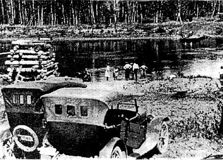
Figure 36. Automobiles gave touriests of modest means an
opportunity to explore the St. Croix valley. Here several cars await
transportation across the river via the Soderbeck ferry. From St. Croix
National Scenic Riverway files.
Logging vs. Recreation: River Use Conflict Comes to a Head
The Navigation Company contacted the War Department regarding the problems with open navigation on the St. Croix River. It seemed to have found a sympathetic ear with Major Frederic V. Abbot who believed his job was to maintain open navigation for all parties on the river, and not simply protect the interests of the wealthy and powerful lumber syndicate. Major Abbot asked the chief of engineers permission to prosecute the loggers under the new River and Harbors Act of March 3, 1899. The Navigation Company was also promised $90,000 to make a three-foot channel below St. Croix Falls. When the logging company got wind of this, they put pressure on their representatives in Congress. The secretary of war then ordered Abbot to stop proceeding until a full investigation could be made. By the summer of 1899, Brigadier General John W. Wilson reviewed the case, and came to a rather ambiguous decision — logging was a legitimate business and Abbot should defend the rights of others to use the St. Croix. When he asked for clarification, Abbot was told the River and Harbors Act was clear enough and individual officers would have to use their own judgment. [106]
In the meantime, the Navigation Company began to collect testimony for their own lawsuit against the St. Croix Boom Company regarding their "capricious" control over the water levels of the river. But things looked dim when the appropriation bill only produced $15,000 and a lawsuit again failed to materialize. Kent and his supporters, however, forged ahead. They bought a small boat called The Hudson with the intention that it could run if the Vernie Mac could not make the trip. For some reason, however, The Hudson never made a trip even though the Vernie Mac was busy even when the water was low. [107]
The St. Croix Boom Company geared up for action. William Sauntry, one of the principal owners of the Boom Company, apparently wanted to eliminate the excursion business entirely, and proceeded to do so in a highly creative way. He purchased the steamer Pauline in 1899 for the sole purpose of giving the excursion business a bad name by finding every sandbar on the river with no thought or care for the comfort or convenience of those aboard. Sauntry then told the Polk County Press that his experiences demonstrated that the St. Croix River above Stillwater was simply not navigable.
In early August 1899, the Navigation Company seemed to be on the verge of triumph when the federal government's barges and sand pumps arrived to improve the channel. Without any explanation, however, they were quickly dispatched to the Minnesota River for the rest of the season. Popular opinion on the river was that the lumber interests pressured the War Department to change its plans. The Polk County Press asserted, "Strenuous efforts are being made secretly by corporation capital to close this water," and the paper wondered how long the towns' people upriver from Stillwater would put up with the "insults inflicted by the company of which Sauntry is boss lumberman." [108]
St. Croix residents heeded the call. In January 1900, Major Abbot held hearing in St. Paul on the issue and found himself confronted with sixty representatives from the communities affected. Frank B. Dorothy of St. Croix Falls presented a petition from one hundred residents asking for "free and unobstructed passage" of the river. The Northwest Ordinance, historian William H.C. Folsom of Taylor Falls argued, had promised all Americans free navigation on inland waterways, and he estimated that there were over 78,000 abandoned logs embedded in the bed of the river that prevented the fulfillment of this promise. One of the most eloquent speakers was William Blanding of St. Croix Falls, who complained that the logging interests of Stillwater had driven small businesses from river towns. He pointed out that sawmills had to be shut down since they could not get any logs, power resources had been hindered, and commercial and pleasure boating were ruined. Lumbering, he argued, was a transient business whose main object was to exhaust the valley's timber supplies and move on. "When like wasting pestilence they have passed over the land and the coming fire has destroyed all traces of the footsteps and the overtaxed waters of the rivers and its tributaries once more flow free to all," Blanding opined, "then perhaps this dam company ridden country may be allowed to make use of what natural resources these greedy tyrants have left in it." [109]
The commissioner of the Minnesota Interstate Park, George Hazzard also testified against the actions of the logging company. His concerns were for visitors to the park and the excursion business, but he also was a champion of small, local businesses and industry who hoped that a free, navigable channel would attract flouring mills, brick manufacturing, and stone quarrying. Steamboat captains also had their turn. They admitted that, thanks to the efficiency of the railroads, the days of commercial packets plying the water were over as only two or three now made the run between St. Louis and St. Paul. However, the tourist business opened new possibilities for the economic enhancement of river towns. Nevers Dam could aid navigation on the river, but the logging business practice of flushing, destroyed chances for unhindered passage by creating gravel bars in the channel. [110]
The railroads also expressed their vested interest in the condition of the St. Croix River. The excursion business proved to be very lucrative. In 1897, the St. Paul and Duluth Railroad grossed $5,418 running trains between Taylors Falls and Stillwater picking up and dropping off visitors to the Interstate Parks and river. Low water levels the following season reduced their income to $1,340. If this were to continue, they would have to discontinue service. [111]
At the hearing the St. Croix Boom Company admitted they had inhibited navigation, but their argument rested on the fact that they needed to control the river or they would be out of business. They employed a large labor force, they had a huge investment in land, transportation, machinery, and buildings and supplied the nation with much needed lumber. Downriver Mississippi towns would languish if logging were restricted. And they had every legal right under state charters to operate the boom and dam. The company also argued disingenuously that interfering with the dam would ruin smaller mills on the upper St. Croix if they could not free-float logs on the river. What the company did not want to admit was that their control over the Nevers Dam had already ruined many a small mill owner up river. [112]
Abbot tried to work out a compromise. He insisted that all parties share the river with certain days allotted solely to the excursion business, such as Decoration Day, Independence Day, and the entire month of August when the winter drives were generally over. During the rest of the season, the Dam and Boom Company had the right to conduct their business as usual. The lumber interests were not happy with this arrangement. They normally still had a lot of logs on the river throughout the summer and contracts on which to deliver. If they could not hold up water at Nevers Dam, the end of summer low waters would strand the logs making it impossible to deliver the promised timber. In May 1900, Congress stepped into the conflict. It removed from the River and Harbors Act the provision that prohibited floating loose timber and logs on inland waterways and gave the secretary of war the power to establish regulations for the logging industry's use of rivers. This ensured that the conflict continued into 1901. Abbot was then replaced as district engineer and his regulations were modified to further accommodate logging interests. The Corps of Engineers then spent $28,846 between 1898 to 1907 dredging the St. Croix between Stillwater and St. Croix Falls. Despite their efforts the Stillwater logging company's continuation of sluicing logs made it impossible to maintain navigable channels. [113]
The logging industry also left behind many problems for the new hydroelectric power plant built in 1905. Sunken logs obstructed the free flow of water required by the generating station. The St. Croix Dam and Boom Company disavowed responsibility to clear the logs because the boom company did not own them. It had only stored and sorted them, and some of the logs left in the river predated the company. The owners and administrators of the Dam and Boom Company, however, shrewdly turned this situation to their advantage when they established the St. Croix Log Lifting Company and obtained a charter from the state of Minnesota that gave it exclusive rights to remove valuable logs from the river. In 1907, the Log Lifting Company removed 1,200,000 feet of lumber. The vast majority, however, were snagged near the shoreline, and few were removed from the channel. The new district engineer for the Army Corps, Major Francis Shunk, estimated that it would take years before the company got to the sunken logs in middle of the river. The owners, however, were not in any hurry as the value of the logs increased with the growing scarcity of wood. Due to the continued sluicing and flushing of the river by the lumbermen until 1914, the Corps abandoned hope to make improvements on the St. Croix in this decade. By the early 1920s, the lumbermen left the St. Croix leaving the Army Corps of Engineers with the responsibility of removing the remainder of obstructing logs. Between 1931 and 1940 the Corps snagged an additional 6,219 logs out of the river. [114]
Many steamboat excursions continued to ply the waters of the St. Croix until the 1920s, but coordinated excursions between railroads, towns, and boats never fully recovered from the conflict with the Dam and Boom Company. Other forms of transportation, such as inter-urban streetcars connected the St. Croix Valley with the Twin Cities and competed with railroads. In 1899, the Twin City Rapid Transit Company began to run cars between St. Paul and Stillwater. The streetcar made it much easier for those in the valley to go to the city for business and shopping. It also provided even easier and cheaper access for Twin City residents to enjoy a day in the St. Croix Valley. A ride from Stillwater to St. Paul cost thirty cents and took an hour and ten minutes. By 1913, cars ran every thirty minutes. In the thirty-three years the interurban serviced the valley thousands of tourists and day-trippers from the Twin Cities enjoyed the splendors of the St. Croix River. Stillwater's state prison attracted its share of tourists to view the workings of the penitentiary. Many valley residents also took the special Sunday car to Wildwood Park on White Bear Lake where they enjoyed the roller coasters, merry-go-rounds, and other amusements. However, in 1930 service was cut back to every two hours. And in the darkest days of the Great Depression the line was cut completely due to lack of money and competition with the automobile. [115]
One of the more viable recreational venues that came out of this era was rowboat concession Carl Muller and his family began operating in 1906 out of Taylors Falls. George Hazzard, then the Minnesota Interstate Park Commissioner, encouraged the Stillwater boat builder to open the business by offering a one-year lease. Muller and his family have renewed the lease ever since. The entrepreneur branched out into selling postcards with pictures of the Dalles he took himself along with other souvenirs. In 1911, he offered personalized postcards by taking pictures of tourists at the Dalles and printing them up within a few hours. Through the years Muller added to his modest fleet with modern launches that he and his wife, Katy, piloted. By 1975, after sixty-nine years in the business, Muller son Robert and his wife Ann were in charge along with their daughter and son-in-law. [116]

Figure 37. The Bayport Civilian Conservation Corps camp.
The site is now occupied by an Anderson Windows warehouse. From the
files of the St. Croix National Scenic Riverway.
Logging's Demise, Recreation's Rise
When the logging era ended, the St. Croix Valley became more reliant upon tourism. In June of 1914, the last log was sent down the boom at Stillwater and by 1920, its population had dropped from twelve thousand to eight thousand residents. [117] However, even before logging officially ended, residents of Marine Mills decided to take charge of their fates and joined with other river villages in the Improvement Club of St. Croix Falls and the Commercial Club of Taylors Falls "to restore the most beautiful, scenic river in the world to its old time steamboat navigation." [118] In July 1908, the Stillwater Messenger noted the growing desirability of the St. Croix River for summer enjoyment:
Afton is becoming noted for its beautiful location as a summer resort and its next-to-nature charms is making it envied by all who see it and are influenced by ‘the call of the wild,' when the grass and flowers begin to make the world beautiful in the spring time. In fact, we often wonder why any place on Lake St. Croix is not the ideal place for summer homes — notably almost any spot between Stillwater and Afton. [119]
In 1910, the Stillwater Gazette added to the growing enthusiasm when it predicted that, "It will be but a few years before the banks of the St. Croix are dotted with summer homes. [120] Many residents of the Twin Cities did begin building summer homes north of Stillwater. "Dedicated fishermen and small-boat owners," wrote James Taylor Dunn, "they all wanted to identify themselves with the river and become a part of its life. [121]
That same summer World War I began and inadvertently boosted tourism in the valley. "It is human nature to look for unusual things in far off places," a tourist brochure of the period noted, "hence the American has become as great a Globe trotter as his English cousins. But in these days when foreign lands are closed to him. . .it might be well to call to his mind that right at home he can find places full worthy of his time and attention. . .many thousands of people living right in this region. . .have never taken the trouble to visit the wonderfully scenic and historic part of this territory known as the St. Croix River Valley." [122]
Nevers Dam -- a remnant of the logging era -- was still an imposing presence on the river and inadvertently contributed to the recreational attraction of the St. Croix. Its fifteen gates created a fifteen-mile flowage. Fish and ducks readily found a home in its placid waters as did boats with fishermen and hunters who were ready to make sport of them. The dam had served as a wagon bridge across the St. Croix when it was built in 1890 by the Milwaukee Bridge & Iron Works. The only other means to cross the river in the area at that time was the Sunrise Ferry upriver from the dam site. Once tourists in their automobiles descended into the St. Croix River Valley after World War I, the dam bridge facilitated this new business until it was washed away in May 1954 and completely removed in 1955. [123]
Many of the folks in the St. Croix Valley, however, were not going to give over their favorite fishing and picnic spots to outsiders. A tradition had developed among residents from Hudson and the Willow River area that when the river opened up for fishing in the spring "every able-bodied man and boy in town would spend the night along the Willow." By the 1910s and 1920s, most of the cottages along the Willow River belonged to residents of Hudson and were built by families and their friends. The land belonged to a local farmer who was unwilling to break up his farm. To accommodate the local fishermen, he leased the land for ten dollars a year. Camping was free, and many families slept in tents, and many a Hudson boy spent his summers sleeping under the stars along the Willow River. The intimate relationship of the cottagers here is illustrated by the story of one fisherman from St. Paul. "Sandy Quosbarth, a veteran Scottish trout fisherman," headed a group of fishermen from the Minnesota city. Sandy soon bought out the other cottage owners in the fishing club, and for the next fifteen years he and his wife became beloved members of the Willow River and Hudson community. [124]
The building of summer homes on the St. Croix was the most tangible sign of the new way the river was appreciated in the wake of logging's decline. A summer hiatus from the din and noise of the cities became the norm for many Americans at the turn of the twentieth century. In his noted book, Nature and the American, Hans Huth documented the growing practice of ownership of country estates and summer homes for average Americans. "Most of the winter-weary townspeople, by going to a resort or to their own country homes, or even by visiting city parks and participating in some kind of summer sport," Huth writes, "could find respite from the city during the sultry months. For these summer pleasures the northern part of the country as far west as the Great Lakes was the favorite section." The St. Croix Valley became a prime destination for those seeking country delights. [125] One such place was the Albert C. Heath Summer Residence on Arcola Trail next to the Soo Line Bridge near Stillwater built in 1911. It is within the Saint Croix National Scenic Riverway, and was put on the National Register of Historic places on February 12, 1980. It was, however, destroyed by an arsonist-set fire in 1986 and lost its status as a registered site. The original grounds included a clay tennis court and three trout ponds and trout breeding tanks, which was not uncommon in an area of fishing enthusiasts. In 1922, the Croxsyde summer home was built eight miles north of Stillwater. It was placed on the National Register on June 3, 1980 both for its rustic log construction and as an example of the transition to recreation in the St. Croix River Valley. It too is within park boundaries, but is privately owned. It, too, once had two trout ponds and a stone hatchery. [126]
The First Efforts to "Save the St. Croix"
Recreationers, however, did not have the river to themselves. In the early twentieth century the growing demand for electrical power sent power generating companies into the St. Croix Valley in search of locations for hydroelectric power. In 1903 the Minneapolis General Electric Company started to build a waterpower generating station at St. Croix Falls. This stopped the arbitrary maintenance of water levels by Nevers Dam. The plant was completed by 1906 and was the first electrical power generated from outside the Twin Cities for the two urban areas. The success of this project encouraged the Minneapolis Electric Company and its successor, the Northern States Power Company, to purchase more sites on the swift flowing river with the hope of lighting up the entire Twin Cities. In a few short years in the early 1900s, the power company became the largest owner of St. Croix river frontage. To people like George Hazzard and those who lived along the St. Croix, the new power dam was one more example of the use of the river for the benefit of outside interests. The Northern States Power Company was not quite as tyrannical as the lumbermen who controlled Nevers Dam, but the river served their needs first and the needs of residents and tourists second. [127]
However, times were changing and the Progressive Era, roughly the years from 1900 to 1920, and its conservation movement, with loose ties to Romanticism, Primitivism, and Transcendentalism, were changing how people thought about the environment, who should control it, and for whose benefit. Notable national conservationists, such as Wisconsin native John Muir, Frederick Law Olmstead, Robert Underwood Johnson, and others called for the protection of significant, monumental landscapes. Muir's conservation ideas were inspired by Thoreau and Emerson. In "A Voice for Wilderness," Muir wrote, "Thousands of tired, nerve-shaken, over-civilized people are beginning to find out that going to the mountains is going home; that wildness is a necessity; and that mountain parks and reservations are useful not only as fountains of timber and irrigating rivers, but as fountains of life." His efforts, and those of others, led to early designation of Yosemite, and ultimately to the formation of the National Park Service in 1916. [128]
Others in the growing conservation movement disagreed with Muir's belief that nature be preserved and untouched for future generations. The most notable leader of the "wise use" contingent was Gifford Pinchot who was appointed head of the newly created U.S. Forest Service by Theodore Roosevelt in 1905. Pinchot firmly believed that the resources of the United States should be used for the benefit of the many, rather than the few, for as long as possible. His scientific management program of logging, mining, and grazing of federal lands rankled special interests groups used to having a free reign on national resources, but provided an enduring approach to both use and preservation.
In between these two philosophies towards the nation's natural resources was the growing recreation and tourism industry, which presented a third approach to conservation. In his book, Sportsmen and the Origins of Conservation, John F. Reiger observed of outdoorsmen that, "While their first concern was wildlife, sportsmen quickly perceived that the effort in behalf of mammals, birds, and fish was a solution to only half the problem. It would do little good to preserve wildlife if its habitat continued to shrink, for eventually both would be gone." Writing generally on the growth of tourism as a conservation industry, Alexander Wilson, in his essay, "The View from the Road: Recreation and Tourism," noted the beginnings of valuing nature as a commodity:
Nature tourism is simply the temporary migration of people to what they understand to be a different and usually more "pure" environment. It's going out to nature for its own sake, and it's all of the ways we talk about that experience. The modern history of nature tourism is a history of altered landforms and changed ideas and experiences of the non-human. Broadly speaking, it involves a shift from a pastoral approach to nature to a consumer approach. This in itself is a huge and significant transition. [129]
Artificially created parks, preserves, and resorts became valued for their "natural characteristics. When Americans took to the woods, they took along many of the comforts of home and generally expected to find modern conveniences. Throughout the country entrepreneurs began to oblige their patrons with transportation to resort areas, developed campgrounds, well-equipped housekeeping cabins, and provisions. Scenic vistas, monumental landscapes, and the experiences they evoked became commodities for sale. [130]
Mineral extraction, over-cutting of timber stores, the high incidence of wild fires ignited and spread by logging waste, and over-hunting contributed to the formation of state conservation agencies in Minnesota and Wisconsin. Strict preservationists, recreation enthusiasts, and hunters, alike, sought protection of natural and "pristine" areas through the establishment of state parks and preserves. In this regard, the people of Minnesota and Wisconsin were far ahead of residents in many others states. [131] Minnesota became a leader in the growing conservation and preservation movement when it established its first state park in Itasca in 1891 and the Pillsbury State Forest in 1899, as well as the Interstate Park. [132] "Going to the lake" became almost a secular religion. As for Wisconsin, the receding forests in the St. Croix Valley alarmed many residents. In the 1890s, J. Stannard Baker of the Baker Land and Title Company became interested in reforesting some of his own lands that had been cutover. He began to plant trees on land he owned on Deer Lake six miles east of his home in St. Croix Falls, as well as in the village. In a period of eight to ten years Baker planted thirty thousand trees. When asked why he bothered to do this when he would probably not live to see them mature, Baker said, "Some people in this world want big white monuments. I will take a green one." By 1950 many of the seedlings had grown thirty to forty feet with fourteen and sixteen inch trunks. [133]
George Hazzard, too, grew alarmed at the changes in the valley with the development of hydroelectric power on the St. Croix. His concern, however, was shaped less by the conservation movement than by the fear that power dams would obstruct navigation and curtail the economic life of the river towns. For the first two decades of the twentieth century, Hazzard tirelessly worked to promote the St. Croix River for tourism and commercial development. He willingly took support from conservationists, sportsmen, and boaters, as well as residents who wanted a greater say in how the river was used. In 1911, he helped organize the St. Croix River Improvement Association. Hazzard was, of course, its first president. Because it was composed of a variety of local interest, its goals were somewhat mixed and contradictory. Fishermen were angered by the power company's control over water levels because when the dam was closed, the water level dropped and left thousands of fish stranded in shallow pools. This action stood in the way of turning the St. Croix into "the best water for the angler that there is in the country." Small boaters feared the "deadhead" logs that were left partially submerged in the river by the lumber industry. While sportsmen got the Association to stock small mouth bass in the river, they were not interested in Hazzard's goal of improving navigation in order to revive commercial and tourist steam boating on the river. [134]
Hazzard, however, had his own ideas about the future of the river. He proposed to rebuild Nevers Dam with concrete in order to create deep, slack pools fit for excursion boats, rather than the swift flowing river favored by sportsmen. Another of his pet projects was to revive a nineteenth century proposal to dig a canal between Lake Superior and the Mississippi River via the Bois Brule River Valley and the St. Croix. Hazzard had even gone so far as to try to recruit support for the canal from the Upper Mississippi Improvement Association. However, after reviewing the facts, the Army Corp of Engineers found the canal idea "inadvisable, infeasible, impractical." Hazzard's ideas, however, had captivated the attention of Minnesota and Wisconsin governors, senators, and representatives who then created their own independent Superior and Mississippi Canal Commissions. The Army Corp, however, remained firm in their position, and Hazzard's dream died. The conservation movement had grown too strong, and by this time the power and influence of the Army Corp of Engineers had also increased. By 1917, Congress expanded the federal government's regulatory mission to include navigation management, flood control, and hydropower. Defeat and old age caused Hazzard to withdraw from public life, and the St. Croix River Improvement Association first efforts to be a force in the valley cam to a close. However, sportsmen and conservationists would continue to revive the association to deal with threats to the river. [135]
Early in the summer of 1923, Stillwater postman, Ira King, took Hazzard's stand. He and other residents formed the Stillwater Council No. 347, United Commercial Travelers (UCT). King served as chairman of its Committee on River Improvement. "We sincerely believe," King told the Stillwater Gazette, "that the St. Croix River is one of Stillwater's best bets and we are putting our best efforts forward to see what can be done to better present conditions." Their goal was to get a deeper channel dug to accommodate pleasure boaters north of the town and commercial barge traffic south of it. The organization began to flood the offices of senators and congressmen from Minnesota and Wisconsin with letters requesting $20,000 for channel improvements from Congress. [136]
The UCT's efforts bore fruit when the Army Corp of Engineers ordered surveys of the river. By 1925, the Stillwater Gazette optimistically reported that the "St. Croix Project" of the Corps of Engineers would be a great economic boon to the "entire Northwest." Citizens from Marine, Osceola, St. Croix Falls, and Taylors Falls also put in a request that wartime regulations that restricted flow of water over the NSP dam be lifted. Low water levels below the dam made navigation between Taylors Falls and Stillwater nearly impossible. The Northern States Power company proposed a solution of building another dam near Prescott to improve water levels south of Stillwater. However, no dam was built on the St. Croix River. Instead, in 1938, the Army Corps built one on the Mississippi River near Red Wing, Minnesota as part of the Nine-Foot Channel Navigation Project. Water levels only improved near the mouth of the St. Croix. [137]
Frustrated by their lack of influence on the Army Corps of Engineers, the UCT decided to revive Hazzard's old organization, and in the late 1920s renamed it the St. Croix River Improvement Association. Their goal changed from requesting a three-foot channel to a six-foot one. Their chief target of animosity remained the Northern States Power company. "Why a corporation is allowed to prostitute for its private gain a beautiful river like the St. Croix," reported John Dunn to the association in 1929, "I cannot conceive. I am positive from my long observation that if we had the natural flow of the river it would within two years make and keep a channel suitable for medium size boats. This opinion has been confirmed time and again by talks with men who have lived close to and on the river during and since steam boat times." [138]
While a three- or six-foot channel was not forthcoming, the St. Croix River Improvement Association did obtain funds from the Corps in the early 1930s for a snag boat and spring clean ups of the river to remove dead heads, overhanging trees on the river banks, and other debris that obstructed navigation. Another victory for the association came in the mid 1930s when commercial net fishing was ended and the line and hook method preferred by sport fishermen was introduced. By 1935, the St. Croix River Improvement Association also got the Minnesota Conservation Commissioner to stock small-mouth bass in the river. However, the association was caught completely off-guard when in 1931, the Minnesota Highway Department built a highway along the bluffs of the river south of Taylors Falls. In the process, the construction firm, A. Guthrie & Co., blasted tons of rock and dirt into the St. Croix River creating a large island that obstructed more than three-quarters of its channel. Despite protests and hearings with the Army Corps, the firm was never forced to clean up the debris. [139]
Tourism and recreation had set permanent roots in the Lower St. Croix Valley by the early twentieth century. It was dotted by hotels and restaurants, railroads and inter-urban cars brought in a host of visitors, whether day trippers or seasonal resort residences, from the Twin Cities, as well as southern Wisconsin and the Chicago area, steamboat excursions plied the river, and fish hatcheries and hunting preserves welcomed the new outdoorsmen. Just as occurred in other parts of the United States, industry, community development, and the growth of the recreation and tourism advanced uneasily together in the St. Croix Valley. [140]
Recreation Along the Upper St. Croix and Namekagon Rivers
As the Lower St. Croix River adjusted to the decline in logging and its replacement by recreation, the Upper St. Croix and Namekagon Rivers experienced their own growth in tourism. In 1902, the tireless promoter of Burnett County, Ed Peet, was not just interested in attracting agricultural settlers, but he also extolled the county's potential for recreation. "Burnett is a county filled with lakes. . .nearly all of the lakes are filled with fine fish and into many of the lakes run swift little streams in which the speckled trout is found," he wrote. "The finest lake in the county, if not the finest in the state, is Yellow Lake. . .It is filled with fish of all kinds. . . Should a railroad ever touch Yellow lake there is no reason why it would not become one of the finest summer resorts in all the west." Peet also claimed that if the railroad ever reached Trade Lake it, too, "would be well patronized as a summer resort, as it contains many conditions that would attract people seeking rest and pleasure." [141]
Most of the first resort owners in the cutover had been loggers, guides, or farmers. Many farmers struggling in the cutover got into the resort business by simply allowing travelers to pitch a tent on their property or they took in boarders who were primarily interested in hunting or fishing. [142]
Many early hunting and fishing hostels dating back as early as the 1880s and 1890s were hotels and boarding houses in towns and stopping places along the roads used by transient lumbermen and teamsters. "Private rooms were available in the urban places," wrote local historian and resident, Eldon Marple, "but bunks were the rule of the country, rudimentary lodging at best. . .Few were the females who braved the rigors of resorting then." Even before Ed Peet began to sing the praises of the Upper St. Croix and Namekagon Rivers for recreation, a few locals began their own boosterism. In 1885, two Hayward residents advertised in the North Wisconsin News, proclaiming that, "Mr. J.N. Russell and Mr. Christie have for the past month been building a summer resort hotel out on Spider Lake." The resort was located east of Spider Creek near the present town hall site, which was a quarter mile from the lake. In 1894, Bill Cornick bought the hotel and called it a "Fisherman's Camp." By 1896, he built the first cottage on Spider Lake, and one on Lost Land Lake. [143] The Sawyer County plat book for 1897 ran advertisements for the Round Lake Park Place Summer Resort and Round Lake House Summer Resort, both located seven to eight miles east of Hayward. An advertisement for the Cable House, in the town of Cable, proclaimed it as a "Sportsmen's Paradise." A Hayward livery stable operator eagerly catered to the tourist trade by claiming, "I keep first class conveyances for transporting people to various Lake Resorts, such as Round Lake, Spider Lake, Lost Lake, Sand Lake, and Lac-Court Oreilles Lakes." [144]
In 1888, F.D. Stone, the county sheriff, opened his Jericho resort on Grindstone Lake, which he nicknamed the "seaport on Grindstone." Guests were entertained with a steamboat ride through the Grindstone-Court Oreilles — Whitefish chain of lakes. Although the Jericho apparently did good business, the resort burned down in 1891. However, in 1890 a ninety-room hotel was built in the town of Cable providing vacationers with another alternative, and the older Hotel Isted in town took in many excursionists. Another hotel was also completed the following year "at the old Crane Creek stopping place" by a man named Angus McPhee "Thad Thayer took in guests from the early days at Trading Post, as did Bill Hogue at his stopping place on the south end of Round Lake," related Eldon Marple. "John Berger operated the Eagles' Nest on Tyner Lake, and there were four fishing clubs on Lac Courte Oreilles: the Ashland, Hayden, Omaha and Chicago Club Houses." And in 1893, the old stopping place, Hotel Wright on Sand Lake, began taking in summer guests. [145]
Another example of the early resort beginnings is Boulder Lodge built on an old driving camp located on Ghost Creek. Jim Goodwins of Hayward started it as a fishing camp and stopping place and later turned it into a resort. It got its name from the big rock beside the road. William Cornick built cottages on Lost Lake in upper Sawyer County in May 1896. They, however, burned down in 1903. Cornick then built a lodge on Teal Lake. In 1921, the Ross family took it over and has operated it as Teal Lake Lodge. [146]
During the years of the First World War, railroads played an important role in the development of tourism in northern Wisconsin and Minnesota. In 1916, the Chicago & NorthWestern Railway distributed a brochure entitled, Lakes and Resorts of the Northwest. "Hundreds of delightful lakes and resorts situated in Wisconsin," it beckoned, "are in a region where one may escape from the heat and dust of the city, where the nights are cool and restful, and days full of sunshine, and where there is an evenness in climactic conditions and a purity of atmosphere that cannot be surpassed." It added that there were "scores of fishing and hunting resorts, hidden away in the virgin forests of northern Wisconsin. . .where the lover of Nature may make camp amid innumerable lakes and streams, surrounded by forests, where the soft balsam of the pines pervades the air, where speckled trout are abundant in the streams, and black bass and muskellunge in the lakes." Cedar Lodge Resort, built on the east bay of Spider Lake in 1918 by Wes Turnbull, is an example of a vacation resort of this era, and Empire Lodge, located on Upper A and Empire road in Sawyer County, began in 1923 by Cliff Brandt. [147]
A night's ride in a Pullman car was all it took to deposit vacationers in the North Woods in time for breakfast. Included in the recommended towns with resorts were Hayward and Chisago City, Minnesota. The lakes of the Hayward area were "reached by beautiful drives through the heart of the pines." Round Lake was "an entrancing body of cold, clear water, fed by numerous streams." For the fishermen there were good trout streams, and for the hunter grouse, partridge, duck, and deer during hunting season. Chisago City was described as having excellent fishing, good duck hunting, and very attractive scenery. The brochure provided a list of hotels, lodges, and boarding houses along with their rates and distance from the station. [148]
Wisconsin and Minnesota were poised to take advantage of this growth in tourism and outdoor recreation. By 1920, the two states were leaders in the establishment of state parks, each having six, and the "Wisconsin Idea" of better government, in which a well-informed electorate worked in close cooperation with government agencies, had spread the spirit of reform throughout the country. In these two Midwestern states grassroots conservationists benefited from more responsive state governments. They got an additional boost from the National Park Service. In 1920, the director of the NPS, Stephen Mather called for a meeting with key state conservationists who could assist the federal government. Gems of the National Park Service, such as Yellowstone, Yosemite, and the Grand Canyon, were becoming increasingly in danger of over use. In the era of growing demand by the public for recreational spaces, state parks could play a key role in providing additional parkland and diverting visitors from the National Parks. State parks, he believed, could protect natural areas that did not have national significance and could service local populations better. The 1921 National Conference on State Parks (NCSP) was described as "an epochal meeting." Two hundred representatives from twenty-five states met in Des Moines, Iowa, to discuss the importance of designating accessible natural and recreational areas. The NCSP was formally incorporated as a standing organization with the following mission:
To urge upon our governments, local, county, state, and national, the acquisition of additional land and water areas suitable for recreation, for the study of natural history and its scientific aspects, and the preservation of wild life [sic], as a form of the conservation of our national resources; until there shall be public parks, forests and preserves within easy access of all the citizens of every state and territory of the United States; and also to encourage the interest of non-governmental agencies and individuals in acquiring, maintaining and dedicating for public uses similar areas; and in educating the citizens of the United States in the values and uses of recreational areas.
The new organization's slogan became, "A State Park Every Hundred Miles." Between 1921 and 1927 seventeen states established state park boards or commissions with the authority to manage scenic and recreation areas that would come to include state monuments, beaches, lakeshores, parkways, waysides, and historical markers. Many partners, from state park superintendents to state departments of conservation to state comptrollers and local boosters came together in a concerted effort to preserve natural settings, market them for public consumption, and glean a bit of pride in sharing their part of the American scene. [149]
Vacationers also found the north woods more accessible in the post-war years as a network of paved roads were expanded and improved. In 1893, Congress established the Office of Road Inquiry as part of the Department of Agriculture. It was later named the Office of Public Road Inquiry (OPRI). Its mission was to improve rudimentary road design, materials, and construction techniques. By the turn of the century, OPRI's budget and staffing were increased, and more emphasis was put on improved transportation routes across the United States. In 1912, Congress established the "10% fund" that diverted ten percent of forest revenues to road construction. Four years later, the Federal Aid Road Act authorized $10 million for this purpose. A federal highway act was also passed in 1916 that required "states to establish highway departments in order that they might obtain, on a matching basis, federal subsidy for highway construction." An additional three million dollars came through the Post Office Appropriation Act of 1919, to ensure "rural free delivery" of mail to all households. By 1920, the OPRI was reorganized as a separate agency, called the Bureau of Public Roads. Its task was to provide technical assistance and direction for all future road construction. As early as 1902 the American Automobile Association (AAA) was promoting recreational auto-tourism. [150]
Roads in northern Wisconsin were also improved thanks to the growing popularity of the automobile. Between the two world wars state paved roads reached into the lower and upper St. Croix Valley. Road building was actually quite easy in the sandy soils of the cutover, and by the early 1930s the Upper St. Croix and Namekagon River area was "welded together by a road system which is very elaborate for such a little used area." The roads, however, were not well built or maintained, but this added to the rustic charm of this wilder region. [151]
The automobile did much to democratize recreation and tourism in America. Families with more modest incomes from Milwaukee and Chicago could now easily access the cooler breezes and refreshing lakes of northern Wisconsin. Civic boosters in both Minnesota and Wisconsin were quick to recognize the growing popularity of the automobile and the rising demand for family vacation destination and cultivated auto-tourism for its economic benefits. Both states and enterprising individuals billed their local communities as the best their respective state had to offer. In 1916, Minnesota formed the Ten Thousand Lakes Association to capitalize on its scores of lakes. The "Arrow Head Region" of Minnesota, in the northeast portion of the state, was touted as being the heart of fishing and hunting country. The Minnesota Arrowhead Association, comprised of member organizations from various local communities, established its headquarters in Duluth. Its purpose was to attract visitors, enlist new members, and to encourage preservation of the region's natural resources. The Arrowhead Country was advertised as "a wonderful unspoiled playground," and led the rest of the state in the tourism industry. During the 1920s members combined their efforts with those of local automobile clubs, the Minnesota Automobile Association, the AAA, local commercial clubs, and local chambers of commerce located throughout the state. The Minnesota Arrowhead Association and state automobile associations hosted exhibits at the annual state fair and sponsored annual "Scenic Minnesota Good Roads Tours," under the auspices of the United States Good Roads Association, Inc. to showcase the various regions of the state. In 1926, the group also attracted the attention of the Associated Press, which "spread the story of the Arrowhead Country throughout the nation." [152] By the early 1930s the state recognized how much money tourism generated and began a Tourist Bureau that later became a general department of business. In 1932, the Minnesota State Board of Health also began to distribute a booklet on State Laws and Regulations Relating to Hotels, Restaurants, and Places of Refreshment, Lodging Houses and Boarding Houses. This included resorts, summer camps, summer cottages, cabin camps and tourist camps. By the end of the decade Minnesota estimated it took in over a hundred million tourist dollars. [153]
Wisconsin was not to be outdone by its neighbor across the river. In 1921, in response to this new breed of vacationers, local businessmen across the North Woods organized the Northern Wisconsin Resort Association. Their goal was to entice vacationers northward with their dollars and to enhance services and improve the natural environment. Within a year two thousand businessmen from lumber companies, banks, automobile and oil companies, hotel and resort owners, and people from retail business joined in the effort to promote the "Wisconsin Land O' Lakes Association." The association, headquartered in Rhinelander, sent brochures, road maps, and travel information to cities outside the state, as well as established tourist bureaus in Milwaukee and Chicago. Although no statistics are available, the Land O' Lakes Association considered their 1923 campaign a resounding success. [154]
The promotion of the north woods for vacationers did stimulate local businesses. During the 1920s real estate developers, like the Homeseekers Land Company of Hayward, advertised Wisconsin's cut-over lands to residents in the Minneapolis and Chicago metropolitan areas as, "Desirable locations for Lake Summer Homes, Fur Farming, private trout ponds, club properties, etc." [155] The Baker Land and Title Company started to sell lake front lands for summer cottages. The Bakers subdivided, platted, and sold lots to people from the Twin Cities to Chicago and more distant places. [156] By 1931, grocery stores in Danbury, Gordon, and Solon Springs were doing a booming business catering to summer visitors. "Resort people from Eau Claire Lakes to the east and Bardon Lake to the southwest flock into Gordon daily during the summer season to get the mail and to shop," wrote an observer, "and this trade is the main support of the grocery stores, and is of importance to all the other business houses of the towns as well." [157] Struggling farmers in the cutover, who had not been able to form creameries due to low production, found the summer season a prime opportunity to sell their milk and cream to resorts. [158]
One poignant example of the transition from logging to elite tourism to the era of tourism of the masses is the Taylor House in Taylors Falls. In 1856, Joshua L. Taylor built a splendid Gothic revival house in his namesake town for his new bride. Although two Greek revival houses had previously been built in the town, the building of the Taylor house was symbolic. "The first rough era of the frontier was past, and. . .the foundation had been laid for a stable community." The Taylors, however, never had children and two years before his death, Mr. Taylor sold the house to Smith Ellison, who proceeded to put on an addition and turn the impressive home into a summer hotel. But after the First World War and into the 1920s the automobile transformed the character of tourism and tourists. Visitors now had more freedom and independence. The era of the town-based hotel was over as vacationers preferred to find their own little cottage or resort on a lake. The Taylor house hotel lost its clientele and eventually its building material was used for a motion picture theater. [159]
During the years between the First and Second World Wars, more summer homes and humble sportsmen's lodges began to dot the lakes and river in the St. Croix Valley, including Lake St. Croix, which had been shunned by tourists during the logging era. The Brule River, along which traversed Indians and traders of another era, was now a summer haven with beautiful seasonal homes. Its denizens enjoyed the trout in its waters and the forests with its game. In the cutover regions of Burnett, Washburn, and Sawyer Counties whose poorer soil defeated many a farmer, vacationers discovered sandy-bottomed lakes with clear, sparkling water, unlike the "pea soup" waters of neighboring counties south with their richer, heavier soils. An example of a sportsman's lodge that developed in the 1920s was Kilkare Lodge located between Birch Island Lake and Fish Lake in Burnett County. The Board of Governors, composed of businessmen from Chicago, "hand-picked" its members through mutual acquaintances ensuring there were "carefully selected executives and professional men." Its pamphlet boasted that, "When you join here, your associates are ‘your kind of folks,' from every standpoint!" It offered a "fully appointed Club House, our own farm, complete commissary, a chancy golf course, three lakes. . .swimming, boating, trail-riding, shooting and trout-fishing." By 1929, its dining room hosted two hundred patrons and was open year round. [160]
Depressed land values from failed or struggling farms only added to the enticement of the area for vacationers. "The larger lakes and many of the better small ones have summer cottages along their shores, and the summer hotel, too, has become very important in the lakes country," wrote University of Wisconsin geographer, Raymond Murphy in 1931. "Prices are considerably lower than would be the case in a better agricultural section where agriculture would compete with resorts for the land, and, moreover, summer visitors find relatively wild unsettled areas more attractive." Murphy, however, could not help but notice the contrast between the poor and abandoned farms of the cutover and the new summer homes being built. "Wooded shores of the larger lakes," he wrote, "are the sites of expensive summer homes and resorts which seem strangely out of place in this unfruitful country." [161]
The success of tourist recruitment to the north woods, however, had its down side. The area was not prepared for the large numbers of tourist who began roaming the countryside in automobiles. Travelers who had difficulty finding or affording accommodations began a practice called "gypsying." Without a railroad to funnel them into specific locales at specific times, car travelers simply took to the roads, stopping and starting as their desires struck, and they camped wherever they pleased. While the gypsy tourist reveled in the new freedom from civilization, farmers found them a downright nuisance. Picnickers and campers often left their garbage behind and relieved themselves. Bolder ones helped themselves to local produce. Since they needed the money tourists brought into the area, local authorities were reluctant to harass the "gypsies." Communities were then forced to find other ways to house and police these wanderlusts. Public parks and campgrounds proved to be one answer. Local resort owners also responded to the call by catering to this more modest income group. After 1925, tourist and cabin camps gained popularity with those tired of auto-camping. Individual cabins offered outdoor, quasi-communal settings with family privacy in comfortable accommodations, sometimes including a central dining/recreation hall, central bathhouse, and gas station. Another complaint of locals was that these new tourists were somewhat pesky with their demands that accommodations match those in the cities, and they expected local residents to fit a stereotyped image of north woods pioneers. But most residents swallowed their irritations and learned to please paying guests. [162] Well into the 1930s and 1940s, cabin owners provided better furnishings, homey decorations, plumbing, bedding, and kitchen equipment. Travelers no longer had to carry makeshift households in their car, so travel became much easier and both tourist and host communities were much happier. [163]
The increased recreation and automobile traffic was also a boon for the ferry business. During the 1920s and 1930s the Soderbeck family ferried automobiles across the St. Croix River just north of Grantsburg. The season opened with the spring ice break-up and ended with the winter freeze. Rather than drive down to St. Croix Falls or up to Danbury to use the bridges there, travelers chose the leisurely trip across the St. Croix that cost them fifty cents. Years later Bill Soderbeck recalled many humorous tales of misadventure on the ferry, such as two preachers overshooting the ferry deck causing their car to hang precariously over the edge, as well as a group of genuine gypsies offering to pay their way across by telling fortunes. Nonetheless, the ferry passage was critical to the recreation business and the new breed of vacationers in their Model T's. [164]
Through the years, Burnett County attracted many vacationers, and summer resorts sprouted along their shores. "Many lakes and river shorelands that we would not have taken as a gift thirty years ago," wrote one old timer in 1976, "are beauty spots now and provide homes and retreats for many." One enterprising promoter was Iver Johnson. He began his career as a humble postmaster in Webb Lake, Wisconsin with a side business of running a little Indian trading store. Any travelers who ventured into the store at mealtimes were always asked to dinner. One guest who visited in the mid-1920s changed Johnson's life. He was Gus Munch, a Chicago baseball pitcher and sports writer.
Before Munch left, he asked the Johnsons to build a new cottage and promised to write an article in Outdoor Life and Recreation. Munch kept his promise and described Webb Lake as a "veritable paradise for the bass fisherman looking for virgin waters and as yet but little fished and less known. . ."Tis indeed a delightful country for the sportsman who wants to camp out in the wilderness and not be bothered by tourists. They don't get there. The roads are too bad, but the fishing! Well, go on up there, and try it yourself, you'll see!" Munch said Johnson could take care of two people interested in fishing in the area. Within a short time Johnson was receiving a dozen letters a day from sportsmen all over the region wanting to be one of the two he could accommodate. Johnson immediately began to build a cabin and rented a vacated house on Fairy Lake, pitched a tent, and added on to his store. He then proceeded to book twenty to thirty fishermen at a time charging three dollars a day for room and board. He met the sportsmen (women did not come then) at the train in Spooner and brought them over the rough country "to the land of beauty and good fishing." With his new business booming Johnson built more cottages, a tavern, and a dance hall that booked well-known traveling bands. By 1933, Johnson bragged that he could "accommodate 50. . .instead of being able to care for two." In a brochure he put together, Mr. Johnson assured his guests that, "Every effort was utilized to make our cottages the best in this locality. They are all new and well screened." The resort offered both light housekeeping cottages and sleeping cabins. The light housekeeping one were "completely furnished with good clean beds, bedding including linens, dressers, stoves, dishes, tables, chairs, rockers, rugs, and in fact everything that is needed except towels and tea towels." Guests who preferred to not cook, could dine in the main building. Johnson also offered river trips, tube floats, and horseback riding. As tourism boomed, other residents catered to the overflow the Johnsons could not handle. [165]
Beginning in the 1920s the American plan, which had been the model for resorts throughout the north woods in earlier years, gave way to what was called "housekeeping" style resorts. These were more individualistic and less expensive than the earlier American plan. Housekeeping resorts were composed of a collection of small cottages where guests were expected to bring their own food and linens and fend for themselves. There was no main lodge as a focal point for social gatherings. Stays were much shorter as well. The reasons for this shift where in part due to better roads and automobiles that allowed people to check out a variety of places in a single vacation. The wealthy began to build their own summer homes, often times buying a parcel of an American plan resort. And the new travelers had less money to spend. [166]
The Great Depression of the 1930s disrupted for a time this boom era in tourism in the far north woods. Hard times found the north woods with more cottages and resorts than people to fill them. "So rapidly have summer homes and hotels sprung up along the shores of better lakes," wrote an observer, "that today the number of commercial resorts is too great in proportion to the number of visitors for the business to be profitable." Hardship once again returned to the cutover. [167]
A New Deal for the St. Croix
Oddly enough, however, the Depression and the New Deal programs of Franklin Roosevelt laid the groundwork that would help transform the north woods and the St. Croix Valley into a vacationland and marked the beginning of federal involvement in the fate of the river. With so many Americans unemployed and the private sector of the economy severely shaken, Roosevelt sought ways to employ people using the resources of the federal government. Among his most noteworthy programs were the Civilian Conservation Corp (CCC) and the Works Progress Administration (WPA). These programs helped establish the trend for greater government involvement in preserving and protecting the St. Croix River and its tributaries, its forests, and facilitating the development of recreation.
In June of 1933, 198 young men of the Civilian Conservation Corp of Company #647 arrived in Burnett County from Fort Sheridan, Illinois. The company was composed of young men whose future prospects for work and careers were discouraging in depressed cities. Useful, vigorous jobs in the countryside were supposed to channel their energies into productive endeavors instead of leaving them idle in the streets. The four hundred thousand strong CCC, under the auspices of the U.S. Army, became renowned for its accomplishments in forest, soil, water, and wildlife conservation. Federal or state agencies that developed a conservation project could request a CCC company. Camps were formed in national and state forests or in soil conservation districts. Forest fires, of course, had been the most immediate and biggest problem for conservationists and residents since the last century.
Wisconsin quite early in its history had recognized problems associated with the depletion of its forests, and in 1867, the legislature formed a commission to assess the state's forest reserves. Increase A. Lapham, the commission chair, produced a study entitled, Report of the Disastrous Effects of the Destruction of Forest Trees Now Going on So Rapidly in the State of Wisconsin. The report provided a comprehensive view of the effects of logging and lumbering. It specifically noted that the elimination of the forest cover reduced stream flow and led to widespread flooding and erosion. Professors at the University of Wisconsin and their students contributed to the call for measures to stop the ravage of forests fires. These fires ravage the north country at the end of the nineteenth century, and in 1897 the Wisconsin legislature finally initiated a program to monitor and preserve its natural resources. Members appointed a state forestry warden, who implemented a system of town wardens and volunteer firefighters. Some watchtowers were built and two-way radios came into use. However, these efforts were not enough. [168]
In 1908, after a particularly bad season of fire damage, a citizens' committee formed to pressure the state legislature for better forest protection. Governor James O. Davidson then appointed a State Conservation Commission to study the problem of forest fires and make recommendations to the legislature. This eventually resulted in the creation of fire protection districts in 1923. In 1925, these districts were given $25,000. By the 1920s disenchantment from the indiscriminant promotion of agricultural settlement, especially in the cutover, encouraged Wisconsin conservationists to push for a constitutional amendment to allow for state-owned and managed forests. This was passed in 1924 thus overriding the Wisconsin Supreme Court's 1915 ruling. In 1927, the state passed a forest crop law that encouraged counties and private owners to put land into forest plantation by implementing a tax plan that recognized the long-term nature of forestland use. The Wisconsin Conservation Department became an independent agency and was given responsibility for the protection of all forestlands. In addition to these developments, in 1929 a new zoning law made it possible for counties to zone lands as out of bounds for agricultural settlement. "It was a final recognition that an unsuccessful farmer, settled on unsuitable land in an isolated place," wrote historian Robert C. Nesbit, "was anything but a taxable asset to the county." [169]
Minnesota had also taken action to monitor and protect its forests. The Minnesota State Forestry Association, one of the earliest forestry organizations in the country, was established in 1876. Members worked primarily on the grassroots level, through civic groups and fraternal organizations. After the disastrous Hinkley fire in September 1894, Minnesota lawmakers took more direct action in forest management and preservation. The state auditor was authorized to also act as state forest commissioner. The forest commissioner then appointed a chief fire warden, who in turn appointed deputy wardens to monitor conditions throughout the state. Christopher Columbus Andrews, a leading conservationist, served as the first chief fire warden. Under his leadership Minnesota adopted a progressive philosophy of forestry management. In addition, the state established a School of Forestry at the University of Minnesota to train professionals, establish a state nursery, state forest park preserves, and more state parks that emphasized natural resource conservation. The Conservation Commission, organized in 1925, served as an umbrella agency over forestry, fire prevention, game and fish, lands and timber, state parks, and state public campgrounds. By the mid-1920s, the state of Minnesota offered a wide-variety of well-managed recreational venues and facilities for visitors to the north woods. [170]
Wisconsin was thus poised to take full advantage of New Deal conservation programs. The CCC built twelve camps in its national forests, twelve in its state forests, and eight in its state parks. The state employed more than ninety-two thousand workers in the nine years it existed. [171]
The cutover of Wisconsin and Minnesota was sorely in need of revitalization. The state governments of Wisconsin and Minnesota cooperated with county agencies to receive several companies to help redevelop the St. Croix Valley. Most of the workers were from urban areas, especially Chicago, but many young men from local counties were also able to get work with the Corp. One of the first camps was located two miles east of Pacwawong Lake in the upper reaches of the Namekagon River in Burnett County. It was called Camp Smith Lake. Others were Clam Lake Camp, Ghost Lake Camp, Sawyer Camp, and Camp Riverside nine miles northeast of Danbury. Wisconsin's Interstate Park hosted two camps, one from 1935 to 1940 and the second from 1938 to 1940. Pine County in Minnesota hosted a CCC camp, and on the lower St. Croix River a camp was stationed in Bayport (now occupied by the Anderson Windows storage building). This camp was entirely made up of veterans, primarily sailors and ex-marines. [172]
The main objective of CCC programs in the valley was, of course, reforestation and conservation. The young "CC boys," as they were called, built fire roads and lookout towers, which finally helped end the ravage of fires that had swept through the area in the nineteenth and early twentieth centuries. Once the fires were brought under control, the forests had the chance to recover. The CCC then planted scores of trees from the millions of seedlings they grew in their own nurseries. Forest experts were enlisted to provide advice on location and type of soil to plant them in. [173]
An example of charred cutover land returned to verdant forests was the handiwork of Camp Riverside. Shortly before the company arrived a fire had swept through fifteen hundred acres in Burnett County. The inexperienced young CCC men had a big job ahead of them. For the next six years they cleared debris and planted nearly 2,500,000 Jack, Norway, White Pine, and Spruce trees. They built seventy-five miles of fire roads, and laid 107 miles of fireproof telephone lines to the Burnett and Washburn County fire protection districts, as well as connecting lines to forestry units elsewhere in the state. The CCC also erected two fire towers — the Sterling Tower in Polk County and the McKenzie Tower in Burnett County. Firebreaks were cut across areas that posed high fire hazards, such as in the jack pine barrens. Water table surveys were made in order to install fire-fighting wells and pumps.
The Riverside CCC also constructed a 130-foot, two-span timber bridge across the St. Croix River along the historic St. Croix Trail that marks the overland route from the Twin Cities to Bayfield, Wisconsin. This overland portage was abandoned when the railroads came to the north woods. The camp boys also built an earthen dam on Loon Creek, which enters the Yellow River just before it joins with the St. Croix River, to raise the water level of the Loon Creek chain of lakes. They added four more parks and equipped them with campsites that created increasing the recreational opportunities in Burnett County. And three thousand pheasants raised from chicks were released into the second growth forests for sportsmen. [174] As Burnett County became reclaimed by forest and farmland diminished, the county government found its tax rolls reduced. One way it found to raise money was to cater to hunters. Cabins and house trailers on government property were leased thereby enhancing recreational usage of land in the St. Croix Valley. These small, crude shelters dotted the St. Croix and Namekagon Rivers in Burnett County until they were taken over by the National Park Service in the 1970s. [175]
In addition to forestry programs, fish propagation and river and stream improvements were among the more popular programs of the CCC. One of the legacies left by the logging era was dozens of streams and rivers along the St. Croix, including the St. Croix itself, were filled with silt when the forest was gone and nothing was left to hold the soil in place. The banks of rivers had also been severely eroded by increased rainwater runoff and from log drives. Many lakes had been so filled in by silt that they became more like swamps and muskegs. Alder took root where once there had been blue water. Back in the nineteenth century many hunters and trappers had reconciled themselves to the inevitability of the disappearance of game. Fishermen, however, had fully expected their sport to continue unabated after the forests had been logged over and lands turned to farms. When fish numbers began to decline in the nineteenth century throughout Wisconsin, there was an outcry to do something about it. Unfortunately, early stocking practices were not carefully considered. In 1881, carp were introduced into rivers and streams in southern Wisconsin because they were able to survive in warm and semi-stagnant water. The carp, however, bred quickly and made any future efforts in promoting more desirable species difficult. By 1935, the state began to hire men to clean out the carp and expanded native fish hatcheries. Inexperienced volunteers, however, dumped untold numbers of fry into the waters where most died. With the assistance of the CCC the Wisconsin Conservation Commission then began the practice of allowing fry to mature and released them under more careful supervision. The St. Croix Valley benefited from these efforts. [176]
The Civilian Conservation Corp along with the Wisconsin Conservation Department built a fish hatchery near Hayward on the Namekagon River. The CCC also planted a grove of conifers on the grounds of the hatchery and along the road leading up to it. Streams were cleared of debris and the Corp recruits built diversion dams where temperatures and water speeds could be carefully monitored. The lakes in Burnett County were mapped for depth and type of bottom, and "fish refuges" were built and sunk to nurture fish life. [177] The CCC also planted trees along barren riverbanks to prevent erosion and the silting of fish habitats. This provided shade and cooler waters for fish. The agency also placed V-shaped log dams in streams to create shallow spawning beds. [178]
Although fishing recovered in the valley and attracted sport fishermen, locals became concerned that visitors took more fish than they could possibly use. Fred Etcherson had lived in the St. Croix Valley nearly all his life and developed a very conservative attitude towards fishing and was irritated by the waste. "When I go there to fish, I get two. . .if I got someone who is going to go home with me to help eat them trout, I might take four," he related. "I want one left for tomorrow." But the visitors "catch more than they can take care of, so they throw them away." [179] There was clearly some tension between the locals who saw fishing as a supplement to their diet and vacationers who often saw it as sport more than sustenance. The CCC then provided advice to the state on fishing laws regulating size, bag limit, seasons, and licenses
Among the variety of work done by the CCC was plant disease control to limit the spread of white pine blister rust, and insect control to stop the spread of grasshoppers and moths. Grasshoppers were poisoned, while slashing and burning the timber in infected areas curbed the jack pine tussock moth. Wildlife was counted and surveyed and their habitants enhanced. Roadside picnic areas and state parks were developed or enlarged. Facilities for visitors were built, such as visitor centers, and were equipped with rest room facilities. The CCC landscaped the grounds. Nearby timber stands were cleaned up, as well as springs and ponds, and nature trails and access roads were laid out.
Since it was located primarily in farm country, the main mission of the Bayport CCC Camp was soil conservation. With supervision from the Federal Soil Conservation Corps, the CCC recruited ninety-one Washington County farmers who held eleven hundred acres of land for a five-year soil conservation program. The men spent a considerable time fluming and riprapping gullies and constructing drainage ditches along roads. They planted at least 250,000 trees on farms to prevent erosion, and assisted in rebuilding fences. The Bayport Camp also helped educate its recruits for future jobs beyond the CCC. Classes were offered in radio, concrete work, forestry, wildlife conservation, agronomy, and animal husbandry. Several CCC workers were later able to find work outside the Corp with this training. [180]
In the Wisconsin Interstate Park the CCC developed, under the direction of the technical staff of the National Park Service (NPS), a survey of the park and a master plan for trails and rustic shelters. All buildings were built from stone that came from a quarry in the park following the guidelines of Albert Good, an architect noted for his rustic designs. The CC boys cleared a trail along the St. Croix River by removing rocks using a variety of methods, such as crowbars, block and tackle, and even the "Indian method" of "fire and water." Rocks were heated for several hours or even days. Once heated through, cold water was poured on top to crack and shatter them. In 1937, the first camp razed the old bathhouses in the park, brought in new sand for a beach on the river, and built a trailside shelter, and a log restroom. The second CCC camp completed a new bathhouse, a shelter along Horizon Rock trail, a park office, a picnic shelter by the beach, as well as picnicking and parking areas. [181]
The over-used Minnesota side of the Interstate Park also needed a lot of work. In 1937, it welcomed 327,496 visitors. On some Sundays ten thousand people crowded into the park. CCC workers built a variety of structures ranging from a refectory, stone curbing, stone retaining walls, and a stone drinking fountain. When the CCC was disbanded, the Works Progress Administration built a twenty-two acre campground, a shelter-refectory combination building housing restrooms, laundry, kitchen, and utility facilities. The National Resister of Historic Places recognized the unique rustic designs with its designation of the "Interstate State Park CCC/WPA/Rustic Style Historic District" near Taylors Falls. [182]
The WPA also constructed overlooks along the St. Croix River. The first one it constructed sits atop a ridge located approximately one-to-two miles south of Stillwater offering a long, southward view of the St. Croix River. Workers implemented a semi-circular design, defined by a curvilinear roadway, stone sidewalks, and stone retaining walls. The site is still used as an overlook and features a plaque that discusses the geology of the St. Croix. WPA workers also constructed a wayside rest area near the nationally historic St. Croix Boom Site, located approximately three miles north of Stillwater on Minnesota State Route 95. It functions as a scenic overlook, historic site, picnic spot, and rest stop. With assistance from the National Youth Administration, the WPA constructed low, stone, retaining walls encircling the cliff bank high above the river and placed stone fire rings within the designated cooking/picnicking islands, which were also defined by low, semi-circular stone "walls." Curvilinear sidewalks meander through the site and a steep stairway leads visitors down to the banks of the St. Croix River. [183]
Besides conservation New Deal programs targeted certain areas for economic development. Water development projects for poverty-stricken or overly exploited areas offered the means to encourage regional planning and to create a multiple use of waterways for economic development as well as for recreational uses. One of the most famous New Deal sponsored projects was the Tennessee Valley Authority (TVA), which created hydroelectric power and thereby provided a shot-in-the-arm for the local economy. The TVA was hailed as a model of federal leadership bringing an impoverished, backward area to life. Comparisons, of course, had been made between the poverty of Appalachia and the cutover regions of northern Wisconsin, Michigan, and Minnesota that had failed to create viable farming communities since the 1920s. The New Deal inspired federal and state planners to respond to the growing poverty of this area.
The St. Croix River counties of Washburn in Wisconsin and Pine County in Minnesota were among the areas in greatest need. Pine County led its state in tax delinquencies. This prompted the Minnesota Natural Resources Board to recommend reforestation as in the area's long-term best interest. Beginning in 1935 federal and state officials began to work together to create a forest reserve near the Kettle River on the St. Croix Valley. This tract was owned by Northern States Power Company, which leased it to the Department of the Interior. In the latter part of 1935 and into 1936 the CCC established the St. Croix Recreational Demonstration Area (RDA). It was composed of 30,000 acres, which made the St. Croix RDA the largest in the country. The vast pine, spruce, and hardwood forests near Hinckley, Minnesota, had been decimated through cultivation and from the disastrous fire of 1894. The large, but poor, area included scenic views along the high banks of the Kettle and St. Croix Rivers. Its potential for recreational use made the site ideal for the New Deal Program. Existing farmhouses and outbuildings were demolished to make way for five developed areas; including facilities for a park administration and visitor center, three group camps, and one public campground and day-use area. Between 1936 and 1942, the CCC and the WPA constructed buildings, structures, scenic overlooks, cut roads and trails, erected dams, installed fish rearing ponds, and landscaped portions of the RDA. The entire "St. Croix Recreational Demonstration Area" historic district, comprised of 164 contributing resources, was designated a National Historic Landmark (NHL) in September 1997 because of its landscape architecture, recreation and culture, transportation, and domestic use. [184]
With the help of CCC workers the area was planted with pine, spruce, and hardwood trees. In 1943, the federal government donated to the state of Minnesota the newly restored forest. While most newly created state and county forests aimed to serve to dual interests of commercial logging and sporting activities, the unique scenic appeal of the rugged high banks of the St. Croix at Kettle Falls led the state of Minnesota in 1943 to preserve the historic RDA as the St. Croix River State Park. [185]
Unfortunately for the St. Croix Valley, as unemployment dropped in the late 1930s from its high of twenty-five percent to approximately fourteen percent, it became more difficult to continue to get money and men for the program. When the threat of war for the United States seemed imminent in the spring of 1941, many camps were turned into non-combatant training centers. In December, after Pearl Harbor, the CCC was disbanded completely. Work left uncompleted was finished by day laborers from the WPA.
Although defunct, the CCC had a lasting influence on the St. Croix Valley in reforestation, professional management of state forests, lakes and streams, and control of soil erosion. Once these resources were preserved and used more wisely wild life and fish were able to flourish, and to this day vacationers relish the natural beauty. Another legacy of the CCC is the St. Croix State Park on the Minnesota side of the river near Hinckley. Just as in Burnett County, farmers here had tried to raise crops on the land after loggers cleared it. The sandy soil, however, was not responsive to the best efforts of these tillers and most eventually gave up. Their tax delinquent property was then taken over in 1931 with the intention of making the area a state forest. [186]
The WPA also engaged in dam building in the region. One of the most notable projects was the dam on the north fork of the Chief River in Sawyer County along the Tiger Cat Flowage and Round Lake. The area had been plagued by a drought that dried up old springs which then in turn dried up lakes, forests, and over-cultivated land. Round Lake, which did not have much drainage to begin with, "dropped so low that some lakeshore residents had to take a long walk to go swimming." The North Fork of the Chief River, however, had a vast drainage network, which made its water reserves more than adequate. The proposed plan was to build Tiger Cat dam higher to hold back the flows of Twin and Dead Creeks. This would raise the water levels of all the lakes in the chain. Plenty of water would still flow into the Chief River so as not to destroy its fish habitat. Surplus water was to be detoured through ditches into Placid Lake to raise that lake ten feet and the rest would flow into Round Lake to return its water level to what it had been previously.
On April 9, 1936 an application was made to the Public Service Commission and aroused much controversy. However, the mandatory public hearings in May of that year allayed many fears. On February 25, 1937 Sawyer County was granted a permit to build the dam. Although the WPA supplied the labor the dam cost $75,000. The ditches, or canals, cost an additional $10,000 to the county. The project was in some respects too successful. Residents of Round Lake complained there was too much water that was now washing away their beaches, piers, and shorelines. [187]
The Army Corps of engineers also played a role in enhancing the recreational potential of the St. Croix River. Beginning in 1927 and over the course of the following fifty years, the Corps dredged 1,711,616 yards of sediment from the river, which had been left behind by the logging industry. Most of this came from the Hudson bar, the Catfish bar, and the mouth of the Kinnickinnic River. Powerboats, water-skiers, sailboats, and yachts, in addition to the canoes of an earlier day thereafter became increasingly more common. [188]
The Works Progress Administration used more than construction techniques to promote tourism in the St. Croix Valley. While some of its workers did a variety of manual jobs, the WPA also hired artists, musicians, and writers to promote the arts and culture in America. Many writers were employed to write state guidebooks. These books essentially provided a brief history of the particular state, its resources, and unique characteristics, as well as provided descriptive guided tours of the states. Wisconsin: A Guide to the Badger State (1941) and Minnesota: A State Guide (1938) included the St. Croix Valley in its tours. In contrast to the cultivated farm land of southern Wisconsin, the Wisconsin guide book described the northern half of Wisconsin as "a forest wilderness, smelling of pine pitch and brush fires, where rivers thunder across trap-rock ledges, or flow quietly on clean sand beds. The land is pitted with swamps, hidden ponds, and uncounted lakes, and wildlife abounds in both the uplands and the lowlands." The guide reported that Wisconsin's tourism industry brought in $250 million dollars in 1938, which made it one of the state's leading industries. "Its program is of two types," noted the WPA writers, "that undertaken by local, Federal, and State agencies, and that undertaken by individual promoters, real estate men, and chambers of commerce." They credited the Wisconsin Conservation Commission, which established a recreational publicity department in 1936, with the dramatic growth of the industry. The state added its influence to the publicity campaigns already being conducted by private and community-based associations, which specifically targeted Chicago and other large metropolitan areas in the Midwest. [189]
The WPA guidebooks offered several auto-tours that crossed the current boundaries of the Saint Croix National Scenic Riverway. Tour 16 began in the east in Norway, Michigan and then traversed Wisconsin along Route 8 through Rhineland, Prentice, Ladysmith to St. Croix Falls and ended at Taylors Falls. The Interstate Park, wrote the guide, looked "down from timbered banks to the boiling waters of the St. Croix River. Here towering columns of rock and pot holes, made by some prehistoric waterfall, lie within a wild, natural valley." It described the unique features of the Dalles, of course, and noted the network of roads and trails that traversed the park to invite the interested traveler. Tour 17 began in Green Bay and followed route 29 to Wausau and then to the Minnesota line, featuring the Lower St. Croix from River Falls to Prescott. [190]
Tour 9, began along Lake Superior and ran along U.S. Highway 63 went through Ashland, Spooner, and Hager City. "US 63 slants southwest from Lake Superior," wrote the authors, "through a country of sand and jack pine, a region of lakes, stream, and low young forests to which hundreds of sportsmen come each year to hunt and fish." This route extended through the small town of Cable, whose history was marked by forest fires, violence, and economic downturns. By 1938, however, WPA workers reported, "Rebuilt on a more modest scale, Cable had become by 1907 a center for fishermen seeking trout in near-by [sic] Namekagon River. Now there are about 45 resorts and many private cabins and cottages on the lakes near the village." [191]
Hayward was described as a well-established vacation center for the region. The town reportedly expanded five and six times its normal size during the summer months due to the influx of tourists. There were approximately, "50 resorts and innumerable private cabins and cottages scattered throughout the surrounding woods." Fishermen could rely on the well-stocked rivers and streams, supplied by two state fish hatcheries near Hayward and one near Spooner. Tour 10 also ventured southward from Lake Superior, through Solon Springs, Gordon, and Spooner by way of U.S. Highway 53. Again, subsistence farming and tourism provided the greatest economic opportunities in this northern cutover region. Travelers on Tour 13 skirted the west side of the Riverway along State Route 35, passing through Dairyland, Siren, Osceola, Somerset, and Hudson. Once in Hudson, they could find, "A small landscaped Municipal Park and Bathing Beach" at the entrance to a toll bridge extending across the Saint Croix River to Minnesota. Prospect Park, described as overlooking Hudson and the upper river, also provided free facilities, with kitchen and a public dining room. [192]
Federal writers with the WPA also discussed "Sports and Recreation" in a state history of Minnesota. They especially touted the Arrowhead District with its large national forests and abundant lakes, but also gave brief attention to leading lakes and rivers, including the St. Croix, for its fine small bass fishing. The WPA's Minnesota: A State Guide also featured the St. Croix on one of its designated tours. Tour 1 began in the Canadian twin cities of Port Arthur and Fort William, Ontario. From there it proceeded along Route 61 to Duluth and down to Hinckley. In Hinckley the guide encouraged travelers to visit the Monument to the Fire Victims of 1894. The St. Croix, however, received a cursory description. "The scenic ST. CROIX RECREATIONAL AREA," the guide said belonged, "to the Federal Government. . .in Pine County, along the west bank of the St. Croix River." It warned that all the facilities, including Pine Camp, a Girls' Camp, and a CCC camp were rustic in their accommodations. It did, however, recommend the river for canoeing enthusiasts and trout fishermen. No mention was made of the Interstate Park and its main tourist attraction for the past century — the Dalles. From there the tour continued to St. Paul and then down to Red Wing and Winona. Tour 19, however, began at St. Croix Falls where it crossed to Taylors Fall. It did mention the Minnesota Interstate Park, but used none of the picturesque language of the last century. Its geological features merely received a scientific description. The river was described as "a quiet stream, beloved by fishermen, canoeists, and summer residents, whose cabins are hidden by the trees that line its banks." The tour continued down river through Marine and Stillwater. The guide noted their quaint charm and provided historical background information, which largely focused on its logging history. In Bayport, visitors could view "a fine panorama of the mile-wide lake, with its unusually clear water and sandy beaches. Across the lake the bluffs rise precipitously. Resorts and summer homes are numerous along the shore; the finer estates have hanging gardens built on terraces." From there the tour reverted northward to the Chisago Lakes region, where its Scandinavian background received mention, but nothing was said of the beauty of the lakes and the resorts on them. WPA writers had merely called attention to what others had known since the early twentieth century. The St. Croix was a vibrant vacation spot and regional highlight, popular on the automobile tour circuit and as a hideaway for short-term and seasonal resort guests. [193]
The WPA Writers' Project also put out smaller pamphlets on recreation in each of the forty-eight states. In the Minnesota booklet the St. Croix River and Valley was given its own automobile tour up State 95 from Point Douglas to Taylors Falls — a fifty-three mile trip. None of the fifteen recommended tours received more than a cursory description, but the Interstate Park did get its deserved attention on the St. Croix tour complete with mention of camp sites and boat excursions into the Dalles. [194] The Wisconsin recreation book provided a descriptive tour of "The Northwestern Lakes Region," which included Burnett, Washburn, Sawyer, Polk, and St. Croix counties as well as the other counties that comprised Indian Head country — Barron, Rusk, Dunn, Chippewa, and Eau Claire counties. "Within the area are thousands of lakes, many of them famous among fishermen for the excellent muskellunge, bass, walleyed and northern pike fishing," the guidebook explained. "The St. Croix, Totogatic, Namekagon, Clam, Yellow, Apple, Red Cedar, Chippewa, Flambeau, and Thornapple Rivers produce all kinds of game fish, and many of their feeders are fine trout streams. All kinds of wild game native to Wisconsin live in the northern part of the region. Hundreds of resorts dot the area." Hayward was described as "the leading resort center in northwestern Wisconsin. . .[with] some of Wisconsin's best muskellunge waters. . .All varieties of game fish are plentiful. Deer and small game abound in the forest regions." Spooner was singled out as a host to many resorts on the surrounding lakes. "Most of the streams near Spooner are rated highly as trout, bass, and walleyed pike waters." Canoe trips down the Namekagon started at Trego. The seven-mile rapid on the St. Croix River near Grantsburg "is one of the best smallmouthed black bass waters in the world." Danbury, Webster, Siren, Luck, Milltown and Balsam Lake "serve scores of resorts on the numerous lakes that dot this region." St. Croix Falls received special note as "a farm trading and resort community near Interstate Park, Wisconsin's oldest State park, at the Dalles of the St. Croix River." [195]
The St. Croix Valley, however, did not need to rely solely on WPA guides to promote itself to tourists. By 1936, local tourist boards, headquartered in Eau Claire, formed an organization to promote "Indian Head Country." The geographic contours of northwestern Wisconsin, in part shaped by the St. Croix River, lent itself to an artistic rendering of a profile of an Indian face. With this description, St. Croix Valley hoped to create a distinctive identity and locale for vacationers. The organization responded to requests for travel information, participated in sports shows, published annual vacation books, quarterly newsletters, and produced advertising and press releases on behalf of member communities and resort owners. A booklet, featuring the vacationing opportunities in the various counties in this area, was published annually for the next half-century or more. By 1949, Indian Head Country, Inc., served fifteen counties in "the development of the vast recreational assets of Northwestern Wisconsin, through the execution of a program of advertising, highway development, conservation and legislation." [196]
While outdoor recreation dominated the tourist business, the 1930s also witnessed a growing interest in historical attractions. Tourism associations and community chambers of commerce also called attention to historic sites along the river. In 1936, members and friends of the Minnesota Historical Society decided to host their State Historical Convention at various locations along the St. Croix River. They took a tour along the Minnesota side of the river, from Hastings to Afton, Stillwater, Marine, and as far north as Taylors Falls. At different points along the way, participants read papers relating to the natural and cultural history of the St. Croix Valley. The event raised awareness of the impact that people had had on the area throughout its history. The WPA State Guides also contributed to this growing historical awareness by noting historical features of the area such as its logging days or Indian haunts. [197]
In 1938, the Minnesota Historical Society completed a "Statewide Archaeological and Historical Survey Project" with the assistance of the Minnesota WPA. The University of Minnesota and State Conservation and Highway Departments collaborated to research, identify, and mark historic sites, buildings, trails, cemeteries, and significant private burials. One of its stated purposes was to develop "the information into a useable form for public consumption." It constituted "an investigation of all of the various types of sites mentioned for their historical preservation" and authorized the erection of interpretive signs at those deemed significant. As a result, the tourism industry began to incorporate cultural resources into its range of attractions. No longer were nature, leisure and sport the only "draws" for visitors to the St. Croix. [198]
Towns along the lower river also tried to attract tourism dollars. Inter-urban trains and expanded use of automobiles made day trips from the Twin Cities possible. Stillwater, which had been laid low by the double disaster of the end of the logging industry and the decline of its once successful farm machinery industries, shook off the cobwebs with a series of important infrastructure improvements. Between 1913 and 1916 the city took tentative steps toward transforming its riverfront. Once the scene of lumber rafts, warehouses, and rail yards, the prime real estate was gradually reclaimed as parkland. Old frame buildings were torn down and a concrete levee was built to keep back the all too frequent spring floods. By the time of World War I a public pavilion had been erected and the area was graced with the name Lowell Park. It was not, however, until 1935 that the approaches to the park were cleared of the rail tracks and trestles that cast an industrial gloom on the riverfront. [199]
Access to Stillwater was enhanced during this period by the building of the Stillwater lift-bridge, a major public works improvement jointly funded by the states of Wisconsin and Minnesota. Since 1910 a pontoon swing bridge had provided easy passage from Stillwater to the Wisconsin shore. But by 1925, that structure was, in the words of Stillwater's mayor, "fast deteriorating" and was seen as a safety risk. By 1928, it was necessary to close the bridge to heavy traffic. In 1929, a contract was awarded to design a new bridge for the site. Two years later a vertical-lift bridge was opened in Stillwater. The rare lift mechanism was deemed necessary because of the St. Croix's status as a navigable river. In actuality river traffic in the post lumber era had dwindled to insignificance and the elaborate lift mechanisms of the bridge were rarely called into use. The towering steel truss towers of the bridge with their great concrete counter-weights nonetheless quickly became notable landmarks. [200] The new bridge, together with Stillwater's restored riverfront enhanced the attractiveness of the city to day-trippers from St. Paul. By the end of World War II the stagnation of Stillwater's business district after 1914 became a positive asset as its marvelous array of 1880s and 1890s architecture graced the town with an historical ambiance that was attractive to tourists.
By the late 1930s, resort ownership and tourism venues expanded dramatically. Fueled by the automobile and highway construction, this was indeed the era when recreation took hold as a very profitable and popular part of modern American culture. [201] Reflecting on the meaning of recreation for people during the years of the Great Depression, historian Theodore Blegen concluded:
Sports and recreation eased the stress of life in the 1930s, but their role is larger than their special contribution to a period of anxiety. They contributed to balanced living in the modern, industrializing state. In their diverse forms, they took advantage of increasing leisure and of the interplay of town and country in the era of modern transportation. In a broad sense sport has contributed to the poise and well being of Minnesotans from pioneer days to the present. The contribution was enlarged as population increased, as urban life with its industry and business became more marked, and as sport itself and recreation were made the object of organization and of civic and state exploitation. [202]
Resort ownership also provided a viable economic alternative for families out of work and cheap accommodations for those who could afford them. Small resorts, usually featuring cheaply constructed housekeeping cabins, provided an opportunity for many farmers and women to survive in times of economic uncertainty. The St. Croix River Valley's future as a recreational region certainly benefited from the meeting of these two needs for economic opportunity and respite from daily toils. [203]
The New Deal programs provided a tremendous infusion of capital into the region, supplementing well-established recreational resources that had originated largely through private means. The National Park Service, in collaboration with the state conservation departments of Wisconsin and Minnesota, offered a tremendous wealth of professional staff, well established planning procedures, and previously drafted master plans to the emergency conservation work undertaken by the CCC and WPA. This activity signified the introduction of a federal presence along the riverway and a turn towards aggressive, public development of large tracts of land designed specifically for recreations and leisure activities. [204]
The Lost Tribe of the Chippewas
While recreation offered a large segment of the population a break from the burdensome cares of the 1930s, increased recreation was another invasion into traditional Native American life. Oddly enough, one of the features that made the North Woods so enticing to people further south was that Indians still lived, hunted, and fished in the area. Their presence added to the "local color." However, with tourists flocking to the area, Native Americans experienced another intrusion of whites disrupting what traditional lifestyle they had been able to maintain. Over fifty years before, a band of Chippewa's refused to settle on a reservation at Lac Court Oreilles with several other tribes. They wanted their own separate reservation. When this was not granted, this "Lost Tribe" simply continued to wander through the country around the headwaters of the St. Croix River to hunt and fish as they always had. As late as 1919 the tribal chiefs petitioned Governor Emanuel L. Philipp for their own reservation. The governor apparently took some interest in their plight and initiated some steps to obtain land for them. The plan, however, was never carried out. "Of late years," wrote the Wausau Record-Herald in 1936, "tourists and summer resorters have been buying the lake frontage and land along the St. Croix river, and ‘The Lost Band' is becoming restricted to less desirable camping grounds." Unlike earlier periods, the newspaper expressed sympathy for the Indians. "Where once they were free to roam the forests and plains of all part of the territory," it wrote, "they are no longer welcome in many of the settled portions. . .Their hunting grounds are being usurped by peaceful tourists and summer resorts. . .and the Indians numbering 250 adults and their children are practically without a home. . .They are. . .unable to take up agriculture, having no permanent lands." [205]
These laments, however, did not stem the tide of tourists. With the return of prosperity during World War II, the civilian population had discretionary money. Works Progress Administration guides and the writings of the likes of Wisconsin historian Louise Phelps Kellogg lured many people northward. Kellogg, the librarian for the State Historical Society of Wisconsin, produced several books that made available to the general public the original journals and letters of the first European explorers of the Great Lakes — Upper Mississippi region. From these accounts a new appreciation was born for the culture and traditions of Wisconsin's native peoples. [206]
In 1942, Kellogg described a Wisconsin landscape that was much different from the war-like images of decimation used to describe the region in years past. "Passing from south to north Wisconsin's face changes from the smiling quiet of cultivated fields, through the lands of the cutover plains and marshes, to the Lakeland of the North," she wrote. "Here are literally hundreds of lakes, which attract visitors from all the Mississippi Valley to enjoy fishing, game hunting in the autumn, and well-kept resorts, where Indian guides can be secured for canoe or land trips of many miles. This land o' lakes is the playground not only of Wisconsin, but of the Middle West." [207]
While all the reforestation, fire control efforts, and establishment of state and federal forests and park, helped restore much of the land of the St. Croix River Valley to what it was before logging and settlement, they put an end to the abundant blueberry harvests of the cutover lands much to the dismay of those who remembered gorging themselves during blueberry picking season. The treeless, brushy meadowlands of the cutover made a perfect habitant for the berries that liked warm, acid, sandy soil and full sunlight. When the trees once again began to grow and cast their shadows over the forest floor, blueberries could no longer grow. Although the trend in recent years had been to restore the natural landscape, in 1968 federal, state, and county forest departments along with the Soil Conservation Service and the University of Wisconsin Extension divisions met to discuss the loss of blueberry habitat and its effect on wildlife management, especially sharptailed grouse and prairie chickens. They agreed to look into wild blueberry management as a managed commercial crop. [208]
Extra cash gave vacationers not only the opportunity to travel, but also provided some with the possibility of owning their own cottage. By the 1940s the demand for summer cottages created a market for vacation homebuilders. How-to-books and manuals on building a vacation home had been around since the early part of the century. But by the 1930s more began to appear. In 1934, the first edition of Popular Science Monthly, How to Build Cabins, Lodges, and Bungalows: Complete Manual of Constructing, Decorating, and Furnishing Homes for Recreation or Profit was published. It competed with Ralph P. Dillon's very popular Sunset Cabin Plan Book that had reached its sixth edition in 1938. [209] The National Plan Service out of Chicago published a promotional booklet of models and floor plans of forty-eight cottages encouraging its readers to "invest in health and happiness." "Take your family away from the grind, routine, and rush of the city," they recommend, "to the beautiful lakes, the cool shaded forests, and the invigorating air of the country." Those interested could purchase a blueprint of any of the models offered, or have the National Plan Service design one. Models ranged from modest, rustic-looking one-room cottages to five room retreats, equipped with baths, eat-in nooks, and porches. Some were intended for family use, others were designed for resort operators. [210]
In the post war years the St. Croix and Namekagon River valleys secured their place among fishing enthusiasts. Its vast lakes and streams teamed with boaters, sportsmen, and fish. When Cal Johnson, an outdoor writer and Hayward booster captured a world record Musky in 1949, Hayward declared itself the "Musky Capital of the World." At a dinner honoring Johnson's prize catch, local resort operators suggested an annual festival to celebrate the town's claim to fame. Out of this came the National Musky Festival Association that worked over the winter to present the town with a three-day festival the next June. The festival was a resounding success, attracting over five thousand visitors "despite the fact that it was a miserably cold day." The popularity and challenge of Musky fishing prompted the Wisconsin state legislature to pass a joint resolution adopting the musky as the official state fish. Hayward received the distinction of hosting the dedication ceremony. [211]
Another visionary for the recreational development of the north woods was Hayward-native Anthony Wise. When stationed in the Bavarian Alps during the Second World War, Wise conceived of a project that would invigorate the depressed climate of northern Wisconsin — an alpine skiing resort. As a 1947 Harvard Business School graduate Wise was keenly aware of the fact that while tourist dollars came to the area with the warm weather, they left like departing flocks of geese for the south before winter chills set in. Alpine skiing was a bit foreign to some Wisconsinites, but Scandinavian immigrants had introduced skikjoring, or skiing, to the region in the mid-nineteenth century in Minnesota. By the 1880s, ski-jumping clubs had been organized in Minneapolis and Red Wing, Minnesota. And in 1883, the Skiing Association of the Northwest was organized. By the 1930s, Minnesotans enjoyed the "Winter Sports Week," which included a variety of activities, including hockey, skiing, skating, ice boating, curling, tobogganing, bobsled and sleighing parties, snow sculpture, and costume parades. While Wisconsinites were warming to these outdoor activities, WPA authors noted that they were a bit behind their Minnesota counterparts. "The winter scene began to change shortly before the Second World War," wrote Wisconsin historian Richard Current. [212]
These developments gave Wise confidence that the sport would take off in the Midwest. Wise proved to be not only a dreamer but also a shrewd businessman. In 1947, he wrote a report to the Hayward Chamber of Commerce completed with facts and figures of the potential of developing a ski resort in the area.
Based on his analysis of a survey conducted by the Charles W. Hoyt Company of New York in 1944 and 1945 of recreational habits and desires of residence in states north of the Ohio River and east of the Mississippi. The survey probed the current interest in winter sports vacations. He also studied winter sporting activities in New England for comparison sake. What Wise found was that the greatest interest was in skiing. Tobogganing and skating were just side attractions for most people. In order to lure winter tourists to northern Wisconsin. Wise contacted the Wisconsin Tourist Board in Chicago. "The Telemark Company has just finished construction of the finest downhill ski area in the Midwest," he wrote in December 1947, ". . .Naturally we are very desirous of tapping the big Chicago market." Wise explained to them that he and his partner, H.B. Hewett of Minneapolis, were ex-GI's and had sunk their entire savings as well as risked loans to the tune of $10,000 to buy a 370-foot high mound of Ice Age rock and gravel with a vertical drop of 2400 feet three miles east of Cable, Wisconsin. They also built a rustic one-room day lodge at the base and had cleared a path for two downhill runs and installed a towrope. They, however, had little left for advertising, and appealed to the Tourist Board for a deal. If the Board sent vacationers to their ski resort, they would return to them a ten percent commission. Wise proved his business acumen by claiming he got fourteen hotels and summer resorts to stay open during the winter months to encourage his new venture, and he had contracted with a ski instructor from Norway to conduct a school. [213]
Within eight years, Wise's Telemark resort attracted 17,000 skiers in one season. During that time he added Ski Inn, Norway Lodge, and Ski Lark Motel. At the end of two decades Telemark attracted 100,000 Midwesterners per season, and became known as the most innovative ski resort in the Midwest. It was equipped with T-bars and ski lifts, and it boasted a certified ski instruction school. In 1961, after a particularly light season for snow, Wise introduced snowmaking machines to northern Wisconsin. Federal aid from the Small Business Association made this possible by supplementing loans from local banks. Wise was also the first to use "snow-cats." This "pioneering efforts in snow grooming, with the help of creative blacksmiths from local lumber camps, provided good skiing conditions throughout the long season in spite of the intemperate climate." Reminiscent of an era when lumbermen prowled these woods, outdoor employees were dressed in "lumberjack" uniforms with red shirts, stag pants, high leather boots and a high-crowned Scotch hat. In the spring lift ticket-holders received a free roast beef dinner at the Blue Ox Feast, and skiers enjoyed fresh maple syrup during the Maple Sugar Feast. [214]
In 1972, the four-season Telemark Lodge opened for vacationers and conventioneers. The multi-million dollar resort surrounded by nearly one million acres of state and national forests included the Telemark Recreational Community of single-family homes, townhouses, and condominiums complete with a sixty-three kilometer cross-country ski complex, a golf course, tennis courts, riding stables, trout ponds, canoe rentals, and bicycle and hiking trails. Not content to rest solely on his success in the ski resort business, Wise also proved to be a major booster of his hometown of Hayward. Beginning in 1960, Wise built upon the "Lumberjack Saturday" begun in the town during the annual muskie festival. His interest in local history encouraged him to preserve elements of the region's colorful past. By inviting lumberjacks from all over the country to compete in an annual Lumberjack World Championships, skills once needed for survival in the lumber camps and woods, were on display. Teams came from Australia, Germany, Japan, British Columbia, and from heavily forested areas in the East and West parts of the United States. For three days contestants vied to see who was best at chopping, speed climbing, tree topping, and log rolling. When the contests concluded, visitors could step back in time at Wise's Historyland — a living history village of a church, hotel, bunkhouse, blacksmith shop, and a wannigan. In addition, Historyland hosted other festivals, such as Voyageur Wild River Days and Indian Pow-wows at the Chippewa Indian Village. Looking back on what made this endeavor such a success, Tony Wise concluded that it was a $150,000 loan from the SBA. "As far as we're concerned. . .the United States government stepped in when nature failed." [215]
Telemark was not the only ski resort to open in the wake of the Second World War. In the fall of 1950 Lee Rogers and Walter J. Peterson opened Trollhaugen ski hill just east of Osceola on land purchased from Paul Neilsen. It, too, had a modest beginning with one towrope and three slopes. By 1956, however, Trollhaugen, provided skiers with five towropes and six slopes. A rustic chalet was on hand to warm skiers and provide some hospitality. During these early years an average of five thousand skiers traverse the slopes. Trollhaugen also suffered from light snow in the early 1960s, and not to be out done by Telemark, it too installed a snow-making system. Through out the 1960s T-bar lifts were added, a chair lift, more slopes were opened and by the end of the decade 80,000 skiers swooshed their way down the hills in one season. Trolhaugen also boasted that it had one of the best national ski patrols and ski schools in the Midwest. Other ski resorts added to the area are Wild Mountain and Afton Alps. [216]
Preserving the St. Croix River
President Franklin Roosevelt's New Deal had a profound influence on reawakening popular interest in preservation and protection of the St. Croix River. Its culmination was in many respects the passage of the Wild and Scenic River Act by Congress on October 2, 1968 that designated the St. Croix and Namekagon Rivers as National and Scenic Rivers. With so many tourists and sportsmen enjoying the St. Croix Valley issues of control over the river and its proper usage once again emerged. By the 1920s the Northern State Power Company had bought up extensive frontage on the St. Croix and Namekagon Rivers. In 1928, the Power Company applied for a permit to build a dam on the St. Croix at Kettle Rapids. Sportsmen complained that the dam would flood some of the finest small mouth bass fishing areas on the river. The dam never materialized because engineers for NSP even questioned the feasibility of a large dam on the river. Innovations in coal-generated power plants prompted the NSP to let their permit elapse. However, the company owned 29,238 acres of land on the St. Croix River. Since it was such a large landowner on the river, the Northern States Power company could not help but be a factor in determining the future of the river. [217]
Back in the 1930s the Army Corp of Engineers aimed to revitalize the towns on the lower St. Croix by reviving a plan created in the Herbert Hoover years of dredging a nine-foot channel on the Mississippi. The plan required a series of locks and dams along the entire length of the river. The Corp was permitted to use relief funds to hire workers and finance construction contracts. In 1936, a dam was built at Red Wing on the Mississippi that backed up water on the St. Croix. Although conservationists, such as the Izaak Walton League, complained that the creation of a slackwater pool would harm wildlife, the economic distress of the times caused such objections to fall on deaf ears. By 1940, the Army Corp of Engineers' feat of turning the Mississippi River into a giant canal made the federal agency appear to be critical to the economic well being of river valleys and towns. Struggling farmers in Wisconsin and Minnesota appealed to the Corp district headquarters in St. Paul to turn the St. Croix River into a "Little TVA of the North" with a dam at Kettle River.
The Kettle River project united the interests of northern farmers, who wanted more electrical power for milking machines and the like with the Army Corp of Engineers who wanted more dams to control flooding down river. In 1945, a River and Harbors Act authorized a study of the St. Croix River basin. Among the proposals was rebuilding Nevers Dam to a height of forty-five feet. Damming the river would create a thirty-mile lake between Nevers Dam and Kettle River, and would create a reservoir from there to Danbury. The proposed project would affect seventy-five miles of the St. Croix River. [218]
The Northern States Power Company, conservationists, and townspeople on the river were determined to oppose the project. The motive of conservationists was obvious — to preserve wildlife habitat and fishing streams. Public opinion in the towns on the lower river were against the dam for fear of flooding and because so much work and money had already been spent on promoting tourism and in the Interstate Park and all along the river. The Northern States Power Company, however, had other interests in the fight. In the past they had cooperated with the federal government in conservation efforts and now felt they were being edged out by the Rural Electrification Administration (REA) program, a creation of the New Deal. The REA had done much to bring remote rural areas into the twentieth century by creating the means for farmers to purchase electric power cheaply. But if the REA were behind the Kettle River dam project, the Northern State Power Company would have a new competitor — the federal government. In 1947, after a long, bitter struggle dam permits were denied.
The Army Corp and farmers had failed to create a united effort. The sole aim of farmers was to create hydroelectric power, which was somewhat at odds with the goal of their allies, the Army Corps, whose aim was flood control and improved navigation. Because the proponents of the "Little TVA of the North" did not put forth a unified and concerted effort, the St. Croix River was spared during the 1940s and 1950 -- the age of unprecedented dam building in America. Even in 1953 the Federal Power Commission refused to grant the Wisconsin Hydroelectric Company a permit to build a twenty-five-foot dam on the Namekagon. The decision was based on the "unique" recreational features of the river. "The canoeist has the illusion of being in a forest primeval, far from civilization," wrote the presiding judge. The Namekagon case was a milestone in recognizing that energy development and the deep-rooted need for unspoiled recreation should be balanced. However, despite these efforts to maintain the natural setting of the river, by 1953, there were twenty-three dams and hydroelectric plants in the St. Croix Basin. The upper Namekagon had five small dams including electric generating stations at Trego and Hayward. [219]
In 1947, revitalized by these developments, the St. Croix River Improvement Association was renamed the St. Croix River Association. While water flow and channel depths remained on their agenda, the association expanded its concerns to include sewage disposal and river pollution, parks, roads, and bridges along the river, wildlife and fish propagation, pleasure boating. [220]
Thanks to local, state, and even federal efforts, by 1950 a series of state parks and wild life refuges were created in the St. Croix River Valley. The Interstate Parks were no longer the sole preserver of the river's scenic wonders and resources. The creation of recreational forests by the CCC encouraged the private sector to add to the preservation of the St. Croix for posterity. In 1945, Alice M. O'Brien donated to the state of Minnesota the 180 riverfront acres of land her father, William O'Brien, had owned north of Marine on St. Croix. Within two years the Minnesota state legislature officially established it as a state park. In 1951, Alice O'Brien donated an additional fifteen acres, and in 1958, S. David Greenberg donated a sixty-six acre island. Over the years the William O'Brien State Park has grown through personal gifts and through the efforts of the Minnesota Parks Foundation to 1343 acres. [221]
During this same period, the state of Wisconsin began to develop the Crex Meadows Wildlife Area in Burnett County, approximately one mile north of Grantsburg. The property contains 25,000 acres of restored wetlands. It was necessary to construct miles of dikes and a series of water-control structures to recreate a thriving marsh habitat. The marsh is home to several species of birds and animals, and is used by hunters and naturalists. The William O'Brien State Park and the Crex Meadows Wildlife Area have contributed yet another dimension to the development of leisure activities, by offering bird watching, wildflower appreciation, naturalists talks, and walking tours. [222] Through the establishment of the St. Croix River State Park and the Carlos Avery Wildlife Area the state of Minnesota further expanded these opportunities.
The state of Wisconsin added to its forestland when it bought Soren Jensen Uhrenholdt's forestlands as a demonstration plot. Jensen's children donated more land as a memorial not only to Soren but to his wife and also a son and grandson who died in the armed services. On August 15, 1947, few months after his death, the Uhrenholdt Memorial Forest was dedicated in the town of Seeley "among the lofty pines he preserved," wrote his neighbor Eldon Marple, " — a fit tribute to a man of vision who had the courage and wisdom to carry out practices he knew to be right,. The tree did grow!" On May 6, 1969 a Nature Trail was dedicated to the public in Uhrenholdt's forest. [223]
Another example of local efforts to preserve the heritage and environment of the St. Croix-Namekagon River Valley was the revival of the old Portage Trail along the Namekagon River near Hayward, once used by Indians, fur traders, and explorers, as a hiking route. In 1965, a local society under the leadership of Lyman Williamson set its goal to preserve what was left of the trail. Thanks to an 1855 government land survey and some help from old time hunters and farmers, the group was able to locate sections of the old trail. Williamson laid out the route and obtained permission from property owners to make the improvements and allow hikers to use it. On May 22, 1966 the historic trail was reopened with the help of more than two hundred Boy Scouts of the Chippewa Valley Council and their leaders cleared out the logs, brush, and debris strewn on the path. Since most of the trail is on private property, however, permission is usually needed for groups to traverse it.
Despite all these efforts at preserving areas along the St. Croix River, it was not enough to protect the unique qualities of the river. By the mid-twentieth century the St. Croix River Valley began to take on a suburban quality, in part from the dramatic growth of communities on the river and due to its close proximity to Minneapolis and St. Paul.. The commuting time and the ease of travel between the Twin Cities and the St. Croix were drastically changed thanks to the automobile. Before long towns and resorts along the St. Croix, particularly Stillwater, functioned as virtual suburbs of the metropolitan area. The presence of commuters in the valley was also noticed in many communities. "With the end of the 1940s more and more city dwellers, having first come into the valley as summer renters," wrote James Taylor Dunn, "were establishing themselves in Marine as permanent residents, commuting to their jobs in Stillwater, St. Paul, and Minneapolis." The various parks and recreation areas attracted these newcomers, but at the same time a surge in residential population threatened to drastically alter the ambience of the area. [224]
In 1957, Theodore A. Norelius, editor of the Chisago County Press was the first to voice the opinion that the St. Croix's scenic and recreational features deserved national attention. The Northern States Power Company still owned extensive tracts of land along the St. Croix River. For years it had graciously allowed sportsmen access to the game and fish on their land. Norelius, however, feared that in an era when nuclear power seemed to be the future of electrical energy, the utility might be tempted to sell its lands to real estate developers who would subdivide the land for cottages. "If Mr. Public has a place or places to play in the future," he asserted, "now is the time to consolidate all efforts here in the upper Midwest and ask for a gigantic St. Croix Federal Park, perhaps named the ‘River of Pioneers National Park.'" Only in this way, he argued, could sportsmen avoid signs stating "Private" and "No Trespassing." "This is your land," Norelius wrote, "protect it and preserve it for all posterity." [225] Through a bit of luck Norelius's editorials received the attention of the National Parks Service when U.E. Hella, director of the Minnesota State Park System passed it along to Howard Baker, director of the Omaha office. Norelius won the support of Minnesota Senator Hubert H. Humphrey, but state and federal agencies did not make the St. Croix a park proposal priority.
All this began to change, however, as public concern for environmental protection grew. In his influential books, The Singing Wilderness (1956) and The Listening Point 1958, Sigurd Olson drew attention to the threats against the environment. He argued that the unique values and beauty of the North Country were very fragile and threatened by development. Rachel Carson's Silent Spring, published in 1962, created a national sensation by her convincing arguments about the devastating harm caused by pesticides on wildlife. As the 1960s became an activist decade the environmental movement enjoyed a revival of public interest and support not seen since the Progressive Era's conservation movement. Along with these noteworthy books was the 1959 National Park Service report, Our Fourth Shore: Great Lakes Shoreline Recreation Area Survey. This work helped bring the National Park Service into the Great Lakes region. While it did not specifically target the St. Croix River Valley, the river would never have received the attention it later did without it. [226]
On September 3, 1964 the U.S. Congress passed the Wilderness Act. This marked another significant shift in American attitudes towards nature and the outdoors. This act required federal agencies to identify and preserve areas as part of a national wilderness preservation system. Along with other criteria, these basically included regions unspoiled and uninhabited by humans. The aesthetic and spiritual qualities of nature were once again valued for their own sakes, but this time they were perceived as benefiting the public good. Emphasis turned from parceling natural resources as commodities to a more holistic approach based on ecological values that ultimately would benefit everyone. [227]
This modern view of environmentalism was clearly evident along the St. Croix during the 1960s. Concerns about pollution of the river, injury to its native species, and over-development of adjacent lands, led to calls for its protection. The Saint Croix River Association rose to challenge the Northern States Power Company (NSP), which proposed the construction of two new power plants near Oak Park Heights and Bayport, Minnesota, just south of Stillwater. Although only successful in stopping the building of one of the generating stations, the power plant project awakened the people of the St. Croix to a broader environmental cause — protecting the river's ecosystem. [228]
Although much time, effort, and political wrangling went into it, by September 12, 1968 the House of Representatives passed the Wild and Scenic Rivers Act with a vote of 265 to 7. On October 2 the Senate was on board with the House bill, and in the closing days of Lyndon Johnson's administration the Wild and Scenic Rivers Act was signed giving the St. Croix and Namekagon River from St. Croix Falls up to Gordon, Wisconsin national distinction as a protected area. Making the park a reality, however, also required a new approach to park management. The type of park the St. Croix would become was unprecedented. It not only faced the problems of dealing with extensive private ownership issues along its extensive banks, but the legislation that created the park did not give the National Parks Service final authority. That authority was to be shared by private, county, state, and federal agencies. The National Park Service's administration of the river was haunted by the legacy of divided authority that had long plagued the St. Croix Valley. The concept of a park the length of the upper river ran counter to deep rooted traditions, from the Anglo-American custom of using rivers as boundaries to the 1785 Land Ordnance's imposition of a grid system of property ownership along the rivers, and perhaps most strikingly, to the National Park Service's power of condemnation that flew in the face of what some owners of river lands regarded as their American right to private property. It would take several decades of conflict, court cases, and interagency cooperation before the riverway park concept could be fully realized. [229]
In 1970, the St. Croix Valley got another boost to protect it as a wild and scenic river when the St. Croix River State Forest was established. The forest was the culmination of agreements made between the Department of the Interior, Northern States Power Company, and the states of Wisconsin and Minnesota. It is a narrow stretch of land on either side of the river reaching from Nevers Dam Site in Polk County to Danbury in Burnett County. Its purpose was to create a buffer zone along the river corridor and provide more recreational options for the public. The land had belonged to the Northern States Power Company. The National Parks Service facilitated the donation of 4600 acres to the State of Minnesota. Additional contributions to the cooperative river-park concept included the opening of Wild River State Park. By 1978, Wild River State Park opened to the public, relieving the overcrowding of hikers and campers in William O'Brien State Park. In 1982 the Afton State Park joined the St. Croix parks system with "1684 acres of steep bluffs, deep wooded ravines, broad rolling fields, and some impressively sweeping views." Chester S. Wilson, who had served as Minnesota's commissioner of conservation, conceived the idea for this park. As recreation boomed and visitors flocked to the available water sites along the river, Wilson felt that the Afton area was one of the last remaining scenic spots for a state park on the Minnesota side of the St. Croix. In 1967, he asked the Minnesota Parks Foundation for assistance in obtaining the key tract of land at the mouth of Trout Brook until the Minnesota legislature could authorize a state park. Through the work of foundation members, enough money was raised from individuals, corporations, and foundations to buy the necessary land. In 1969, the Minnesota legislature passed a bill authorizing the Afton State Park, and the Minnesota Parks Foundation turned over its land to the state. The park, however, had no public facilities and did not welcome visitors for twelve years. By 1981, the Department of Natural Resources finally opened the gates to this latest addition to the St. Croix River system. During the 1980s, the state of Wisconsin established Kinnickinnic State Park across the river from Afton. [230]
In July 1997, National Geographic commented on the changing face of the valley. "Today the St. Croix is an asset for its own sake," wrote David S. Boyer, "no longer for its wild rice or furs or timber, nor for other purposes of man's pocketbook, but now for his silence and his soul." [231]
But silence was becoming increasingly rare on the lower St. Croix River. During the late 1960s and early 1970s the sprawl of the Twin Cities metropoliatan areas began to lap against the banks of the St. Croix. Scores of new bedroom communities arose to provide a status address and a high quality of life for doctors, lawyers, airline pilots, 3M managers, and corporate executives. [232] Recreational boat traffic on the lower river exploded during the 1960s, particularly on summer weekends. The National Scenic Riverway played no role in protecting the river downstream from Taylors Falls because it had not been included in the 1968 Wild and Scenic Rivers Act. Wisconsin Senator Gaylord Nelson bitterly regretted the last minute deletion of the lower river from the original bill and in 1971 he introduced into the Senate a new bill to create a Lower St. Croix National Scenic Riverway. Concern over cost and administration made the National Park Service less than enthusiastic about the proposal. But development pressures on the lower river were desperately needed to be brought under control. At the time Nelson's bill was announced plans were underway to construct a series of high rise condominium towers at Hudson. Development along the St. Croix was moving forward so fast that many people felt a new river bill could not be passed soon enough to be of any good. Yet, in what Minnesota Governor Albert Quie accurately described as a "legislative miracle" Nelson's bill was approved by the Congress in October, 1972. [233]
The Lower St. Croix National Scenic Riverway differed considerably with the legislative mandate for the management of the upper river. The lion's share of the agency's responsibility on the lower river was to cooperate with local government's to manage traffic on the river and control development along its banks. As a result the National Park Service took much less of an ownership role on the lower river. This proved to be more challenging than traditional park management. It also was very expensive as the park service devoted considerable sums to a program to purchase easements on riverfront property in an effort to freeze development at existing levels. National Park Service managers were forced to become involved with numerous local issues from zoning rules to marina construction and bridge building. [234]
The Lower St. Croix National Scenic Riverway helped to create a forum by which suburban sprawl could be checked along the river. Still it was up to each municipality along the river to embrace or reject the partnership opportunities the new park offered. Emblematic of the way many river towns responded was the experience of Stillwater. Rather than be swallowed up in the Twin Cities' commuter world, Stillwater sought to retain its historic charm and identity, as well as cater to tourists. By the mid-1970s the town began an ambitious restoration program. The buildings and homes from the era of the lumber barons and jacks were painstakingly restored and renovated into shops, restaurants, and museums. "This combination of natural and mad-made attractions, plus some carefully orchestrated festivals," wrote the Pioneer Press, "have created in Stillwater an increase in tourism unlike most other towns in the state." Its fifty-year old Lowell Inn continues its tradition of fine dining and accommodations. Picnickers now enjoyed the spot where the old Stillwater boom collected its logs. Its annual "Lumberjack Days" and revived steamboat excursions celebrate its yester years for residents and visitors. "The ‘birth place of Minnesota' now is experiencing a robust rebirth of its own." [235]
The growth of recreation in the Upper St. Croix and Namekagon region is illustrated by a 1976 census of Yellow Lake. In that year the village reported a year-round population of only ten, but a summer census revealed hundreds of people made it their summer home. The largest resorts in the 1970s were Log Cabin Hollow, Lucky Strike Resort, Carl Peterson, Birch Grove, Al Anderson, Pursel's Resort, Atlasta Resort, Larry Hanson, Yellow Lake Lodge, Norway Slope, and Ray Pardun. Yellow Lake even had its own resort owners association. "We have wonderful summers and autumns," wrote one resident, "and tourists from all over the U.S. and Canada are with us then." In the early part of the twentieth century Burnett County was described as the poorest county in the state and that Webb Lake was the poorest town in the county. However, by the 1970s most of its lakeshore lots had been sold and new summer homes as well as year-round homes for retirees from the Twin Cities were built. [236] Winter sports enthusiasts made recreation a year round activity. Cross-country skiers, snowmobilers, sledders, and skaters joined their nineteenth century counterparts who found the weather brisk and exhilarating.
In 1993, the well-entrenched tourist industry along the upper river prompted the Department of Natural Resources in Wisconsin to begin the Northern Initiatives Project for northern Wisconsin. This project was the result of an internal review of the DNR that revealed that the agency played a greater role in the economic well being of the northern half of the state than in the south. Decisions made by the DNR relating to deer permits, fishing bag limits, and the like had a profound impact on which areas tourists chose for their vacation destination. The DNR invited the residents of northern Wisconsin to share in the decision-making of how to manage the state's natural resources. The Initiative concluded that northern Wisconsin had successfully transformed itself into:
a unique and distinguishable regional entity. . .with its reputation for clean air, water, healthy forests and abundant public opportunities. It is a place where sound science shapes environmental policy, guides sustainable management and ensures expenditures that yield commensurate environmental benefits. The North has a viable and diverse economy that is compatible with its ecological and social values. It is a place where residents and visitors can live, work and play in harmony and safety. [237]
At the dawn of another century and millennium, the recreational experience along the Saint Croix National Scenic Riverway is perhaps more structured than at any time in its history. State and federal park units have imprinted the landscape with standardized signage, trails, structures, and campgrounds. Private concession operators supplement these public resources with additional recreational facilities and tourist amenities. Developed areas have been "returned" to their "natural" states in an attempt to enhance the Riverway's "wild" and "scenic" character. [238]
The St. Croix is not a wild river, but Congress has designated it a scenic river and its scenic qualities constitute its principle economic asset. That asset is today managed with a rigor that would have been unimaginable to the American Fur Company and which would astonish even an organizational genius like Frederick Weyerhauser. But it is useful to recall that the valley has long been managed by its human population, from the family hunting zones established by the Chippewa to the 160-acre farms that sprang from federal homestead law and immigrant dreams. Our management reflects our desires and our values. Over time from furs, to lumber, to wheat, to diary, to scenery we have varied how we manage the valley based upon our economic needs. The Bible says the "Earth abides," and history teaches us that people change. The landscape of the beautiful St. Croix is a product of abiding, persistent nature and the restless, changeable human societies that have called the valley home. The St. Croix is what we have made it and it will be what we dream it to become.
| <<< Previous | <<< Contents>>> | Next >>> |
sacn/hrs/chap4.htm
Last Updated: 17-Oct-2002