|
SHENANDOAH
Guidebook 1941 |

|
Shenandoah
THE BLUE RIDGE MOUNTAINS of Virginia are famed in song and tradition for their scenic loveliness, romantic setting, and historical association. In the heart of these mountains is the Shenandoah National Park, established in 1935, the first wilderness area east of the Mississippi to be created a national park.
Comprising 182,854 acres, the park extends for 75 miles in a narrow strip along the crest of the Blue Ridge from Front Royal on the northeast to the vicinity of Waynesboro on the southeast. The altitude varies from 600 feet above sea level at the north entrance to 4,049 feet at the summit of Hawksbill Mountain.
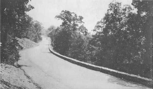
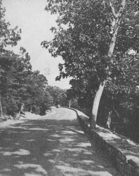 A TYPICAL SECTION OF THE FAMOUS SKYLINE DRIVE SHOWING THE EASY GRADIENT AND FLOWING CURVES. Virginia State Chamber of Commerce Photo |
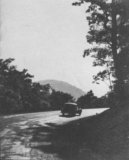 LATE AFTERNOON ON SKYLINE DRIVE. HAWKSBILL, HIGHEST POINT IN THE PARK, IS SILHOUETTED IN THE DISTANCE. Virginia State Chamber of Commerce Photo |
The Skyline Drive
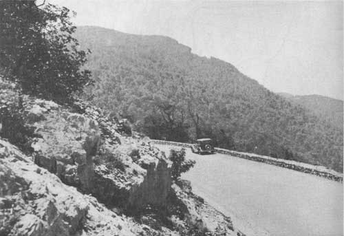
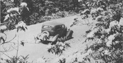
It is for the far-reaching views from the Skyline Drive that the park is most widely known. The drive, macadamized and smooth, with an easy gradient and wide, sweeping curves, unfolds to view innumerable sweeping panoramas of lofty peaks, forested ravines, meandering streams, and the green and brown patchwork fields of the valley farms below.
Built at a cost of more than $4,500,000, the famous 97-mile scenic highway traverses the entire length of the park along the backbone of the Blue Ridge from Front Royal to Jarman Gap, where it connects with the 485-mile Blue Ridge Parkway, now under construction, that will link Shenandoah National Park with the Great Smoky Mountains National Park in Tennessee and North Carolina.
At intervals along the drive, parking overlooks have been constructed to afford the motorist an opportunity to pause and enjoy the breath-taking vistas.
Trails and Bridle Paths
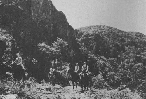
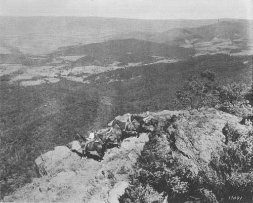
A system of bridle paths and foot trails invites horseman and hiker to exploration. Paralleling the Skyline Drive for its entire length is a section of the famous Appalachian Trail, which extends from Maine to Georgia. All of the trails are so planned as to enable amateur hikers to enjoy them without too great physical strain. Most of the trails may be reached easily from points along the Skyline Drive. The trail system is so extensive that the nature lover could spend every week-end for two years on walking trips in Shenandoah National Park, yet never go over the same ground twice.
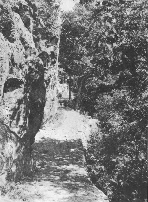 ALONG THE TRAIL IN THE STONY MAN SECTION, SHO WINO ROCK CLIFFS AND DENSE WOODS. Virginia State Chamber of Commerce Photo |
Geology
PERSONS INTERESTED in the story of the formation of the hills and valleys and of the rocks and minerals composing them will find much to command their attention in Shenandoah National Park. They will recognize the crest of the Blue Ridge Mountains as a remnant of a once vast plain which extended from the mountain ridges toward the West to the strand line of the sea. The carving of the mountains and valleys out of this plain is one of the later chapters in the earth history of this area. The visitor may also visualize in the greenstone rocks of these mountains the outpourings of lava released during a remote age when volcanic vents were conspicuous features of the landscape. The folded rock strata reveal the magnitude of the forces which wrinkled and broke the earth's crust, causing an overlap for several miles. These and many other geological features reveal a long and complex record of earth events.
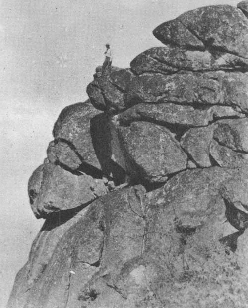 THE ROCKY CREST OF OLD RAG MOUNTAIN, 3,291 - FEET ABOVE SEA LEVEL, IS POPULAR WITH HIKERS. |
 HORSEBACK RIDERS AND HIKERS ENJOY THE TRAIL UNDER STONY MAN CLIFFS. |
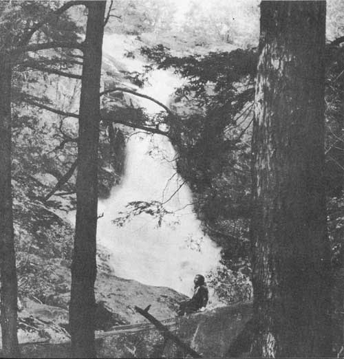
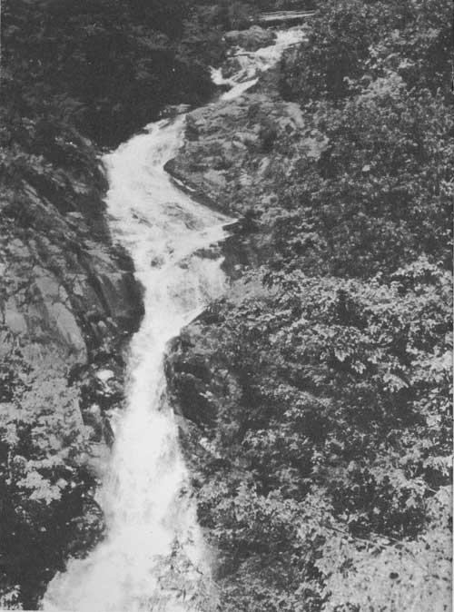 UPPER FALLS OF WHITE OAK RIVER IN WHITE OAK CANYON. HERE THE RIVER DROPS 1,500 FEET WITHIN TWO AND A HALF MILES. Virginia State Chamber of Commerce Photo |
 SOUTH PORTAL OF THE 700-FOOT TUNNEL THROUGH MARY'S ROCK, NEAR PANORAMA. BORED THROUGH SOLID GRANITE, IT IS ONE OF THE OUTSTANDING ENGINEERING ACCOMPLISHMENTS IN THE CONSTRUCTION OF THE DRIVE. Virginia State Chamber of Commerce Photo |
 OLD STONY MAN, THE SECOND HIGHEST PEAK IN THE PARK, AS VIEWED FROM HUGHES RIVER GAP. Virginia State Chamber of Commerce Photo |
Vacation Land
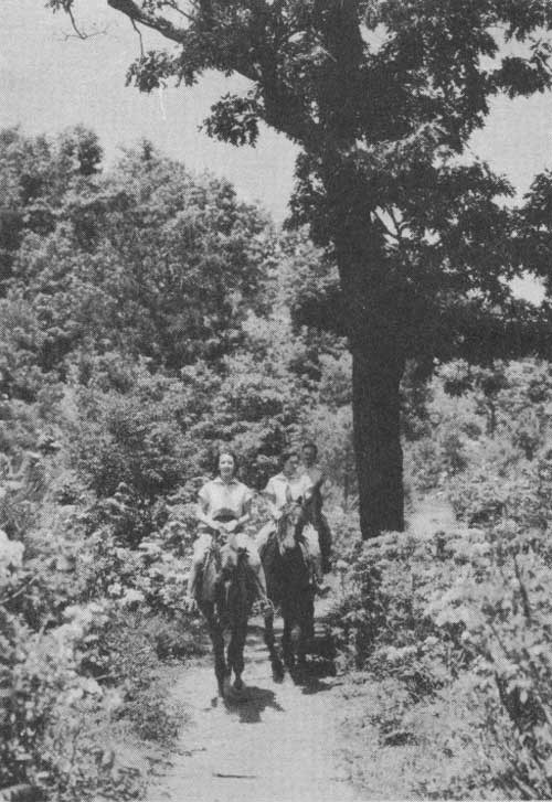
SHENANDOAH NATIONAL PARK offers to the visitor a combination of mountain and valley scenery of unsurpassed beauty. These scenes are to be discovered in panoramic views from the Skyline Drive, but still more fascinated is the park visitor who can take the time and effort to get out of his car and follow some of the numerous trails that the National Park Service has developed. Better still, a horseback ride from Skyland or Big Meadows is a good way to enjoy the mountains with their rocky crags, or the hollows with their rushing streams and verdant slopes. It is by such intimate contact with the beauties and wonders at nature that the visitor appreciates the many interesting things that have been provided for his enjoyment.
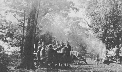 GROUPS ENJOYING AN OUTDOOR PICNIC AT ONE OF THE SIX PICNIC AREAS IN THE PARK. |
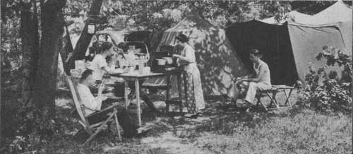 CAMPING AT THE BIG MEADOWS CAMPGROUND. Virginia Conservation Commission Photo |
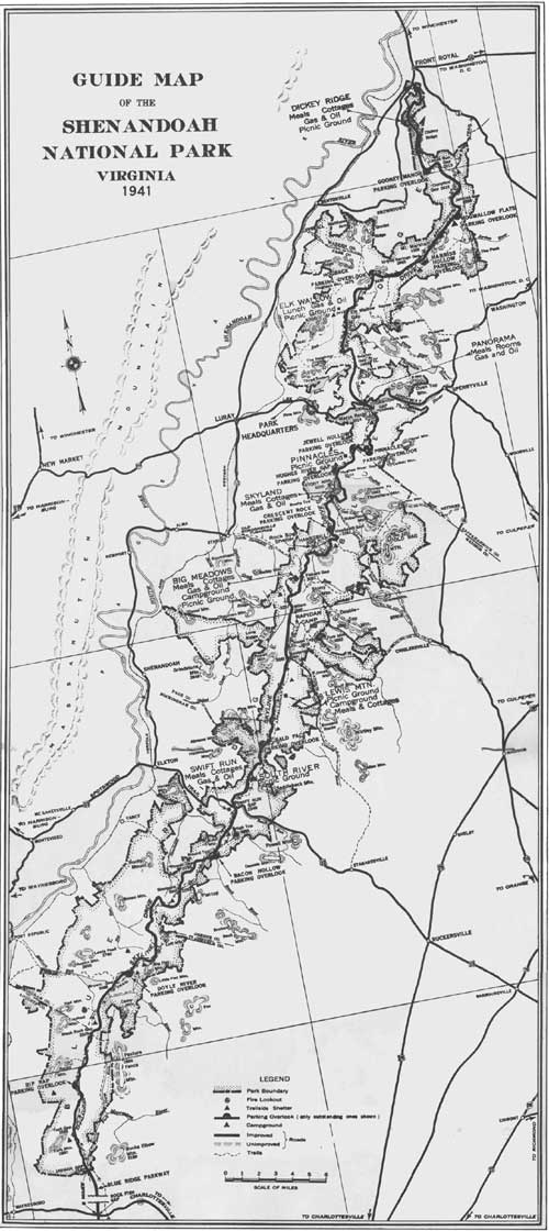 GUIDE MAP TO THE SHENANDOAH NATIONAL PARK, VIRGINIA (1941) (click on image for a PDF version) |
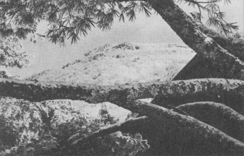 STONY MAN MOUNTAIN IN DISTANCE AFTER KING WINTER HAS BRUSHED ITS SLOPES WITH SNOW. |
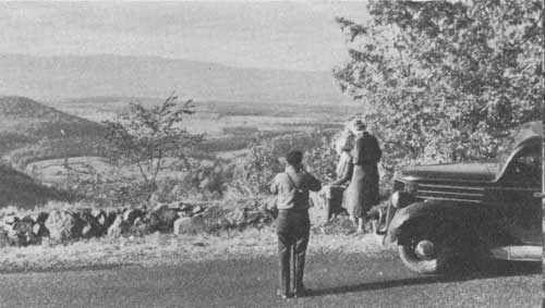 ONE OF THE NUMEROUS PANORAMIC VIEWS OF THE SHENANDOAH VALLEY AS SEEN FROM THE SKYLINE DRIVE. |
 BIG MEADOWS LODGE, OPERATED BY THE VIRGINIA SKY-LINE COMPANY. |
FLORA
ASIDE FROM the magnificent views, the profuse vegetation which smoothly cloaks the Blue Ridge never fails to charm the visitor to Shenandoah Notional Park. There are fully 100 different kinds of trees in the area, 10 of which are evergreens; more than 50 shrubs, many with conspicuous flowers; hundreds of herbaceous wildflowers; and a wealth of ferns, mosses, lichens, and other plants which thrive in the moist woods.
Mountain laurel, blooming early in June, heads the list of flowering shrubs and is followed closely in profusion by azaleas, redbud, Jersey tea, nine-bark, sumac, purple-flowering raspberry, hydrangea, and witchhazel which blooms in late fall and early winter.
Any month from April through October finds an abundance of wildflowers in bloom. The large number of wildflowers to be seen by the motorist along the drive is simply a prelude to what awaits the hiker along the trails, who delights at every turn in the wondrous display of bloom.
One of the greatest displays of the spring is presented by the mountain laurel in early June over immense areas along the Skyline Drive and trails alike. The blooming of this shrub is a spectacle second only to the riotous colors of turning leaves in mid-October each year.
Because of the preponderance of hardwoods, the fall season in the park is a festival of color. Shenandoah's autumnal foliage display of all shades of crimson, gold, and russet, accentuated by the green of the conifers, bathed in the soft blue haze of Indian summer, annually attracts thousands of visitors from all over the United States. The color is usually at its height between October 10 and 20, but it is evident as early as the last week in September and remains until the end of October.
 USERS OF THE TRAILS ARE AFFORDED OPPORTUNITIES TO STUDY AND ENJOY THE DISPLAY OF WILD FLOWERS. Virginia State Chamber of Commerce Photo |
 MOTORISTS GET GLIMPSES OF THE MOUNTAIN LAUREL ALONG SKYLINE DRIVE. Virginia State Chamber of Commerce Photo |
 HORSEBACK RIDERS STOP TO ENJOY DISTANT VIEWS. Norfolk and Western Railway Photo |
 A VIEW OF THE SKYLINE DRIVE, SHOWING PROTECTIVE STONE GUARD WALL ERECTED ALONG STEEP FILL. |
Wildlife
WHILE THE POPULATION of wildlife in the region is not so great as it will be after a few years of protection, wild animals and birds are by no means absent. Bobcats and foxes move silently through the woods; whitetailed deer, raccoons, opossums, woodchucks, rabbits, and flying squirrels live in the area and are sometimes seen; gray squirrels and chipmunks are common. Hikers are often startled by the sudden booming flight of quail or ruffed grouse and are thrilled by the chattering, whistling, and warbling of numerous song birds.
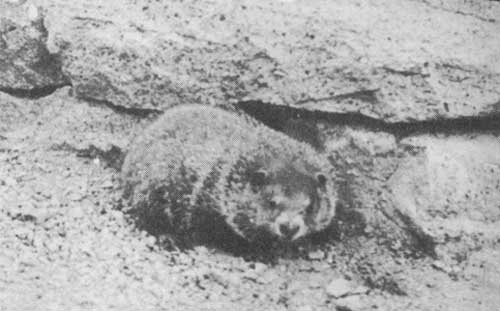 WOODCHUCK, ONE OF THE COMMON SMALL MAMMALS OF THE PARK. |
 LOWER FALLS IN BEAUTIFUL WHITE OAK CANYON. HERE THE HIKER MAY FOLLOW THE COURSE OF THE STREAM THROUGH UNSPOILED WILDERNESS THAT EXTENDS TO THE VALLEY FAR BELOW. Norfolk and Western Railway Photo |
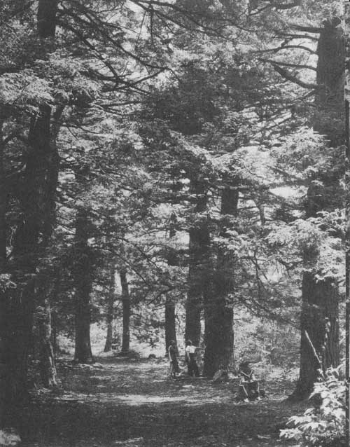 AMONG THE GIANT HEMLOCKS ON THE TRAIL THROUGH "LIMBERLOST SWAMP." Virginia State Chamber of Commerce Photo |
Welcome to Visitors
THIS IS YOUR PARK, and, while we of the National Park Service have been commissioned to protect it in its natural state for all to enjoy, we ask you to assist us in fulfilling our duty of enforcing park regulations by:
1. Leaving everything as you find it. Wildflowers are one of our greatest attractions; it is selfish to pick them and destroy their beauty for others. Signs and buildings are new; let's keep them unmarked.
2. Driving carefully. Traffic signs will aid you. If you have an accident, report it to a park ranger. Parking areas are placed at the most scenic spots.
3. Using receptacles at all parking and picnic areas for paper and lunch refuse. Picnic grounds are adequately equipped with fireplaces, tables, water, and comfort stations for your convenience.
4. Using the fireplaces in the campgrounds and picnic areas since FIRE is the arch-enemy of your park. Burning matches and tobacco will start fires, too, so dispose of them safely by using the ash tray in your car; when hiking, grind them out on a rock or in wet soil.
5. Walking on designated trails and paths since short cuts destroy the plant life and cause erosion. Signs have been placed at intersections on established trails to indicate the directions.
6. Protecting all wildlife, since the park is an absolute sanctuary. Watch for animals along the road lest you run over them.
7. Asking a park ranger at any of the entrances for a copy of the special regulations before you begin to fish.
8. Securing a permit from a park ranger before making camp along a trail. No permit is required in designated picnic and campground areas.
Any violation of park regulations is punishable by law.
ACCOMMODATIONS
Six picnic grounds at locations shown on the map inside, fully equipped with water, fireplaces, wood, tables and benches, rest rooms, and ample parking space, are provided at no charge by the National Park Service for your use and enjoyment. Similarly, a public campground at Big Meadows provides all facilities, except electricity, required for either tent or trailer camping. Camping is free, with use limited to 30 days. Camping facilities are also available at Lewis Mountain. For location of the individual areas within the park, see the map.
All overnight and restaurant facilities in the park are furnished through the park operator, the Virginia Sky-Line Company, Inc. Requests for rates, reservations, etc., should be addressed to that company at Luray, Va.
The following tabulation shows the rates for rooms and meals at the various locations.
| Dickey Ridge |
Panorama | Skyland | Big Meadows |
Lewis Mountain |
Swift Run | |
| No. Rooms | 32 | 8 | 100 | 38 | 8 | 6 |
| Rate, Single | $1.50 to $2.50 | $1.50 | $1.00 to $4.00 | $2.50 to $4.00 | $1.25 | $1.25 |
| Rate, Double | $2.50 to $4.00 | $2.00 | $1.50 to $6.00 | $4.00 to $7.00 | $2.25 | $2.00 |
Meals; Breakfast, 35 cents to 75 cents; lunch, 50 cents to $1; dinner 75 cents to $1.50.
Roadside lunchrooms and filling stations are available at intervals to provide light meals and to render service to the motorist.
HOW TO REACH THE PARK
The Shenandoah National Park is accessible via main highways at four points — from State Highways 12 and 55 at Front Royal; from Lee Highway, U. S. 211, at Thornton Gap; from Spotswood Trail, U. S. 33, at Swift Run Gap, and from the Charlottesville-Waynesboro Highway, U. S. 250, 8 miles south of the park boundary.
ENTRANCE FEES
Private vehicle, 25 cents per daily trip. Annual permits, $1 per private vehicle. Commercial busses, $5 per daily trip.
Communications regarding the park should be addressed to the Superintendent, Shenandoah National Park, Luray, Va.
| <<< Previous | <<< Contents>>> |
1941/shen/sec1.htm
Last Updated: 20-Jun-2010