|
GEORGE WASHINGTON BIRTHPLACE National Monument |
 |
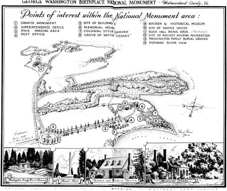
(click on image for an enlargement in a new window)
Guide To The Area
The information which follows, supplements that contained in the narrative of this handbook. It has been arranged to enable you to make your own tour of the area. The numbers given correspond to the numbers on the map of the national monument (above).
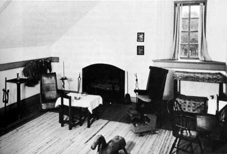
A part of the parlor.
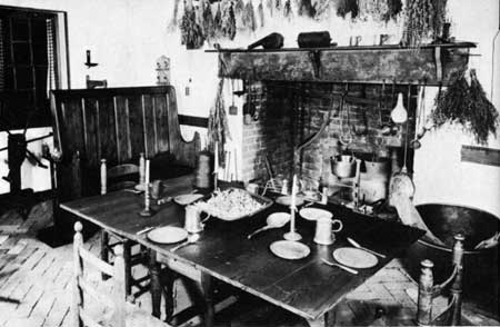
Interior of reconstructed colonial
kitchen.
9. THE KITCHEN AND HISTORICAL MUSEUM. The colonial-style kitchen building is located about 50 feet west of the memorial house. Its old chimney was the last above-ground brickwork of the original buildings at Wakefield owned by George Washington's father. Still standing in 1872, when it was sketched by a visiting artist, it finally collapsed and fell to the ground the following year. In 1930 the foundations of the old kitchen were uncovered, and subsequently a colonial-style building was constructed on the site. The east room in the building has been furnished with cooking utensils, kitchen accessories, fireplace equipment, and furniture of the 1700-50 period. The west room is used for the display of colonial artifacts which were unearthed at Bridges Creek and from various foundations found near the site of the original home on Popes Creek. The exhibits relate to the history of the Bridges Creek and Popes Creek plantations as well as to the activities of the early Washingtons who lived there.
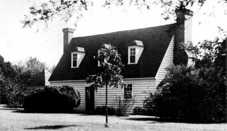
Colonial-type kitchen. One room is furnished as an
18th century kitchen; another room houses excavated objects and exhibits
relating to the early Washingtons who lived at Bridges Creek and Popes
Creek.
10. SITE OF SMOKEHOUSE. The boxwood plants mark the site of an old building foundation believed to be that of an early 18th-century smoke house. Excavated in 1936, the building had brick foundations as well as a brick floor. The foundations were located about 65 feet west of the kitchen building.
11. DUCK HALL PARKING AND PICNIC AREA. This section of the national monument is located approximately three-quarters of a mile northeast of the granite shaft. It may be reached over a paved road which runs north from the granite shaft for about one-fourth of a mile, then turns eastward. From the Duck Hall picnic area may be seen magnificent views of Popes Creek and the Potomac River.
12. SITE OF 17TH-CENTURY BRICK BUILDING. In 1934 brick foundations of a small 17th-century building were unearthed about 180 feet south east of the Washington family burying ground. One glass bottle seal found near the building site was inscribed with the name "John Washington." The structure was probably an outbuilding which belonged to George Washington's great-grandfather.
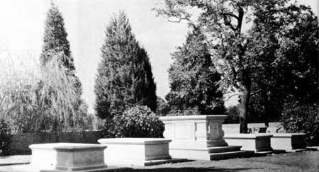
Washington family burying ground.
13. WASHINGTON FAMILY BURYING GROUND. Established by John Washington, the founder of the Washington family in Virginia, the family burying ground is located about 1 mile north of the granite shaft. In his will, John, the great-grandfather of George, asked "to be buried on ye plantation wheire I now live, by the side of my wife yt is already buried." In the years that followed, members of succeeding generations of Washingtons found final resting place in the ancient cemetery.
Here the father, grandfather, and great-grandfather of George Washington, together with 29 other early members of the family, are interred. In 1906 the Colonial Dames of Virginia made some improvements at the burying ground. In 1930, under the auspices of the Wakefield National Memorial Association, the burying ground was enclosed by a wall of handmade bricks. Five new tablestones were erected and the area was appropriately landscaped. A parking area is located about 300 feet east of the burying ground.
The tract of land surrounding the burying ground was purchased by John Washington in 1664 from David Anderson. The site of his home is in the vicinity of the burying ground.
14. POTOMAC RIVER VIEW. About a quarter of a mile north of the Washington family burying ground is the south shore of the Potomac River. Here may be seen a delightful view of the river, approximately 5 miles wide at this point. President James Monroe, the fifth President, was born on a farm facing the deep bay on the extreme left.

|
|
Last Modified: Mon, Jan 20 2003 10:00:00 pm PDT |


