|
|
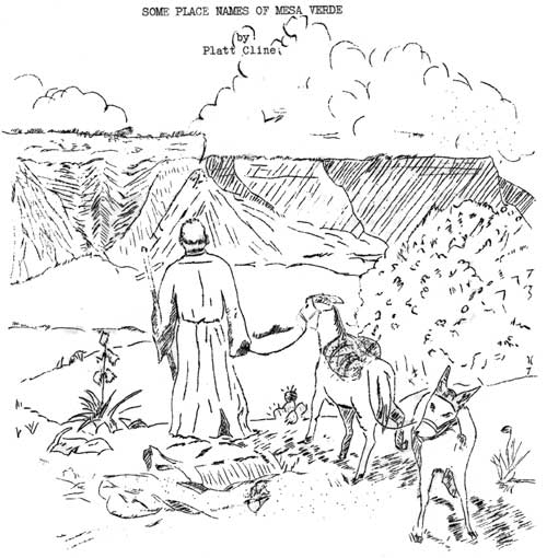
While many of the place-names of the Mesa Verde are inappropriate and lacking in color, a study of their origins may bring to light some curious and possibly amusing, historical lore. From a paper which is being prepared on the place-names of Mesa Verde National Park and territory immediately adjacent, there have been selected five names, and some little information concerning their history, which is herewith presented. Possibly, this data may be of interest to the readers of "Mesa Verde Notes." MESA VERDE: (Span., "Green table-land.") "The Mesa Verde is the name given to the high plateau which rises above the Mancos and Montezuma Valleys to a height of from fifteen hundred to two thousand feet. Roughly speaking, it is about twenty by thirty miles in extent, and thus contains over six hundred square miles."—F.H. Chapin, "The Land of the Cliff Dwellers", Appalachian Mountain Club, Boston, 1892. p. 174. The person who gave the name "Mesa Verde" to the plateau is unknown. We suppose that it was named sometime between 1776, the year Escalante, a Spanish Priest, passed through the valley on an exploring expedition, and 1859, when a government party visited the valley and mentioned that the plateau was called "Mesa Verde" at that time. This government party made the first mention in the print of the name: "Between the Rio de La Plata and the Rio de los Mancos we skirted the base of the extreme southern point of the Sierra de la Plata. These mountains terminate southward in a long slope, which falls down to a level of about 7500 feet above the sea, forming a plateau which extends southward to the San Juan, the Mesa Verde...."—Report of the Exploring Expedition from Santa Fé., New Mexico, to the junction of the Grand and Green Rivers of the Great Colorado of the West, in 1859. Macomb and Newberry. Washington, Gov't. Printing Office, 1876. p. 83. MANCOS RIVER: (Span., Rio de los Mancos: "River of the Cripples." There seems to be some little difference of meaning of the word "Mancos" in different parts of the area. Some of the Mexican boys employed at the Park state that it simply means "cripples" while others say that it means crippled four-legged animals, and others, four-legged animals with more than one member injured.) The river is formed by the union of its north and south forks in T.36, R.13 W., New Mex. princ. meridian. It forms about 4 miles of the east boundary of Mesa Verde National Park, flowing southwest into the San Juan River in New Mexico. We do not know why the river was so named, or who named it. The first mention of the name is as follows: "We passed on two leagues farther west, but were obliged to stop by the first of the two small streams which make up the San Lazaro, otherwise called Las Mancos."—Escalante's Diary, August 10th, 1776. Quoted from the Catholic Church in Utah, Bishop Scanlan, Intermountain Catholic Press, Salt Lake City, 1909. p. 133. Escalante (Fray Silvestre Velez de Escalante) was sent out from Santa Fé, New Mexico to discover a route to Monterey in Southern California, July 29, 1776. "Leaving Santa Fé, the first stopping place of the party was at the old Spanish town of Santa Clara, which name the village still retains, and another nine leagues, or twenty one and a half miles, brought them to Santa Rosa de Abiquiu, the still existing town of that name. From here the trail bore to the north and west to a point near the present village of Chama on...the....railroad, from where the priests turned abruptly to the westward, following practically the route at present taken by the railroad, to the west (where they passed through the Mancos Valley) until they arrived at the present station of Dolores, where...the course taken was...north."—Bishop Scanlan. See above for title. p. 243. Escalante finally abandoned the search for the route to Monterey, and returned to Santa Fé on Jan. 2nd, 1777. It may be interesting to note that Escalante has the river feminine, "Las Mancos", while the government party 73 years later made it masculine, "Los Mancos." KODAK HOUSE: prehistoric cliff-dwelling ruin in the Park, situated about 2 and 3/8 mi. west and slightly south of Headquarters, and about 3/4 mi. east of the western boundary of the Park. A foot-note on p. 21, G. Nordenskiold, "The Cliff Dwellers of the Mesa Verde", Stockholm, 1893, states: "This cliff-dwelling is named after the well-known camera "Kodak" as we kept one of these apparatuses hidden for some time in one of the rooms. The propriety of the name may be called in question, but as it has already gained ground, I have thought it best to retain it." CLIFF PALACE: prehistoric cliff-dwelling ruin in the Park, located in a lofty recess upon the east wall of Cliff Canyon near lat. 37 10' N., long. 108 28' 15" W. Has 217 rooms, 23 kivas, being the largest of the cliff-dwellings. Quoting from p. 12 of Nordenskiold's book (see above for title): "The two largest ruins were found by Richard Wetherill and Charley Mason one December day in 1888, as they were riding together through the pinon wood on the Mesa, in search of a stray herd. They had penetrated through the dense scrub to the edge of a deep canyon. In the opposite cliff, sheltered by a huge, massive vault of rock, there lay before their astonished eyes a whole town with towers and walls, rising out of a heap of ruins. This grand monument of bygone ages seemed to them well deserving of the name of the Cliff Palace." CHAPIN MESA: in the Park, extends south between the Soda Canyon and Navaho Canyon drainages for entire length, crossing secs. 27, 28, and 33, T.35 N., R. 15 W., New Mexico meridian, and thence on unsurveyed land to and beyond the southern boundary of the Park. As the visitor enters Mesa Verde National Park, he commences to gain altitude rapidly, until finally he comes to the highest point in the park, Park Point. From here he drops rapidly, until, when he is about six miles from park headquarters, he comes out onto Chapin Mesa. Unless he takes horseback trips to the west side to the more out-of-the-way ruins, he will stay on Chapin Mesa for the entire duration of his visit. All of the ruins visited by the regular guided trips are either on Chapin Mesa or in the Cliffs just below the edge of the mesa. It was named by Nordenskiold, who tells us, on p. 49, of his book (see above for title): "I call this plateau Chapin's Mesa, after F.H. Chapin, who was the first to publish any description of the more important ruins of the Mesa Verde." The reference here is to Frederick H. Chapin, author of "The Land of the Cliff Dwellers", pub. Appalachian Mountain Club, Boston, 1892. | ||||||
| <<< Previous | > Cover < | Next >>> |
vol6-1d.htm
14-Oct-2011