|
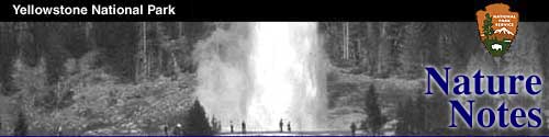
YELLOWSTONE NATURE NOTES
|
| Vol. XXXIII |
June, 1960 |
Special Edition |
|
EARTHQUAKE WATER TABLE EFFECTS AROUND THE WORLD
The alluvial mantle that veneers bedrock over most of
the earth is the realm of ground water, one of our most precious natural
resources that serves to feed water wells and permanent flowing streams.
The United States Coast and Geodetic Survey, Ground Water Branch
maintains observation wells with automatic recording gauges at many
points in the United States.
The August 17th, 1959, earthquake caused a change in
water level in 177 wells in 25 states and Puerto Rico. Minor
fluctuations were recorded as far away as the Hawaiian Islands and a
maximum change of ten feet was noted in an artesian well 85 miles south
of Hebgen Dam. A mine water pool in the Northern Anthracite field near
Wilkes Barre, Pennsylvania, was also observed to fluctuate.
Table 3.* Summary of Effects of Montana Earthquake on Water Levels in
Observation Wells
| State | Number of Wells | Maximum
Fluctuation (ft.) |
|---|
| Alabama | 20 | 1.3 |
| Arizona | 3 | .29 |
| Arkansas | 6 | .06 |
| California | 22 | 1.11 |
| Colorado | 1 | .03 |
| Florida | 15 | .48 |
| Hawaii | 4 | .10 |
| Idaho | 18 | 10.0 |
| Illinois | 4 | .95 |
| Indiana | 10 | .49 |
| Kentucky | 2 | .28 |
| Michigan | 5 | .26 |
| Minnesota | 6 | .67 |
| Montana | 10 | 1.76 |
| Nebraska | 1 | .23 |
| Nevada | 3 | 1.00 |
| New Jersey | 6 | 1.42 |
| New Mexico | 10 | 1.3 |
| New York | 2 | .28 |
| Ohio | 7 | .24 |
| Oklahoma | 1 | .28 |
| Puerto Rico | 1 | .01 |
| Texas | 4 | .60 |
| Utah | 5 | 5.1 |
| Washington | 6 | 1.15 |
| Wisconsin | 5 | 1.00 |
| *Water Resources Review, U.S.
Geological Survey—Sept. 1959. |
Earthquake waves shaking the unconsolidated sand and
gravel cover cause a compaction of the material. This reduces the
available pore space and drives water out of the voids thus causing
increased discharge. During the period August 1-16 the net inflow into
Hebgen Lake was about 600 cubic feet per second. From August 21-31 the inflow
increased to about 1,100 cubic feet. It is impossible to predict what
long range effect this increased discharge may have on water wells in
the immediate earthquake area.
Locally a number of sinuous fissures were opened in
the alluvial cover and ground water and sand were forcibly ejected from
them. Such features are known as sand spouts. Near Hebgen Lake Lodge a
fissure 50 feet long, 20 feet wide, and about 9 feet deep ejected water,
sand and cobblestones. In Yellowstone Park smaller sand spouts have been
observed in the Madison Junction campground and also two miles east near
the base of Tuff Cliff.
Effects of the earthquakes on Yellowstone's hot water
resources are discussed in the chapter "Changing Geysers and Hot
Springs."
|