|
Big Bend
Administrative History |

|
CHAPTER 11:
Discovering Nature's Way: Scientific Research and Resource Protection, 1936
The years between congressional authorization of Big Bend National Park and its establishment witnessed a steady stream of university faculty and graduate students, as well as park service technicians, eager to chart the natural and cultural wonders of the region. These observers of the landscape anchored Big Bend's reputation as a marvel of scientific opportunity. They also recognized the need for protection of the flora and fauna from human intrusion, and called on many occasions for regulation of such practices as overgrazing and big game hunting. From these appeals would come patterns of resource management that reinforced Big Bend's reputation as an outstanding nature park. The emphasis on the latter phenomenon also paralleled the general NPS tendency to discount cultural resources. Thus the legacy of Big Bend as a "pristine" wilderness, where signs of human habitation should be removed, gained momentum in the first years of research, and had become its signature when the park opened for visitors.
Once the preliminary surveys of Big Bend had been completed, NPS officials set out in early 1936 to expand upon the findings and make recommendations for park facilities, interpretative programs, and future research needs. The massive study undertaken late in 1935 by William B. McDougall and Maynard Johnson led George F. Baggley, wildlife supervisor for the NPS's branch of planning and state cooperation, to suggest several initiatives for the Big Bend. "In view of the present land status in the Big Bend area," Baggley warned Conrad Wirth, "it is naturally difficult to undertake any large work projects with the CCC camps now in the area." Yet the NPS wildlife supervisor saw an immediate need for "range study plots," as these would "determine the rate of change in range grass cover and forest reproduction." Baggley wanted "at least one such plot . . . located in each of the different cover type zones." These would measure 33 feet square, and would have to be fenced "to exclude all animals." The state of Texas could assist the NPS by conducting "erosion control on State-owned land." The park service would need a relief map of the future national park unit, as well as a topographical map "with as many of the existing roads, trails, fences, and other improvements as possible." Baggley hoped that the NPS could initiate "a continuing project to provide for wildlife observation and a study of all wildlife species, their abundance and distribution." Building on that study, Baggley wanted to "arrange with the State authorities for immediate protection of the Peccary which has no protection whatever in the Big Bend project." Baggley then reminded Wirth: "On the Big Bend project similarly as at Boulder Dam there seems to be a definite need for the assignment for a wildlife foreman to devote his full time to this project." [1]
Survey of Big Bend's natural landscape had an additional purpose in 1936: the need for regulation of resource use. Conrad Wirth asked George A. Moskey, assistant director for the NPS, to offer advice on requests for permission to mine the region. While the history of the Big Bend reflected the impact of resource extraction, the new authority of the park service prohibited this pattern of use. Moskey told the NPS director of land planning that "we should make it clear to these people that when the lands are turned over to the Federal Government for national park purposes, no mining of any kind can or will be permitted." The park service needed to make clear, Moskey warned, that "any reservation in the deed of conveyance, or any covenant in connection with the transfer, which could require that the land be open to mining, or compel the United States to open the area to the extraction of minerals, will prevent our accepting the land for national park purposes." Moskey noted that the NPS had faced similar situations when accepting land donations for such parks as Shenandoah, Great Smokies, and the Everglades. The assistant NPS director also advised Wirth that "a well-studied letter should be written to the [Texas] Governor to supplement the brief letter of October 14, 1935, covering fully the requirements that will be insisted upon by us in the transfer of lands to the Federal Government." He also asked Wirth to remind Texas officials of "the necessity for the State to enact preliminary legislation ceding to the United States exclusive jurisdiction over the area." This latter point would complicate relations between the park service and state and local law enforcement officials for the remainder of the twentieth century. It also required legal clarification as late as 1996 when closure of the park during a shutdown of the federal government blocked access for travelers and locals across the vast expanses of the park. [2]
Protection of the NPS's interests in the area, and acquisition of knowledge about Big Bend's resources, also required the park service to promote the findings of its technicians. In April 1936, George Baggley received an invitation to speak on Big Bend at the annual meeting of the Society of Mammologists. Baggley asked Maynard Johnson to craft an argument that would appeal to his audience, and the NPS regional wildlife technician responded by linking the American and Mexican portions of the Big Bend. This would give scientists, said Johnson, "an approximately complete biological unit," making Big Bend "the only national park that does so." Johnson also praised the future park's inclusion of the Chisos Mountains, as they were "separated from any other mountains by wide stretches of desert flats." This meant that "the fauna will be better protected in certain respects than is possible in any other national park." Johnson remarked that another distinctive feature of Big Bend was "several Mexican species that enter the United States only at this point," most notably the "weeping Juniper (Juniperus flaccida)." The wildlife technician noted that the "most characteristic plant" of the plains surrounding the Chisos Mountains was the creosote bush, with mesquite, ocotillo, lechuguilla, and prickly pear the other representatives of lower Sonoran desert cacti. The higher that one climbed into the Chisos, said Johnson, the more one encountered Upper Sonoran species like the Mexican buckeye, desert willow, Apache plume, oak, pinon, juniper, Arizona cypress, Douglas fir, and yellow pine. [3]
Johnson hoped to impress upon Baggley that "the study of the flora of this region is in its infancy." While scientists already had identified some 450 to 500 species, much remained to be accomplished. As an example, Johnson cited disparities in naming oak trees in the future national park. "There are probably nine or ten species and varieties of oaks in the Chisos Mountains," wrote Johnson, "some of which may be new to science and some of which are probably hybrids." Since Baggley's audience would focus primarily on mammals, Johnson mentioned that "tree squirrels, and porcupines, are among the mammal groups absent from the area -- perhaps because an extensive area surrounding the Chisos Mountains is treeless semi-desert." In the proposed park area as a whole, the mammals most frequently seen were Texas jackrabbits. The "most abundant" of mammals "are various species of Peromyscus -- especially in the mountains, and perognathus -- especially on sandy lowlands." [4]
Despite large quantities of mammals as common as jackrabbits, Johnson nonetheless recognized that "there are several other features or characteristics that will serve to make the mammalian fauna of this park outstanding and intensely interesting." He noted that "the peccary occurs here and in no other existing or proposed national park." The regional wildlife technician reiterated the charge of earlier NPS surveyors that the javelina "was formerly very abundant in this region but has been killed extensively for hides and often by hunters merely for the sake of something to shoot." Johnson did know of "several small bands in the area," and believed that "with protection they will increase satisfactorily." Of major importance to this effort, wrote Johnson, were plans "to make the area a state game refuge in order to prohibit all hunting until such time as the park is established and full protection is given to the entire fauna and flora." [5]
In addition to the need for protection of the javelina, Johnson also drew attention to "another characteristic of the unique mammalian fauna of this park:" the presence of three distinctive species of deer. Most common was the Mexican mule deer. "Since this is the only place in Texas where the mule deer is abundant," reported Johnson, "it has in the past been hunted rather persistently." NPS officials had undertaken "voluntary agreements with the ranchers" that provided "a measure of protection." Mule deer as a result had become "quite abundant," and were increasing "at a satisfactory rate." The NPS technician also noted the presence of the Texas whitetail deer, "found mostly in the rimrock country of the southern foothills of the Chisos Mountains." Johnson found that "the range overlaps that of the mule deer to a certain extent," but did not extend to the surrounding flats "where the mule deer has a tendency to range." The whitetail also foraged higher into the mountains, encountering there the fantail deer. "Since the whitetail deer are common in some other parts of Texas," Johnson told Baggley, "and are smaller than the mule deer they have not been hunted so persistently." [6]
Johnson then turned to mountain lions, which were "frequently killed" by local hunters. Echoing later laments of NPS officials about the hunting of predators, the technician reported that "there seems to be no way of giving certain protection to these animals at present." One reason was because "these animals range so widely," so that "the protection that is given them in most national parks is often of little benefit." Johnson hoped, however, that "since the Big Bend National Park will be biologically isolated the protection of predatory animals will be a somewhat simpler matter than elsewhere." He claimed that "indeed, this park is likely to be one of the most favorable places in the United States, if not the most favorable, for the permanent preservation of any kind of cougar," as "the variety occurring in the Big Bend (Felis oregonensis azteca) is not found in other national parks." Johnson then added three smaller mammals "that are peculiar to this park:" the Couch black rock squirrel, which was "found only in northeastern Mexico and the adjacent part of Texas;" the Chisos Mountain cotton rat, "known nowhere else in the United States;" and the Davis Mountains cottontail, which Johnson claimed "is known only from the Davis, Chisos and a few other mountains of southwestern Texas." [7]
The field research conducted in the Big Bend area by regional geologist Charles H. Gould paralleled the biological work of McDougall and Johnson as the Civilian Conservation Camp expanded. On the second of six visits to the area in April 1935, Gould sought more information about the future park site, and also hoped "to collect specimens and start the geological museum." His first destination was the "Chisos Pen," an old camping and branding site located near some tinajas (rock water holes) about three miles south of Slick Rock Mountain, "at a point where Cottonwood Creek has cut its way through a row of hills which extend north from the north end of Burro Mesa." Here at what local ranchers called "Sulphur Springs" did Dr. J.A. Udden in 1907 make "his classic section of the Rattlesnake (Aguja) beds." Gould described the formation as "yielding large quantities of petrified wood, and occasional dinosaur bones and sharks' teeth." The geologist also identified deposits of sandstone, volcanic igneous rock, clays, sandy shale and coal around Sulphur Springs, the latter connected to an abandoned mine at the south flank of Slickrock Mountain. Some of the sandstone strata along the north side of Cottonwood Creek contained "many fossils, chiefly oysters," and Gould highlighted this in his call for more research on the area. [8]
From the Chisos Pen at Sulphur Spring, Gould then journeyed to the Banta Shut-In, which the geologist described as "a deep narrow gorge cut by water flowing in Tornillo Creek through an intrusive sill of lava." He examined a section some 5.5 miles "as the crow flies" due east of "the point where the road to the [CCC] camp leaves the Marathon-Boquillas road." Gould noted that "this region is now impassible for cars," as he had to drive over "an old road, to a point on Tornillo Creek about a mile west of the old Stillwell Ranch, and the same distance southwest of McKinney Spring." At that juncture Gould had to proceed on foot, "down the dry bed of Tornillo Creek, a distance, following the winding of the creek, of about six miles." The geologist found his hike "very interesting," as Tornillo Creek and its tributaries "have cut steep bluffs and over-hanging cliffs, in places 100 feet or more high, in the Rattlesnake and Terlingua beds." As he had at the Chisos Pen, Gould found in the Banta Shut-In oyster shells and petrified wood. He then speculated on the formation of the Banta Shut-In; a term that "has long been used for a narrow gorge, which in many ways, rivals [the] Royal Gorge of Colorado." The Banta Shut-In, "while not so deep as the latter," nonetheless "has sides . . . as precipitous," with a canyon narrower than the Arkansas River chasm in south-central Colorado. Gould suggested that the "Banta Shut In might be utilized in one of two ways:" as a "show place, and second, as a reservoir site." Because "people like to walk through narrow gorges," said Gould, "a road could be easily constructed from the present Marathon-Boquillas road along one of the ridges between draws, and come out on top of the gorge." The dam site could "form a lake for bathing and fishing," as "there is little doubt that the basaltic walls would hold water." Gould estimated that the drainage area for a reservoir would be over 300 square miles. Hindering such a plan, reported the NPS geologist, was the fact that "rainfall is scanty, occurring usually as cloudbursts." In addition, "the evaporation is excessive, and the reservoir will probably silt up rapidly." Thus Gould cautioned his superiors: "Careful studies should be made of all the involved factors before seriously considering building a dam." [9]
Gould's third inspection in the spring of 1936 was in Dog Canyon, which local residents also called "Bone Gap". Situated about five miles south of Persimmon Gap, Bone Draw had cut "a deep and narrow gorge . . . across a limestone mountain 500 to 1000 feet high and a mile wide." This constituted part of a larger series of fissures in the earth that stretched "for a distance of approximately 80 miles in Texas and for an unknown distance in Mexico." Gould found that "the dry bed of Bone Draw affords easy walking, and an auto road could easily be lead down the canyon, the entrance to which is about two miles from the Marathon-Boquillas road." Its only problem, Gould conceded, was that "this road would have to be repaired after heavy rains." Nonetheless, the regional geologist pressed for inclusion of Bone Draw in the park's planning, as "I do not remember of ever having seen finer examples of faulting in limestone than those shown in Dog Canyon." The area was "longer and deeper than the Banta Shut In, but not so narrow." It also did not require the twelve-mile hike of Banta Shut-In for access. Gould did note that "on account of the porous and soluble nature of the limestones comprising the walls[,] Dog Canyon would probably not be suitable as a reservoir site." Given this dilemma, the geologist suggested that "mention should be made of Devil's Den, located about one mile south of Dog Canyon." This "narrow, winding, tortuous gorge, easily seen from the road," had "many tenajas [sic], or rock water holes, in the gorge, so that under ordinary conditions it can be traversed only by swimming in certain places." [10]
Completing his arc from northeast to southwest in the Big Bend area, Gould stopped last at the "Terlingua-Lajitas country." He described Lajitas as "a small village located one mile above the entrance to Santa Helena Canyon and twelve miles southwest of Terlingua." Surrounding Lajitas were rocks dating to the Cretaceous age, while "fossil shells found at Fossil Knobs two miles northwest of Terlingua indicate that the rocks are Boquillas flags." Further to the southwest, Gould identified "large fossil oysters thirty inches in diameter" in the Terlingua beds, "very similar to those found at San Vicente." Between Terlingua and the Rio Grande, "and extending from the mouth of Santa Helena Canyon to Lajitas," reported Gould, "appears to be a series of fault blocks, similar, structurally, to those which make up the Del Carmen-Dead Horse-Santiago Range." Known as the Mesa de Anguila on the American side of the river, and at the time the "Sierra Rica" on the Mexican side (later changed to "Sierra Ponce"), these ridges "constitute the western limit of the 'graben' which occupies the greater part of Big Bend park." [11]
With his journey complete, Gould devoted the remainder of his report to his efforts to create at the Chisos CCC headquarters a geological museum. Workers at the camp had finished a laboratory-museum structure that allowed the geologist to "have tables built and shelving erected, to display a number of geological specimens." After each surveying trip made by Gould, he would send back to the camp a truckload of specimens, and "one special trip was made to San Vincinte [sic] and Glenn Springs to collect large fossil oysters." Once Gould had departed the Chisos Mountains, the museum had over 300 specimens on display, with "the most abundant material [consisting] of fossil oysters and ammonite found in the Terlingua beds." He also took pride in the display of "a very good collection of 'desert pebbles,'" along with "crystals of calcite and quartz, novocalcite, celestite, lava, petrified wood, sandstone, limestone, flint chips, hammerstones, and metates." The museum also benefited from the assignment by CCC superintendent Morgan of two enrolless, "one lettering signs and labels, the other arranging specimens." These activities led Gould to conclude: "Only a very crude beginning has been made, but with time and effort a very creditable exhibit of geological and paleontological material may be collected and displayed." [12]
Throughout the summer of 1936, voices of concern arose to call for protection of the future park's natural resources. Arthur F. Robinson of the Alpine chamber of commerce wrote to Conrad Wirth and Herbert Maier to offer his advice. "Because of my continued interest in our Big Bend Park and close observance, for a number of years, regarding plant life, animal life and Indian Archaeology," said Robinson, "I am taking the privilege of outlining information which I believe will be valuable to you . . . for the future good of our Park." The Alpine business leader noted that "conservation of the plants and animals and the archaeological sites of the Big Bend is a subject near to the hearts of an increasing number of residents of the region." Along with "observers from outside," champions of the new park "realize the imminent danger of their [the resources'] serious depletion, and even of the extinction of some species." For Robinson and other park advocates, "since the acquirement of the land for park and its transfer to the National Parks Service will require some time, steps should be taken IMMEDIATELY to form a game reserve that will include the whole Big Bend." This would mean that "the remaining remnants of deer, bear, jabalinas [sic] and other animals may be preserved to become a [nucleus] for the Big Bend National Park." [13]
As for the flora of the region, said Robinson, "hundreds of truck loads of cacti have been taken from the Big Bend by commercial curio dealers and [those] to whom the fad of a cactus garden appeals." These thieves ignored "the commoner species," preferring "the smaller and rarer species." Thus "whole localities have been denuded of rare species that once occurred plentifully." All of this persisted "in spite of a prohibitory measure passed by the State Legislature some five years ago." Robinson conceded that "regulations should not preclude the taking of herbarium specimens by bona fide scientists." He also noted that "the dry shelters of the Big Bend are known to contain relics of ancient cultures about which too little is known." He feared that "if the present practices of relic hunters and amateur archaeologists from the city museums are continued, these shelters will be denuded without doing anyone any good or proper records being obtained." Robinson called the Big Bend "the happy hunting ground of relic hunters who invariably spoil more material than they save." He called upon the NPS to leave "as many of the shelters in the Park area as possible . . . in their natural state." Robinson would allow for "representative shelters [to] be explored for the material for study to determine the culture represented, the material to be deposited in a museum at the Park headquarters with duplicates in the museum of the West Texas Historical and Scientific Society [in Alpine]." [14]
Robinson gave specific attention to the "pulling of wild flowers" in the Big Bend region by visitors, calling this "an inane and useless pastime as they seldom last half an hour before wilting." His observations led the Alpine chamber official to conclude: "Whole areas of lupines, penstemens and other wild flowers that formerly grew in certain localities in profusion have entirely disappeared due to their destruction by thoughtless people." Ironically, Robinson claimed that "the publicity given the region by reason of the establishment of the Big Bend National Park has turned the attention of game and relic hunters to the Big Bend." Ignoring his chamber's role in the promotion of the future park, Robinson told NPS officials: "Conservation measures should be initiated immediately if they are to do any good." He wanted "property owners in the region [to be] encouraged to cooperate in protecting the flora and fauna which, after all, contributes so much to the charm of the Big Bend." This meant that the NPS should station a uniformed ranger in the area "at an early date." He then revealed his proprietary interest in the scheme: "As you know my intimate acquaintance with the property owners and this territory for twenty years, I shall appreciate your consideration for the position." [15]
While the park service could not accommodate Robinson's request for employment, it did take seriously his call for protection of natural and cultural resources in the Big Bend area. James O. Stevenson, acting chief of the NPS's wildlife division in Washington, asked officials of the Oklahoma City-based region for advice on "current activities of Texas or federal agencies for the conservation of wildlife and Indian relics in the Big Bend." Stevenson acknowledged that "Doctor McDougall has discussed establishment of a game refuge in Brewster County, Texas, with the Texas Game Commission." Stevenson also knew that "some action is being taken for the protection of javelina and one or more species of deer." The park service, however, realized that "Texas authorities feel there is little likelihood that the entire Big Bend can be made a game refuge as suggested by Mr. Robinson." The acting wildlife division chief reminded Region Three officials that "it is certainly desirable that Texas laws, prohibiting removal of cacti, be enforced." Stevenson thus wanted to know if the regional office had "any information as to which bureau of the Texas government should be contacted with reference to this enforcement?" [16]
Regional biologist William McDougall participated in this dialogue with additional work related to resource protection in the Big Bend area. In June 1936, McDougall outlined some six pairs of plots of land for range study, with different types of vegetation for accuracy in sampling. These pairs would have one section of 33 feet square fenced to keep out all grazing animals. Dr. Omer C. Sperry of Sul Ross College would monitor the plots, with the goal "to show what progress in the recovery of over-grazed areas may be expected when domestic animals are finally removed from the Big Bend Park area." McDougall foresaw an additional benefit from the range-study plots: "They will also be very valuable in enabling us to estimate the wildlife carrying capacity of the various portions of this area." Beyond that, said the biologist, "the plots will be of considerable value in enabling us to work out the natural plant successions in this area." [17]
McDougall also addressed the pleas of A.F. Robinson and others for protection of fauna in the future park. McDougall's conversations with officials from the state game, fish and oyster commission revealed that "'since several large areas have already been set aside as game refuges in Brewster County it would not be possible, under the law, to include more than 20,000 acres in a Big Bend refuge.'" Everett Townsend had suggested that the Texas legislature enact sweeping legislation protecting entire species of animals that inhabited the Big Bend, but McDougall believed that "'this could not be successfully done without the consent of the ranch owners in the region concerned.'" The NPS biologist recalled that "'before there was any protection at all for game animals in the Big Bend area, hunters came into the region by the hundreds to shoot deer and incidentally to kill javelinas and other animals.'" Then Texas passed a law "'prohibiting any hunting on privately owned land without the consent of, and some compensation to, the owners.'" McDougall claimed that "'this served to materially reduce the numbers of hunters.'" He then turned to predators, stating that "'the ranchmen are constantly fighting the predatory animals and especially the mountain lion.'" The only such animal for which they might accept restrictions, reported McDougall, would be the bear. Further complicating the work of resource preservation was the ranchers' belief that "once the international park is established and protection given to all life the predatory animals will increase rapidly.'" [18]
With the admonitions of A.F. Robinson clearly in mind, McDougall had sent Everett Townsend "a list of eight species of animals including the javelina, three species of deer, bear, badger, raccoon, and rock squirrel with instructions to contact the ranchmen and endeavor to get their consent to the protection of these animals.'" The biologist also had "given [Townsend] authority to remove from the list any animal that the ranchmen object to excepting the javelina.'" From this Townsend could approach "'a local representative to introduce a bill in the next legislature when it meets in January.'" McDougall had less advice for Herbert Maier about the issues raised by Robinson on the loss of plants in the Big Bend country. "I question whether much destruction of flora is taking place under present conditions," wrote the biologist, "other than that done by domestic animals and by the activities of [Ira] Hector in burning old maguey and sotol plants." McDougall nonetheless warned that "nothing should be taken for granted and every effort should be made to give as much protection to the flora as possible." He advised Maier to seek the advice of Townsend and the CCC superintendent, "since they are not seeking jobs as rangers." McDougall agreed that "certainly there should be one or more rangers in the area." Yet he saw "no way of putting them there unless the Texas State Park Board can do it." He then concluded by noting to Maier: "I have no information about the archaeological situation." [19]
Conscious of the need to address resource protection issues, more NPS staff and academics converged upon the Big Bend area throughout the summer of 1936. One party traversing the Grapevine Springs district of the future park uncovered "two teeth of an elephant believed to have perished in the mud and water of an ancient lake." An NPS press release of August 6 further stated that "other discoveries made in the Big Bend district include bones of dinosaurs, shark, and giant turtles." Park service officials reported that "more than 100 specimens have been collected of oyster, clam, and other shells, and a similar number of volcanic rocks have been found." This activity prompted Everett Townsend to approach Stanford Payne, state representative from Del Rio, with clarification of the issues of resource management confronting the park service. Sensitive to charges of federal intrusion into private lands, Townsend told Payne that neither the NPS's William McDougall nor the agency itself wished "to deprive the residents of that region of revenues that may come through seasonable hunting privileges." Townsend had discussed McDougall's list of potential protected species in the Big Bend area with local ranchers, and found that "there is no objection to including the deer in the protective list as some of them derive much needed income from the hunters each season." Townsend himself wanted the deer protected, but cautioned: "I hardly think they will all be killed before the area is acquired." The longstanding champion of Big Bend National Park had spoken with Ray Williams, local game warden, and learned of his willingness to "close the deer season over those portions of the counties [lying] south of the Southern Pacific Railway." Williams had advised Townsend that in this area "the deer are rapidly disappearing," and the former county sheriff hoped that Payne "will get through a bill closing the season on all of these animals, excluding the deer, unless your investigations convince you they should be included." Townsend then appended to his remarks the warning that "because of the difficulty in defining the boundary of the Park Area and the trouble in enforcing a local law where the boundary line is not marked and well known," Payne should include all lands south of Alpine and Marathon in any protection of the species outlined by McDougall and accepted by local ranchers. [20]
With the close of the summer research season, NPS officials in 1936 had a wealth of data from which to plan future development of Big Bend National Park. Erik Reed, assistant archaeologist for Region III, completed what would be the most thorough assessment of cultural resources in the park area for the next five decades. As had his peers in biology and geology, Reed outlined the distinctive features of human habitation of the Big Bend area. "The Big Bend proper," reported Reed, "is less rich in specimens than other sections" of the United States, "especially the lower Pecos [River]." Yet the NPS archaeologist found that "many good collections have been made there; of sandals, matting, wooden implements, basketry, etc." Reed told his superiors that "the historic occupants of the Trans-Pecos (Jumanos, Lipanes, etc.) are not very thoroughly known, and the affinities of the prehistoric cave-dwellers are a matter of controversy." This was "in contrast to the northern Arizona-southern Utah area," where "the culture of the Basketmakers of the northern part of the arid southwest is fairly well known." Archaeological evidence there had identified "the irruption of a new people into the Pueblo civilization, and connection somehow with the historic Shoshoneans of the Great Basin." Unfortunately, reported Reed, "none of these statements apply to the west Texas cave-dwellers." [21]
Despite the lack of scholarly interest in the cultures of the Rio Grande basin, Reed found of value their survival skills in the desert. "The group under discussion," wrote the NPS archaeologist, "lived in caves and probably also crude brush shelters, had very little agriculture (none on the Pecos; some maize grown in the Big Bend; apparently none in the Hueco-El Paso area)." While these ancient peoples "made no pottery [a feature that enamored archaeologists of the Pueblo cultures of northern New Mexico and Arizona]," Reed found that "they wove quite good baskets -twined and coiled, especially split-stitch coiled - and twilled matting." Their sandals were "roughly woven of yucca leaves, in several techniques," while "little else is known of their clothing." For weapons the Big Bend cultures "used the atl-atl or dart-thrower," and evidence abounded of the use of the bow and arrow (which Reed noted was "not known to the southwestern Basketmakers until the beginning of Pueblo immigration"), as well as the "carved rabbit stick" that archaeologists had located among the Basketmakers and the Historic Shoshoneans of the Great Basin. [22]
It was the comparison with the more prominent ancestors of New Mexico's Pueblo peoples (whom the NPS had begun to study in depth in the 1930s at sites like Chaco Canyon, Bandelier, and Mesa Verde) that drew much of Reed's analysis, although he did report that "one cannot safely link them [the Big Bend peoples] at all strongly with . . . the Lipan Apache, the Patarabueyes or Jumanos, and the Basketmakers of the Southwest." The Big Bend cultures, the New Mexican Native communities, and ancient villages known to park service archaeologists as "Ozark bluff-dwellers" "all have many points of similarity, but are nevertheless separate entities." Reed placed these groups "all on about the same level of cultural development, at a stage that many cultures pass through." He then stated that "there is no need to suppose that these three peoples spoke the same language, were more closely related than any other widely separated groups of aboriginal Americans or were even contemporary - although all this is perfectly possible." Reed believed that "the Patarabueyes who were settled at the mouth of the Conchos (where now is Presidio, Texas) in the sixteenth century are to be connected with the west Texas cave-dwellers." More likely for Reed was evidence from "two additional groups of archaeological finds in the west Texas area." These he labeled "the discovery of extremely ancient sites in Guadalupe Mountains in Texas and in New Mexico and farther north around Clovis and Roswell, New Mexico," as well as "the 14th century occurrence of Pueblo culture around El Paso." Reed claimed that "it is perfectly possible that the Big Bend cave-dwellers were descendants of the very early inhabitants of the Guadalupes." He also suggested that "the folk who lived in the El Paso pueblos and manufactured crude polychrome pottery were a branch of the cave people become sedentary and relatively civilized under Puebloan influence from the Mimbres-Chihuahua basin." [23]
It was easier for Reed to distance the Big Bend cultures from the Lipan Apaches, "who are the most important people of west Texas in historic times." He argued that, "despite great superficial similarity," one would have to accept "very unlikely hypotheses" that included "that the whole cave-culture dates from after the 13th century (or else that the Apache came into the southwest much earlier than is at present believed)." Reed added to this scenario the idea that "agriculture was abandoned, that certain arrowpoint types disappeared and quite different ones replaced them (instead of one type gradually evolving into another)." The NPS archaeologist, however, did find "definite connections southward of the west Texas cave-dwellers -with a very similar but little-known cave culture in the mountains of Coahuila." Yet Reed declared it "impossible to specifically link them with any historic or prehistoric group in the United States." At best, the scientific evidence revealed that the Big Bend culture "is very like that of the Basketmakers and that the two groups may well be cognate representatives of the same fundamental stock." [24]
Given this dilemma of identity, Reed could speak with more certainty about "their place in time." He reported that "the west Texas cave-dwellers may have been in existence as such two thousand years ago and they may have still been there when Cabeza de Vaca traveled through Texas [1541]." The archaeologist noted that "an antiquity comparable to that of the Basketmakers (i.e., going back a few centuries before the time of Christ) has been postulated and is supported by the finding of cave-dweller materials in association with an extinct species of antelope (Tetrameryx)." A "competent and trustworthy archaeologist" had found shards of fourteenth-century Pueblo pottery ("El Paso polychrome notably"). This led Reed to theorize "that the west Texas cave-dwellers inhabited the region from fairly early times on down to about the fourteenth century, at which time they were overrun by the Lipanes and either vanished into the mountains of Coahuila or became the Patarabueyes at the confluence of the Conchos and the Rio Grande." Reed thus concluded about the identity of the cave-dwellers: "They present an interesting problem, in whose solution the discipline or technique to be most utilized is that of the shovel and trowel." [25]
That reference to the "spadework" of archaeologists led Reed to outline the plan of work undertaken from June to September of 1936. Working with the Oklahoma City-based archaeologist on a full-time basis were Edgar C. Niebuhr of the University of Texas, and J. Charles Kelley of the University of New Mexico, joined for part of the summer by William M. Pearce of Texas Technical College in Lubbock. "In one excavation job," reported Reed, "several enrollees from Co. 1855 USCCC [Civilian Conservation Corps] were used for labor and did excellently." Reed also praised the work of "the SP ECW staff at SP-33-T (Big Bend State Park)," singling out Superintendent R.D. Morgan for his "cooperation and helpfulness." The team devoted "somewhat over half the time [to] archaeological reconnaissance-survey," where "the area is thoroughly scouted and as many sites as can be found are located and described as exactly as possible and surface specimens collected." That summer the Reed party visited 184 sites, selecting four to be excavated. One was a small rock shelter in the Chisos Basin "which yielded no specimens," while others included "a small cave in Mariscal Mountain," a cave in the east side of the Val Verde in the Dead Horse country, and "a debris-midden in the Chisos . . from which a fair number of stone artifacts was recovered." Reed reported that 325 archaeological specimens were collected that summer from 45 surface sites. "It is to be hoped," the NPS archaeologist concluded, "that a good deal of further archaeological work can be carried on in the Big Bend in future years by the National Park Service, or by other competent public and private organizations," as "there is much that should be done - and done right - in the Big Bend area." [26]
Reed's crew worked in conjunction with several other groups of archaeologists throughout west Texas that summer, making 1936 perhaps the high point of scientific effort in matters of cultural resource research. To emphasize the significance of the collaborative efforts in the region, Reed noted that excavations were underway in the Val Verde country ("the lower Pecos, Seminole Canyon, Shumla, Devil's River Canyon") by the University of Texas and by the San Antonio-based Witte Museum. Around El Paso Reed found crews digging near the Hueco Tanks, while "minor investigations have been carried out in the northern part of the trans-Pecos, especially Culberson county." The Smithsonian Institution and the West Texas Historical and Scientific Society had sent crews into the field north of Alpine and Marfa, while the former agency also had workers inside the boundaries of the future Big Bend National Park at Mule Ears Peak. Frank Setzler of the Smithsonian's National Museum (the precursor of the National Museum of American History) oversaw excavation of two caves in that area, while the Witte Museum staff examined the west side of Panther Canyon northeast of the Chisos Basin. Reed had less information about the work that summer of M.R. Harrington, although the latter and E.F. Coffin had dug in Bee Cave near Chalk Draw in the vicinity of Santiago Peak. [27]
The NPS archaeologist had few kind words for the "great deal of amateur excavation and vandalism" that coexisted with professional activity throughout the Trans-Pecos region. "In the Big Bend proper," wrote Reed, "most of the amateur archaeological work has been done by Mr. and Mrs. Elmo Johnson of Castolon." Reed also identified "Tom and Roy Miller of San Vicente" as exploiters of the region's cultural heritage. "Most of the other local people," said Reed, "have done little or no digging, but many have collected numerous arrowpoints, metates, etc., on the surface." He did concede that "the work done by the Johnsons in the Big Bend and across in Mexico is more or less all right." Reed stated that "they have taken care of their finds in most cases, and are genuinely interested," a circumstance validated by their cooperation with Smithsonian and park service crews. "The Johnsons fall in the group I classify as more or less beneficent amateurs," wrote Reed, "whose activities are to be encouraged and guided rather than halted (which is almost impossible anyway)." Unfortunately for Reed, "all other local digging has been vandalism, at best curio-hunting, including that of the Millers." The archaeologist stated that "the cooperation of the Millers with the field groups of the Witte Museum is not enough to their credit to make their account balance." Reed admitted that "the picking-up of projectile points and other surface specimens is regrettable but cannot be stopped; and it can be partly justified in that most good archaeologists start out as arrowhead-collectors." In addition, Reed noted that "a few curio-hunters have come in from the outside, but have not done as much damage as might be expected in most cases [as] the local people are opposed to outsiders taking materials out." [28]
As did other NPS scientists who came to Big Bend in the summer of 1936, Erik Reed and his archaeological crew included examination of cultural resources on the Mexican side of the Rio Grande. Reed's journey south into Coahuila and Chihuahua revealed that "very little archaeological work has been done in northern Mexico in general, and almost none in this region." He learned that "the more westerly part of Chihuahua has been studied extensively, with very little reference to the mountains of eastern Chihuahua." In the area of Coahuila to become part of any future international park, Reed noted that a survey team from Harvard College had spent time there in 1885. "This has never been completely published," reported the archaeologist, "but the cultural material recovered is still at the Peabody Museum in Cambridge, Mass." Reed then spoke of his conversations with Elmo Johnson about cultural resource sites in Mexico. "A good part of [the Johnsons'] collection comes from south of the river," wrote Reed, with one particular site "a largish cave in which were a great number of burials, the skeletal material being in quite good condition apparently." Reed lamented that "this site is totally lost to science, due to Johnson's digging therein," but he hoped that "there may be others like it" in the area. Reed himself only had time to visit one site in Mexico that summer: the Canon de los Altares in Chihuahua, which he reached from Santa Elena. There he reported "an unusually extensive set of petroglyphs." Reed also recognized "camp-sites along the Mexican side of the Rio Grande as on the Texas side," while "back into the hills there are shelter sites and camps." In addition, said Reed, "there are interesting early Spanish sites at a few places on the river, notably presidio San Vicente." [29]
While the international park idea attracted the curiosity of Reed and his colleagues, he devoted much of his report to the details of the 184 sites examined on the American side of the Rio Grande. Of these, 89 he called "open camps." There were 95 caves explored that "not only showed definite evidence of having been utilized as at least temporary or occasional dwellings but also of containing in their fill cultural remains of their occupants." The open sites "yield few specimens and none of the perishable materials" of the caves, yet Reed found in them "utilized flint - spalls, chips, rejects, and cores - scattered over an area a few hundred feet each way." Some of the campsites had "accumulations of refuse - ashes and burnt rocks." These could be as small as "a few bed-rock mortars, . . . a few rock hearths and practically nothing else." Such camps appeared most frequently along the Rio Grande, rather than in the mountains. Reed also discovered what he called "sotol pits:" "a burnt-rock mound in the shape of a ring instead of irregular flat or subconical." Conventional wisdom held that "the depressed center of the mound represents the actual hearth where sotol was cooked with hot rocks." These then "were thrown away as they split into small fragments, forming a circular accumulation around the sotol hearth." [30]
Reed's surveys led him to draft several general themes for the NPS to consider in its planning for cultural resource preservation at Big Bend. "Archaeological sites in the Big Bend are for the most part near a permanent or semi-permanent water supply," wrote Reed, "as is the case in most areas." He determined that "any archaeological site that is not within striking distance of a spring or stream (or where the water table is easily reached) is obviously certain at least to have been little more than a halting place where a nomadic people made occasional dry camps." Reed then commented upon the ethnic complexities in the Big Bend region when he advised his superiors: "At almost any present point of settlement - any ranch or Mexican shack - there are remains of aboriginal occupants." This he considered "actual enough - if it is a good place for white men or Mexicans to settle, it was a good place for Indians." [31]
The work of Erik Reed in the field paralleled that of Charles Gould, who made yet another tour of Big Bend in August 1936 with a crew of geologists. Among his employees was Ross Maxwell, the junior geologist with the NPS's Region III, and student technicians Hugh M. Eley and O'Reilly N. Sandoz. Early in the summer Gould's crew had the services of Dr. C.P. Ross of the U.S. Geological Survey, whom Gould identified as having surveyed the western portions of the Big Bend area in 1934 "while engaged in quicksilver investigation." Between Maxwell's map, and the assistance of the students, Gould could report in September that "something between one-half and two-thirds of the area of the proposed park has been mapped." The regional geologist also took notice of the fact that "it now looks as if the Big Bend area will be one of the most prolific dinosaur collecting areas in the United States." The geology surveyors found "some eight to ten areas yielding dinosaur remains," with several large bones excavated by Maxwell and the technicians. These finds represented six different species of dinosaur, among them Diplodocus, Ceratops, and Stegosaur. "The men estimate that they have seen traces of several hundred individuals," reported Gould, "and it is a fact that at certain places one may walk one-half mile and step on broken fragments of dinosaur bones all the way." Other discoveries included turtle bones, sharks' teeth, a pre-historic bird, petrified wood (the largest of the "hundreds of stumps" measuring ten feet in diameter and 30 feet in length). Gould also claimed to have found a new species of oyster fossilized in the rock, with the largest being three feet eight inches by four feet. The "many specimens of volcanic and other igneous rocks" would be loaned to Hugh Eley for his master's thesis from the University of Oklahoma, while the Big Bend museum now boasted of 125 labeled species of invertebrates, and a similar number of rock specimens. [32]
When Gould had more time in the fall of 1936 to reflect upon the findings of his geological survey crew, he wrote to Herbert Maier about the problems of preserving the specimens at hand. "The greater part of the land which contains these prehistoric remains," said Gould in October, "is now in private ownership, and until it has been secured by the State or National park authorities it will perhaps be best to give little publicity to the existence of these fossils." Gould also warned his superiors that "the effective display of dinosaur skeletons requires considerable space." Some of the specimens at Big Bend could reach lengths of 30 to 40 feet, and stand 20 feet tall. "If they are to be displayed to advantage on the park," wrote Gould, "it will necessitate a rather large museum building containing one or more halls devoted to dinosaurs." Such a facility also could stabilize the bones excavated by the geology crew, as O'Reilly Sandoz had placed some 300 bones in plaster that could deteriorate over time and ruin the specimen. Similar attention needed to be paid to the abundance of petrified wood. "There is scarcely a square mile in the Big Bend Park," said Gould, "where [the Aguja] formation [containing the wood] does not occur." Fossils of oysters embedded in the "Boquillas flags" proliferated, including Inoceramus grandis, which Gould believed was new. [33]
Ross Maxwell spent much of his time identifying and cataloguing the varieties of volcanic rock that abounded in the future national park. "As more and more time is spent in Big Bend country," reported Gould, "and more details worked out it becomes increasingly evident that we have only begun to read the story told in the rocks." Maxwell and Hugh Eley read the literature extant about Big Bend's geology, and conversed with the eminent scholars working in the area. Among their conclusions that Gould supplied to NPS officials was evidence that "a considerable part of Pulliam and Ward Mountains consist of a bathlith [sic] across which Oak Canyon has cut a deep gorge." They believed that "Emory Peak, Casa Grande, South Rim, and other peaks, consist of intrusive lava, in the form of sills [in actuality extrusive surface lava flows]." Maxwell could not determine, however, the origins of this material, as he found "no evidence of cores, plugs or volcanic vents from which this material might have come." Similar mysteries abounded with the study of the volcanic ash and tuff that comprised the Chisos Beds. [34]
As had Erik Reed, Charles Gould appealed to regional NPS officials to sponsor additional survey and research work on the Big Bend's geological wonders. "At the first possible moment," wrote Gould, "at least three scientists, each man a specialist in his particular line, should be assigned to work in Big Bend." One should be a vertebrate paleontologist, whose task would be "dinosaurs and associated forms." An invertebrate paleontologist with expertise in cretaceous fossils "should work out the petrified shells." The third specialist, an expert in volcanic and igneous petrography, "should attempt to solve the problem of the origin of the volcanic rocks, and identify and classify them." Gould was pleased that Ross Maxwell would remain involved in the drafting of the geologic map for Big Bend. Then Gould suggested that the NPS consider the following summer's research needs by including a survey of the Dead Horse Mountains, which he claimed had "never been visited by the technicians of the National Park Service." Gould noted that Herbert Maier "has authorized a pack-train trip to be taken in October of this year to explore the area." The group would number two geologists, two wildlife experts, a guide and a camp outfitter. Their agenda would include Boquillas, a hike up Straw House Trail to Heath Creek, and then a journey north past Sue Peak to Dagger Flats and on to Persimmon Gap. [35]
Perhaps the most dramatic survey conducted in the Big Bend region in the summer of 1936 was that of Ernest G. Marsh, Junior, a graduate student in botany at the University of Texas. On October 11, Marsh filed with Region III officials "A Preliminary Report on a Biological Survey of the Santa Rosa and Del Carmen Mountains of Northern Coahuila, Mexico." His findings, while not complete, were such that the regional NPS office sent press releases to all newspapers in the Southwest trumpeting his achievement. Marsh had accepted an appointment "to spend three months in the Muzquiz-Boquillas region of northern Coahuila." The trip began eighteen days late, with the UT graduate student "awaiting permission from the Mexican government to enter the country as a government employee." Then "a delayed rainy season broke heavily two days before my arrival in Muzquiz." Marsh faced "continual rains, the loss of seventeen bird specimens, and a shortage of time" that prompted "abandoning the avifaunal and reptile collections for the Muzquiz area." He then made "successive trips of one week's duration to the Sabinas River, the Zacate-Encantada, and the Mariposa-Gacha," turning his attention to the more northern regions of Coahuila. [36]
Marsh's descriptions of his journey, and of the places that he surveyed, read more like an adventure novel than a scientific report. It took him nearly one week to drive from Muzquiz to the Big Bend area, where he encountered the 2,000-foot Carmen escarpment (which could be crossed only on a wagon road). Once in Piedra Blanca, some 175 miles north of Muzquiz, Marsh had to abandon his vehicle and transfer his equipment to "a more favorable mode, the burros." On July 30, he made camp at Canon de las Vivoras, south of the "Haciendo del Jardin," or 35 miles west of Piedra Blanca. From this base Marsh observed that "the northern Del Carmens are represented by two chains of mountains running parallel in a general northeastern direction." He then wrote that "the more western chain ends abruptly in probably the highest peak of northern Coahuila, La Sierra del Jardin." Marsh noted that "the complexity of the rough country and the slow method of travel force me to concentrate my efforts to a portion of the area rather than the whole." Claiming that "for no reason other than that it was a bit farther removed from inhabitants," Marsh "chose the western side of the western chain, a fifteen mile stretch of deep canyons and towering peaks." For the next six weeks he studied the Sierra del Carmen, coming to appreciate "the immensity of problems arising within such a small area of unexplored mountains." His hikes took him to the "great bare slope that leads up to approximately 6,000 feet to terminate in an abrupt Escarpmento de las Fronterizas." After making two excursions into the mountains, Marsh found himself riding out onto "the wide stretch of flats along the Chihuahua line." From there he "retraced the road to Muzquiz to spend seven days working in the Muzquiz Swamp and the canyons of La Mariposa." When it came time to leave, said Marsh, "it was almost with regrets that on September 23 I saw the last horizon of old Mexico pass behind me, and I was back again to the point of beginning." [37]
Marsh's survey marked the most detailed explanation to date of the Mexican side of the Rio Grande available to the park service. His collections included four species of amphibians from the Sierra del Carmen, one of which (the leopard frog) Marsh described as "the largest specimen I have ever seen." He also gathered samples of 39 species of birds, out of some 83 species that he recorded in the Coahuila range. He also recorded (but did not collect) 31 species of mammals on his tour. The UT graduate technician also collected some 850 specimens of plants, 400 of which came from the Sierra del Carmen. In addition, Marsh carried out "some thirty five or forty species of cacti, which, as yet, have not been determined." Of reptiles, Marsh could report preserving nineteen species. Completing Marsh's work were 100 photographs of animal and plant life, as well as scenic shots of the Sierra del Carmen, the Santa Rosa Mountains, and the town of Muzquiz. [38]
It was Marsh's description of the communities and land forms that he encountered, however, that gave the NPS for the first time a detailed picture of life in what one day would become Mexico's protected areas along and near Big Bend National Park. Muzquiz was "a picturesque Mexican village of 6,000 population," wrote Marsh, "lying off the south escarpment of the Santa Rosa Mountains." He had learned that "for many years this town was the most important mining center of northern Coahuila," a distinction that had faded with time. "Coal, copper and silver are still mined," reported Marsh, and "ranching has grown much in importance over the last twenty years." Thus "the little town of Muzquiz now devotes the major part of its business toward the several large ranches extending to the east and north." Two of these ranches ("El Zacate" and "La Encantada") were owned by Americans, and could be reached "by journeying east from Muzquiz, and north through the Santa Anna Canyon." Beyond the Encantada ranch, "there is no road for vehicles," said Marsh, "and to reach the great FRESNOS MESA country one must travel by horse." In Santa Anna Canyon, Marsh found "a forty mile expanse of walled valleys, offering the one gateway to the west." From there "a seldom used trail strikes west from the Zacate to cross the arid west plains of Coahuila and into the State of Chihuahua." [39]
To the east of Muzquiz, and "swinging north around the southern tip of the Carmen escarpment," said Marsh, were "three other ranches, LA MARIPOSA, LA GACHA, and LA ROSITA." Marsh found there "deep canyons and grass-filled valleys radiating down from the mountains [that] furnish them with abundant pasture lands." To the north of La Rosita he encountered "the famous LA BAVIA ranch, once owned by Spanish royalty, but now by an American capitalist." Marsh described the ranch as "a great valley floor 40 miles from east to west, and 100 miles long, watered by mountain springs." This he called "the most perfect ranching country in all of northern Coahuila." Beyond La Bavia to the north Marsh found Santo Domingo, "a German owned ranch," and Conejo, "a government inspection post inhabited by two customs officials." The small village of Piedra Blanca was "ranching territory owned by an American living in Del Rio, Texas," wrote Marsh. He marveled at the grandeur of El Jardin, "a local term applied to the highest and most northern peak of the Del Carmen mountains." This term also applied "to the extensive land holdings of a Mexican diplomat," and constituted "the Jardin Ranch which includes almost the whole of the northern Carmens, west to the Chihuahua line and north to Boquillas." Within the ranch, Marsh found the "American Club," "probably the most beautiful part of the lovely Carmen Mountains, owned by a party of American sportsmen who visit there during the hunting seasons." The eastern terminus of Marsh's journey was Boquillas, which he described in his 1936 report as "a small Mexican border town of 200 inhabitants, located near the southern tip of the Big Bend area, originally settled as a gate for the transportation of mineral ore from the Carmens into Texas." With the decline of the mining industry, said Marsh, Boquillas was "now dependent upon the small cattle and goat farms along the Rio Grande River and the Fronteriza Escarpment." [40]
Once McDougall had prefaced his remarks with this disclaimer, he then spoke to the features of the Dead Horse Mountains that he found worthy of additional study. "The abundance of certain species here," he told his superiors, "is in marked contrast to their sparce [sic] occurrence in other parts of the proposed park site." Among these features were candelilla, "and a grama grass (Bouteloua ap) locally called Chino Grass." The NPS biologist reported that "the abundance of candelilla on some of the slopes of the valleys visited is undoubtedly due to the inaccessibility of the area." He had learned that "a few years ago wax factories were in operation in the Big Bend," and that "this plant was collected almost to the point of extermination in the more accessible places." Yet in the Dead Horse range, "it was apparently untouched." [42]
Equally striking to McDougall was the paradox of an abundance of chino grass, side-oats grama, "and other valuable forage and browse plants . . . due to the absence of water." The site of their encampment on October 16 "contained the only water we found anywhere in the mountains." McDougall surmised that "had water been available these valleys would have been overrun with domestic animals and the forage plants would have disappeared." McDougall, Maxwell, and the other survey party members learned of this when they rode to Ernst Tank in the valley of the same name. "This tank," reported McDougall, "with an area of nearly an acre, was constructed some thirty years ago and has contained water most of the time since." The result was that "the valley has been grazed by cattle and goats until very few forage plants are left." This contrasted sharply with "the valleys of the mountains that we visited on horseback." There the party found "no domestic animals and very few wild animals, all because of the lack of water." McDougall cited as an example the fact that "during the four days the only large mammals we saw were three mule deer and one peccary." [43]
In regard to fauna of the Dead Horse range, the party identified as characteristic the yucca, the creosote bush, and chino grass. This latter plant "is said to be an excellent forage for horses at all seasons of the year," wrote McDougall, "but cattle do not like it although they will eat it if necessary." Wildflowers like the blue and reddish-purple strains of Leucophyllum grew throughout the Dead Horse Mountains, and the party discovered the only location in the Big Bend area for desert willow, apache plume, sumac, Mexican buckeye, walnut, and persimmon trees. His findings led McDougall to conclude that "these parts of the Dead Horse Mountains visited would be excellent for wild animal life or for longhorn cattle provided that water were to be developed." Otherwise, said the NPS biologist, "the area is suitable only for plant life and some of the smaller animals." [44]
In tandem with McDougall's study of vegetation in the Dead Horse Mountains was Charles Gould's report of the area's geological phenomena. This marked Gould's fifth foray into the Big Bend area, but his first into the eastern end of the future national park. He described the range as "a series of parallel ridges composed of limestone, trending north to Persimmon Gap." He counted three mountains in an area "approximately thirty miles long [that] averages twelve miles wide, containing about 360 square miles, or approximately 230,000 acres." Gould connected the Dead Horse Mountains to the longer chain that ran from Colorado and New Mexico south to the Sierra del Carmen and the Sierra Madre. Their formation resulted from "a series of six to eight parallel, steep faults, which have tilted the formations to the west, so that the dip slopes are to the west while the scarp slopes face east." Much erosion had occurred over these faulted blocks, with the majority of the streams running north to south. Gould also calculated the lowest and highest points in the Dead Horse range as 1,800 feet at the Rio Grande, and 5,857 feet at Sue Peak. [45]
As a geologist, Gould found amusing the process used by the U.S. Geological Survey to identify prominent features of the Big Bend landscape. "One is lead to suspect," wrote Gould, "that the U.S. topographers who drew the map in 1903, drew on their imagination for such names as Val Verde, Margaret and Sue." He wrote of the Devil's River and its limestone formations, the Del Rio clays, the "Buda limestone," and the Boquillas flags. "These formations once probably covered the entire Dead Horse Mountain region," Gould stated, "but have been carried away by erosion." His guesswork resulted from the fact that "before the time of our reconnaissance no technician of the National Park Service had been in the region." Thus the survey crew needed to "learn something of the geology, botany and animal life of the area." Then Gould and his colleagues were to "find out if there was sufficient water and grass in the mountains to support a herd of longhorn cattle," on the chance that "it should be decided to undertake there the propagation and preservation of this fast-disappearing variety of cattle once so common on the Texas plains." Their conclusion echoed previous studies of Conrad Wirth's dream of a working cattle ranch in the Big Bend, as Gould reported: "Our investigations showed that there is no water, but plenty of grass." Gould further declared that "in our four-day trip in the mountains we did not see a single horse, cow or goat, and only three deer." [46]
Because the location of water sources was so critical to the success of Big Bend National Park, Gould pressed on for evidence of springs or intermittent pools in the Dead Horse Mountains. "The Devil's River limestone," said the geologist, "is notably cavernous and contains many crevices and solution channels." Rainwater would pass down these courses "and does not appear again as springs in the immediate area." Dr. C.B. Baker contended that "there are many strong springs, a few miles down the Rio Grande, farther east," leading Gould to speculate that "it is possible that the water which supplies these springs originally fell as rain in the Dead Horse Mountains." Gould then offered three solutions to the lack of surface moisture: "namely, wells, tanks and pumping." The first strategy also would be the cheapest, "provided that water is found to occur in the stream gravels of Ernst Valley or Heath Creek." Gould, however, had no evidence of any successful wells dug in either stream. "The only well which we found," the geologist noted, "had penetrated the stream gravel approximately thirty feet without finding water." Yet "if it ever becomes necessary to provide stock water in this area," said Gould, "my suggestion would be to dig a well in the gravel to bedrock, in each valley." He believed that an underground water source could be found, and "if so, this method would be more certain, and at the same time less expensive than any other." [47]
Despite being more expensive, Gould believed that the construction of "header tanks" in the Dead Horse range would be the "most feasible plan." The NPS geologist had seen "many places in the mountains where gulches or small canyons have cut narrow channels in the limestone." Thus "a concrete dam built at one of these places would form a reservoir to impound water." Gould warned, however, that "certain precautions should be taken," among these the location of the dam "at a place where no fractures or crevices appear in the limestone." In addition, the NPS would be wise to erect check dams above the reservoir "to collect gravel and other debris." His logic was that "the greater part of the rains in this area occur usually during the summer months as a few short but severe downpours." Gould surmised that "in most cases, a small reservoir would be filled by water from a single rain, and, unless drawn on too heavily, the water would probably last throughout the year." He cited examples of similar reservoirs in west Texas, like the one at the "old Knight Ranch southwest of Marfa." Gould's final recommendation to NPS planners for water in the Dead Horse Mountains was the pumping of stream flow from either Tornillo Creek or the Rio Grande itself. "Water might be raised to a large concrete tank built on one summit of Hubert Ridge," wrote Gould, "or on any one of several high peaks or ridges in the mountains." Then the water could be distributed by gravity flow to smaller tanks below "at various strategic points up and down the valleys." The geologist realized that "this method will be expensive, both as to installation and subsequent maintenance." [48]
The geological surveyors paid close attention to one area in particular with a history of grazing: Val Verde. "Because of the abundant water supply," wrote Gould, "this valley has been overgrazed for many years." He had been told that "at one time 8,000 goats watered at the Ernst tank." The best estimate of the surveyors was that "it will take at least five years, or more probably ten years, for grass to come back." This led Gould to state what he called "an axiom that throughout the greater part of the area of the proposed Big Bend Park good grass is found only in places where no water is available." Evidence included the Chisos Mountains, where goats and cattle threatened the landscape. "If all this stock were removed," recommended Gould, "on account of heavier rainfall, the grass would eventually come back, and this would make an ideal reserve for deer." [49]
Before closing his remarks to Region III officials on the Dead Horse Mountains, Gould noted that "there are two localities that I have not yet visited that should be inspected before a final decision regarding the longhorn pasture is made." The first included the Rosillos range, the Christmas Mountains, and the area between them along the headwaters of Tornillo Creek. "Both these mountains consist of volcanic igneous rocks," wrote Gould, "the soil from which usually produces good grass." Local ranchers also had informed Gould of "several good springs and considerable grazing in this area." The second area that Gould recommended for study was Mesa de Anguila, to the north of Santa Elena Canyon. "This is a high table land," reported Gould, "ten miles long and approximately three to four miles wide." Its principal drawback would be "securing water for stock." Gould noted "several tinajas on the Mesa," and thought that "header tanks might be constructed." He considered the drilling of wells to be "improbable." Yet he encouraged the NPS to send a pack train onto the Mesa de Anguila to give the area further study, a suggestion that extended to the Rosillos and Christmas mountains to the north and east. [50]
Gould's mention of the Mesa de Anguila intrigued Region III officials, who decided in late November to send Ross Maxwell into the western reaches of the future national park. Maxwell encountered much rain and fog that late in the season, and he wrote to Gould on December 2 that "between the weather and the hunters I didn't get into the field much." He considered his excursion to the Mesa de Anguila a "flop," in part because ranchers and hunters needed all available horses. Maxwell then followed the advice of a local rancher and drove to the foot of the mesa near Terlingua Abaja, only to have his vehicle stuck in the mud for sixteen hours. "On top of all that," Maxwell told Gould, "every time I get out something goes wrong with the old car." He then lost the services of Ardrey Borell, whose task had been to identify species of birds on the mesa. Maxwell also showed little enthusiasm for setting out "geologic markers and trailside displays." He feared that such publicity would attract vandals looking for petrified wood and dinosaur bones. He did agree to "show the location of the big oysters and markers pointing to the various geologic formations and topographic features." Maxwell anticipated a surge of visitation in the coming summer season, and asked if CCC employees could make these signs. He also sought Gould's advice on utilizing the camp facilities for polishing rocks and displaying the geologic specimens collected to date. Finally, the junior geologist needed help in completing his maps, and the CCC could provide assistants in the process of mounting these for display in the museum. [51]
At year's end, the work of the NPS scientists and survey crews had generated much knowledge about a part of America that would call itself "the last frontier" for the remainder of the twentieth century. This nickname would attract visitors once the new park opened its doors, but for park service professionals the mysteries of Big Bend had been confronted, if not resolved, with twelve months of rewarding research and fieldwork. Thus the words of Dr. Hermon C. Bumpus of the NPS advisory board pleased Region III officials when the former came once again to Big Bend in mid-December. After a tour from Santa Elena to Alpine with Everett Townsend, Bumpus offered Maier his conclusion that "the Big Bend National Park project is . . . justified and should be brought to a conclusion as soon as possible." He called the plans for the Chisos Basin "excellent," and he hoped that Glenn Springs could become "a rendezvous and lunch place" for visitors. "While the visitor is relaxed, at or in a properly landscaped area," wrote Bumpus, "trailside shrines could well tell the story . . . of the occurrence that resulted in the temporary occupation by the U.S. Army." Other interpretative features could include "the decline and fall of the wax industry," and the "flora of the desert and the quickening of plant life in the presence of water." Future park signs also could explain "the block sinking of the entire area and the significance of the surrounding escarpment." [52]
Bumpus then suggested to Maier that "another profitable day can be spent in picking up the Rio Grande at the oyster beds." From there visitors could return to the river at Boquillas and Hot Springs. The advisory board member wanted shrines and information media placed at both of these sites. Less attention should be paid to the "petrified tree" in the vicinity, as "those who have seen better would call it a 'flop.'" A visitor's third day in Big Bend "would be spent in the trip to Santa Helena, etc., at which place a proper rendezvous should be provided." Bumpus suggested that this include a climb to the top of the canyon walls. He then offered Maier his opinion "about the men," of whom Maxwell earned high praise. "Ross Maxwell is a corker," wrote Bumpus, "and has done a splendid job." He called Charles Gould "a stimulating companion, of wide experience and just the kind of a man to make a good 'back log.'" Bumpus considered Gould to be someone who "fits into the picture, frames the picture," but Maxwell "has the intimate stuff and can't help doing things." [53]
The advisory board chairman's thoughts paralleled those of Charles Gould, who filed his own report on December 18 with Region III's Herbert Maier. The party had covered much territory in three days, with a presentation to the CCC camp enrollees added for good measure. Gould noted that "during the three days we discussed many problems of the National Park Service." He found Bumpus "bubbling over with ideas and has a vast fund of practical experience, in both scientific and administrative matters." Gould echoed Bumpus's "highest praise" for the work of Ross Maxwell, but also appreciated the chairman's recommendations for improvement of the Big Bend park plan. Bumpus wanted the NPS to complete Maxwell's geologic mapping "as rapidly as possible," while "the collecting of rocks, minerals and fossils should be continued." He called for construction of "a central museum at headquarters, and this museum should become the chief study center for the park." Smaller "trail-side museums" could be placed at Glenn Springs, Santa Elena Canyon, Hot Springs and San Vicente. Bumpus told Gould that "a wayside shrine should be built on the banks of the Rio Grande a mile southeast of San Vicente, at which place unusually good specimens of petrified seashells occurs." He also wondered if "selected locations should be indicated where the public may be permitted to collect [shells]." Gould concurred that "the dominant idea should always be to make the story easily understandable to the tourist," and both he and Maxwell "are in most hearty accord with the ideas of Dr. Bumpus," promising Maier that "we will do everything in our power to attempt to see that these ideas are carried out." [54]
Gould's trip to Big Bend in December 1936 marked his sixth tour of the future national park in the short span of two years. It also symbolized the commitment of the park service's scientific professionals to discover all that they could about nature's way in the forbidding landscape of southern Brewster County. They had identified critical strategies for the protection of natural resources in the region, chief among these the end to overgrazing of stock. The survey work was difficult, as evidenced by Ross Maxwell's disappointing trip late in the fall to the Mesa de Anguila. In addition, the scientists had no clear boundaries to follow, as the land-acquisition program had no funds and little hope for a swift resolution. Yet they showed how important Big Bend would be to the larger goals of the park service to protect natural treasures, and to ensure that generations to come had access to the same wonders that Charles Gould, William McDougall, Ross Maxwell, and their colleagues admired as they charted and mapped the last frontier.
| |
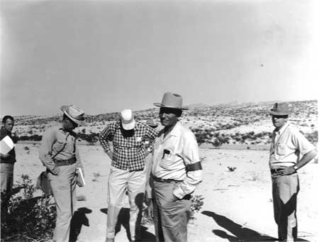
| Figure 16: Superintendent Ross Maxwell, Leading a Geology Trip in the Park | |
Endnotes
1 Memorandum of George F. Baggley, Wildlife Supervisor, Branch of Planning and State Cooperation, NPS, Washington, DC, to Wirth, March 9, 1936, 720-04 Wildlife Survey Big Bend National Park File, RG79, NPS, CCF 1933-1949 Big Bend National Park 719 - 833.05 Files, Box 836, DC NARA II.
2 Memorandum of G.A. Moskey, Assistant Director, NPS, Washington, DC, to Wirth, March 11, 1936, RG79, NPS, CCF 1933-1949 Big Bend National Park 0-32 File, Box 821, DC NARA II; Interview with Jose A. Cisneros, Superintendent, Big Bend National Park, January 11, 1996.
3 Memorandum of Maynard S. Johnson, NPS Regional Wildlife Technician, Bronxville, NY, to Baggley, April 24, 1936, RG79, NPS, CCF, 1933-1949 Big Bend 0-32 File, Box 82, DC NARA II. The memorandum cited included a report by W.B. McDougall and M.S. Johnson, "Unique Fauna And Flora Of The American Side Of The Proposed Big Bend International Park."
8 Charles N. Gould, Regional Geologist, Region VII, , Oklahoma City, OK, "Second Preliminary Report On Big Bend State Park SP-33-T," April 30, 1936, Big Bend Historical Files, Science and Resources Management Division Library (cited as SRM Library), Big Bend National Park.
13 A.F. Robinson, Alpine, TX, to "Secty. Dept. Interior, Mr. Conrad L. Worth, Mr. Herbert Maier, Washington, D.C.," June 6, 1936, RG79, NPS, SWRO, Santa FE, Correspondence Relating to National Parks, Monuments, and Recreational Areas, 1927-1953, Folder: General April 1, 1936-July 30, 1936, Box 94, DEN NARA.
16 James O. Stevenson, Acting Chief, Wildlife Division, NPS, Washington, DC, to Regional Officer, Region No. 3, Oklahoma City, OK, June 13, 1936, RG79, NPS, CCF 1933-1949 Big Bend -=32 File, Box 821, DC NARA II.
17 Memorandum of McDougall, "Big Bend SP 33-T Project 1005, Experimental Plots," June 11, 1936, RG79, NPS, SWRO, Santa Fe, Correspondence Relating to CCC, ECW, and ERA Work in National Parks, Forests, and Monuments and Recreational Areas, 1933-1934, Box 95, Folder: Project 1005, DEN NARA.
18 Memorandum of McDougall to Mr. Maier, "Protection of Flora, Fauna, and Archaeology in the Big Bend, Texas," June 19, 1936, RG79, NPS, SWRO, Santa Fe, Correspondence Relating to National Parks, Monuments, and Recreational Areas, 1927-1953, Folder: General April 1, 1936-July 30, 1936, Box 94, DEN NARA.
20 Press Release, August 6, 1936, NPS, Oklahoma City, OK, RG79, NPS, CCF 1933-1949 Big Bend 0-32 File, Box 821, DC NARA II; Townsend to the Honorable Stafford Payne, Del Rio, TX, August 24, 1936, RG79, NPS, SWRO, Santa Fe, Correspondence Relating to CCC, ECW, and ERA Work in National Parks, Forests, and Monuments and Recreational Areas, 1933-1934, Box 96, Folder: General Pt. 2, DEN NARA.
21 Erik K. Reed, Assistant Archaeologist, Region III, NPS, Oklahoma City, "Special Report on Archaeological Work in the Big Bend, During the Summer of 1936," September 1936, RG79, NPS, CCF 1933-1949 Big Bend National Park 207 Files, Box 825, DC NARA II.
32 Memorandum of Gould to Maier, September 11, 1936, "Progress of Geological Work at Big Bend SP-33-T, May-August 1936," RG79, NPS, SWRO, Correspondence Relating to CCC, ECW, and ERA Work in National Parks, Forests and Monuments and Recreational Areas, 1933-1934, Box 96, Folder: General Pt. 2, DEN NARA.
33 Gould, "Fourth Progress Report On Big Bend SP-33-T," Report No. 71, October 1, 1936, RG79, NPS, SWRO, Santa Fe, Correspondence Relating to National Parks, Monuments, and Recreational Areas, 1927-1953, Folder: 4th Progress Report on Big Bend - Region III, Box 94, DEN NARA.
36 Ernest G. Marsh, Jr., Student Technician, Department of Botany, University of Texas, Austin, "A Preliminary Report On A Biological Survey Of The Santa Rosa And Del Carmen Mountains Of Northern Coahuila, Mexico, July 2, September 22, 1936," October 11, 1936, 720-04 Wildlife Survey Big Bend National Park File, RG79, NPS, CCF 1933-1949 Big Bend National Park 719 - 833-05 Files, Box 836, DC NARA II; Press Release, Region III, NPS, Oklahoma City, October 17, 1936, RG79, NPS, SWRO, Santa Fe, Correspondence Relating to CCC, ECW, and ERA Work in National Parks, Forests and Monuments and Recreational Areas, 1933-1934, Box 96, Folder: General Pt. 2, DEN NARA.
37 Marsh, "Preliminary Report on a Biological Survey of the Santa Rosa and Del Carmen Mountains."
41 W.B. McDougall, Wildlife Technician, NPS, "Special Report: Preliminary Report On The Vegetation Of The Dead Horse Mountains, Big Bend Area Of Texas," October 30, 1936, RG79, NPS, SWRO, Santa Fe, Correspondence Relating to National Parks, Monuments, and Recreational Areas, 1927-1953, Folder: Special Report - Preliminary Report on the Vegetation of the Dead Horse Mountains, Box 94, DEN NARA.
45 Gould, "Fifth Progress Report On The Geology Of Big Bend, SP-33-T," November 3, 1936, RG79, NPS, SWRO, Santa Fe, Correspondence Relating to National Parks, Monuments, and Recreational Areas, 1927-1953, Folder: 5th Progress Report on the Geology of Big Bend, Box 94, DEN NARA.
51 Maxwell to Gould, December 2, 1936, RG79, NPS, SWRO, Santa Fe, Correspondence Relating to CCC, ECW, and ERA Work in National Parks, Forests and Monuments and Recreational Areas, 1933-1934, Box 95, Folder: DSP 1, DEN NARA.
52 Bumpus to "Herb" (Maier), December 16, 1936 (?), RG79, NPS, SWRO, Santa Fe, Correspondence Relating to CCC, ECW, and ERA Work in National Parks, Forests and Monuments and Recreational Areas, 1933-1934, Box 95, Folder: General Pt. 3, DEN NARA.
54 Memorandum of Gould to Maier, "Visit Of Dr. H.C. Bumpus To Big Bend, SP-33-T," December 18, 1936, RG79, NPS, SWRO, Santa Fe, Correspondence Relating to CCC, ECW, and ERA Work in National Parks, Forests and Monuments and Recreational Areas, 1933-1934, Box 95, Folder: General
| <<< Previous | <<< Contents >>> | Next >>> |
bibe/adhi/chap11.htm
Last Updated: 03-Mar-2003