|
Big Bend
Administrative History |

|
CHAPTER 3:
First Impressions: A Critical Year of Park Planning, 1935
Enthusiasm ran high in the winter of 1934-1935 for creation of a national park in the Big Bend country. Brewster County officials had secured federal funding for a CCC camp in the Chisos Basin, NPS staff members had visited the potential site to initiate scientific surveys, and the Texas congressional delegation had signaled its willingness to sponsor enabling legislation. Mexican officials under the reform leadership of President Lazaro Cardenas announced their intention to establish a joint U.S.-Mexico international peace park, akin to the Canadian-American venture connecting Glacier and Waterton Lakes parks. At the same time, the sluggish economy dictated delays in Texas' desire to pay for the massive land acquisition program mandated by federal law. U.S. officials also chafed at the restrictions that Texas placed upon land transactions between private owners and public entities. Not until the onset of World War II, with its massive federal expenditures for weapons procurement, food and fiber production, and employment in the public and private sectors, did Texas's leadership agree to contribute its share of financial resources. Thus a careful analysis of the "first impressions" of all parties to the formation of Big Bend National Park might reveal the lessons learned in the first year of park planning.
Indication of the seriousness of the NPS's position on Big Bend came in January 1935, when ECW regional director Herbert Maier released a lengthy report on the geology, vegetation, wildlife, history, boundaries, and international dimensions of Big Bend National Park. Consisting of a series of studies begun in the fall of 1934, and serving as the rationale for El Paso Congressman R. Ewing Thomason's bill to establish the NPS's first park site in Texas, the report outlined the complexity of Big Bend's appeal. "The Big Bend area is the last great wilderness area of Texas," wrote the NPS official, with "the reason for the long isolation . . . [being] its low economic value." Other than quicksilver operations at Mariscal, Study Butte, and Terlingua, "there has been no need for arteries of trade." The ECW did not seek control of the entire ecosystem of 3.5 million acres, "since the northern portion thereof consists principally of dry plain having no superlative features." Maier and the NPS staff members did see value in recognizing the presence of Mexico across the border. "The romance of old frontier Mexico," said the report, "is in the atmosphere of the Big Bend region." Echoing the sentiments of Everett Townsend, Maier believed that "everything should be done in developing the area to preserve for the tourists seeking rest and relaxation the Spanish-Mexican feeling of manana." This meant pursuit of the "highly intriguing . . . aspects of a possible international park." Finally, the state of Texas, which Maier identified as the "largest state in the Union," had no national park unit, an oversight that Big Bend could correct. [1]
While the park service's preliminary endorsement of a site along the Rio Grande stimulated much public interest, the NPS recognized many challenges awaiting its personnel. Maier informed Conrad Wirth, at that time the director of the ECW's state-park program in Washington, that Congressman Thomason had solicited advice from Everett Townsend, now designated "project manager" of the "land acquisition program." Two features of local interest concerned Maier: the potential for increased land values, and the independent initiative for an international park. Maier knew that "West Texas had National Park aspirations for this area and carried out publicity accordingly long before we came into the picture." For that reason, "it is . . . difficult to entirely smother publicity especially since a CCC Camp has been installed there." Regarding the international park idea, "while I believe it will be a most outstanding thing if such an international recreational area of this scope could be realized," Maier sensed that "such a thing is far in the offing." Speaking prophetically to Wirth, Maier contended that "Mexico would move very slowly in such a matter since she has done little in large park development." History also would affect any negotiations for the venture, as "the Mexicans and Texans were pretty bitter toward each other in the old days." Maier predicted that "a National Park on the U.S. side would have to be a glorious relationship before the Mexicans would enter into the thing with gusto." [2]
Beyond the dream of Mexican-U.S. collaboration, Maier faced the task of acquiring land on the American side of the border in the event that Congress approved Thomason's bill. In January 1935, the ECW district director wrote to Dan T. Gray of the University of Arkansas to explain the preliminary steps to define the scale and scope of land purchases in Brewster County. The NPS hoped to accelerate park creation by including much of the acreage under the New Deal program of "sub-marginal land projects." This initiative allowed for federal purchase of lands considered unfit for future agricultural production, and their restoration for purposes of recreation and wildlife habitat. To that end, the NPS had hired Everett Townsend to classify all of the potential acreage, pursuant to an official survey and campaign for acquisition. "It takes a great many years," Maier told the Arkansas university dean, "to get the land matters straightened up in an area considered for an National Park." In his capacity as a reviewer of the merits of sub-marginal lands, Gray could assist the NPS in "this outstanding opportunity not only for working up the land status but also for land acquisition." [3]
In addition to land surveys, the NPS also needed to link the ongoing construction work of the CCC camp in the Chisos Basin with any future plans for the park. George Nason had asked Maier in January 1935 for advice on building permanent structures with an eye to NPS use and maintenance. Maier cautioned Nason that the NPS needed a master plan prior to any approval, a condition exacerbated by the agency's workload and the distance to the Chisos CCC site. Maier noted with some concern the increases in cost for roads and trails construction, which could exceed the NPS's standard of spending no more than 25 percent of a camp's budget on roadwork. Nason asked Maier to support his efforts in the Chisos Basin, as "carefulness of development is the important thing in this area." Nason also agreed that the park service should move cautiously on plans to build elaborate resort facilities in the Basin without NPS approval of the master plan. [4]
To ascertain the merits of ECW plans for Big Bend, Maier asked Dr. Hermon C. Bumpus, chairman of the NPS's education advisory board, to visit the future park site in late December of 1934. Familiarizing himself with the planning process by means of Maier's report, Bumpus joined A.F. Ahrens, district inspector for the ECW, and their spouses on a trip from Oklahoma City to Big Bend. Bumpus found the isolation of Brewster County invigorating. "To leave a trans-continental highway," he wrote to Wirth, "and motor away from railroads, hotels and filling-stations invariably gives a pleasurable reaction to a sensitive person." Big Bend, moreover, exceeded Bumpus's expectations. "When [a visitor] passes through a country that is wide in its expanse, rich in the volcanic monuments of the geologic past, fascinating in its color effect and suddenly comes to a stop within the solid walls that Nature has erected around the 'Chisos Bowl,'" said Bumpus, "he is prepared to relax." Particularly attractive to Bumpus and other NPS officials was the area's proximity to Mexico. Describing the village of Boquillas, Texas, as "a miniature garden," and its Mexican counterpart "an irresistible lure for the kodak [camera]," the advisory board member summarized the charm of the border for future visitors: "May the burros, that provide the scant international transportation across the river at this point, never be succeeded by ferry or bridge." To Bumpus, "the beauty of the river, the enclosing walls, the vegetation and the primitive human habitations all conspire against modernity." Bumpus deferred to NPS experts in wildlife and geology to explain the area's natural resource significance. He concluded that "the desires and ambitions of a relatively small fraction of our population should not alone [inspire] hope that this - possibly the last of our frontiers - may come under Federal control and be preserved so coming generations may derive pleasure therefrom." [5]
Bumpus's description of the Big Bend area intrigued ECW personnel, as he offered the first "outsider's" view of their planning. A.F. Ahrens told Maier of the good time that the Bumpus party had in traversing the countryside, despite the cold temperatures and dusty conditions. Bumpus "spent considerable time studying the rock formations and especially the fossils and relics" that J.O. Langford had on display in his store at Hot Springs. While visiting the mining community of Terlingua, Bumpus remarked to his NPS and CCC hosts about "the typical local color portrayed and the lack of any attempt to 'modernize' the village." He also told Ahrens of his preference for hotel accommodations within the Chisos Basin, rather than at the entrance in Green Gulch (Bumpus noted the fact that sunlight struck that location later than in the basin, resulting in a lingering chill on winter mornings). "It is hardly necessary for me to say," Ahrens concluded, that the party "departed very much enthused over the country and most anxious to see it become a National Park." [6]
For Maier and Nason, the visit by Dr. Bumpus vindicated their efforts to design the NPS's 27th park site in the absence of close supervision by Washington officials. "As far as you and I know," Maier told Nason, "in dealing with this ever-changing picture, we might not be able to get [Conrad] Wirth down here for a year." Absent the guidance of the ECW's planning chief, Maier had to pursue the sub-marginal lands project, and to initiate road construction. Nason concurred, heralding "Dr. Bumpus' opinion [as] the first authoritative opinion we have had." Nason told his superior that he "had just approved and had forwarded to you plans showing some four and three-quarters miles of road leading from the desert up to the saddle [of the Chisos Basin]." The ECW inspector believed that "any road that we build must go through this pass," a situation which entailed "a considerable amount of work to be done." Yet "we do own the land up to this point," Nason told Maier, and hoped that problems with future land purchases could be addressed by the Texas state parks board. [7]
Nason's delight at Bumpus's praise for the work at Big Bend contrasted sharply with the ongoing dispute between the park service and Texas attorney general, James V. Allred. The latter on November 19, 1934, had ruled on the legality of the Big Bend State Park Act, finding unconstitutional the provision to "sell" the mineral rights of approximately 121,000 acres of state school lands. While granting that the Texas legislature had the right to create parks, maintain them, and accept donations for the purchase of private lands, Allred opined that "one cent an acre or five cents an acre [the valuation given by the lawmakers to the mineral rights] is so palpably insufficient as consideration for the sale of Texas Public School Lands that it must be treated as no consideration at all." Allred placed himself between the schoolchildren of Texas and the ambitions of park promoters by holding that "the two parks acts [of 1933] plainly violate Sections 4 and 5, Article VII, of the Texas Constitution." The attorney general agreed that "the establishment of a system of State Parks is important to the health and happiness of a people," but concluded bluntly that "support therefore must be found in sources other than [the] Permanent School Fund." [8]
The future Texas governor's ruling caused much consternation in the park service's Washington and Oklahoma City. The NPS had counted on the state legislature's generosity to expedite planning for Big Bend National Park. Douglas C. Lauderdale, regional attorney for the NPS, hurriedly drafted a memorandum in February 1935 to explain the park service's position on the school lands controversy. Lauderdale argued that the $1,500 allocated by the legislature to the state school fund from the sale of the mineral rights constituted a donation. In addition, "after the park has been developed, much revenue should be derived from the sale of gas, and much profit to the people in general." Neither should one overlook the intangible benefits of Big Bend, said the regional attorney, as "the scenic beauty of the Big Bend project will be brought out as a diamond in the rough." Allred's charge that the state had been denied full market value for its lands struck Lauderdale as spurious. "I am sure," he wrote, "that no individual would accept the school lands that have been picked over and left, which now lie idle, as a gift if they had to pay taxes on it and further, if the mineral rights were reserved by the Public School fund." Lauderdale believed that the state park had managed to generate revenue where none had existed, since the lawmakers had included "the consideration of an added tax revenue that would be derived from the sale of gasoline from tourists in every section of the country coming to Texas to view the beautiful park that we hope to develop." The NPS lawyer then turned Allred's argument around, noting that in light of the hardships that the people of Texas had endured throughout the Depression, "the Federal government, in . . . buying up the lands within the various states of the Union, does so only to relieve the farmers who have here-to-fore been unable to enjoy a high standard of living." Lauderdale further charged that "if the State is unwilling to cooperate by adding lands which they own to projects within the purchase area of proposed [park] sites, then the Federal Government does not want to be antagonistic, and therefore, will not insist in this program being carried out." [9]
As Congressman Thomason drafted his legislation to create a federal park in Brewster County, and the state of Texas argued with its future partner in park management, NPS officials in February 1935 continued to struggle with the vagaries of nature in the Big Bend region, and the politics of New Deal agency funding. Maier and Nason discussed at length the problem of building a campground high in the Chisos Basin. "We have the blue print of the Big Bend Shelter here in the office now," said Maier, "and obviously it is impossible." The district ECW officer told Nason that "for a structure to be placed in a future National Park it certainly looks like hell." Nason had designed a facility that was "vertical rather than horizontal," with a "roof well-nigh impossible" and "rocks . . . all out of scale." Maier then addressed the complaint made a year earlier by W.G. Carnes about the lack of architectural expertise at Big Bend. "That [shelter] seems to be one of the difficulties down at the Big Bend," said Maier. "No one down there seems to have grasped the idea of scale," and despite the fact that "it may be very hard to get big rocks," Maier nonetheless warned that "we will never get away with using the size of stuff that is restricted to city parks." Instead he suggested that Nason "call off work on the shelter immediately," and await the arrival of an NPS architect. [10]
As if funding, staffing, design, and legal issues were not enough, the NPS also faced in early 1935 local ranchers' confusion over the status of grazing lands in the future park. Maier learned that "grazing is still continued in the Chisos Mountains on the areas on which we are working." Because of this, "the trails that we have built have been destroyed at several points." Contributing to this problem was the attitude of rancher Ira Hector, the first to sell a portion of his land to the NPS for the Chisos CCC camp. Nason informed Maier of the tenuous relationship that the NPS had with Hector, as "the section just west of No. 32, which was turned over to the [state] Parks Board by Mr. Hector, was turned over with a definite agreement that cattle could be left in until the sum of $3800 had been paid." Hector had agreed to accept less payment from the parks board for each year that he continued to graze on his former acreage. "We are now faced with the proposition," said Nason, "that the State does not really own this land and cannot stop the grazing." Nor did the NPS "have any fences around the few sections that we do own that can keep cattle from wandering on." The ECW official also disliked the fact that "Section 32, where a lot of the trails are, is school land and there is no authority to order these cattle off." Local ranchers had used the school lands of the Big Bend area as open range, and "until we can consolidate enough sections in one area," said Nason, "there is no use of fencing." Then in a contradictory conclusion, Nason suggested: "I do not think the damage to the trails is so very serious." He believed that the cattle "are breaking down the shoulder slopes on the upper side into a rather natural condition." This led Nason to remark: "This may be classified as 'local participation' by the local inhabitants!" [11]
Far from the trails of the Chisos Basin, on March 4, 1935, Ewing Thomason formally requested that the U.S. House of Representatives make permanent the dream of Everett Townsend and the NPS planners for a national park in the Big Bend country. In the first session of the 74th Congress, the El Paso Democrat introduced House Resolution (HR) 6373, "A Bill To provide for the establishment of the Big Bend National Park, in the State of Texas, and for other purposes." Morris Sheppard and Tom Connally, like Thomason members of the majority political party, asked their Senate colleagues to do the same. Cognizant of disputes in Austin and Brewster County about the purchase of private lands with public monies, Thomason declared that Big Bend would open only "when title to such lands as may be determined by the Secretary of the Interior as necessary for recreational park purposes within boundaries to be determined by him within the area of approximately one million five hundred thousand acres, in the counties of Brewster and Presidio, . . . shall have been vested in the United States." No federal funds would be expended on private property. In addition, stated Thomason, "no land for said park shall be accepted until exclusive jurisdiction over the entire area, in form satisfactory to the Secretary of the Interior, shall have been ceded by the State of Texas to the United States." Then in a reference to the issue of water resource development in arid west Texas, Thomason stipulated that "the provisions of the Act of June 10, 1920, known as the 'Federal Water Power Act,' shall not apply to this park." Congress had authorized creation of the Federal Power Commission (FPC) to study construction of hydroelectric power sites in the nation's rivers and streams. Exclusion of Big Bend's stretch of the Rio Grande from the purview of the FPC would have implications soon thereafter, as in 1935 the International Boundary Commission (IBC) would study the potential for hydropower facilities in the canyons of the upper and lower Rio Grande. [12]
Where Thomason's bill emphasized the financial and political realities of Texas and the Big Bend country, Senator Sheppard furthered the cause of the international park concept by soliciting the support of President Roosevelt. The president, eager for venues to pursue better relations with Mexico, asked Interior Secretary Harold Ickes to respond quickly to Sheppard's request. Ickes, known for his incorporation of employment and economic development features in national parks, submitted to FDR a proposal for a park unit at Big Bend. He concurred in the judgment of Herbert Maier, Conrad Wirth, et al., "that the area referred to in Texas be established as the Big Bend National Park." He added that "the possibility of an international park in this region meets with my approval." If Congress concurred, said Ickes, "the Mexican Government [should] be invited to cooperate with the United States in the establishment of such an international park." [13]
Once the White House and the powerful Interior secretary went public with their endorsement of the Thomason and Shepard initiatives, planning for Big Bend accelerated. Four days after the introduction of HR 6373, Texas attorney general Allred agreed to vacate his decision on the mineral rights issue. Allred's earlier opinion unfortunately had blocked NPS approval of Big Bend's submarginal-land project. "This [the school lands controversy] was a rather unhappy discovery," Maier informed Wirth, which forced the NPS to exert "considerable pressure" on Allred to "bring about a reversal of this opinion." After "a long session with the Attorney General," said Maier, Douglas Lauderdale received a telegram from Allred declaring that "the School Fund can turn over its land in fee simple to the State Park Board and the State Park Board is the only one that already has the right to turn the land over to the Federal Government for National Park purposes." Maier contended that "the main stumbling block as regards the land acquisition program has been removed," and he hoped that "the State of Texas will now be in a very strategic position to accumulate the necessary area for a National Park." [14]
From his vantage point in Oklahoma City, Lauderdale could be optimistic about the future of Big Bend. Less enthusiastic was Everett Townsend, a landowner in his own right and the manager of the land acquisition project terminated by Allred's earlier restrictions on school land sales. Townsend knew the ranchers of Brewster County well, and warned Maier "that if the responsibility for the acquisition of lands . . . is placed with the State, it will be a very slow process." The harsh realities of the Lone Star economy meant that "any procurements made will have to be wrung from an empty treasury - a difficult problem." In addition, said the former U.S. Customs officer and Brewster County sheriff, "donations from those owning lands within the area can hardly be expected, except on a very small scale because they are now laden with debts from which they can never emerge." When one considered the drought and the deplorable economic condition of the inhabitants of the region, said Townsend, "there is much merit in giving it serious consideration under the [sub-marginal] Land Program." Committed as ever to his dream of a national park, Townsend told Maier: "I shall keep right on with the work I am doing and hope to completely cover the Chisos Mountains area and the most important sections of the River front by the end of the month." "My heart is in this 'project,'" he confided to Maier, "and I am ready to do my best no matter whether I am off or on the pay-roll." [15]
When Townsend completed his report on March 31, he had produced no fewer than 56 pages of names, property valuations, and land status for the NPS to consider. Working non-stop through the months of February and March, Townsend had not had time to identify all property owners with delinquent taxes on their lands. In addition, he found in the Brewster County clerk's office a disturbing pattern of recordkeeping. "The addresses of many of the non-resident owners are missing," he told Maier, as "few of these are correctly given on the Tax Rolls." A correct list could "be obtained only by the examination of hundreds of letters received in the remittance of taxes for all parts of the County, all of which are thrown indiscriminately into a large drawer without any semblance of order." Such carelessness in official documentation led Townsend to discover another feature of Brewster County's lax procedures: "In my work I have found two valuable surveys, one in the Chisos Mountains Basin and the other on the Boquillas Canyon, which are claimed by individuals." Townsend believed instead that "the Texas State Parks Board [has] valid title." One example was the claim of A.M. Gilmer, whose land the state legislature had included in the Big Bend State Park Act because of nonpayment of property taxes. "It is the only survey we can claim that lies immediately on the Boquillas Canyon," Townsend told D.E. Colp, "and is very valuable for park purposes as it [is] within the bend of that canyon and the River flows on two sides of it." The Gilmer claim, while "almost unknown," constituted what Townsend called "scenically one of the grandest regions in the Park area." In like manner, Townsend uncovered a deed for 640 acres of land in the Chisos Basin once claimed by the Gulf Coast and San Francisco Railway. This included "the greater part of the 'Window:'" the spectacular notch in the Chisos Basin that looked out onto the Rio Grande and Mexico below. [ 16]
NPS officials in April then learned that the CCC camp wished to implement an aggressive predator-control program in the Chisos Basin. George Nason informed Maier that "panther, or mountain lion, are causing considerable trouble in preying on young deer in the mountains." James O. Stevenson, regional wildlife technician for the NPS, noted that camp officials sought permission "to establish trap lines to catch these animals." The issue of predator removal echoed a debate at the highest levels of the park service, where in 1931 then-director Horace Albright had, in the words of Richard Sellars, "announced the policy of limiting predator control to what was absolutely necessary." By that time, said Sellars, "wolves and cougars had been virtually eradicated from all national parks in the forty-eight states," leaving only the coyote "in substantial numbers." [17]
As with land acquisition matters, predator control in the Big Bend area forced the NPS to reassess newly drafted regulations concerning issues of wildlife and ecosystem management. Stevenson told Maier that, "according to the policy of the National Park Service and the State Park Division, as explained in the ECW Handbook, predators are definitely protected." The rules did allow "in extreme cases" for control, "but they should never be exterminated." NPS guidelines held that "no predator, such as the panther, should be destroyed on account of its normal use of any other park animal unless that animal, such as the deer, is in danger of extinction." Stevenson, however, hinted at his desire to accede to the wishes of CCC camp officials and local ranchers. "If action on this emergency situation is authorized by the Washington office," he told Maier, "I will write the Biological Survey for the best and most practical means of control." In his opinion, "if trapping is the most feasible way, a man experienced in predatory animal control must be obtained to superintend this work." [18]
By June 1935, the NPS had completed enough survey work on land issues and natural resources to submit a formal application for Big Bend National Park; a prerequisite to congressional and executive action. Herbert Maier noted in his letter to the NPS's State Park ECW office that little had changed since he had filed his report in January on Big Bend. The NPS should seek a land base of some 1.5 million acres (or 2,343 square miles, nearly double the size of the state of Rhode Island). "From personal knowledge of the area," wrote Maier, "I would say that the caliber of such an area would rank favorably with that of Zion National Park, although different in physical aspects." The nation also would gain a cultural resource unlike any other in the NPS system, as "the general atmosphere of the Big Bend area is Spanish-Mexican in feeling and would add an entirely new flavor to the chain of national parks." Maier further encouraged NPS officials to focus upon the Chisos Mountains, which "themselves might be considered as a preliminary acquisition area, comprising approximately 65,000 acres." He also reminded his Washington superiors that Roger Toll had praised Big Bend's national benefits, even as he noted its land-purchase issues, when he recommended following the procedure of Great Smoky Mountains National Park in Tennessee, where a portion of the future park entered the NPS system prior to final acquisition. [19]
Coincident with Maier's application for park status for Big Bend was completion in July of a report by H.P.K. Agersborg, chief biologist for the NPS, entitled, "Certain State Parks and Other Areas in Texas." Agersborg had gone to Big Bend in the spring with James O. Stevenson and J.T. Roberts of the Oklahoma City NPS office. Conceding that his first impression of the area "was not favorable," the NPS biologist nonetheless offered a balanced perspective of Big Bend's strengths and weaknesses as a new park unit. "While the distance from civilization over 112 miles of 'corduroy' road," said Agersborg, "makes it rather expensive to reach the interior of the area," it was "necessary to go to this trouble in order to save this area for the future." Echoing the thoughts of George Nason and Herbert Maier, Agersborg admitted that "to build a good road will be very costly," yet "it will pay" in the long run. The park service biologist then offered the most critical assessment of the drought of the 1930s on the Big Bend ecosystem. "After one reaches the more scenic parts of the park area," said Agersborg, "one is met face to face with problems vital to the State [of Texas]." In Big Bend, "one sees the badly eroded, denuded soil, closely cropped flowering desert shrubs--which otherwise should be beautiful--and the presence of hungry and thirsty herds of sheep, goats, beef-cattle and horses." Beyond this, "continuous grazing over a long period has left the land desolate," a condition that Agersborg believed "the State wants to change." "It is somewhat paradoxical," he noted, "to witness domesticated cattle graze side by side with the park officials as the latter are trying to build a park in a desert for the public to enjoy." Adding to the future park's ecological burden were the practices of the CCC workers to strip the bark from the century plants, and visitors who "in the past have been allowed to kill and carry off valuable and rare birds." During the previous year (1934), hunters had bagged 5,000 deer in the park area. All of this, Agersborg hoped, would cease once Big Bend entered the NPS system, with tourism replacing the current destructive uses of the landscape. [20]
A step in that direction occurred on June 20, 1935, when Congress enacted and President Roosevelt signed Public Law No. 157. This measure authorized the creation of Big Bend National Park. FDR and the nation's lawmakers accepted the NPS's request to set aside 1.5 million acres of land for "recreational park purposes." Other suggestions for purchase of the lands made by Herbert Maier and his staff became part of the act, as did the proscription against inclusion of the park's portion of the Rio Grande in any FPC project development. This permitted Everett Townsend to return to the field as "senior foreman" at the Chisos CCC camp, with the authority to continue his surveys of property ownership. Among his more daunting tasks was convincing J.J. Willis to deed his holdings to the State Parks Board. Townsend had discovered that "much of [Willis's land] he had bought at tax sales in 1929 and has paid no taxes on any of it since that year." Townsend also learned that the Houston and Texas Coast Railway had subdivided two sections of the Chisos Basin adjacent to the CCC camp into 40-acre tracts. He hoped to convince the Brewster County court to declare this land delinquent in tax payments, and include them in the early design of the park. [21]
Throughout the summer of 1935, CCC work moved forward in anticipation of the land-acquisition program. J.T. Haile of the ECW Procurement Office in Austin went to the new park area to review the distinctive conditions of work. He noted the need for an extensive fleet of trucks, and the heavy use they received in driving from the railheads in Alpine and Marathon through the desert and up the north face of the Chisos Mountains. "In this rough area," Haile wrote to his superiors in Oklahoma City, "there is no choice of roads over which to transport men and material." One must "build as you go, and there is no opportunity of detouring to avoid a rough spot or an excessive grade." The Chisos camp (renumbered as SP-33-T), had a crew of 247 men who had to be driven some three miles daily to and from their work sites. "When these trucks have delivered their men to the work sites over road conditions prevailing at this camp," said Haile, "there is very little time left for their use in the transportation of construction materials before they are required to return for the workers." Among the items transported were "stones weighing from 6,000 to 8,000 pounds" to be used in the construction of head walls and culverts. Haile asked the ECW to provide additional equipment for the Chisos camp, "in order that the work program, as outlined for this park, be carried out properly and effectively, and in view of the large number of enrollees now stationed at this camp." [22]
Another sign of the permanence of the CCC program, and of the distinctive cultural features of the region, came in July when Maier asked L.W. Rogers, educational advisor for the Army's Eighth Corps Area at Fort Sam Houston, to provide Big Bend with an educational specialist. Robert Morgan and his staff were "exceedingly anxious to have such a man," wrote Maier, "not only because of the good it will do the enrollees," but because they were "off in the mountains where they very seldom have the opportunity of going into town, and so the work is bound to aid the general tone of the camp." An earlier educational advisor had proven "of very little value," and had not remained in camp long. The CCC staff also believed, in the words of Maier, that "the educational adviser must know Spanish in order to get along advantageously with the Mexican enrollees who comprise more than fifty per cent of the personnel." [23]
Commitment of resources to Big Bend's park planning also led the ECW to prepare a thorough report in July on the status of land title searches. Everett Townsend had completed his survey of all state and privately owned parcels within the park, and had drawn a map outlining them for use by the NPS. Raymond Higgins, assistant regional projects manager for the Oklahoma City ECW district, told Herbert Maier that "any discussion of Texas land titles must commence with an explanation of the historical origin of the railroad grants and public school lands." In addition, the NPS needed to know "the constitutional and statutory provisions relating to Texas lands." Higgins characterized this story as one where "the pioneers of the Republic, and later State, of Texas were early concerned with three major problems." These Higgins identified as "encouraging immigration; encouraging the construction of railroads; and, provisions for education." In this the Texas lawmakers mimicked the practices of the U.S. Congress, which had enacted similar legislation for the expanding United States through the Land Ordinance of 1785, and subsequent grants to railroad companies to accelerate the pace of national growth and absorb the risks normally encountered in the free market. [24]
Once Texas had committed itself to a partnership with farmers, ranchers, and railroads to stimulate growth in the vastness of the Lone Star State, the legislature had authorized in 1854 and 1875 donations of 16 sections of state land (10,240 acres) for each mile of track that the companies might construct. As Texas had no apparatus in place to survey these lands, the lawmakers agreed to allow the railroads to determine the acreage they wanted. In exchange, they would identify the even-numbered sections as state school lands, while claiming the odd-numbered sections for themselves. Supposedly this pattern of "checker-boarded" land grants would guarantee more sales (given the stake that the railroads had in the growth of any particular area where they ran track), and the money generated by the sale of school lands "has always been zealously guarded by the Legislature and the powerful school lobby or group." In 1897, the lawmakers added mineral rights to oil, gas, and coal, to the school fund upon the sale of any state lands. Two years later the legislature declared that "all un-appropriated public domain and any lands thereafter recovered by the State, as lands forfeited for non-payment of taxes, were set apart for and added to the school fund." Finally, in 1919 the state ordered that "15/16ths of the oil and gas in school lands were relinquished to the various purchasers by which Act the School Fund and the owner of the surface each own half of lease bonuses, rentals and the customary 1/8th royalty of production." [25]
In the case of Big Bend, this meant that the Public School Fund had title to 116,722.1 acres in numerous tracts scattered over the entire area, 8,470.5 acres of these in the Chisos Mountains. Higgins believed that the school fund also controlled 2499.5 acres, "the exact location and conditions of title of which are as yet not ascertained." Everett Townsend had determined that "a total of 25,595.2 acres has been forfeited to and title is now held by the State of Texas by reason of non-payment of taxes and forfeiture suits and judgments." Another discovery of Townsend's was that "the Public School Fund formerly owned a great deal of the now privately owned lands and, on the sale of such lands, retained all or part of the mineral interests, the amount reserved being dependent on the date of the respective sale." Higgins determined that "these School Fund mineral interests in privately owned lands are restricted and inalienable under present laws." Higgins considered it legally impossible "for the Federal Government or anyone else to acquire the full fee title, including all mineral rights, to any Public School Lands or tax-forfeited lands in the State of Texas." To do so, the NPS would have to seek amendment of these laws in the face of "the attitude of recent Legislatures and the powerful and continued activities of the influential school bloc." As a former member of the state house of representatives, Townsend suggested to Higgins that the NPS support a bill giving the parks board control of state mineral reserves in the park area for a total of 99 years. Townsend explained to Higgins that "when the public sees the realization of the Park, understands its recreational and educational values as well as enjoy the great financial increases in returns to the Public School Fund through the gasoline tax," Texans would not hesitate to give complete title to all rights held by the state. [ 26]
Soon after the Higgins report went to Washington, a team of high-ranking NPS officials traveled to Big Bend in August to inspect the site. Led by assistant director Conrad Wirth, the party included fifteen representatives of the park service, the ECW, the state parks board, and Everett Townsend. W.C. Carnes, now deputy chief architect for the NPS's Western Division branch of plans and design, reported on the four-day excursion through the future park site. "The purpose of the trip," said Carnes, "was understood to be two-fold: first, to submit recommendations on the desirable boundaries of the proposed National Park and second, to study the probable ultimate development, should the area acquire National Park status." This latter issue involved coordinating ECW plans with NPS ideas for the larger Big Bend park unit. Carnes recalled how impressed he had been in earlier visits to the area, and now realized that "the scenic, historic and scientific features of the area are quite varied and few, if any, of its qualities duplicate anything already existing in the National Park System." Carnes and others in Wirth's party agreed that "from a landscape point of view the suggested north boundary with a latitude 29 [degrees] 41 [minutes] is satisfactory." He dismissed talk of including "the mountains which lie north of this[line], as they "offer no incentive to commercial development and will always be part of the scenic assets of the area, without being brought within the park boundaries proper." The Rio Grande made logical sense as the southern limit of the park, reaching from Santa Elena Canyon (which locals called the "Grand Canyon"), through Mariscal and Boquillas Canyons. "The points at which the north and south boundary lines should tie into latitude 29 [degrees] 31 [minutes]," said Carnes, "are not important from a landscape viewpoint, and should be determined more from the geological and wild life standpoint, based upon the particular features and the amount of natural range it is desired to have within the park." [27]
Wirth, Carnes, and the other inspection team members took the route south of Marathon to Big Bend, which Carnes described as a "panorama . . . of mediocre scenic value." The NPS architect found a "much superior panoramic silhouette," however, in the Chisos Mountain range "when viewed from either the east or west sides." The party took the road from the Chisos Mountainswest to the mining town of Terlingua, and thence north to Alpine. They believed that neither route merited inclusion in park planning. Instead, Carnes hoped that the NPS could identify "a possible route which could be constructed in a more direct line and which would avoid the several rivers at present encountered and which are dry much of the time, but of flood water proportions after heavy rains." The Wirth reconnaissance suggested that any road come out of Alpine, with a "fork somewhere in the vicinity of Government Spring and that one branch of it lead along the west side of the Chisos Mountains and on to Santa Helena Canyon." The other fork should circle the east side of the Chisos Mountains and "terminate on the Rio Grande River at the Mexican community known as Boquillas. Carnes surmised that "fullest use of the park in the future may force the construction of a road along the Rio Grande River between Santa Helena Canyon on the west and Boquillas on the east." Yet the NPS inspection team did not wish to recommend this as part of the master plan, in that "there seem to be no points of interest between these two terminals to warrant the construction of a road, considering the construction difficulties which would be encountered both in location and in the number of drainage structures required." [28]
In assessing the challenge of road building, the architect suggested that "little encouragement should be offered tourists to visit this area until suitable roads have been constructed." He noted that "many of the existing roads follow creek beds which can become raging torrents within an hour's time after a heavy rain starts." Carnes feared that "a venturesome tourist might well become marooned in some canyon, many miles from store, gasoline, tow cars, or emergency repair service." He predicted that "should the Big Bend area become a National Park, the Service must look forward to spending a fair portion of its major road bill annually over a period of say five years and, in addition, keep a maintenance organization on hand for repair work after storms." Despite the area's desert conditions, "road construction here is not going to be inexpensive." Carnes did note, however, the presence of such road-building materials as sand, gravel, and stone in the park, thus reducing the costs of construction. [29]
When the Wirth party turned to park administration and concessions facilities, they agreed upon five items: a visitors lodge, "housekeeping cabin units," a campground, a "Government area, utilities and residences," and a "checking station." The group debated the merits of a lodge at the site known as Laguna, "well up in the Chisos Mountains." Carnes described the area as "a beautiful mountain meadow with large shade trees in abundance." NPS officials worried that "the difficulty of building a road to it, and the desirability of preserving the area undeveloped, are sufficient to eliminate it as a possible building site." Hence the party agreed upon the "comparatively level bench above the present C.C.C. camp," the future site of Basin development. "The area has a goodly number of fair sized oak trees," said Carnes, "which offer considerable shade." For Carnes and the others, "its chief attraction scenically is that it overlooks the canyon which terminates well above the surrounding plateau and which is known locally as 'The Window.'" [30]
Summarizing their thoughts, NPS planners needed to remember that "Texas was once part of the Mexican nation." In addition, said Carnes, "the area in question at Big Bend has never been developed by Americans beyond the few scattered ranches and isolated mining activities." The architect noted that "considering the possibility that the Republic of Mexico may establish a national park across the Rio Grande," he recommended that "so far as physical improvements are concerned, the Mexican hacienda, or "ranch type" of development be followed as closely as possible." Similar cultural resource issues prevailed at Santa Elena Canyon, which Carnes believed could contain "a stone or adobe ranch style of development, to function quite similar to the Phantom Ranch at Grand Canyon National Park." At Boquillas, Carnes again called for this architectural form, with the hope that "the existing Mexican ranches there can be preserved, as they are bonafide examples of same, having been [built] before there was any thought of their being used as tourist attractions." [31]
To implement this plan, thought Carnes, the NPS needed to be mindful of the partnership developed with the state of Texas. David Colp of the Texas state parks board suggested a quick resolution to the boundary survey, so that ongoing CCC activities would meet park service expectations. Carnes offered to provide an architect from the San Francisco office to begin work that fall or winter. Finally, he warned his colleagues that "since there is no public domain in the State of Texas, it seems unlikely that the National Park Service can ever use any of its road funds for construction of approach roads." He called instead for the NPS to decide "on the proposed road system for the park in order that whatever work the State of Texas or the County of Alpine [Brewster County] performs in the next few years, may be invested on an alignment which will be utilized when, and if, the park is created." [32]
When the Wirth inspection team returned from the Big Bend area to Alpine, local boosters of the park called upon them to reveal their findings in a public meeting held on August 8 at the Holland Hotel. There in the ballroom, Wirth and his colleagues spoke of their journey via car, horseback, plane, and on foot. The Alpine Avalanche reported that "Colonel Wirth was enthusiastic about the possibilities of the Big Bend from the standpoint of park development." Wirth saw "educational advantages and year round accessibility" as the park's strengths. "No other National Park," the Avalanche quoted Wirth, "included a complete mountain, offering life zones from Lower Sonoran, through Upper Sonoran and Transition, to Canadian, with their gamut of changing flora and fauna." Herbert Maier told the audience of "the financial advantages of national parks," and how "he counted himself fortunate in having Texas in his [ECW] district." David Colp then asked Brewster County residents to cooperate with the state parks board in the land-acquisition program, which he hoped would begin "immediately upon notification by the National Park Service of the boundaries of the acceptable area." [33]
True to their word, Wirth's associates returned to their offices in Washington, San Francisco, and Oklahoma City to record their thoughts on the status of Big Bend as a national park site. James O. Stevenson called the area "a true biological 'gem,'" whose "value of fauna and flora . . . lies not only in their varied nature and abundance but in the fact that many of their components cannot be duplicated in any other sections of the United States." The wildlife specialist noted the presence of more than 60 species of mammals, while recording the extinction of such creatures as big horn sheep and antelope. The Big Bend country could boast of more than 200 species of birds, a function of its location at "the meeting place of many species whose main range lies to the north or to the south." Stevenson also observed "a mingling here of typical Mexican species with others representing the Rocky Mountain fauna of the Western United States." These birds and mammals could find in the Chisos Mountains alone more than 450 species of plants. "Several eminent botanists," wrote Stevenson, "have stated that more species of plants are found on the higher slopes of the Chisos, in an area of approximately 30 square miles, than in any other region of similar size in the United States, with the possible exception of one locality in Florida." [34]
Because of Conrad Wirth's highly publicized plan for establishment of park boundaries, Stevenson and his colleagues weighed in with their suggestions based upon their particular area of expertise. "Since there are no natural barriers in the Big Bend or faunal zones which form boundaries to animal life," said Stevenson, "the best solution in insuring the protection of wildlife is to obtain an adequate tract of territory in the southern tip of the Big Bend." He called for making Boquillas Canyon an eastern terminus, with a line northward to the Sue Peaks in the Caballo Muerto range. Stevenson believed that this would offer "an adequate deer range in the desert mountains east of the Chisos," even though its lack of water and vegetation meant that "it will never have great general importance for wildlife." Stevenson's park boundary would then move north from the Sue Peaks to Persimmon Gap, "in order to control roads leading to the Chisos and to check on visitors to the area." He would have the line then run south (to the east of the Rosillos Mountains), and then westward to include Grapevine and Paint Gap Hills, which formed the southern boundary with the Christmas Mountains. From there, Stevenson would draw his line southwest from Slickrock Mountain to include Burro Mesa and the Rattlesnake Mountains, and then to the western end of Santa Elena Canyon. Once that had been achieved, Stevenson would call for "a thorough biological survey of the Big Bend and an extensive report on suitable boundaries or possible park extensions." Finally, park planners should remember that "a study of the biology of the adjacent region in Mexico, . . . with relation to a possible future international park, should be made." [35]
Bernard Manbey, associate engineer for the NPS's western division in San Francisco, echoed the sentiments of Stevenson, and offered his thoughts as a facilities designer. He marveled at the breathtaking beauty of the South Rim of the Chisos Mountains, which "at least insofar as distance goes, would be hard to beat anywhere." Manbey theorized that "the average person does not realize that there are almost innumerable mountains in Texas and range after range after range in the adjacent portion of Mexico." He recommended that "a standard horse trail from the 'Basin' to the 'South Rim' might be included as one of the first ECW projects under the 6th Period Program." The party then drove to Terlingua, forded several streams where the cars had to be pushed across, and then stopped at "the former military post at Castolon" for lunch. After a long drive across the southern tip of the future park, Manbey and his colleagues came to Boquillas at sunset. "Here, in a typical setting of Old Mexico," said the engineer, "we had our dinner with a Mexican host, Mexican orchestra, and Mexican dishes which the writer cannot attempt to enumerate or describe." [36]
Adding to the stimulating experience for Manbey was the opportunity to fly over the future park. Manbey also hiked in the Chisos to the top of Casa Grande Peak (elevation 7,350 feet). He then encouraged the party to include the area north and west of Terlingua in the park, because of "the reported wealth of unique and valuable geological formations in that district," including Solitario Mountain. Manbey also noted the unusual collection of "skulls, skeletons, bones, Indian basket work, stone arrow heads and tools," that Elmo and Ada Johnson had on display at their ranch. The Johnsons contended that these came from caves along the Rio Grande, and Elmo Johnson recommended to the Wirth party that if the NPS made a "'Natural Museum' out of one or two of the caves and show relics in various stages of discovery," the caves "would have a far greater appeal and be intensely more interesting to the average tourist." The Indian sites would only enhance the dominant theme of old Mexico surrounding Big Bend. Manbey wrote that "the C.C.C. enrollees are mostly Mexicans, the mines are worked almost entirely by Mexicans, the houses are Mexican, there are very interesting Mexican cemeteries at Terlingua and elsewhere." Thus he concurred with all suggestions to retain the border atmosphere in architecture and concessions, a situation that Manbey saw as "particularly fitting in view of the fact that the area is spoken of as an "'International Park.'" [37]
Enthusiastic reports like those of Manbey and Stevenson led NPS officials to implement some of their recommendations as quickly as personnel and funding permitted. An important feature of this process was an official survey of plant and animal life, as suggested by James Stevenson. In late September, NPS officials in Washington detailed Maynard S. Johnson and William B. McDougall to the Big Bend for an assessment of the flora and fauna that the NPS would soon inherit and protect. After ten days in the area, Johnson and McDougall went west to New Mexico and Arizona to conduct research at a future site of U.S.-Mexican collaboration in park management: the Ajo Mountains (later known as Organ Pipe Cactus National Monument). They then returned to Big Bend for a month's work, and filed their reports by the close of 1935. As the NPS specialist on wildlife, Johnson noted the climate and topography of the area as highly complex and little understood. The Chisos Basin had sufficient rainfall to permit continued grazing, said Johnson, while "we were told that between Glen[n] Spring and the river there had been no rain for three years." Johnson and McDougall also did not venture into the Dead Horse Mountains. "Apparently no other Park people have been there," Johnson reported, "and Big Bend residents with whom we talked have only the vaguest notions of that section." Perhaps the reluctance to travel into the area resulted from its supposed lack of food and water, but Johnson believed that "it should be investigated." [38]
With Johnson's main focus the historical and contemporary conditions of animal life in the Big Bend, he interviewed a variety of local residents about their perceptions of native animals. Because ranchers had increased their stocks of sheep and goats in recent years, they had begun extensive operations to remove what they called "panthers" (the term used by locals for all manner of mountain lions and cougars). "I am told," wrote Johnson, "that Mr. Homer Wilson killed 28 panthers in the last six years - six or eight in the last year." Johnson also learned that "a government trapper was working in the Rosillos Mountains, trying to trap another panther." He believed that panthers were not being depleted, since "they are more abundant here than in any other park area," yet the "present drain on their numbers seems more than could be withstood permanently." Johnson hoped that "the existence in this proposed park of such a 'biological island' as the Chisos Mountains . . . perhaps offers the best chance in the United States for the perpetuation of this cat." Similar stories were told about bears in the Big Bend area, which local residents considered to be "less abundant than panthers." CCC camp superintendent Morgan told Johnson that he had found bear tracks recently near his cabin, and others said that "a year or two ago a bear was seen to swim across the river at Boquillas, going from the United States into Mexico." Elmo Johnson also offered the opinion that "bears are very abundant in the mountains on the Mexican side of the river." [39]
Two other animals noted in abundance by Maynard Johnson were several kinds of deer, and the peccary (known as the "javelina"). Deer provided opportunity for local ranchers to earn additional income by hosting hunting parties, primarily in the Chisos Mountains. Mule deer seemed the most prominent to Johnson, although "does considerably outnumber bucks--according to some estimates as much as ten to one." Texas white-tailed deer had begun to proliferate in the Chisos area, as had fan-tailed deer. For reasons not explained by Johnson, hunting parties avoided the area near the fan-tailed deer population. "Neighboring ranchers," he wrote, "have agreed not to bring hunters into the higher parts of the mountains, and the main entrance road into the Basin is prominently marked with 'No Hunting' signs." No such generosity was extended to the javelina. "Javelinas have been killed for their hides, and shot by hunters," said Johnson, "merely for something to shoot at." The peccary had "no protection at law, and practically none from public sentiment." The NPS biologist found this disconcerting, in that javelinas "are harmless in their food habits and seem destined for extirpation if they are not protected." A request by Texas game department officials "to give javelinas part-year protection by classing them as game animals failed to pass [the legislature]," he noted, and hoped that "special state action might be taken to give year-round protection to javelinas in and near the proposed Big Bend National Park, if such action were requested by or on behalf of the National Park Service." [40]
Where deer and javelinas prowled the Chisos Basin in abundance, Johnson noted the near-absence of two additional species once present in the area: big horn sheep and antelope. The former "were best known in the Mariscal Mountains," said the biologist, "at the point of the Big Bend of the river." In addition, big horn sheep sightings had occurred "in Santa Helena canyon, on Pulliam's bluff in the Chisos Mountains, and also in the Rosillos Mountains." Johnson had learned from Ray Miller, a local rancher, that "the last instance of a mountain sheep being shot in this region was in 1907" when Tom Golby came upon a band of fifteen sheep and killed one. A 1931 study of bighorn sheep in west Texas by Vernon Bailey concluded "that it is highly probable that the Texas bighorn in early days extended almost continuously in Texas from the Guadalupe Mountains (its type locality) to the Chisos Mountains." By the mid-1930s, said Johnson, "the habitat for mountain sheep in the Mariscal Mountains of the Big Bend is no doubt as good as ever, and restoration of them there would be desirable." Unfortunately, "there is at present no group of this variety of sheep secure enough to serve as a source of stock for reintroduction." Compounding the problem was the eradication of the animal on both sides of the Rio Grande, as the Mexican bighorn seemed the more common before the twentieth-century campaign of removal. [41]
With the fate of the antelope, Johnson noticed a different rationale for their demise. Everett Townsend told the NPS biologist "that he has seen antelope within the park area a number of years ago." Some still roamed around the town of Alpine, "but none now south of the railroad." Their disappearance Johnson attributed to a lack of "suitable habitat," a circumstance that also militated against "possible reintroduction." "There is now no sod or extensive grass," said Johnson, "on any part of the flat lowlands of the proposed park." He detected evidence of grasslands to the south and west of Persimmon Gap, and to the west of Mariscal Ridge. "When livestock grazing is discontinued," he reported, "grass may become reestablished in these places, and satisfactory antelope habitat restored." Should the park service wish to restore the animal sooner than that, Johnson surmised that the best opportunity for antelope would be the Sierra Quemada, south of the South Rim of the Chisos Mountains. This he found to be "somewhat broken, treeless country, with grama grass and sotol in abundance." Were the NPS to find a source of water in the area, "there is food and apparently [a] favorable situation for a considerable herd of antelope here." [42]
Johnson then spent some time discussing smaller game, along with lesser predators like the coyote, the fox, and the wolf. "Coyotes are characteristic of the flat lands in the Big Bend Park region," Johnson reported, with their main territory being the foothills of the Chisos Mountains. "In this region," he noted, "they are destructive to sheep and goats, but not to cattle." Yet "coyote skins are of little value," and local ranchers trapped them "more from the standpoint of protecting livestock than of deriving revenue from pelts." Less common in the area was the New Mexico desert fox, known to local residents as the "kit fox." As for the "Gray or 'lobo' Wolf," which Johnson labeled Canis lycaon nubilus, the biologist believed that it "probably once occurred here, though I have no definite records of it." Ranchers had reported no sightings of the lobo anywhere in the Big Bend area. [43]
Perhaps the most intriguing feature of Big Bend's wildlife was what Johnson called "wild" livestock. Later managers of the national park would struggle with feral stock throughout the mountains and deserts. Wild horses had roamed the area, said Johnson, but local ranchers had shot them "because the ownerless horses trampled their range and muddied their springs." Any horses not killed "were caught and shipped out of the region, as horse prices rose enough to make such action profitable." Johnson saw as more problematic the presence of wild burros, which he calculated "outnumber all other kinds of wild livestock." He predicted that "they will be much less easy to eliminate than were the wild horses, either by shooting or trapping." In addition, "the importance of the wild burro situation is increased by the Texas Fever quarantine south of the Chisos Mountains, and the impossibility of giving the wild burros a required dip at two-week intervals." Johnson saw evidence of some wild sheep and goats that had escaped from ranchers' corrals, while "several people have reported a group of turkeys existing wild in Boot Canyon." Finally, he reported that "a pair of hounds belonging to Mr. Ira Hector are allowed to run at large, and spend much of their time in [the] Chisos Mountains chasing deer." [44]
Once Johnson had completed his inventory of animal life in the future Big Bend National Park, he offered his recommendations to those already submitted by earlier NPS visitors. One striking difference in his report was the inclusion of the Christmas and Rosillos mountains within the park boundary, as "these mountains with the intervening flat land would provide ample range for the proposed longhorn cattle ranch without encroachment on the biological unit of the Chisos Mountains." NPS officials had considered, and would study that fall a plan to run a herd of cattle in the park area to remind visitors of the heritage of ranching in the Big Bend. Beyond this plan, Johnson saw a larger boundary providing "a buffer area which would considerably improve the survival prospects of panthers and eagles within the park, and lessen complaints against these predators by neighboring ranchers." To leave out the Christmas and Rosillos ranges meant that "access of ranchers and their stock would be across the park." Realizing the political and economic variables present in boundary studies, Johnson nonetheless asked the NPS that "consideration should still be given to the desirability of acquiring it [the expanded acreage] as [the] first addition to the original park." [45]
In matters of roads and trails, Johnson called for "only a single entrance road on the United States side, at least until traffic shows actual need of additional entrances." He argued that "the administrative problems of an international park would be multiplied by multiple entrances." Johnson had no preference between a route south from Marathon, or from Alpine through Terlingua. He also saw value in horse trails within the park, primarily in the Chisos Basin. "There should be a horse trail by way of Laguna and Boot Spring to the South Rim," Johnson recommended, as "this trail will exhibit most types of habitat in the park which are not reached by road." He further predicted that, "as the South Rim is probably the supreme view in the park, this trail will be much used." Yet he knew that "not half the people who come into the park will spend the several dollars necessary to hire a horse, and still fewer will hire a horse more than one day." For that reason, Johnson called for several hiking trails in the basin, each to "offer some fairly strenuous climbing, and superb views, to be had without the hire of a horse." Johnson did caution his superiors that "further development of roads and trails be deferred until the need for them is clearly demonstrated, and that in any case such development be kept to a minimum." He warned that "the great bulk of the park area (especially the Chisos Mountain area) should deliberately be left alone to recover its wilderness character, undisturbed by human intrusion." If park planners accommodated his vision, prophesied Johnson, "there will be more wilderness along the trails, if the trails do not too greatly subdivide the wilderness." [46]
A similar logic should prevail in the design of overnight accommodations for visitors, said Johnson. "There will be less disturbance of the biology of the region," he reported, "if all development of public use areas (hotel or lodge, cabins, and camping area) in the Chisos Mountains [are] confined to the Basin or the road between Government Springs and the Basin, rather than scattered in several places in the mountains." He noted that calls might be made for lodging "at the river crossings -- at Boquillas, and either at Castellan [Castolon] or Johnson's Ranch." Evidence of this came from the fact that construction of accommodations for government officials, including Park Service officials, already had been authorized at Johnson's Ranch as a relief project. [ 47]
In matters affecting the Rio Grande and lands adjacent in Mexico, Johnson noted that the International Boundary Commission favored construction of several dams in the canyons of the future park. Johnson believed that "the purpose of such dams would be not primarily for power production, but to store flood waters and equalize the flow in the lower river, where the water is wanted for irrigation." These plans had "been discussed favorably in newspaper editorials," said Johnson, and were "believed favored by down-river residents." In addition, "considerable survey work has already been done" on much of the Rio Grande in and near the park's boundaries. This activity did not seem to concern Johnson, as he then spoke to the need to study the areas south of the river that would comprise an international park. He described the drop of more than two miles to the Rio Grande at Boquillas as "a contrast of heights and depths not approached at the Grand Canyon or in any other national park." Johnson believed that "it is practicable to build a road from Boquillas around the south end of the Del Carmen Mountains and up the moderate east slope to within 2,000 feet of the summit." Should the Mexican government agree to this, the "view from this summit should well be the crowning spectacle of the whole international area." The Mexican park area also would benefit from inclusion of the "Jardine, El Pino, and Paloma mountains," as "a few antelope still occur on Paloma mountain; [and] bear are much more abundant in all these mountains than on the United States side of the river." The NPS biologist then called upon the park service to utilize "the road south from Johnson's ranch into interior Mexico." This he described as "an old Indian route [the Comanche war trail]" that "compares favorably with roads on [the] United States side of the river." [48]
Even more important than the physical boundary of the park, Johnson concluded, was acquisition of land to halt the harmful effects of grazing and hunting. "So long as title to the land is in private ownership," wrote the NPS biologist, "deteriorating changes go on affecting both vegetation and animals, and for the most part there is nothing we can do about it until the federal government gets ahold of the land." While the state of Texas owned surface rights to "scattered sections of land distributed in all parts of the proposed park," the state parks board "[did] not own enough anywhere, in a solid block, to set up and control even the nucleus of a park." Further complicating NPS plans was the fact that "the owner (or former owner) [a reference to Ira Hector] has retained grazing rights for a long term of years in the Basin where the CCC camp is located." Johnson believed that "the State has . . . appropriated no money whatever toward buying for park purposes the holdings of the many private owners." He then cautioned his superiors: "The biological material in this report should be read with the thought that the park may be a long time in the making, and that biological conditions are certain to be worse then than now." [49]
Pointing to stock raising as an example of this deterioration, Johnson said that "there is now no grass whatever on Tornillo Flat, though parts of that flat within the memory of residents grew a crop of grass that could be moved." With overgrazing came erosion, and "where appreciable erosion has occurred, even cessation of grazing will not restore the original vegetation." He theorized that "cattle, sheep and goats have a successive effect on this forage; the sheep and goats continue the destructive process, after cattle can no longer make a living." Johnson saw a pattern in the overgrazing process, as "grazing affects animals as truly as plants, by modifying their food and habitat, but the relation is more difficult to work out." He then recommended "that fenced sample plots (from which grazing is excluded) be established at once on State-owned sections of land in representative locations in various parts of the proposed park area." From this the NPS could learn, "in a few years, what the park will look like with domestic stock removed." Removal of stock also would eliminate panthers and eagles, a circumstance exacerbated in recent years with the addition of sheep and goats to the range, "as the latter animals are more vulnerable to predators." In addition, this strategy would halt "the chopping of sotol (to provide more food for stock) and the burning of maguey." Hindering such plans was the fact that most of the owners within the limits of the proposed park did not use their land. Instead, said Johnson, "a few stockowners control all the water, and use all the usable land -- their own and that of the many non-resident owners." Ranchers also claimed that their grazing practices aided the ecology of the area, in that "if cattle did not keep grass and other forage closely eaten it would be a serious fire hazard." Ira Hector in particular had "burned persistently for years," and Johnson believed that "he has considerably reduced the number of [dead maguey] plants which he regards as a hazard to cattle." Johnson recognized the political realities of the ranchers' land-use patterns when he suggested: "The hazard, if there shall prove to be one, will have to be met in other ways than 'fireproofing' through grazing." [50]
When Johnson analyzed local ranchers' perceptions of federal predator control, he noted that "the opinion is widely held in the Big Bend region that when a park is established the government should undertake a program of killing predators . . . in order to have an abundance of game in the park." Johnson and McDougall even had "met one man who said he had hope of getting a government job trapping panthers in the park." Addressing an issue that would haunt NPS wildlife management practices nationwide, Johnson noted: "It is not widely enough understood that in a national park a game animal has no preferred status over any other interesting animal." The NPS biologist contended that "in the Big Bend park area the large predators are much more in need of protection than deer and other game, since both locally and on a country-wide basis they are in greater danger of extermination." The irony for Johnson was that predators also provided "the best insurance against unmanageable surpluses of deer, which local people confidently expect will soon force park authorities to permit deer hunting within the park." Should "predators and their prey . . . [be] protected from human interference, a natural equilibrium will be established insuring the perpetuation of all native species." Then such animals as javelinas and rattlesnakes, neither of which were threats to livestock, could thrive in their native habitat. Of the latter, Johnson noted that "ranchers in the Big Bend region kill considerable numbers . . . , and lose no opportunity to do so." "When the area comes under National Park Service control," said Johnson, "I recommend that the attitude toward rattlesnakes be reversed." While "not the most numerous, rattlesnakes are among the most characteristic of the animals" in the area. CCC camp employees mentioned seeing them on occasion, "but no enrollees have been bitten in the history of the camp." Everett Townsend told Johnson that in "a long and extensive acquaintance in West Texas, he has not known of more than ten people being bitten by rattlesnakes, and all of these people recovered." The NPS, Johnson urged, should "transfer individual snakes happening into the area of most intensive public use, and for the rest merely to let the snakes alone and encourage visitors to do likewise." [51]
Johnson's analysis of wildlife, domestic animals, and ranchers' land-use patterns paralleled the work conducted by his partner, wildlife technician Walter B. McDougall. Where Johnson saw fauna affecting flora, McDougall viewed the future park from the ground up. Plant life supported both wild and domestic creatures, and in addition generated the aesthetic qualities that enhanced Big Bend's appeal to the traveling public. "Plant life is so obvious in most parks," said McDougall, "that park naturalists everywhere find that a large percentage of the questions that they are called upon to answer are concerned with plants and their names." The problem for McDougall at Big Bend was that "at the present time there is no suitable means of identifying plants . . . in the field." Botanists had surveyed the area, "but none have given us more than a mere list of plants identified." More than any other study, said McDougall, Big Bend needed "an illustrated, descriptive key for use in field identifications of plants." Given such an instrument for research, "one could proceed to the real task of making an ecological, wildlife survey for the region." For the NPS biologist, "one can often tell what kinds of animals are likely to be found in an area by observing the associations of the plants." Then, too, "the whole surface of the earth is made beautiful everywhere by the plants that grow upon it." [52]
McDougall studied the Big Bend region with these thoughts in mind, and substantiated Johnson's findings with his own ideas. One example of his use of botanical evidence to reconcile local stories involved Emory Peak. "The highest peak of the mountains," McDougall wrote, "is labeled on the maps as being 7835 feet high." Local residents, however, "said that army officers have gone over it in airplanes with altimeters and found it to be nearly 10,000 feet high." Although not a surveyor, McDougall argued that "the probability of this higher altitude being correct is borne out by the fact that there is a cluster of aspen trees (Populus tremuloides) at some little distance from the summit on the south slope and one would not expect to find this species in such a position at less than 9000 feet or higher." More scientific was McDougall's technique of driving around the park area, "stopping at stations one mile apart and [recording] the conspicuous plants to be seen within a few rods of the car." He noted some 123 measuring stations on his route, with creosote bush observed in over 90 percent of them (113 stations). Nearly half had mesquite, and ocotillo, prickly pear, yucca, lechuguilla, pincushion, acacia carpet, and lignum vitae abounded. McDougall agreed with Johnson that "grasses and other herbaceous plants are almost entirely lacking over a great deal of the area of the flats." He too believed that some native plants and grasses could return with the cessation of grazing, but warned that re-vegetation "should be done through planting of native plants rather than by man-made structures that would look artificial and would mar the natural beauty of the region." [53]
Because of the significance of plant species to the future of the park, McDougall asked his superiors to permit him in 1936 to undertake a thorough study of the region. He had identified some 464 species within the future park boundaries, and suggested that the park service approve the "collection of as many species as possible for permanent herbarium specimens." In addition, McDougall wanted to take extensive photographs during the blooming season, and to record "ecological relationships" in the Big Bend area. A descriptive handbook of plants also would be of value, as McDougall had coauthored a similar volume "of the Plants of Yellowstone National Park [with] Mrs. George Baggley." He then concluded his report of November 1935 with suggestions for facilities, roads and trails, and studies parallel to those of Maynard Johnson. Among these was his recommendation that any international park include the El Pino, Del Carmen, and Jardine Mountains. "The El Pino Mountains," he wrote, "are beautifully covered with a heavy stand of pine timber and it is said that one can drive practically to the top of these mountains." The Jardine Mountains, though less wooded, "produce an abundance of acorns [which] . . . support many bears . . . [and] many deer, peccaries, and panthers." As for the two-mile-plus decline from the summit of the Sierra del Carmen to the Rio Grande, "Pike's Peak would be put to shame by such a view." McDougall called for roads through the Mexican park area from Boquillas, Johnson's Ranch, and "Castalan," with a "loop road from the American entrance at Persimmon Gap to headquarters in the Chisos Mountains, to Castalan, to the Mexican entrance, to Boquillas, to Persimmon Gap." [54]
As with other preliminary studies of Big Bend, the NPS in the waning months of 1935 initiated those projects that it deemed most critical, and most easily funded. An example of the need to expedite these scientific surveys, and to convince the Texas legislature to purchase land for the park, came in September when NPS geologist Carroll Wegemann learned of claims made by L.T. Barrow, chief geologist for Humble Oil and Refining Company, of potential oil deposits in the Big Bend area. "There are numerous faults, anticlines and faulted anticlines in that section of Texas," said Barrow, but "it is simply a matter of opinion of whether the oil possibilities are 'good' or not." Humble Oil had "purchased a few scattered leases in that section, but dropped them," he told Wegemann. He then learned that "the Texas Company purchased mineral rights on some of the anticlines." While this did not "look as favorable to us as most of Texas, it certainly is 'possible' oil country, not 'probable' oil territory." Barrow concluded that "it would be unfortunate if this promise of the Big Bend country should prevent a National Park from being established." The Humble Oil geologist, aware of the starkness of the Big Bend landscape, nonetheless believed that "while it may not be attractive to some people, it has always held a fascination to me, and would make a striking contrast to other National Parks." [55]
Upon learning of Humble Oil's thinking on Big Bend, Wegemann wrote to Earl A. Trager, chief of the NPS's naturalist division in Washington, about the need for closer study of oil production in south Brewster County. Wegemann's own survey of the area detected a line of folding "from the South Rim of the Chisos, at a point one and one half miles due south of Emory Peak toward an anticline which lies immediately west of the fold of Mariscal." There he believed one could find "possibilities of oil accumulation if there were any reversal of dip to the south of it." He had not found such a formation, nor had the Humble and Gulf Oil Companies. His professional training led Wegemann to warn Trager: "In any area in which oil bearing strata are folded and faulted as they are in the Big Bend it is unsafe to assume that no oil accumulation has taken place." He concurred in Barrow's conclusion that oil was possible, but not probable. Then Wegemann called upon Herbert Maier to undertake a serious study of the issue, and to consider adding oil derricks to the landscape of the Big Bend. "'After all,'" Wegemann told the ECW official in Oklahoma City, "'what is the difference, a few derricks out on the plains would add interest to the scene and in three or four years they would be pulled down and you would never know the pumps were there.'" Maier found this suggestion, along with the hint of oil deposits in the park area, to be misplaced. "I do not believe," said Maier to Conrad Wirth, "that oil derricks would improve the scenic element in any wilderness area." He also dismissed Wegemann's claim that "'oil development is a very transitory matter any way.'" "I wonder," said Maier, "if there is a single major oil activity in the country which has not left its scars for at least twenty-five years." [56]
As Maier contended with Wegemann's ideas for oil production where none had occurred before, he also responded to George Nason's suggestions about the "Big Bend General Plan." Nason had reviewed the thoughts of ECW regional inspector J.T. Roberts for facilities in the Chisos Basin, rejecting his call for structures in the Pine Canyon area. "The view of Pine Canyon is so fine," wrote Nason to Roberts, "that I hesitate to place anything within it which will be in the immediate foreground," in that it was "a very fine objective point." Nason also was "not very enthusiastic about putting a museum on the South Rim." This area was "so definitely and wonderfully magnificent that I do not see that we can add anything to it." He believed that "an attempt to look at minor museum pieces when one of the finest views in America is in front of you is somewhat like going to the Alps to play bridge." Nason preferred "to locate the museum somewhere in the Basin area if we are to have one." Roberts' ideas for a "hacienda" resort left Nason ambivalent, yet the idea that one large structure would be less damaging to the environment appealed to Nason. Herbert Maier agreed with Nason to avoid a museum on the South Rim, and on accommodations in the Basin that would keep the visitor for more than one day. "Of course," said Maier, "the sunset and sunrise is everything at the South Rim." He believed that "a simple overnight lodge, with an enclosed veranda on the very edge of the Rim, from which the tourist may view the splash of color at sundown and again the mystery of sunrise, is something that is bound to come, sooner or later, at this point." [57]
Another idea surfacing from the Wirth surveying party was the ECW director's call for a longhorn ranch on park property. The endorsements of Maynard Johnson and Walter McDougall led Herbert Maier to send Paul Russell, another NPS wildlife technician, to the area to examine the merits of the ranch. Maier also engaged William Hogan, a regional historian with the NPS and a former student of Walter Prescott Webb's at the University of Texas, to contribute historical knowledge to the project. Hogan in turn corresponded with J. Evetts Haley at the UT History Department about the concept. "Herb Maier's idea for the development of a typical ranch in the Chisos," wrote the former cowhand and native of west Texas, "has my hearty approval along with his further idea of stocking it with a herd of Texas longhorns." Haley, whose path-breaking study of the vast XIT ranch north of Amarillo led to his appointment at UT, and whose biography of Charles Goodnight was considered the definitive work on the subject, warned Hogan that "we might have to go across into Mexico to get the stock we want." In addition, "all of you should realize that a herd of longhorns does not have quite the spectacular appearance that a greenhorn is apt to suppose." By this Haley meant that "some of them have horns of a rather modest length, while the greatest length of horn is usually developed in the older steers." He encouraged Hogan to visit the Wichita National Forest to observe a similar experiment with the heritage of cattle ranching, as "the idea is not altogether impractical, and I should like to see it followed out." [58]
Within days of Haley's correspondence with William Hogan, Paul Russell filed his "Preliminary Range Survey of Big Bend Area Texas With Relation to a Proposed Longhorn Ranch." "The Big Bend country," said the NPS wildlife technician, "surrounding the Chisos Mountains has long been known as a stock country." In the late nineteenth and early twentieth centuries, "before ranches were fenced, excellent range was always available for large herds of cattle." Russell found that "in those days tobosa grass covered many of the lower regions along the main drainage courses." Also, "the semi-desert lowlands supplied many quick growing summer grasses and winter weeds in addition to several species of grama grass and a wide variety of forage shrubs." Along the lower mountain slopes could be found "chino grass, . . . many shrubs, sotol, [lechuguilla] and other plants, while the higher slopes "supplied oak, mountain mahogany, and other browse." Russell also surmised that "the higher elevations were practically never used by cattle in the early days." Disease was uncommon, with the exception of "Texas fever carried by the tick," while "calves born during the summer months were often lost as a result of screw-worm infections." But, said Russell, "with the advent of fences and the division of the Big Bend into pastures a big change has been made in range conditions." "Excessive amounts of cattle, sheep and goats," he reported, "have been confined continuously on practically all areas of the Big Bend." This pattern of land use, "with the resulting erosion, has reduced many good ranges to almost a valueless condition with only a small chance for slow recovery." [59]
Aware of the general interest of ECW director Conrad Wirth in Big Bend National Park, and in the longhorn ranch in particular, Russell recommended a variety of options to Maier for implementation of the plan. "Practically all of the Chisos Mountains area proper from 4000 feet up will support a large number of cattle," said Russell. Yet he encouraged the NPS not to introduce cattle in the area, as it was "more valuable for native species of animals and for the preservation of unusual plants." Below 4,000 feet in altitude, Russell found few areas between the Rio Grande and the Chisos suitable in their present condition for such a project. "Large portions of this area," he noted, "have never produced a good forage supply and the entire area has been severely over-grazed by cattle, sheep, and goats." During Russell's visit, he saw "only a few herds of goats and very poor cattle . . . existing in this area." Exacerbating the poor quality of the range was the fact that "practically all of this area is included in a quarantine zone." All cattle had to be dipped every nine days to prevent the spread of Texas Fever from tick-infested areas along the river. Similar hardships prevailed in the Dead Horse Mountains and foothills east of Tornillo Creek and the Marathon road. The water supply was "very limited and poorly distributed," while "many very steep canyons and abrupt rock slopes make it practically inaccessible for cattle." Overgrazing eliminated use of the land for longhorn production, "but [it] would serve satisfactorily as range for a few old steers." [60]
Determined to find a place in south Brewster County for Wirth's idea, Russell reported to his superiors that the best potential longhorn range outside of the Chisos Mountains was an area from Dugout Wells and the Marathon road on the east, north of the quarantine line and west around the mountain to include the north portion of Burro Mesa, the entire east slopes of the Christmas Mountains on the west and the entire Rosillos Mountains water shed on the east. Sounding much like the recommendations of Johnson and McDougall, Russell called it "the best watered section of the Big Bend area." There the NPS would find "a wide variety of grass, browse shrubs, and other foods so that cattle ranging in the area now are in good condition." The presence of three mountain ranges enhanced the potential for rainfall, and "there are still tobosa meadows represented in the area." Russell believed that "over a long period of years with proper management and seasonal distribution of cattle, this large area will carry a yearly average of ten head of cattle per section and at the same time allow the range to support game species present." The extent of the range would be 128,000 acres, or one-sixth of the land base under consideration by the NPS. Russell contended that "the type of land, rainfall, and plant distribution is such in the Big Bend that very large areas must be included to make a complete range unit." He did not, however, offer any suggestions about the cost of creating and maintaining such a herd; nor did Russell indicate how the longhorn ranch would affect the overall park experience for visitors. [61]
As the year 1935 drew to a close, the most critical feature of park creation - the purchase of lands - drew the attention of Herbert Maier. He called upon Raymond Higgins of the Austin office of the park service to visit the Big Bend area in November in the company of state park board officials. After meeting in Alpine with park promoters Everett Townsend, former state senator Benjamin F. Berkeley, James Casner, and F.L. McCollum, president of the Alpine chamber of commerce, Higgins traveled through south Brewster County with Townsend. In Alpine, Higgins learned that the chamber planned an aggressive statewide campaign to solicit donations, lobby the state legislature, and secure the most critical tracts of land as soon as possible. "All of the members of the committee," Higgins reported to Maier, "are enthusiastic in their praise and support of the National Park, but are divided in their opinions as to the [state] Legislature's reaction to their request for a sizeable appropriation to purchase privately owned lands in the park area." Berkeley, sponsor of the 1925 petition to study a national park in the Davis Mountains, "was the most pessimistic member of the committee," said Higgins. He was "so convinced that the Legislature will appropriate only a small fraction of the part of the sum needed that he argued that only a part of the necessary sum be requested." Instead, the Alpine boosters should content themselves instead with "piece meal appropriations." [62]
For Berkeley, the persistence of the Great Depression contributed materially to the reluctance of his former colleagues to create Texas's first national park. "The status of Texas State finances is no better than that of other neighboring states today," wrote Higgins, while "the Legislature is hard-pressed to find and raise money for an old age pension law recently passed." During a recent special session, the Lone Star lawmakers "refused to enact a sales act requested by the Governor for the payment of the old age pension." Governor James Allred believed that "the legislature would be brought back into other special sessions until they have passed his tax bill to pay the pensions and that he would not permit the passage of any other matters until this has been done." Local park sponsors, aware of the implications of this debate in Austin, asked Higgins: "Would the National Park Service consider starting actual development . . . when and if the state acquired and turned over to the Government an area considerably smaller than that embraced within the boundaries as approved by the [Interior] Secretary, which area should include the Chisos Mountains and one or more of the Rio Grande Canyons." The chamber believed that "it would take ten or more years to acquire the entire area within the present boundaries." Starting with a smaller land base might make it "much easier to obtain legislative appropriations to purchase the balance of the entire recommended area," and "such early commencement would not increase the price of the other lands or prevent their subsequent acquisition." [63]
While Higgins understood the sponsors' anxiety, he informed them that the NPS "would not now agree to start development on any area less than that embraced within the present recommended and approved boundary." Should the Alpine chamber approach federal officials with their request, "[they] would display their pessimism and be an admission that they had been hopelessly defeated before they had even commenced their work." Higgins provided Townsend, Berkeley, et al., with examples "of recent experiences in state park development work in this region, trying to convince them that the start of developments before the entire tract was acquired would raise the price on the balance of the land entirely out of reach." This also would "totally destroy the sponsor's ambition to continue their campaign to acquire the balance of the area." One reason for the tone of resignation in the committee's discussion with Higgins was the temporary absence of Dr. Horace Morelock, president of Sul Ross State College, whom Townsend described as "an aggressive and optimistic committeeman." Upon Morelock's return to Alpine, in the words of Higgins, "true to expectations, [he] overrode Mr. Berkeley and converted Mr. McCollum to his optimistic state of mind." The group "decided not to publicly admit defeat until they had been refused by every session of the Legislature from now on." Morelock also convinced the chamber that "when they did ask for an appropriation, they would ask for enough at one time to buy the entire area." [64]
Higgins also had been motivated by the conversations he had in the Chisos CCC camp with superintendent Robert Morgan. The latter informed Higgins that "several of the large land owners in the Chisos Mountains area had heard different and conflicting rumors regarding the committee's activities and intentions." Morgan feared "that these owners were becoming dissatisfied and unfriendly toward the whole move [to create a park]." Higgins encouraged Morelock, Berkeley, and their peers to host a meeting with the seven or eight ranchers in question to "enlist the land owners in the move, gain their confidence by the open and above board explanations and, in the future, obtain reasonable and fair prices on the various ranches." Higgins further noted that Governor Allred had planned a visit to Alpine that weekend "to attend certain ceremonies at the Teacher's College." Allred would include a visit to "Big Bend State Park," and Higgins suggested that the chamber solicit the governor's advice "as to when the appropriation should be asked and the size of the request." The following week after Allred's visit, Sul Ross would host "a group of about 40 educators and teachers of northern Mexico and particularly Chihuahua." Coming so soon after the governor's appearance, the Mexican educators' arrival "offers a wonderful opportunity to further the 'International Peace Park' aspects and angles of the proposed park." [65]
Once Higgins had dispensed with the good news, he informed Maier of the obstacles awaiting any campaign to acquire the 700,000-plus acres for Big Bend National Park. "It is my opinion," he wrote, "that the local sponsors will have a long, hard struggle to obtain the necessary legislative appropriation for the purchase of the private lands in the National Park area." He also believed that "the present Alpine committee should be only the starting point or nucleus of a state wide association to sponsor and solicit public spirited members from the entire state." Higgins suggested that "such an association would be sufficiently large to raise adequate funds for a proper lobbying campaign among the Legislators." The committee would be wise, felt the NPS inspector, to hire "a full time secretary, one having a wide acquaintanceship and considerable influence among the present Legislators." That individual would face the persistent question of public school lands and their mineral rights. Everett Townsend's idea for a 99-year "lease" of such lands to the NPS met with immediate opposition from H. Grady Chandler, the attorney general's land-title expert. "The school or teacher's lobby and bloc in the Texas legislature," said Higgins, "is notoriously strong and resists with vigor any attempt to divert or detract from any of the school fund." Further, "the tax forfeited lands and other State lands south of the latitude 29 [degrees] 25 [minutes] has never been actually deeded to the State Parks Board." Because of the impending creation of a national park, "Mr. Townsend expressed his opinion that now . . . speculators would enter the bidding with the idea and hope of later selling their title to the Government or State for higher prices." In light of this situation, Townsend encouraged the NPS not to press for any tax-forfeiture suits. [66]
As Higgins left Alpine, he heard from chamber officials of yet another crisis in land-purchase matters. They had raised the sum of $2,000 to pay rancher Waddy Burnam for the section of land comprising the Big Bend State Park and CCC camp. "Thereafter," wrote Higgins, "Mr. Burnam made known the fact that he had obtained a written agreement with the Texas State Parks Board to pay him the additional sum of $1800.00 for this section." Ira Hector also received from the state parks board "a consideration to rent saddle horses and to graze cattle in the present state park," a circumstance that generated much criticism from NPS wildlife officials studying the park (Johnson, McDougall, Stevenson, and Russell). Higgins further realized that "part of the site of the proposed lodge development is outside of the land now owned by the State Parks Board and is on land privately owned." The Alpine boosters feared that this might "cause a shutdown in the present park development plans and a withdrawal of the present CCC camp." They had read newspaper accounts of "the contraction of the CCC movement from 600,000 to 500,000 enrollees and the planned future contraction to 300,000 enrollees." Should the NPS abolish the Chisos camp "before the Legislature made the necessary appropriations for the purchase of private lands," said Higgins, "such withdrawal would inevitably create the belief in the minds of the Legislators that the Federal Government had lost interest in the Big Bend State Park and the proposed Big Bend National Park." [67]
Higgins explained to the Alpine chamber that "it was planned to reduce the CCC movement sometime in the middle part of 1936 to 300,000 enrollees, a reduction of approximately 40%, and that consequently about 40% of all present camps would be lost." The NPS had based previous reductions "almost entirely upon the need and merit of the proposed development program, the status of past developments, the status of the publicly-owned lands with regards [to] the future developments, and the reaction and cooperation of the localities in which the various camps were located as to the work already done and the work proposed to be done in the future." He also noted that "our [NPS] recommendations were not followed in all cases," and that "a certain amount of congressional influence was exerted by others in reaching the final decision as to the continuance or withdrawal of such camps." The committee responded that "with the first money raised in their drive for contributions, they intended to purchase the lands needed at the site of the proposed lodge development." Higgins decided not to inform them of NPS policy restricting plans for any facility planning "until after the area actually became a National Park." He then concluded with a discussion of the chamber's relationship with the "seven or eight large land owners who practically control the entire Chisos Mountain area." Of these, Homer Wilson, Sam Nail, Waddy Burnam, W.A. Stroman, R.A. Serna, and Boye Babb all resided on their properties, and "the local Committee anticipates little or no difficulty in making reasonable deals with these owners." The same could not be said for the lone absentee owner, William Herring of Amarillo, whom Higgins reported "is said to have shown little inclination to be reasonable in the matter." [68]
By the end of 1935, the NPS had a good idea of the challenges and opportunities awaiting any park unit in south Brewster County. Land acquisition would be difficult but not impossible, and would solve a variety of problems related to wildlife habitat restoration. Plans for the former activity advanced with completion in November of the "Big Bend Base Map." A.W. Burney, assistant chief engineer of the park service, wrote to Maier that "we have deliberately shown a little additional area to the north and west in case the boundary as tentatively decided upon should be shifted." NPS cartographers also had "included a Vicinity Map, which takes in such portions of the States of Coahuila and Chihuahua in Mexico as would be embraced in an international park." CCC Superintendent Morgan reviewed Burney's map, and noted that "the area east of the present Marathon Road is far more un-interesting than the western area as shown included." The eastern portion of the future park "is inaccessible except on horses," Morgan continued, and "to penetrate this area, if for only service, it would be necessary to construct many miles of roads and trails." Morgan preferred the lands to the west of the Marathon road, "both from a scenic viewpoint as well as plant and animal life." The CCC superintendent reminded Burney that "this area to the west is now reached by the present Alpine-Terlingua road," and "this coupled with the idea of taking our new entrance road thru [sic] the Christmas mountains and intersecting this road would make this entire area available for use." Yet Morgan saw some value in keeping the eastern portion of the park, as the "Banta Shut-In . . . is an ideal site for a Dam that would provide a very desirable body of water." Morgan described "this shut-in [as] only about ten feet wide where Tornillo Creek cuts [through] a solid black dyke." Because the creek generated substantial runoff, "it would be possible, with very little expense to construct and create a nice body of water there." [69]
This anticipation about the future of the park suffused the correspondence of all NPS officials at the close of 1935. Deputy chief architect W.G. Carnes, the erstwhile critic of CCC work at Big Bend, had decided by November that "since Big Bend is quite a gem," and because of "the strong likelihood of its being a park within the next few years," he wanted to be involved in the master planning. He wrote to Thomas Vint, NPS chief architect, that "the area is quite large so that the man who goes should be familiar with the operation and development of several good-sized National Parks." Carnes believed that "it would be a good break for somebody" working in a northern park, "as it has a very fine winter climate." He thus did not "anticipate any difficulty in persuading somebody to accept the assignment." Everett Townsend reported similar enthusiasm from Texas governor Allred, who had accompanied Townsend in November on his tour of the Big Bend area. The "senior foreman" of the CCC camp told Maier that he had escorted Allred and his party to "the Chinese Wall, the head of Pine Canyon, and the crest of one of the peaks of the Lost Mine Mountain." At dinner, the governor received "interesting lectures on wild animal and plant life" from Maynard Johnson and Walter McDougall. "It was a happy thought of Supt. Morgan," said Townsend, "to have this done and the Governor was greatly impressed by the remarks of the two gentlemen." Townsend reported to Maier that Allred "frankly expressed his approval of the project and said he would do everything he could for it." He further advised the NPS party that "everything possible be done to sell the idea to the members of the legislature and to bring out as many members as can be [persuaded] to come and see the area." As proof of the impact of Big Bend upon the Texas chief executive, Townsend closed his note by remarking: "I have contacted a friend who spent two days with [Allred] after his departure and he said the Governor was all enthused and could talk about little else than the park and the Chisos." [70]
Park service officials expressed pleasure at the close of 1935 with the level of energy and commitment surrounding all phases of planning for Texas' first national park. Funding from programs like the CCC and the ECW made possible a host of studies of the flora and fauna of south Brewster County, while a survey of land ownership gave an indication of the extent and cost of property acquisition. NPS officials also discovered the intensely local features of land use in the future park area, as a small group of ranchers utilized the natural resources for the benefit of their herds. This meant overuse of soil, plants, and water sources, as well as eradication of any flora and fauna that threatened stock grazing. By year's end, all of the features of park planning seemed in motion, and the NPS thus turned its attention at the start of the new year towards convincing the Texas legislature to fund the land purchase program necessary to bring Big Bend National Park to life.
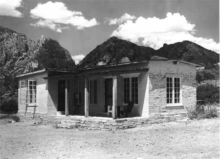
| |
| Figure 7: Chisos Basin Store (late 1940s) | |
Endnotes
1 "Report of the Big Bend Area, Texas," U.S. Department of the Interior, National Park Service, State Park ECW, District III, January 1935, RG 79, NPS SWRO, Santa Fe, Correspondence Relating to National Parks, Monuments, and Recreational Areas, 1927-1953, Box 3, Folder: 207 Reports (General), Folder 2; Ross A. Maxwell, In Collaboration with the Hon. E.E. Townsend and Frank D. Quinn, "Summary of Events That Led to the Establishment of the Big Bend National Park," n.d. 1949 (?), RG 79, NPS, SWRO, Santa Fe, Correspondence Relating to National Parks, Monuments, and Recreational Areas, 1927-1953, Box 2, Folder: 101 NPS History, DEN NARA.
2 Maier to Wirth, January 18, 1935, RG 79, NPS, SWRO, Santa Fe, Correspondence Relating to CCC, ECW, and ERA Work in National Parks, Forests and Monuments and Recreational Areas, 1933-1934, Box 95, Folder: DSP 1, DEN, NARA.
3 Maier to Dean Dan T. Gray, Fayetteville, AR, January 24, 1935, RG 79, NPS, SWRO, Santa Fe, Correspondence Relating to CCC, ECW, and ERA Work in National Parks, Forests and Monuments and Recreational Areas, 1933-1934, Box 95, Folder: DSP 1, DEN NARA.
4 Maier to Nason, January 29, 1935; Nason to Maier, February 2, 1935, RG 79, NPS, SWRO, Santa Fe, Correspondence Relating to CCC, ECW, and ERA Work in National Parks, Forests and Monuments and Recreational Areas, 1933-1934, Box 95, Folder: DSP 1, DEN NARA.
5 Dr. H.C. Bumpus, Chairman, NPS Education Advisory Board, Carlsbad Caverns National Park, NM, to Wirth, January 26, 1935; A.F. Ahrens, District Inspector, ECW, Alpine, TX, to Maier, January 24, 1935, RG 79, NPS, SWRO, Santa Fe, Correspondence Relating to CCC, ECW, and ERA Work in National Parks, Forests and Monuments and Recreational Areas, 1933-1934, Box 95, Folder: DSP 1, DEN NARA.
6 Ahrens to Maier, January 24, 1935.
7 Maier to Nason, n.d. (January 1935?); Nason to Maier, January 30, 1935, RG 79, NPS, SWRO, Santa Fe, Correspondence Relating to CCC, ECW, and ERA Work in National Parks, Forests and Monuments and Recreational Areas, 1933-1934, Box 95, Folder: DSP 1, DEN NARA.
8 James V. Allred, Attorney General of Texas, Austin, to D.E. Colp, Chairman, Texas State Parks Board, Austin, November 19, 1934, RG 79, NPS, SWRO, Santa Fe, Correspondence Relating to CCC, ECW, and ERA Work in National Parks, Forests and Monuments and Recreational Areas, 1933-1934, Box 95, Folder: Land Title File-Higgins, DEN NARA.
9 Douglas C. Lauderdale, Jr., Regional Attorney, NPS, Austin, to Maier, February 9, 1935, RG 79, NPS, SWRO, Santa Fe, Correspondence Relating to CCC, ECW, and ERA Work in National Parks, Forests and Monuments and Recreational Areas, 1933-1934, Box 95, Folder: Land Title-Higgins, DEN NARA.
10 Maier to Nason, February 18, 1935, RG 79, NPS, SWRO, Santa Fe, Correspondence Relating to CCC, ECW, and ERA Work in National Parks, Forests and Monuments and Recreational Areas, 1933-1934, Box 95, Folder: DSP 1, DEN NARA.
11 Maier to Nason, February 22, 1935; Nason to Maier, February 26, 1935, RG 79, NPS, SWRO, Santa Fe, Correspondence Relating to CCC, ECW, and ERA Work in National Parks, Forests and Monuments and Recreational Areas, 1933-1934, Box 95, Folder: DSP 1, DEN NARA.
12 "A Bill To provide for the establishment of the Big Bend National Park, in the State of Texas, and for other purposes," H.R. 6373, 74th Congress, 1st session, March 4, 1935; Joseph L. Arnold, The Evolution of the 1936 Flood Control Act (Fort Belvoir, VA: U.S. Army Corps of Engineers, Office of History, 1988), 16.
13 Maxwell, "Summary of Events that Led to the Establishment of the Big Bend National Park;" Harold L. Ickes, Secretary of the Interior, to The President, The White House, Washington, DC, February 27, 1935, RG 79, NPS, SWRO, Santa Fe, Correspondence Relating to National Parks, Monuments and Recreational Areas, 1927-1953, Box 1, Folder: 0-30 (NPS) Big Bend International Park, DEN NARA.
14 Maier to Wirth, March 15, 1935, RG 79, NPS, SWRO, Santa Fe, Correspondence Relating to CCC, ECW, and ERA Work in National Parks, Forests and Monuments and Recreational Areas, 1933-1934, Box 95, Folder: Land Title File-Higgins, DEN NARA.
15 Townsend to Maier, March 22, 1935, RG 79, NPS, SWRO, Santa Fe, Correspondence Relating to CCC, ECW, and ERA Work in National Parks, Forests and Monuments and Recreational Areas, 1933-1934, Box 95, Folder: Land Title File-Higgins, DEN NARA.
16 Townsend to Colp, March 30, 1935; Townsend to Maier, March 31, 1935, RG 79, NPS, SWRO, Santa Fe, Correspondence Relating to CCC, ECW, and ERA Work in National Parks, Forests and Monuments and Recreational Areas, 1933-1934, Box 95, Folder: Land Title File-Higgins, DEN NARA.
17 James O. Stevenson, NPS Regional Wildlife Technician, Oklahoma City, to Maier, April 4, 1935, RG 79, NPS, SWRO, Santa Fe, Correspondence Relating to National Parks, Monuments and Recreational Areas, 1927-1953, Box 94, Folder: N/A, DEN NARA; Sellars, Preserving Nature in the National Parks, 119.
18 Stevenson to Maier, April 4, 1935.
19 Maier to State Park ECW, NPS, Washington, DC, June 8, 1935, RG 79, NPS, SWRO, Santa Fe, Correspondence Relating to National Parks, Monuments and Recreational Areas, 1927-1953, Box 94, Folder: General April 1, 1936-July 30, 1936, DEN NARA.
20 H.P.K. Agersborg, Ph.D., NPS Chief Biologist, "Report on Certain State Parks and Other Areas in Texas," June 1935, RG 79, NPS, SWRO, Santa Fe, Correspondence Relating to National Parks, Monuments and Recreational Areas, 1927-1953, Box 20, Folder: 720.03 Preserves, DEN NARA.
21 Public Law No. 157 - 74th Congress (S.2131), "An Act To provide for the establishment of the Big Bend National Park in the State of Texas, and for other purposes," June 20, 1935, RG 79, NPS, SWRO, Santa Fe, Correspondence Relating to National Parks, Monuments and Recreational Areas, 1927-1953, Box 22, Folder: 833 Exhibits; Townsend to Maier, June 13, 14, 1935, RG 79, NPS, SWRO, Santa Fe, Correspondence Relating to CCC, ECW, and ERA Work in National Parks, Forests and Monuments and Recreational Areas, 1933-1934, Box 95, Folder: Land Title File-Higgins, DEN NARA.
22 J.T. Haile, Procurement Office, NPS State Park Division, Austin, to Seventh Regional Office, ECW, Oklahoma City, July 8, 1935, RG 79, NPS, SWRO, Santa Fe, Correspondence Relating to National Parks, Monuments and Recreational Areas, 1927-1953, Box 94, Folder: N/A, DEN NARA.
23 Maier to L.W. Rogers, Educational Adviser, Eighth Corps Area Headquarters, Fort Sam Houston, TX, July 19, 1935, RG 79, NPS, SWRO, Santa Fe, Correspondence Relating to National Parks, Monuments and Recreational Areas, 1927-1953, Box 94, Folder: N/A, DEN NARA.
24 Memorandum of Raymond Higgins, Assistant Regional Projects Manager, NPS State Park Division, Oklahoma City, to Maier, "Present Status of Land Titles in Big Bend Area, Texas," July 24, 1935, RG 79, NPS, SWRO, Santa Fe, Correspondence Relating to CCC, ECW, and ERA Work in National Parks, Forests and Monuments and Recreational Areas, 1933-1934, Box 95, Folder: Land Title File-Higgins, DEN NARA. For a discussion of land policies of the early years of the United States, see Malcolm J. Rohrbough, The Land Office Business: The Settlement and Administration of American Public Lands, 1789-1837 (New York: Oxford University Press, 1968), and Paul Wallace Gates, History of Public Land Law Development (Washington, DC: U.S. Government Printing Office, 1968).
25 Memorandum of Higgins to Maier, July 24, 1935.
27 W.G. Carnes, Deputy Chief Architect, Branch of Plans and Design, Western Division, NPS, San Francisco, "Report on Proposed Big Bend National Park, Brewster County, Texas, Trip: August 4 to 8 incl., 1935," August 16, 1935, RG 79, NPS, SWRO, Santa Fe, Correspondence Relating to National Parks, Monuments and Recreational Areas, 1927-1953, Box 94, Folder: N/A, DEN NARA.
33 "National Park Service Committee Makes Tour Of Big Bend Park Area," Alpine Avalanche, August 16, 1935.
34 Stevenson to Maier, August 17, 1935, 720-04 Wildlife Survey Big Bend File, RG 79, NPS, CCF 1933-1949 Big Bend 719 - 833-05 Files, Box 836, DC NARA II.
36 Bernard F. Manbey, Associate Engineer, NPS Western Division, Branch of Engineering, San Francisco, "Proposed Big Bend National Park Report on Suggested Boundary, Engineering Requirements and General Notes," August 19, 1935, RG 79, NPS, SWRO, Santa Fe, General Correspondence Files 1927-1953, Box 15, Folder: 0-32 (NPS) Proposed Parks General R.O., DEN NARA.
38 Maynard S. Johnson, Regional Wildlife Technician, NPS First Region, "Preliminary Report Wildlife Survey of Big Bend National Park (proposed) Texas," n.d. (October 1935?), RG 79, NPS, SWRO, Santa Fe, Correspondence Relating to National Parks, Monuments and Recreational Areas, 1927-1953, Box 20, Folder: 720.04 Wildlife Survey, DEN NARA.
52 W.B. McDougall, Wildlife Technician, State Park Division, NPS, "Preliminary Report on A Plant Ecological Survey of the Big Bend Area, Texas," November 30, 1935, RG 79, NPS CCF 1933-1949 BIBE 207 Files, Box 825, DC NARA II.
55 L.T. Barrow, Chief Geologist, Humble Oil and Refining Company, Houston, TX, to Carroll H. Wegemann, Dallas, TX, September 19, 1935, RG 79, NPS, SWRO, Santa Fe, Correspondence Relating to National Parks, Monuments and Recreational Areas, 1927-1953, Box 94, Folder: Big Bend Correspondence (Folder 1), DEN NARA.
56 Wegemann to Earl A. Trager, Chief, Naturalist Division, NPS, Washington, DC, September 25, 1935; Maier to Wirth, October 10, 1935, RG 79, NPS, SWRO, Santa Fe, Correspondence Relating to National Parks, Monuments and Recreational Areas, 1927-1953, Box 94, Folder: Big Bend Correspondence (Folder 1), DEN NARA.
57 Nason to J.T. Roberts, Regional Inspector, ECW, Alpine, TX, September 26, 1935; Maier to Nason, October 14, 1935, RG 79, NPS, SWRO, Santa Fe, Correspondence Relating to National Parks, Monuments and Recreational Areas, 1927-1953, Box 94, Folder: Big Bend Correspondence (Folder 1), DEN NARA.
58 Maier to Wirth, October 30, 1935; J. Evetts Haley, Department of History, University of Texas, Austin, to William R. Hogan, NPS, Oklahoma City, December 2, 1935, RG 79, NPS, SWRO, Santa Fe, Correspondence Relating to National Parks, Monuments and Recreational Areas, 1927-1953, Box 20, Folder: 720.03 Preserves, DEN NARA; Jefferson C. Dykes, "James Evetts Haley," in Howard R. Lamar, ed., The Reader's Encyclopedia of the American West (New York: Thomas Y. Crowell Company, 1977), 481.
59 Paul Russell, Wildlife Technician, Seventh Region, NPS, "Preliminary Range Survey of Big Bend Area Texas With Relation to a Proposed Longhorn Ranch," December 6, 1935, RG 79, NPS, SWRO, Santa Fe, Correspondence Relating to National Parks, Monuments and Recreational Areas, 1927-1953, Box 20, Folder: 720.03 Preserves, DEN NARA.
62 Memorandum of Raymond Higgins to Maier, "Trip to Austin and Alpine, Texas, regarding Big Bend National Park," November 20, 1935, RG 79, NPS, SWRO, Santa Fe, Correspondence Relating to CCC, ECW, and ERA Work in National Parks, Forests and Monuments and Recreational Areas, 1933-1934, Box 95, Folder: Land Title File-Higgins, DEN NARA.
67 (Supplemental) Memorandum Report of Higgins to Maier, November 21, 1935, RG 79, NPS, SWRO, Santa Fe, Correspondence Relating to CCC, ECW, and ERA Work in National Parks, Forests and Monuments and Recreational Areas, 1933-1934, Box 95, Folder: Land Title File-Higgins, DEN NARA.
69 Bernary F. Manbey, Chief, Surveys and Plans, NPS, Washington, DC, to Townsend, November 26, 1935; Townsend to Manbey, November 19, 1935; A.W. Burney, Assistant Chief Engineer, NPS, Washington, DC, to Maier, October 14, 1935; R.D. Morgan, Superintendent, SP-33-T, Marathon, TX, October 26, 1935, RG 79, NPS, SWRO, Santa Fe, Correspondence Relating to National Parks, Monuments and Recreational Areas, 1927-1953, Box 1, Folder: 000 General Big Bend, DEN NARA.
70 Carnes to Mr. (Thomas) Vint, November 27, 1935, RG 79, NPS, SWRO, Santa Fe, Correspondence Relating to National Parks, Monuments and Recreational Areas, 1927-1953, Box 1, Folder: 000 General Big Bend, DEN NARA; Townsend to Maier, November 29, 1935, RG 79, NPS, SWRO, Santa Fe, Correspondence Relating to National Parks, Monuments, and Recreational Areas, 1927-1953, Box 94, Folder: 4th Progress Report on Big Bend - Region III, DEN NARA.
| <<< Previous | <<< Contents >>> | Next >>> |
bibe/adhi/chap3.htm
Last Updated: 03-Mar-2003