|
LAKE ROOSEVELT The Grand Coulee Dam and the Columbia Basin Reclamation Project |

|
Section I.
THE GRAND COULEE DAM (continued)
PROJECT PROBLEMS
CONTROL OF SPECULATION
The development of speculative land prices on the Columbia Basin Project will be reduced to a minimum by means of the provisions of the Anti-Speculation Act of May 27, 1937. A similar policy was applied successfully on the Kittitas, Owyhee, and Vale Projects.
The principal requirements of this act are (1) that privately owned lands within the area to be served be impartially appraised to determine their present-day market value without reference to the proposed irrigation works; (2) that contracts for the repayment of the part of the cost of the project allocated by the Secretary of the Interior to irrigation, and for other purposes, be made with an irrigation district or with irrigation districts; (3) that private land-owners agree to limit their holdings to 40 acres for an individual or 80 acres for a man and wife; (4) that landowners agree to sell lands held in excess of these minima at the Government-appraised price; (5) that in the event excess lands are sold at higher prices or are retained, no water shall be delivered to the lands involved; (6) that water may be obtained for lands which were purchased at prices above the Government appraisal, unless they were excess land so purchased, upon payment to the Government by the vendor of a portion of the excess price, varying from 50 to 100 percent with the length of time which has elapsed since the sale, this money to be applied in inverse order to the construction payments charged against the land; and (7) that the State of Washington by appropriate legislation shall authorize, adopt, ratify, and consent to all the provisions of the act which come within the jurisdiction of the State. Conditions under which water can be obtained for any tract of land run with the land as part of any title to it.
Copies of the appraisals of project lands mode under the direction of the Secretary of the Interior will be on file in county offices, and will be accessible to prospective buyers of land.
The collecting of annual installments for construction, and for maintenance and operation charges, through the taxing power of irrigation districts, will tend to prevent the holding of idle land for speculative purposes.

|
| Operating bench (left), lamp signal table (right), and graphic recorder for the one-man control of the concrete mixing plant |
COST OF WATER RIGHTS
The exact costs of water rights and of annual maintenance and operating charges cannot be determined until the project is much further advanced. They have been estimated as follows:
The portion of the project costs chargeable to the reclamation of land is estimated at this time to be from $85 to $100 per acre, to be distributed over 40 years without interest. For operation and maintenance, including the cost of power for pumping, the annual charge is estimated at $2.60 per acre. On this basis the total indicated payments by the settler would be $2.60 per acre per year for operation and maintenance and nothing on account of construction for the first 4 years, and would be thereafter about $4.60 per acre per year for 4 years for operation and maintenance, and construction, and about $5.10 per acre per year for the next 32 years for operation and maintenance, and construction.
YEARS REQUIRED FOR COMPLETION
The irrigation of land in the Columbia Basin Project cannot begin until the Grand Coulee Dam, together with portion of the power plant and pumping station, is completed, and the Grand Coulee Reservoir and a system of canals to the northern boundary of the project lands are constructed. When that will be accomplished will depend upon the rate at which funds may be made available by the Congress.
From 26 to 50 years may be required for the completion and settlement of the whole project. The period will be determined by the rate at which extensions of the canal system will make water available. If the land should be brought under cultivation at the rate of only 25,000 acres each year, 48 years will be required to reclaim the entire area to be irrigated.

|
| Eight-ton batches of concrete are handled by huge overhead cranes, directed by telephone-signalmen "on location" |
DEVELOPMENT OF THE UPPER COLUMBIA BASIN
A comprehensive plan for the development of the Columbia River, worked out by the Army engineers, contemplated the construction of 10 dams to utilize 92 percent of the available fall in the river between the international boundary and the Pacific Ocean. By far the largest and most important of these is the Grand Coulee Dam—largest because it uses 355 feet or 27 percent of the total available fall and includes an electric generating installation of 1,890,000-kilowatt capacity, which is larger than any existing development in the world today; and most important because it creates a storage reservoir of over 5 million acre-feet of usable capacity at the highest possible location on the river in this country, and affords the most feasible and practicable means of diverting the waters of the Columbia River out of its canyon and onto any considerable area of arid land.
The Grand Coulee Dam is often referred to as the "key" structure in the plan for the development of the Columbia River. The release of stored water from the reservoir behind the dam during periods of low flow not only will increase the minimum navigable channel depths by 2 feet below the Bonneville Dam and by 4-1/2 feet below the Grand Coulee Dam, with corresponding increases at intermediate points; but it will also double the amount of firm power that can be developed at the six power sites on the Columbia River between Grand Coulee Dam and the point where the Snake River joins the Columbia, and increase by 50 percent the firm power that can be generated at the various sites below this point, including Bonneville.
|
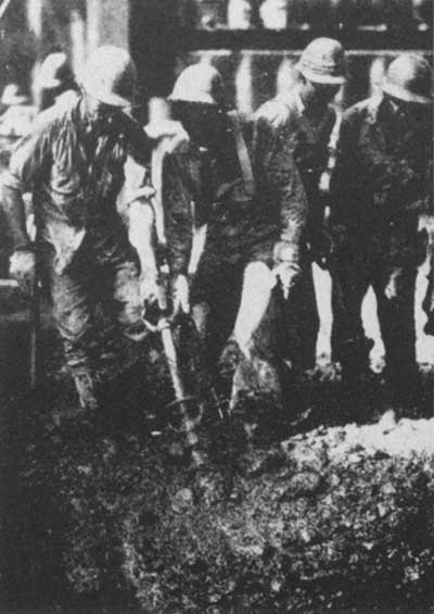
| "Vibrators," thrust into the stiff concrete, cause it to spread without segregation of components |
THE EFFECTS OF IRRIGATION
In the 11 arid and semiarid Western States are 39.5 percent of the area of the United States, a little more than 9 percent of the population, and less than 4.5 percent of the farmed and cropped area. So much of the land is in mountains, forests, and desert that these States can never be agriculturally self-sufficient. Great quantities of the staples of the Middle West and Southern States are shipped in, and chiefly protective foods, fruit, eggs, dairy products, and out-of-season vegetables are shipped out. The irrigated lands at the West supplement the ranges in producing feeder stock for Middle West farmers, and wool to compete with foreign producers in the American market, and they supplement rather than compete with Middle West and Eastern farms in producing a balanced national diet.
Statistics show greater stability and greater purchasing power in irrigated districts than in farming and industrial districts throughout the country. There is an insistent demand for irrigated land to replace the worn-out, eroded, and submarginal lands that are better suited to forestry and grazing than to cultivation.
The Columbia Basin Project will bring about within a period of 25 to 50 years the establishment of 25,000 to 40,000 new farm homes, with a farm population of 100,000 to 200,000 people. In the gradual building, equipping, and improving of those homes there will be a steady demand for the products of eastern industry. Along with the farms, towns and cities will grow up on the project lands with a population as great as that of the farms, and material growth may be expected in the cities and towns in the surrounding area.
It has been the experience of the past that for every family an on irrigated farm there is also one in the towns that are developed on the project to serve the farming districts, and still another in the more distant cities and towns engaged in the manufacturing and transportation of the things that the project people must buy.
| <<< Previous | <<< Contents>>> | Next >>> |
grand_coulee_dam/sec1h.htm
Last Updated: 01-Feb-2008