|
Capitol Reef
Cultural Landscape Report |

|
ANALYSIS AND EVALUATION (continued)
CIRCULATION
Access to Fruita was limited well into the early 1930s. Roads were informal in character and developed as needed, generally following natural landforms and property lines. The primary road through the district was the "Blue Dugway," constructed in 1883, linking the new settlement of Junction (later, Fruita) to other settlements downriver. The road wrapped around the north end of Johnson Mesa, passing through the homestead claims of Elijah Behunin, Nels and John Johnson, and Hyrum Behunin. Although this road (known at different times as the Capitol Gorge Highway, Reef Road, Monument Road, Utah State Route 24, and later known as the Scenic Drive) continued as the primary route through the district, it wasn't completely paved (chip-sealed) until 1987. Over the years it was widened from approximately 16 to 20 feet.
Another early road within the settlement provided limited access to homesteaders and land holders along the north edge of the development. This lane was a narrow, serpentine, dirt road, prone to washouts, that wound past orchards and fields, linking landowners in north Fruita with market towns to the west such as Torrey, Loa, and Bicknell. Other roads were developed as needed to access fields and irrigation works. Two roads were developed on either side of the Johnson Orchard and crossed Sulphur Creek, connecting the Capitol Gorge Highway and the north side of the settlement. These roads remained in use into the 1960s and segments are still used as access lanes today.

| |
| Lane next to Johnson Orchard, looking north, 1993. | |
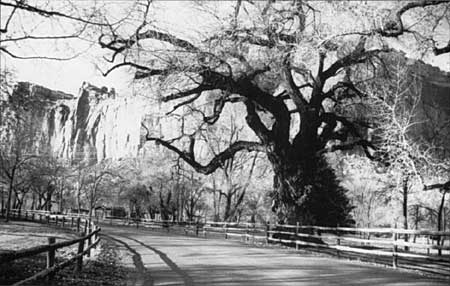
Documentation suggests that throughout the early development of Fruita, some type of access route existed to the irrigation intake line on the Fremont River. A dirt road following the line is evident on a 1938 aerial photograph, and corresponds to the existing road on the east side of Johnson Mesa. In 1962 State Highway 24 was rerouted along the north side of the district, with portions following the general alignment of the historic road. Old State Route 24 became the Scenic Drive and was closed south of the district at Capitol Gorge. This road remains the primary north-south route through the district today. The approximately 2-mile long section of the narrow, winding Scenic Drive that passes through historic Fruita is a contributing structure to the district.
| |
| View of the Scenic Drive, looking northwest, 1993. | |
| <<< Previous | <<< Contents >>> | Next >>> |
http://www.nps.gov/care/clr/clr4e.htm
Last Updated: 01-Apr-2003