|
Capitol Reef
Cultural Landscape Report |

|
ANALYSIS AND EVALUATION (continued)
CLUSTER ARRANGEMENT
There are two primary complexes in the district: the Gifford Farm, in the center of the district along the Scenic Drive, and the Holt Farm, on the northern edge of the district.
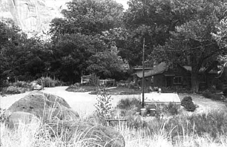
Gifford Farm
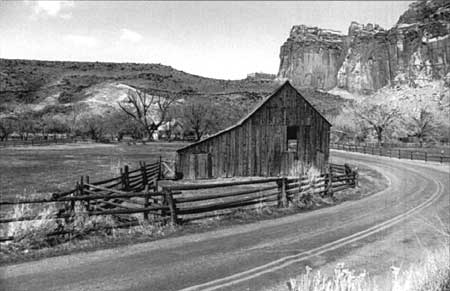
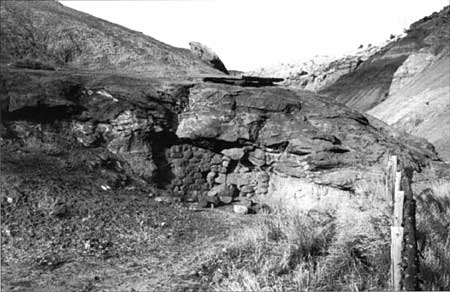
The Gifford Farm is comprised of three primary buildings, two associated structures, approximately 2 acres of fields, an orchard associated with the historic farm operation, and a 5-acre pasture (historically part of the William C. Chesnut property). The three buildings are a main residence, barn, and smokehouse, built by Cal Pendleton prior to the property's sale to Jorgen Jorgensen in 1919. Jorgensen sold the property to his son-in-law, G. Dewey Gifford, in 1929. The Pendleton lime kiln is located approximately .3 miles south of the Gifford Farm along the Scenic Drive. The kiln consists of a 10' x 13' cavity cut into the side of a small cliff, and a curved sandstone wall built of coarsely laid cobblestone. A chimney shaft has been cut through the cliff to vent the kiln. The kiln is currently sealed, with its openings blocked for safety. Documentation suggests that the kiln was constructed between 1890 and 1900 and was used by the community until 1930 to produce lime for building and agricultural practices.
| |
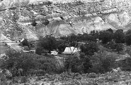
| Gifford Farm complex, looking east, 1993. | |
| |
| Gifford barn, looking west, 1993. | |
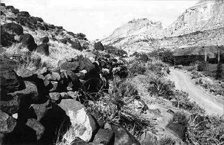
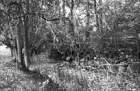
Other structures associated with the Gifford Farm include approximately .7 miles of dry-laid stone walls located on the east slope of Johnson Mesa above the farm, extending south along the service road. (A small east-west section of rock wall also occurs just north of the Gifford house.) Documentation indicates that these walls were constructed about 1905 by Calvin Pendleton and his sons to control ranging livestock. The most visually prominent are two distinct arching walls leading from the west side of the Fremont River, up the east slope of the mesa. The northernmost wall is approximately 1,550 linear feet; the southern wall is approximately 1,350 linear feet.
Another wall abuts the south wall where it crosses the service road, and follows the service road south for 600 feet. [36] From that point, it is found on the north side of the road, in segments all the way to the settling pond. The stone walls average 3 feet in height and the stones are laid in a random fashion. The height, form, and structural condition of the wall varies throughout. [37]
| |
| Pendleton lime kiln, looking north, 1993. | |
| |
| Pendleton rock walls on the side of Johnson Mesa, 1993. | |
Holt Farm
The Holt Farm is located on the north side of State Highway 24, approximately 1 mile east of the visitor center. The complex includes a main residence (ca. 1895), a fruit cellar (ca. 1900), a water cistern north of the house, a non-historic garage (on the site of an early horse shed/barn), a large cut stone wall behind the garage, terraced rock walls on the south side of the property stepping down to the road, a rock and large boulder with historic inscriptions, historic irrigation ditches, remnant orchards, a vegetable garden, and approximately 2 acres of associated land.
| |
| Holt Farm complex, looking east, 1993. | |
| |
| Rock walls and irrigation ditch at the Holt Farm, 1993. | |
| <<< Previous | <<< Contents >>> | Next >>> |
http://www.nps.gov/care/clr/clr4f.htm
Last Updated: 01-Apr-2003