|
CRATER LAKE
Administrative History |

|
CHAPTER NINETEEN:
TRAILS
by Stephen R. Mark, Park Historian, 2013
 |
Crater Lake National Park Trails Administrative History of Crater Lake National Park Stephen R. Mark Pacific West Region |

|
| The Trail Up Garfield Peak. Drawing by L. Howard Crawford in Nature Notes from Crater Lake 7:2 (August, 1934), 1. |

|
| Visitors on the Lake Trail, about 1910. Courtesy of the Klamath County Museum. |
|
| Wizard Island and Crater Lake from the Sparrow Trail, 1917. National Park Service photo. |
Contents
Cover
Cover Photos: (top) Footbridge on the Castle Crest Wildflower Garden Trail. Photo by the author, 2009. (bottom) Visitors on the Crater Wall Trail, early 1950s. National Park Service photo.Contents
Acknowledgements
Introduction
Park Trails Prior to 1916
National Park Service Trail Building, 1917-21
Maintenance and Construction, 1922-28
Expansion and Re-Construction, 1929-32
New Deal Projects, 1933-41
Postwar Planning and Development, 1942-55
The Mission 66 Years, 1956-66
Austerity and a Changing Backcountry, 1967-80
A Holding Pattern, 1981-92
Convergence of Agenda and Funding, 1993-2010
Conclusion
Endnotes
Index (omitted from the online edition)
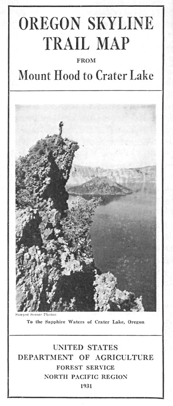
Back Cover(Left) Hiker atop Wizard Island, 1991. (Below) Cover of the U.S. Forest Service brochure on the Oregon Skyline Trail, 1931. (Bottom) Section of the Fort Klamath-Rogue River wagon road near Annie Spring.
Mary Williams Hyde did the final editing and layout. I also wish to thank Andrea Andresen, Gretchen Luxenberg, and Cathy Gilbert as this manuscript passed a critical stage in production.
Acknowledgments
This represents a third attempt to add other chapters to an administrative history of Crater Lake National Park, completed by Harlan Unrau in 1987. Some 25 years hence, it may now be time to revise or revisit the initial work, in whole or in part. While some trails received mention in Unrau's work, he did not index it, so its usefulness is limited to charting how pedestrian circulation roughly developed in the park. His is not alone in that regard, as my Historic American Engineering Record documentation, Addendum to Crater Lake National Park Roads (HAER OR-107), also contains information about trails, but is not indexed. This narrative attempts to correct that deficiency, though it also represents an effort to place trails in somewhat greater context than simply being an adjunct to park development in general, or roads in particular.
A chapter (19) on trails comes as staff members are embarking on a comprehensive trails plan for the park. Support for writing this chapter came from Superintendent Craig Ackerman, Acting Superintendent Vicki Snitzler, Management Assistant Scott Burch, Chief of Interpretation Marsha McCabe, and the Crater Lake Natural History Association. I started the draft in August 2010, at a time when the Plaikni Falls Trail was nearing completion, having earlier assisted on various trails projects from 1997 onward. My thanks go to former Trails Leader Cheri Killam Bomhard, who has shown how the hiking experience of visitors and staff can be improved through realignments that enhance how the landscape is seen and enjoyed. The narrative also benefitted from talks given at the park's science and learning center during the summer months to employees and the dialog that resulted. Mary Williams Hyde did the layout, with funds for printing provided by ........
Stephen R. Mark
December 2012
Introduction
It is fair to say that trails in Crater Lake National Park have received far less attention as circulation devices than roads. There are numerous reasons for this, not least being the distances required for visitors to reach the park and costs associated with ensuring safe vehicular travel. Yet trails can be as central to experiencing the park or more so, especially since they require travel by foot, horseback, and (when covered by snow) skis or snowshoes. Their origin, construction, and use is the subject of this paper, one aimed at providing background and context for how these circulation features were developed over the course of more than a century.
Generalizing about any "system" of trails can be difficult because the term trail has numerous meanings. In this case, trails are separated into four broad categories, beginning with those that are or were beaten paths with few efforts made to improve and maintain them for use by pedestrians or horses. Second, some trails exist with minimal location work, but have been marked by blazes, tags on trees, or signs and receive use that includes skiing and snowshoeing. The third category is limited to roads originally constructed for wagons or automobiles, but subsequent use has been limited to pedestrians and stock. The fourth category of recreational trails usually exhibit engineered qualities that in many respects make them somewhat akin to highways designed for foot travel.
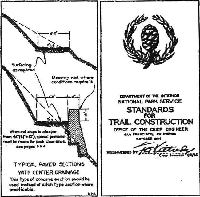
There is some overlap between categories, since some trails at Crater Lake can fit into more than one, but they provide a starting point for describing the intent of their builders, methods of construction, and subsequent realignments. Recreational trails can be further subdivided into the front- and back-country types, but even within these designations, there is often considerable variation in what can be called typical sections. It is probably safer to say that recreational trails tend to follow established standards for width, grade, curvature, and drainage features. Whether intended for pedestrians and/or stock, location work preceded their construction, and in the best examples, trail building reflected the principles expressed in the NPS standards of 1934.1
|
| Excerpts from the NPS Standards for Trail Construction, 1934. Courtesy of Electronic Technical Information Center, Denver. |
Previous documentation, notably in the second volume of an administrative history by Harlan Unrau and a historic resource study by Linda Greene, included trails as a minor component of their work relating to the development of park infrastructure. Apart from the problems associated with construction and maintenance of trails used to access the lakeshore, both accounts are largely limited to depicting the extent of park trails at selected points in time. What drove initial construction, much less changes, their maintenance, and in some cases, interpretation, has been overlooked and could prove useful to future planning efforts. So might a summary of trails that have faded into disuse and the reasons why some proposals for trails in the park did not come to fruition.
Archival records relating to most individual trails are generally fragmentary when compared to roads or other types of infrastructure. The relatively small expense of trail construction and maintenance has meant that few contracts (with their inspection reports and other information) were let for such work. As a whole, the documentation on trails at Crater Lake consists of some reporting on construction, but quite a bit less on maintenance or various changes made in the field. Planning documents, photographs, interpretive guides, and interviews can fill some of the gaps in source material. Yet detail about the factors that influenced location, realignments, and maintenance can often be elusive and sometimes vexing.
In acknowledging these limitations of the record, it is still possible to generalize about which trails have received the most attention from park managers over the past century or so. Given the challenging terrain and comparatively heavy use, it is not surprising that trails to the lake have consumed more funding and administrative time than perhaps all the other types of pedestrian routes combined. In descending order, the next group consists of trails leading to popular viewpoints along the rim and those in the main developed area of Rim Village. Other "front country" trails (that is, designed for day use hikes of relatively short duration) located away from the rim, but in proximity to paved roads, are the next in line. Visitation is considerably lighter in the backcountry, where the trail "system" makes extensive use of former fire roads. There are exceptions, however, as realignments completed by the park's trail crew since 1997 have diverged considerably from the fire roads in some places.
Park Trails Prior to 1916
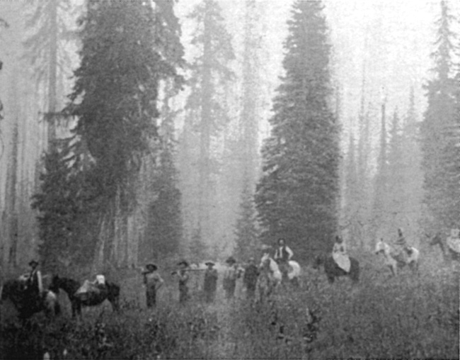
The period preceding the advent of National Park Service administration at Crater Lake includes some antecedent trails, even if most of them can be characterized as either beaten paths or blazed tracks. Among the beaten paths are those used by tribal members resident in the Klamath Basin to reach Huckleberry Mountain and other destinations west of Crater Lake that required travel through the area that later became the national park.2 Most prominent among these was an east-west route roughly corresponding to a subsequent wagon road built by soldiers from Fort Klamath to the Rogue River in 1865.3 Two of the Indian trails remained prominent enough to be mentioned in field notes for the boundary survey of the newly established Crater Lake National Park in 1903, with one of the routes being a path to Huckleberry Mountain, located in the adjacent national forest.4
|
| Nineteenth century travelers making their way to Huckleberry Mountain. Photo credited to Ramona Hanks in Klamath Echoes (Klamath Falls: Klamath County Historical Society, 1968), 93. |
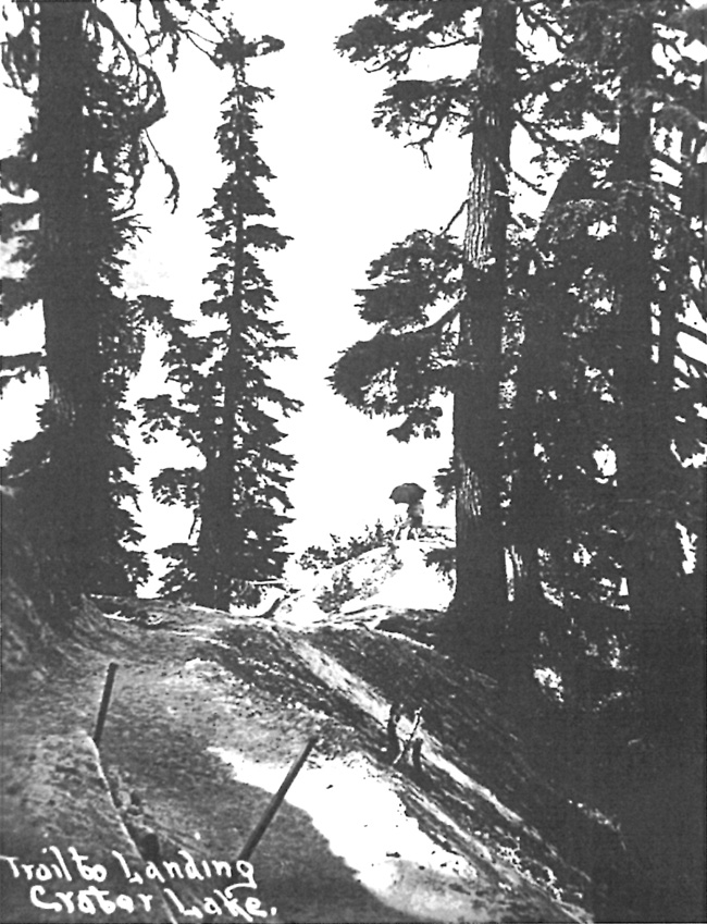
Opening of the wagon road in 1865 eventually induced a party of visitors from Jacksonville to mark a route by blazing trees from a point on the road near Dutton Creek about two miles to the rim of Crater Lake. The blazed track discouraged travel by wagon at first due to the steep and rough terrain, but had been improved enough to be called a "road" in visitor accounts from the 1890s.5 Nevertheless, many camping parties chose to remain along Dutton Creek due to the availability of water, something largely absent at the rim, and then walked to see Crater Lake. Visitors used a path to the lakeshore from the rim by 1890, though more than one account described the precipitous descent from the future site of Crater Lake Lodge as hazardous, not least due to the high likelihood of rockfall.6
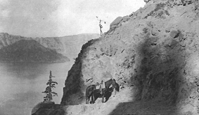
Having a safe trail to the lakeshore became a management concern upon the appointment of William F. Arant as the park's first superintendent in the summer of 1902. The path necessitated a dangerous descent of 900 feet to Eagle Cove, so Arant requested $500 for improvements beginning in 1903.7 He reiterated the request, which included a cable for visitors to use in the most ominous section, in subsequent annual reports. No substantial improvements to its condition came until 1910, when a survey party from the Army Corps of Engineers made some changes in its location. As a small construction crew began work that autumn, they added switchbacks to lessen the grade and widen the route where possible. It still required what Arant described as "considerable repair work" each year due to annual washouts and other damage caused by rain and melting snow.8
|
| Visitors in the "Lower Campground" near Dutton Creek about 1900. Photo by Peter Britt, courtesy of the Southern Oregon Historical Society. |
As part of conducting the earliest scientific work at Crater Lake, J.S. Diller of the U.S. Geological Survey also compiled the first topographic map (in 1896) of what Congress would later designate as the national park. This fixed the park's boundaries in 1902, but as an aid to visitors who wanted to see important geological features, he promoted a pack trip around the rim. Depicted and described as a circuit as early as 1897, Diller noted five years later there was no trail yet in existence for those who wished to follow the route.9 Instead, the closest approximation to any piece of the route started where the "road" blazed in 1869 terminated at the rim. The boundary survey of 1903 described the path as leading west from there to the "foot" of the Watchman, past Glacier (Hillman) Peak and then north/northeast to Diamond Lake.10 Located some 400 feet in elevation above Diller's suggested pack route, Arant described the path as "not so much used." He called for its improvement as early as 1906, recommending that a "good trail" could lead from the informal campground (at what later became Rim Village) to the summit of Hillman Peak, estimating that an appropriation of $200 would be needed for the work.11
The park's total appropriation for the 1905 season amounted to only $3,000, and trail improvements did not feature as a budget item since much of the work that summer focused on completing a new wagon road to the rim through Munson Valley. In his annual report, Arant described what he considered to be the other park trail of that time, one that departed from the undeveloped campground on Dutton Creek and went west and northwest to Bybee Creek, eventually heading out of the park.12 He also thought it needed improvement, describing the trail in his report for 1909 as little more than "mere tracks of horses being ridden from one point to another."13 Appropriations had increased enough in 1908 for locating and marking a trail from the park headquarters (at that time located at Annie Spring) over to the Pinnacles on Wheeler Creek and then to Mount Scott. It, and what amounted to another set of tracks from headquarters to the base of Union Peak, scarcely rated any better in Arant's estimation than the path that went past Bybee Creek.14
Arant urged that the route to Mount Scott be converted to a wagon road in order for visitors to enjoy greater access to that part of the park, but he lacked the funding necessary (estimated at roughly $250) to make it happen. Trails, of the kind that furnished a beaten track as a precursor to more permanent development, represented an inexpensive device that had the potential to enhance the park's popularity in advance of the funding needed for automobile roads or facilities like hotels. He therefore proposed a trail along the rim to Watchman and Hillman Peak, as well as another starting from an unspecified point on the road leading through Munson Valley to what later became known as Rim Village. The latter might take visitors on horseback to Crater Peak, and then down Sun Creek.15
Only one of Arant's proposals for improved trails or additional routes came into being while he served as superintendent from 1902 to 1913. A small crew improved the trail down to Crater Lake in 1910, but this work largely derived from the presence of H.L. Gilbert from the U.S. Army Corps of Engineers, who arrived in the park that summer to begin location studies for a system of roads and trails. To be built by the Corps from annual appropriations over multiple years, the system included trails as a small item in their total estimate of the $627,000 needed for construction. The share for trails amounted to a total of $15,000, thought to be sufficient for building 100 miles of trails to "afford accessibility to points of minor interest in the park, and to portions remote from any of the [proposed] wagon roads."16
|
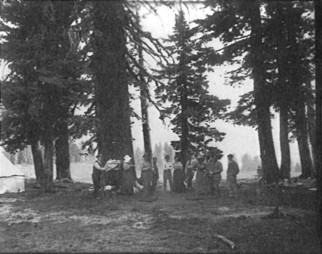
| Campers in what later became known as Rim Village, about 1910. Courtesy of the Klamath County Museum. |
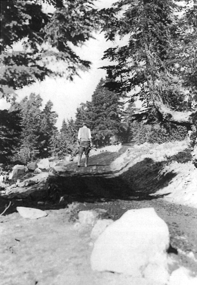
Very little of the proposed trail mileage ultimately materialized from the Corps, mainly because work to grade approach roads and a circuit route along the rim took precedence during the project, which began in 1913 and terminated at the end of June, 1919. The Corps spent just two-thirds of the amount they originally estimated, almost all of it on a road system that never went beyond the grading phase of construction. When the Corps finally left the park, the entire project stood at roughly 50 percent complete. It included building only one trail, but even that one initially served the purpose of allowing for construction crews and equipment to pass between the ends of graded sections on the Rim Road near the Watchman. Less than a mile in length, the trail went up the south side of Watchman and over to what was later called the Watchman Overlook. One engineer described it as having been built in a "cheap" manner during the summer of 1916, varying in width between three and four feet, and on an average grade of 20 percent. He contended that it should be considered part of the proposed trail system since the route shortened distances by foot or saddle horse along the back of the Watchman and could be used by visitors to ascend the peak, where a fire lookout had been built in 1917.17
|
| On the way to Huckleberry Mountain from Fort Klamath, about 1900. Courtesy of the Hescock family. |
William Gladstone Steel succeeded Arant as park superintendent from 1913 to 1916. His most pressing concern in regard to trails was the route to Crater Lake, which required considerable work during his first summer in the job. As a follow up, Steel recommended that another $200 be spent to remove rocks from the trail so that burros (which he wanted the park concessionaire to rent for the use of visitors) could pass over it.18 Conditions on this trail had scarcely improved two years later, when a visit by William Jennings Bryan, the recently resigned U.S. Secretary of State, prompted Steel to pitch the need for a tunnel to the lake. Such a device could obviate the need for a "laborious one thousand feet or more steep descent and climb over a slippery and dangerous trail," something Bryan considered "almost impossible for old people."19 Despite the publicity, the tunnel proposal never gained traction, though it prompted Steel's supervisor, General Superintendent of National Parks Mark Daniels, to recommend that new trail "be built as near to the water's edge as possible and as far around the lake's shoreline as practicability will allow."20
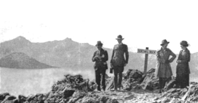
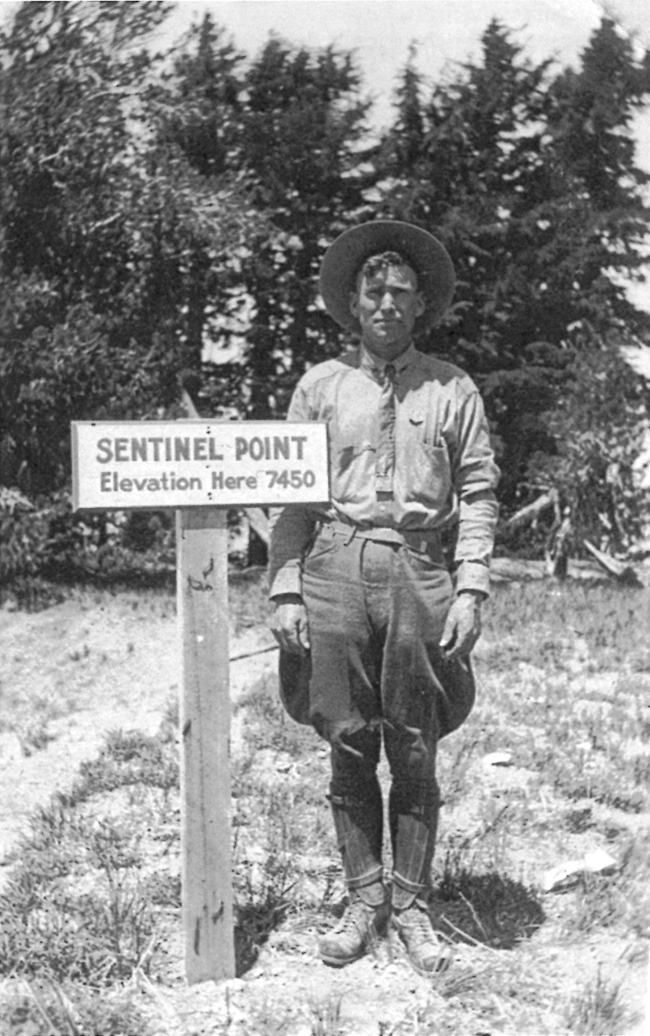
Steel did, however, expend his annual allotment of $250 for rebuilding or "improving" the lake trail, supposedly widening it from two to four feet over its 2,300 foot length.21 He also had another $250 in 1915 to build a trail to the top of Wizard Island. As something of a justification for both developments that summer, the government provided $150 to place crayfish in the lake as food the trout that Steel continued to plant in Crater Lake.22 Steel also found a way to build a four foot trail to Sentinel Point, from where the Corps of Engineers supplied a stopping point for motorists on the Rim Road. This came at the request of Assistant Secretary of the Interior Stephen T. Mather, who presumably approved paying for this relatively small project with the funding provided for paying seasonal rangers.23
Daniels, meanwhile, worked on a plan for Rim Village that summer and thus refined some of his subordinate's recommendations. He began by suggesting a suitable trail to Garfield Peak, given how visitors from the lodge often climbed partway to the summit, but turned back due to the difficulty of going any further. Daniels also recommended the views from Arant Point and Union Peak, so suggested trails to them from the camp near Park Headquarters at Annie Spring. Steel no sooner received an allotment to build a trail up Garfield Peak in 1916, but instead wanted $400 of it reallocated to repair of fences and buildings.24
|
| Visitors with a park ranger at Sentinel Point, about 1920. Photo by Alex Sparrow, courtesy of the Southern Oregon Historical Society. |
By the time Steel resigned as park superintendent in November 1916, he made a reference to outlining a system of trails in his last annual report. Although he supplied few details about the larger plan, Steel called for a route to reach the top of Mount Scott. As preeminent among park trails, he wanted it built on a grade that allowed for subsequent widening, with the eventual aim of use by motorists.25 Although not as chimerical as the tunnel proposal, the summit trail idea attracted no more support in terms of funding than had Arant's recommendation for a wagon road to reach the park's highest point.
Working up estimates for a proposed annual budget at this point involved one submitted by the War Department for road work since the Army Corps of Engineers built the Rim Road and other routes at Crater Lake on a day labor, rather than contract, basis. Another group of estimates came from Interior through the superintendent or other officials appointed to act in his place. Interior's estimates for the season of 1917 represented a more than eight fold increase (to almost $68,000) over what Congress appropriated for Crater Lake in 1916. Nevertheless, trail work totaled $11,475, of which a new trail to the lake accounted for more than half that amount. Eight other routes were included, beginning with a half mile trail from Kerr Notch to the lake. Others consisted of a trail to the top of Garfield Peak (1 mile), a graveled path along the rim near Crater Lake Lodge (.25 mile), one connecting the Rim Road from Devils Backbone to a proposed ranger station at Oasis Spring (8.5 miles), another from Cloudcap to a proposed ranger station at Cascade Spring (2 miles), a trail from Polebridge Creek to a ranger station in the Red Blanket basin (5 miles), one connecting Cloudcap to the top of Mount Scott (4 miles), and finally a route going from the West Entrance Road to Union Peak's summit (5 miles).26
|
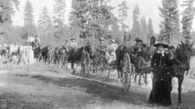
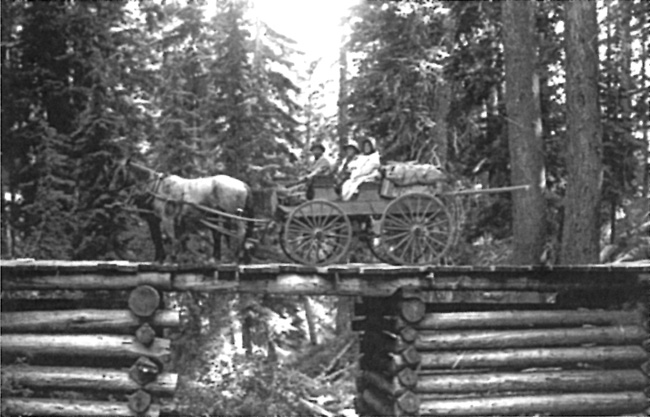
| Wagon and team on wooden bridge in Crater Lake National Park, about 1900. Courtesy of the Klamath County Museum. |
For his part, Steel's annual cost estimates provided to Congress for trails could almost be characterized as a five year plan. In addition, to listing trails to Garfield Peak, Crater Lake, and the Watchman as his top three projects, he listed ten others. Two of them involved building routes along the lakeshore (from the boat landing in Eagle Cove to Kerr Notch and the Watchman slide, respectively), a trail to the water from Kerr Notch was proposed. So too was the reemergence of a proposed trail from the Rim Road to the top of Mount Scott, as well as foot paths suggested by Daniels from Park Headquarters at Annie Spring to Arant Point and Union Peak. Other proposals included one of some 12 miles between headquarters and "Llao Creek" (in the park's northwestern quadrant) as well as a trail near the West Entrance Road, along Castle Creek Canyon, and a more circuitous one mile route aimed at connecting Annie Creek Canyon with Dewie Falls.27
National Park Service Trail Building, 1917-21
If trail construction had to largely depend on annual appropriations made individually to Crater Lake and other national parks in the years before creation of the National Park Service, then it is hardly surprising that so little beyond a dangerous path to the lake could be used by visitors over the first 15 seasons since the park's establishment. Only once during Arant's tenure had yearly appropriations for managing and developing Crater Lake exceeded $3,000. Congress became more magnanimous while Steel served as superintendent, with appropriations reaching $8,000 per year for the period of 1913 through 1916. By contrast, the newly appointed NPS superintendent Alex Sparrow received $15,000 to administer the park in 1917.28 That figure allowed Sparrow latitude in pursuing projects that neither of his predecessors enjoyed, with a comparatively large amount of trail construction completed during the summers of 1917, 1918, and 1919.
Sparrow's training as an engineer led him to Crater Lake in 1913, having been part of the Army Corps contingent assigned to build the park's road and trail system for the following three seasons.29 Although the Corps of Engineers brought only one trail into existence during their stay in the park, Sparrow in his new role as superintendent could fund construction of several new routes intended for hikers and equestrians. NPS crews built three trails in 1917, one of them accessing Garfield Peak from the Crater Lake Lodge in Rim Village. Relatively steep at only 1.25 miles in length (as opposed to 1.7 miles after realignment in 1931), the route had an average width of four feet and cost $960. The new trail also included examples of benching (used to maintain a uniform grade with rock in fill sections), dry laid retaining walls, and sheeting—which avoids cross drainage devices like culverts or water bars by building the trail so that water is shed uniformly across it. Another trail connected the Watchman with Rim Village, a distance of four miles for a mere $460. Generally aligned so that it followed a route closer to the caldera's edge than the Rim Road, it ascended the south and east sides of Watchman.30
|
| Newly-built section of the Garfield Peak Trail, October 1917. Photo by Alex Sparrow, author's files. |
With an appropriation available, Sparrow also had the trail to Crater Lake reconstructed. This amounted to acting on a recommendation made by Daniels three years earlier, though fortunately the funding exceeded Daniels' original estimate of $1,000.31 The NPS aligned it in order to avoid a wet area below Rim Village where running water led to washouts and continual maintenance. A NPS construction crew lengthened the trail to roughly 1.25 miles, lessening the grade by extending switchbacks below the lodge. Built at a cost of $4,462, it provided visitors with a way of participating in boating and fishing, but also allowed for the use of horses and burros when the trail bearing Sparrow's name opened in 1918.32
Although Sparrow reported that the park's trail system in 1918 as consisting of 22 miles, part of this total included rough one-lane service roads built in conjunction with a trail of varying standard.33 An example was the "trail" of four miles or so built in 1918 for light vehicles and horses toward the base of Union Peak. It started from a point about half a mile west of Annie Spring on the Medford Road (built by the Corps and following the same general alignment as Highway 62 later on) and ran in a southwesterly direction. Much of it consisted of a track cut about sixteen feet wide, in order to improve it for automobiles in the future. Reaching the top of Union Peak still required an almost cross country climb of some 700 feet over the last quarter mile, with a "safe and easy" ascent required to reach the summit from the end of this trail.34
Sparrow also described a point about one-eighth of a mile from the base of Union Peak, where a blazed track commenced toward Bald Top and Red Blanket Canyon, some two miles away. Described as rough and still poorly defined, but practical for pack animals, Sparrow saw it as primarily useful for future ranger patrols. As a way of preventing poaching and limiting the spread of wildfires, the route left the park near its southwest corner. It represented a link with trails built by the U.S. Forest Service on the adjacent Crater National Forest, but especially what Sparrow called an "outlet down Dry Creek toward the Wood River Valley," he pledged that the rangers using the route would improve it.35
|
| "The Imp," Superintendent Sparrow's horse, on the trail from lodge to Garfield Peak, November 1917. Photo by Alex Sparrow, author's files. |
Sparrow still counted the Bybee or Copeland route (which was likely a trace leading north from Dutton Creek and then west toward the park boundary) as part of the park's trails, but he figured its length at only 2.2 miles. He also listed some former wagon routes as trails, such as the one running from Annie Spring over to Dutton Creek and then to the rim. It covered a distance of four miles, while another wagon road segment one mile in length built by Arant connected Munson Valley with Rim Village.36 Sparrow described a foot trail to the crater on Wizard Island (built when Steel served as superintendent) as good, but wanted it widened (to four feet) and extended for a distance of 5,000 feet. The route to the top of this cinder cone had not received specific mention in the annual reports written by park superintendents to this point, though some visitors climbed to the island's summit by way of an informal track since 1896.37 The trail to Sentinel Point, built at Mather's behest in 1915, had meanwhile become popular enough for the NPS to place signs as part of alerting visitors to the viewpoint.38
|
| View on the trail to the Watchman from Rim Village, October 1917. Photo by Alex Sparrow, author's files. |
Two more trails were added during the season of 1919, though Sparrow described roughly two-thirds of each route as passable by motor vehicle. One began near where the old Rim Road crossed Sun Meadow and followed a vehicle track for one mile, then narrowing to a "very easy" foot or horse trail to Sun Notch as the terrain became more steep and rocky. He justified establishing this route by stating that the best possible view of Phantom Ship could be obtained from this point on the rim, but no doubt remembered an earlier Corps of Engineers plan for building a road linking Sun Notch with the Rim Road.39 The other trail connected the old Rim Road with Crater Peak. Sparrow wrote that light vehicles could negotiate the first 1.5 miles, after which it was possible to reach the top on horseback in less than a mile. While very steep, that last section afforded a "magnificent view of the Klamath Lake Country."40
|
| "Ranger Perl" at an overlook on the Rim Road that later became know as Victor View. Photo by John Maben, author's files. |
NPS appropriations for the park almost doubled in 1920 (to more than $28,000) over what Sparrow had on hand in 1917, so that the trail "system" grew to 34 miles. Virtually all of the mileage added that year, however, came in one project. It involved making eight miles of the Diamond Lake Trail passable for vehicles by connecting it with the Rim Road. A pack trail had previously come south from Diamond Lake, but after traversing the Pumice Desert, it cut west to terminate at Red Cone Spring instead of ascending the rim.41 Sparrow had hoped to build a connecting trail from Park Headquarters at Annie Spring in 1919 for some $3,000, an ambitious project aimed at staying below the "snow line that blocks the Rim road for about eleven months of the year."42
Not only would a trail 12 miles in length (and intended for light horse-drawn vehicles) connect with the "old Indian trail to Diamond Lake, between Llao Rock and Red Cone," but could also allow for branches to be run to Oasis Spring and Bald Crater.43 Parts of the larger rationale behind this effort came from two sources: an expansion proposal launched by the NPS several years earlier for the park to include Diamond Lake, and a desire to eventually shorten the travel time needed to reach Crater Lake from points north.44 Even if a state highway had yet to reach Diamond Lake or the park's north boundary, by 1920 scenic promoters pitched the idea of a road (or "Skyline Route") to run along the summit of the Cascade Range between Mount Hood and Crater Lake.45 When the Mazamas, a Portland-based mountaineering group founded by W.G. Steel, reached the rim on foot from the north over this route in August 1921, Sparrow called it the "Oregon Skyline Trail." Less than three weeks later, he and two others became the first to go between Diamond Lake and Crater Lake in a motor vehicle over the same route.46 The route remained primitive enough to also be called the "Diamond Lake Auto Trail," so that only the most confident motorist undertook a journey across it.
Maintenance and Construction, 1922-28
|
Whereas use of the words "road" and "trail" could be interchangeable at times, expenditures for maintenance tended to distinguish between them. Sparrow noted that the NPS built no new trails in 1922, but opening and maintaining the trail named for him continued to require considerable effort. While it received about 80 percent of trail use at the park, this trail to Crater Lake consumed two-thirds of the annual trail maintenance allocation. Under Sparrow's successor, Charles Goff Thomson, the NPS needed to spend three-quarters of the park's trail budget on this route in 1923 while building no new trails.47 With visitation growing and the annexes completed on an expanded Crater Lake Lodge the following year, Thomson began talking about the need for a new trail alignment. He wanted to eliminate having visitors pass behind the hotel as they entered the caldera, but also some heavy grades (the steepest was 28 percent) along it as well as some unspecified "dangers" associated with Sparrow's alignment.48
As if to illustrate the latter point, a contemporary account of opening the trail appeared in 1923, as part of a volume on travel to Crater Lake and other destinations:
"There is but one trail down to the water, and without a trail the descent is extremely difficult and dangerous, however carefully you choose your spot. On our first day at the lake, this trail was still snow-blocked, but the boatmen and one or two fishermen had been down and got a few boats out, and, being possessed of Alpine stock and a rope, we saw no reason to wait. But even as we started down, the government gang appeared, armed with shovels, and began on the trail. When we were two or three hundred feet below them, we had to work down through a sharp ravine, like a bottle neck, into which the concavity of the drift was drawing all the lumps of snow tossed out by the trailbreakers above. As they saw us approaching this chute, they redoubled their efforts, and rained upon us a veritable barrage of snow-cakes, which attained tremendous velocity long before they reached us. Some of them were large and solid enough to knock your feet out from under you, or give you a staggering blow on the head, and we clung to our rope as we passed that bombardment with more tenacity than on many a steeper slope, taken in the higher mountains.49
|
| Visitor on horseback at the boat landing, about 1921. Photo by Alex Sparrow, courtesy of the Southern Oregon Historical Society. |
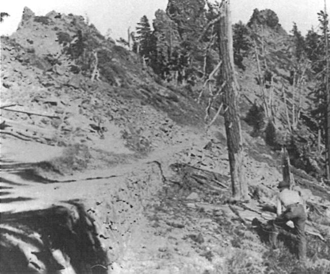
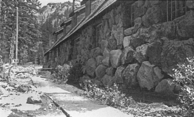
Construction of a new trail to Crater Lake did not start until 1927, after scenic photographer Fred Kiser "blazed" the route and guided a NPS survey party that made the final location.50 It started some 800 feet west of his studio at a site adjoining the new plaza in Rim Village, across from where the concessionaire's cafeteria was to be built in 1928. Intended as a NPS "standard" trail for front-country use, design of what became the "Crater Wall Trail" included 24 short switchbacks in traversing 900 feet of relief over its length of 1.6 miles.51 Those switchbacks, however, represented the biggest challenge for the annual tasks of opening and maintenance over the next three decades given the combination of loosely consolidated material inside the caldera, high snowfall, and sections prone to avalanches. At the outset Thomson waxed about how the trail better accommodated visitors who did not wish to walk during a brief period when the concessionaire experimented with renting mules and burros. As such, the trail was designed to be six feet wide, with a maximum grade of 15 percent. It terminated on a natural bench with more room for docking, so that circulation there improved in comparison to the site further east where the Sparrow Trail reached the shoreline.52
Like his predecessors, Thomson saw a safe and easy trail to the lake as critical to visitor enjoyment, so he thought spending an estimated $10,000 on building the Crater Wall Route perfectly justifiable. Annual visitation almost quadrupled over the six years he served as superintendent (1923-29), and Thomson devoted much of his time to planning for enhanced park infrastructure. He had the help of a slowly growing NPS staff of landscape architects and engineers who could handle many of the technical details of design and oversee construction projects once funding had been secured. During the first few years of Thomson's tenure, construction funding of any kind could be characterized as meager, though by 1926 this had begun to change. Building new trails away from the lake did not rise to the top of NPS priorities for the park, though some small projects could still fit into Thomson's larger objectives.
Increasing visitation brought more people who wanted to camp, so the number of designated areas began to grow in number beyond the two sites (Rim Village and Annie Spring) which already possessed some amenities such as tables and a water system. Four others were shown on the park map by 1924, but they were little more than small areas where motorists could stop next to an approach road. These had a few spots cleared for camping, possibly a pit toilet, and utilized surface water from an adjacent stream.53 Thomson located one of these peripheral camps on Whitehorse Creek on the Medford Road (later known as west Highway 62), and a small crew made a couple of modest improvements that summer.
A new trail from the road bridge on Whitehorse Creek to the "Giant Nutcracker," a narrow gorge later known as Llaos Hallway, quickly became the most auspicious. The trail, as such, went for a distance of a quarter mile to where the creek met a seasonal tributary, and from there hikers had to traverse the gorge on their own.54 It came about when Thomson and Chief Ranger Pete Oard traversed Whitehorse Creek in order to access Castle Creek Canyon in September 1923. They so enthusiastically reported what they found that other NPS employees subsequently made the trip and fueled Thomson's proposal to open a trail the following spring. The Washington office approved this comparatively small undertaking almost immediately due to its low cost and potential public relations value.55
Thomson also recommended moving park headquarters from Annie Spring to "Government Camp" in Munson Valley, where, a few years earlier, the Corps of Engineers had kept their offices and staging area. As part of this shift in operations, the NPS built a short trail leading to a stone figure called the Lady of the Woods in 1924. This unfinished statue, sculpted on a boulder in 1917, had periodically received enough newspaper publicity to catch the attention of visitors traveling the road leading to Rim Village and Thomson saw no reason to discourage this interest.56
Both trail projects amounted to small undertakings in a park where Thomson stated "only four of our trails are much traveled."57 He did not identify which four, but noted in his report for 1925 that heavy spring slides required an unusual amount of work on Sparrow's trail to Crater Lake. It needed so much repair that the rebuilding practically exhausted the park's allotment for trail maintenance.58 Thomson omitted any mention of new trails in his report for 1926, though he mentioned that a fire lookout had been built on Mount Scott from U.S. Forest Service plans. Materials needed for construction were hauled to the site by pack animals over a trail some two miles in length that started from the Rim Road at Cloudcap.59
Thomson transferred from Crater Lake in early 1929, having witnessed substantial completion of the Crater Wall Trail the previous summer. With clearing and grading done by contract in 1927, the NPS found that the switchbacks needed to be widened and lengthened to permit travel by horseback. NPS engineer Ward Webber supervised a park crew to complete this work over the following summer. They also built retaining walls where needed, several parapets, and log seats at convenient intervals. Webber commented about placement of the benches, a first at Crater Lake, specifically on the care taken to permit visitors to enjoy "the play of colors on the water and the surrounding cliffs while resting."60
|
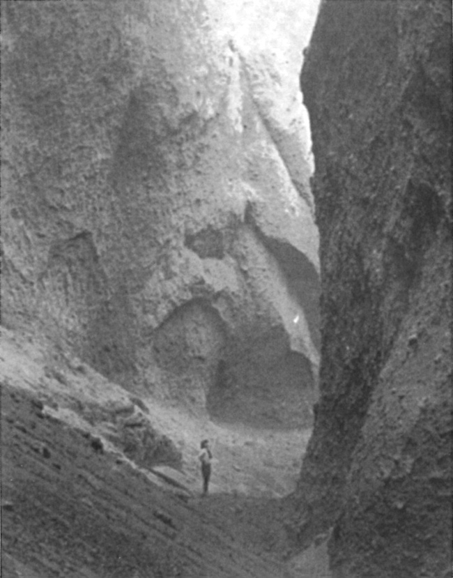
| Ranger in Llaos Hallway, about 1931. National Park Service photo. |
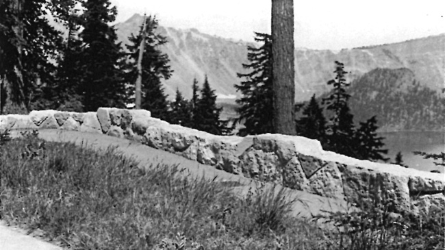
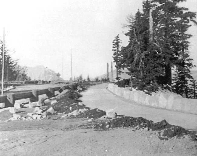
Finishing most of the construction on the Crater Wall Trail in 1928 came during the initial stages of redeveloping the sometimes bleak and dusty site of Rim Village, where visitor services with their associated impacts had long been concentrated. The trailhead was situated near a newly-built parking area, something largely intended for day use, as part of a larger plaza containing the concessionaire's cafeteria. The plaza still needed to be connected with other key features in Rim Village, such as the Crater Lake Lodge and Rim Campground. This could be accomplished by means of a roadway, but also through a network of walkways. Plans for pedestrian circulation at Rim Village centered on building a promenade eight feet wide and running some 2500 feet long (or roughly the distance between the trailhead and lodge), to be located along the edge of the caldera. Work on the promenade thus began in 1928 and continued over the next four summers. The NPS intended to concentrate foot traffic on the promenade and associated walkways (both of which were to be paved) as a way to harden the site, yet this allowed the agency to also take steps toward restoring native vegetation through planting. Officials also planned to use the promenade as a means to unify Rim Village, especially once masonry walls could be erected as a safety barrier on the side facing Crater Lake.61
While both the Crater Wall Trail and a promenade in Rim Village represented improvements to pedestrian circulation in an area where more visitors congregated than anywhere else in the park, they were not the only construction projects undertaken by the NPS at Crater Lake during the summer of 1928. Federal funds aimed at new buildings and roadwork continued to far outstrip those for trails and walkways, but more money paralleled another trend; that of annual appropriations for the park having almost doubled since 1925. It reached more than $62,000 in 1928, a figure meant to cover maintenance costs, utilities, equipment, and staff salaries.62 Most of the money spent on trail maintenance that year still went toward opening Sparrow's route to the lakeshore, just as work proceeded on finishing its replacement. Thomson, meanwhile, saw a need to "recondition" several other trails now that most had been in use for a decade. Without more funding dedicated to maintenance, however, their condition could deteriorate to a point where a full or partial reconstruction became necessary.63
|
| A section of the Sparrow Trail in the 1920s. Photo by Frank Patterson, author's files. |
By this time Thomson had given up his earlier idea for a trail up Llao Rock, one that might culminate with a fenced platform located some 2,000 feet directly above the lake. He thought it could be a "Mecca" for visitors, made accessible by walking a few hundred yards from the Rim Road, and an attraction that could "hold tourists for a while: too many now come, take a look at the Lake and depart."64 In his earlier refusal of the $1,600 initially requested by Steel for a trail down Kerr Notch, Thomson explained that such a development will not be used "except by the very few who might come in the East entrance, go down to the water's edge at the proposed trail, climb back in their cars and depart without seeing the Lodge, the Garden of the Gods [Godfrey Glen] or anything else." He also doubted that the view obtained of the Phantom Ship might equal that already available on the boat trips, much less whether a trail down Kerr Notch could be finished for the amount appropriated. Thomson also wondered about how to cover the maintenance expense brought about by slides along a new trail, as costs associated with opening a trail below Rim Village just seemed to escalate.65
|
| A planting bed along the promenade, Rim Village, in 1931. NPS photo in the National Archives, San Bruno, California. |
Expansion and Reconstruction, 1929-32
Trail projects received a relatively small share of the steadily increasing appropriations for construction and park operations that began in the latter part of the 1920s and which continued through much of the following decade. It is not surprising that trail mileage at Crater Lake increased during this period, as part of an unprecedented growth and development of park infrastructure in general, yet as one observer commented in 1932:
"I was told at the Park that little money will be given for trails because few people use the trails. It is more important to build trails for the few who have interest enough to use them than to build roads for the many..."66
Park employees nevertheless undertook a limited amount of trail construction, something that could usually be accomplished inexpensively in comparison to other kinds of infrastructure. One project came from the staff of three ranger-naturalists hired for the summer season of 1929. By the end of July they submitted plans for a nature trail to go through a wildflower "garden" located east of Park Headquarters in Munson Valley.67 This wetland, found on the lower slope of "Castle Crest" (Garfield Ridge), contains a rich variety of floral species native to the park and allows most visitors relatively easy access once the snow disappears. The NPS expended $140 to build a trail to the garden that summer, a project that included five log bridges, six "rustic" benches, and a number of aluminum labels for identifying the flowers.68 After the trail was repaired and rebuilt in several places the following year, ranger-naturalists began leading regularly scheduled hikes on it.69
Adding new trails like one to the Castle Crest Garden expanded recreational opportunities at the park but did not change what had long since emerged as the top priority for pedestrian circulation. The goal of easy visitor access to Crater Lake seemed to have finally been achieved in early July 1929, when Superintendent E.C. Solinsky accorded the honor of being the first to reach the bottom of the Crater Wall Trail on horseback to Secretary of the Interior Ray Lyman Wilbur. Yet getting the trail open the following year involved removing several slides of mud and rock on the switchbacks as well as repairing damaged tread, so the NPS programmed a post construction project for 1931 in an attempt to address these problems. In any event, reverting to the Sparrow Trail appeared to be out of the question since park crews had already obliterated portions of the route to deter any subsequent visitor use.70 In reporting on the post construction project in the fall of 1931, NPS engineer W.E. Robertson pointed to inherent problems posed by unstable slopes, the number of switchbacks, and an exposed boat landing situated in deep water.71 By that time the superintendent's view of the trail had soured considerably, writing that opening and maintaining it was out of all proportion to the original construction cost, stating the NPS had to practically rebuild the entire route that season. He argued for the trail to be relocated, not only due to the ongoing expense, but also to lessen the chance of visitor injuries caused by loose rocks that could tumble over a long series of switchbacks located one over another.72
Landscape architects began playing a more direct role in the design of roads and trails by this time, though the engineers continued to take the lead in location work as well as provide direct supervision of park crews during construction. The landscape architects furnished site plans and could also make adjustments in the alignments located by engineers as part of making development better fit the park setting. With the re-development of Rim Village underway by 1929, Ernest Davidson and other landscape architects from the NPS office in San Francisco made regular visits. Davidson came to the park in July of that year to stake some walkways intended to connect the still unfinished promenade with a roadway running through Rim Village.73 Solinsky and other NPS officials agreed that paved walkways varying in width between four and six feet were necessary for handling greater numbers of visitors at the park's main developed area, but so was the addition of a better trail to reach its most popular viewpoint.
|
| The promenade and roadway near the entrance to Rim Village, about 1932. National Park Service photo. |
One of Davidson's colleagues, Merel Sager, spent much of the 1930 summer season at Crater Lake designing and then overseeing construction of the Sinnott Memorial located just below the promenade. A beaten path had formerly followed a short ridge down to Victor Rock, where visitors regularly gathered some 900 feet above the lakeshore, but the Sinnott Memorial's construction on that site pointed to the need for a wider and safer route. Sager designed the Victor Rock Trail to start on the promenade just west of Kiser's Studio and run about 200 feet to the parapet of the Sinnott Memorial. Opened in 1931, the trail was paved like the promenade and walkways nearby, but included two flights of stone steps, tread eight feet wide, and lined on both sides by stone masonry walls.
For projects on longer trails, such as reconstructing the one up Garfield Peak, Sager made adjustments in alignment and grade in consultation with Robertson and Solinsky. Intended to replace the earlier route built by Sparrow's crew, the NPS intended the realignment to provide a wider tread surface for horses and pedestrians, but also reduce the trail's average grade to 15 percent. The NPS spent $4,000 that summer on the lower half, building it four feet wide. Sager commented that the trail's visibility as seen from below had been kept to a minimum by using dry laid rockwork for fill sections and he mentioned introducing stone at irregular intervals on the trail's outer edge in order to reduce a line that could be both visible and uniform.74
|
| Benching on a portion of the Garfield Peak Trail, 1931. National Park Service photo. |
The NPS spent another $5,000 in 1931 to widen the lower portion another two feet after first building the slightly longer upper section six feet wide. Robertson explained that six feet allowed for operation of a mechanical oiler intended to reduce dust on the trail. Crews also built smaller trails between two and four feet in width at several prominent viewpoints. These totaled roughly 800 feet in length and included rest stations with stone seats, all "carefully selected for the beautiful and interesting views to be had of the lake and surrounding country."75 In addition to the rest stations, Solinsky also commented on the precautions taken to protect vegetation along the new route, measures which included leaving at least one live whitebark pine in the trail. Like Robertson, he supported applying road oil to reduce dust, since a "very large" percentage of visitors were seen to take the route.76
|
| Portion of the Watchman Trail that has been oiled and shows edge treatment with boulders, 1932. National Park Service photo. |
Only the Garfield Peak and Crater Wall routes were oiled at first (a move intended to prevent losing the tread surface during rainy weather or from melting snow), but the NPS expanded this practice upon completion of trails to the Watchman and Discovery Point in 1932.77 Planning for a trail to the Watchman's summit started in 1931, when Sager and Robertson agreed that the location of a temporary route used to haul construction materials for a new fire lookout should be utilized as much as possible for a permanent hiking trail.78 When work on the permanent trail began the following summer, Sager wrote that the crew did the same good work as had characterized construction of the Garfield Peak Trail.79
The new trail to Watchman started from a point where the old Rim Road crested on a southwest slope as it went around the peak and from there, the summit trail ran some 2,750 feet with a maximum grade of 15 percent.80 Intended to be five feet wide except at switchbacks, the trail incorporated features similar to those on the Garfield Peak route. These included dry-laid retaining walls, considerable benching, and a couple of stone seats intended as rest stations. The crew also placed singular rocks on its outer edge at irregular intervals as a way of minimizing the trail's visual impact as seen from a distance, though the practice did not extend to a section of the old Rim Road which effectively became part of the trail. Its trailhead also migrated down to the Watchman Overlook because construction of the new Rim Drive followed a lower line around the peak than the old road, which the NPS subsequently closed to vehicle traffic.81
With construction of the new route to Watchman essentially completed in three weeks, trail building activity in 1932 shifted toward improving the linkage between Rim Village and Discovery Point. This project covered a total of 1.5 miles, of which more than half (4,280 feet) consisted of new trail. The staked location worked out between Robertson and Sager kept grades under 12 percent, but did require some benching and other rockwork. They utilized portions of the existing trail, originally constructed when Sparrow served as superintendent, though it was widened to five feet to match the new sections. In all, construction lasted barely three weeks and concluded with oiling the trail.82
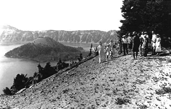
Robertson predicted that the Discovery Point Trail might prove to be quite popular, something helped by the fact that the ranger-naturalists in the 1930s promoted use of this route in the day's waning hours. For a time it became officially known as the "Sunset Trail," a route where hikers could start at the trailhead located on western end of the promenade and obtain views along the rim that were otherwise screened by trees and topography from the sight of motorists traveling on Rim Drive.83 The section receiving the most use, however, served as a link between Discovery Point (the place where a party of miners in 1853 supposedly "discovered" Crater Lake) and a newly built parking lot below it. Part of the use, at least initially, came from the ranger-naturalists leading car caravans around the rim which stopped there, as they also did at the Watchman Overlook. The actual "observation stations" such as Victor Rock, Discovery Point, and Watchman where the naturalists could give talks, were meant to be reached by trail, though this took time and the Rim Caravan as an educational offering eventually fizzled. It remained alive long enough to give rise to other, more informal, trails leading from points along west Rim Drive. One accessed the top of Devils Backbone from a small parking area, while another went to the top of Merriam Point from the junction of Rim Drive and the North Entrance Road.84
|
| Crew building the Watchman Trail, 1931. National Park Service. |
Construction of a new trail to the top of Wizard Island resulted from a visit by NPS senior park naturalist Ansel F. Hall, who had come to the park in July 1931 from his duty station in Berkeley, California. Hall and an assistant used surveying equipment and stakes to lay out a trail on an eight percent grade, intending it to replace an earlier, but steeper, route. This had a direct connection to the naturalists starting a ranger-led boat tour of Crater Lake that summer, something which included a hike to the top of Wizard Island.85 They built what Hall called the "spiral return trail" without clearance from Sager or the other landscape architects, but with the consent of Superintendent Solinsky, who evidently thought its attributes outweighed being more readily seen from the rim. At 30 inches wide, the drifting of cinders quickly began to obscure the line even during the first season. Put on the defensive, Hall and other naturalists pointed to its value in conducting guided walks on the island; not only were marked changes in flora evident on the cinder cone depending upon aspect, but a circular route made tree patterns and geological formations more striking.86
|
| A ranger and visitors at Merriam Point, 1936. Part of the "spiral return trail" is visible in the distance. Photo by George Grant, NPS Historic Photograph Collection. |
Hall also marked a trail along the shoreline to what was later called Fumerole Bay, though the route went from the summit crater down to the water along the island's north side. It still lacked a connection with the boat landing at Governors Bay, something recommended in a report written the following summer by Worth Ryder, an art professor from the University of California. At the behest of cooperating scientists who served as volunteer advisors to the NPS, Ryder made a series of suggestions as part of studying the park's aesthetic qualities so that ways could be found for visitors to better appreciate them. His report of August 1932 mentioned new trails in several places, marking the first time that anyone outside the NPS provided suggestions about what additional routes might enhance the experience of visitors.87
Among Ryder's recommendations was for building a trail from Cleetwood Cove to the rim above it, something that he believed could make possible a combination boat trip and road tour. The NPS took no action on that idea, nor did it act on his suggestion to construct a trail from Garfield Peak to Sun Notch. Ryder may have had some influence in urging that Rim Drive be kept at least 200 yards away from the rim at Sun Notch, a site that he considered the most important viewpoint in the park.88 In emphasizing that great care had to be taken in designing a pedestrian route along that portion of the rim, he went so far to urge that every foot of potential trail be studied prior to construction since Sun Notch could be made into "the most delightful scenic wonder of the entire Park."89
No such study followed from Ryder's recommendation, though a group of faculty members from the University of Oregon took up the question of how visitors could best appreciate nature at Crater Lake the following year. This eventually resulted in a collection of short reports and observations made throughout the park over the course of several summers and included some references to existing trails, insofar as they might contribute to visitor understanding of scenic features.90 Unlike Ryder, the UO authors did not suggest where to build new trails or which of the existing routes to reconstruct. For the most part, trail projects continued to emerge on an ad hoc basis through the superintendent or one of his key subordinates, but on the whole represented only a small fraction of the undertakings aimed at improving park infrastructure during the decade of the 1930s.
Nevertheless, trails could enhance both the park's recreational potential and factor into larger operational goals like suppressing wildfires in the backcountry. As an example, Chief Ranger Bill Godfrey reported in July 1930 that a NPS crew built a trail from the base of Crater Peak to its summit. He described it as being of a standard width and holding a grade of roughly 15 percent in order to reach the top, which Godfrey saw as valuable as an observation point during fire season.91 The new trail climbed the peak's north side by heading west with an elongated curve so that the summit could be reached on a steady grade without switchbacks. Godfrey made no reference to any earlier trail, though he mentioned following "an old wagon road" to reach the base of Crater Peak; most likely the route built during Sparrow's tenure as superintendent.92
Construction of the trail to Crater Peak came in conjunction with building a network of access roads to aid with fire suppression. In this case, the "motorway" or "truck trail" started from the Rim Road near Tututni Pass and was intended to allow park crews to reach places where lightning strikes had caused fires. Limited to administrative use for vehicular travel, these roads were routed in order to minimize the time needed for park crews to reach smokes or wildfires on foot. They could also form part of the hiking or horseback route to a backcountry destination, as at Crater Peak. Although not intended as trails, some of the motorways at Crater Lake received use by visitors in the absence of routes engineered and built for pedestrians.
Motorway construction began in 1930 after location work was initiated with compass surveys, then followed by field drawings and stakes that set road locations.93 This effort took place at Crater Lake and other national park units once the NPS received dedicated funding for fire suppression activities in 1929. It eventually resulted in 130 miles of motorways in the park (a figure which almost doubled that of paved highways at Crater Lake) with grades ranging from flat to ten percent. Built with a bulldozer, the operators simply scraped litter down to mineral soil and pushed material to one side. This created a swath 12 feet wide after some clearing of trees, but inadequate provision for drainage and lack of maintenance meant that sporadic work was needed to keep the motorways serviceable for NPS use.94
The motorway toward Crater Peak included some new construction where Godfrey and others thought the "wagon road" to be problematic or too steep. It more or less followed the older route with some reconstruction to the base of Crater Peak, along the ridge separating the Annie Creek and Sun Creek drainages.95
|
| Map showing several motorways in the southwest quadrant of Crater Lake National Park, author's files. |
Hikers and equestrians traversed only that initial portion of 1.5 miles in order to reach the trail leading to the summit, though the motorway was extended southward to the boundary over the next three summers. This came in accordance with Godfrey's desire to provide administrative access to the park's southeast corner, where it could be linked with other motorways.
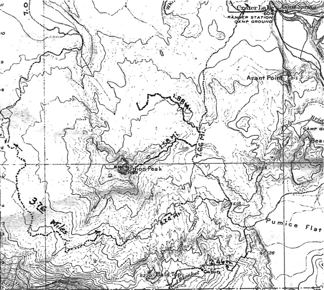
Godfrey also reported on reconstruction of the Union Peak "Trail" in the summer of 1930. He made a distinction between the trail (for the most part a road since its initial construction in 1918) and a motorway. This was due to the former remaining open to vehicles driven by visitors, even though down trees had prevented such use for several years prior to 1930. With rocks and stumps removed, in addition to grading done to fill in high centers, the "trail" was reopened that summer from a turnoff located along the West Entrance Road to the base of Union Peak. It came with some realignment of the older route, including the addition of more than a half mile from the end of the "trail." The extension was to create a linkage, if only for the NPS, with a new motorway built to cross the Cascade Divide from the South Entrance Road. This one traversed Pumice Flat on its way toward Union Peak and could form something of a loop, taking in several miles of highway to complete the circuit.96
Building motorways through the park's backcountry proceeded apace in 1931 and 1932, despite NPS Director Horace Albright expressing some hesitancy to Solinsky about allotting funds for their construction.97 The possibility of cost overruns concerned him the most, so Albright urged the superintendent to provide more oversight of these projects now that they were funded from appropriations earmarked for the relief of high unemployment. With some 75 miles of motorways already constructed by the summer of 1932 in the park, Albright decided there was enough justification to continue building them. While the motorways overtopped earlier roads or trails in some places, most of the mileage held little interest for hikers and equestrians. This was largely due to the motorways being located without reference to views or necessarily leading to points of interest.
The NPS attempted to remedy these shortcomings, at least in part, by creating a network of bridle trails for equestrians between Annie Spring and Rim Village. Like the motorways, their construction began in 1930. Eleven miles of equestrian paths were built by the end of that season, starting with a trail down Dutton Creek from Rim Village that incorporated some of the nineteenth century wagon route.98 It was to form part of a large loop, one that continued toward Annie Spring by way of a pass used by the earlier wagon route to cross the watershed divide. From Annie Spring the bridle path ran north of the highway toward Munson Creek, and then to Park Headquarters where it began the climb on the lower slopes of Castle Crest to Rim Village. With one exception, other bridle paths branched from this larger loop. One of them linked Dutton Creek with Park Headquarters by climbing over Munson Ridge and could thus split the larger loop into two smaller ones. Another bridle path diverged from the main loop near Godfrey Glen and formed a smaller circuit in order to reach an area located only a short distance from the highway. The lone exception to utilizing the larger loop connected the top of Garfield Peak with the old Rim Road, but was routed east of the ridge forming Castle Crest.99
|
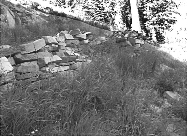
| A section of one bridle trail, 1931. National Park Service photo. |
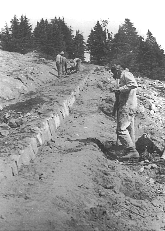
In all, park crews built a total of approximately 13.5 miles of bridle paths during the seasons of 1930 and 1931 for $4,000. As with other trails, Sager worked with the engineers to approve final locations and any changes needed during construction. NPS engineers Webber and Robertson noted the numerous inspections by the Landscape Division in their completion report and included one photograph of a typical section.100 It showed a trail four feet wide on a moderate grade sloped slightly inward to better expedite drainage. This reflected the use of standardized approaches meant to minimize the need for maintenance or future reconstruction, yet also made a trail better fit into the park setting. Completion of the bridle paths more than doubled the mileage of "standard" trails at Crater Lake, but it also represented the most coherent effort made so far toward bringing about some type of system through interconnection and loops.
The bridle paths were one, albeit small, piece of a larger improvement program in the park, one funded at the unprecedented level of $177,000 in 1930. This funding came in response to the continuing rise in annual visitation (to a record setting 157,000 in 1930 and then 175,000 in 1931), but also the Hoover Administration's aim to relieve unemployment caused by the onset of the Great Depression. Building infrastructure to support the national parks found favor with President Herbert Hoover and Congress, so NPS budgets received funding for more projects than at any time since the agency's creation in 1916. Bridle paths had already appeared in several other national parks, with this type of trail tending to emphasize recreational riding over necessarily reaching specific points of interest. The paths at Crater Lake were signed for visitors, but the NPS otherwise did little to promote their use by equestrians. The Great Depression's onset terminated any plans the park concessionaire might have had to offer horse rentals, so equestrian use was limited to the few who could bring riding animals with them. Hikers occasionally traversed portions of these trails, though with day use visitation increasingly dominant at Crater Lake, their interests tended to center on the rim rather than the largely forested areas traversed by the bridle paths for the time they had available.
|
| Map showing the location of bridle trails, 1932. Note the Munson Valley area. National Park Service. The numbers indicate roads. |
New Deal Projects, 1933-41
An infusion of project money aimed at building park infrastructure continued to reach Crater Lake during the first eight years of the Roosevelt Administration, fueled by the need to put people to work. Nevertheless, a perception that most of the necessary trails had already been built or reconstructed by that time meant that the park's inventory of pedestrian routes grew slowly during the last half of the 1930s, with much of the funding for trails going toward maintenance while plans for any new trails usually received low priority for funding. Even so, a few projects for new trails received funding through a job training program called the Civilian Conservation Corps (CCC) and an agency that hired temporary workers known as the Public Works Administration (PWA).
CCC enrollees from a camp at Lost Creek built a trail to the lookout on Mount Scott in 1933. Sager referred to it as a horse trail, one originally intended for packing supplies to the lookout a little more than two miles away. As a National Park Service "standard" trail four feet wide, its maximum grade did not exceed 15 percent.101 This new route superceded the longer trail from Cloudcap, since the road circuit around the lake was realigned to employ a long sinuous curve that got closer to the base of Mount Scott. Once contractors completed grading this section of Rim Drive, visitors could now start about a mile closer to Mount Scott than formerly. The trailhead maintained a weak sense of arrival, however, since the initial section of trail involved a quarter mile of travel over an unpaved track resembling a motorway.

|
| Ranger on the Mount Scott Trail, 1933. NPS photo in the National Archives, San Bruno, California. |
Enrollees from the same camp may have worked on reconstructing or improving portions of the old "motor trail" leading to Sun Notch that summer, though records for the project are sketchy. A more ambitious undertaking was proposed for the 1934 season involving construction of a horse trail from a point on the old Rim Road where it crossed Sun Valley, then to Sun Notch, and over to Garfield Peak. The idea for a prospective link to Garfield seemed to come from Superintendent Solinsky, once NPS Director Horace Albright had decided against locating Rim Drive next to the caldera at Sun Notch.102 The NPS landscape architects objected to any proposed trail going past Sun Notch, so the effort shifted to building a route that could link Garfield Peak with Vidae Falls. Enrollees started construction of the trail where Vidae Creek crossed the old Rim Road in August 1934, but it only went about a mile toward Garfield Peak by October, and terminated at an overlook located above the falls.103 Another group of enrollees began building a trail from Lost Creek toward Vidae Falls that season, though the project was quietly abandoned after its initial stages. The only other CCC trail project of 1934 consisted of a short trail approximately six tenths of a mile along Lost Creek.104
|
| Benching on a section of the abandoned Vidae Falls Trail, 2010. Photo by the author. |
Temporary employees hired by the PWA also contributed to trail improvements beginning in 1933. By early fall of that year, $450 had been spent to make the Crater Peak Trail some 4,000 feet long, 30 inches wide, and provide a maximum grade of 15 percent. At the same time, double that amount of PWA funds went toward improving the Union Peak Trail. It had the same length and maximum gradient, but a full three feet of width upon completion in October.105 A PWA crew also undertook building yet another trail on Wizard Island the following year, this one utilizing three switchbacks on the south side of the cinder cone.106 Finished by September 1934, the trail extended 5,500 feet from the boat landing on Governors Bay to the summit crater. The project also provided a connection with a shoreline trail to Fumerole Bay, one pioneered by Ansel Hall in 1931. This project came amid debate over whether Hall's "spiral return trail" should be retained as part of ranger-led trips on the island since it circled the cone and allowed visitors to note differences in vegetation based on their aspect.107
Trail maintenance became a CCC responsibility at Crater Lake during the New Deal, though this activity did not take place on an annual basis except for work to open the Crater Wall Trail, a task usually involving considerable snow removal. Unusually heavy thunderstorms in July 1935 also carried thousands of yards of material over the trail, requiring much additional work by CCC crews.108 The other project for the summer of 1935 involved a group of enrollees maintaining and repairing 18 miles of horse trails in the park. This figure included the 13.5 miles of bridle paths built by NPS crews in 1930-31, but presumably other trails (such as the one to Mount Scott) receiving more use.
|
| Public Works Administration map of the Wizard Island Trail project, 1934, author's files. |
The CCC did not construct any new trails at Crater Lake that summer, though several proposals had been floated by the NPS. One project had been initially programmed, that of building a one mile trail to the top of Red Cone from the motorway below it, but this prospect fizzled in the face of other priorities.109 The NPS regional geologist visited Crater Lake that summer and suggested that the CCC construct trails to several points of geological interest.110 One of these proposals persisted on the main park planning document (a master plan) for more than a decade and consisted of a trail some two feet wide leading from the North Junction to Llao Rock. The project remained a low priority, however, and was never undertaken.111

|
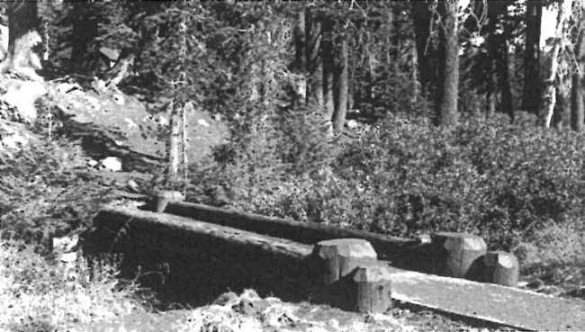
| Crater Lake National Park. Footbridge and Ranger Dormitory, 1936. NPS photo by Francis G. Lange, included in volume 1 of Park and Recreation Structures (Washington, DC: Government Printing Office, 1938), 183. |
Apart from maintenance (which included snow removal, clearing, and oiling of the most heavily used pedestrian routes), trail improvements at Crater Lake were limited to the area around Park Headquarters in 1936. CCC enrollees built a footbridge over Munson Creek, one designed by resident landscape architect Francis G. Lange. It replaced a more modest structure behind the Ranger Dormitory on the Lady of the Woods Trail, a route they also surfaced that trail with gravel over its entire length. They maintained and improved the existing trail through the Castle Crest Wildflower Garden, as well as a trail that linked the popular wetland area with the newly completed Administration Building.112
By 1937, some components of the park's "system" met with criticism from NPS staff. Lange's report on grading a portion of Rim Drive contained an observation that the old "motor trail" to Sun Notch could be seen within a thousand feet of the new road. In keeping with the NPS practice of removing old roads visible from Rim Drive, he suggested obliterating the "trail" and noted that plans now called for its removal.113 Wildlife technician E. Lowell Sumner, meanwhile, protested the use of a small tractor for oiling the Garfield Peak Trail after his field visit in July 1937. He attributed the "surprising" width of this and several oilier trails to the machine used to oil them. At six feet wide, however, such a trail actually discouraged use by hikers who had since shortcut the "highway" by making a path of their own with a width of some 18 inches. Sumner noted that the wider trail had an "aggravated tendency" toward bank erosion and often led to situations where work crews more often undermined important trailside trees by chopping away lateral roots. In his view, trails of that width conveyed "no feeling of isolation, no feeling of primitive nature no matter how rugged the surroundings into which they are introduced."114
Beyond opening the park's most heavily used pedestrian routes, the CCC placed a total of 20 log benches along the Garfield Peak and Crater Wall trails that summer. These features utilized logs cut in half and further divided into sections of six feet, then placed into smaller supports on the ground that were notched to hold the seat.115 Enrollees then added two "rock seats" to this number, stone features that were presumably similar to the benches located along the Watchman Trail in 1932. The CCC also completed the final stage of building walks at Rim Village that summer, with some of the enrollees focusing their efforts on the parking area south of Crater Lake Lodge, in addition to linking a new comfort station near the plaza with visitor parking. They also added a walk at Park Headquarters, effectively connecting the Ranger Dormitory with the Messhall.116
A small number of enrollees took on reconstructing the Castle Crest Wildflower Trail in 1938, a project that included several major changes to what had been built nine years earlier. The most conspicuous involved a new trailhead, now that contractors were grading the last section of Rim Drive. Enrollees moved the trailhead to a new parking area located along the road, but also obliterated several confusing cross trails and moved a telephone line that had formerly crossed the "garden." They repaired log footbridges, built rock steps in several spots, and placed larger flagstones where the trail crossed wet ground.117
|
| Walkway at rear of the Ranger Dormitory, 1937. NPS photo by Francis G. Lange in the National Archives, San Bruno, California. |
Funding and enrollment in the CCC had declined to where one of the two camps in the park was eliminated for the 1939 working season. Just as before, priorities for trails consisted of opening the Crater Wall Trail and maintaining the most heavily used routes, but enrollees did not undertake any new construction. They instead placed a wooden footbridge across a small stream near the Lady of the Woods and a virtually identical structure over Munson Creek between the Ranger Dormitory and three employee residences located above the dormitory. Enrollees also continued with a project started in 1937, which involved replacing metal signs with hand carved markers designed by Lange at various places frequented by visitors. Included in the program were signs at trailheads such as those for Lady of the Woods and Mount Scott.118
|
| Footbridge across Munson Creek, Park Headquarters. NPS photo by Francis G. Lange in the National Archives, San Bruno, California. |
Another trail sign came into existence once the NPS and USFS agreed on how to indicate a change in jurisdiction where the Oregon Skyline Trail crossed into the park from the Rogue River National Forest. This did not mean that a viable trail traversed the park, even if the NPS publicly supported the idea of a larger route extending from the Columbia River to the California state line. Although the initial concept of a Skyline route in 1920 had more to do with a road connection between Mount Hood and Crater Lake, Forest Service personnel worked steadily throughout the following two decades to build and connect trail segments in the high Cascades. A small band of outside supporters liked the idea and helped the Forest Service publicize the Oregon Skyline Trail with maps and leaflets, but they also began to think in terms of a backcountry route only available to hikers and equestrians that might link the border with Canada to the one shared with Mexico.119
One of the advocates, Clinton Clarke, contacted Superintendent Solinsky in November 1932 with a proposal to extend the John Muir Trail (which connected Yosemite Valley with Mount Whitney in the Sierra Nevada) northward through the Cascade Range to British Columbia, but also the other direction through the Sierra and then southern California.120 Clarke's vision of a well-marked wilderness trail more than 2,000 miles in length gave rise to an organization called the Pacific Crest Trail Conference, which attracted support from the Sierra Club, Mazamas, Mountaineers, YMCA and Boy Scouts through the Western Federation of Outdoor Clubs.121 The USFS responded to interest in the Oregon portion of the larger trail by issuing a reconnaissance report in 1934, something which went from the Columbia River to a ranger station at Lake of the Woods.122

|
| Drawing for national forest boundary sign on the Pacific Crest Trail, 1938, author's files. |
At that time the Oregon Skyline Trail route through the park consisted entirely of either paved highway or motorways. It began from the north by following a road from Diamond Lake to a point on the North Entrance Road, where a motorway then ran west around Red Cone. It continued south through thick timber with no view of the lake to an intersection of the motorway with the old route up Dutton Creek. The original wagon route had become a bridle trail in 1930 and for a brief time, the NPS referenced it as the "Cascade Divide Trail."123 This route allowed for viewing the lake at Rim Village and linked it with Park Headquarters, where trail users could pick up mail and supplies from the post office, once the NPS built a short segment from the Rim Campground to Munson Ridge in 1940. A bridle path went to headquarters from there by way of the Sleepy Hollow housing area.124 From headquarters, the Skyline Trail originally ran south on a bridle path past Annie Spring and then along the highway to Cold Spring. It turned southwest on a motorway from there across Pumice Flat and then toward the park boundary, at a point located somewhat east of Red Blanket Canyon, but near Bald Top and Stuart Falls. This allowed for a connection with some six miles of trail built in 1937 under auspices of the Forest Service, a route extending from the park boundary to Ethel Mountain in the Rogue River National Forest.
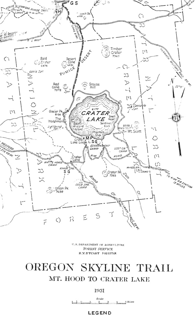
|
| Map showing route of the Oregon Skyline Trail through Crater Lake National Park and vicinity, 1931. Courtesy of Wendy Hull, Federal Highway Administration, Vancouver, Washington. |
The Forest Service reconnaissance of 1934 noted that the park lacked any signage which indicated the existence of an Oregon Skyline Trail, something again underscored by a scout group traversing the park by horseback in 1937.125 Two years later, Superintendent Leavitt and two of the rangers worried less about signs and more about motorists and pack stock sharing park highways. The NPS thus supported several changes to the route, beginning with the Forest Service possibly building a southwesterly link from Diamond Lake toward Lake West so that the trail might enter the park at Boundary Springs. From there it could follow existing motorways to Red Cone Spring, and then go south along a fire road to the headwaters of Castle Creek, just as the existing route did. Trail users could then either go up Dutton Creek, where equestrians were to then tie their horses at a point below Rim Village, or proceed by way of a bridle path to the campground at Annie Spring. South of there a short section of trail could be constructed so that a connection to the existing motorway, one that ran toward Union Peak, might be made—thereby avoiding the highway route to Cold Spring and the motorway across Pumice Flat. The locations of prospective horse camps were also discussed (mainly because the Forest Service issued a map of the Skyline route) but the NPS took no action toward building them. For its part, the Forest Service was anything but encouraging about redirecting the trail from Diamond Lake. Instead, they attempted to convince park officials that crossing the Pumice Desert on horseback had great appeal, especially if it could be done by separating the trail from the North Entrance Road.126
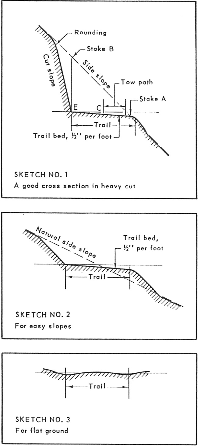
|
| The CCC printed guidance for trail work and other jobs. This page appeared in a booklet issued in 1937. |
|
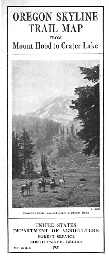
What little planning and development of a trail route through the park by the NPS resulted from prodding by the Forest Service and conservation groups, but it remained a low priority in a park perceived as visited almost solely by motorists. Nevertheless, Chief Ranger Carlisle Crouch reported that the Skyline trail through the park had been maintained and signed by August 1940. In addition to shifting the trail route off the North Entrance Road (in favor of the abandoned roadway left by a portion of the Diamond Lake Auto Trail) until users reached the motorway near Red Cone, a camp on Dutton Creek was selected for trail parties who traveled presumably on horseback due to its proximity to Rim Village.127 It received little use, as did the trail, even in a year when Crater Lake finally drew a quarter million visitors. With a central feature so dominant and road access to lake viewpoints relatively easy with Rim Drive being virtually completed, the appeal of backcountry travel at Crater Lake remained limited. Elsewhere on the Skyline route, trails remained the only way of accessing the high country around the Three Sisters and Mount Jefferson, so a long distance route could attract a constituency especially if its wilderness character could be associated with ice-clad peaks, mountain lakes, or even big trees. At Crater Lake, however, the Skyline trail routing simply represented a void between the Sky Lakes area to the south and Mount Thielsen north of the park.128
Not that such perception worked to stop all new trails in the park. CCC enrollees did some regrading of the trail to Sentinel Point in 1940, given how contractors had completed a parking overlook with some log steps leading from a walkway along the parapet wall two years earlier. The CCC also extended the trail on Mount Scott another tenth of a mile to the lookout, but their largest undertaking to improve the experience of pedestrians that year involved building a half mile trail so that visitors to the Castle Crest Wildflower Garden had the option of hiking to an overlook and then into the wetland. Leavitt requested several additional trail projects for the following summer, these being new construction for a route to the lake, another accessing Llao Rock, and one along Sand Creek. CCC funding had by that time slowed to a trickle in comparison to the halcyon days of 1934 and 1935, when the program operated at its peak.129
Postwar Planning and Development, 1942-55
Annual visitation at the park during the 1941 season set a record of more than 273,000, so Leavitt began to rethink circulation at Rim Village in view of the impacts associated with concentrating services there. Losing the one remaining CCC camp due to American involvement in World War II once again pushed concerns about the expense and problems with opening and maintaining the Crater Wall Trail to the forefront of park planning. Leavitt pointed to the need in March 1942 for studying a site located some 2,000 feet west of the boat landing as a small harbor, in addition to finding a safe and inexpensive way of reaching it.130 Since 500 to 800 man days of CCC labor had been allocated each year to opening the existing trail, Leavitt reasoned that more expensive NPS or contracted manpower might bring a tramway or elevator into consideration as an alternative if trail realignment proved to be difficult or impossible. The realm of possible options to reach the water even included construction of a tunnel from Park Headquarters until NPS Director Newton B. Drury nixed any means of reaching the water other than a trail from further consideration in early 1944.131
|
| The old giving way to modern means of experiencing national parks, 1942. Drawing from Yellowstone Nature Notes, National Park Service. |
Not everyone who remained on the small NPS staff in wartime agreed with the idea that visitors came to Crater Lake attracted by park features, with the lake being foremost. Chief Park Naturalist George Ruhle observed that a large percentage of visitors came to Crater Lake due to its status as a national park, one which happened to be along their intended travel route. In his "Comments concerning the 1942 Master Plan," Ruhle related that there was the need to change the answers given about guided trail trips, fishing, horse rentals, and having just one way to reach the water. To that end, he proposed a series allowing for 5, 10, and 15 mile hikes. Although the trails should not be well-developed and certainly not paved, they had to reach objectives. Ruhle listed 11 destinations as a start: Red Cone, Llaos Hallway, Union Peak, Crater Peak, Boundary Springs, Cascade Spring, meadows near Lightning Spring, Red Blanket Canyon, Timber Crater, Watchman from Rim Village, as well as Dutton Cliff from Crater Lake Lodge. In being no fan of the parking area and trailhead built for the Castle Crest Garden on Rim Drive, Ruhle wanted the route to start at Park Headquarters and go to the talus and then down to the wetland. He also thought visitors, knowing the risks after having read posted warning signs, could visit the lakeshore by way of Wineglass or Kerr Notch, and even from Cloudcap via the Pumice Castle.132
The next master plan revision came less than two years later, but reflected none of Ruhle's views, perhaps because he had entered military service in 1943. Leavitt and Crouch had since come out squarely against public use of four "incipient" trails leading to the lake. These included a trace down Kerr Notch, an animal track called the "Bear Trail" from Rim Drive to Cleetwood Cove, a beaten path used by fishermen at the Wineglass, and remnants of the old Lake Trail below Crater Lake Lodge.133 The development outline, which accompanied the master plans, had since evolved from interleaved sheets bound among full sized drawings into a narrative with charts and other features of a report, mostly in response to a directive from President Franklin Roosevelt in 1943 that stipulated the NPS and other federal agencies should undertake planning efforts aimed at postwar conditions. This meant that managers of individual park units compile data on existing and proposed facilities such as trails. Leavitt thus listed 18 routes as existing, with 11 as proposed—though four of those simply involved oiling the most popular trails. A new Crater Wall Trail was held in abeyance after a meeting in Drury's office, while the others proposed were designated either low priority or lacked even a funding request.134
Funding for any new projects, let alone one involving trails, was nonexistent during World War II and in very short supply in the first few years afterward.135 Annual visitation rebounded quickly after the lows of the war years (due to gasoline rationing and no snow removal from highways), setting a new record of almost 290,000 in 1947. With every indication that it could well continue upward, the NPS made Crater Lake an "all year" park in 1948 as a way of promoting winter recreation. With studies of possible downhill ski areas showing only marginal results at best, local enthusiasts had to make do with a rope tow at Rim Village set up on winter weekends. Cross country skiers had used portions of the Rim Drive since the 1930s, but park rangers began marking trails such as the route down Dutton Creek by 1949.136
With scarcely enough money to open the Crater Wall Trail (in addition to the NPS maintaining the routes to Garfield Peak, Discovery Point, and the Watchman), the list of existing pedestrian routes had not changed during the decade of the 1940s.137 The possibility of increased funding for trail maintenance led to some estimates approved by Leavitt, which he forwarded to the regional office in San Francisco in the late summer of 1949. Based on work by one of the rangers, these estimates included some comment on each of the 18 trails, mostly to justify re-grading some of the routes while oiling was proposed for others.138
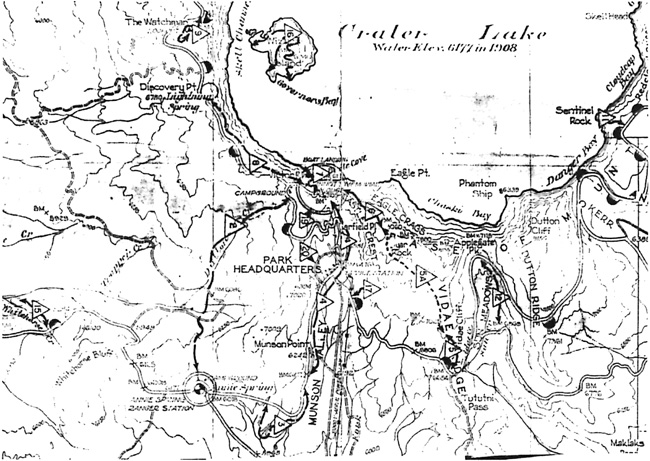
|
| Master Plan section showing a portion of the park's trails, 1950, author's files. Note the bridle trails (numbers 3, 4, 17, 19, and 20, as (5A) between Garfield Peak and Vidae Falls, Sparrow's route up Sun Valley (12) is also depicted. |
Just as before, what funding for trails that could be obtained went to the most popular routes, so that some of the remainder fell prey to neglect. This seems to be the case for the bridle paths, except where enough intermittent foot traffic could sustain a trail, such as the one between Park Headquarters and the Rim Campground. Short trails along Lost Creek and into Llaos Hallway likewise faded, as did the partially constructed route near Vidae Falls.139 The route connecting Sun Notch with the old Rim Road had also become faint for the most part, though a piece of it disintegrated into desire lines once visitors passed through a small cut bank located just a short distance from the parking area on Rim Drive.140
The trails inventory of 1955 varied somewhat from the one prepared six years earlier, especially with respect to what the NPS proposed to build with funding in the offing from an agency initiative that Director Conrad Wirth called "Mission 66." Grading, all of it by hand from NPS crews as part of maintenance, was proposed for nine of the existing trails, beginning with work on six miles of the Oregon Skyline route through the park.141 Planners also proposed obliterating the Crater Wall Trail in favor of a new route to the lake, one linking the Pumice Point overlook on Rim Drive with a dock at Cleetwood Cove. The other prospective change involved removing a segment of the Watchman Trail that traversed the old Rim Road for 0.3 miles and shifting its trailhead away from the Watchman Overlook. A new trailhead would have been developed across from where a motorway led to Lightning Spring and the Skyline route, thus requiring hikers to ascend Watchman from the south. It could also create a trail junction near the motorway gate since an "alternate" to the Skyline route might then run along the rim from there toward Rim Village and then down Dutton Creek.142 Another trail reported as part of the inventory climbed Llao Rock from a yet to be constructed pullout on Rim Drive, but from the north, instead of going east from Merriam Point as had been proposed in 1935. None of the other potential projects matched those proposed a decade or so earlier; at this point agency planners added several short trails to their wish list. These included one of 0.7 miles to the top of Timber Crater from a motorway that looped around its northern base. Another started from a parking area on Rim Drive and went to the top of Palisade Point. The longest trail would have reached the top of Scoria Cone in 1.8 miles from a proposed parking area to be located north of Annie Falls on the South Entrance Road.143
The Mission 66 Years, 1956-1966
Annual visitation topped 370,000 in 1954 and with some variability over the next 12 years, finally reached the half million mark at Crater Lake in time for the NPS to celebrate its fiftieth anniversary. The agency undertook a new and large development program in response to increasing visitation and deferred maintenance throughout the entire national park system, while anticipating a sustained level of appropriated dollars over a ten year horizon. Unlike the 1930s, when appropriations paid for new facilities through work relief programs, Mission 66 projects were restricted to day labor and contracts. Most of the Mission 66 funding received for trails at Crater Lake centered on just one undertaking, one aimed at relocating pedestrian access to the lake from Rim Village with a new route leading from the northern part of Rim Drive to Cleetwood Cove.
|
| Oregon State Highway Commission advertisement, 1951. Courtesy of Pat Solomon, Oregon Department of Transportation Archives. |
The launch of Mission 66 came in early 1956 with issuing a "prospectus" for each park, one detailing problems that proposed projects could address. The one for Crater Lake included how a new trail might disperse crowds who might otherwise access the shore from Rim Village and pointed to the advantages of the new location. One was aspect, since the southern exposure could reduce, or possibly eliminate, the hand clearing of snow so prevalent on the Crater Wall Trail. The cove below lent itself to building a marine railway for launching and retrieving boats, something that might obviate the need for dock facilities. As for park trails in general, NPS planners added more general language about improving and marking the Oregon Skyline route, but they also cited a need for "numerous" self-guiding trails to better distribute visitor use away from the developed areas.144
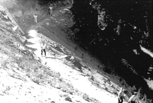
|
| Visitors on the Crater Wall Trail in the 1950s. National Park Service photo. |
Just as grading work on the new trail to Crater Lake began in July 1958, the park's Mission 66 development schedule listed it and three other trail projects as priorities. Projected funding for the route to Cleetwood Cove included paving, so the initial request amounted to more than four times larger than the other three trail projects combined. The three would have reconstructed the Garfield Peak and Discovery Point trails, finished the route to Union Peak, and built the realigned trail on the south side of Watchman.145 NPS crews completed work on the Garfield Peak and Discovery Point reconstructions by September, but did not undertake the other two projects. Instead, the Cleetwood project required several seasons. Rough grading took place by hand until a small tractor with bulldozer arrived from Lake Mead National Recreation Area. This "trail cat" expedited work, though the NPS crew soon found that a steep switchback near the bottom needed to be eliminated from the located line. The rocks encountered on that section slowed further progress, as did building stone retaining walls for the shorter switchbacks situated above it.146
Grading the Cleetwood Cove Trail continued in 1959, but a number of tasks were deferred to the following summer when phase 1 of the project finished in August. The initial stage produced a trail six feet wide on what could be characterized as an easy grade (in comparison with the Crater Wall Trail) apart from a few sections. Except for a minor location change aimed at eliminating the aforementioned switchback at the bottom, some steep sections needed to be re-graded and then surfaced. Plans also called for enlarging the terminus at the shore, while the installation of both rock and treated wood cribbing was ongoing.147 Although visitor and concession use of the trail began during the 1959 season, construction activity did not conclude until September 1962, when the cumulative total spent on the project had reached almost $60,000.148
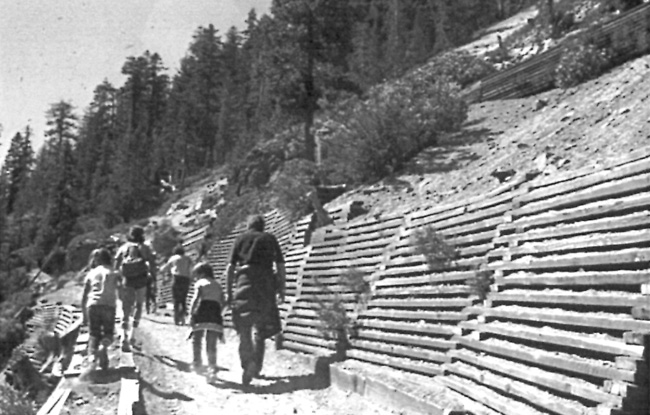
|
| Cribbing on the Cleetwood Cove Trail. National Park Service photo. |
While NPS planners made reference to a system of self-guiding trails at Crater Lake in 1957, this consisted only of plant labels placed along a loop in the Castle Crest Garden and some sprinkled along the Discovery Point and Garfield Peak routes.149 A precedent for describing geological features, trees, flowers, and birds through a bulletin called "Trailside Notes" had been established along the Crater Wall Trail in 1929, but another three decades elapsed before another such booklet appeared in the park.150 Initially mimeographed when released in August 1960, the "Castle Crest Nature Trail" booklet interpreted 29 stations marked by numbered posts. It followed from rebuilding the trail, a project that also included placement of a new footbridge along the route.151
Another self-guiding trail came into existence by 1964, when for a decade or less, the name "Canyon Rim Loop Trail" supplanted the "Godfrey Glen" route.152 A small realignment of the Munson Valley Road took place as part of a larger reconstruction project effectively allowed for making a section of the old road into trailhead parking in 1962. One of the naturalists authored a pamphlet that interpreted 16 stops marked by posts virtually coinciding with the road realignment.153
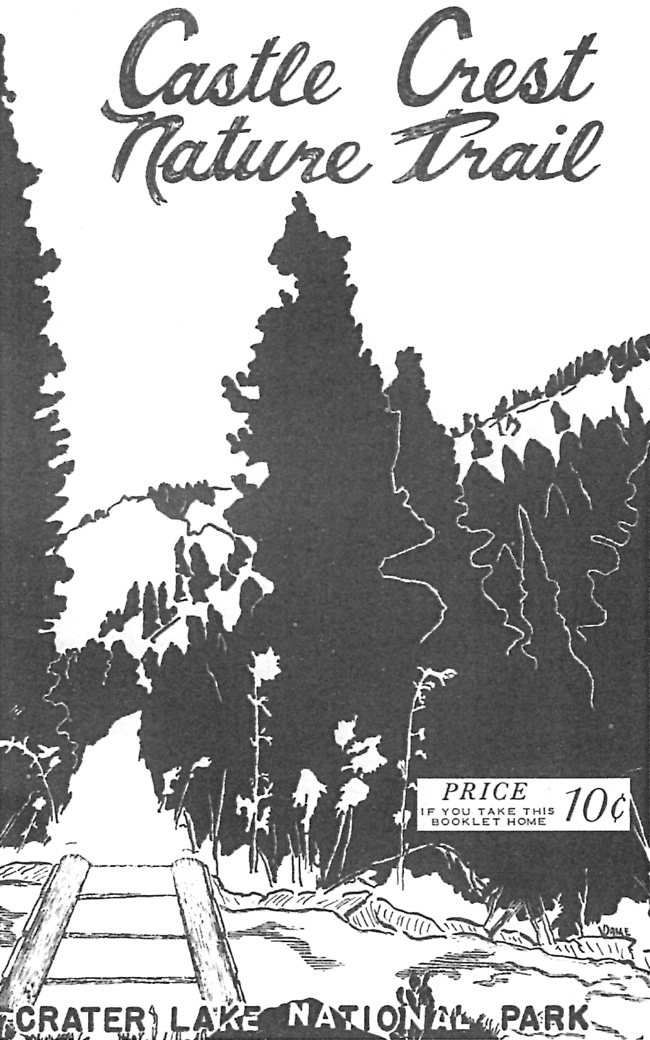
|
| Cover illustration of the interpretive booklet by R.M. Brown, 1962. |
Abandonment of the connecting bridle paths during World War II led to creation of the loop above Godfrey Glen by 1956 so that a self-guiding nature trail required little, if any, new construction. Building a new trail loop in Annie Creek Canyon from the Mazama Campground came once contractors had completed construction of five camping loops and an amphitheater by the fall of 1962. At three feet wide, the trail formed a 1.7 mile loop that started at the amphitheater and descended into the canyon. Initially called the "Camp Fire Trail" in reference to evening programs held at the amphitheater, it became known as the "Annie Creek Trail" when completed in 1963.154 A master plan narrative for the park drafted the following year called for adding a nature trail along the new route, with the aquatic environment to supply its interpretive theme.155
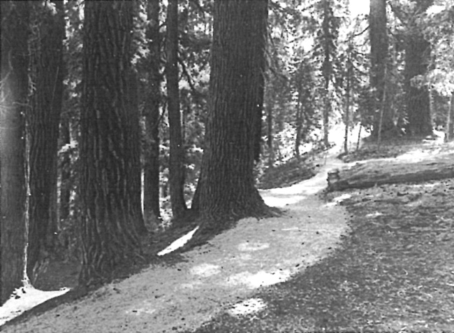
|
| Newly completed Annie Creek Canyon Trail, 1963, author's files. |
Whereas the master plan of 1957 described the park's trail system as adequate (except for the link between Rim Village and the lakeshore), the narrative of 1964 called for an expansion to both disperse visitor use and provide public access to additional areas.156 However, Superintendent Richard Nelson sent something of a mixed signal to regional NPS officials in February 1965 by deleting a number of trails shown on the master plan that had either been abandoned or never built. He wanted to encourage visitors to use "existing" trails that the NPS chose to maintain, but hedged by retaining four proposed routes: Sentinel Point, Llao Rock, Pumice Point, and a realigned trail to Union Peak. At the close of Mission 66 eighteen months later, the NPS listed 15 trails that comprised its "system" at Crater Lake: Pacific Crest (Oregon Skyline), Duwee Falls (Godfrey Glen) Nature, Garfield Peak, Discovery Point, Watchman, Mount Scott, Sun Notch, Union Peak, Llao Rock, Wizard Island, Fumerole Bay, Castle Crest Nature, Palisade Point, Lake (Cleetwood Cove), and Annie Creek.157
Austerity and a Changing Backcountry, 1967-1980
The Mission 66 years brought about some important additions to park infrastructure, such as the Cleetwood Cove Trail, Steel Circle housing units, and the Mazama Campground. Whether directly or indirectly, these facilities responded to increased visitation at Crater Lake, given how annual attendance in 1966 was double that of 1941, when funding from Depression-era work relief programs concluded. Funding for infrastructure dropped dramatically once Mission 66 ended, however, even with the launch of a new NPS initiative called "Parkscape." It attempted to draw upon widespread public support for expanding opportunities for outdoor recreation, but while the number of national park units continued to grow throughout the 1970s, NPS appropriations remained flat when adjusted for inflation. Permanent staffing at Crater Lake actually declined, as funding for construction dropped to a trickle of what it had been during Mission 66, but visitation numbers remained strong and peaked at an all-time high of 617,000 in 1977. As with other types of park facilities, the NPS struggled to fund trail maintenance, whose budget nevertheless went from $7,500 in 1965 to $9,200 four years later.158
Consequently, new projects were set on the back burner unless they had minimal costs. Making one of the parking overlooks on East Rim Drive into a nature trail furnished one example of a small project providing new recreational opportunity at virtually no outlay. Opened in 1967, it needed only a trail sign and some plant labels at one of the two parapets completed almost three decades earlier above Grotto Cove. With a virtually level asphalt walkway extending more than 200 feet from the road surface already in place, it represented the park's first handicapped accessible trail and required no new construction. Within a decade, however, the NPS removed the sign and labels along the walk amid questions whether the labels adequately interpreted plant and animal ecology along the rim.159

|
| Visitors at the entrance to the Grotto Cove Trail, 1970s. National Park Service photo. |
It took more time for the idea of "motor nature trails" at the park to go by the boards. Conceived in the Washington Office and promoted by NPS director George Hartzog, the intention was to spread visitors out somewhat by allowing for vehicle travel in the backcountry of parks. As a sort of counterbalance to managing most of the acreage at Crater Lake and other national parks as wilderness, motor nature trails remained unpaved (though sometimes oiled) and generally included an interpretive component such as wayside exhibits. A portion of the old Rim Road between Lost Creek and Vidae Falls was already maintained (meaning re-graded on something of an annual basis) as an alternate route to the Rim Drive above it in the postwar years due to sporadic problems with rockfall between Kerr Notch and Sun Notch. It assumed a new name as the one way "Grayback Motor Nature Trail" in 1969 and included several wayside exhibits that highlighted forest succession.160
|
| Cover of interpretive booklet, 1976. |
The NPS also proposed a second motor nature trail for an area south of Highway 62 that could be accessed by motorways still maintained as fire access roads. One leg went south roughly five miles from a departure point located west of Annie Spring, an identical route to that of the Pacific Crest (Oregon Skyline) Trail going past Union Peak. The motor nature route would then turn east and cross Pumice Flat before terminating at Highway 62 across from the Lodgepole Picnic Area. It was incorporated into the NPS wilderness proposal for Crater Lake, which the agency began to prepare in 1968. Since the Wilderness Act passed in 1964 required public hearings before agency recommendations were transmitted to Congress, this meant that the motor nature trail proposal was subject to public review and comment.161 The Union Peak Motor Nature Trail met with considerable opposition at hearings conducted in January 1971 so that the NPS withdrew it from further consideration.
The only trail construction undertaken in the park during this period reacted to closing gaps in the Pacific Crest Trail, or responding to shifts in the trail's alignment on national forest lands. In 1969 volunteers built a new half mile connection to Highway 62 from the Cascade Divide in order to allow users to avoid traveling on the road from Annie Spring, but they also signed and improved what had once been a bridle path over the divide.162 Another divergence stemmed from what had been the Oregon Skyline route on the Rogue River National Forest in 1968-69. Fourteen miles of new trail construction in the roadless Sky Lakes Study Area immediately south of the park brought the PCT to boundary monument 122, located about two miles east of where the Skyline trail met one of the motorways.163 The NPS eventually provided roughly a mile of new trail north of the boundary, routing it to a junction with the motorways that either took users to Highway 62 by way of Pumice Flat, or northward along the "trail" serving as the PCT.
Another new segment of the PCT within the park came about once Forest Service crews reached the north boundary in July 1972 and began developing a trailhead with parking on Highway 138.164 These developments stemmed from an agreement reached with the NPS in 1969, whereby the PCT was to follow the watershed divide south of Mount Thielsen, so that a new trail segment had to be built east of the North Entrance Road from the boundary.165 NPS crews did not commence work until the USFS had finished its portion of the project, so opening of the park's segment was delayed until 1976.166 This piece of the new PCT still made use of a motorway, though for only two miles (it utilized part of a much longer loop around Timber Crater) until it crossed the highway between Grouse Hill and Red Cone. In all, roughly 4.5 miles of "connections" to the new Pacific Crest Trail (as opposed to the old Oregon Skyline route) were built in the park by NPS crews during this period.167
|
| Section of the Pacific Crest Trail on one of the fire roads, 1970s. National Park Service photo. |
With the active maintenance of motorways for administrative use by government vehicles ending in 1971, the NPS began to more earnestly consider where to develop campsites along the PCT. Heretofore camping on the trail supposedly required a permit, even if the campsites were informal and largely concentrated in the vicinity of Red Cone Spring, Gold Camp Meadow, Bybee Creek, or along Dutton Creek.168 The park's annual visitation exceeded 600,000 for the first time during the 1976 season, and with it came rising use of the PCT. Management response took the form of a permit system to track overnight use away from developed areas of the park, while self registration stations were placed at both ends of the PCT route and at four other trailheads as part of a wider NPS effort to track backcountry use in the national parks.169 Park staff wanted to concentrate backcountry camping at designated sites rather than let dispersed use (as evidenced by fire rings) continue over a wider area. Consequently, a designated backcountry camp for hikers had been established by 1978 at Lightning Spring, to be followed by ones near Dutton Creek and Red Cone Spring in 1979.170
Although overnight camping on the PCT assumed greater importance as a management concern by the late 1970s than previously, other changes in backcountry trails were driven primarily by day use. The numbers could be suspect due to different counting methods, but hiking was said to have more than doubled from 1958 to 1968, and within the following decade, doubled again.171 Most of the use still came on frontcountry trails (Cleetwood Cove, Garfield Peak, Watchman, and Mount Scott), just as it had before Mission 66, though the superintendent claimed that information derived from overnight permits and day use registers justified regular care of more backcountry trails. As filings stood, the NPS maintained about 70 miles of trail in the park as of 1978, though much of that total included what had been fire access roads (motorways) before 1971.172
While annual visitation at Crater Lake reached its zenith of 617,000 in 1977, the park's backcountry attracted only a small percentage of hikers (who continued to favor frontcountry destinations) and a tiny fraction (less than one percent) of the overall total. Nevertheless, trail crews periodically cut back brush and cleared fallen logs from the motorway routes maintained as trails, and began covering one of the vehicle tracks in order to give the fire access roads a more "natural" appearance.173 New construction in 1977, however, was limited to realignment of the short upper section of the Dutton Creek Trail. This was aimed at locating a new trailhead next to the Munson Valley Road, only a short distance from Rim Village.174
Much of the maintenance work still centered on opening the Cleetwood Cove Trail each spring, though the tasks of removing rocks and snow paled in comparison to the effort once required on the Crater Wall Trail. By the summer of 1978, however, an eroded bank along the Cleetwood trail required about a thousand square feet of stone rip rap.175 Major maintenance projects aside, the superintendent several months previously requested $2,000 in order to combat loose soil and dust by spreading wood chips on the trail. After eschewing the traditional dust palliative of road oil, the NPS found that wood chips used from 1965 to 1968 could not stand up to trail tractors used by the park concessionaire to service the boat operation. Since hard surfacing the trail with asphalt constituted a safety hazard, the NPS applied an oil spray treatment in 1969 that had to suffice as a surface for much of the following decade.176
Despite the Cleetwood Cove Trail remaining in the leading position with regard to use, interest in the backcountry and hiking at Crater Lake in general had widened to the point where the first guidebook to park trails was published in 1980. It included several motorways that had never been maintained as trails and the author noted such routes might be cleared and improved as visitor interest in the backcountry increased.177 The author also mentioned that the snow-free season for hiking at Crater Lake could be short depending on the year, but did not include which trails had been marked for winter travel after stating that snowshoeing and cross country skiing were permitted.
In responding to what several park staff members saw as an increase in winter backcountry use, the NPS placed colored tags on trees located along several trail corridors during the summer of 1978. Employees signed a total of 21 miles this way, thus creating new ski trails to serve as an adjunct to the more popular Rim Drive circuit that bore no winter markings, apart from temporary signage at the two terminal points.178 By the end of 1980, a total of 50 miles of ski trails had been marked to include the Dutton Creek route, the old motorway that traversed Pumice Flat (the "Stuart Falls Trail") and the one forming the PCT route going past Union Peak and then north to cross Highway 62, and eventually veering east toward Lightning Spring. Another motorway route went past Crater Peak and was marked all the way to the park's south boundary.179
When the Crater Lake Ski Service began renting cross country skis and snowshoes at Rim Village in November 1978, its staff provided the impetus for a 1.3 mile loop to materialize. Dubbed the "Hemlock" Trail, this marked circuit fit between the village roadway and the Munson Valley Road below it. More experienced skiers could descend from Rim Village to Park Headquarters by way of a route that generally corresponded to the 1.2 mile road segment built under Superintendent Arant's direction in 1904-05, which the ski service called the "Raven" Trail.180 The relatively rapid emergence of these and other ski trails was part of a tenfold increase in winter day use between 1977 and 1980, something also fueled by the NPS offering guided snowshoe walks on the weekends and the annual Alia Mage ski race that commenced in 1978.
|
| Cover of Crater Lake Ski Service brochure, 1980, author's files. |
While still more prevalent than winter trail use, hiking over the brief summer period showed only a slight increase during the same three year stretch. Although new trail construction had been limited to the realignment along the Dutton Creek Trail in 1977, what amounted to a more noticeable change came in 1980 with the installation of fifty anodized aluminum signs. Set on steel posts at trailheads or at junction points, these devices represented, at least in the view of Superintendent James Rouse, the first backcountry sign system for the park. Their installation coincided with the appearance of the trail guide, so Rouse was more likely closer to being right than most of his predecessors when he stated that the park's trail system was now "defined."181
A Holding Pattern, 1981-1992
Changes in Crater Lake's backcountry, though often slow in coming, reflected larger trends felt in other national parks during the late 1970s. One was the emergence of a political constituency for wilderness preservation, something that translated into legislation and ended the use of vehicles on motorways in the backcountry, even if formal designation of the park's backcountry as wilderness remained on hold after the NPS submitted a recommendation to the President in 1974. Another was the advent of funding specifically for resource management projects, like those which addressed the impact of dispersed camping in backcountry areas.182 Although trails at Crater Lake had never been addressed in a systematic way other than as an adjunct to roads on the park's master plan from the 1930s to the early 1950s, key NPS staff members of the time were predisposed toward trails in the midst of other competing priorities. Superintendents Frank Betts and James Rouse had extensive backcountry experience in previous assignments, though Chief Ranger Dan Sholly was perhaps more important in staffing a trail crew and seasonal positions in resource management. Mark Forbes, formerly a wildlife ranger, had been hired as the park's first resource management specialist in 1978—a position intended to centralize the natural resource management function instead of it being divided among park rangers as a collateral duty to law enforcement.183
Sholly departed Crater Lake in 1981, just as the park expanded by 22,000 acres, all of it transferred from adjacent national forests. Despite much of the acreage being roadless, it contained only one short trail segment in active use.184 The one to Boundary Springs followed the Rogue River from a road crossing near Lake West, and was built after the Forest Service designated 300 acres adjacent to the park boundary as a scenic area in 1970.185 It came about as part of a USFS plan to construct the larger Rogue River Trail along a route through the Prospect Ranger District. This resulted in just over a mile of new trail between Boundary Springs and the road crossing, about half of which was absorbed into the expanded park.186
|
| Excerpt from brochure on park's backcountry, about 1980. Courtesy of the Crater Lake Natural History Association. |
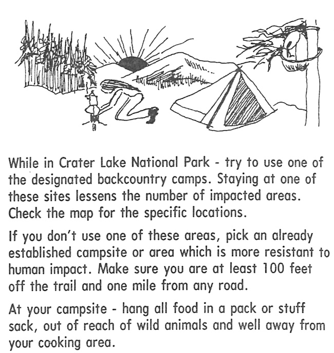
|
| Excerpt from a brochure on the park's backcountry, about 1980. Courtesy of the Crater Lake Natural History Association. |
No new trail construction took place at Crater Lake during the first decade that followed park expansion, even though hiking in the park maintained its popularity. Three short loop trails, however, became the subjects of individual four-color interpretive booklets written in 1982 and published by the Crater Lake Natural History Association. Joining the Castle Crest Wildflower Garden and Godfrey Glen Trail in this group was the Annie Creek Canyon Trail, even though it received substantial repair work and some realignment during the summer of 1983.187 A revised guide to the park's trails also appeared that summer, somewhat coincident with a new guide to Crater Lake that focused on hiking and natural history, but also included adjacent trails in the upper Rogue Basin, as well as those in the roadless Sky Lakes area and the Mountain Lakes Wilderness.188 Despite the interest generated by availability of these guides and the possibilities presented by an expanded park, the NPS made no moves toward building new trails during the 1980s. It instead allocated the rather meager funding for trails to maintenance of existing routes, apart from some reconstruction of the lower switchbacks on the Cleetwood Cove Trail.189
|
| Cover of one trail brochure produced through the Crater Lake Natural History Association, 1983. |
Opening the Cleetwood Cove Trail each spring continued to be the trail crew's top priority, followed by removing snow from the Victor Rock Trail so that visitors could access the Sinnott Memorial at Rim Village. They routinely cleared other trails, though depending on available funds and yearly snow conditions, maintenance of some former motorways in the backcountry (apart from the PCT route) was more sporadic. Small projects during the 1980s included installation of several wooden guardrails impregnated with creosote along the Garfield Peak Trail and on the rim at Sun Notch. For the most part, however, the emphasis of park facility management remained squarely on new building construction or rehabilitation of offices and staff housing.
A brief resurgence of interest in trails came in the summer of 1991 as part of a community outreach effort led by Acting Superintendent Ben Ladd. The NPS reopened the motorways forming what was called the "Bald Crater Loop" in the park's northwest quadrant and the "Stuart Falls Trail" (formerly a segment of the PCT) to equestrian use in exchange for the horse groups monitoring impacts.190 Ladd also seized an opportunity to work with staff on the Winema National Forest and develop a trail suitable for hikers and mountain bike riders. It connected the Pinnacles Overlook with trailhead parking on national forest land adjacent to the park's east entrance, a distance of one half mile. Although this trail primarily utilized the old roadbed linking the two terminal points, it also included pullouts built by the NPS trail crew to handicapped accessible overlooks located along that part of Wheeler Creek Canyon.191
The Convergence of Agenda and Funding, 1993-2010
Trails quickly returned to their former place at the periphery of management concern when Ladd resumed his post as superintendent of John Day Fossil Beds National Monument. His successor, David Morris, nevertheless continued with outreach efforts by assisting with the establishment of a support group, the Friends of Crater Lake National Park in 1993. It initially attracted 135 members and represented the largest single pool of volunteers that the NPS could call to implement projects.192 The next largest group, the Crater Lake Ski Patrol, had been formed a decade earlier and varied between 20 and 30 members.193 Both organizations displayed a liking of the park's trails early in their existence, perhaps because trails so often play a central role in visitors experiencing a national park. Trail work could generally be accomplished without using heavy equipment and was usually done with unskilled labor under the direction of an experienced ranger or crew leader.
By the end of 1993 staff in the park's ranger division had once again tried to revive interest in the backcountry by promoting use of the PCT. A wayside exhibit was added at the trail crossing on Highway 62 next to a turnout that summer, serving as something of a precursor to an alternative PCT route that might allow hikers to see Crater Lake while on the trail. Following the motorway put hikers and equestrians two or more miles west of the rim and more than a thousand feet below it, so NPS staff sought to rectify the situation by inadvertently reviving an idea last floated in the master plan draft of October 1970. From the aforementioned trail crossing, the thought in 1993 was to make use of the existing connector and bridle path down to the motorway on Castle Creek. Pedestrians only might then use the Dutton Creek Trail to reach a short connecting part at the top, which put them on the Discovery Point Trail heading west. New construction beyond Discovery Point could then be minimized by using the old Rim Road route to a point north of Hillman Peak, where it descended toward the Devils Backbone to be overtopped by Rim Drive. New tread had to be built for the line to stay above the road to North Junction, where the trail could continue north toward a junction near Grouse Hill and an extant crossing on the North Entrance Road.194
Building 2.5 miles of new trail to connect existing segments of the PCT was completed by the park's trail crew in conjunction with volunteers from the Friends of Crater Lake National Park in August 1994.195 Only one of the two camps envisioned in the project's environmental assessment materialized, while its initial designation as the rerouted PCT proved to be ephemeral.196 The NPS realized its goal of providing a trail that offered outstanding vistas of Crater Lake as part of the PCT through route, but the undertaking did not spark completion of either a trails management plan or a plan for the park's backcountry as the project's environmental assessment implied.197 Instead, the addition of a 9.3 mile trail segment on the western flank of Mount Mazama could be viewed as another in a series of ad hoc trail projects—as opposed to the product of comprehensive planning for pedestrian circulation in the park, something urged by at least one member of park staff.198
Not only did changes in NPS staffing and competing park priorities hinder such planning, such an effort might have to begin with what constituted a trail. Some "trails" were simply fire roads, though at no point did the NPS consider the entire network of motorways to be trails. Many of the motorways had simply been abandoned after 1971, while others were signed as trails even though little effort beyond sporadically brushing one of the two vehicle tracks. Where foot trails instead of roads had been constructed, only some of the routes could be called "engineered" as the product of location study followed by stationing, where calculations of curvature and grade were evident in addition to provisions for drainage devices and finish grading to check erosion. Building the "PCT Alternate," for example, proceeded without the engineering step apart from what was already in place along the old Rim Road or trail segments such as the one to Discovery Point built during the 1930s. Some calculations of the park's trail mileage included the paved walkways at Rim Village, Park Headquarters, and along Rim Drive (a total of three miles by one reckoning in 1974), though the figure for what the NPS maintained as unpaved trails could vary drastically depending on when or who did the reporting. In 1974, for instance, NPS officials figured that 41.3 miles of unpaved hiking trails were maintained for that purpose. Twenty years later, however, the maintained mileage supposedly shot upward to 85, at least according to the park superintendent.199
|

The 1994 figure did not include walkways, but it encompassed a mix of motorways, "standard" trails (as described earlier in this paper), or those having tread dug without the benefit of an engineering assistance. Only 22 miles of trail maintained at the time did not have their origin as a motorway, so any allusion to a "system" of pedestrian circulation had to be made almost tongue in cheek.200 The park's trail crew bounced back and forth as part of either the maintenance or ranger divisions; the former as a poor cousin to road maintenance priorities, and the latter as an adjunct to patrolling the backcountry. In any event, their top priority, that of opening the Cleetwood Cove Trail, had not changed. Clearing other trails and special projects could be done as time and the limited amount of funding allotted to the crew permitted, though this changed somewhat with creation of a permanent, subject to furlough position of crew leader in 1996. Cheri Killam-Bomhard filled the lead role so that the crew could continue their maintenance duties, but also augment the completion of an increasing number of special projects each summer.201
Not that any dramatic increases in funding followed, at least in the beginning. Some projects simply came out of park "base" (ONPS) funding, such as work to correct a rock fall hazard on the Cleetwood Cove Trail that resulted in a visitor fatality during the 1993 season, or subsequently replacing the creosote treated footbridges on the Castle Crest Wildflower loop and the Lady of the Woods Trail with re-creations of those built by CCC enrollees 60 years earlier. More routine tasks could be accomplished with a Youth Conservation Corps crew consisting of six to eight students from local high schools. Projects accomplished with the aid of Sierra Club members or the Friends group had to be relatively short in duration, such as removing culverts from the old motorway serving as a segment of the PCT or improvements such as building a bridge, rock culverts, and sand box on the Annie Creek Canyon Trail.202
A combination of base funding and volunteer effort brought a loop trail at Park Headquarters into existence during the late summer of 1999. It arose from the need to rehabilitate structures such as the Superintendent's Residence (declared a national historic landmark in 1987) within the Munson Valley Historic District, but also to have some way of facilitating self-guided interpretation of the district. Killam-Bomhard located a preliminary line for the trail, one that started at the Lady of the Woods and ascended to the residence, then continued downhill to finish at the Ranger Dormitory. It made use of ten numbered posts keyed to a booklet, something which represented the first interpretive trail constructed in the park since the early 1960s. The trail crew and members of the Friends group built roughly half of the tread and a footbridge over an August weekend. NPS employees essentially completed the project several weeks later on a cross-divisional workday, one that allowed for distributing an interpretive booklet published by the Crater Lake Natural History Association to participants.203
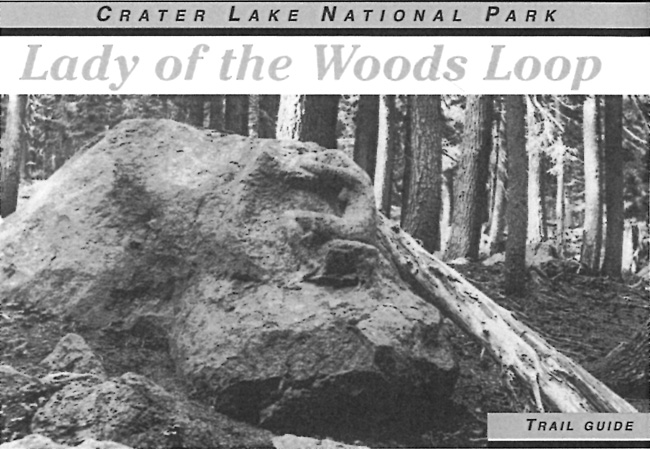
|
| Cover of an interpretive brochure, 2007. Photo by Alex Sparrow; booklet produced by the Crater Lake Natural History Association. |
While the half mile circuit represented the latest in a string of trail projects planned and built on an ad hoc basis, advent of the Fee Demonstration Program (where a percentage of entrance fees collected at Crater Lake and other park units could be retained by the NPS for use in projects rather than being sent directly to the Treasury) created the possibility of a stable and abundant funding source for undertakings with a direct tie to enhancing visitor experience. One of the first proposals submitted for this program at Crater Lake aimed at remaking motorways used as trails into routes that did not look or feel like roads. Some of this work might be accomplished through removal of one or both vehicle tracks, culverts at stream crossings, and revegetating heavily disturbed areas. Killam-Bomhard and other staff members knew, however, that the goal could only be accomplished in many places through reroutes that required building new tread.204
Two trail segments floated to the top of a matrix used for site selection in 1998. The first was a 1.6 mile section of the PCT between junctions with the Dutton Creek Trail and the connecting link to Annie Spring. Stakes indicating station numbers had been placed along it by the summer of 1999 as part of survey for identifying the work needed and then estimating costs. The upper half became part of a reroute that originated in 2000. It ascended the divide further upslope and utilized switchbacks before joining the old motorway near Castle Creek, so as to avoid a badly eroded section of old road.205 The other got wrapped into a larger site redevelopment project near Vidae Falls, which involved reconfiguring the picnic area, trail rerouting, and the reallocation of vehicle parking there. The trail portion called for abandoning a sequence of "tank traps" and where the old motorway snaked along a portion of Vidae Ridge in favor of starting the trail from the Vidae Falls Picnic Area. From there it followed the old Rim Road corridor to Vidae Ridge, adopting a route having more views of Crater Peak and the background panorama of mountains. Augmenting the trail crew's efforts were a group of Northwest Youth Corps enrollees for the heavy rock work needed to establish a route where the old Rim Road had been buried by the fill from Rim Drive above it. Volunteers from the Friends of Crater Lake National Park helped with tread work so that the one mile reroute could be completed in 2001.206
Success with the initial reroute led to another set of undertakings. One project called for essentially abandoning a half mile segment of bridle path linking Annie Spring with the PCT in favor of a more sinuous route up the divide. The other projects effected more extensive reroutes, in that more than 2.5 miles of fire roads were to be abandoned north of its junction with the Pumice Flat "Trail." Killam-Bomhard proposed an almost total realignment of the Union Peak Trail of 1.9 miles, save for the last tenth of a mile to the summit. This necessitated abandonment of all fire roads leading west from the PCT and over half of the existing foot trail.207 Work took place during the summers of 2002 and 2003 in conjunction with other trail maintenance tasks assigned to NPS crews and the Northwest Youth Corps.208
What drove the reroutes was the feeling that the motorways no longer served, if they ever did, hikers wanting to experience the park's backcountry. Apart from the very different purposes of building fire roads and engineered recreational trails, wanting to enhance several experiential characteristics that led visitors to walk away from roads had been articulated following completion of the first reroute projects funded through the Fee Demonstration Program. As one contribution quoted from existing literature in the annual publication Nature Notes from Crater Lake:
"Mystery is where landscapes give the impression that one could acquire new information by traveling deeper into the scene. Good trail layout accentuates mystery and a winding path, where constantly shifting views of vegetation and the landscape sustain interest. Legibility allows for extensive exploration in an environment that looks easy to discern if a person goes further into it; trails can therefore utilize landmarks and periodic openness to reduce anxiety about getting lost. A prospect often highlights the hike, by providing a vista that extends for miles, even if in just one direction. Refuge describes places on or near the trail that provide seeing without being seen, whereby information is gained without giving any away.209
The last in this series of reroutes could likely be considered the most dramatic as it completely eliminated the Red Blanket Motorway as a hiking "trail." Instead, a new route linked the previously rerouted PCT segment nears its junction with the Pumice Flat Motorway with the park boundary, less than a quarter mile from Stuart Falls on the Rogue River - Siskiyou National Forest. The new trail came closer to Bald Top than the motorway had and made for a more seamless transition with the Forest Service trail network in the Sky Lakes Wilderness.210
|
| Portion of a topographic map showing realigned trail (solid line); dashes show existing (motorway) routes in 1997, author's files. |
Funding for reroutes was largely limited to the one fee demonstration project that ended in 2004, but the NPS concurrently utilized money from different sources to make various kinds of improvements on other trails without realigning them. Although the idea of making Godfrey Glen Trail handicapped accessible could be traced to a park-wide report on accessibility by Jacque M. Beechel in 1979, project planning did not begin until 1993, when Kelly Donahue wrote a draft report on the trail.211 Some dedicated year-end funding made more detailed design work possible through the Denver Service Center in 1998, so that a separate fee demonstration project could commence in 2000.212 The park's trail crew and other staff members completed work to re-open the route in 2002, but the self-guiding interpretive component languished after only one draft.213
Other improvement projects were limited to the trail crew's involvement, though in one instance, their efforts represented mitigation for a larger project. Cultural cyclic maintenance funds paid for repairing the Watchman Trail, which required some work once project activities aimed at restoring the lookout structure halted in 2000. That funding source also paid for replacing creosote-treated timbers at several observation points on the Garfield Peak Trail in 2007. During this undertaking the trail crew substituted stone masonry for the timbers as safety barriers while also replacing some benches partially built from materials treated with creosote. They restored some damaged dry-laid retaining walls on the trail that dated from 1931 and addressed an increased number of social paths that had developed along the route.214
Over the following summers, the trail crew again utilized cultural cyclic maintenance funding to address the deteriorating condition of the Castle Crest Wildflower Garden loop and connecting trail from Park Headquarters. Little work apart from annual clearing had been accomplished there since the footbridge replacements of the late 1990s, and the necessity to correct cross drainage problems brought about a project that proceeded in two phases. The first aimed at returning the trail to its original width of three feet and making it more stable, particularly with the use of stepping stones as tread through wet areas. Its second phase included replacing log bollards in the parking area with stone masonry piers connected by log cross members. Drainage from the parking lot created a gully through the initial section, so crew members raised the tread with some benching and apparently solved the problem.215
A new trail guide for the wildflower garden made its debut in late 2010, as the first in an effort to update the three interpretive booklets written for pedestrian loops in 1982.216 The only other guide to an individual trail published since completion of the Lady of the Woods Loop (formerly "Park Headquarters Historic Walking Tour") in 1999 was one for the Garfield Peak Trail in 2004. Funded by the non-profit Crater Lake Institute, it initially appeared a year earlier but underwent considerable revision and redesign, only to disappear in the wake of the trail crew's maintenance project on Garfield Peak.217 A bequest to the Crater Lake Natural History Association triggered publication of a guide to all of the park's maintained trails in 2010, whereby the CLNHA ended its support of the guide by Connie Toops that had first appeared in 1980. The new volume by William L. Sullivan dropped several routes utilizing motorways, but included new trails and others rerouted since the Toops guide was last revised in 1995.218
In addition to the Lady of the Woods Loop and the trail reroutes implemented since 1999, the Sullivan guide included a trail not completed until after his book was in print. Dubbed the "Plaikni Falls Trail" at the suggestion of Perry Chocktoot, Jr., director of the culture and heritage department of the Klamath Tribes, this route linked a new trailhead on the Pinnacles Road with a cataract at the base of Anderson Bluffs. Climbing 140 feet over its length of one mile, it allows visitors to view a portion of Sand Creek below Anderson Spring in the final third of the hike.219 It is one of the few with stone benches and even wayside exhibits built in several places along the route, and proved popular not least because of publicity generated through the park newspaper.
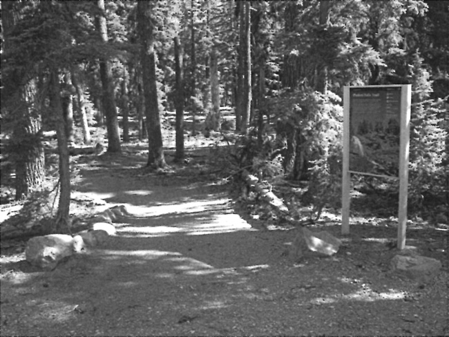
|
| Trailhead for route to Plaikni Falls, 2012. Photo by the author. |
Conclusion
This paper has attempted to show how engineered recreational trails (as opposed to those that can be characterized as blazed paths, beaten tracks, motorways, abandoned roads, or ski trails) struggled to become the dominant means used to convey pedestrians at Crater Lake from a trailhead to a terminal point. Even with new construction or extensive reroutes of recent vintage, they still constitute less than a quarter of all mileage signed as trails in the park. One of the main reasons stemmed from the beginning of NPS administration in 1917, when the line between roads and trails blurred, though the road system in the park eventually fit rather neatly into a classic hierarchy of circuit, approach, secondary, and service routes.220 There is no comparable way to organize trails at Crater Lake, mainly because an ad hoc approach (that is, for a particular purpose) has dominated planning for these facilities instead of one based on park-wide goals for recreational access, interpretive values, or causes such as wilderness preservation. The trails could certainly be classified according to shape (such as a loop, line, or horseshoe), or use (hiking, equestrian, or both), but they made no sense as a system if the motorways or old Rim Road were removed as maintained "trails." Were that to occur, what might result bears no resemblance to the Sky Lakes Wilderness or Oregon Caves National Monument, where there are obvious trunk, branch, and feeder trails.
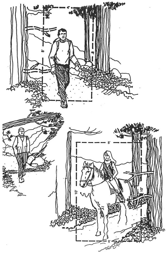
|
| Illustrations for trail standards adopted at Crater Lake National Park, author's files. |
The routes labeled as trails (or, more broadly, part of pedestrian circulation) still fit within eight categories: lakeshore access, viewpoints above the lake, walkways adjacent to paved roads, short loops, routes directed to specific backcountry destinations, bridle paths, motorways or fire roads, and abandoned segments of circuit or approach roads. Some components of pedestrian circulation comprising this "envelope" are still missing or hardly evident in a park of more than 180,000 acres and five thousand feet of relief. Perhaps the most obvious is a "low elevation" trail allowing visitors to hike during June and much of July while snow is still melting on higher ground. Another omission is the lack of loops exceeding two miles in length, apart from several fire roads (which, of course, were not built as pedestrian routes). Even with the walkways included, there are very few parts of the park's pedestrian circulation features that are universally accessible, while many of its most intriguing features can only be reached by hiking cross country in order to reach them.

|
| Portion of Discovery Point Trail leading to the Discovery Point Overlook. Both the trail and Rim Drive are in a historic district listed in the National Register of Historic Places in 2008. Photo by the author. |
It is true that the rim area is open enough to largely obviate the need for trails, but a couple of factors may yet bring comprehensive planning for pedestrian circulation into the front rank of NPS priorities. One is that planning efforts aimed at creating new developed areas or expanding their existing footprint will not likely be justified in terms of increasing visitation, given how annual attendance has remained relatively static for more than three decades. Less obvious is the growth of historic properties in the park during this same period, with four trails listed as contributing resources when the Rim Drive Historic District was formally added to the National Register in 2008.221 Other trails may be eligible for listing, and the planning for new routes or realignments has to take the presence of cultural resources into account—something usually accomplished by avoiding impacts to archaeological sites and isolated finds.222
What may well be the most compelling reason for such planning is that adding to the park's trail inventory furnishes a way to relieve mounting pressure to obligate and spend the available revenue that accrues from entrance fees. Unlike other types of facilities, trail projects do not necessarily involve contracting for specialized skills and a labor force that can far outnumber (at least on a temporary basis) the park staff. It may instead employ unskilled labor or participants in job-training programs through direct hiring, thus being better able to mobilize and work during a short construction season. A comprehensive trails program should also represent an opportunity, especially in the planning phase, to conduct needed surveys of natural and cultural resources in order to inform location studies and subsequent decisions about how an individual project might proceed. The effort can also provide a chance to compare how pedestrian circulation works in other areas and how it could influence the ways in which visitors experience not only Crater Lake, but the entire park.
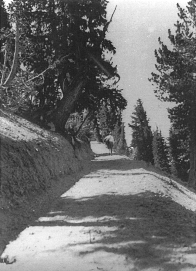
|
| Portion of the newly completed Mount Scott Trail, 1933, author's files. |
Endnotes
1 NPS Office of the Chief Engineer, "Standards for Trail Construction," drawing PG-5088, one sheet (folded into 16 pages), October 1934, Electronic Technical Information Center (ETIC), Denver Service Center.
2 Douglas Deur, In the Footprints of Gmukamps: A Traditional Use Study of Crater Lake National Park and Lava Beds National Monument (Seattle: Government Printing Office, 2008), 121-125.
3 Ibid. See also Steve Mark, "Others Have Passed This Way," Nature Notes from Crater Lake 32-33 (2001-2002), 28-31.
4 Claude R. Caudle, Field Notes of the Survey of the Boundaries of Crater Lake National Park in Oregon, pages 88 and 107. Original in RG 79, 150:32:4, Shelf 2, Box 8, National Archives II, College Park, Maryland. The name "national forest" became official in 1905; both Huckleberry Mountain and Crater Lake had been in the Cascade Range Forest Reserve upon its proclamation in 1893.
5 The track was initially described as faint and in places challenging to follow, at least according to Emil Britt, who accompanied his father Peter to Crater Lake in 1874; Britt to W.G. Steel, November 17, 1918, 2, Southern Oregon Historical Society files, Medford.
6 An example is "Crater Lake," Salem Daily Statesman, August 27, 1885, which summarized the trip taken by William G. Steel and several others earlier in the month.
7 Arant, Report on Crater Lake National Park, in Report of the Secretary of the Interior, 1903 (Washington, DC: Government Printing Office, 1903), 166. He increased the estimated cost of improvements on the path by another $100 in 1906.
8 Arant, "Report of the Superintendent of Crater Lake National Park," in Annual Report of the Secretary of the Interior (Washington, DC: Government Printing Office, 1910), 535. The trail location work came in conjunction with the Corps surveying the park for a system of roads and trails, an undertaking that eventually led to construction of the first Rim Road in 1913.
9 Diller, "Excursions about Crater Lake," in Geology and Petrography of Crater Lake National Park, USGS Professional Paper No. 3 (Washington, DC: Government Printing Office, 1902), 8-9, 17. The circuit was previously depicted promoted in Earl Morse Wilbur, "Description of Crater Lake," Mazama 1:2 (1897), 60-62. Parts of it roughly correspond to the Rim Road circuit built between 1913 and 1918 by the Corps of Engineers, particularly the southern and eastern sections.
10 Caudle, Fieldnotes, 122.
11 Arant, quoted from recommendations made in his annual report to the Secretary of the Interior, in "Improve the Park," Portland Morning Oregonian, November 7, 1906. The only improvement made over the following year that could fit the category of trails was $150 spent on a safety railing for the outer edge of Victor Rock, something ordered by the Secretary of the Interior James Garfield during his visit to the park that summer; Arant to the Secretary of the Interior, November 29, 1907, RG 79, Entry P9, Box 008, File 1236, Part 1, NARA II.
12 As shown on several early maps, it roughly corresponded to a piece of the modern Pacific Crest Trail until it veered west from Bybee Creek, crossing the park boundary at monument no. 22.
13 Arant, "Report to the Secretary of the Interior," October 1, 1909, 3, RG 79, Central Classified Files 1907-39, File 1235, Part I, NARA II.
14 Ibid; Arant, "Report to the Secretary of the Interior, September 29, 1908, 4, RG 79, Entry 6, Central Classified File Reports, Box 13, folder Annual Reports, Part I, NA. Out of Arant's estimates for 1907 (which totaled some $5,500), he estimated $500 for the lake trail, $250 for one to Mount Scott, and $200 to the Watchman; RG 79, Entry P9, Box 005, File 1237, Part 1, Appropriations, NARA II.
15 Arant, "Report to the Secretary of the Interior," October 1, 1909, 3-4. He also made the same recommendation in 1908; Report on Wind Cave, Crater Lake, Sullys Hill, and Platt National Parks... compiled in the Office of the Secretary of the Interior (Washington, DC: Government Printing Office, 1908), 6. Arant did not see the long distance trails as practical for hikers, stating in his estimates for 1913 that they should only be cut out for horse travel; Arant to the Secretary of the Interior, September 7, 1912, RG 79, Entry P9, Box 005, File 1237, Part 6, Appropriations, NARA II.
16 William G. Carroll, Junior Engineer, to Major Jay J. Morrow, Corps of Engineers, November 15, 1911, 16-17, RG 77, First Portland District, General Correspondence 1900-42, Box 407, File CLP 105, NA Seattle.
17 [George Goodwin, COE] Crater Lake National Park, Report on Improvement of Roads and Bridges, Report of Operations for the working season of 1918, 6, RG 77, Box 406, CLP Monthly Reports file, NA Seattle. The trail's total cost was calculated to be $118.95.
18 Steel, Report of the Superintendent of Crater Lake National Park to the Secretary of the Interior, 1913, (Washington, DC: Government Printing Office, 1914), 8.
19 Bryan, quoted in the Salem Capitol Journal, cited in Harlan Unrau, Administrative History, Crater Lake National Park, Oregon (Denver: Government Printing Office, 1988), 212. See also "Bryan volunteers to spread the fame of Crater Lake: Distinguished visitor urges construction of a tunnel through wall of the Crater," Portland Oregonian, August 8, 1915.
20 Daniels, Report of the Landscape Engineer of National Parks, in Annual Report, Department of the Interior, 1915 (Washington, DC: Government Printing Office, 1916), 854.
21 William G. Steel to the Secretary of the Interior, September 11, 1915, 2, RG 79, Entry P9, Box 008, File 123, Part 2, Expenditures, NARA II. Some of the funds were used to extend the trail from Eagle Cove along the lakeshore toward the Watchman, though another proposal made in 1914 also recommended a trail to Kerr Notch; Mark Daniels to the Secretary of the Interior, September 22, 1914, 3, RG 79, Entry P9, Box 005, File 1237, Part 1, Appropriations, NARA II.
22 With that expenditure in mind Assistant Secretary of the Interior Bo Sweeney refused Steel's request of additional funds for bringing fresh water shrimp and snails as fish food. Expenditures for trail building and fish food that year are shown on monthly statements dated August 31 and October 31; RG 79, Entry P9, Box 006, File 123, Part 5, Appropriations, NARA II. Steel requested $150 for the shrimp and snails; Steel to the Secretary of the Interior, August 31, 1915. Sweeney cited the fact that the State of Oregon required visitors to buy fishing licenses in the park, while the federal government provided what amounted to a subsidy by stocking Crater Lake with fish; Sweeney to Steel, September 9, 1915, RG 79, Entry P9, Box 006, File 123, Part 5, Appropriations, NARA II.
23 William Steel to the Secretary of the Interior, October 1, 1915, RG 79, Entry P9, Box 013, File 123, Reports Monthly May 5, 1915 to July 15, 1919, NARA II.
24 Steel to R.B. Marshall [General Superintendent of National Parks], August 9, 1916, RG 79, Entry P9, Box 006, File 123, Part 5 Appropriations, NARA II. Steel's reasoning was that the snow drifts were still heavy and thought it wise not to attempt trail construction that summer; Steel to the Secretary of the Interior, September 25, 1916. He estimated that $750 was needed to build a four foot trail up Garfield Peak, but did not have a location survey in hand. Similarly, $500 was needed to construct a four foot trail from Annie Spring to Arant Point. The trail from headquarters to Union Peak, to be four feet for four miles and the two feet once it climbed the rocky slopes of Union Peak for the last mile would cost $1,000 to build; Steel to the Secretary of the Interior, September 23, 1914, 3-4, RG 79, Entry P9, Box 005, File 1237, Part 1, Appropriations, NARA II.
25 Steel, in Crater Lake portion of the Report of the Superintendent of National Parks, part of the larger Annual Report, Department of the Interior, 1916 (Washington, DC: Government Printing Office, 1917), 806; also quoted in Unrau, Administrative History, 205. It also appeared in "Road Circling Crater Lake will be finished this year," Portland Oregonian, March 4, 1917.
26 Memorandum for W.C. Hawley (Oregon congressman), U.S. House of Representatives, undated [1916] and Analysis of Estimate, RG 79, Entry P9, File 1237, Part 2 Appropriations, NARA II.
27 Steel, Cost Statement to accompany Annual Estimates of the Crater Lake National Park, for the fiscal year ending June 30, 1918; and Exhibits accompanying Annual Estimates of the Crater Lake National Park, for the fiscal year ending June 30, 1918, RG 79, Entry P9, Box 005, File 1237, Part 2, Appropriations, NARA II.
28 Budget figures for Crater Lake and other early parks are in the Report of the Director of the National Park Service to the Secretary of the Interior (Washington, DC: Government Printing Office, 1917), 215-216.
29 William Alley, "The Photographic Legacy of Alex Sparrow," Southern Oregon Heritage Today 4:5 (May 2002), 8-12.
30 Sparrow's photographs of these and other trails, along with short captions, are in an album (CRLA 1649) housed in the Crater Lake National Park Museum and Archives Collections.
31 Daniels to the Secretary of the Interior, August 31, 1914, 1, op. cit. Daniels observed that while other trails in the park were little used, a "good" trail to the lake "would be used by nearly every person visiting the lake."
32 Sparrow in Report of the Director of the National Park Service to the Secretary of the Interior (hereafter DAR), 1917 (Washington, DC: Government Printing Office, 1917), 54; and Sparrow in DAR 1918, 61. Cost figures came from Sparrow, Summary of Cost Report, July 24, 1918, 1, RG 79, Entry P9, Box 013, File 123, Reports-Monthly-Superintendent, May 5, 1915 - July 15, 1919, NARAII.
33 As part of trail maintenance in 1917, Sparrow included the Copeland Creek Trail and the Dewie Trail (a road segment on what is now the Godfrey Glen Trail, put in place while Steel was superintendent) in the total; Summary of Cost Report, op. cit.
34 Alignment of the 1918 trail had very little overlap with the later fire road to Union Peak. The latter takes a more southern route from Highway 62 and is still used as part of the Pacific Crest Trail through the park. Sparrow described the trail construction in his monthly report for January 1919; Sparrow, monthly report, January 5, 1919, 2, RG 79, Entry P9, Box 013, File 123, Reports - Monthly - Superintendent, May 5, 1915 - July 15, 1919, NARA II.
35 Sparrow, DAR 1918, op cit. It supposedly traversed a distance of only two miles, but is not evident on the maps from that period. The Forest Service trails of the time formed something of a network, primarily aimed at access for firefighting. This segment may have been in response to the trail estimates provided in 1916, a route that originally called for linking Polebridge Creek with Red Blanket Canyon; Sparrow ruled out the Polebridge Creek to Union Peak segment in 1917; Sparrow to the Director, November 2, 1917, 2, RG 79, Entry P9, Box 013, File 123, Reports - Monthly - Superintendent, May 5, 1915 - July 15, 1919, NARA II. Sparrow put the total cost of the Union Peak and Red Blanket routes at $950, Sparrow to the Director, January 5, 1919, 2, RG 79, Entry P9, Box 013, File 123, Reports - Monthly - Superintendent.
36 Ibid. Part of the road built by Arant was later marked for skiers as the "Raven Trail." What Sparrow called the "Dewie Trail" was a dead end spur road built while the Corps of Engineers were in the park. A portion of it was later incorporated into the Godfrey Glen Trail.
37 Earl Morse Wilbur, "Description of Crater Lake," Mazama 1:2 (1897), 146.
38 A photo appears in William Alley, "The Photographic Legacy of Alex Sparrow," 12.
39 Sparrow, DAR 1919, 218. The plan is referenced in George E. Goodwin, Crater Lake National Park, Improvement of Roads and Bridges, November 1914, 14, MS 591, Southern Oregon Historical Society.
40 Ibid. Sparrow estimated the job at only $150 for three miles of trail; Sparrow, Supplementary Report to accompany the annual estimates for the Crater Lake National Park: for the fiscal year ending June 30, 1920, dated July 21, 1918, 3, RG 79, Entry P9, Box 005, File 1237, Part 2, Appropriations, NARA II. As early as November 1917, Sparrow remarked that a trail should be built to Sun Notch if the Corps of Engineers did not construct a road there; Sparrow to the Director, November 2, 1917, 3, RG 79, Entry P9, Box 013, File 123, Reports - Monthly - Superintendent, May 5, 1915 - July 15, 1919, NARA II. He made trail construction there a priority in his estimates for FY19.
41 Sparrow, DAR 1920, 281.
42 Sparrow, Supplementary Report, July 21, 1918, op. cit., 2.
43 Ibid.
44 NPS civil engineer George Goodwin made both points after his horseback examination of the trail's location in 1919, followed by visiting Diamond Lake at a time when the Forest Service was widening an old trail for a road to the south end of the lake, possibly with an eye to providing eventual access to the Klamath Marsh; Goodwin, undated Memorandum to the Director [October 1919], 2-3, RG 79, Entry P9, Box 005, File 1237, Part 2, Appropriations, NARA II. Sparrow saw construction of a trail to the park's north boundary in June 1920 as contingent on the NPS adding Diamond Lake to the park, as Director Stephen T. Mather repeatedly requested in Congress; Sparrow to Mather, June 2, 1920, 1, RG 79, Entry P9, Box 006, File 6, Appropriations-General, NARA II.
45 E.R. Johnson, Report of Preliminary Investigation Oregon Skyline Route Between Crater Lake Boundary to Three Fingered Jack in the State of Oregon, July 10 - October 10, 1920, U.S. Forest Service Files, Umpqua National Forest, copy in author's possession.
46 Sparrow, DAR 1921, 226.
47 Thomson, DAR 1923, 143.
48 Thomson to Stephen T. Mather, NPS Director, November 12, 1927, p. 1, RG 79, Central Classified Files 1907-39, File 640 (Trails General), NARAII.
49 Walter Pilchard Eaton, Skyline Camps (Boston: W.A. Wilde, 1923), 140-41.
50 Thomson to Mather, 2.
51 Ernest P. Leavitt (Superintendent), Crater Wall Trail, Master Plan revision of March 6, 1942, RG 79, 67A614, Box 8936, File 600.09 Master Plan Correspondence, NA Seattle.
52 Unrau, Administrative History, 474.
53 USDI-NPS, Motorists Guide, Crater Lake National Park, Oregon 1924. Besides the Rim Campground and Annie Spring, the other four designated sites were at Whitehorse Creek, Cold Spring, Lost Creek, and Wheeler Creek.
54 Thomson, DAR 1924, 119. There was a strange lack of news coverage for the project, possibly due to the eroding soils that needed annual maintenance for any trail into the hallway. The distance of a quarter mile is in "A trip to Llao's Hallway," in Ralph Leighton, et al., Collection of Notes and Materials on the Study of the Appreciation of Nature at Crater Lake, Oregon, typescript dated 1941, V-118, Crater Lake National Park Library.
55 Thomson estimated construction to cost less than $100 (of the $680 allocated to trails in 1924) and suggested the name "Giant Nutcracker" due to the feeling he had that "even a sneeze would crash the walls (of the canyon) together;" Thomson to the Director, September 28, 1923, RG 79, Entry P9, Box 009, Part 3, Miscellaneous, NARA II.
56 Ibid. While there are numerous articles about the Lady of the Woods, there is little or no information about the original trail apart from mention in Thomson's report. His predecessor, Sparrow, had opted for something of a "middle ground" when faced with interest generated by newspaper articles in 1921. The NPS put a few painted arrows on trees in order to point visitors to the sculpture; Sparrow to the Director, September 21, 1921, RG 79, Entry P9, Box 009, File 1239, Part 3, Miscellaneous, NARA II.
57 Ibid.
58 Thomson, DAR 1925, 103.
59 Thomson, DAR 1926, 115. This lookout preceded the one built in 1952, and came with a cupola, in the style prevalent on the national forests of the Pacific Northwest from roughly 1910 to 1930. The trail's existence is briefly noted in a chart listing "Principal Points of Interest" as part of Rules and Regulations, Crater Lake National Park, Oregon (Washington, DC: Government Printing Office, 1924), 10.
60 Webber, Report on Construction Activities in Crater Lake National Park, Season of 1928, January 25, 1929, 12, RG 79, Central Classified Files 1907-39, National Archives, copy in Rim Drive binder, Crater Lake National Park Library (hereafter cited as RD/L).
61 Webber, Report on Construction, 10-11.
62 Thomson, DAR 1928, 29.
63 With completion of the Crater Wall Trail so near at hand, Thomson articulated a need for maintenance work elsewhere. He named the trails leading to the Watchman, Crater Peak, Union Peak, and Annie Spring as his top priorities; Thomson, Superintendent's Monthly Report (SMR), September 3, 1928, 2.
64 Thomson to the Director, June 18, 1923, 1, RG 79, Entry P9, Box 006, File 123, Part 7, NARA II.
65 Ibid.
66 Worth Ryder, Recommendations in General, attachment to Report and Survey of Crater Lake National Park, August 1932, 4, John C. Merriam Papers, Crater Lake National Park Museum and Archives Collections (CLNPMAC).
67 Elbert C. Solinsky, SMR July 1929, 2; Earl Homuth, Acting Park Naturalist, Report of Educational Division, July 31, 1929, 3.
68 Solinsky, Superintendent's Annual Report (SAR) 1929, 3-4. For additional information about this type of trail at Crater Lake and other national parks, see Erica Owens, National Park Service Cultural Landscape Inventory, Castle Crest Wildflower Trail, Crater Lake National Park, 2001.
69 F.L. Wynd, Park Naturalist's Report, August 5, 1930; D.F. Libbey, Park Naturalist's Report, August 15, 1932.
70 "Old Crater Path now forbidden Trek to Surface," Medford Mail Tribune, July 19, 1930.
71 Robertson, Report of 1931 Construction Activities, November 1, 1931, 2-3, RD/L.
72 Solinsky, Report on Operations and Approved Construction Projects, Season of 1931, 23, RD/L; Solinsky, SAR 1931, 7.
73 Davidson, Report to the Chief Landscape Architect, through the Superintendent of Crater Lake National Park, July 21-25, 1929, 1-2.
74 Sager, Report to the Chief Landscape Architect, July 4 - August 1, 1930, 1-2; Sager, Report to the Chief Landscape Architect, September 16 - October 6, 1930, 3. The length of trail completed in 1930 was 3,900 feet, or to a point beyond the first lookout saddle. The agency's intent of replacing the trail built in 1917 is mentioned in "Big Outlay to Improve C. Lake Park," Medford Mail Tribune, May 20, 1930.
75 Robertson, Report of 1931 Construction Activities, 4.
76 Solinsky, Report on Operations and Approved Construction Projects, 27-28; see also Record of Improvements—Crater Lake National Park, May 1, 1945, 11, RG 79, 67A614, Box 8936, NA-Seattle. Some 2,500 gallons were applied during the initial application in 1931.
77 Crater Lake National Park, Minor Roads and Trails [Project] Justification, 7, Trail Oiling: Mount Scott Trail, Garfield Peak Trail, Watchman Peak Trail, and Discovery Point Trail, RG 79, Central Classified Files 1933-49, Box 885, File 618 Program, NARA II.
78 Sager, Report to the Chief Landscape Architect, June 8, 1931, 3-4.
79 Sager, Report to the Chief Landscape Architect, July 11-30, 1932, 3. Curiously, he made no mention of the trail built by the Corps of Engineers, or the one from Rim Village built by Sparrow's crew.
80 Solinsky, SAR 1932, 8; Robertson, Report on 1932 Construction Activities, November 1, 1932, 7. Robertson mentioned that the rough trail used for transporting materials in 1931 was utilized as much as possible.
81 Sager commented that the rough trail of 1931 had been narrowed in places and its grade made more uniform the following year. He mentioned a parking area at the original trailhead along the old road and considered the new trail to be the same standard of construction as the one on Garfield Peak; Sager, A Summary of Construction during the season of 1932, October 29, 1932, 28.
82 Solinsky, SAR 1932, 8.
83 The name "Sunset Trail" was also used in reference to the promenade, specifically that section between the Sinnott Memorial and the western end of the walk; Ernest G. Moll, Report of the Trip over the "Sunset Trail," IV-148 through IV-150 in Leighton, et al., Collection of Notes and Materials on the Study of the Appreciation of Nature, op. cit.
84 USDI-NPS, Rim Auto Caravan, July 14, 1931, 1. Much of the impetus behind observation stations and the interpretation of features along the rim came from cooperating scientists who helped the NPS establish an interpretive program at Crater Lake. Their ideas affected park development to a point, especially during the period of 1929-31; Sager, Report to the Chief Landscape Architect, July 4-August 1, 1930, 3.
85 W. Drew Chick, "Adventure and Discovery, 1931: A Personal Account," transcript of a talk given at the Ninetieth Anniversary Symposium of Crater Lake National Park, May 16, 1992, Ashland, Oregon.
86 Hall to the NPS Director, August 11, 1934, and Warren G. Moody, Acting Park Naturalist, to David H. Canfield, Acting Superintendent, August 20,1934.
87 While some members of the directorate in Washington welcomed the report, other expressed disappointment since Ryder did not furnish much in the way of analysis or guidance at the Sinnott Memorial; Arno B. Cammerer to Albright, June 13, 1933 (Cammerer's complimentary view of Ryder's report was weakened somewhat by never having visited the park at that time), and the more negative Harold C. Bryant to Albright, June 25, 1933, both RG 79, Stack 150, 32:35:5, Box 473, Crater Lake files, NARA II.
88 Director Albright's decision in August 1933 to prohibit road building between Sun Notch and Garfield Peak was more directly supported by study and analysis by associate directors Arthur Demaray and Arno Cammerer; Cammerer to Albright, June 13, 1933, and Albright to Solinsky, August 9, 1933, both RG 79, Central Classified Files 1933-49, Stack 150, 32:35:5, Box 473, Crater Lake files, NARA II.
89 Ryder, Report and Survey of Crater Lake National Park, August 1932, 6-7. He also recommended a trail for the south side of Wheeler Creek near the Pinnacles, expressing the view that visitors should walk to the rim instead of developing too many overlooks for motorists.
90 These were compiled by R.W. Leighton into a bound typescript titled Collection of Notes and Materials on the Study of the Appreciation of Nature at Crater Lake, Oregon with a copyright date of 1941.
91 Godfrey, Chief Ranger's Monthly Report to the Superintendent, July 1930, 2.
92 Ibid.
93 Interview with Larry Espey, Crater Lake National Park Oral History Series, August 2, 1990, 1-2. Location work for the motorways began in 1929; Espey worked as an engineering aide in 1930.
94 Crater Lake National Park Development Outline, Circulation System, March 9, 1944, 7-8, RG 79, Region IV, Central Classified Files, Crater Lake, Box 12, Folder 600.01, Master Plans, Part 1, NA-San Bruno, California.
95 Godfrey, Chief Ranger's Monthly Report, op. cit.
96 USDI-NPS, Motorways in Crater Lake National Park, December 1, 1937, 1-2, RG 79, 67A618, File 641, Motorway, NA-Seattle. These segments are listed as part of the Union Peak Loop, a link between the Union Peak Loop and the Red Blanket Motorway, and the Red Blanket Motorway. Godfrey referred to the latter as the Pumice Flat Motorway, where clearing in July 1930 had been done for two miles so that a bulldozer could then shape a roadway.
97 Albright to Solinsky, July 22, 1932, 2, RD/L.
98 Sager, Report to the Chief Landscape Architect, July 4 - August 1, 1930, 4.
99 Sager, Report to the Chief Landscape Architect, September 16 - October 6, 1930, 3. A NPS press release of the time predicted that the bridle path to Garfield Peak might become a popular moonlight trip; USDI-NPS, Memorandum for the Press, 1930 - 39, Trails folder.
100 Ward P. Webber and William E. Robertson, Final Construction Report on Bridle Paths, Account No. 571, January 15, 1932, RD/L.
101 Sager, Report to the Chief Architect through the Superintendent of CLNP, October 13, 1933, 8.
102 Solinsky estimated that such a trail would be about two and a half or three miles in length and cost $3,000, with construction presumably completed through the PWA; Solinsky to the Director (Albright), July 7, 1933, RG 79, Stack 150, 32:35:5, Box 473, Crater Lake files, NARA II.
103 G.F. Whitworth, Report to the Director [of the CCC] through the Superintendent, CLNP, on ECW Activities at the Parks and Monuments under the jurisdiction of Crater Lake National Park during the Third Enrollment Period (April-October 1934), Section C, Analysis of Work Projects. Resident Landscape Architect Armin Doerner suggested further work, whether that involved a route to Garfield Peak, or perhaps as a loop trail back to the place where the job started at the base of Vidae Falls.
104 NPS Development Outline, Road and/or Trail System Plan, March 1944, trail system sheets.
105 Sager, Report to the Chief Architect, October 16, 1933, 4-5. Record of Improvements, CLNP, May 1, 1945, 11.
106 William E. Robertson, Wizard Island - Trail to Summit and along shore, January 1934, CL-5018, one sheet, NPS files.
107 Hall to the NPS Director, August 11, 1934; Warren G. Moody, acting park naturalist, to David Canfield, acting superintendent, August 20, 1934, RG 79, Central Classified Files (Crater Lake) 1907-49, File 640 Trails (General), NARA II.
108 They also had to repair storm damage on the Garfield Peak Trail; Frank A. Kittredge, Chief Engineer, to the Director (Cammerer), August 17, 1935, 1, RG 79, Stack 150, 32:35:5, Box 473, Crater Lake files, NARA II.
109 The construction estimate was $500, given how a "low standard" trail was contemplated to accommodate visitors who might use it, given that interest would be limited to those few attracted by the geological formation; Item 23, Red Cone Trail, RG 79, Central Classified Files 1933-49, Box 885, File 618, Part 1, Public Works, NABA II.
110 H.C. Bryant, Assistant Director, to J. Volney Lewis, Regional Geologist, transmittal of January 27, 1936, referencing proposed CCC Project 78, trails to points of geological interest, RD/L.
111 CLNP Development Outline, Trail System, January 1, 1940; Development Outline, Road and/or Trail System, March 1944; Master Plan, Diamond Lake (North) Junction sheet, 1947. Its disappearance from planning documents was likely tied to the proposed removal of facilities from the North Junction (a ranger station and entrance station) in favor of a station near the North Entrance.
112 Record of Improvements, op. cit., 12; see also CLNP Development Outline (Master Plan narrative), 1936.
113 Lange, Monthly Narrative Report to the Chief Architect, July 25-August 24, 1937, 5.
114 Sumner, Special Report on Job No. 206, Priority No. 106, Foot Trail Maintenance, Crater Lake National Park, Ninth Period Program, attached to memorandum to the acting Regional Officer, July 27, 1937, RG 79, Central Files 1933-49, NARA II.
115 Record of Improvements, op. cit., project 119, 11. There is a discrepancy with the number cited in the 1939/40 Development Outline (Master Plan narrative) which gives a total of 50 log benches placed on those two trails in 1937.
116 Record of Improvements, p. 16. The reasoning was to avoid tracking mud into the Messhall's dining room during wet weather. A sidewalk around the building was also proposed to effect better drainage on the north and east sides of that building; RG 79, Central Classified Files 1933-49, Box 885, File 618, Program, NARA II.
117 John E. Doerr, Chief Park Naturalist's Report, August 1938, cited in Erica Owens, Castle Crest Wildflower Trail, NPS Cultural Landscape Inventory, 2001, Part 2b, 1. The trailhead's relocation was not to everyone's liking, as one of Doerr's successors (Chief Park Naturalist George Ruhle) noted in 1942 when he offered comments on the park's master plan: "My personal opinion is that the appreciation of the Castle Crest Garden has been cut by 95% due to the relocation of the head of the trail to its present location" (Ruhle, quoted in Owens). Just two years earlier Doerr's predecessor, D.S. Libbey, proposed to only to rebuild the stepping stones to make them more firm and to add new footbridges; Libbey, Project Application and Accomplishment Record, CL - 58, March 31, 1936, RG 79, Entry P124, Box 031, File Crater Lake 51 to 75, NARA II.
118 These are the only known trail signs at Crater Lake built by the CCC, though enrollees carved a number of signs for the trail system at Oregon Caves. Sign shops were established in both places for the project.
119 Clinton C. Clarke, President, Report of the Annual Meeting of the Pacific Crest Trail Conference, September 5-6-7, 1936, RG 79, 67A618, Box 4499, File 640-01 Pacific Crest Trail, NARA Seattle.
120 Clarke to Solinsky with attachment, November 2, 1932, 67A618, Box 4499, File 640-01 Pacific Crest Trail, NARA Seattle.
121 The USFS approved Clarke's suggested name "Pacific Crest Trail" for the route and had already begun construction of the Cascade Crest Trail through the State of Washington by that time; C.J. Buck, Regional Forester, to Clarke, November 5, 1934, Pacific Crest Trail folder. Limiting the trail route to foot and equestrian use only, however, did not come until 1964; "Skyline Trail to the Restricted to Foot and Horseback Travel," Medford Mail Tribune, August 19, 1964.
122 Report by William L. Royer, Skyline Trail 1934 Reconnaissance, November 15, 1934, attached to a transmittal from C.J. Buck, Regional Forester, to Superintendent David Canfield, November 26, 1934, Pacific Crest Trail folder.
123 See Stanton C. Lapham, The Enchanted Lake: Mount Mazama and Crater Lake in Story, History, and Legend (Salem: Statesman Publishing, 1931), 92 for a short description. A longer account of the "Munson Valley Trail" follows since a loop could be made of it.
124 Specific reference to the Government Camp Trail is on page 11 of Royer's report. A diagram of the trail segment is attached to a park-related memorandum from Chief Ranger Carlisle Crouch to Leavitt, August 23, 1940, 67A618, Box 4499, File 641-01, Pacific Crest Trail, NARA Seattle. The development outline of March 1944 (2) recognized three bridle paths from Park Headquarters: north to Rim Village (route of what was later called the "horse" trail), south to Annie Spring, and west to "Patton" (Dutton) Creek over the watershed divide.
125 Royer, 12-13. G.H. Oberteuffer, Scout Executive, to Leavitt, May 26, 1938, Pacific Crest Trail folder. Lack of signage was not limited to the park, as Oberteuffer noted in the Rogue River National Forest section; Oberteuffer to C.J. Buck, Regional Forester, March 2, 1939, 2, Pacific Crest Trail Folder. Not until 1939 did the NPS begin counting the Skyline trail mileage in the park total; [Leavitt], Annual Report of Roads and Trails Construction Activities, for the fiscal year ending June 30, 1939, [February 7, 1940], 2, RG 79, 67A612, Box 4418, File 207-01.6 Roads and Trails Construction Activity, NARA Seattle.
126 Wilfred T. Frost to Leavitt, February 11, 1939, Crouch to Leavitt, July 3, 1939, Pacific Crest Trail folder. Forest Service officials preferred a route heading due south from Diamond Lake to the highway junction of SR 138 and the North Entrance Road; Lyle F. Watts, Regional Forester, to Leavitt, May 3, 1939, Pacific Crest Trail folder. Users then had to follow the North Entrance Road to its intersection with the motorway heading west to Red Cone; USDA Forest Service Region Six, Oregon Skyline Trail 1952, Pacific Crest Trail System, map in Pacific Crest Trail folder, author's files.
127 Crouch to Leavitt, August 23, 1940, Pacific Crest Trail folder. The northern section utilized what had served as the North Entrance Road's predecessor, the since-abandoned Diamond Lake Auto Trail.
128 Not that it necessarily had to be this way, as the NPS initiated discussion among superintendents as early as 1921 about how visitors who wished to hike through the national parks without cars could be accommodated. The Washington office promoted the idea of individual parks issuing leaflets about such trips, to include suggested preparations and details regarding points of interest; Arno B. Cammerer, Acting Director, to Sparrow, June 13, 1921, RG 79, Entry P9, Box 009, File 1239, Part 3, Misc., NARA II.
129 Crater Lake National Park Development Outline, Trail System, 1939-40 Master Plan. Not all trail-related undertakings depended upon CCC allotments, as the naturalists maintained trailside markers (plant labels) along the promenade at Rim Village, in the Castle Crest Garden, as well as trails to Discovery Point and Garfield Peak; [M.V. Walker, Chief Park Naturalist], Outline of Work for 1940, Report of the Naturalist Division.
130 Leavitt, Crater Wall Trail, text for master plan revision dated March 6, 1942, RG 79, 67A614, Box 8936, File 600.01 Master Plan Correspondence, NARA Seattle.
131 Drury to Leavitt, January 13, 1944, RG 79, 67A618, Box 4499, File 642 Tunnel, NARA Seattle.
132 Ruhle, "Comments," notation with date of August 1, 1942, 2-4, RG 79, 67A614, Box 8936, File 600-01 Master Plan correspondence, NARA Seattle.
33 Crouch, Crater Wall Trails in Crater Lake National Park, February 14, 1944; Leavitt to the Regional Director, Region Four (O.W Tomlinson), February 17, 1944, RG 79, 67A618, Box 4499, File 640 Trails, NARA Seattle.
134 CLNP Development Outline, March 1944, Proposed Trails, note A, op. cit. Low priority projects included the Llao Rock Trail and connections with motorways comprising the Oregon Skyline Trail. No funding requests had been made for the 0.7 mile Sand Creek Trail, a 0.75 mile Wizard Island "extension," or the obliteration of 1.2 miles of old trail built during Sparrow's tenure as superintendent between Annie Spring and the motorway going south toward Union Peak. In another part of the master plan, a short trail was proposed from a parking area on the West Entrance Road to a viewpoint called "Elephants Back" overlooking Castle Creek Canyon; CLNP, Minor Developed Area, West Entrance, 1. Like the two other proposed trails, it failed to materialize.
135 Ruhle promoted travel to his backcountry objectives, albeit with less candor than in his master plan comments of 1942 with an article in the annual volume of Nature Notes from Crater Lake issued four years later; see "The Back Country of Crater Lake," Nature Notes from Crater Lake 12 (1946), 32-34. The only addition was a place Ruhle called "Snow Crater" on the summit of Scoria Cone.
136 Steve Mark, "Fifty Years of Ski Trails," Caldera Chronicles 1: 9 (1999), 2-3; Betty H. Huntress, "To see and ski at Crater Lake," The Highway Magazine (1950), 261-62; notes from an oral history interview with Lee Sneddon, November 12, 1991, 2. Rope tows had been in use as early as 1940, with one of them located just south of Crater Lake Lodge; E.A. Davidson, Landscape Architecture Field Notes, November 7, 1940, 5, RG 79, Central Classified Files, Box 11, File 600, Part III, NARA San Bruno.
137 Leavitt through the regional director to Drury, August 30, 1949, RG 79, 67A618, Box 6, File 624 Trails, NARA Seattle.
138 Duane S. Fitzgerald to H.S. Shilko, regional engineer, August 13, 1949; Leavitt to the regional director, August 25, 1949, RG 79, 67A618, Box 4499, File 630 Roads (General), NARA Seattle.
139 The Lost Creek Trail presumably ran 0.7 miles along the stream south of the portable entrance station, but it had received light use that dwindled to almost nothing once the closure of the east entrance took effect in 1956, thus obviating any need for the station. The Llaos Hallway Trail supposedly ran 0.8 miles through the trees until steep walls made walking in Whitehorse Creek the only practical route. Closure of the campground adjacent to Highway 62 after the summer of 1941 helped to place the trail out of sight and thus out of mind. Use of the trail afterward could be characterized as (at best) light. The CCC trail of 1934 climbed a slope near Vidae Falls and started from where the old Rim Road crossed Vidae Creek, but with the new alignment of Rim Drive crossing the fill made to bridge the creek, few visitors could be bothered finding a path to the overlook.
140 The same could be said for traversing the older route through Sun Meadow, even while that portion of Rim Drive between Dutton Cliff and Vidae Falls remained closed during and after the war due to rock fall, so that visitors had to use the Grayback Road. When Rim Drive did re-open, the absence of developed viewpoints at the rim of Sun Notch led to social trails along the 0.3 mile route to the parking area.
141 USDI-NPS, Roads, Trails, and Parkways, Construction Data as of September 1955, one sheet, catalog 8899, item 80, CLNP Museum and Archives Collections; USDI-NPS, Branch of Landscape Architecture, Western Office of Design and Construction, Roads and Trails, part of the master plan, CLNP, September 1955, one of three sheets, catalog 8899, item 241, CLNPMAC. As for the Skyline route, 20 of the 26 miles in the park were maintained fire roads. The other eight trails in the proposed program were to be cleared and rebuilt where necessary over their entire length. These included mails to Garfield Peak, "Castle Creek" (the old bridle path from Annie Spring over the divide), "Duwee Falls" (Godfrey Glen), Dutton Creek, Discovery Point, Sun Notch, Crater Peak, and Union Peak. No work was proposed for the Mount Scott, Sentinel Point, Wizard Island, and Castle Crest Garden trails.
142 Ibid.
143 Ibid. It listed a "Munson Valley Trail" as proposed, one that mostly corresponded with much of the old Government Camp Trail that led from Park Headquarters to Munson Ridge or Cascade Divide.
144 USDI-NPS, Mission 66 Prospectus, Crater Lake National Park, April 20, 1956, 13, RG 79, 67A863, Box 9, File A98 Mission 66, NARA Seattle.
145 USDI-NPS, Mission 66 Development Schedule, July 1958, 25, Mission 66 folder.
146 Superintendent's Monthly Report, September 10, 1958, 11.
147 Narrative Statement, 1959 Progress Report, Cleetwood Cove Trail, 1, Park Maintenance files.
148 Completion Report, January 16, 1963, 1, Park Maintenance files. Paving the trail had been deferred indefinitely.
149 USDI-NPS, Mission 66 for Crater Lake National Park, 4, RG 79, 67A863, Box 9, File A98 Mission 66, NARA Seattle. Routed plastic labels mounted on steel posts replaced the "old style" labels in 1960.
150 Reference to it appeared in a NPS press release, August 24, 1929, though no copies survive.
151 Superintendent's Monthly Report, August 9, 1960, 6, followed by SMR, September 7, 1960, 4. The trail booklet assumed printed form in 1962. Authored by Assistant Park Naturalist Richard M. "Dick" Brown, it was published by the Crater Lake Natural History Association.
152 George C. Ruhle, Along Crater Lake Roads (Crater Lake: Crater Lake Natural History Association, 1964), 37. Ruhle referred to it as the Duwee Falls Trail in the first (1953) edition of his book, a name that surfaced again in a list of trails compiled by the NPS in 1966.
153 Superintendent's Monthly Report, December 7, 1962, 2.
154 Superintendent's Monthly Report, October 5, 1962, 6.
155 Master Plan for Crater Lake National Park, Chapter 3, Section 2, 5, Master Plans (general) 1940s-60s folder.
156 Master Plan Development Outline, General Development, January 1957, 3; Master Plan for Crater Lake National Park, Chapter 3, Section 1, p. 4.
157 [T.J. Adams], CLNP Trail System, August 25, 1966. According to the list, trails varied in width, with seven of them being three feet, five at four feet, and three at five feet wide.
158 Lennon W. Hooper, National Park Trails: Analytical Report on Trails of the National Park System, March 1973 (Crater Lake data).
159 Crater Lake National Park Interpretive Statement, April 4, 1972, 12 and USDI-NPS, Interpretive Prospectus, CLNP, March 1972, 14. The park's general management plan appeared in 1977 and omitted any mention of the trail. The labels and sign had been removed by the summer of 1976; John Davis to Ernest Borgman, July 15, 1976 (comments on draft Visitor Use and General Development Plan), 2.
160 The Waysides were removed in 1976 in favor of 14 numbered posts keyed to a booklet; Thomas McDonough, Grayback Motor Nature Trail (Crater Lake: Crater Lake Natural History Association, 1976).
161 USDI-NPS, Wilderness Proposal, Crater Lake National Park (Preliminary), October 1970, appendix, E. The Union Peak Motor Nature Trail proposal also appeared in USDI-NPS, Description of Wilderness Proposal for Crater Lake National Park, Oregon (Preliminary), February 1969. It cited a willingness on the part of the NPS to obliterate more than 10 miles of motorways, while dispensing with plans for two trail shelters (one near the south boundary and the Pacific Crest Trail and the other next to Grouse Hill); the latter appeared in a master plan draft of October 1970, 26-27.
162 Pacific Crest National Scenic Trail Condition Report, August 25, 1969. This alignment is shown as "proposed" in map 106-20003 as part of USDI-NPS, Interpretive Prospectus, Crater Lake National Park, Oregon (1973).
163 Dick Griggs, "Few Tread the Oregon Desert," Klamath Falls Herald and News, July 18, 1968.
164 Robert B. Rea, Forest Supervisor, to Crater Lake Superintendent, July 3, 1972, USFS file code 7310 Buildings and Trails, Pacific Crest Trail folder.
165 Paul A. Larson (Acting Superintendent) to Don Spalding (General Superintendent, Klamath Falls Cluster Office), October 1, 1969, 2.
166 Larry and Lloyd Smith (comps.), Smith Brothers' Chronological History of Crater Lake National Park, 2009 edition, 176.
167 USDI-NPS, Denver Service Center, Resources Basic Inventory for Crater Lake National Park, July 1974, 63.
168 Camping on the Oregon Skyline route through the park had been restricted, at least in theory, to Red Cone Spring and Dutton Creek; Ernest P. Leavitt to Karl L. Janouch, Rogue River National Forest supervisor, November 14, 1949, 1, RG 79, 67A618, Box 4499, File 640 Trails, NARA Seattle.
169 [Resource Management Crew], Backcountry Permit System, 1, typescript insert in resource management binder, 1977, vertical files, park library. Instigated in 1977, the permit system was called Code-A-Site. Self registration boxes were placed where the PCT crossed Highway 62, the crossing of the North Entrance Road, and trailheads for Dutton Creek and Lightning Spring; Backcountry Hiking and Camping typescript [1976] in the 1977 guide, vertical files, park library.
170 Gary Hoskins, Backcountry Camps Progress and Proposal Report, 1979, typescript, p. 1, vertical files, park library. A "pack stock" camp near Bybee Creek soon followed; Crater Lake Backcountry Use, Crater Lake Natural History Association pamphlet, n.d. [c. 1980].
171 The numbers for 1958 (7,000) and 1968 (15,667) come from a memorandum sent by Superintendent Don Spalding to Regional Director John Rutter, February 1970, 3. A figure of some 30,000 for 1977 appeared on a typed sheet tided "Day Use of Trails" included in the 1977 report by the park's resource management crew.
172 Superintendent's Annual Report 1978, 6. The superintendent (James Rouse) had formerly been the region's resource management specialist and wilderness coordinator, though he simply continued staffing the trail crew and backcountry patrols begun during the tenure of his predecessor, Frank Betts.
173 Constance M. Toops, Crater Lake National Park Trails (Crater Lake: Crater Lake Natural History Association, 1980), 4.
174 The trail had formerly followed the old wagon road spur toward the Cafeteria, thus requiring hikers to cross the Munson Valley Road below Rim Village. The Smith Brothers Chronology notes its "reopening" in 1977 "after many years of disuse," SBC 2009, 182.
175 Superintendent's Annual Report 1978, 12.
176 T.J. Adams to Superintendent Don Spalding, December 9, 1968 and Frank J. Betts, Superintendent, Pacific Northwest Region Maintenance Project Proposal (written by Adams), May 1, 1978, park maintenance files.
177 Toops, op. cit.
178 Superintendent's Annual Report 1978, 6.
179 Superintendent's Annual Report 1979, 6. Routes were shown on most of the winter editions of the park's newspaper Reflections, whose printing was funded by the Crater Lake Natural History Association.
180 Larry Smith and Lloyd Smith, The Smith Brothers' Chronological History, 2009, 188. The ski service's rental inventory came from the Rogue Ski Shop in Medford.
181 Superintendent's Annual Report 1980, p. 6. The report also provided use statistics for the period of 1977-80. Day use for skiing went from 657 in 1977 (which was the lowest snow year on record to that time) to 7,302 three years later, while hiking grew from 25,437 in 1977 to 27,746 in 1980. Overnight use during the same period (which did not distinguish between summer and winter) grew from 2,429 in 1977 to 2,962 in 1980.
182 Richard West Sellars, Preserving Nature in the National Parks: A History (New Haven, Connecticut: Yale University Press, 1997), 217-235.
183 Stephen R. Mark, Administrative History, Chapter 18: Research (Seattle: Government Printing Office, 2003), 774.
184 Most of the transferred land had been subject to the USFS process called RARE II (Roadless Area Review and Evaluation), which had been invalidated by a court decision in 1979. Senator Mark Hatfield asked the NPS and USFS to work out how much of the acreage would come into the park and then drafted legislation for this purpose in 1980. At least one disused segment of trail (an example being the Thousand Springs route, most of which had mostly been superseded by roads) came into the park, but was not actively used as a hiking trail.
185 Paul A. Larson, Acting Superintendent, to General Superintendent, Klamath Falls Cluster Office, October 1, 1969, 1. The NPS was initially against the trail, but reversed itself three years later; Einar Johnson, Superintendent, to Irving E. Smith, District Ranger (Prospect District, Rogue River National Forest), September 25, 1972, backcountry vertical file, park library.
186 The date of construction is uncertain, though it appears to be after 1972 given the exchange between the above referenced correspondence between Johnson and Smith. The trail is referenced in the 1980 edition of the park's trail guide by Toops (21). This link also allowed PCT users an alternate route by way of national forest road 281 to Lake West and a trail from the south shore of Diamond Lake, then to Mount Thielsen.
187 Superintendent's Annual Report 1982, 13; SAR 1983, 9.
188 Jeffrey P. Shaffer, Crater Lake National Park and Vicinity (Berkeley, California: Wilderness Press, 1983).
189 [Robert E. Benton], Crater Lake National Park 1984 to 1990, Construction Ramifications, 14, Miscellaneous Annual Reports file, Park Historian's office. Reconstruction largely consisted of replacing wooden cribbing on switchbacks in the trail's lower sections. A short path from the North Junction parking area was pioneered by the trail crew in 1987. It soon widened into a "network" of social trails and has yet to be addressed.
190 Superintendent's Annual Report 1991, 5.
191 Superintendent's Annual Report 1991, 3.
192 Superintendent's Annual Report 1993, 10; Morris to Larry Swan, Winema National Forest, January 25, 1994, 2.
193 Organized in December 1983, the patrol grew from an initial expression of interest by the Alia Mage Ski Club of Klamath Falls in 1982. One of their first projects involved installing signs at all major junctions along 35 miles of signed ski trails; Superintendent's Annual Report 1983, 11; [Neil Barrett] A Brief History of the Crater Lake National Park Ski Patrol, 1982-1999, 1.
194 Uwe Nehring, Environmental Assessment, Pacific Crest Trail Reroute, Crater Lake National Park, May 11, 1994, 2-3, in compliance files, Historian's office.
195 Superintendent's Annual Report 1994, 10.
196 Those camps were to be situated on Dutton Creek ("Oklahoma Camp," an archaeological site) and at the base of Grouse Hill, though the latter lacked water; Nehring, 3. The PCT designation was dropped within the park in 1996 after discussion with the Pacific Crest Trail Conference, yet the section map for the PCT printed by the Forest Service in 2008 shows the trail as an official alternate for hikers only. Other maps, such as the National Geographic Trails Illustrated sheet (#244) for Crater Lake National Park make no mention of a PCT Alternate, while the latest guidebook for park trails (Trails of Crater Lake National Park and Oregon Caves National Monument by William Sullivan, 2010) appears to dance around the subject.
197 Nehring, Environmental Assessment, 2.
198 Stephen R. Mark to Trails Committee, Crater Lake National Park, June 8, 1993, D30 Trails, Central Files.
199 John R. Davis, Jr., Klamath Falls Cluster Office, to Elva Michael, Crater Lake National Park, April 1, 1974; David K. Morris, Superintendent, to Larry Swan, Winema National Forest, January 25, 1994, p. 1.
200 The ad hoc origins of those 22 miles made use of the term "system" problematic. Trails remained well down the list of park priorities, which usually focused on the developed sites (such as Rim Village, Park Headquarters, or Annie Spring) and road corridors. The operating budget in FY94 was $2.7 million, with an average of $250,000 in project money added to the park base.
201 Superintendent's Annual Report 1996, 9; SAR 1997, 12; and SAR 1998, 12.
202 Footbridges in the Castle Crest Garden or along the Lady of the Woods Trail were replaced in 1997 and 1998, with the largest one (in the Garden) being a Friends project. Culvert removal required excavation and hauling in 1998, the same year hitch rails in the Sphagnum Bog area were relocated from more sensitive sites.
203 Initially named the "Park Headquarters Historic Walking Tour," the guide was later revised and re-titled "Lady of the Woods Loop" in 2007.
204 Cheri Killam-Bomhard, Trail Restoration Project, Fee Demonstration #415, Planning Stage, Crater Lake National Park, February 1999, 1.
205 [Steve Mark], Notes from walking a preliminary a proposed re-route of the Pacific Crest Trail, Cascade Divide, north of Highway 62, along Munson Ridge, October 2, 1999.
206 Steve Mark, "Presenting Crater Peak and the Pacific Crest," Nature Notes from Crater Lake 32-33 (2001/2002), 25-27.
207 Killam-Bomhard (comp.), Trail Restoration Project, Fee Demonstration #448, January 16, 2002.
208 Trail locations are shown in relation to abandoned sections in Kelly N. Ktitzer, Report on the Archeological Survey of the Proposed Annie Spring Spur Trail Project, Crater Lake National Park, Oregon, January 7, 2002, and a similar report on the PCT Rehabilitation and Development Project, January 8, 2002, cultural resources files. A brief mention of the work is in the Superintendent's Annual Report 2003, 4.
209 Mark, op. cit., 27. Some of the article is derived from Tony Hiss, "Reflections (Experiencing Places, Part I)," The New Yorker (June 22, 1987), 63-64.
210 A brief description of the project and depiction of it in relation to the motorway is in Kelly N. Kritzer, Report on the Archeological Survey of the Proposed Stewart (sic) Falls Trail Realignments, Crater Lake National Park, Oregon, December 19, 2003, Cultural Resources files. The Sky Lakes Wilderness was designated by Congress in 1984.
211 Beechel, Modifying Visitor Facilities and Programs for Disabled Persons, CPSU/UW 79-2, May 1979, 44-45; Kelly Donahue, The Godfrey Glen Trail: a design guideline for an accessible outdoor recreation trail [1993]; transmittal to park January 1994, Cultural Resources files.
212 [Terri Urbanowski], The Godfrey Glen Trail: An Implementation Guide for an Accessible Outdoor Recreation Trail, December 1998, Cultural Resources files.
213 Tom McDonough, Godfrey Glenn (sic) Nature Trail Guide, August 2001 draft, Cultural Resources files.
214 Section 106 form and accompanying PMIS #19086, Restore Garfield Peak Trail, June 6, 2007, plus attachments, Compliance files 2007, Historian's office.
215 Section 106 form accompanying PMIS #26558, Rehabilitate Castle Crest Wildflower Trail and Parking Area, June 25, 2009, in Compliance files, Historian's office. The latter phase also included replacement of log benches built in the early 1980s and some vista clearing, as well as hazard tree removal.
216 Trail Guide to the Castle Crest Wildflower Garden (Crater Lake: Crater Lake Natural History Association, 2010).
217 K. Rodney Cranson and F. Owen Hoffman, Garfield Peak Trail Guide (Crater Lake: Crater Lake Institute, 2004). Larry Eifert carried out much of the revision, but it disappeared based on a decision by the Crater Lake Natural History Association not to carry the guide.
218 Sullivan, Trails of Crater Lake National Park and Oregon Caves National Monument (Eugene: Navillus Press, 2010). Not only was age a factor in the declining sales of the volume by Toops, but a topographic map highlighting trail locations had been sold by the CLNHA since 1994. Based on the special map produced by the U.S. Geological Survey, the "Trails Illustrated" series by National Geographic had not been updated since 1998; Crater Lake National Park, Oregon, USA, Trails Illustrated Map #244 (Evergreen, CO: National Geographic Society, 1994, rev. 1998). The book by Jeffrey Schaffer, Crater Lake National Park and Vicinity (Berkeley: Wilderness Press, 1983), which included a number of park trails as well as those on surrounding federal lands, went to a second printing in 1992 and then ceased publication.
219 Sullivan, 66-67.
220 See Stephen R. Mark, Addendum to Crater Lake National Park Roads, Historic American Engineering Record project documentation, HAER No. OR-107, (2003), copy in park library.
221 These are the Discovery Point Trail, Watchman Trail, Mount Scott Trail, and the loop through the Castle Crest Wildflower Garden. The district was listed on January 30, 2008.
222 There may be ways to use cultural resources, such as the Fort Klamath - Rogue River wagon road, as trails, or part of a larger loop. Trails can provide a way to do cultural resources interpretation, something generally lacking at Crater Lake.
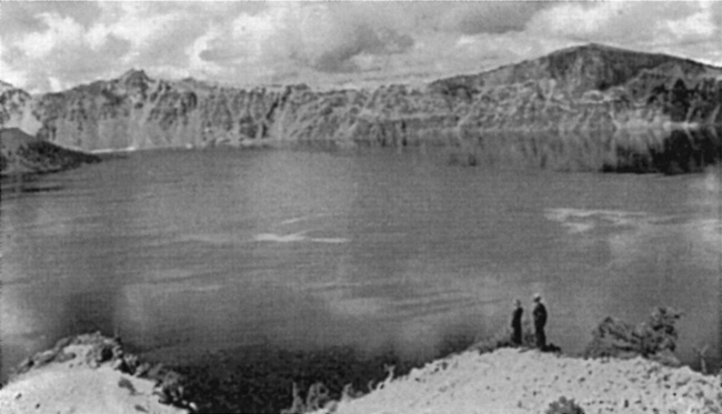
|
| Visitors on the Sentinel Point Trail, 1936. National Park Service photo by George Grant. |
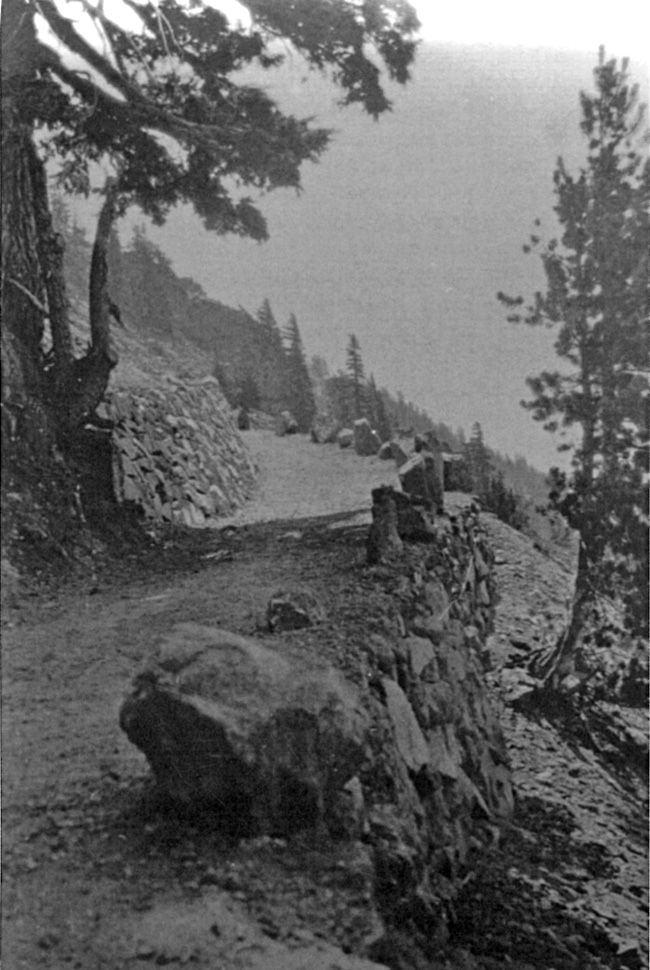
|
| Section of the Watchman Trail showing boulders as an edge treatment, 1932. National Park Service photo. |
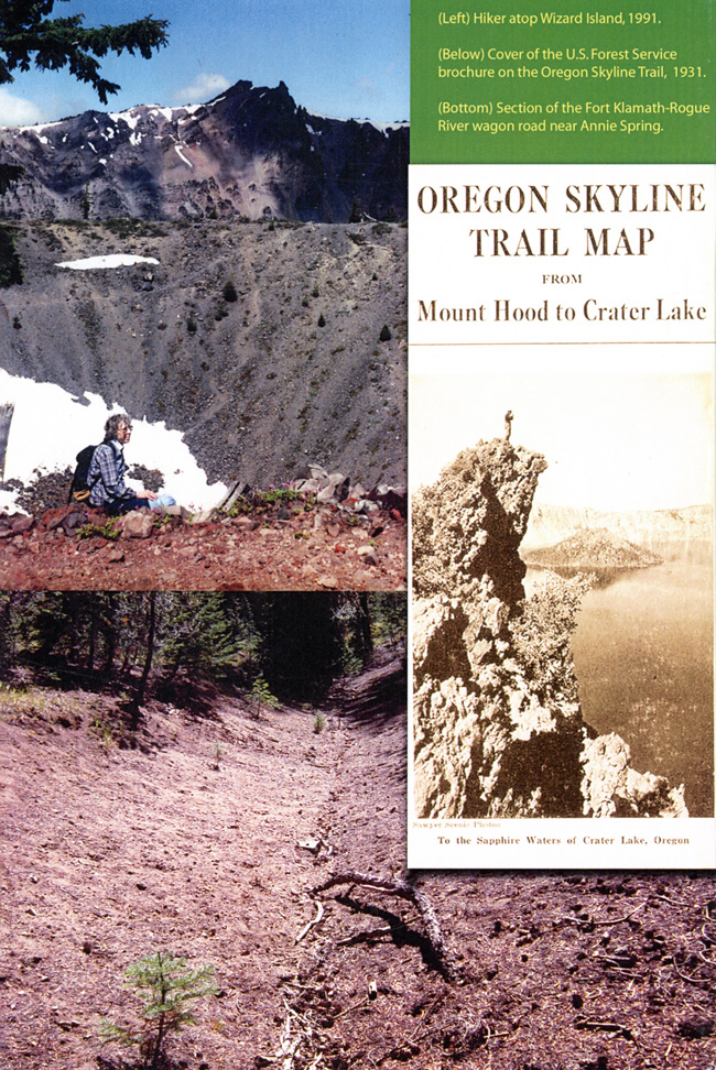
|
| (Left) Hiker atop Wizard Island, 1991; (Below) Cover of the U.S. Forest Service brochure on the Oregon Skyline Trail, 1931; (Bottom) Section o the Fort Klamath-Rogue River wagon road near Annie Spring. |
| <<< Previous | <<< Contents>>> | Next >>> |
crla/adhi/chap19.htm
Last Updated: 13-Aug-2010