|
Denali
A History of the Denali - Mount McKinley, Region, Alaska Historic Resource Study of Denali National Park and Preserve |

|
Chapter 3:
CHALLENGE OF THE MOUNTAIN
The dozen years that followed the Brooks Expedition would set the pieces of the frame for the Denali region's future. Three men—Judge James Wickersham, Charles Sheldon, and Harry Karstens—would emerge as the moving forces whose interaction would create the park-refuge idea, carry it through to legislative enactment, then pioneer the new park on the ground.
Wickersham made the first attempt to ascend the mountain, one year after Brooks had gazed along its precipitous slopes. In so doing, the judge launched a heroic chapter in mountaineering, peopled by literate adventurers whose exploration and climbing accounts make a fascinating history of truth, falsehood, controversy, and final summit achievement. In aggregate, their published descriptions made Mount McKinley and its game-rich forelands household symbols of the Alaskan wild.
|
| An early climbing party on Mount McKinley. Francis P. Farquhar Collection, UAF |
The placer mining claims that Wickersham's party staked in the Kantishna Hills, on the way to the mountain, created a minor gold rush that evolved into a long-term mining community whose hospitality and knowledge of the country would support and inform successive expeditions of mountaineers, hunters, and explorers.
The isolated miners of Kantishna and neighboring mining districts would seek government assistance to make their mining profitable and their lives more civilized. These demands contributed to government development of trail, mail, and rail services in the Denali region—the basic infrastructure that would in time provide access to Mount McKinley National Park.
The shared concerns of Charles Sheldon and Harry Karstens over the market hunting of Denali's game animals to supply mining camps and future railroad construction camps translated into the threat of wholesale slaughter of North America's premier wildlife assemblage. This threat, carried to Congress by Charles Sheldon and the cohort he led, motivated the legislators to create Mount McKinley National Park. Judge Wickersham—by then Alaska's Territorial Delegate to Congress—introduced the park bill. Karstens, with backing from Sheldon and Wickersham, became the pioneer superintendent of the new park-refuge.
Thus did the years 1903 through 1914 string the woof upon the loom: committed personalities, adventure and description, mining and hunting, definition of transportation needs and routes, the park-refuge idea. The warp would follow with Congressional action and early park development and access. Intervening history, from then until now, has been and continues to be woven on that same loom, with only variations of design.
In 1900 Federal Judge James Wickersham set up District Court in Eagle, Alaska, under the terms of Alaska's new Civil Code, which followed hard upon the Gold Rush. His judicial district covered more than half of Alaska, centering upon the vast Interior. Wickersham won appointment to the judgeship after effective work as lawyer and political campaigner in Tacoma, Washington. His judicial and political career in Alaska would span more than 30 years. He helped guide Alaska's transition from orphan outpost to full territorial status in 1912, and subsequently served several terms as Alaska's Delegate to Congress. [1]
With the Fairbanks gold discoveries and stampede of 1902, the population of Wickersham's district gravitated to the new bonanza on the Tanana, and so, too, did the judge. After organizing his court and Fairbanks' civil offices in Spring 1903, Wickersham considered what to do until his court convened in the fall. For him "...the most interesting object on the horizon was the massive dome that dominates the valleys of the Tanana, the Yukon, and the Kuskokwim—the monarch of North American mountains—Mount McKinley." [2]
After assembling four kindred spirits for the expedition, the judge set out for the mountain in May 1903. The party chose to approach as closely as possible by boat, thus pioneering steamboat access up the Kantishna River. [3] This route, down the Tanana and up the Kantishna to head of navigation, would be perfected with boat landings, trails, and supply points during the Kantishna gold rush of 1905, which was inspired by the Wickersham party's staking of placer claims.
Wickersham and his companions enjoyed their trip. His account sparkles with reflections on the virgin beauty of the land they had entered, well timbered, fertile—a valley scene that resembled the lower Mississippi more than the boreal Yukon drainage. Only the distant summits of the snowy range indicated their northern latitude. [4]
Along the river they found Tena (Tanana) Indians in traditional spring hunting camps in the neighborhood of the Toklat-Kantishna confluence. These people had left their winter villages on the lower Tanana in February, hauling their gear with dogs and toboggans. Foraging through the forests and foothills, they had taken moose and caribou, and now they hunted ducks migrating into the Kantishna's river-and-lake lowlands. The Indians shared their fresh meat and their knowledge of the landscape, pointing out the easiest route for the men and mules to the base of Mount McKinley—via Chitsia Creek, the lower birch-clad slopes of the Kantishna Hills (above the swamps and deep creeks), and the gap through those hills formed by Moose Creek and Wonder Lake.
Having off-loaded from their steamer, Tanana Chief, the men progressed with mules, backpacks, and a poling boat, Mudlark, which they had found and reconditioned near the mouth of the Kantishna. They encountered first one, then two more white trappers scouting the country for furbearers. The latter two had portaged from the Kuskokwim and after a year in the wilderness were en route to the Tanana trading posts with their furs. [5] Already the patterns of trade and transportation were being traced across a country unknown to white men just a few years earlier.
At the Telida Indian camp called Anotoktilon, near the mouth of Bearpaw River, Wickersham's party met Chief Sesui, rescuer of the Herron party. This band of hunters regularly pursued caribou and sheep on the plateau and in the headwater canyons below the Denali-McKinley massif. They gave detailed instructions for reaching the glaciers that descend from Denali's summit. They recommended that the poling boat be cached at this point for the trip across the foothills. [6]
The cross-country march took Wickersham and his companions past lakes alive with waterfowl and on to the flank of Chitsia Mountain, which they would climb for a magnificent view of the country. Chitsia or Heart Mountain (so-called because it is shaped like a moose heart) was a sacred place of the Tena Indians. During Wickersham's visit with them a few days earlier their blind shaman, Koonah, had told him of Yako, the Tena's origin hero. Yako had fathered the Tena people in the ancient past. He had magically created the Denali massif from giant sea waves sent to destroy him by Totson the Raven Chief. During a later struggle, Tebay the White Sheep Chief had climbed to his Chitsia Mountain lookout to direct the enemies of Yako to his village on the banks of the Yukon. There the treacherous warriors from the southern sea were vanquished by Yako and his children so the Tena could live in peace. [7]
From Tebay's lookout, Wickersham describes the scene:
The little peak stands in the forefront of the mountain mass, the descent to the valley is abrupt; the Toclat spreads out at its base on the eastern slope, and is in view from the mountains in the south to its confluence with the Kantishna. Far to the east we can see the bluffs at Chena, and beyond, Fairbanks; the Tanana and the Tolovana hills are in view across the northern horizon, while the Nuchusala hills in the west rise hardly to our level. Minchumina Lake lies to the westward and glistens like silver in the sunlight. The view continues far south of Minchumina to the massive McKinley range. We can trace the course of the Kuskokwim into the Bull Moose hills and the portage from Minchumina lake to that river. The valley view from the Tebay's aerie is a widespread panorama of forest, lake, and river, stretching from the distant eastern horizon around by north and west to the western flanks of Mount McKinley due south of us. This three-quarters of a circle is a wide, flat valley, carpeted with an evergreen forest, marked by rivers and dotted with lakes. The sun shone in glorious radiance over Yako's land, and we now understood and better appreciated the vivid description of it given to us by Koonah, the blind shaman of lowland Kantishna. [8]
In succeeding days the party hunted and jerked caribou, found colors and staked claims on Chitsia Creek (the first mining claims in the Kantishna district), passed through the Moose Creek-Wonder Lake gap, and crossed the bars and channels of McKinley River, its silt and gravel plucked by Muldrow Glacier from the high walls of the mountain that now hung over them. [9]
The mountaineers set up base camp on the lower reaches of Peters Glacier. Ascending its main course they aimed for the northwest buttress of McKinley's North Peak as their route to the top. Turned by a chaotic icefall, crevasses, and sheer cliffs where Peters Glacier plunges through narrowed walls, Wickersham bore left up smaller Jeffery Glacier, which, in the towering topography and obscuring walls, seemed to offer access to the ascent ridge. After hours of careful toil avoiding crevasses and gingerly crossing snow bridges,
. . . we reached an arete or sharp ridge of bare rock at the extreme upper end of the bench glacier, and found, to our intense disappointment, that the glacier did not connect with the high ridge we were seeking to reach, which yet seemed as far above us as when we began the ascent. We are now about 10,000 feet above sea-level on a sharp ridge of rock. Here our bench glacier roadway ends, for over this arete which juts out from the mountain wall, the descent is almost perpendicular to the great bergs of the main glacier, far below as they crowd over each other to enter the narrow gorge. Here is a tremendous precipice beyond which we cannot go. Our only line of further ascent would be to climb the vertical wall of the mountain at our left, and that is impossible. [10]
That vertical wall, now known as Wickersham Wall, rises 14,000 feet from Peters Glacier to McKinley's North Peak.
The Wickersham climb, and another attempt the same year by Frederick Cook, served well as reconnaissance ventures. They showed that Peters Glacier was a dead end, at least for the pioneer climbers. The way to the top in the early days of Mount McKinley mountaineering awaited discovery of the ridge-hidden Muldrow Glacier route.
Wickersham's party returned to civilization, by raft, boat, and steamboat after a glorious summer adventure. They had probed and mapped the approaches to the mountain. They had found traces of gold, and when they filed their claims at the Rampart recorder's office on the Yukon, they assured that others would come in force to the virgin lands of the Kantishna.
By 1903 Dr. Frederick A. Cook—a self-made man, medical doctor, and courageous member of four Arctic and Antarctic expeditions since 1901—had established impeccable credentials as an explorer. Among his admirers and former expedition colleagues were Robert E. Peary and Roald Amundsen of polar discovery fame.
Cook's 1903 attempt to climb Mount McKinley foundered in the maze of cliffs and drop-offs surrounding Peters Glacier and its upper basin, as had Wickersham's 2 months earlier. Cook and his companions managed to surmount the ice fall in the Peters Glacier canyon that had blocked the earlier party, and finally reached an elevation of about 11,000 feet on the North Peak's northwest buttress. From their highest camp, a hole chopped in a blue-ice precipice, the ridge
. . .led with an ever-increasing slope to a granite cliff which did not appear unclimbable from below. But at close range and in a good light we could see that farther progress . . . was impossible. There were successive cliffs for four thousand feet. [11]
Acknowledging defeat, the party cached its extra food and fuel to lighten packs, then dashed 29 miles to the face of Peters Glacier.
Despite the mountain's dominance Cook's expedition that year brought richly deserved acclaim as a feat of exploration. His was the first circumnavigation of the McKinley massif. Paralleling Brooks' 1902 route from Tyonek, across the range, then along its northwest slope—with the climbing interlude at Peters Glacier—Cook scouted the unexplored heights northeasterly of Muldrow Glacier. There he found a pass negotiable by the party's pack horses via the extreme headwaters and intervening glaciers of the Toklat and Chulitna rivers. Thence, after abandoning the horses, the party rafted down the main courses of the Chulitna and the Susitna to Susitna Station and eventually came back to Tyonek. [12]
Had Doctor Cook ended his Mount McKinley career with this 3-month, 1,000-mile trek—its northern pass-finding arc through unexplored mountains—he would have capped a remarkable saga of exploration. But the lure of the mountain and the glory he sought would lead him to make false claims 3 years later to the destruction of his reputation. [13]
Cook's expedition demonstrated the terrible toll of even approaching the isolated mountain, much less climbing it. Moreover, the narrow window imposed by subarctic seasons and weather nearly closed on Cook and his men as winter marched in step with them during their September dash across the range and down the Susitna.
Robert Dunn, a Harvard-educated journalist, accompanied Cook in 1903. Cook appointed him to a role best described as operational chief of the expedition, thus he labored and led the crew as a sweating participant, not as an observing reporter. Dunn's mentor, editor Lincoln Steffens, had charged him to write a completely truthful account of an exploring expedition—an expose of the rows, bickering, dissents, and demoralizations usually hidden behind the heroic prose of the exploring fraternity. [14]

|
| Route of the 1903 Cook Expedition. Robert Dunn, The Shamless Diary of an Explorer, 1907. |
The pages of Dunn's The Shameless Diary of an Explorer fulfilled that charge. They painted an ambivalent picture of Doctor Cook: sometimes hero, usually kind though often petulant, sometimes indecisive, on-again off-again as a leader and technically competent wilderness man. Dunn's descriptions of trail conditions, mishaps, and smoldering enmities amongst the party depict the attrition, physical and mental, of men and animals marooned except for their own unceasing labors in a wilderness beyond help of others.
First on the trail through the Skwentna River swamps:
By noon, it seemed that we'd been traveling a year, hewing down, down, stem by stem, among the iron-limbed alders. Winter snows flatten, toughen, bind, and bend them into tempered springs. You can't move an inch without an axe, or getting gouged in the face. And then to drive fourteen, exhausted, half-wild bronchos, stampeding, snorting, as you hear the whooping-screeching rip of canvas—see the cinches dangling from the brush! Oh, our hot oaths as we hunt and gather the packs, chopping a clear place to pack, fighting mosquitoes! And for every foot the beasts travel we cover forty, dashing forward to head them, unsnarl, drag from the mud.
..........
We reached a big crick paralleling the river. The banks were slewed and clogged with drift and willows. We were an hour crossing and ploughing through the quicksands, finding the lead for trail beyond....
..........
Cutting trail with me on the other side and piling brush to keep the beasts from jumping into the crick where it turned and gouged the bank, Jack suddenly lost his temper for no reason I could see, and hurled off his axe murderously into the brush. Then he snagged his eye, and sat down, quivering for ten minutes on the sand-bar, his head in his hands, so no one dared to speak to him. [15]
Next, a moment of inspiration on a highpoint overlooking Peters Glacier:
The dizzy unworldliness of it all was intensified, compressed by perspective. You seemed suspended in air, infinitely near, yet infinitely far from ice or rock wall. The sky overhead was blue-black. The haze had dissolved, leaving rainbow islands of cloud at succeeding spheres of the shadowy cut, casting down abnormal shadows, swift darknesses, blazing revelations. Think of it—this mile-wide trail [Peters Glacier], unknown miles long, hemmed by one wall a mile high, another three sheer miles, and so straight you can hit its base with a snowball, as you look up at its summit, the apex of North America. Somewhere a snow-slide thunders, a tiny white cloud of fuzz like the puff from ten thousand cannon blurs the wall, its whisper dies away into the pre-creative silence. [16]
Finally, the doubt before choosing the doubtful exit from their plight, across the range and down the Susitna:
We've been discussing how to get out of the country, for ice is beginning to rim the river slews at night. Twelve days' rafting down the Peters stream should bring us to Tanana river and a Yukon trading post. But northeast stretches mile on mile, white with 10,000-foot alps, and the flat avenues of the world's biggest inland glaciers, ramifying like the tentacles of a cuttle-fish this supreme American range. And it is all unmapped, undiscovered, bleak and shriveled under the breath of autumn. And south across these mountains, to the Sushitna River and Cook Inlet, the Government Survey report we read between chapters of our one and only Tom Sawyer, says with familiar triteness that it is "extremely doubtful" if any pass exists. [17]
One of the true heroes of McKinley mountaineering was Belmore Browne. He was a man for all seasons: lumberjack, explorer, artist, hunter, artful writer, scholar, and right arm to Charles Sheldon in the political struggles of the McKinley park movement. Except for a sudden storm at the last moment and final steps of a great climb in 1912, he would have been the first man to achieve McKinley's summit. His love of Alaska took him to its farthest reaches over many decades, beginning as an 8-year-old boy in 1888. His career mingled with that of Doctor Cook, as colleague, then as critic. Regretfully, Browne and his partner Herschel Parker, would prove the falsehood of Cook's claim to conquest of the mountain in 1906. [18]
Browne's three expeditions to Mount McKinley during the period 1906-1912 gave him profound understanding of the mountain's challenge—particularly in the pre-aircraft era of the pioneer climbs. His book, The Conquest of Mount McKinley (1913), captures the perspective of that era—picturing the great mountain barricaded by distance, labyrinthine terrain, and arctic weather from those tiny mortals who stood at its base and longed to reach its top.
He describes the mountain as ". . . a gigantic mass of granite that was forced upward through the stratum of slate that overlaid it." The slate survives on the lower peaks, giving them "a strange, black-capped appearance."
A principal difficulty for the mountaineer is the low altitude from which the mountain rises. The plateaus of South America and Tibet allow climbers to hike halfway up to the peaks they seek to climb. But ascent of McKinley begins near sea level. After 30 miles of difficult ice-and snow traverse on the glacial avenues that offer the only access through the gorges to the climbing heights—carrying all supplies in backpacks—the climber still looks up at 3 vertical miles of ice, snow, and forbidding cliffs, toward a peak still 10 or 12 miles distant, rimmed by sub-peaks and huge buttresses, which in themselves are major challenges, and beyond which (in those foot-slogging days without aerial reconnaissance) lie unseen gorges and ridges that may foil the climber's planned route. Even on the glacier approach polar equipment is mandatory, and the time required for the climb and weather delays demands mountains of supplies. All this just to climb the mountain. Getting to the mountain, geographically placed "in the most inaccessible position obtainable," was the other half of the struggle. [19] Until the Alaska Railroad was completed in 1923 and glacier piloting began in 1932, approach logistics consumed such prodigious energies and supplies that many expeditions were whipped before they started the ascent.
With such depletions in mind, the mountain's other challenges, beyond technical mountaineering, came to the fore: perennial arctic conditions above 10,000 feet-constant cold at subzero temperatures; sudden storms, blinding snow, hurricane winds, causing wind-chill factors well below minus 100 degrees; tents and equipment ripped, lost, buried; trails laboriously broken, then erased by drifts, to be found and broken again by people breathing and pumping like hummingbirds, counting to ten between each step; climbers exhausted, disabled or dying from altitude sickness or hypothermia; the loss of a mitt or a wet sock the difference between life and death. All of this beyond avalanches, falls, crevasse disappearances, and the terrible toil of simply moving upward in air nearly devoid of oxygen. These hazards still obtain, as the mountain's constantly growing death toll demonstrates and despite modern improvements of aircraft and high-tech mountaineering, medical, and rescue operations. That the pioneer climbers incrementally discovered the way up, made their ascents, and came back to tell their stories is a testimonial to grit, frontier improvisation, and luck. [20]
Terris Moore's history of the pioneer climbs cites 11 distinct mountaineering expeditions, beginning with Wickersham's, leading to the first completely successful ascent of Mount McKinley in 1913. Only highlights of the balance of these efforts can be presented in the context of this regional history.
Doctor Cook returned to Mount McKinley in 1906 in company with Herschel C. Parker, professor of physics at Columbia University, and Belmore Browne, artist, among others. This expedition resulted in a valuable reconnaissance and mapping of the southern approaches to the mountain. The party used a pack train and a motor launch to investigate the Susitna's tributaries and their heading glaciers on McKinley's south flank. After 2 months of intense work without finding a route to the top, the party returned to Cook Inlet, and its members went their separate ways. Doctor Cook remained in the vicinity, and in early September with horse-packer Robert Barrill made . . . A LAST DESPERATE ATTEMPT ON MOUNT MCKINLEY," [21] as Cook phrased it in a dramatic telegram to Eastern backers. His subsequent claim that he had dashed to the top and back in less than 2 weeks via Ruth Glacier inspired instant skepticism amongst those familiar with the country, including Parker and Browne. What came to be known as the Fake Ascent spawned a controversy between Cook loyalists and mountaineering detectives that even now sputters on, despite overwhelming evidence that Cook lied.
Browne's The Conquest of Mount McKinley recounts his and Professor Parker's sleuthing that identified a rock pinnacle in a side basin halfway up Ruth Glacier as the site of Cook's famous "summit" photograph. This point is about 5,300 feet above the sea and some 19 miles from McKinley's summit on a straight line. Cook trapped himself with his own photography in a preliminary article and in his later book, To the Top of the Continent. The book's unretouched summit photo, which shows a back ground peak (not shown in the retouched article photo), plus contextual photos of the side basin (claimed by Cook to be thousands of feet above its actual elevation) allowed Parker and Browne to pinpoint the rock pinnacle on the ground in 1910. Barrill, sworn to silence by Cook, later revealed the hoax in an affidavit, stating that Cook had dictated false entries for Barrill's diary. Brad Washburn assembled and critiqued all available evidence, including his own ground proofing, in his 1958 American Alpine Journal article, "Doctor Cook and Mount McKinley." Despite frost-action crumbling of the rotten rock pinnacle, which had altered its profile as shown in Cook's photos, the photos in Washburn's article show key remaining features of the pinnacle, and the tale-tale background mountain in a comparative photo essay. It was the "fingerprint" of this mountain (as Browne said, "No man can lie topographically") that had guided Parker and Browne to the pinnacle in 1910. Aside from all this physical evidence, the timetables, distances, logistics, and the route to the top described and mapped by Doctor Cook seemed immediately and were later proved incredible. After their own experiences with Cook earlier that summer of 1906, probing up the great tendril glaciers of McKinley's weather flank, Parker and Browne could not buy the 12-day up-and-back story from their first hearing of it.
As the Mount McKinley controversy grew riper, Doctor Cook threw another bombshell. In 1908 he claimed to have reached the North Pole, beating his former leader Robert Peary to the prize. This claim was immediately challenged by Peary and others, and another controversy erupted. This claim too was later disproved.
The combination of claims, suspicions, and rebuttals finally impelled the Explorers Club to call Doctor Cook before a committee of peers to clear himself. He refused to testify and disappeared. The Explorers Club, of which Doctor Cook had been president, expelled him in late 1909. He was also dropped from the rolls of the American Alpine Club and various geographical and learned societies.
Then followed several mountaineering expeditions to Mount McKinley in 1910, both to attempt the ascent and to test Cook's claims. Two of these came back with authoritative evidence. Parker and Browne led the Explorers Club-American Geographical Society party that discovered the false peak. The distinguished experts who made up this expedition had been charged to find solid proof one way or the other respecting Cook's claim to have climbed the mountain. For the Cook controversies—both McKinley and North Pole—had turned ugly. The public suspected that Cook, their popular hero, was the victim of individual and institutional jealousies. Reputations were at stake—including those of such eminent third parties as Charles Sheldon and Alfred Hulse Brooks. who had contributed technical appendices to Cook's book, thereby implicitly endorsing his claims.
On the approach to Ruth Glacier in 1910, Parker and Browne encountered C.E. Rusk leader of the Portland, Oregon Mazama Mountaineering Club expedition. The Mazamas wanted to track Cook's route as described in his writings and on his 1907 map. In this way they would assess his claims on the ground. Their sympathies lay with Cook but objectivity was their guide. The two expeditions joined in the quest for truth but proceeded separately. Weeks of hard hiking and glacier hazards, encumbered with polar equipment and supplies, brought the Mazamas up Ruth Glacier's vast trench to its great amphitheater and upper branches. At this point Rusk and his companions saw that Cook's map was the product of his imagination, for it matched in no way the actual scene before them. Cook had described a valley glacier route giving access northward to Muldrow Glacier, and thence to the top. A maze of mountains and glacial box canyons enclosed by cliffs greeted the Mazamas. Rusk would later close his meticulous report with this sad statement: [22]
Dr. Cook had many admirers who would have rejoiced to see his claims vindicated, and I too would have been glad to add my mite in clearing his name. But it could not be. Of his courage and resolution there can be no doubt. He is described as absolutely fearless. He is also considered as always willing to do his share and as an-all-around good fellow to be out with. His explorations around Mount McKinley were extensive. They were of interest and value to the world. Had he persevered, he doubtless would have reached the summit on some future expedition. He was the first to demonstrate the possibility of launch navigation up the Susitna and Chulitna Rivers. And that one trip alone—when with a single companion he braved the awful solitude of Ruth Glacier and penetrated the wild, crag-guarded region near the foot of McKinley—should have made him famous. But as we gazed upon the forbidding crags of the great mountain from far up the Ruth Glacier at the point of (Cook's and Barrill's) farthest advance and realized that it would require perhaps weeks or months more in which to explore a route to the summit, we realized how utterly impossible and absurd was the story of this man who, carrying a single pack, claims to have started from the Tokositna on the eighth of September, and to have stood on the highest point of McKinley on the sixteenth of the month. The man does not live who can perform such a feat. Let us draw the mantle of charity around him and believe, if we can, that there is a thread of insanity running through the woof of his brilliant mind... If he is not mentally imbalanced, he is entitled to the pity of mankind. If he is not, there is no corner of the earth where he can hide from his past.
In mountaineering circles, the Cook controversy generated a mythos and a literature similar to the Custeriana that followed and still follows the Battle of the Little Bighorn. [23] But this study must move on, drawing once more the mantle of charity over a man whose genuine exploits and deserved reputation dissolved in falsehoods meant to enhance them.
The Kantishna gold rush of 1905 had come and gone by the time Doctor Cook's summit story hit the papers in 1906. Of the thousands who had followed Judge Wickersham to the Kantishna Hills only about 50 hard-core prospectors and miners remained, centered on the streams flowing into Moose Creek. These men were seasoned veterans who had taken over the best claims and were prepared for years of mine-development toil. Easy surface gold had been quickly exhausted; illusions of quick riches and those who held them had departed.
On the fringes of the isolated mining camps that year of 1906 roamed two other men important to this history, Harry Karstens and Charles Sheldon. Karstens was a bona fide Sourdough: Klondike stampeder, Seventymile River miner and cofounder of the nearby town of Eagle on the upper Yukon, and, lately, dog-team mail driver for the Kantishna camps. Sheldon himself was no stranger to Alaska and the Yukon country. A man of independent wealth, this distinguished member of the Eastern establishment combined the joy of the hunt with the pursuit of scientific knowledge and the collection of specimens for the scientific and museum communities. His special interest in the various species of the North American mountain sheep had drawn him northward from Mexico, through the Rockies, and on to British Columbia. Now he sought definitive knowledge of the life history of Alaska's white sheep, Ovis dali. After extended tracking of these sheep along the Alaskan-Canadian borderlands, he came to the Denali region in the summer of 1906, accompanied by Harry Karstens. Of his guide and friend Sheldon stated:
. . .I recall no better fortune than that which befell me when Harry Karstens was engaged as assistant packer. . . . He is a tall, stalwart man, well poised, frank, and strictly honorable. One of the best dog drivers in the north, and peculiarly fitted by youth and experience for explorations in little-known regions, he proved a most efficient and congenial companion. [24]
For this cast now assembled on the north side of Denali's vast stage, the mountain and its approaches became a matter of daily experience. On clear days the miners, aware of the Wickersham and Cook climbing attempts, glassed the peak from highpoints in the Kantishna Hills. They speculated on the lay of the land and from their various observation points spotted glacial trenches and bordering ridges that might lead through the topographical maze toward the domed summit. From the Toklat area they saw that an upper basin sloped down from the top of the mountain.
During Sheldon's 1906-08 rambles on the piedmont plateau and foothills bordering the mountain massif, he had traced the lower course of Muldrow Glacier. He also spotted the icefall and ridges that led to the upper basin just below McKinley's two peaks. Sheldon became acquainted with miners Tom Lloyd and his partners, whose mining claims on a high ridge above Lloyd's cabin at the head of Glen Creek offered unexcelled views of Mount McKinley. From that ridge one day in January 1908, Sheldon and Lloyd viewed the mountain and Sheldon told of its double summit, North Peak and South Peak, and of the high glacier and icefalls descending from the basin between them. Sheldon believed that one of the ridges alongside that high glacier would give access to the top, as indeed one would 2 years later. As yet, no one knew the entire winding course of Muldrow Glacier—hidden by intervening ridges and mountains—which would soon serve as the broad avenue leading to the upper elevations and the peaks. [25]
The miners of Kantishna and their friends in Fairbanks shared in the skepticism bred by Doctor Cook's tale of whirlwind ascent. They knew the scale of the mountain. They believed that Alaskans, hardy men like themselves, should be the fittest and the first to scale McKinley's heights, not Outsiders who visited for a summer. The challenge galvanized Fairbanks. Backers and bettors urged the project along. Thus outfitted and assured prizes and glory, Tom Lloyd and his partners—Charley McGonagall, Billy Taylor, and Pete Anderson—left Fairbanks with dogs, horses, and a mule in late December 1909, en route to Denali's north flank. By early March 1910, after supply relays, establishment of a base camp at timberline near one of A.H. Brooks' old camps, and discovery of Glacier (now McGonagall) Pass, which accessed middle Muldrow Glacier, the reach for higher elevations began. Intermediate camps along the glacier led to the Sourdoughs' highest camp near the head of Muldrow at 11,000 feet. This was the highest point reached by the overweight Lloyd. But the three younger and stronger men-McGonagall, Anderson, and Taylor-set out for the top early on April 3 hauling a 14-foot-long spruce pole and a flag, which, emplanted on the peak, would prove their conquest. They pioneered the route via Karstens Ridge around the Harper Icefall to the upper basin, then struggled up Sourdough Gully to Pioneer Ridge. Somewhere around 18,000 or 19,000 feet the older McGonagall dropped out. His job was to get the pole within striking distance. He did that, and there was no reason to go any further, he later stated, because Pete and Billy were skookum and didn't need any more help from him. So Anderson and Taylor went up the last hard ridge and planted their flag in a rock outcrop just below the North Peak summit.

|
| Members of the 1909-1910 Sourdough Expedition were (left to right): Charley McGonagall, Pete Anderson, Tom Lloyd (seated), and Billy Taylor. Francis P. Farquhar Collection, UAF |
According to later interview accounts from Taylor and McGonagall, their objective was to place the flag where it might be seen by telescope from Fairbanks. As they saw it, the peaks looked about the same height, but the South Peak could not be seen from Fairbanks.
Both contemporary and modern climbers have viewed with awe the amazing accomplishment of the Sourdoughs. Starting from their 11,000-foot camp, the 18-hour ascent and return, during which the pioneers negotiated some 8,500 feet of vertical rise over a route they discovered as they climbed, would tax the best climbers of any age. These miners were novice mountaineers with rudimentary, improvised equipment, wearing bib overalls, longjohns, and unlined parkas, and carrying a bag of doughnuts and a thermos of hot chocolate for provisions. But they were tough (as well as very lucky with the weather) and they proved the point that real Alaskans could climb that mountain if they set their minds to it. Aside from the sheer physical prowess of the Sourdoughs, the route they pioneered through McGonagall Pass, up the Muldrow, and around Harper Icefall via Karstens Ridge stood for more than 40 years as the only climbing route to McKinley's summit. Unfortunately Lloyd—first to return to Fair banks—would claim that all four Sourdoughs reached the top. This tale clouded the party's real achievement, briefly relegating it to another Cook-like fantasy. But 3 years later the Karstens-Stuck party sighted the flagpole, and later interviews with Billy Taylor and Charley McGonagall distilled the truth from Lloyd's fictions. [26]
The Parker-Browne expedition of 1912 was the first serious and technically competent effort by skilled alpinists to climb Mount McKinley. From their previous experiences—on the south flank with Cook in 1906 and in the east-side Ruth Glacier maze in 1910—plus their awareness of the 1903 failures on the western side, Parker and Browne were convinced that the northern approach via Muldrow Glacier offered the best chance for success. Moreover, knowing the scale of the country and the time required to complete logistical preparations for a serious assault, they determined on a winter approach march. They would in effect, two-stage their expedition: first, the long march from the coast, with establishment of a base camp on the piedmont plateau, then the climb itself.
Wishing to explore the Alaska Range northwest of McKinley, Parker and Browne set their course in late January from the port of Seward to Susitna Station via Knik arm. Continuing their mushing with dog teams they ascended the Susitna Valley and followed up the Chulitna River to the then unnamed Ohio Creek. At its head they crossed the range over glaciers and icefields, and finally, after 17 days on the ice, debouched at the lower curve of Muldrow Glacier. Thence they proceeded down Muldrow and cross-country to Clearwater Creek. In late April they established base camp on Cache Creek within easy reach of McGonagall Pass.
Though the Sourdoughs had come this same way, Browne did not know their precise route. His intensive study of McKinley's northeastern face set the climbing route and the approach to higher elevations. His probes through the blocking foothills led him up Cache Creek and to rediscovery of the pass onto Muldrow Glacier first found by McGonagall in 1910. There, at its midcourse, he tied the Muldrow together from its terminal moraine to the cliffs at its head, under the overhanging Harper Icefall. From various highpoints in the foothills he saw the advantages of yet unnamed Karstens Ridge as the route around that icefall and up into the big basin under the towering peaks. No better example of the logic of terrain could be found than Browne's independent rediscovery of the Sourdough route.
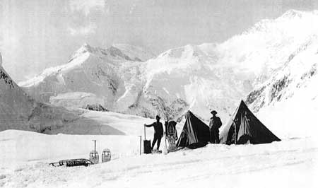
Almost immediately Browne and Parker, aided by Merl La Voy of Seattle, began supply relays with the dogs up Muldrow Glacier. At its head they cached their goods in a tarped and anchored sled at 11,000 feet, near the notch that gave access to Karstens Ridge. By May 8 they were back at base camp, which was run by the fourth, non-climbing member of the party, Arthur Aten of Valdez, Alaska. Then followed several weeks of rest, hunting, and equipment tending as the Denali spring changed the lower elevations into a paradise of flowered meadows, singing birds, and wandering game animals.
Except for a knee injury suffered earlier by La Voy, the three-man party started the big climb on June 5 in good shape. Their equipment was of the best alpine sort, and a balanced menu—based on energy-rich pemmican with a high-fat content—promised good strength to counter the effects of altitude and cold.
The attrition began early with a heavy snowstorm that trapped them on Muldrow for 3 days. Then they waited for avalanches to unload the snow-packed heights before threading the icefall narrows near Muldrow's head. After the excess snow had fallen they went on up to 11,000 feet, finding their sled-cache buried but intact, then climbed up on Karstens Ridge. In a series of exhausting advances and supply relays through deep snow they set up camps and snow shelters every 1,500 to 2,000 feet until reaching their final camp in the big basin at 16,500 feet. Throughout the advance La Voy's knee, reinjured in a crevasse fall, gave him trouble. Browne did double duty in the relay packing, hauling the heavy loads, and in breaking trail. The soft snow tripled their toil, and cold and altitude began sapping the men's energies. Sixty degree slopes overhanging drops of 2,000 to 5,000 feet demanded tight-wire concentration, not aided in the least by bouts of snow blindness and wind squalls that struck laden packers without warning. Slow progress through the snow forced more food relays from a cache nearly a mile below their upper camp. Then the source of their energy, the fatty pemmican, failed them. Beginning at 11,000 feet, the men began getting sick when they ate the pemmican. As they got higher their bodies absolutely refused to metabolize the fat, which became, in effect, a poison. Thus, just as they got set for the final climb, they were reduced to a starvation diet of tea, sugar, raisins, and hardtack. This snack fuel gave little heat and energy. So the daily rebound from toil and cold expected of solid food could not occur. As the climbers weakened under cumulative attrition, normal sleep became impossible, further eroding energies and resistance to cold.
On June 27 Browne and his companions set up their final camp in the big basin. Their frigid hollow grew colder as congealed air flowed down from the upper icefields. To gather themselves they rested for one day in the tent, avoiding exposure and chill, and their spirits came back.
This was the third time that Parker and Browne had tried to climb this mountain. Now, poised at the base of the last big ridge leading toward the shoulder that marked final access to the summit, they could almost see their goal about 3,500 feet above.
Next morning, June 29, they felt good and the weather was clear. The sun began to moderate the stabbing cold. Browne noted in his diary, "There is nothing to stop us except a storm." [27] Leaving camp at 6 a.m. the climbers progressed almost as planned, though they could not meet their goal of 500 feet elevation gain each hour. Then in the lee of the ridge they hit soft snow, further slowing their pace. At nearly 19,000 feet they topped the big ridge and took a break at the base of the last slope to the summit. Browne describes the scene:
We had long dreamed of this moment, because, for the first time, we were able to look down into our [Ruth Glacier] battle-ground of 1910, and see all the glaciers and peaks that we had hobnobbed with in the "old days." But the views looking north-eastward along the Alaskan Range were even more magnificent. We could see the great wilderness of peaks and glaciers spread out below us like a map. On the northern side of the range there was not one cloud; the icy mountains blended into the rolling foothills which in turn melted into the dim blue of the timbered lowlands, that rolled away to the north, growing bluer and bluer until they were lost at the edge of the world. On the humid south side, a sea of clouds was rolling against the main range like surf on a rocky shore. The clouds rose as we watched. At one point a cloud would break through between two guarding peaks; beyond, a second serpentine mass would creep northward along a glacier gap in the range; soon every pass was filled with cloud battalions that joined forces on the northern side, and swept downward like a triumphant army over the northern foothills. It was a striking and impressive illustration of the war the elements are constantly waging along the Alaskan Range. [28]
Above them the way to the summit, whose edge they could plainly see, . . . rose as innocently as a snow-covered tennis court and as we looked it over we grinned with relief—we knew the peak was ours." [29]
But just then the wind picked up and the sky darkened. The storm advancing from the south had found the final heights. In minutes a snow-laden gale enveloped the chambers. Visibility decreased as the blizzard gained force, but if they kept going uphill they must reach the summit. Forced to chop steps on the steeper slopes, their hands began to freeze and blowing ice particles blinded them. Cold now gripped their bodies entire, and they lost time desperately stomping and moving their extremities to keep feeling and life in them. Finally they emerged from a partially sheltering lee for the last few feet of ascent to the summit. In the full force of the wind they felt life ebbing. Browne, in the lead, was less than 200 feet below the summit elevation and only about 200 yards distant from it. At this farthest point of advance he realized that it would be suicidal to proceed. It had taken him several minutes to move only a few feet during his last upward exertions—blind, buffeted, and in places simply hunched in place as the hurricane battered him to a standstill. He turned back to La Voy and Parker and they huddled for a moment in a quickly chopped seat in the ice. But they could feel themselves freezing as they yelled against the wind. Browne screamed, "The game's up; we've got to get down." [30] Professor Parker wanted to go on, volunteering to chop the last steps. But the danger from freezing was now compounded by the packing snow filling their chopped steps and the wind erasing all signs of the trail back to their camp.
Slowly they retreated feeling their way and using the wind to guide them. Had it shifted they would have perished. By great good fortune they found the rocky spine of the ridge bounding the basin. Guided and sheltered by this line of rocks, they struggled to their tent.
Browne had got to the mountain top, halfway between the 20,125-foot summit shoulder and the true summit at 20,320 feet, but not to the very top of the mountain. Indeed, as he lamented, it had been a cruel and heartbreaking day.
Next day they rested and dosed themselves with boracic acid for snow blindness. They packed their rebellious stomachs with as much hardtack and raisins as they could stand. With great difficulty they dried out the frost particles that had penetrated every part of their clothing. Then they tried one more time. Leaving at 3 a.m. they got to the base of the final dome and began its ascent. Again they raced a rising storm. After an hour of vicious wind and blinding snow, they turned and stumbled wordlessly back to their tent. Browne remembered ". . . only a feeling of weakness and dumb despair; we had burned up and lived off our own tissue until we didn't care much what happened!" [31]
After a quick descent with its full share of obstacles and adventures the weary climbers reached their base camp where the faithful Aten awaited them. Rest, food, and recuperation followed. But even in this verdant resort, after a month on the mountain's ice and snow, Alaska's extremes tracked them down. The evening of July 6 grew ominous with heavy air and a sickly green sky. Then a great earthquake struck. The Alaska Range boomed and bellowed, then disappeared into snowy mists as avalanches and icefalls jolted from its cliffs and slopes. Fierce, debris-laden winds swept down from the mountains. The very ground they stood on heaved, split and slid. Streams crested with thick brown water from earth slides.
Later they learned of the great Katmai volcanic eruption on the Alaska Peninsula hundreds of miles to the south, of which this earthquake was an aftermath. Brad Washburn notes that had the pemmican not failed the Parker-Browne party they would have waited out the storms for another summit attempt. High on the unstable mountain ice they would have died without a trace in the earthquake's chaos. [32] (One year later, the Karstens-Stuck expedition would struggle though the vast debris of giant iceblocks that had tumbled from the mountain.)
For 36 hours the aftershocks persisted. Then the Parker-Browne party headed north, via the Kantishna mining camps, to the Yukon and home. [33]
The mountaineering match-up of Sourdough Harry Karstens and Alaska's Episcopal Archdeacon Hudson Stuck produced both tensions and victory. It was an inevitable pairing in Alaska's small and interlocked community. Karstens' exploits of exploration and dog driving, and his 1906-08 expeditions with Charles Sheldon in the Denali country, made him a natural choice for pioneering co-leader when the eminent missionary set his sights on Denali's peak.
In 1904, shortly after coming into the country, Stuck first glimpsed Denali, whose Indian name he always preferred. Smitten with the mountain's beauty and its dominance over the Alaska Range, he determined that one day he would at least stand upon its foothills or ascend its flanks. In time, as Doctor Cook's fraudulent claims and the doubts spawned by Tom Lloyd's overblown story demeaned the mountain's majesty, Stuck vowed to climb it himself. The near success of Parker and Browne in 1912 spurred him on. He believed that starting from Fairbanks—instead of from the coast as they had—he could be successful.
As a traveling missionary through Alaska's Interior and Arctic regions, Hudson Stuck was no stranger to the "strenuous life" that was the ideal of the times. He sledded and boated from village to village establishing missions and schools, and performing annual visits to the more isolated camps of his scattered Native adherents. He admired Native culture and their competence on the land, often clashing with superiors who would divorce Native peoples from their land-based way of life. He had emigrated from England in search of adventure. After divinity school he sought missionary challenge. He found both in Alaska. [34]
An enthusiastic but amateur mountaineer (with experience in the Rockies and Cascades, and a few days climbing in the Alps), he knew that he needed a partner who could lead ". . . . in the face of difficulty and danger." [35] Karstens, a fellow Episcopalian in Fairbanks, fit the bill. [36] Karstens and Sourdough climber Charley McGonagall had once partnered in mail driving and they had worked claims together during the Kantishna gold rush. When Karstens later explored Denali with Charles Sheldon they had jointly studied the access ridge, later to bear Karstens' name, and agreed that it was the key to higher elevations. They even talked of climbing the mountain together. But, to Karstens' everlasting regret, Sheldon returned to the States and marriage, and never came back to Alaska. Stuck knew of the McGonagall-Karstens partnership and their shared knowledge of the route to the top. So it was that the Karstens-Stuck climbing expedition took shape. [37]
As finally assembled, the climbing party comprised the Archdeacon and Karstens as co-leaders (the former as organizer and cook, the latter as trail and climbing leader); robust Walter Harper, Stuck's 21-year-old aide and traveling companion, son of Yukon-Tanana explorer Arthur Harper and an Indian mother; and another able youth, Robert Tatum, a theology student whose recent services to the Episcopal missions included a heroic dog-team supply run to succor isolated mission women on the upper Tanana.
After many delays and frustrations, including non-arrival of previously ordered technical climbing gear—which forced Karstens to improvise critical equipment—the party left Fairbanks in mid-March 1913 by dog team. At the Nenana mission they picked up two teenage Indian lads Esaias and Johnny Fredson, along with another dog team. These young students at the mission school proved invaluable assistants, both of them helping in the supply relays up Muldrow Glacier before Esaias had to return to Nenana, and Johnny remaining as the lonesome base-camp and dog-team keeper during the month-long absence of the climbing party.
Following established trails to the Kantishna mining camps (where final consultations with Sourdough climbers took place), the party broke trail past Wonder Lake, crossed McKinley River, and, on April 4, set up a wood-cutting camp at the last good spruce stand up Clearwater Creek. While wood was being gathered, Karstens went ahead and located the base camp at the forks of Cache Creek, just below McGonagall Pass. After transfer of the wood fuel up Cache Creek and preparation of rich mountain rations from caribou meat and marrow, the company began trailbreaking and supply relays up Muldrow Glacier on April 16.
The success of this pioneering expedition would be based on Karstens' pioneering experience and never-say-die toughness; on the shared knowledge of route and climbing conditions provided by his Sourdough-climb friends as well as Belmore Browne's recently published magazine account; and on the foresight, determination, and improvisational abilities of its members. Native foods in ample supply, locally hunted and processed for mountain transport, plus plenty of fuel and good bedding assured energy-rich nutrition and sleeping comfort throughout a long and storm-assaulted climb. Improved snow-goggles saved them from painful blindness. The climbers were mentally in the struggle for the duration, and they had the physical means to preserve their strength for the final push at high altitude.
Their way was not easy. Because this was no quick dash to the top (they knew they could not count on the Sourdoughs' luck with the weather), the immense physical labor required to assemble and transport equipment, supplies, and wood-fuel (the latter to the 11,000-foot camp) took its toll even in rare good weather. In the prevailing storms these labors were doubled. Storm-bound days confined to camp sapped will and gave rein to frustration. In these conditions even the best of friends get testy. Karstens and Stuck, because of temperament and style clashes, were hardly the best of friends.
Then there was the fire at their Muldrow camp: tents, socks, mitts, food destroyed or damaged. The devastation shook them. The expedition, so well prepared, faced defeat, victim of a stray spark and whipping winds. But Karstens said "Forget it," and the party improvised, making tents from sled covers, socks from Stuck's camel-hair sleeping bag liner, and so on. At one point, with the men sitting around sewing, the camp looked like a sweat shop. Deprived of such luxuries as sugar, powdered milk, and dried fruit—all burned—they still had the basics and they forged on.
Next they took on the access ridge, Karstens Ridge as named by Stuck. The steep and sheer, yet practicable pathway described by Belmore Browne was no more. Rising above them was a primordial shambles. Fringing the 3,000-foot high Harper Icefall, the ridge connected to the high basin formed by Harper Glacier. There was no other way to the final heights. They stared at the shattered ridge in disbelief, even as it dawned on them that the 1912 earthquake had created this chaos. They saw great blocks of ice, bigger than buildings, some the size of city blocks. They leaned, balanced, and honey combed on each other on a thin ridge that fell more than 1,000 feet to Muldrow Glacier and 3,000 feet to its eastern branch, the Traleika.
For 3 weeks, as storms allowed, Karstens and Harper spent most of their time probing through this jumbled nightmare and chopping steps—3 miles of them—out of the concrete-like ice. They avoided the nearly sheer flanking slopes as much as possible, for avalanche danger was great, and the overhanging, unconsolidated blocks of ice balanced in defiance of gravity. In his diary Karstens noted that some of the blocks would fall if someone whispered at them. Stuck and Tatum began supply relays with backpacks as soon as the icy staircase reached flat spots where goods could be cached.
Finally, at 15,000 feet they passed beyond the ridge into the basin, above which rose Denali's great peaks. On June 3, at mid-point on Harper Glacier, Walter Harper spotted the Sourdoughs' flagpole on the North Peak. With the glasses everyone saw it, thus confirming the Taylor-Anderson ascent and McGonagall's hauling of the pole to nearly 19,000 feet.
In deliberate stages the men now advanced from camp to camp, always getting higher and closer to the South Peak. Their last camp at 17,500 feet—almost directly below Denali Pass between the peaks—put them about 1,000 feet higher for the final assault than Parker-Browne had been the year before. This was a critical advantage for 50- year-old Hudson Stuck, who was feeling the altitude much more than the youthful Harper and Tatum and the mid-thirties Karstens. At that they still had nearly 3,000 feet to go vertically. But with all hands reasonably healthy, plenty of food, good bedding, and ample gas fuel for their stove, their objective was attainable.
Next morning, Saturday June 7, came on clear and cold, good weather for the climb. But except for Walter Harper, the men were suffering. For dinner the night before Harper had cooked noodles to thicken the caribou stew; at such altitude and lacking baking powder—also burned—the noodles were a half-done mess that wreaked havoc upon all digestive systems except the chef's. This, plus the last few day's extreme efforts at high altitude and excitement over the next day's climb, had made sleep impossible. Alone with his thoughts in the early hours, huddled over the gas stove, Stuck had stared at failure. All but Walter looked upon the new day with bad stomachs and wracking headaches. Karstens would have stayed in bed except that this was the day of the climb.
After a very light breakfast Karstens assigned the lead to the sturdy Walter, and at 4 a.m., with sun shining, a keen wind, and the thermometer marking minus 4 degrees F., the sorry company followed the indomitable young Indian toward the utmost heights. They carried lunch and scientific-instrument packs only. First they traversed the snow ridge that rose above their camp, then headed toward the final rises that still hid the summit. It was step by gasping step in bitter cold, which, aided by the wind pierced their layered clothing and numbed their heavily clad hands and feet. Stuck relates that Karstens beat his freezing feet so violently against the packed snow that two of his nails later dropped off. On the margin between life and terrible damage or death by freezing, they pushed on. Behind a ridge, partially sheltered from the wind, the ascending sun gave a little warmth. Lunch and a thermos of hot tea helped.
As confidence grew, however, so did altitude. Hudson Stuck's oxygen deficiency nearly overcame him several times. He would black-out, then rest and recover. Walter Harper relieved him of the bulky mercurial barometer that Stuck had insisted on carrying.
At last, with Harper still in the lead and the first man there to stand, they got to the very top. Stuck, on the verge of unconsciousness had to be braced the last few steps by his companions.
After a few moments of recovery the climbers shook hands and gave thanks to an Almighty who seemed very near on this high place. Then the party set up the little instrument tent and began their measurements—temperature, altitude, and others. From later expert calculations of their readings, the mountain's altitude averaged out at 20,700 feet. One of the experts, U.S. Geological Survey topographer C.E. Giffin, figured 20,374 feet above sea level, closest to the true 20,320. [38] (A 1909 Coast and Geodetic Survey observation had placed the altitude at 20,300, only 20 feet off the mark.) [39]
Finally, finished with the obligatory science, the men posed for photographs, which ended up double-exposed due to cold-numbed fingers. Then they looked about them.
Stuck gave thanks for a perfectly clear day in all directions—a rarity that the churchman could attribute only to God's design on the very day of their climb. In this providential moment Hudson Stuck touched the sublime in what he saw and how he described it:
Immediately before us, in the direction in which we had climbed, lay—nothing: a void, a sheer gulf many thousands of feet deep, and one shrank back instinctively from the little parapet of the [summit] snow basin when one had glanced at the awful profundity. Across the gulf . . . sprang most splendidly into view the great mass of Denali's Wife, or Mount Foraker . . . filling majestically all the middle distance.... And never was nobler sight displayed to man than that great, isolated mountain spread out completely, with all its spurs and ridges, its cliffs and its glaciers, lofty and mighty and yet far beneath us. . . . Beyond stretched, blue and vague to the southwest, the wide valley of the Kuskokwim, with an end of all mountains. To the north we looked right over the North Peak to the foot hills below, patched with lakes and lingering snow, glittering with streams. . . .
It was, however, to the south and east that the most marvelous prospect opened before us. What infinite tangle of mountain ranges filled the whole scene, until gray sky, gray mountains, and gray sea merged in the ultimate distance! The near-by peaks and ridges stood out with dazzling distinction, the glaciation, the drainage, the relation of each part to the others all revealed. [40]
In the detachment that he felt from the world below, under the deep blue dome of the stratospheric sky, Hudson Stuck searched is feelings about their attainment:
There was no pride of conquest, no trace of that exultation of victory some enjoy upon the first ascent of a lofty peak, no gloating over good fortune that had hoisted us a few hundred feet higher than others who had struggled and been discomfited. Rather was the feeling that a privileged communion with the high places of the earth had been granted; that not only we had been permitted to lift up eager eyes to these summits, secret and solitary since the world began, but to enter boldly upon them, to take place, as it were, domestically in their hitherto sealed chambers, to inhabit them, and to cast our eyes down from them, seeing all things as they spread out from the windows of heaven itself. [41]
After an hour-and-a-half on the summit the remorseless cold cut contemplation and drove them downward. Next day, from their camp high in the basin, they descended rapidly in good spirits to the 11,000-foot camp on upper Muldrow. On June 9 they reached base camp on Cache Creek.
Young Johnny Fredson had been hearing voices for days as the climbers' absence stretched past the planned 2 weeks to the month that had passed since last farewells at the Muldrow camp. Finally the boy heard real voices and the ghosts became real men, weather beaten and hungry. Roast caribou and sheep greeted them, along with Johnny's share of sugar and milk for coffee, which he had religiously saved for them after theirs was lost in the fire. The well kept dogs joined in the joyful reunion.
From there on out, excepting Tatum's near drowning in McKinley River—dragged down by his pack, pulled out by Karstens—and a series of foundering feeds with miner friends at the Kantishna camps, the return trip was routine. Their cached poling boat, named Getaway by Karstens, took them down the rivers to the town of Tanana, where they arrived June 20, more than 3 months after leaving Fairbanks.
As news of the first complete ascent of Mount McKinley flashed across the country, Cook supporters rallied to dispute this latest first-climb claim, but most everyone else accepted the missionary's word.
Despite Stuck's giving immediate and subsequent credit to Karstens as the true climbing leader, news stories about the exploit revolved around the Archdeacon, with only anonymous reference to his "companions." The resentments that Karstens had built up during the expedition—based partly on Stuck's sparse participation in camp duties, particularly his leaving the cooking to others, and partly on his literary airs and refined manner—now exploded. In an undated letter to Charles Sheldon, probably written in early August 1913, Karstens expanded upon both the technical aspects of the climb and his many complaints about Stuck. He lamented the fact that Sheldon had not climbed the mountain with him rather than the "preacher."
Despite Stuck's repeated attempts at reconciliation, the strong-willed Karstens never forgave him. Mutual avoidance was the only resolution. As can be inferred from the careful treatment of this feud by Stuck's biographer, [42] the chemistries and backgrounds of the two men—the rough-hewn pioneer versus the doctor of divinity—were so distinct that the rights and wrongs of the dispute probably were less important than differences of style. Unfortunately but predictably, Karstens' volatile temperament would raise its head again in this stalwart man's career. Yet the very singlemindedness that maintained Karstens' grudge would be one of his greatest strengths as a pioneering superintendent.
Beyond its unfortunate aftermath the climb had been, after all, a resounding success: well planned, well executed by men totally committed and able to surmount extreme physical challenges. Karstens' splendid pioneering ability and field leadership—as Hudson Stuck constantly reiterated—had been the key to that success.
It would be 19 years before the top-dwelling spirit of Denali would receive another visitor. [43]
| <<< Previous | <<< Contents >>> | Next >>> |
dena/hrs/chap3.htm
Last Updated: 04-Jan-2004