FORT VANCOUVER
The History of Fort Vancouver and its Physical Structure
|

|
PLATES
|
|
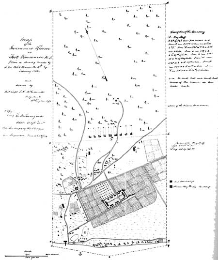
Plate XVI—Map of the Government
Reserve at Fort Vancouver Drawn by Brevet Capt. T. R. McConnell in 1854
from the Survey Made by Lieut. Col. B. L. E. Bonneville in 1854. From
General Land Office Records, Abandoned Military Reservation Series, Ft.
Vancouver, Washington, Box 100, in the National Archives. (click on
image for a PDF version)
|
|
|
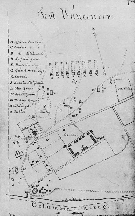
Plate XVII—Ground Plan of Fort
Vancouver Military Reservation, 1854, by Joseph K. Mansfield. From
Mansfield, Report . . . to Brevet Lieut. Genl. Winfield Scott, March 1,
1855, MS, in A. G. O., Miscellaneous File 282. (click on image for a
PDF version)
|
|
|
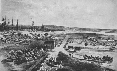
Plate XVIII—Fort Vancouver from the
Northwest, 1854, Drawn by Gustavus Sohon. From United States, War
Department, Reports of Explorations and Surveys, to Ascertain the
Most Practicable and Economical Route for a Railroad from the
Mississippi River to the Pacific Ocean, vol. XII, plate XLIV.
|
|
|
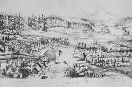
Plate XIX—View of Fort Vancouver
from the Northwest, 1855, Drawn by R. Covington. From photostat in
possession of Howard J. Burnham.
|
|
|
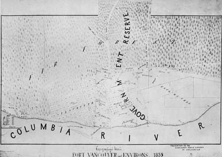
Plate XX—Topographical Sketch of
Fort Vancouver and Environs, 1855. From photostat in possession of
Howard J. Burnham. (click on image for a PDF version)
|
fova/hussey/plates4.htm
Last Updated: 18-Feb-2008
|