|
Gauley River National Recreation Area West Virginia |
|
 NPS photo | |
The Gauley River was added to the National Park System in 1988 in order to protect and preserve the scenic, recreational, geological and cultural resources along with the fish and wildlife.
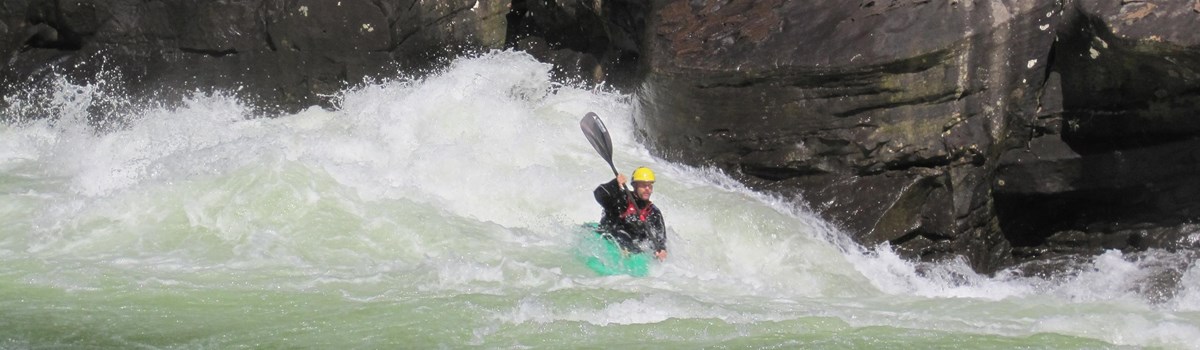
The 25 miles of Gauley River and six miles of the Meadow River pass through scenic gorges and valleys containing a wide variety of natural features. Dropping 26 feet per mile through a gorge that averages 500 feet in depth, the Gauley is noted for its outstanding Whitewater and is one of the most technical rivers in the nation. The Meadow River gradient averages 71 feet per mile.
In developing the National Recreation Area, the National Park Service will provide land and water based recreational sites and programs. This will allow the visitor to experience the park's resources without impairing the natural, cultural and scenic values of the area.
History
The Gauley River historically has been both a corridor and a barrier to human activity. The first non-native settlement was established in the late 1700s at Peter's Creek. In the early 1900s railroads and lumber companies came to the Gauley River gorge to harvest the vast supply of timber.
The Civil War was a major event of significance along the Gauley River. Life was disrupted as disorganization and turmoil affected everyone living in the area. A major Civil War incident occurred on September 10, 1861, at the confluence of the Gauley and Meadow rivers. Union troops engaged the confederates and forced them to evacuate an entrenched position overlooking Carnifex Ferry. The site of this event is located two miles southwest of the Summersville Dam and is listed on the National Register of Historical Places as Carnifex Ferry Battlefield State Park.
Nature
Many species of plants and animals persist in the Gauley River National Recreation Area. Ranging from the ridgetop varieties adapted to constant winds and rocky, dry soils to the mixed hardwood forests, the plant and animal types vary at different levels along the gorge.
The Gauley River also may have the largest population in the world of Virginia Spiraea, a rare plant species. Ten other rare plants and six species of rare animals are present in the initial studies of this park service area. In addition to these rare varieties, an abundance of other plants and wildlife live in the Gauley River gorge.
Recreation
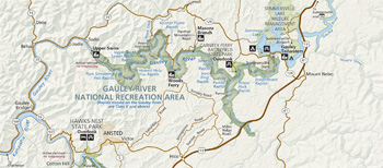 (click for larger map) |
It is believed the first recreational use of the Gauley River began in the early 1900's in the community of Swiss. Here city dwellers were invited to enjoy a country retreat along the river. Local residents remember childhood adventures of riding railroad ties when flood waters created huge curling waves.
Today recreation along the Gauley and Meadow rivers is provided in a primitive setting, but not quite as primitive as floating on railroad ties. Whitewater rafters and boaters are thrilled by the exciting turbulence of the rapids ranging from Class I to Class V+. Rock climbers are challenged by the high cliff walls and hikers enjoy rustic trails and beautiful views. Fishing is permitted in accordance with federal and state laws and breeding areas are at a premium for smallmouth bass and walleye.
Source: NPS Brochure (1996)
|
Establishment Gauley River National Recreation Area — December 26, 1988 |
For More Information Please Visit The  OFFICIAL NPS WEBSITE |
Documents
Final Wild and Scenic River Study: Gauley River, West Virginia (August 1983)
Ethnographic Overview and Assessment, New River Gorge National River and Gauley River National Recreation Area (Mary Hufford, September 2007)
Foundation Document, Gauley River National Recreation Area, West Virginia (June 2016)
Foundation Document Overview, Gauley River National Recreation Area, West Virginia (January 2016)
Geologic Resources Inventory Report, Bluestone National Scenic River, Gauley River National Recreation Area, and New River Gorge National River NPS Natural Resource Report NPS/NRPC/GRD/NRR-2017/1532 (T.L. Thornberry-Ehrlich, October 2017)
Historical Archeological Survey: New River Gorge National River and Gauley River National Recreation Area Kentucky Archaeological Survey Report No. 143 (Lori Stahlgren, Meagan Jones, Rick Burdin and Brian Mabelitini, 2007)
Natural Resource Condition Assessment, Gauley River National Recreation Area NPS Natural Resource Report NPS/GARI//NRR-2019/1859 (Andy J. Nadeau, Kathy Allen, Hannah Hutchins and Andrew Robertson, January 2019)
Park Newspaper (Three Rivers Review): 2003 • 2004 • 2006 • 2008 • 2012 • 2013
Polycyclic Aromatic Hydrocarbons in Bottom Sediment and Bioavailability in Streams in the New River Gorge National River and Gauley River National Recreation Area, West Virginia, 2002 USGS Scientific Investigations Report 2004-5045 (Terence Messinger, 2004)
Soil Survey of Gauley River National Recreation Area, West Virginia (2013)
gari/index.htm
Last Updated: 01-Jan-2025